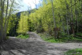
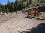
7/9/2020 Posted On: 7/21/2020 By: hikerjess Info: Got my 2wd toyota sequoia up to the point about 0.6 miles below the trailhead with minimal/no issues. Just take it steady. There were a bunch of downed trees, but they have since been moved to the side. Lots of exposed rocks and a few ruts, but they are avoidable. Summer conditions all the way. One small water crossing and a mud pit that was only a few inches deep. I would highly recommend 4WD the rest of the way to the trailhead from there. Lots of beautiful spots to pull off and camp along the way. | ||||
6/26/2020 Posted On: 6/26/2020 By: corunner Info: Would agree about the downed trees. They are all in the first mile or so of the North Hensen Rd stretch. I drove a stock Silverado 1500 4wd and found only one spot problematic. I made it through fine with a few inches between the truck and downed aspen trees...but only because my passenger and I rolled down the windows watching each side carefully as we passed through. If I was alone, I bet I would have scraped the side of my truck. Smaller vehicles should be fine. We then parked .7 mi from the upper TH. Glad we did. It would have been pretty bad...for my truck at least. | ||||
6/26/2020 Posted On: 6/29/2020 By: little_castaldo Info: Offering another opinion: I didn't think the road up to the upper TH was that bad. My stock Jeep Wrangler made it just fine, and I didn't have to get out to spot anything. Squeezing through the cut trees though made me a little nervous, but no issue. | ||||
6/23/2020 Posted On: 6/25/2020 By: BB Info: If you're in a larger vehicle, say an F250 or Tundra etc., you might want to take a chainsaw. Many downed trees across the road from last winter's snows & avalanches. These trees have been cut to open the road, but in several places -- one in particular -- the gaps are pretty tight. | ||||
6/22/2020 Posted On: 6/23/2020 By: hogantheepic Info: No snow on this road, but this road is craaaaazy. Was very surprised that my Ford Escape made it up the road. Do not attempt this road unless you have god driving skills (my dad drove, not me) and/or you have a super high clearance vehicle and 4WD. Edit: the previous trailhead report downplays the condition of the road. Again, even if a suburu made it, they probably scraped their car a bunch and potentially damaged things. We scraped our muffler a couple times. Just a warning. | 2 |
|||
6/22/2020 Posted On: 6/25/2020 By: jvirene Info: This is a pretty fun 4wd trail, if you have a larger vehicle i'd keep an eye out because there are a bunch of down trees that, although have been sawed, only give narrow passage so they might scrape. My buddy drove up the trail in a Mazda CX-5 and we didn't have any issues, made it all the way up to the upper 4wd trailhead. | ||||
6/21/2020 Posted On: 6/21/2020 By: Squirrellysquirrel Info: Matterhorn Creek TH is in summer conditions as are roads around this point. Accessible with 4WD, also did see some AWD Subies and such as well. Some rough spots, yet if you go slow, should be okay. Matterhorn and Wetterhorn are pretty much summer conditions. | ||||
11/9/2019 Posted On: 11/9/2019 By: Flyingfish Info: Engineer pass CR 20 is open as far as you can drive. Below Capitol city the road is mostly dry to the Matterhorn Creek turn off. Above capitol city there are large portions of the road covered in snow. I did not go up Matterhorn Creek so I don't know what the upper road looks like | ||||
8/8/2019 Posted On: 8/8/2019 By: larixpjm Info: The road is cleared from trees. I could reach the TH with 4runner without any problems. | 1 |
|||
7/30/2019 Posted On: 7/31/2019 By: tjf242424 Info: No problems getting to the lower TH in an Outback. Probably could have made it all the way, but not worth the stress for the 0.7 mi of walking saved. | ||||
7/26/2019 Posted On: 7/26/2019 By: RGrimm518 Info: Trailhead fully accessible. Between miles 9-11 some debris that has been freshly cleared (photo). The last .7 mile stretch was doable in our Grand Cherokee Trailhawk using 4WD and with the suspension raised up. Also up there was a F150 and Tacoma TRD, and some side-by-sides. | ||||
7/21/2019 Posted On: 7/25/2019 By: davidboron Info: Lot of avalance debris at beginning of trailhead. Need to step over, around and thru the pines that have been tumbled by the slide. Debris path is about 100yds long. All's well after that. | ||||
7/20/2019 Posted On: 7/20/2019 By: LetsGoMets Info: North Henson Road is clear of Avy debris and any other obstacles and driveable easily to the lower TH (where I Parked). Alao clear to the Upper as well. The entire 2.5ish miles is decently rough and gutted in places, and (currently) I personally would not consider taking a 2WD on it despite the label. | ||||
7/20/2019 Posted On: 7/22/2019 By: RyGuy Info: Road is clear of avalanche debris to the upper 4WD TH. avalanche even clipped the upper 4WD parking area, although the trail signs are intact. Road to the lower 2WD TH is in decent shape, road from the turn-off to the upper 4WD trail is pretty solidly 4WD only. Saw a Honda Element that tried and couldn't make it past one of the first good ruts. Finally, get there early. This isn't a big TH and there aren't many pull offs on the way up from the lower TH. Picture 1: Looking at the gate and avalanche debris that clipped the TH parking area Picture 2: Just right of the first picture. TH sign was thankfully missed. Picture 3: Looking at the little campsite just below the parking area with more avalanche debris. | 1 |
|||
7/15/2019 Posted On: 7/16/2019 By: sunny1 Info: Access clear & dry to Matterhorn TH. There were a few spots where avy debris has been cleared. | 1 |


