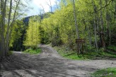
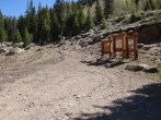
5/8/2021 Posted On: 5/8/2021 By: KyaCav Info: North Henson Road is good to go. A few large snowdrifts remain, but they have been mashed through. Park at .7 miles from the actual 4x4 trailhead and gate. That last section of Jeep trail is still covered with too much snow. | ||||
4/30/2021 Posted On: 5/4/2021 By: One Sierra Charlie Info: I was able to drive 1.0 miles above Capitol City before the snow drifts were too deep to cross in my 4-Runner. There are many sections of drifted snow on the road above this but these may melt in the next week or so. The spur to the summer trailhead contains much more snow and will probably not melt for a few more weeks. | ||||
4/19/2021 Posted On: 4/19/2021 By: COnaive Info: I had no issues driving to Capitol City in a low clearance vehicle, but past Nellie Creek was very slow. Took the old Jeep up North Henson road a few days later (main Engineer Pass road was gated not far past Capitol City but was plowed past the gate), and pushed through some snow to maybe a mile up the road before deciding that getting stuck was highly likely. | ||||
11/3/2020 Posted On: 11/4/2020 By: supranihilest Info: Some snow and ice but a good driver should have no problem reaching the upper, 4WD trailhead. | ||||
9/16/2020 Posted On: 9/17/2020 By: Thevirtualsherpa Info: Echoing the last report with a bit more context with a different vehicle. The first 9 miles are a bit rough but passable with most vehicles. There is one massive puddle just before right hand turn to North Henson Road that I scraped going in but avoided going out. Hard to tell how deep it is and one large rock in the middle of it. North Henson has really gone to hell over the years, I was able to get my legacy up to the upper 4wd TH split but a handful of spots that required careful navigating to avoid scraping. To be honest, besides 2-3 spots, the difference between North Henson and the last .7 miles is not that different these days. The main difference on the last .7 besides those 2-3 spots is the amount of loose rock on the road. | 3 |
|||
9/13/2020 Posted On: 9/14/2020 By: Chicago Transplant Info: Road to the traditional 4WD trailhead from Capitol City is degraded from years past. There are several rocky sections spread out over that 2 miles that rival the last section to Lily Lake TH in the Sangres (Lindsey). I would call this portion of the road a "3" on the scale now. Luckily one of the rough spots is early, park at the bottom of this road if you have any questions and walk the first 100-200 yards and you will get a good sense of the road. There was one Impreza up there, but it probably scraped? I had no issues in a 2012 Outback with the right driving line, which required a few zig zags. Other vehicles that were up there included a 2017 and 2019 Forester, Hyundai Santa Fe and an Audi Q5. Somehow a CRV was at the upper TH, but I wouldn't recommend that. Even the road between Nellie and Capitol City has degraded, there are a few rocky spots and some muddy puddles. One of the puddles is across most of the road and could be an issue for a lower sedan/mini van. | ||||
8/29/2020 Posted On: 8/30/2020 By: MountainBuhn Info: Lower 4wd: Recent rain made the depth of the puddles on North Henson hard to gauge, but nothing too troublesome for an ordinary crossover with 7+ inches of clearance. Doable with below that but very cautious driving and good maneuvering around some larger rock fields necessary. Saw a couple of foresters get up about a quarter of the true 4wd, but I wouldnt comfortably drive up without more than 9-10 inches of clearance. One stock Grand Cherokee was at the top Henson creek road has a couple of deeper spots close to the turn off so dont get lazy. | ||||
8/9/2020 Posted On: 8/9/2020 By: sky_high Info: Second the information from the last report. The road is clear and completely doable with a stock 4wd or high-clearance 2wd to the lower trailhead. There is downed brush that makes some of the route tight, but it generally doesn't impeded the road. Just an FYI from driving in the dark, don't be fooled by the lazy right turn at about .5 miles up the 4wd road, go straight instead. The road itself is rubbly and rutted and there are two or three patches that dip significantly, but can maneuvered through easily. That said, the upper 4wd trailhead has some pretty difficult rocks to negotiate and several tight turns. If you weren't okay with Nellie Creek you shouldn't be okay with this either. Several lifted Jeeps and a stock Rubicon looked like they made it up okay, but wide trucks will find it hard to avoid the worst obstacles. The parking for the lower 4wd trailhead is just past the turnoff for the upper trailhead. | 3 |
|||
7/26/2020 Posted On: 7/27/2020 By: rchacon Info: Road was easily passable by any crossover up until the last .7 miles. From there, you'll get a healthy view of what to expect for the last .7 miles to the trailhead. The last .7 miles was more challenging than the Nellie Creek road, but shorter and without the difficult first stream crossing on the Nellie Creek road. I was mistaken in thinking that this road was going to be easier than Nellie Creek - it's not, just shorter. Still, I easily drove it with a stock 4Runner SR5 (no rear locker) with AT tires. No need for a spotter and similar 4X4s shouldn't have any issue. I would definitely not suggest taking a Subaru or any crossover the last .7 miles unless you're willing to hit a few rocks along the way. | 1 |
|||
7/18/2020 Posted On: 7/20/2020 By: Been_Jammin Info: 2003 Chevy Tahoe Z71 made it to the top easily. | ||||
7/18/2020 Posted On: 7/20/2020 By: kspitzer1987 Info: Stock 2015 F150, crew cab, long bed (6.5'), towing mirrors There are reports in previous posts about downed aspens making the trail so narrow that it was nearly impossible to pass unless somebody brings in a chainsaw to widen it. Well, that must have happened. I went all the way up to the trailhead and never had less than 6" to spare on both sides of my truck (mirrors were folded in). No danger of scraping the side of your vehicle on aspens anymore so long as your mirrors are folded in. The road from Lake City to the first 4x4 road is doable in a sedan, although it will be a very rough, slow ride. The lower 4x4 road is a different story. I saw a Subaru Legacy halfway up the lower 4x4, but I'm not sure how it made it...I suspect it suffered some scraping and undercarriage damage. If you don't want to suffer damage to the underside of your vehicle, do NOT drive a sedan up the lower 4x4 trail. I made it very easily in my truck. The upper 4x4 trail was much more technical than the lower and required significantly more ground clearance, but I still made it relatively easily in my F150. While ground clearance was an absolute must for large rocks, I never had a problem with my long wheelbase. If for some crazy reason a sedan or low-clearance vehicle made it all the way up the lower 4x4 road, I assure you they WILL NOT make it up the upper 4x4 trail, so please don't try. | 1 |
|||
7/11/2020 Posted On: 7/14/2020 By: jharned Info: The posts describing the downed trees on the way up the road have been cut and moved out of the way to not cause any obstruction to the road. Made it to the 4WD trailhead with no issues with stock Silverado 4WD. You could argue that the last 50 yards before the 4WD TH there is a funky rock to navigate around, but it wasn't a major issue. Way more mellow than Nellie Creek. | 3 |
|||
7/9/2020 Posted On: 7/21/2020 By: hikerjess Info: Got my 2wd toyota sequoia up to the point about 0.6 miles below the trailhead with minimal/no issues. Just take it steady. There were a bunch of downed trees, but they have since been moved to the side. Lots of exposed rocks and a few ruts, but they are avoidable. Summer conditions all the way. One small water crossing and a mud pit that was only a few inches deep. I would highly recommend 4WD the rest of the way to the trailhead from there. Lots of beautiful spots to pull off and camp along the way. | ||||
6/26/2020 Posted On: 6/26/2020 By: corunner Info: Would agree about the downed trees. They are all in the first mile or so of the North Hensen Rd stretch. I drove a stock Silverado 1500 4wd and found only one spot problematic. I made it through fine with a few inches between the truck and downed aspen trees...but only because my passenger and I rolled down the windows watching each side carefully as we passed through. If I was alone, I bet I would have scraped the side of my truck. Smaller vehicles should be fine. We then parked .7 mi from the upper TH. Glad we did. It would have been pretty bad...for my truck at least. | ||||
6/26/2020 Posted On: 6/29/2020 By: little_castaldo Info: Offering another opinion: I didn't think the road up to the upper TH was that bad. My stock Jeep Wrangler made it just fine, and I didn't have to get out to spot anything. Squeezing through the cut trees though made me a little nervous, but no issue. |


