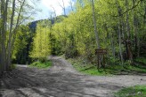
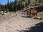
7/22/2022 Posted On: 7/22/2022 By: 14er101 Info: Road up to the "2wd trailhead" around 10,300 is in decent shape, a stock Honda HRV made it up to the trailhead with only a minor scrape that could have been avoided via better route finding. For some reason, it ended up duplicating the entry. | 3 |
|||
7/22/2022 Posted On: 7/22/2022 By: 14er101 Info: Road up to the "2wd trailhead" around 10,300 is in decent shape, a stock Honda HRV made it up to the trailhead with only a minor scrape that could have been avoided via better route finding. | ||||
6/14/2022 Posted On: 6/19/2022 By: globreal Info: The road is clear of debris. Drove all the way to the end of the 4x4 road to the Matterhorn Creek TH in a Jeep Grand Cherokee. Lower all wheel drive vehicles like Subaru Outbacks can make it most of the way. However, the last .6 mile is rough with a couple of big boulders to go over. I thought this section was worse than the Nellie Creek road up to Uncompahgre's TH and wouldn't recommend without a true 4x4. | ||||
5/27/2022 Posted On: 5/27/2022 By: coopergould Info: Tree cleared - no issues driving to upper TH in stock tacoma | ||||
10/5/2021 Posted On: 10/6/2021 By: finick01 Info: Road is snow-free and dry except for some scattered puddles. Pretty much any car should be able to reach the North Henson turnoff, but its not worth going any further without higher clearance (as others have said). Its doable, but so slow and such a pain in the ass that youre better off walking that stretch. | ||||
10/2/2021 Posted On: 10/4/2021 By: Thevirtualsherpa Info: County is slowly improving CR20 (Henson Creek) - in really great shape before the turnoff to CR24. From 24 (North Henson), road is in usual rougher condition but had no issues with Forester getting to lower and upper Matterhorn Creek TH. Minimal snow but lots of mud which made drive very tricky. No bottoming out or spinning out with low gear driving and experience/patience. Way down, found a lovely screw and had a major issue replacing our tire. Wanted to sincerely thank the two guys who were able to help us out with the local towing company. Can't thank you two enough!! Lesson learned on putting e brake on Subbie when replacing tire. | ||||
8/21/2021 Posted On: 8/23/2021 By: supranihilest Info: Hinsdale County seems to have really embraced off-road culture, and by that I mean they've given up even the slightest appearance of taking care of their county roads. Enjoy the non-stop potholes and washboarding to the CR 20 (Engineer Pass)/CR 24 (North Henson Creek) split, and once on CR 24 add giant potholes and tons of rock, both loose and embedded, to the mix. I drove my Civic to the lower trailhead years ago, now I wouldn't drive anything that has less clearance than an Outback up there. I was glad to have 8.5" of clearance and 4x4, and the road to the upper trailhead (which I did not drive) looked like a war zone. I continued to the switchback at the end of CR 24 and the road deteriorates significantly getting there, basically just piles of rubble for the last half mile or so. | ||||
8/7/2021 Posted On: 8/7/2021 By: patrickmcl89 Info: Made it to 4wd trailhead in stock Nissan Xterra (9.1 inches of clearance) with duratracs. Road is in good shape, just need to maneuver around the bigger rocks. | ||||
7/30/2021 Posted On: 7/30/2021 By: RyGuy Info: From Hinsdale County Road and Bridge: Friday, July 30 - 7 pm A mud and rock slide on Engineer Pass (CR 20) has closed the road near MM 13 or 14. Road and Bridge Dept are headed to scene. Estimated to be near Capital City, but exact location not yet determined. Heavy rains in the Lake City area predicted this weekend can cause mud sides and close roads. Use great caution in the back road and be prepared to turn around. Never attempt to drive through or over a mud or rock slide. | ||||
7/9/2021 Posted On: 7/10/2021 By: chow Info: Road is nice and dry. Last 0.7 miles is rough and narrow at a couple of places. Definitely need a high clearance 4wd. | ||||
7/5/2021 Posted On: 7/5/2021 By: kimbuk2 Info: Drive a 2016 Land Cruiser, no lift, 9.1 of clearance. Parked at the lower 4x4 trailhead (10,300~), probably could have driven to the upper trailhead. Lower TH is Subaru-able, but would recommend clearance and 4WD for the upper TH. | ||||
6/5/2021 Posted On: 6/7/2021 By: tlgold1990 Info: Made it just below the actual trailhead in a stock 2019 RAM 1500. Parked at the spot that's less than 1/4 mile from the trailhead. Should have just kept driving since it would have been easy. Road is narrow in a lot of sections but only a few sections with steep drop offs. I did take one corner too sharp and scraped under my running board, could have easily been avoided if I wasn't trying to hurry down the last section. As long as you know how to navigate around/over bigger rocks, any full size stock truck SHOULD be fine. Again, as long as you have experience. | ||||
5/31/2021 Posted On: 6/1/2021 By: dfralick07 Info: Made it to Matterhorn Creek in my stock 2013 Impreza hatchback. A few puddles to cross, nothing 2WD couldn't handle. The last 0.5 to 1 mile to the crossing would be a little rough for 2WD. Scraped a rocker panel twice that last half mile, but nothing unmanageable to experienced drivers. Yeah, you'll need something with 4WD and higher clearance to get up the last 0.6 miles to the 4WD TH from this point. But no more snow and ice the whole way up Engineer Pass! | 2 |
|||
5/29/2021 Posted On: 5/30/2021 By: ButterDips12 Info: On 5/29 made it to the upper 4wd trailhead in a stock 2017 GMC Sierra Denali with A/T tires. Did not scrape the undercarriage, but some branches did brush the side of my vehicle. | ||||
5/16/2021 Posted On: 5/16/2021 By: coopereitel Info: Clear to ~10,440' then snow-banky |


