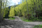
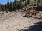
8/2/2014 Posted On: 8/3/2014 By: mlayman09 Info: Currently some small puddles in the road, other than that it‘s dry. 2WD vehicles can make it to the lower trailhead, as long as they go slow. I made it to the 2WD trailhead in my ‘86 Camry. | ||||
7/19/2014 Posted On: 8/8/2014 By: Krullin_14ers Info: 2012 Outback made it to a few hundred yards below the summit. No damage or breaks. | ||||
6/8/2014 Posted On: 6/8/2014 By: Nelson Info: Road is easily drivable all the way to the upper TH. The last .7 miles is as nasty as it always is i.e. you need 4wd. | ||||
6/2/2014 Posted On: 6/3/2014 By: glencharnoski Info: Henson Creek Road completely clear to turn-off 9.2 miles at 9,700‘. The steep and rough 2.0 mile (sign posted) spur road to the right is also clear, but a little eroded, and an Outback or similar is recommended, but not mandatory. The 4x4 road up Matterhorn Creeks east side looks clear, but has snow 3-4‘ drifts 100yds up covering most of the road, although an ATV could get through. Should be a week or two to drive up, but its only 0.6 miles up the road to the trailhead, so walking isn‘t a problem. | ||||
9/3/2013 Posted On: 9/5/2013 By: zsmith Info: With the heavy rain, the road is getting very difficult. The creek crossings are shallow, but 30ft wide. Lots of large puddles. Overall, I would not attempt the road without a truck-based, high clearance, short wheelbase vehicle. | ||||
8/25/2013 Posted On: 8/26/2013 By: wattsup Info: Heavy weekend rain but road to TH is passable with 4x4 and high clearance. | ||||
6/13/2013 Posted On: 6/14/2013 By: djrunner Info: High clearence 4wd needed for the last portion. My Tacoma made it up and I only scraped once. I‘ll just say it was because I drove up it at night. I did not scrape on the way down. | ||||
5/26/2013 Posted On: 5/27/2013 By: jmanner Info: You can make it up to the 4WD trailhead: is clear and in great shape. | ||||
5/12/2013 Posted On: 5/12/2013 By: sdkeil Info: Road is still clear to the 2wd parking area. Only one drift about 20 yards long and a couple feet deep near the start of the 4wd road is all that is left on the road to the upper TH. One weeks melt and a determined 4wd should be able to make it. | ||||
5/3/2013 Posted On: 5/3/2013 By: killingcokes Info: Road is clear to the lower trailhead as of today. Immediately above that its snowed in. Have fun | ||||
9/2/2012 Posted On: 9/9/2012 By: Bullwinkle Info: The last .7 mile to the upper TH is rough, but acceptable for stock 4WD vehicles. Strongly suggest this not be attempted in a standard passenger vehicle. A minimum of 8.5 inches of ground clearance, skid plates, and off-road tires recommended. | ||||
8/25/2012 Posted On: 8/26/2012 By: zephyr_pelicante Info: My 2WD Camry made it to turnoff to Matterhorn Creek TH. A few spots on the "North Henson Creek" road made me cringe a little but I went slowly and made it through. To get to the upper 4WD trail you need a vehicle with some serous clearance, tires, and you must possess proficient driving skills; if you have to pass someone you‘re in big trouble. Even if I had a 4WD I‘d just walk - driving saves you only 0.7 miles. | ||||
6/23/2012 Posted On: 6/27/2012 By: AeroFaze Info: Road to the LOWER parking area is easier than the road going all the way up to Nellie Creek TH (Uncompahgre). We saw an Impreza WRX at this lower Matterhorn TH area. Having heard of the steepness of the road leading up to the upper TH, we left my manual tranny '07 Forester XT (7.9" clearance, 99.4" wheelbase) at this lower area, also. Beyond this, we only saw large pickups, Jeeps, and a 4Runner at the upper TH. Just before reaching the upper TH, the road forks with both options leading to the upper parking, but as mentioned in previous posts, the left option is the way to go unless you're looking for something interesting. Spots for 3-4 tents at the top. At the base of the fork mentioned above, there's space for maybe 1-2 tents more. | ||||
5/25/2012 Posted On: 5/27/2012 By: Zambo Info: The TH is completely dry and open for business. Any remaining snow from a few weeks ago is long gone, and the road is in great shape for any competent 4wd vehicle. Agree with Anna that the best option is to go left near the top of the 4wd TH. | ||||
4/7/2012 Posted On: 4/7/2012 By: Nelson Info: The Hanson Creekroad is closed at the Nellie Creek Turn off. This means you have an extra 6 mile walk to the upper Matterhorn TH. I noticed that quite a few people were going around the closure to the right . On the day I was there they were getting up to 10,100 or .4 miles on the North Hanson road. Things ar melting fast and I am sure that equally nefarious people will soon be able to get to the turn off to the upper trailhead. |


