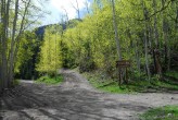
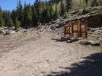
1/4/2016 Posted On: 1/6/2016 By: spiritualundead Info: The road is plowed to 1/4 mile past Nellie Creek. Beyond that, there is a good packed trail as a result of snowmobiles, snowshoers, and skiiers (that‘s us!) all the way to the turn off of Engineer Pass up Matterhorn Creek. Beyond that it was untouched snow. | ||||
9/25/2015 Posted On: 9/27/2015 By: Blue6String Info: 2nd street is closed for construction. Come at Engineer Pass from 3rd street instead. | ||||
9/15/2015 Posted On: 9/15/2015 By: jaquetcj Info: Trailhead was dry, 4wd road passable w Tacoma truck Snowed above 12000 feet this morning at 5 am so access may change quickly. Expect pockets of snow on your climb | ||||
9/3/2015 Posted On: 9/5/2015 By: WillRobnett Info: Started from upper 4WD Matterhorn Trailhead and climbed Wetterhorn. Driving in, the Aspens were just starting to turn. Still mostly green. More fall colors showing here than near Telluride/Wilson Peak two days before. Free of snow and ice, still dry. | ||||
8/22/2015 Posted On: 8/22/2015 By: barryfagin Info: I drive an MR2 Spyder, possibly the worst car possible for trailhead access :-). I drove it easily the 9.2 miles to North Henson Road, then parked there. Any passenger car can do that. I did not take it up any farther, and I‘m glad I didn‘t. But the roads to the trailhead are exactly as described. | ||||
8/3/2015 Posted On: 8/5/2015 By: addrock528 Info: Woo Whee! The 4x4 section sure had some surprises! I made it up in a Toyota Sequoia. Definitely need something equivalent. Only saw jeeps, side by sides, and capable SUV‘s up there. Very reminiscent of South Colony TH in the Sangre De Christo range if you‘ve been there. In contrast to nearby Nellie Creek TH, it is much shorter but more tricky. Everything up to the 4x4 turn off is doable by any car as "trinkner" proved. | ||||
7/24/2015 Posted On: 7/24/2015 By: trinkner Info: The road to the 2WD trailhead is in very good shape. I drove it both yesterday and today in my standard-issue 2009 Prius with no problems, even in the pitch dark before dawn. It takes about 35 minutes to reach the TH from Lake City, driving at about 20 mph and slowing down for a few obstacles. From Lake City, the first 9 miles present only a few small potholes that low-clearance vehicles should avoid. The final 2 miles to the TH are steeper and do have large potholes and some medium sized rocks. Still, my low-clearance Prius had no problems. I could avoid all rocks and potholes by using the full width of the road and being careful. The steep portions of the road are fairly short and do require somewhat of a "running start" for a Prius, since the car‘s anti-skid mechanism can cut off power when the wheels slip, which happens a few times on these steeper slopes. None of the steep sections had rocks or potholes. The pre-dawn hours have no traffic whatsoever. After your climb, though, you‘ll share the road with the Jeep and ATV drivers who rent their vehicles in Lake City. This just means that you need to be careful when you turn in to the oncoming-traffic part of the road to avoid a pothole or rock, especially on a blind curve. The road is plenty wide to allow vehicles to pass. If you have a passenger car, don‘t even consider driving to the 4WD TH. It‘s very rocky. Besides, it‘s so close to the 2WD TH that you might as well walk it and avoid any possibility of damaging your car. (BTW, it was fun to see the Jeepers and ATVers, decked out in helmets and ski goggles, as they watched my Prius drive by them.) | ||||
6/14/2015 Posted On: 6/15/2015 By: yingyangsoup89 Info: Clear all the way to upper 4wd trailhead. Good camping spots just below the gate near the trailhead sign. Would highly recommend a 4wd with clearance for the last .6 miles. | ||||
6/9/2015 Posted On: 6/9/2015 By: Mt_DAN Info: Road is in good shape to the trailhead. 4x4 is a good idea to make it to the end. | ||||
6/8/2015 Posted On: 6/9/2015 By: JoseDeMoor Info: Was able to drive in my 4Runner all the way up to the TH. Tree blockage has been removed, no snow on the road. | ||||
5/16/2015 Posted On: 5/22/2015 By: WillRobnett Info: Tree fall still there. Road is drivable 9.8 miles from the milage start. A few snow drifts from 9.8 up to summer TH. Quickly melting snow covered the route above. | ||||
5/9/2015 Posted On: 5/9/2015 By: rcrisp88 Info: The road is clear to about 1 mile from the summer 2WD trailhead. There are two obstacles left (a set of downed trees and a big drift) See pictures. | ||||
1/19/2015 Posted On: 1/20/2015 By: SnowAlien Info: Snowmobile track from winter closure to upper summer TH (Wilderness area boundary). Made for a perfect skin track. We broke trail after that to tree line. Above the tree line we didn‘t posthole much, snow appeared pretty well consolidated and with any new snow, don‘t expect the fairly faint skin/snowshoe track to stay much longer. | ||||
11/9/2014 Posted On: 11/10/2014 By: Eagle Eye Info: Some lower sections of the road have windblown snow on them but overall dry and easily driveable to the TH. At the 9 mile mark the North Henson road is identified as a "4WD Recommended" road. Very near the TH, the left fork of the road is less difficult than the right. Either one leads to the small parking area at the TH. | ||||
10/26/2014 Posted On: 10/26/2014 By: Chicago Transplant Info: No snow to either lower or upper trailhead, some puddles in the various potholes, but otherwise dry. |


