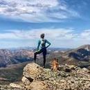
My doc told me to climb 14ers for 7-10d before my 2nd attempt on Kili (got HAPE before). I want to camp on an easy 14er (I'll be 76) and summit repeatedly, so I stay at 10,000-14,000 ft for a week. I did Elbert last Aug but having to carry water would keep me descending to 10,000 ft. I want to camp as high as possible, preferably at tree line at 12,500 or so, and do daily summits to maximize my time up high.
I'm looking at Redcloud and Sunshine peaks, accessed on the Silver Creek trail from Grizzly Gulch TH. The map in Climbing Colorado's Fourteeners shows multiple stream crossings and little bridges but the map in alltrails only shows crossings just before and just after the junction to Sunshine. Can I get water along Silver Creek trail at any stream crossings in the latter half of August?
Are there other peaks you would recommend instead?
climbs w water: acclimatizing for Kilimanjaro
Forum rules
- This is a mountaineering forum, so please keep your posts on-topic. Posts do not all have to be related to the 14ers but should at least be mountaineering-related.
- Personal attacks and confrontational behavior will result in removal from the forum at the discretion of the administrators.
- Do not use this forum to advertise, sell photos or other products or promote a commercial website.
- Posts will be removed at the discretion of the site administrator or moderator(s), including: Troll posts, posts pushing political views or religious beliefs, and posts with the purpose of instigating conflict within the forum.
-
MITbeaver
- Posts: 2
- Joined: 4/8/2025
- Trip Reports (0)

Re: climbs w water: acclimatizing for Kilimanjaro
Sneffels might be an option from the blue lakes side, it has a lake at around 11,600 ft. You could setup camp there and then hike up Sneffels everyday for training. Good luck, hope this helps.
Consecutive months with at least one 13er or 14er, 88 months
-
planet54

- Posts: 492
- Joined: 4/11/2011
- 14ers: 58
- 13ers: 20
- Trip Reports (0)
Re: climbs w water: acclimatizing for Kilimanjaro
You could look at Bear Lake, 12,374 ft which is close to Mt Harvard. If lake water isn't your thing the east wall of the Continental Divide is right there and should have some snowfields at that time of year. Mt Harvard is close to as high as you can go in this state.
I would rather sit on a pumpkin and have it all to myself than be crowded on a velvet cushion. H D Thoreau

Re: climbs w water: acclimatizing for Kilimanjaro
Sloan Lake at 12,900 ft. in American Basin below Handies might be another option. It looks like it's very close to the trail with some grassy areas where you could probably camp. I haven't climbed Handies from that side though, so can't say for sure.
Be aware that going straight up and camping near 13,000 ft. could also cause altitude sickness issues. Might be smart to spend a night or two at 10,000 or so first.
Be aware that going straight up and camping near 13,000 ft. could also cause altitude sickness issues. Might be smart to spend a night or two at 10,000 or so first.

Re: climbs w water: acclimatizing for Kilimanjaro
Your other option is to sleep in leadville at 10k, or car camp on indy pass at 12k. Sleeping high plus the comforts of hotel and/or car camping gear.
After climbing a great hill, one only finds that there are many more hills to climb. -Nelson Mandela
Whenever I climb I am followed by a dog called Ego. -Nietzsche
Whenever I climb I am followed by a dog called Ego. -Nietzsche
Re: climbs w water: acclimatizing for Kilimanjaro
you do not want to drink the water by RC&SS. my dog declined both times and he is a total creek snob (would rather drink from the outside than from a water bottle) so my assumption is that it's contaminated with iron sulfide.
“To walk in nature is to witness a thousand miracles.” – Mary Davis
-
PJ88
- Posts: 201
- Joined: 5/10/2020
- 14ers: 43
- 13ers: 15
- Trip Reports (0)
Re: climbs w water: acclimatizing for Kilimanjaro
I remember reading something about this but wasn't able to find it. I honestly didn't look too hard. I remember the creek looking a little funky when I did this last year. I wasn't too worried about filtering because I could get water from the campground before and after my hikes.two lunches wrote: ↑Thu Apr 10, 2025 2:36 pm you do not want to drink the water by RC&SS. my dog declined both times and he is a total creek snob (would rather drink from the outside than from a water bottle) so my assumption is that it's contaminated with iron sulfide.
-
Monte Meals

- Posts: 506
- Joined: 5/16/2011
- Trip Reports (0)
Re: climbs w water: acclimatizing for Kilimanjaro
If you want to car camp, I suggest Mt Sherman
https://www.14ers.com/route.php?route=sher1
You can park at 12K - there is a stream but don't drink it - heavy metal pollution.
Sherman and Sheridan (and others) are easy with several interesting mining relics
in the area.
A good stretch goal from there would be a ridge walk to Horseshoe Mountain
https://www.14ers.com/peaks/10251/13er- ... e-mountain
You could easily spend a week there exploring the area.
-
MITbeaver
- Posts: 2
- Joined: 4/8/2025
- Trip Reports (0)
Re: climbs w water: acclimatizing for Kilimanjaro
Thank you very much! I was more worried about creeks drying up by August, but contamination is more serious. Is Colorado Mountain Club a good source of information about water?two lunches wrote: ↑Thu Apr 10, 2025 2:36 pm you do not want to drink the water by RC&SS. my dog declined both times and he is a total creek snob (would rather drink from the outside than from a water bottle) so my assumption is that it's contaminated with iron sulfide.
-
Monte Meals
- Posts: 506
- Joined: 5/16/2011
- Trip Reports (0)
Re: climbs w water: acclimatizing for Kilimanjaro
Another 12K car camping suggestion:
Democrat, Cameron, Lincoln, Bross
https://www.14ers.com/route.php?route=bros6
The trailhead (kite lake) is at 12K has bathrooms
and camp spots (small fee)
Very social spot with many campers.
Democrat, Cameron, Lincoln, Bross
https://www.14ers.com/route.php?route=bros6
The trailhead (kite lake) is at 12K has bathrooms
and camp spots (small fee)
Very social spot with many campers.
-
dwoodward13
- Posts: 853
- Joined: 3/26/2011
- 14ers: 58 12
- 13ers: 172 6
- Trip Reports (1)
Re: climbs w water: acclimatizing for Kilimanjaro
No. They are just a (mostly) volunteer led hiking club/organization. There is really no organization or agency in the state that will have catalogued water quality of these mostly because very few of these high alpine streams are getting tested…there’s just not a public interest in doing so when considering the thousands and thousands of streams in the state. That’s really only a priority until much further downstream where a population would be consistently using it in a city or town.MITbeaver wrote: ↑Thu Apr 10, 2025 5:36 pmThank you very much! I was more worried about creeks drying up by August, but contamination is more serious. Is Colorado Mountain Club a good source of information about water?two lunches wrote: ↑Thu Apr 10, 2025 2:36 pm you do not want to drink the water by RC&SS. my dog declined both times and he is a total creek snob (would rather drink from the outside than from a water bottle) so my assumption is that it's contaminated with iron sulfide.
Your best bet for remotely gauging stream quality is to use google earth and look for obvious discoloration, typically red, although sometimes bleached white like the aforementioned Silver Creek (redcloud). On the ground you can use additional clues such as smell, and the presence or lack there of of vegetation very near the banks (moss on rocks, shrubs or grasses on the banks). No vegetation is a telltale sign the something in the water is too toxic for plant life.
The overwhelming majority of streams are totally fine. There are really only a handful of places in the state to be concerned, areas with high mineral concentration and/or mining activity. Unfortunately those happen to coincide with what you are trying to find. The ease of vehicular access in high altitude areas is mostly a byproduct of past mining (and thus possibly mineral richness).
-
HikerGuy
- Posts: 1462
- Joined: 5/25/2006
- 14ers: 58
- 13ers: 504 8
- Trip Reports (9)
Re: climbs w water: acclimatizing for Kilimanjaro
This page contains the links below and has info in regard to mine-impacted water quality. The interactive map is probably most useful.
https://cdphe.colorado.gov/mine-impacte ... task-force
Abandoned mines water quality study
This study is a collaborative effort focused on water discharged from 145 abandoned mines that could impact Colorado lakes and streams.
Interactive map - Colorado Abandoned Mine Land Water Quality Information.
Fact sheet - Overview.
Report - Abandoned Mines Water Quality Study.
Note, that is for mine-impacted water sources. There are also water sources impacted by naturally-occurring geological processes. The download on this page has a map of those impacted areas. Free download here: https://coloradogeologicalsurvey.org/pu ... -colorado/. This is really interesting read.

