
Having just been in the Rock Creek, Sunlight Creek, and Vallecito Creek drainages this week, I can speak to those areas. I see you've chosen a more Chicago Basin-centric trip, but here's some info for the future!
Beartown to Hunchback Pass: easy, good trail.
Hunchback Pass to Nebo Creek: easy, good trail. Probably a good trail up Nebo Creek since it's part of the CDT. From Ute Creek to Rock Lake is probably pretty good as well, since there's actual trails marked on the map.
Rock Lake drainage: easy, good trail.
Vallecito Creek drainage: easy, good trail. There's numerous creek crossings down lower in the drainage, FYI.
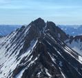
Sunlight Creek: you won't be coming up Sunlight Creek, which is good, because it's pretty rough and overgrown, but the area east of Chicago Basin to Sunlight Lake to Leviathan Basin is fairly straight forward. There's not much in the way of trails but you'll be able to see high passes and such from other high passes. You'll likely have to drop low in between which can be problematic with cliffs, loose rock, terrain that looked passable but isn't, willows, you name it. We climbed darn near everything from "South Windom" through Peak Six and you can stay high throughout most of that area, and there's trails up from Sunlight Lake to north of Jagged, and people routinely come south to Jagged from Leviathan Basin.
Weminuche high route
Forum rules
- This is a mountaineering forum, so please keep your posts on-topic. Posts do not all have to be related to the 14ers but should at least be mountaineering-related.
- Personal attacks and confrontational behavior will result in removal from the forum at the discretion of the administrators.
- Do not use this forum to advertise, sell photos or other products or promote a commercial website.
- Posts will be removed at the discretion of the site administrator or moderator(s), including: Troll posts, posts pushing political views or religious beliefs, and posts with the purpose of instigating conflict within the forum.
For more details, please see the Terms of Use you agreed to when joining the forum.
-
douglasian
- Posts: 4
- Joined: 3/7/2025
- 14ers: 4
- 13ers: 10
- Trip Reports (0)
Re: Weminuche high route
@bapazian1 How did the route go?
I'm planning a surprisingly similar itinerary and would be very interested in your (and everyone else's) thoughts on the segment highlighted on your topo between Hazel Lake and Trinity Lake.
Appreciate any input you could share.
I'm planning a surprisingly similar itinerary and would be very interested in your (and everyone else's) thoughts on the segment highlighted on your topo between Hazel Lake and Trinity Lake.
Appreciate any input you could share.
-
Ericds84
- Posts: 32
- Joined: 5/10/2012
- 14ers: 42
- 13ers: 35
- Trip Reports (0)
Re: Weminuche high route
I did something like the northern portion of this trip, but it's been 10+ years at this point. We did something more akin to a lollipop route, starting from the north. Our trip was in early Aug.
- Afternoon storms still very much a problem this time of year, although we largely enjoyed good weather. I would not be comfortable bivouacing out there given the potential intensity of storms. I also remember it being pretty buggy in the wooded areas. We also had some unusually aggressive deer bothering us at night.
- From Eldorado Lake to Trinity lake, we traversed west across the 3-way saddle near White Dome and Peak One. This saves losing/regaining some elevation and distance vs. going around.
- Terrain approaching saddle to Trinity Lake is pretty loose talus. Still have a scar from a microwave-sized rock that took a bite out of my knee.
- Some maps may depict a trail in the Trinity basin, but I found it to be inconsistent at best, and there was significant blow-down and very slow travel through the area, which is heavily wooded.
- Route to Lake Silex follows a narrow gully that still held snow in August. The terrain above was also very loose talus and would make for slow travel. This was a side trip for us, but continuing through this portion would be very slow, exposed to storms, and I suspect suitable camping spots would be a challenge to find. Lake Silex sits down in a fairly steep depression.
- This area is amazing backcountry and well worth the trip, but I would be very conservative in your estimation of travel times.
-
Tweedie
- Posts: 21
- Joined: 5/19/2017
- 14ers: 7
- 13ers: 28
- Trip Reports (1)
Re: Weminuche high route
I’m heading there tomorrow. I’ve seen most of the route personally and done a lot of research. There is a lot of scree and Talus, but there is places to camp at Leviathan and I know sunlight lake has good camping. I’m also unsure about the route from Sunlight to Hazel (see recent post and question). The consensus seems to be to head over the pass just west of Grizzly peak. I can update on what I find. But I may skip over the sunlight to hazel section and go west from sunlight over Windom pass or north of knife point and over to Ruby basin.douglasian wrote: ↑Thu Jun 26, 2025 7:11 pm @bapazian1 How did the route go?
I'm planning a surprisingly similar itinerary and would be very interested in your (and everyone else's) thoughts on the segment highlighted on your topo between Hazel Lake and Trinity Lake.
Appreciate any input you could share.
Also, if you want less talus, drop down to Balsam lake and then head south over the peak5/6 pass to noname and then Twin thumbs. I did that a few years ago (minus twin thumbs, we went out Ruby). It is more elevation gain/loss, but each valley has lots of trees and forest and awesome lakes. I’ll be heading back north that way after going south on the Kodiak high route.
I can give you an update in a week when I get back.

Re: Weminuche high route
I think from what I can see in satellite imagery and from neighboring peaks that the line shown as the "Kodiak High Route" is a side hill of talus behind the Trinities. I don't think its a trail. I have never taken it, but I have taken a line lower in elevation that parallels this, that line is below the cliffs and primarily crosses on a grassy use/game trail. I have used it to get to Balsam Lake for camping and also to day trip Peak Eight from Vestal Basin. I would recommend finding that trail instead of sidehilling talus unless someone who had done the KHR has a compelling story for saving on elevation. That grassy trail goes quick and seems worth the elevation loss to me.
Peak Eight report with some information on the trail I found: https://www.14ers.com/php14ers/triprepo ... trip=21781
Peak Eight report with some information on the trail I found: https://www.14ers.com/php14ers/triprepo ... trip=21781
"We want the unpopular challenge. We want to test our intellect!" - Snapcase
"You are not what you own" - Fugazi
"Life's a mountain not a beach" - Fortune Cookie I got at lunch the other day
"You are not what you own" - Fugazi
"Life's a mountain not a beach" - Fortune Cookie I got at lunch the other day
-
josephnephi

- Posts: 37
- Joined: 7/1/2022
- 14ers: 58 1
- 13ers: 632 3
- Trip Reports (4)
Re: Weminuche high route
Here is my route through the Northern Weminuche from a few years ago: .
Nothing was particularly spicy or unpleasant as far as traversing went and was much better that bushwhacking down in the basins. I don't remember the side-hilling behind the Trinities as being very bad but I also only did it oneway.
Nothing was particularly spicy or unpleasant as far as traversing went and was much better that bushwhacking down in the basins. I don't remember the side-hilling behind the Trinities as being very bad but I also only did it oneway.
You do not have the required permissions to view the files attached to this post.
-
Teresa Gergen
- Posts: 252
- Joined: 8/12/2012
- Trip Reports (0)
Re: Weminuche high route
Northern part of your route in question:douglasian wrote: ↑Thu Jun 26, 2025 7:11 pm @bapazian1 How did the route go?
I'm planning a surprisingly similar itinerary and would be very interested in your (and everyone else's) thoughts on the segment highlighted on your topo between Hazel Lake and Trinity Lake.
Appreciate any input you could share.
None of the terrain is intrinsically difficult for someone versed in Colorado off-trail travel, although I did it at a time when I could see on the Sentinel layer on caltopo that the snow was almost completely gone from my planned route. Much of this traverse has old, hidden, informal use trails, which might be easier to find if you download actual .gpx files from LOJ, split and join them to create your own planned route, upload that to a GPS unit or maybe an app if it lets you zoom in far enough, and attempt to follow it very closely. The old-timers who are even older than me spent summers traversing all over this range with no trails, no guidebooks, no internet, no forebearers to ask questions of, and no GPS.
You do not have the required permissions to view the files attached to this post.

