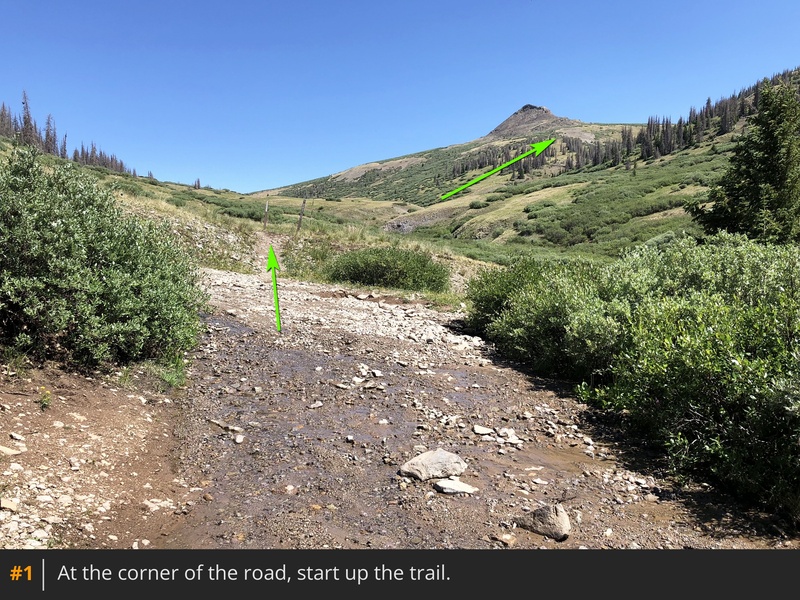
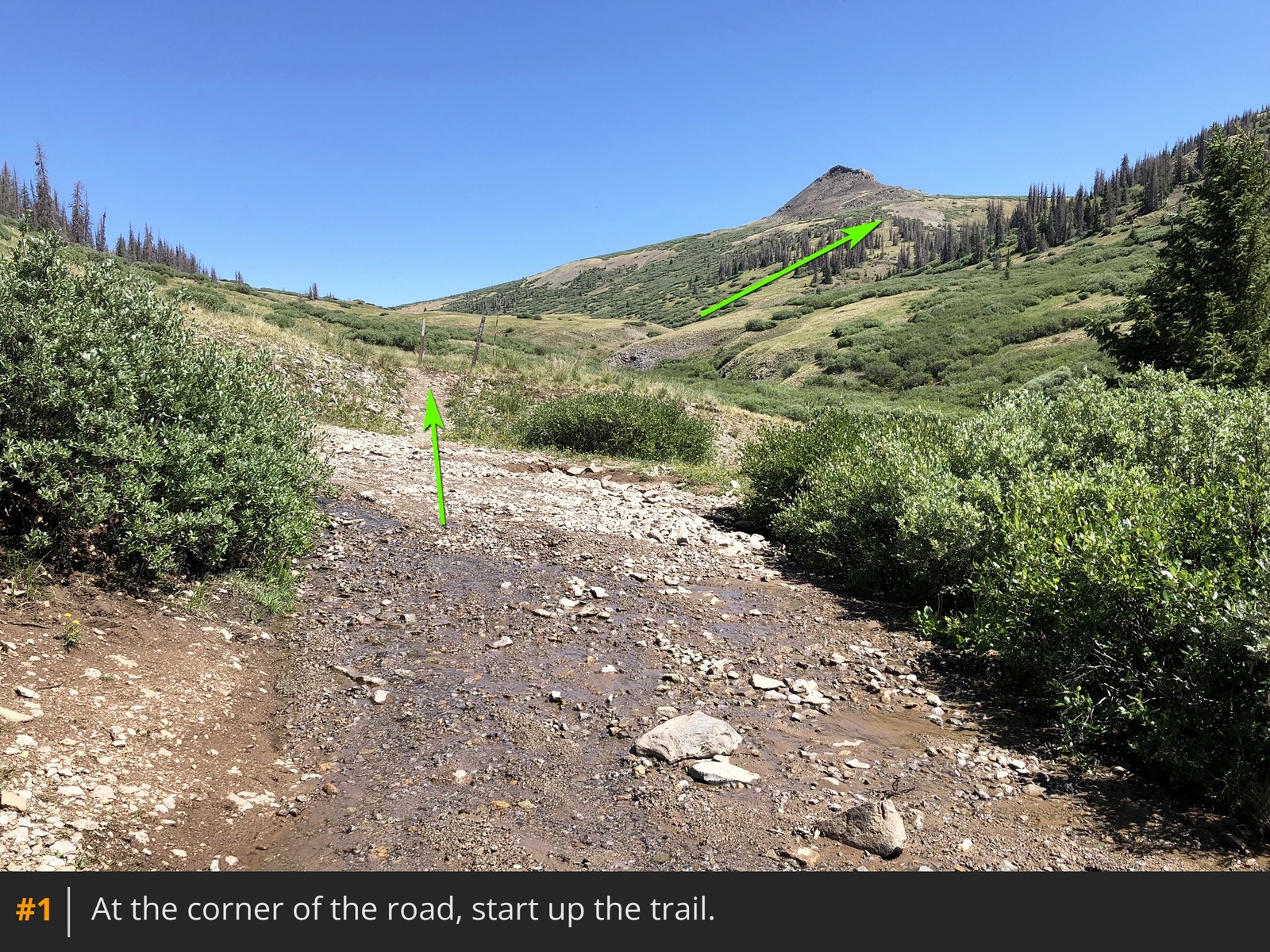
From the 4WD parking area, walk a few feet to a sharp corner on the road and start north up the marked trail
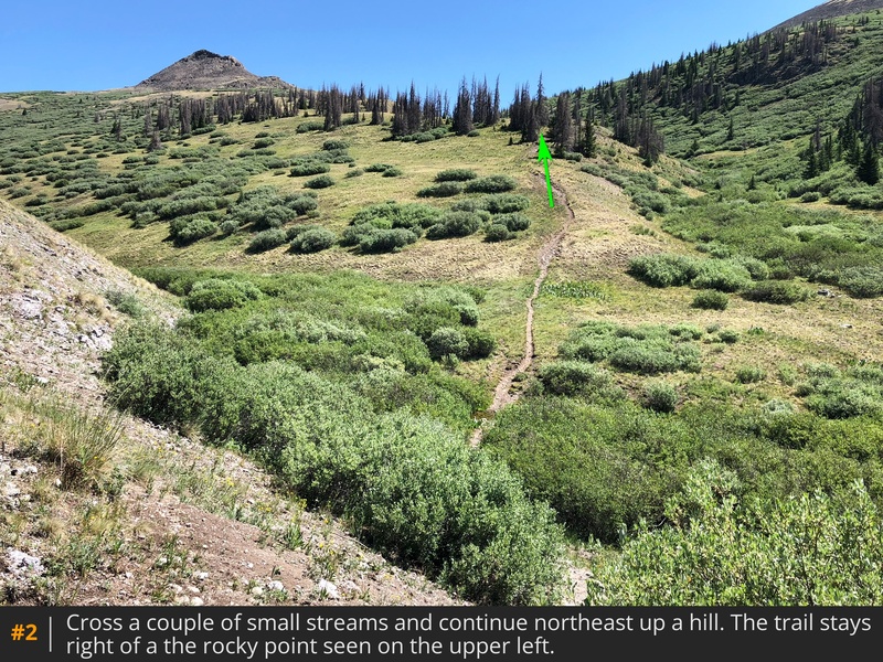
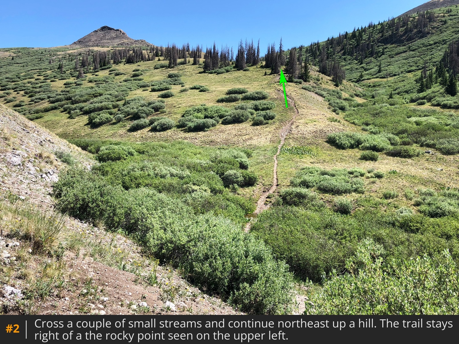
1. Turn northeast, cross a couple of small streams and follow the trail up a hill, heading toward a rocky point
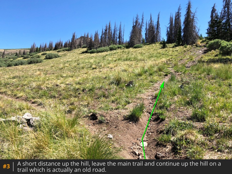
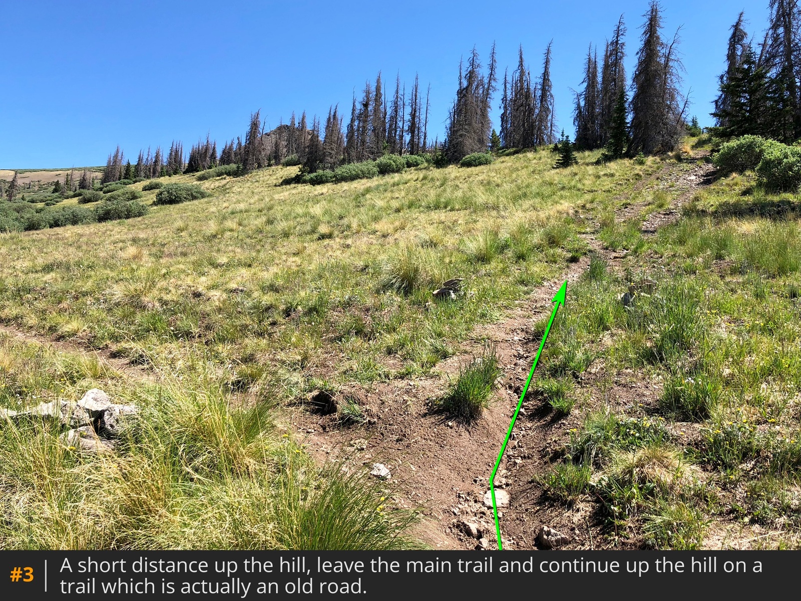
2. A short distance up the hill, you'll reach a junction - leave the main trail and stay right on an old road
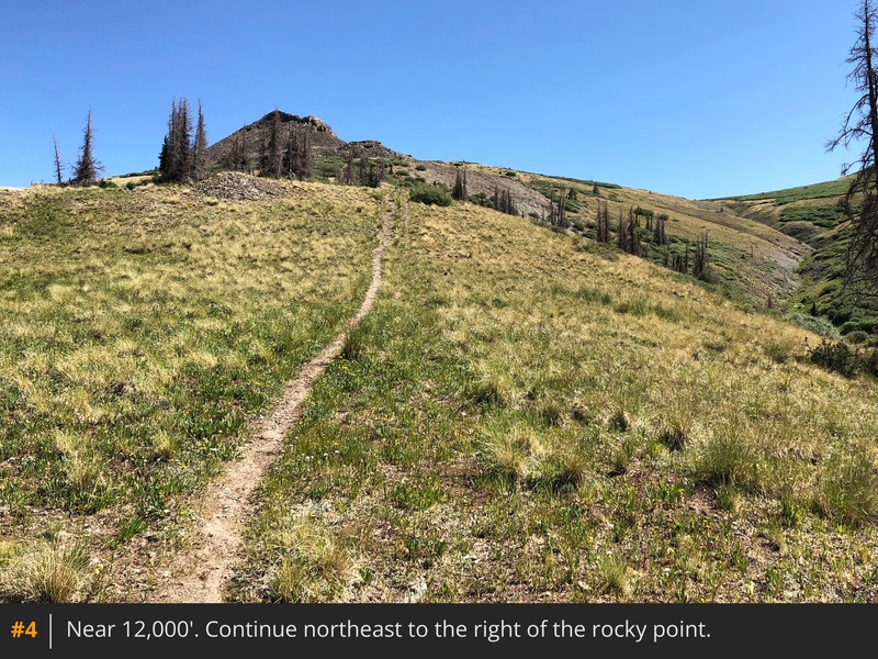
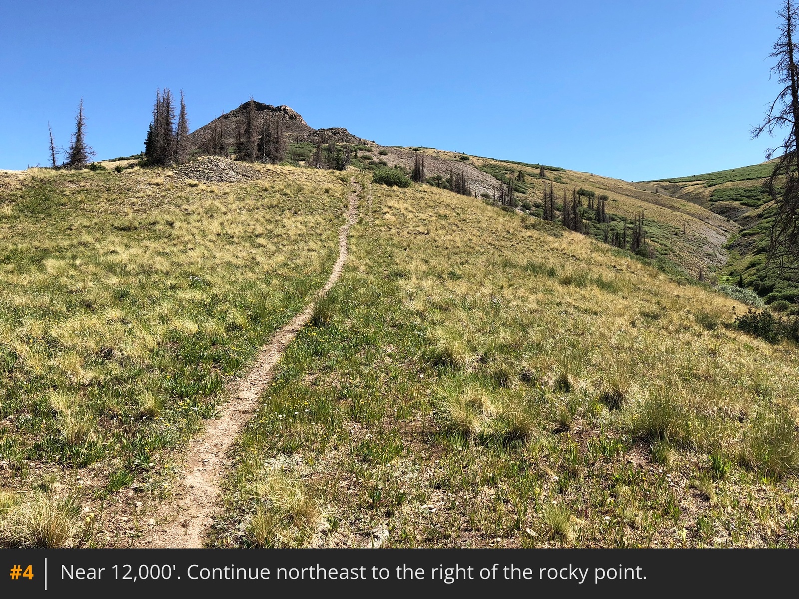
3. Follow the road/trail northeast out of the trees and toward the rocky point
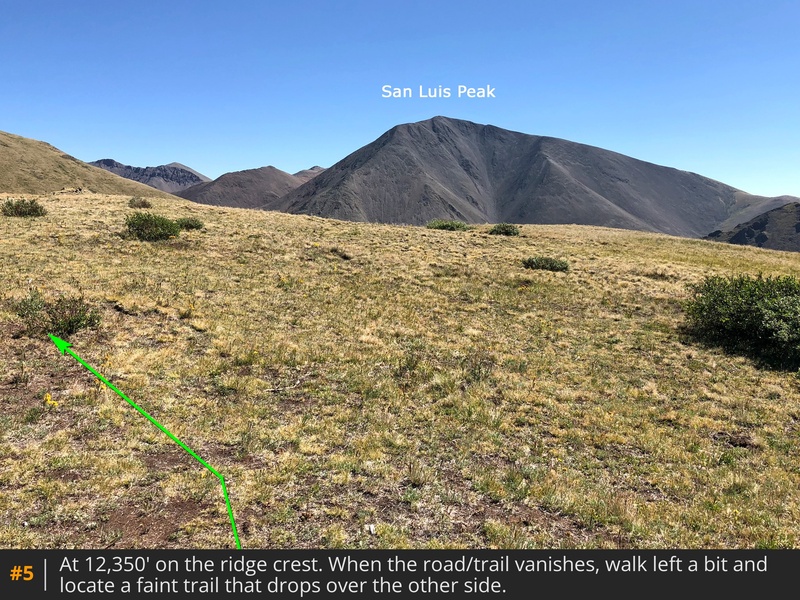
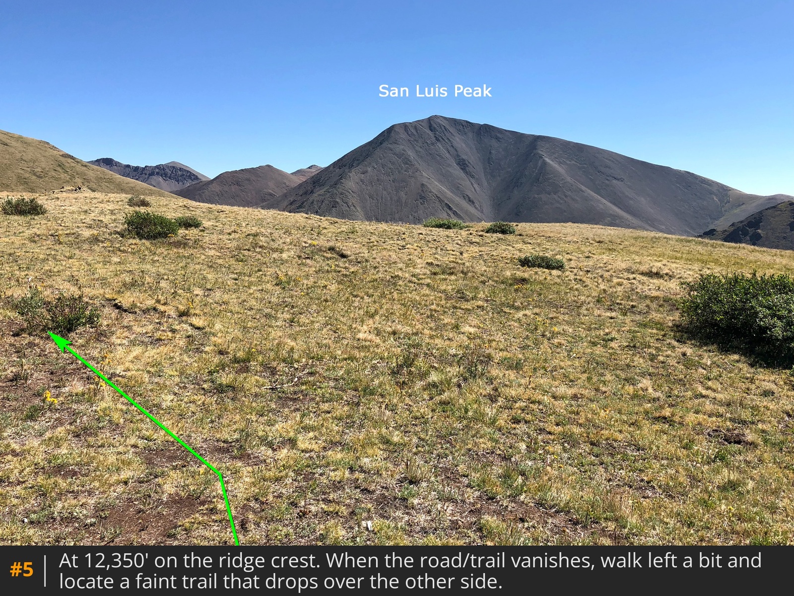
4. At 12,350', reach a ridge crest on the right side of the point
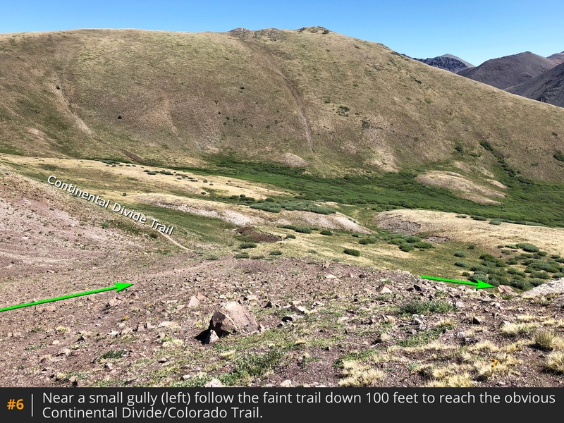
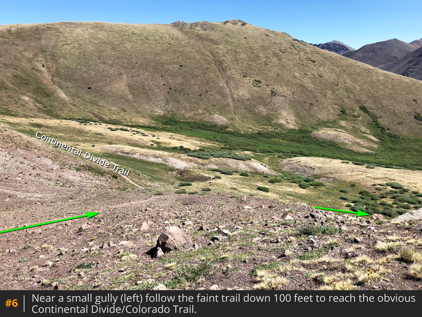
5. The old road ends here. Walk a short distance to your left and locate a faint trail that drops off north off the ridge
6 and follow it down 100' to intersect the Continental Divide Trail (CDT), also the Colorado Trail.
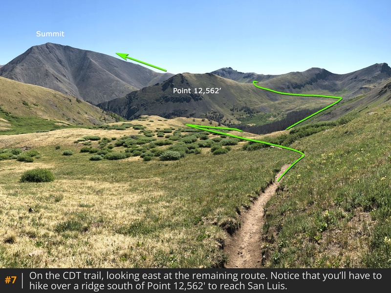
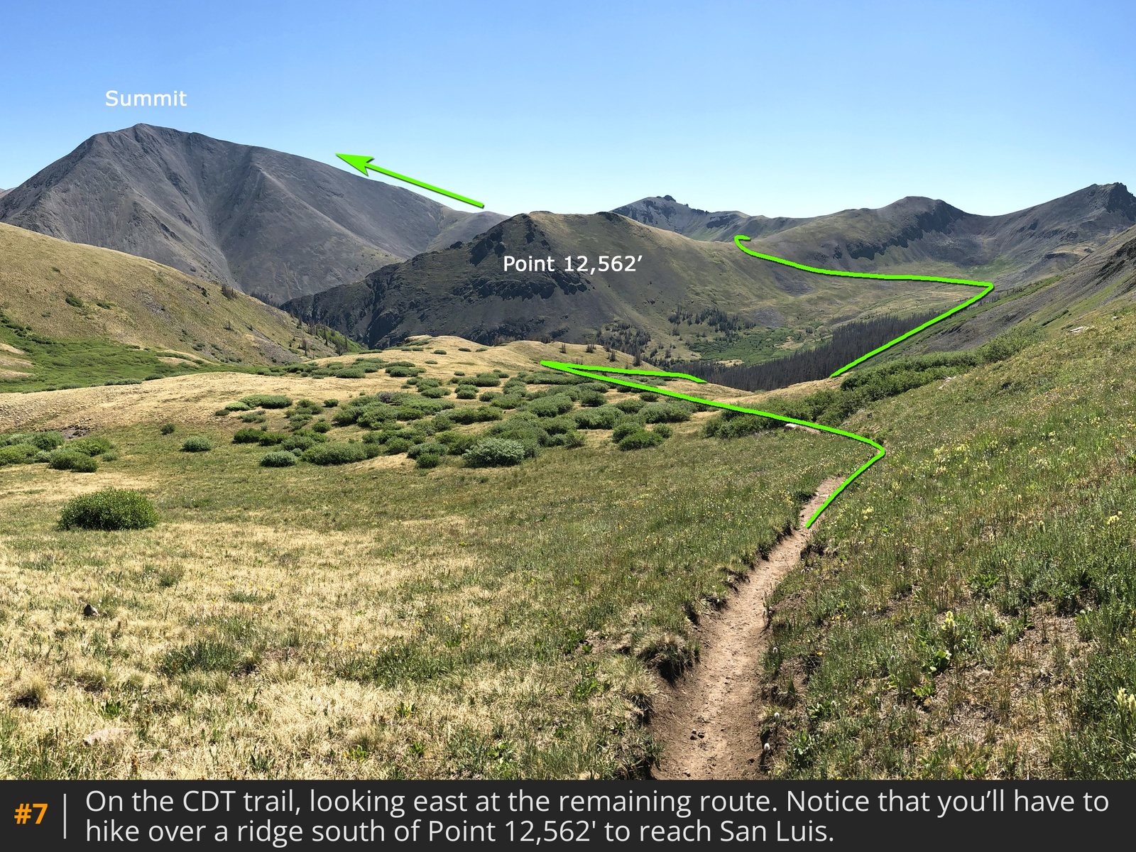
Turn right to see the remaining route
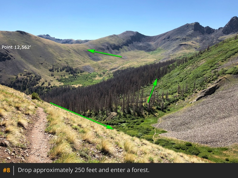
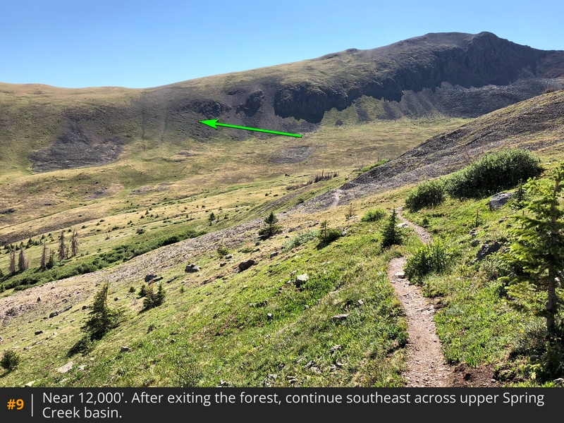
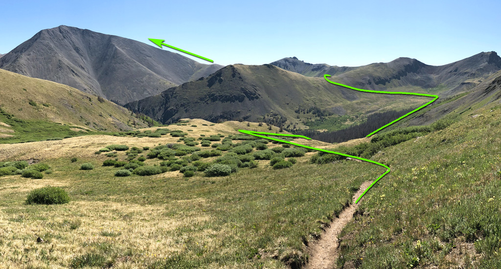
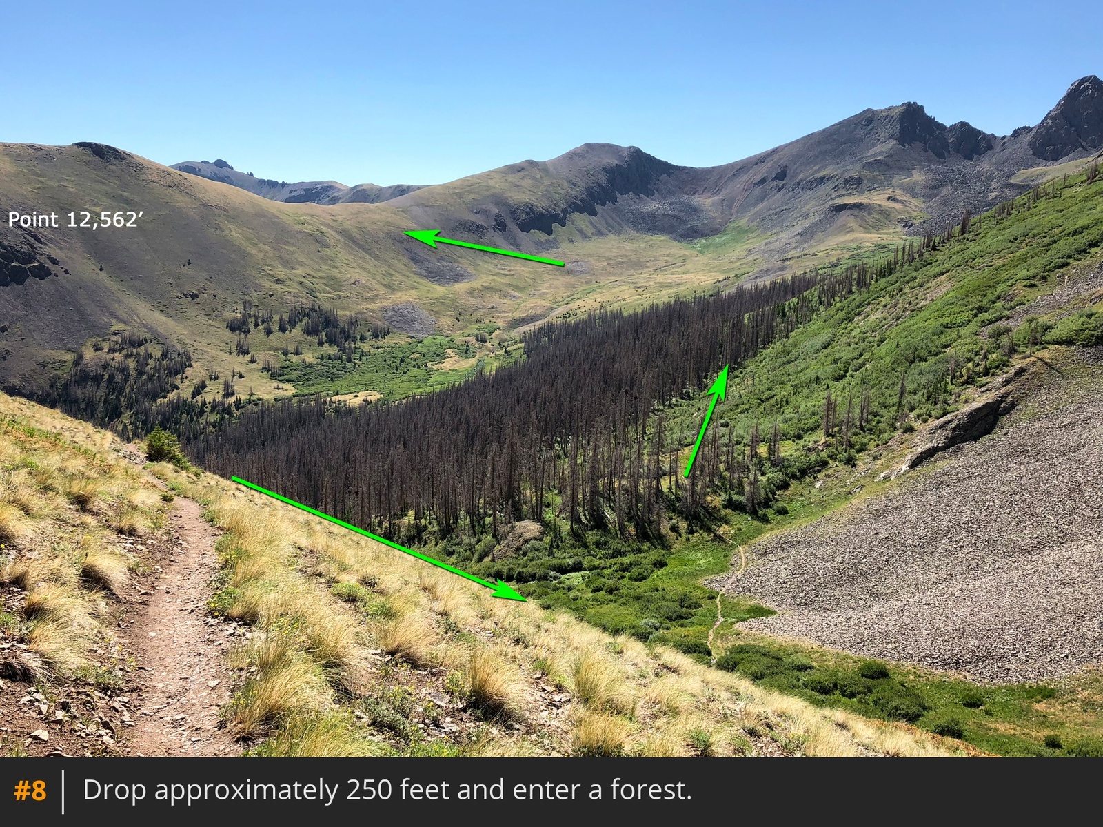
7. In short, you'll cross Spring Creek basin, hike over a ridge south of Point 12,562' and cross another basin to reach San Luis' south ridge. Now, continue east on the CDT, drop 250 feet and enter a dead spruce forest
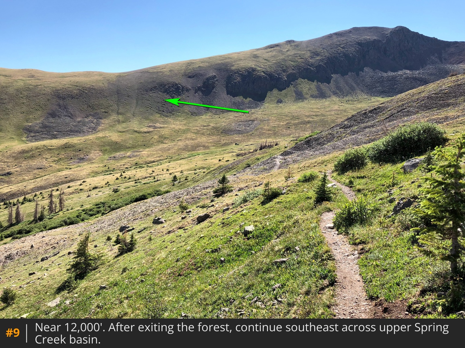
8. After exiting the forest, continue southeast across upper Spring Creek basin
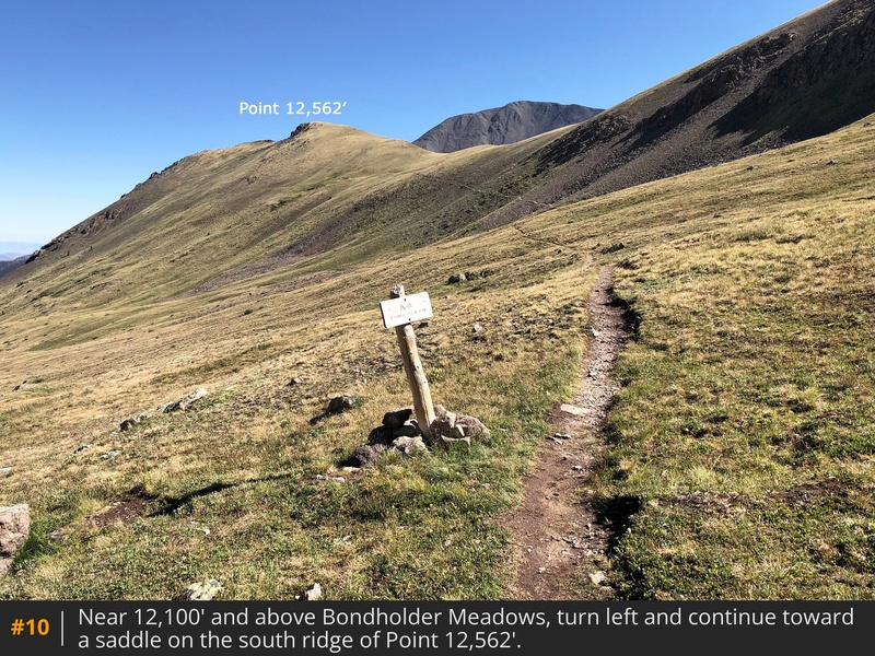
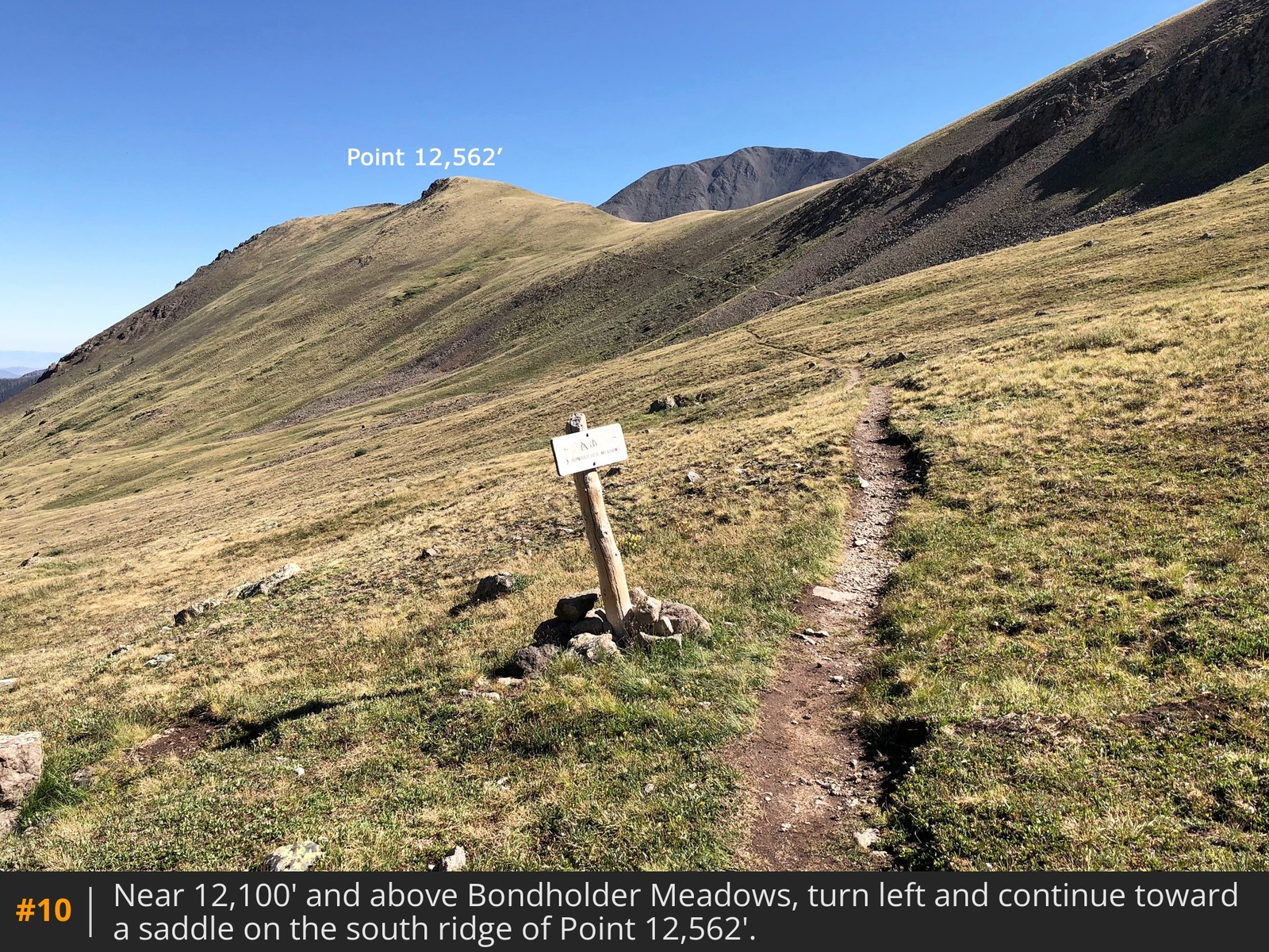
9. Near 12,100' and 1/2 way to the summit, you'll pass a sign for Bondholder Meadows. Turn left and continue toward a saddle on the south ridge of Point 12,562'
10.
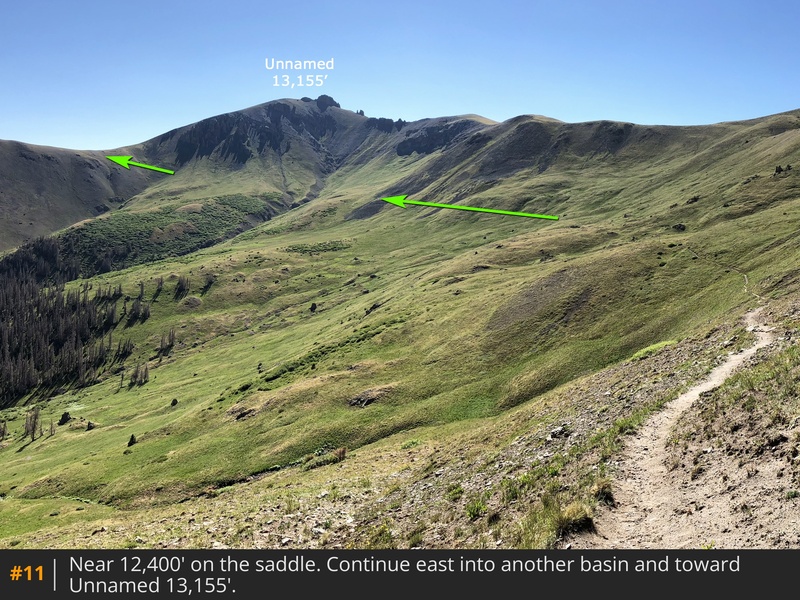
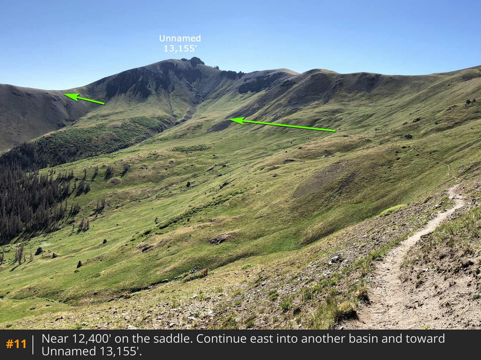
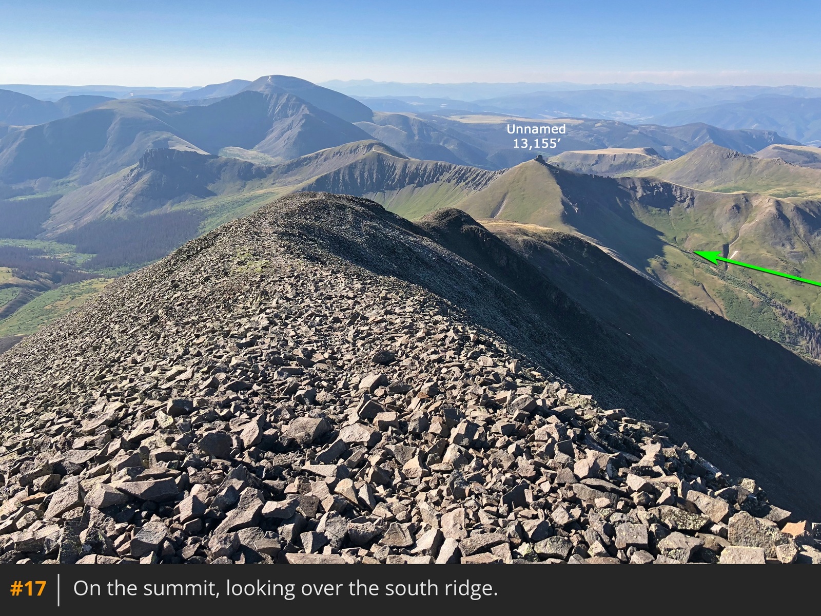
Cross over the saddle and continue east into another basin and toward Unnamed 13,155'
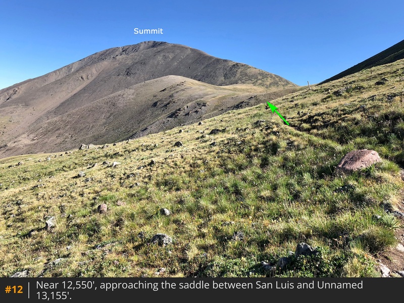
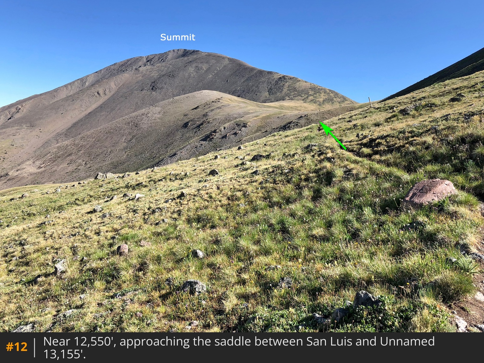
11. On the east side of the basin, ascends to the saddle between San Luis and Unnamed 13,155'
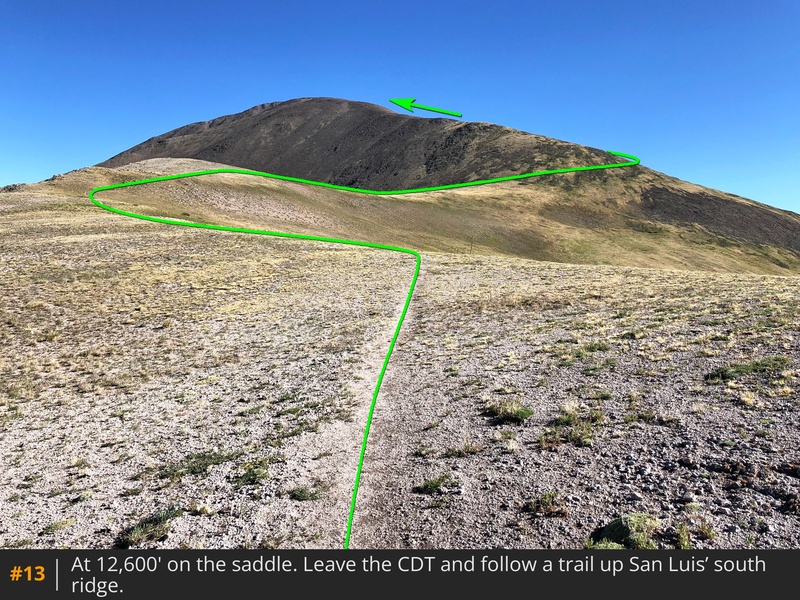
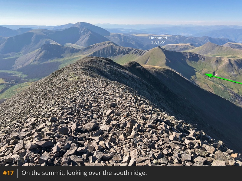
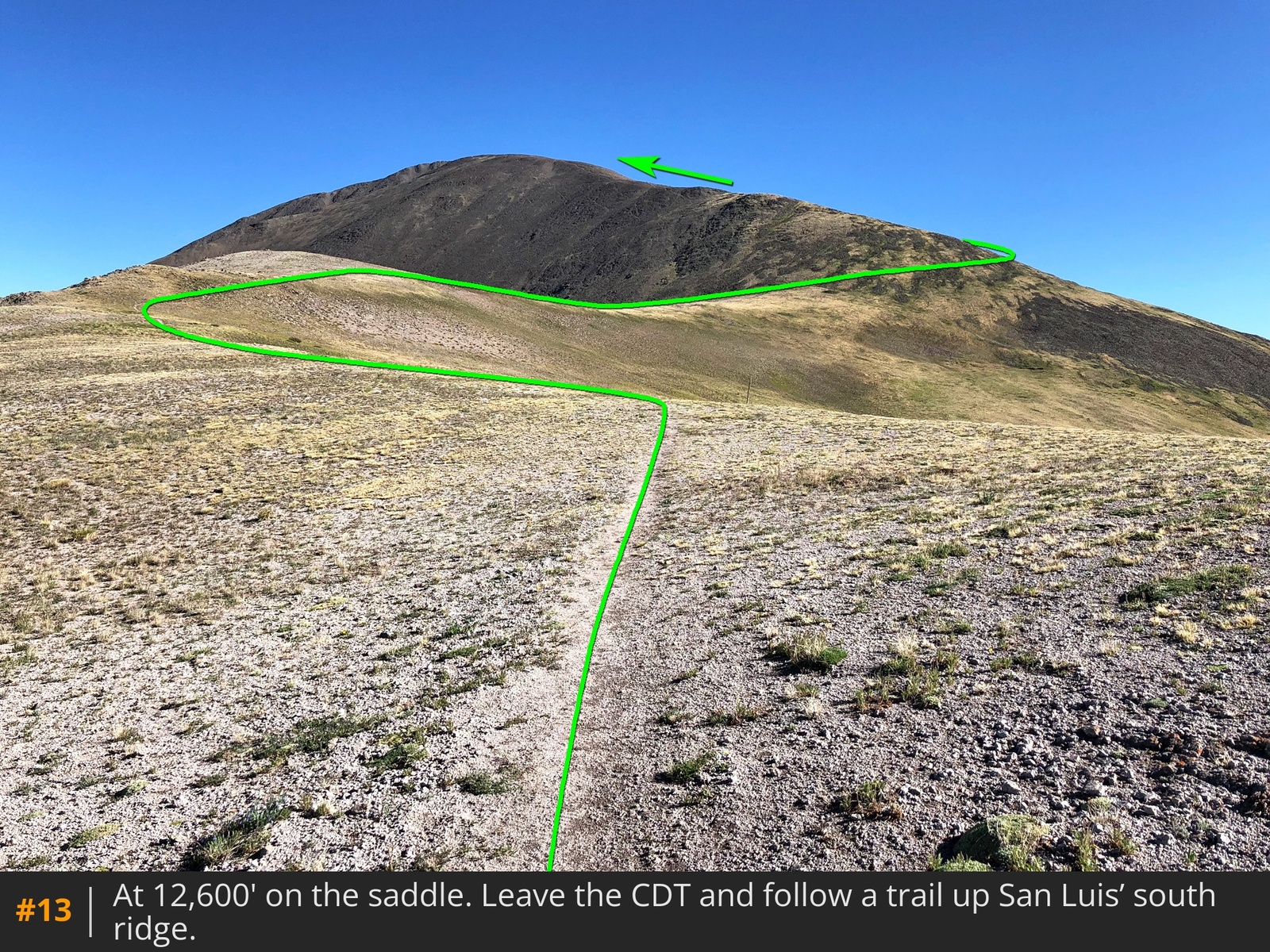
12. From the broad, 12,600-foot saddle, leave the CDT and walk left (north) on San Luis' south ridge trail
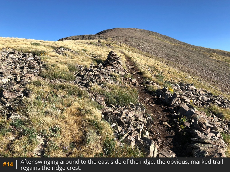
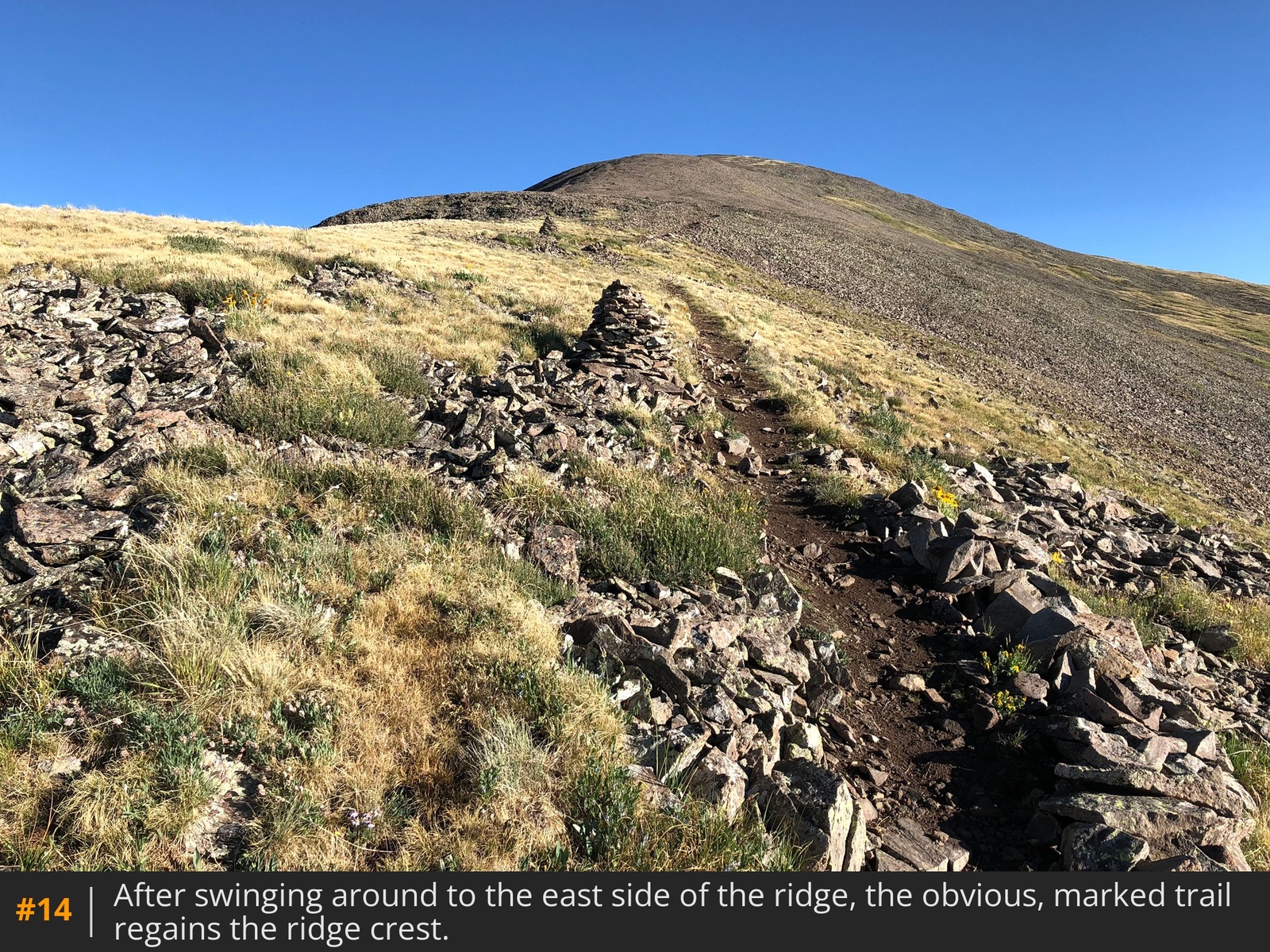
13. Hike northeast and east as the trail swings to the east side of the ridge before regaining it, near 13,100'
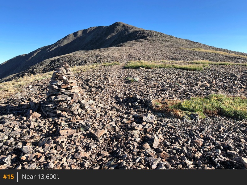
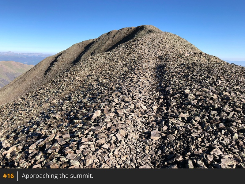
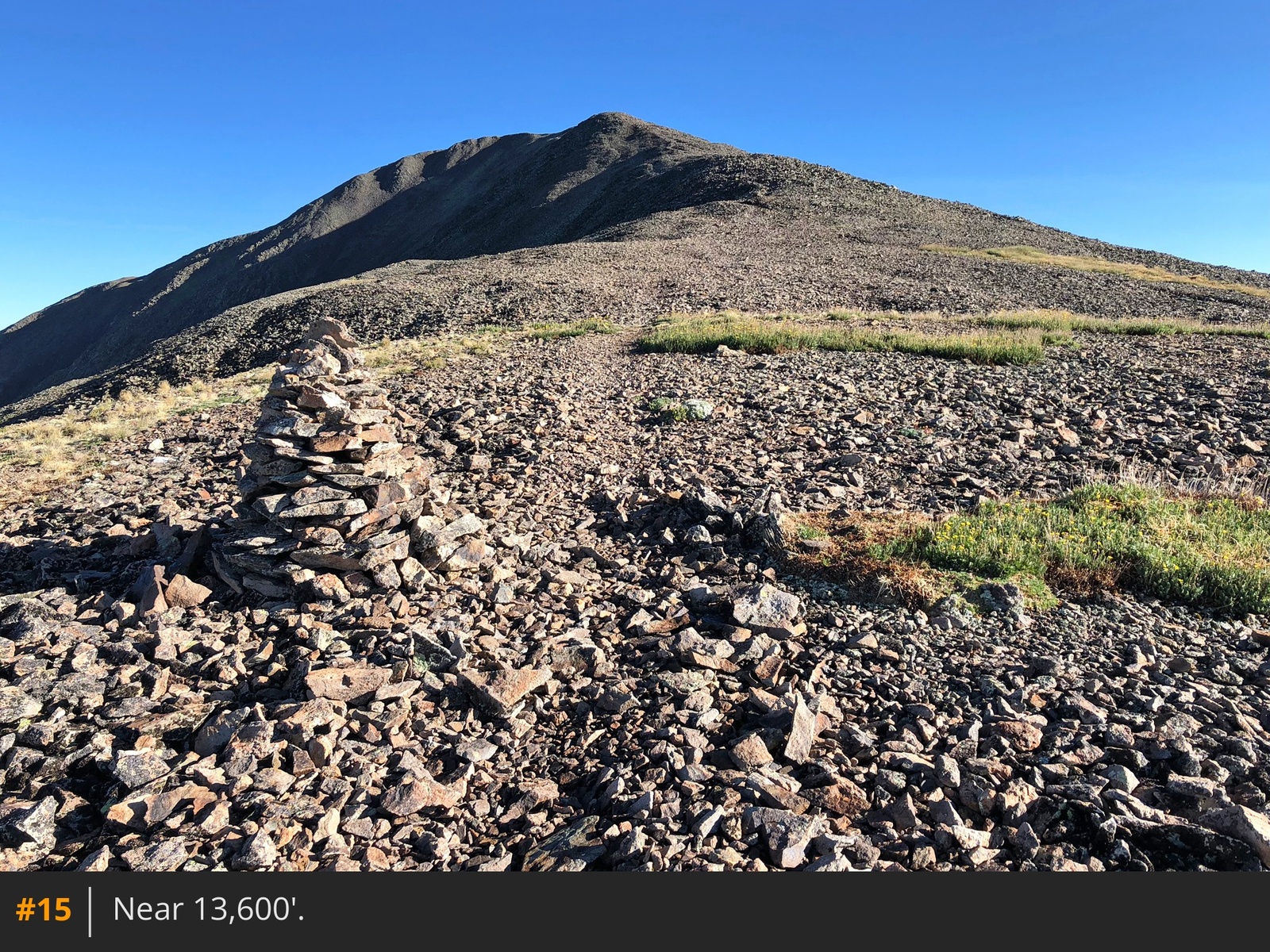
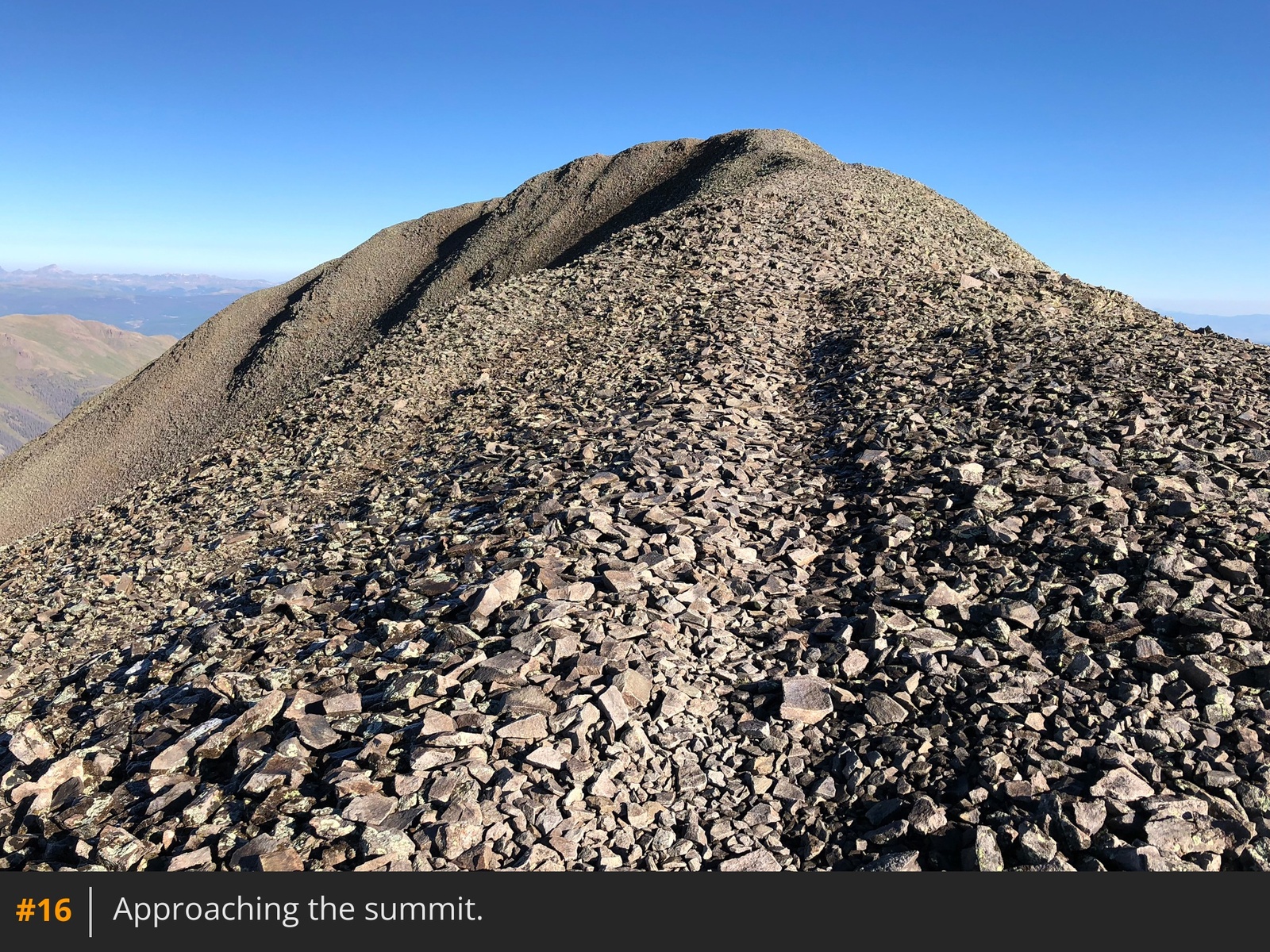
14. Follow the well-cairned trail up the ridge and to the summit
15 16 17.






 GPX
GPX KML
KML