From the Silver Creek trailhead, hike northeast, ascending a hill and entering the forest -
1. Near 11,100', exit the forest and follow the trail, which parallels Silver Creek on your right. After about 1.5 miles and near 11,300', the trail gets close to the creek
. Continue northeast along Silver Creek, passing several rockslide deposits on the left side of the creek -
2. Near 12,000', the terrain opens up to the east -
3. Stay on the trail as it curves right (southeast) and enters the basin northeast of Redcloud Peak -
4. At this point, you've hiked approximately 3 miles and gained 2,000 feet of elevation -
5.
This area often holds snow in early summer. Head south toward the saddle between Point 13,561' and Redcloud (
6), as you zigzag up an easy slope to reach the 13,000-foot saddle
-
7. Turn right (west) to see the remainder of the route up Redcloud's northeast ridge -
8,
9. Follow the trail as it curves right before regaining the ridge crest at a higher point -
10. Near the top of the ridge, pass over a false summit (
11) to reach 13,900', just below the final pitch -
12. Follow the final section of the trail to reach the summit -
13,
14,
15.


 GPX Track File
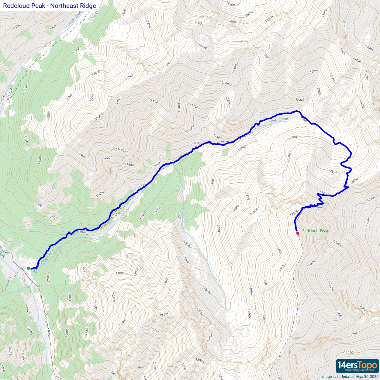


