First, hike to the summit of Mt. Belford via the
Northwest Ridge route. Then, traverse to Mt. Oxford via the
Belford-to-Oxford Traverse route. Leave Oxford and retrace your route back to 14,150 feet on Belford's southern ridge
1. Once you have regained the ridge, follow the trail right a short distance toward the Belford summit and locate a trail junction, which is usually marked with a cairn
2. Since your next objective is to hike Missouri Mountain, you don't want to go back to the Belford summit. Instead, hike down Belford's southwest slopes toward Elk Head Pass. Turn left and follow the new trail south
3. Continue down Belford's southwest slopes toward Elk Head Pass
4,
5.
You can see Missouri Mountain and its east ridge ahead. It appears that you could just climb that east ridge to take a much shorter line to the summit, but don't be fooled—Missouri's east ridge is a difficult mess of rotten rock. It is much easier and safer to continue on this route by hiking Missouri's standard trail. At Elk Head Pass, turn right and follow the Missouri Gulch/Elk Head Pass trail north down into Missouri Gulch
6,
7. When you get below 13,000 feet, you can see the Missouri Mountain trail ahead on the west side of the basin
7. Descend to 12,600 feet to reach the trail junction for Missouri Mountain
8.
It's decision time. It takes another 1,600 feet of elevation gain and three round-trip miles to add Missouri Mountain. If you don't have enough energy to summit Missouri, just keep descending the main trail. If you do, you will head off toward Missouri from this junction and return here when you're done.
Turn left and begin zigzagging westward up the slope
9. At 12,900 feet, the terrain levels out as the trail approaches Point 13,784'
10. Follow the trail northwest onto talus, then traverse across the south side of Point 13,784'
11. Stick to the trail as it zigzags upward to reach the saddle between Points 13,930' and 13,784'
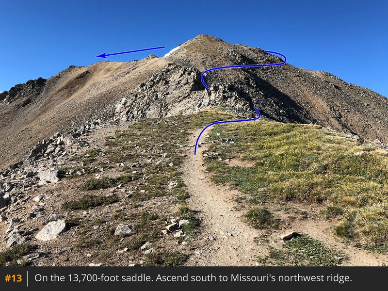
12. From the 13,700-foot saddle, turn left and follow the trail onto Missouri's northwest ridge
13. Pass the west side of Point 13,930' (
14) and climb onto the crest of the ridge, where the summit finally comes into view
15.
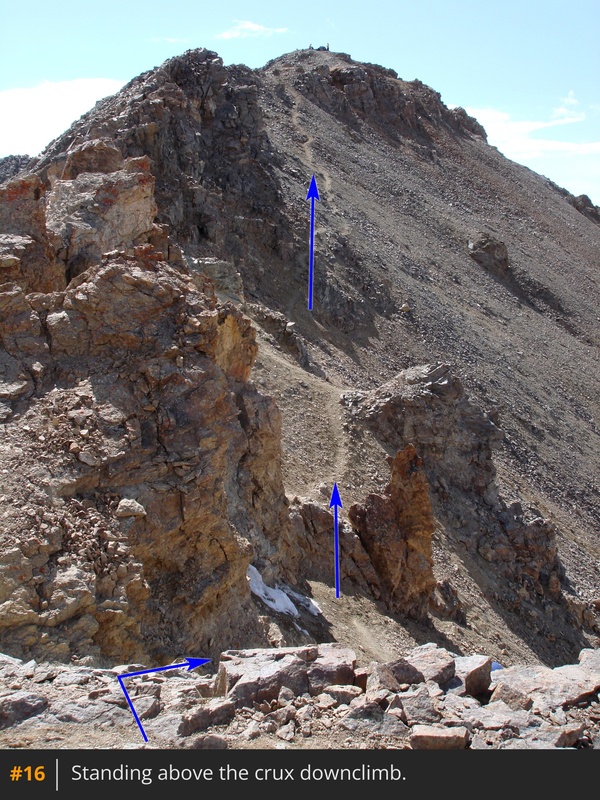
From here, stay on the trail along the ridge crest. Two-thirds of the way across, the route dodges rocky obstacles on the ridge crest by dropping about 25 feet to the right. This is a brief section of more difficult Class 2 terrain
16,
17. After clearing this section, continue along the trail to the summit
18,
19,
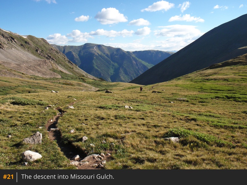
20. For the descent, return to the Missouri trail junction at 12,600 feet, and turn left to follow the main Missouri Gulch trail 3.5+ miles back to the trailhead
21.


 GPX Track File


