1 and
2 show the route from the east. This route is Class 2 but it lacks a trail above 11,200'. If you parked at the lower trailhead, begin your hike up the road. Pass the road to Crystal Creek soon after you leave the trailhead. Reach the Aqueduct road after 1 mile on the Spruce Creek road. Turn right and walk up the Aqueduct road to a gate. Pass the gate and walk 50 yards to reach the Wheeler trail as it enters the forest on the left. The entrance is marked with a small sign.
Follow the trail about 100 yards through the forest to a point where the trail begins to climb a small hill. The remaining route does not have a defined trail. Turn left and leave the Wheeler trail. Hike west, southwest up a short slope. There are few small clearings along the way. Not long after starting up through the trees, continue directly west up through the trees. Near 11,200' the terrain flattens out and there are some clearings. Continue west and locate a steep gully that cuts through the trees.
3 and
4 show the gully. Climb the gully from 11,300' to 11,500'. This narrow gully is a bit steep but still easy to hike. A small stream runs down the center through mid-summer. At the top, angle to the right into a clearing. Reach tree line near 11,600'.
Find another, wider gully above tree line -
5. It's in the middle of Helen's east slope. This gully usually holds snow into July. The remaining 1,500' feet to the summit is on grass and easy terrain. Hike up or around the wide gully and continue west up the east slope.
6 shows the last 600' feet to the summit. Keep hauling to reach the easy talus below the summit. Gain the summit for a great view of surrounding Tenmile peaks.
7 and
8 are views from the summit.
9 looks back down on the route.


 GPX
GPX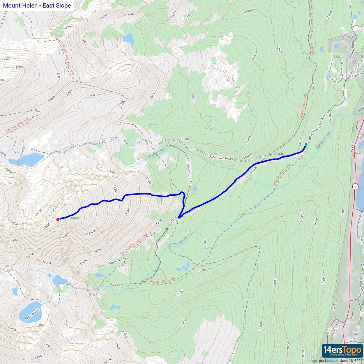


