1 provides a distant view of the route. From the 10,400-foot trailhead, follow the 4WD road a short distance until you reach a road junction. Turn right here and follow another 4WD road toward Crystal Creek. Hike up the steep, narrow road for over a mile, eventually leaving behind the dense forest. Around 1.3 miles from the trailhead, cross the Wheeler Trail. Taken in winter,
2 shows the view ahead. Continue on the road through Crystal Creek Basin to reach Lower Crystal Lake, near 12,000'. The lake is roughly 2.25 miles from the trailhead.
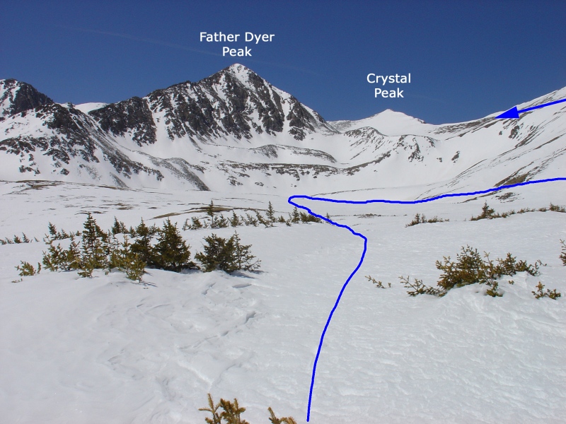
Near an old mine building, turn right and walk down toward the creek (
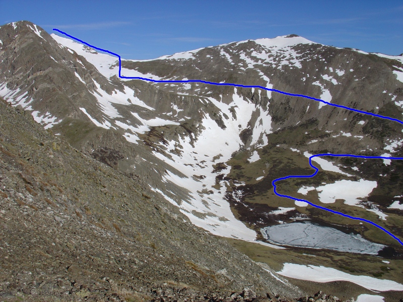
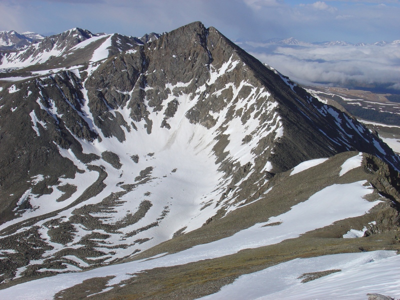
3). Taken from Mt. Helen,
4 shows the route as it climbs part of Peak 10 and then veers west toward Crystal Peak. Follow an old road west, passing the lake until you reach the end of the basin. The road then curves to the south side of Peak 10, turns right, and begins ascending the slope (
5). Zigzag up the slope, where the road transitions into a trail. Near 12,400', the trail heads left (south) and climbs to 12,800' before leveling out and heading toward Upper Crystal Lake. This section crosses steep terrain, which can become slightly hazardous when covered in snow. Proceed along the trail as it approaches the lake (
6).
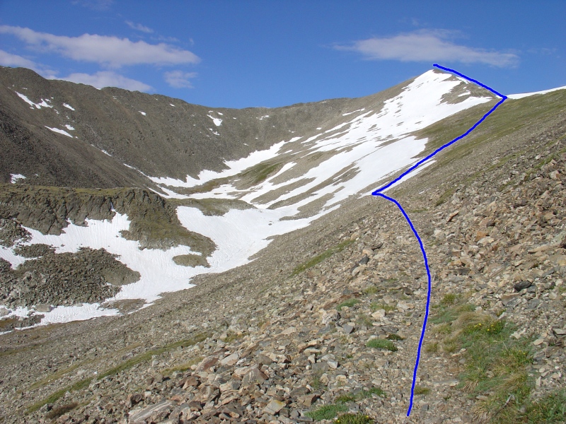
Before reaching the lake, around 12,900', turn right and climb directly up to the Crystal-Peak 10 saddle (
7). The slope consists of grassy areas and stable talus. Once at the saddle, turn left (southwest) and ascend Crystal's northeast ridge (
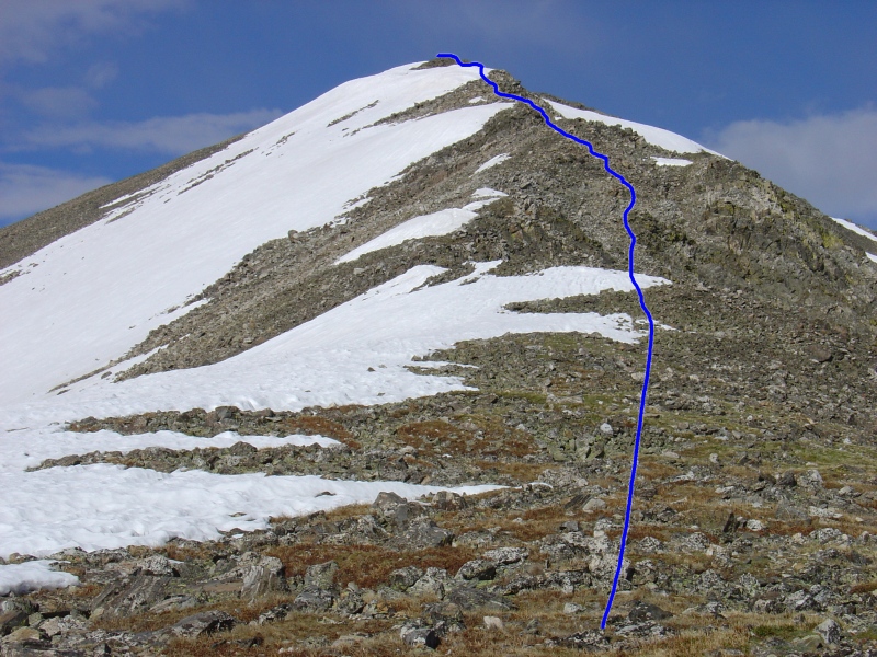
8 and
9). While there are a few narrow spots, they do not exceed Class 2 difficulty. Finally, after a couple of false summits along the ridge, reach the summit (
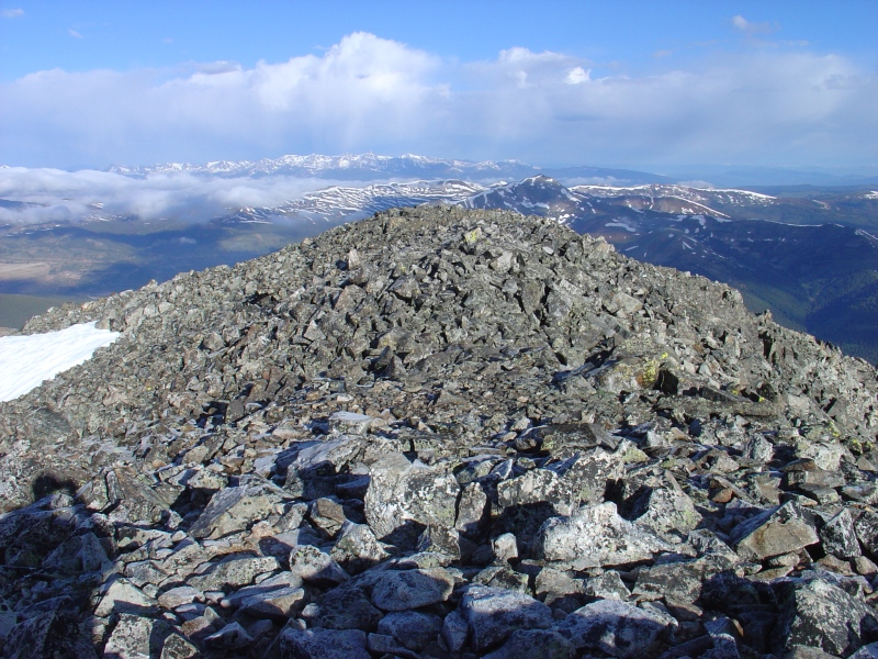
10 and
11).


 GPX
GPX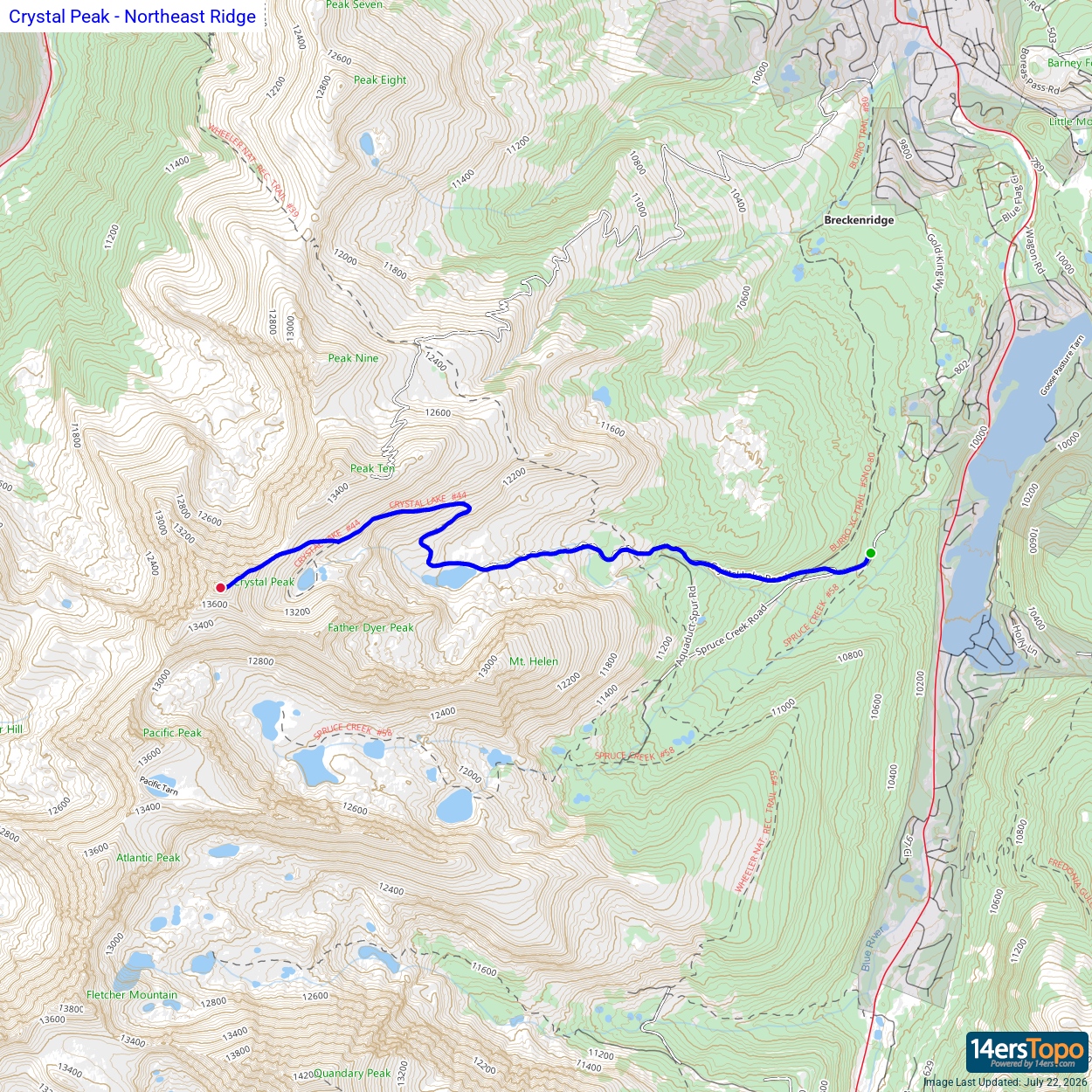


