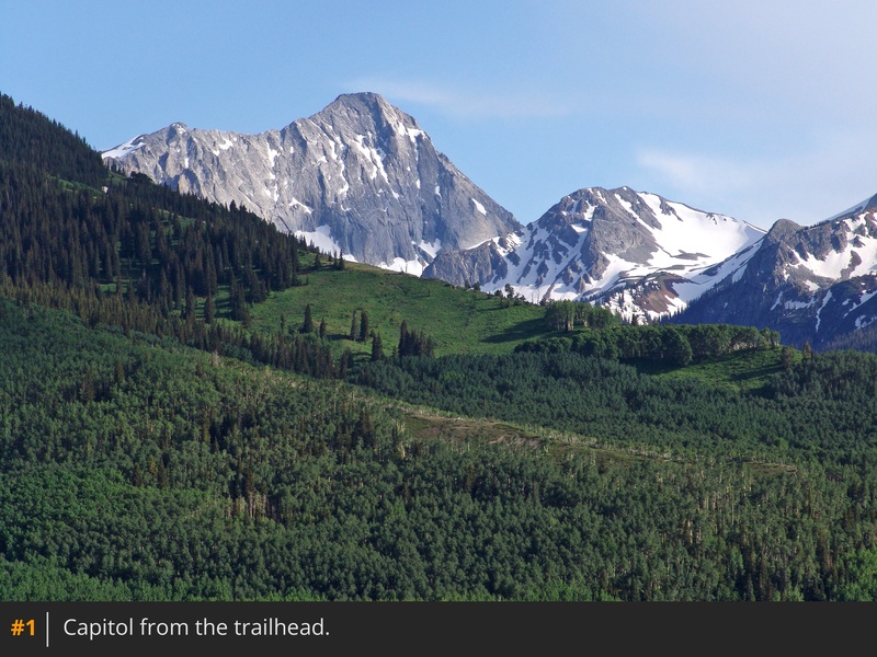
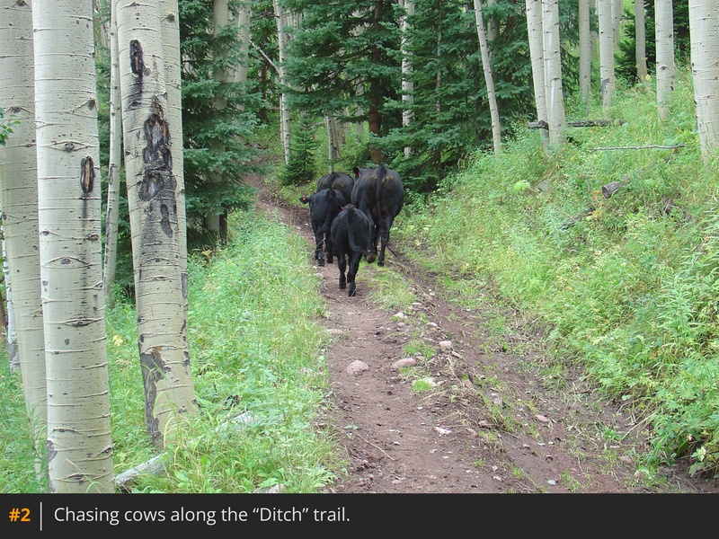
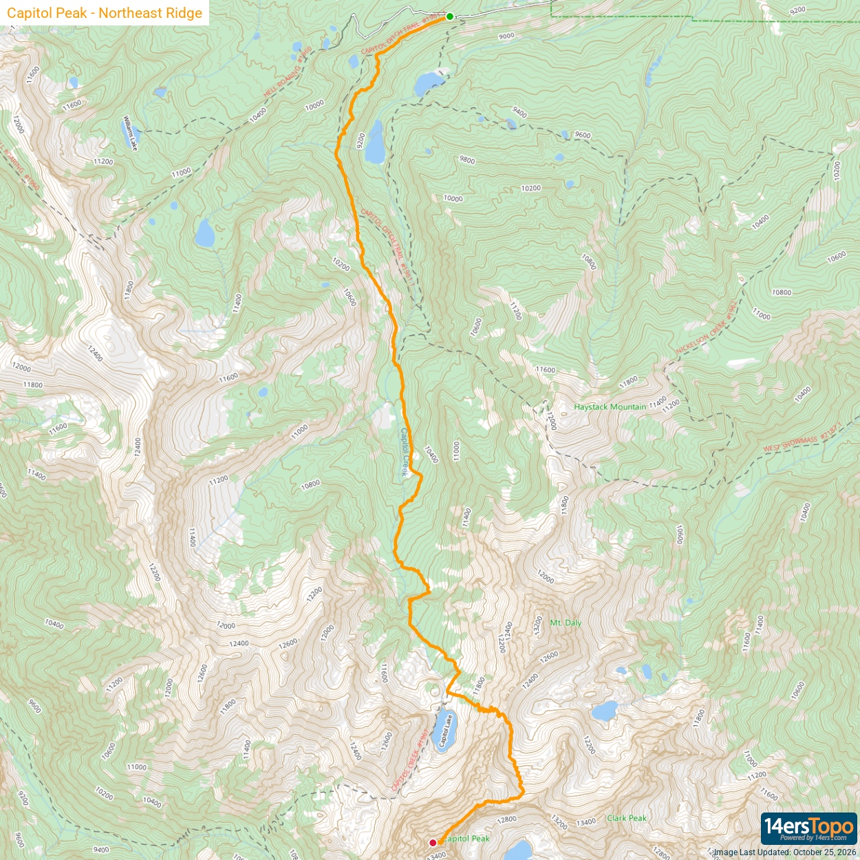
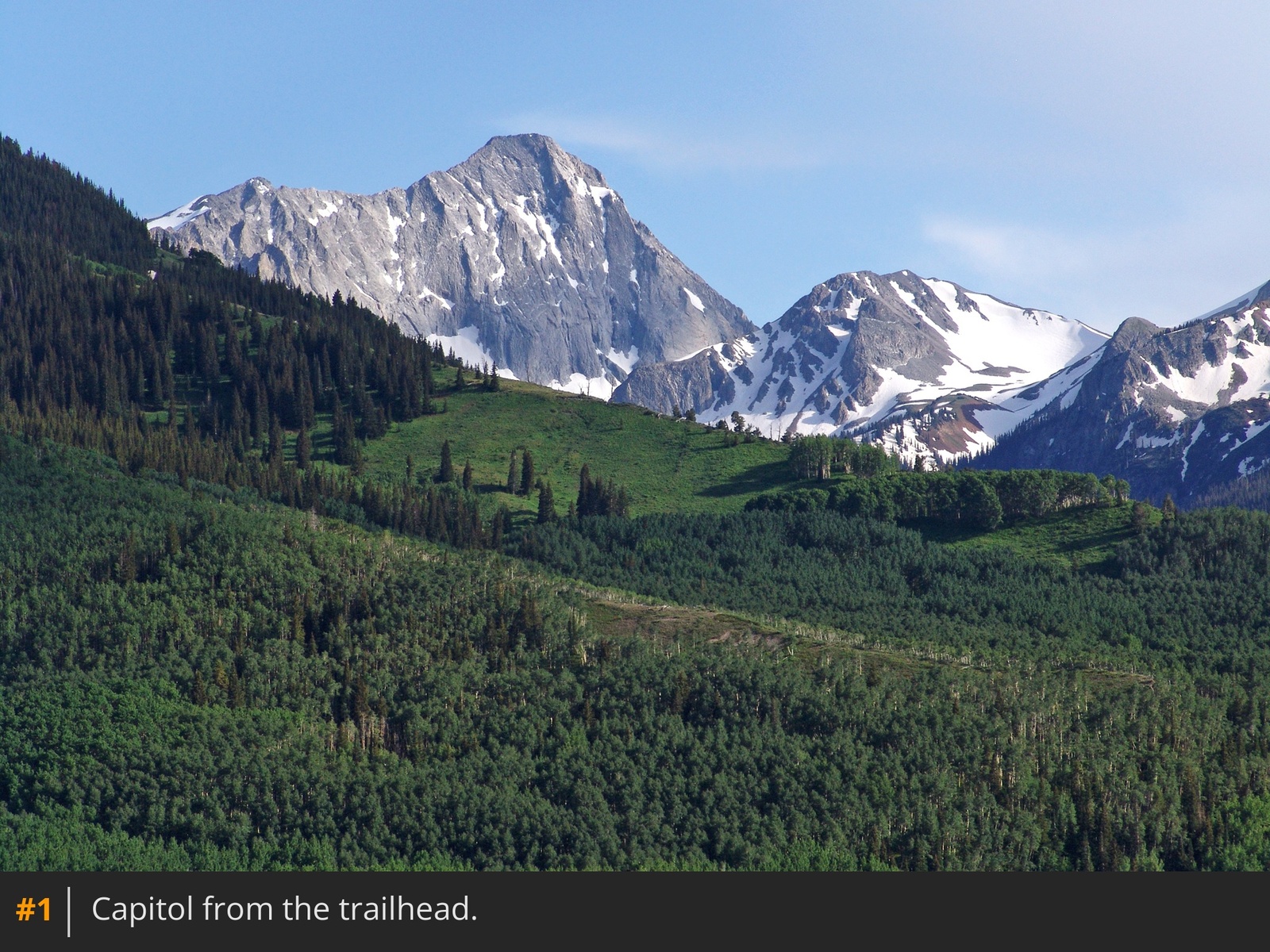
1 shows the incredible view of Capitol Peak from the trailhead, where two trails begin: Capitol Creek Trail #1961 and Capitol Creek Ditch Trail #1963. The Capitol Creek Trail has traditionally been the main approach, but more hikers now prefer the ditch trail since it avoids losing and regaining elevation. This description follows the ditch trail, making the hike to Capitol Lake approximately 6 miles long. From the west end of the trailhead parking area, follow the signed ditch trail
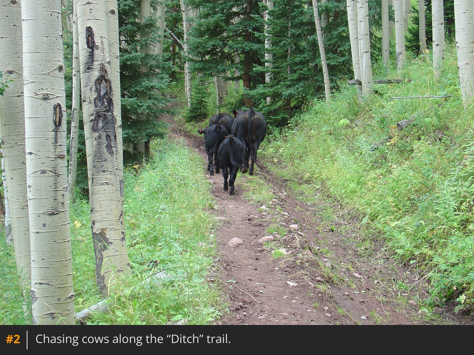
2. After 1.2 miles, you'll reach a junction at 9,500'
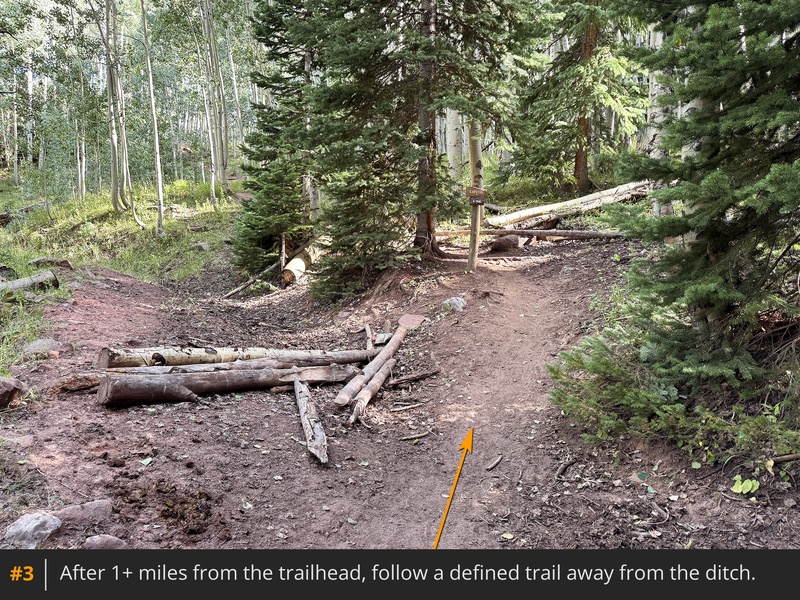
3 where you'll leave the ditch and continue on a well-defined trail. Weave through the forest, cross a stream, and enter the Maroon Bells-Snowmass Wilderness after passing through a meadow. Continue through aspens and clearings to reach a wide-open area above Capitol Creek
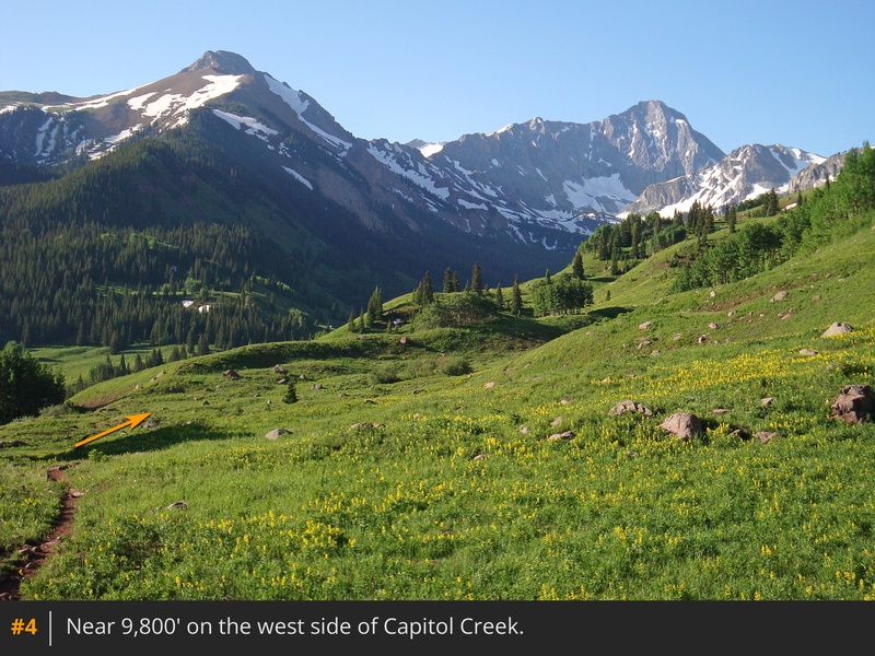
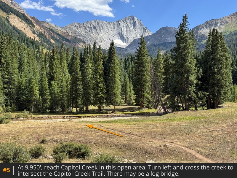
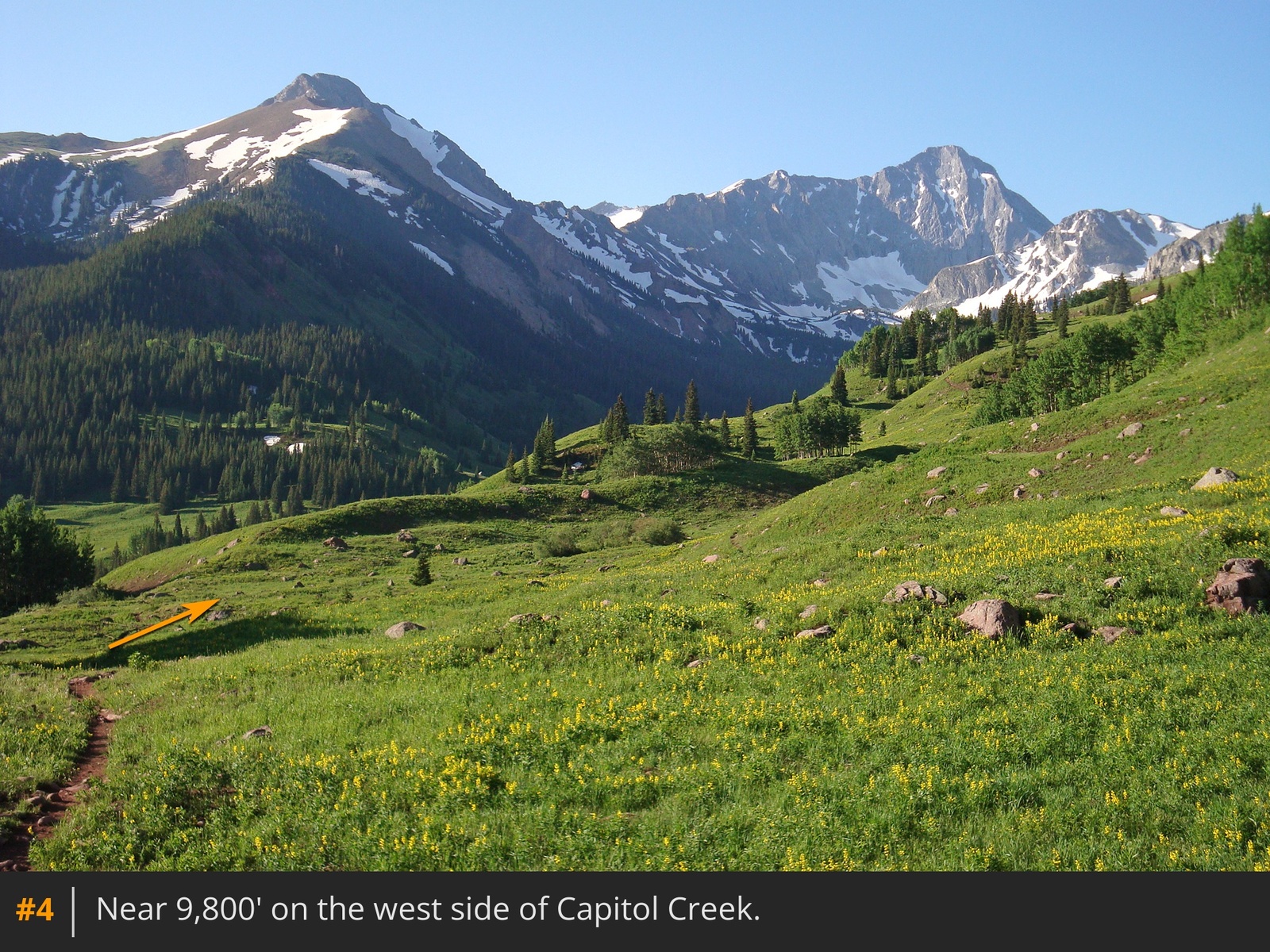
4. Stay along the hillside for 1.5 miles, then descend to the creek, approximately 3.25 miles from the trailhead
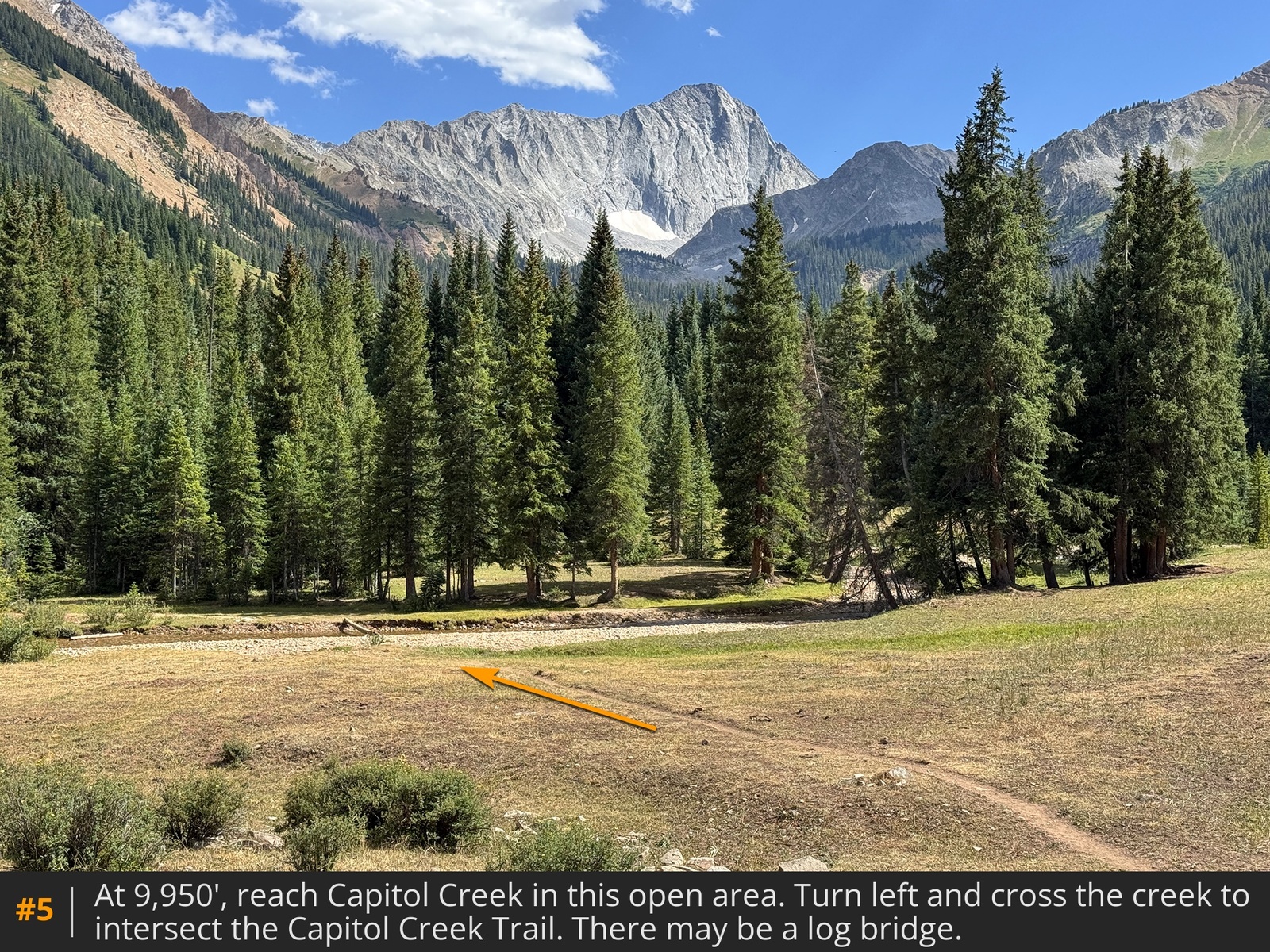
5. Angle left, cross the creek
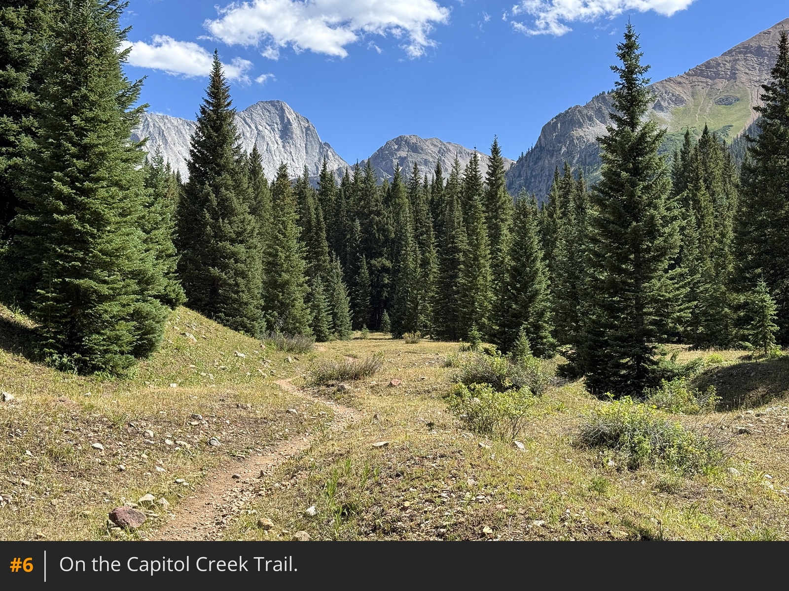
, and intersect the main Capitol Creek Trail. Turn right and continue south
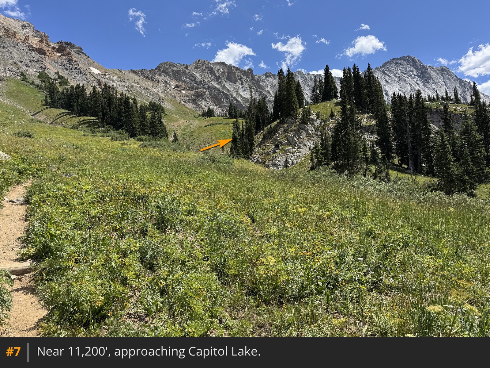
6. Near 4 miles in, you'll reach a gate in a fence that is suppose to keep cattle from going higher. This fence is also the boundary of the Capitol Peak Permit Zone so camping higher, at the lake, requires a permit. If you don't have one, and plan to camp, it's best to set up camp before this fence. Now 2 miles from Capitol Lake, continue through the forest and toward the lake area
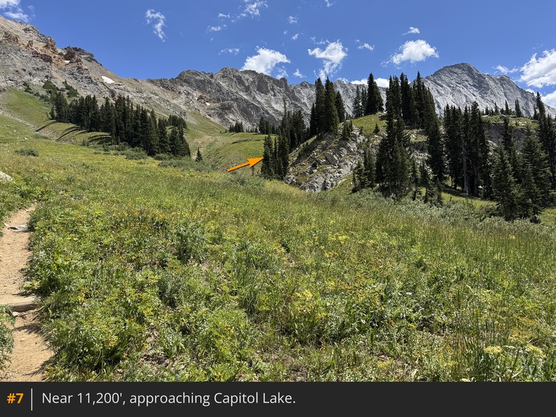
7. Near 11,400', turn sharply right and hike a bit higher to reach the basin just below Capitol Lake, where the designated camp
sites are on the right
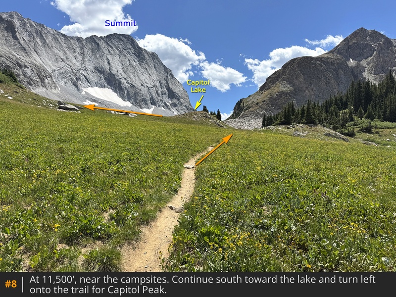
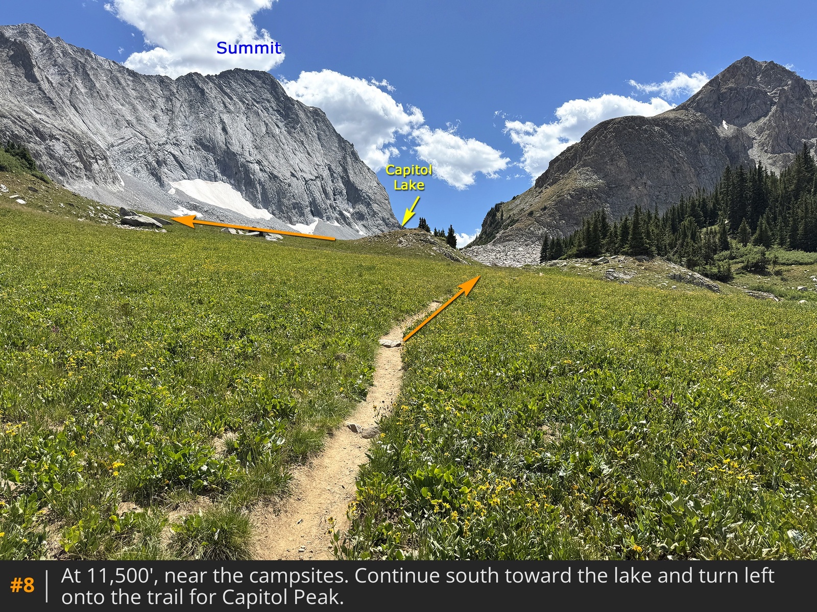
8.
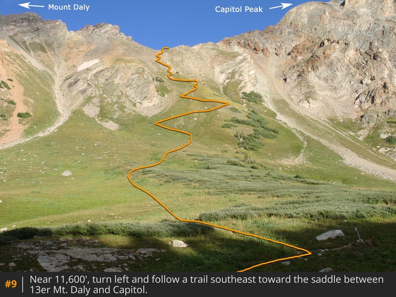
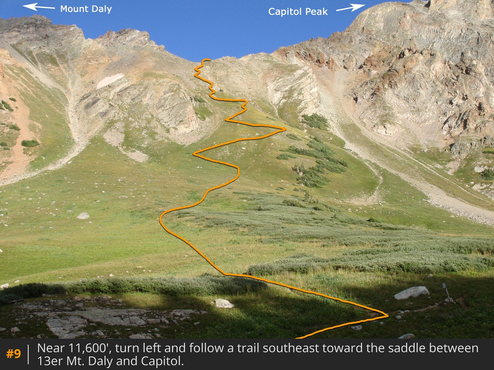
Just below Capitol Lake, turn left on the Capitol Trail, heading southeast toward the saddle between Mt. Daly and Capitol Peak
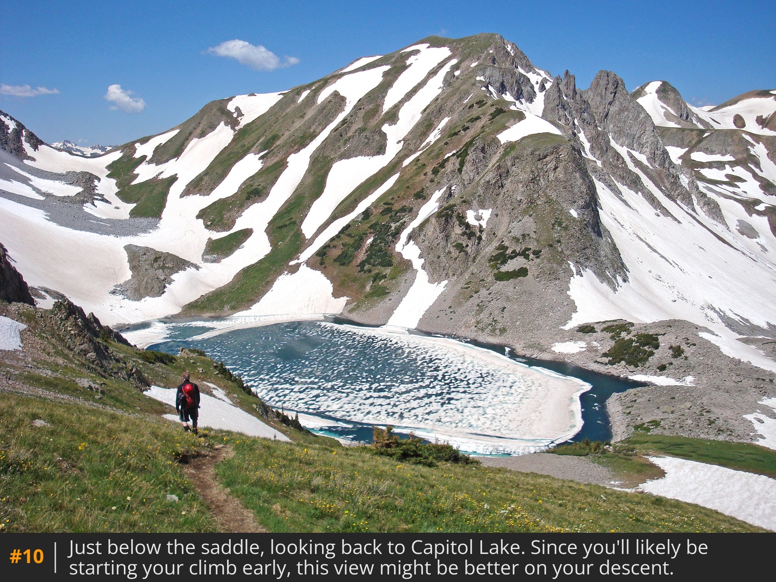
9. Climb 900 feet to reach the saddle
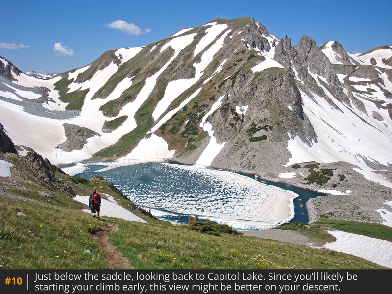
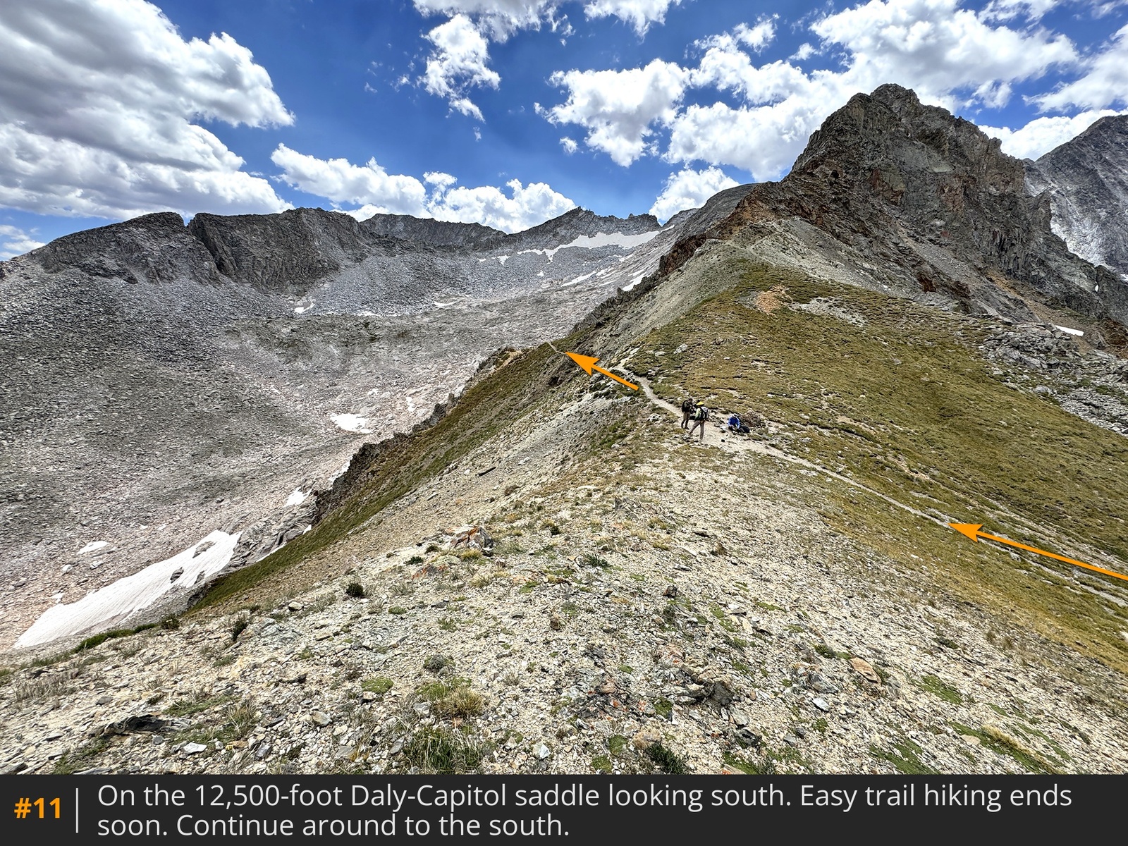
10, marking the end of the easy trail portion. From here, you have two options: take the "direct" Class 4 ridge climb south, or follow the standard, easier route on the east side
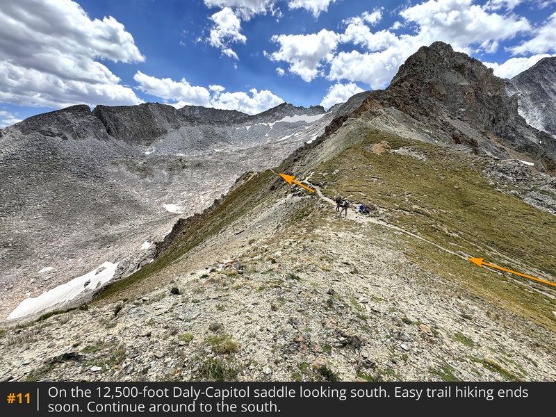
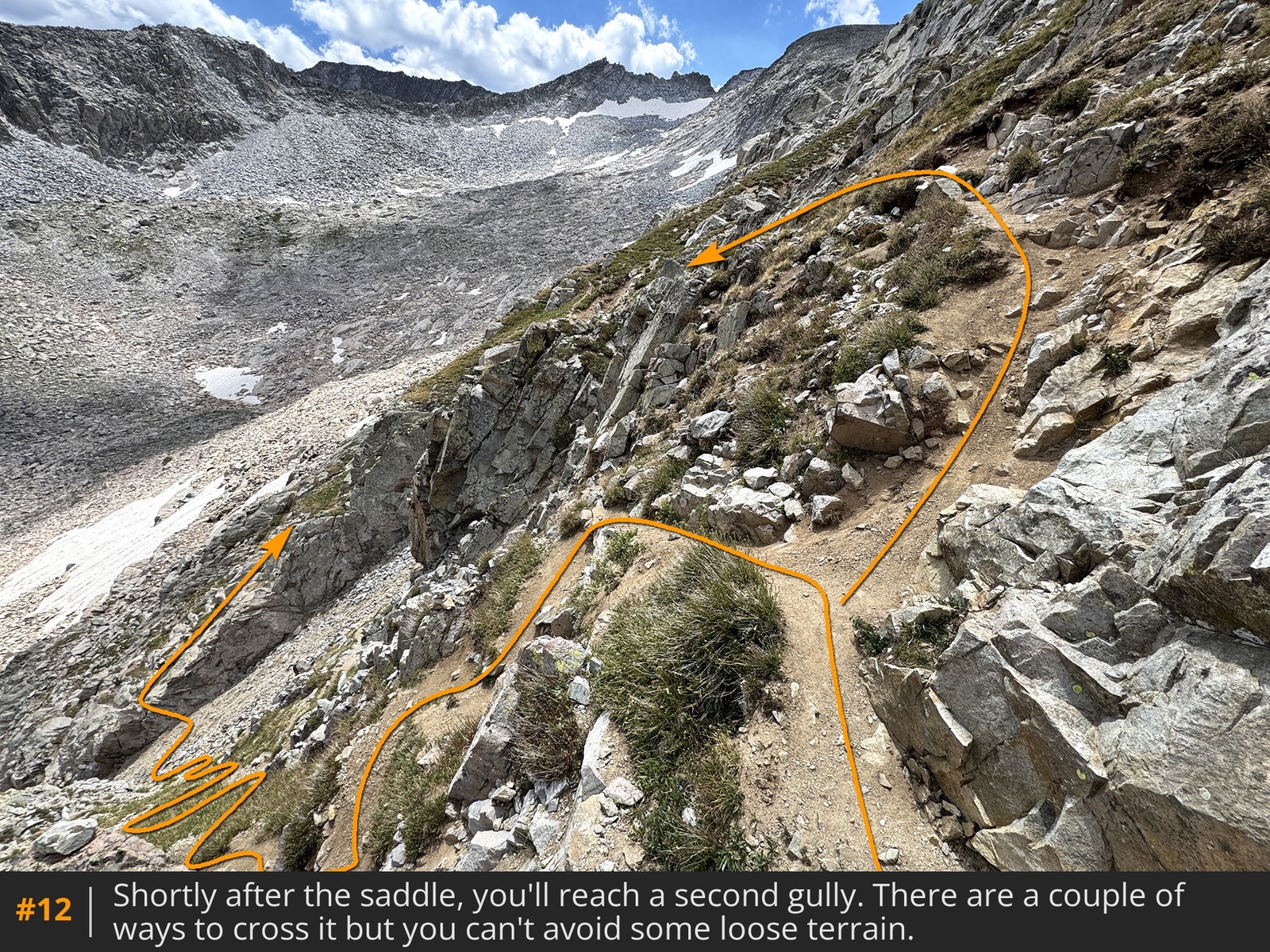
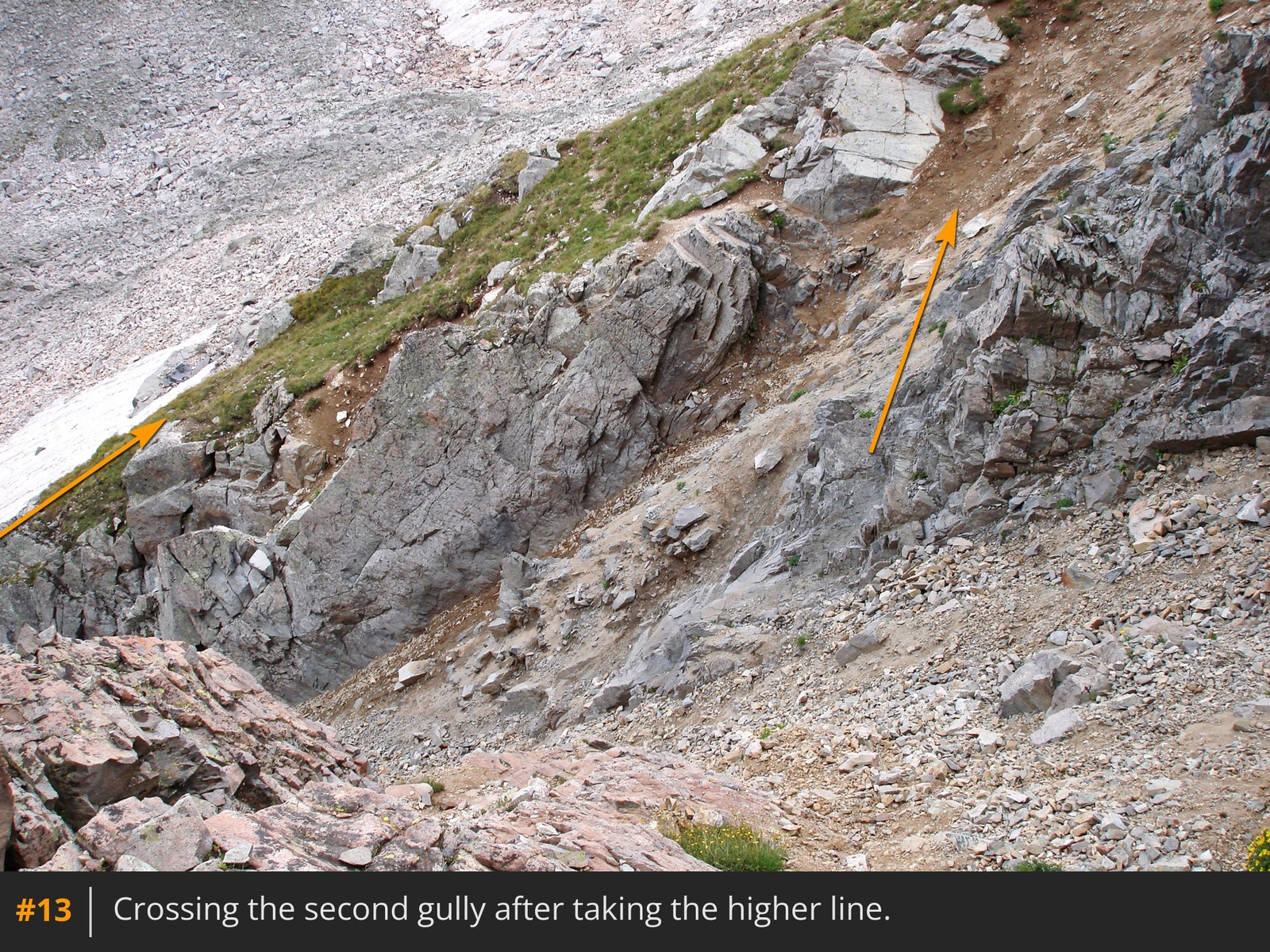
11. The standard route is strongly recommended for most hikers. Begin by following the trail south from the east side of the saddle. You'll soon reach a couple of gullies that must be crossed. The second one is the most difficult
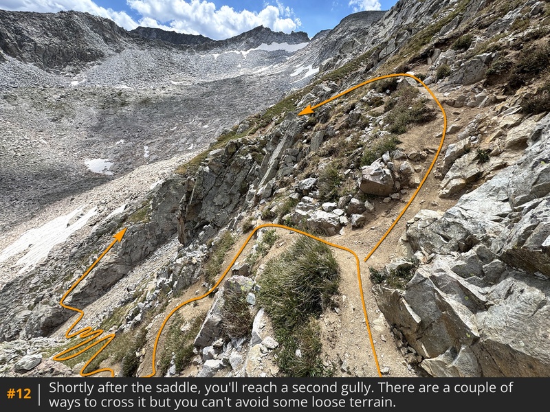
12 and has a couple of options: 1) Descend a steep trail before crossing a rock rib, or 2) Take a more direct line with a bit more scrambling on the sides of the gully
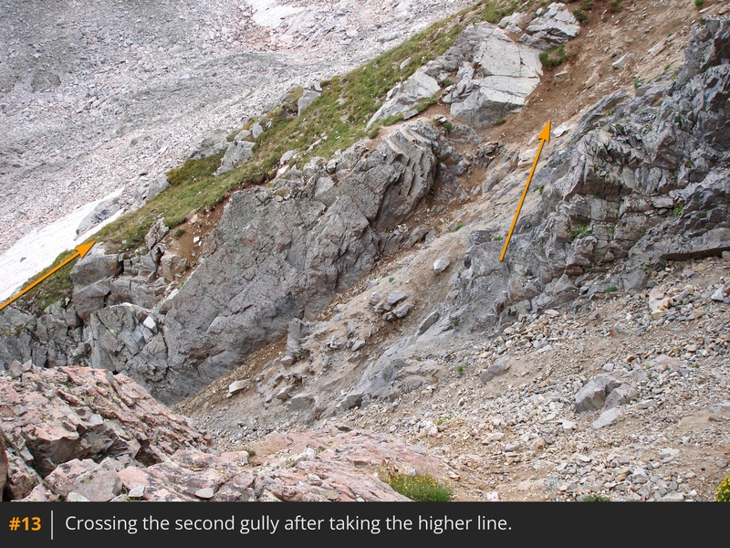
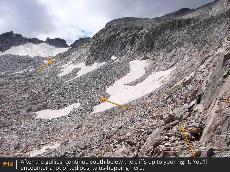
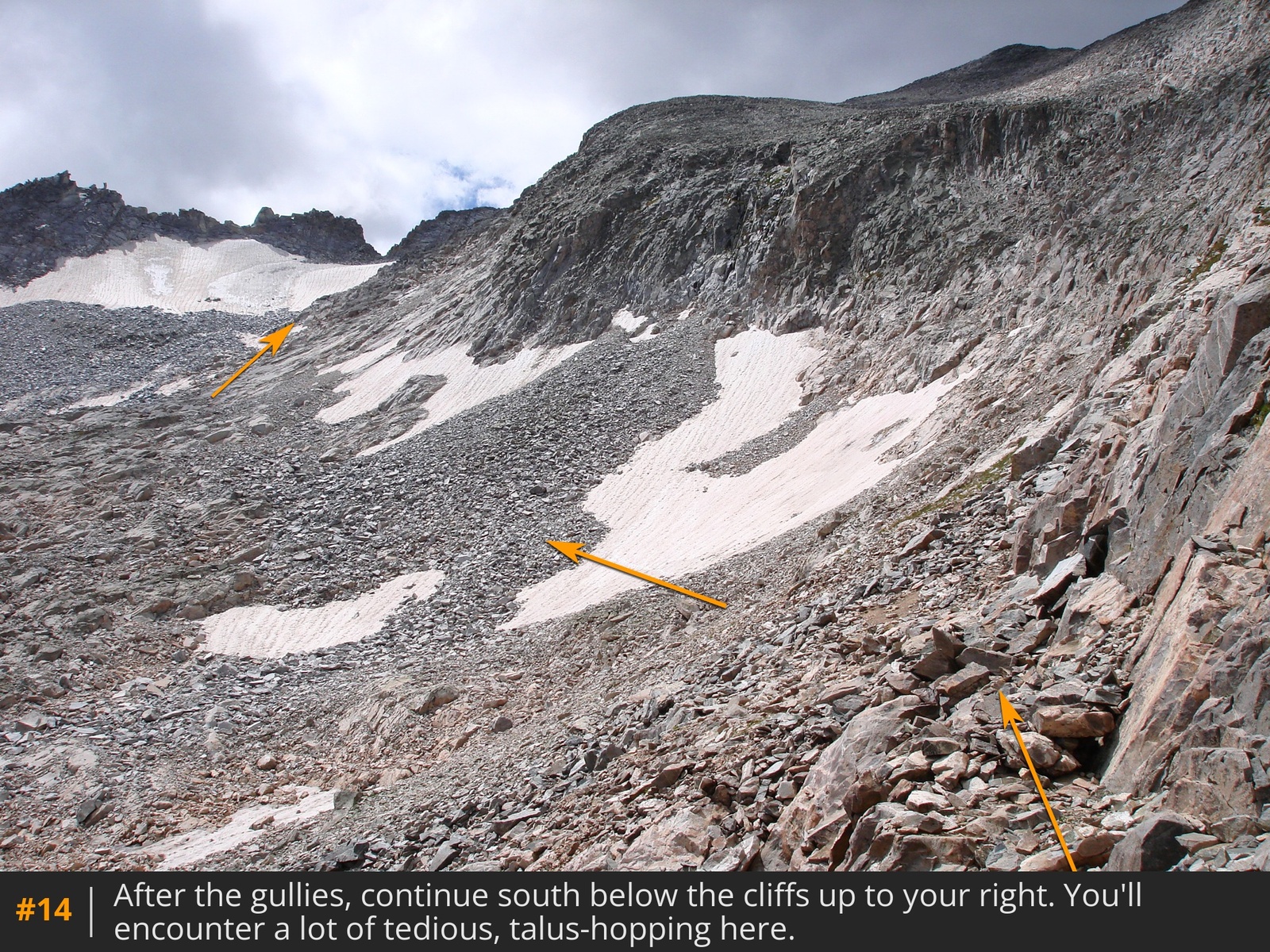
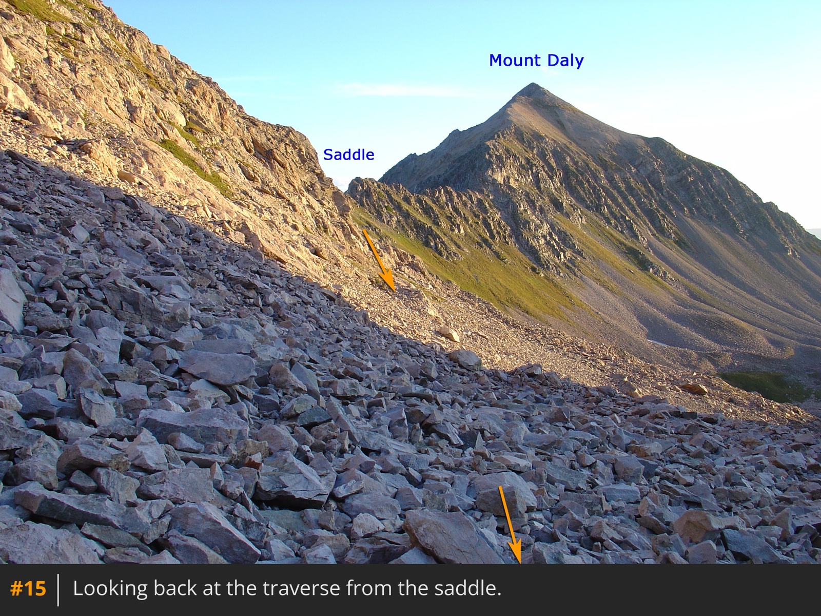
13. After the gullies, the route traverses across talus, without a trail
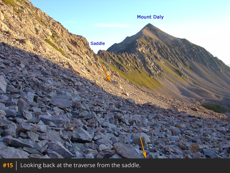
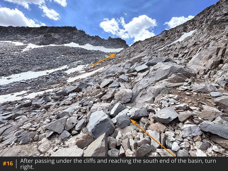
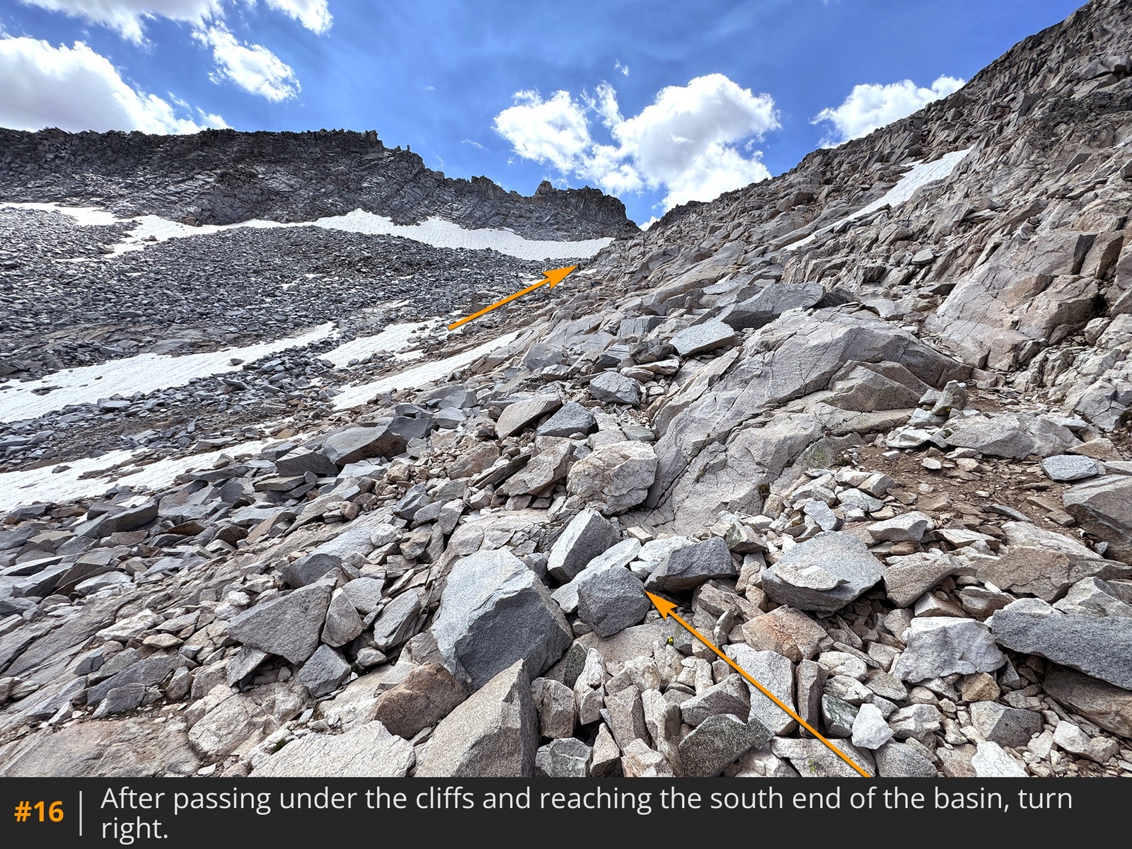
14 15. Look for cairns and try not to lose or gain too much elevation as you cross. Near 12,700', angle up to your right
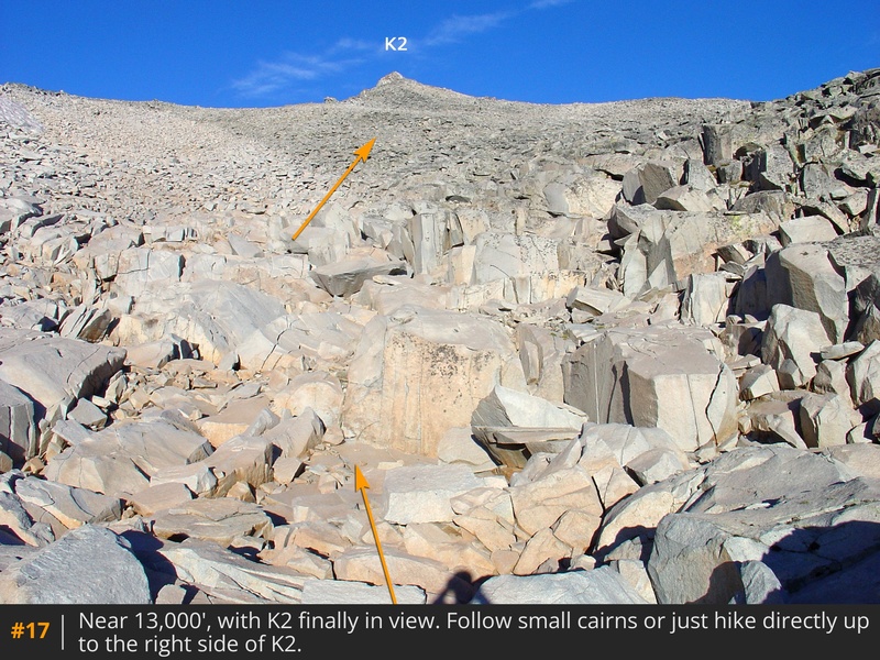
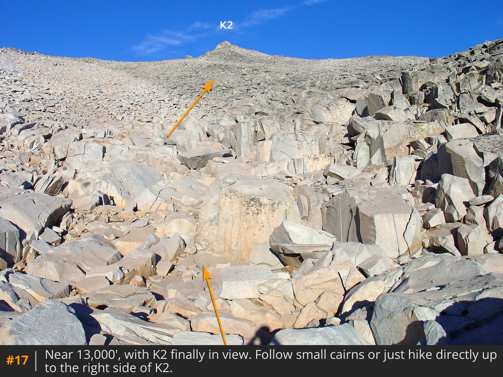
16 toward 13er "K2," to the southwest
17. Talus-hop up the slope to K2's right side, just before its top
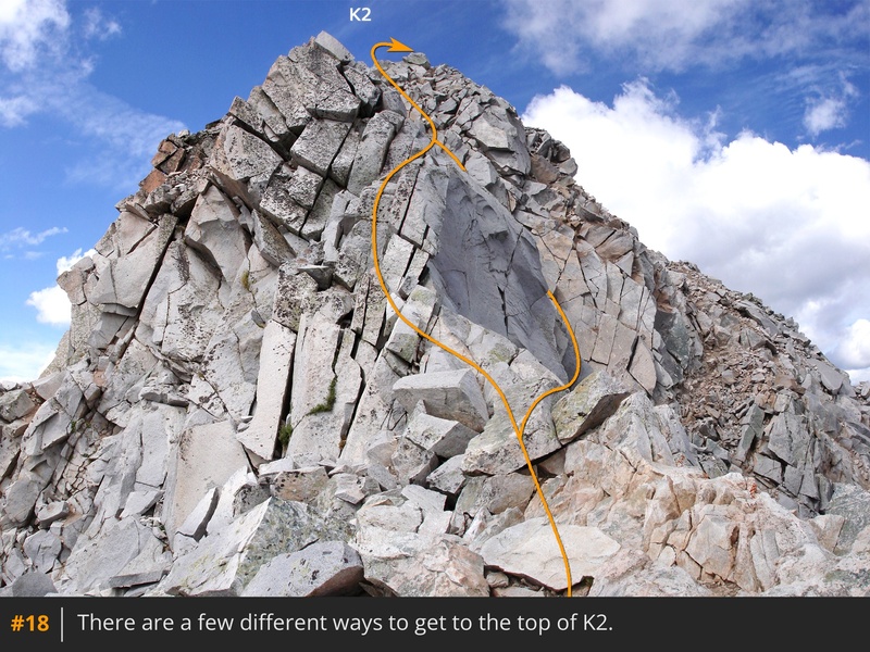
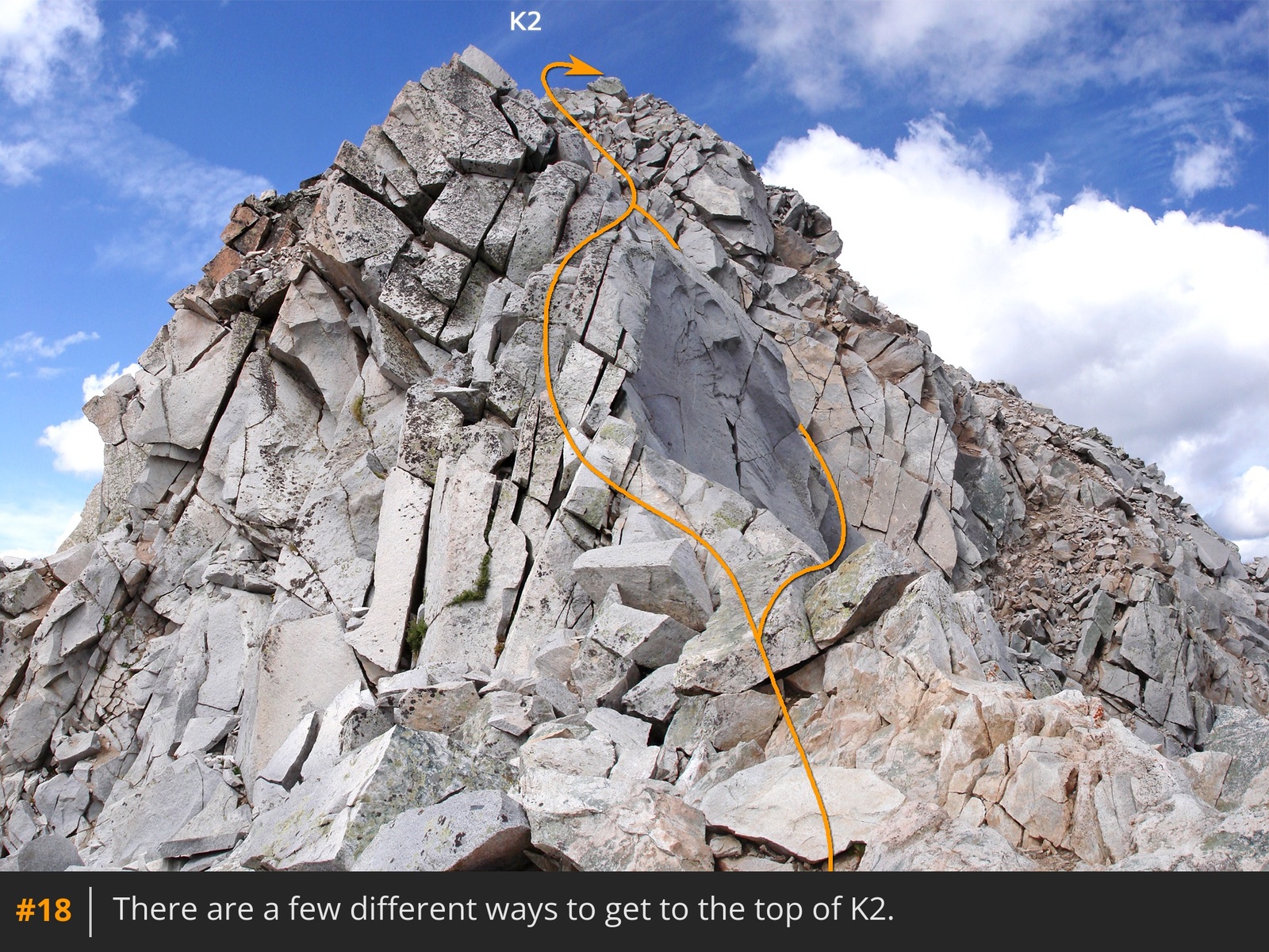
18. Next, you need to get past K2
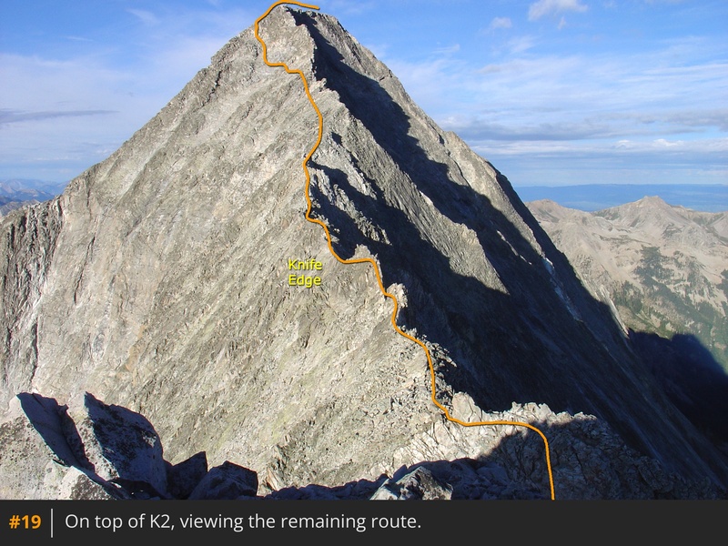
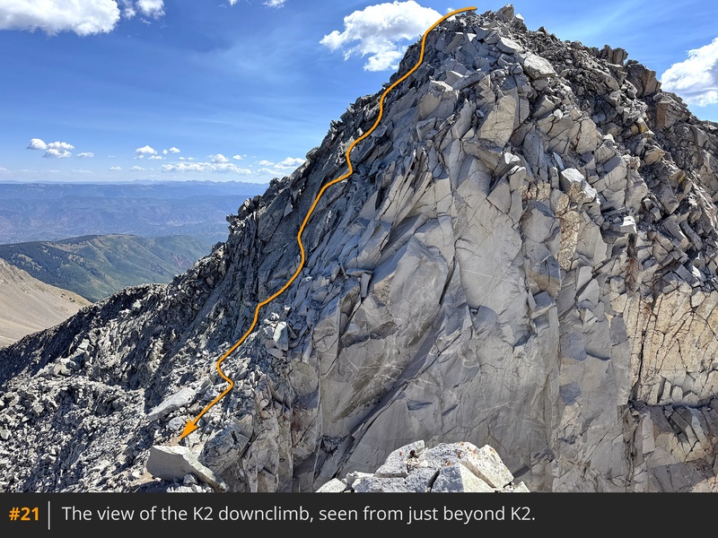
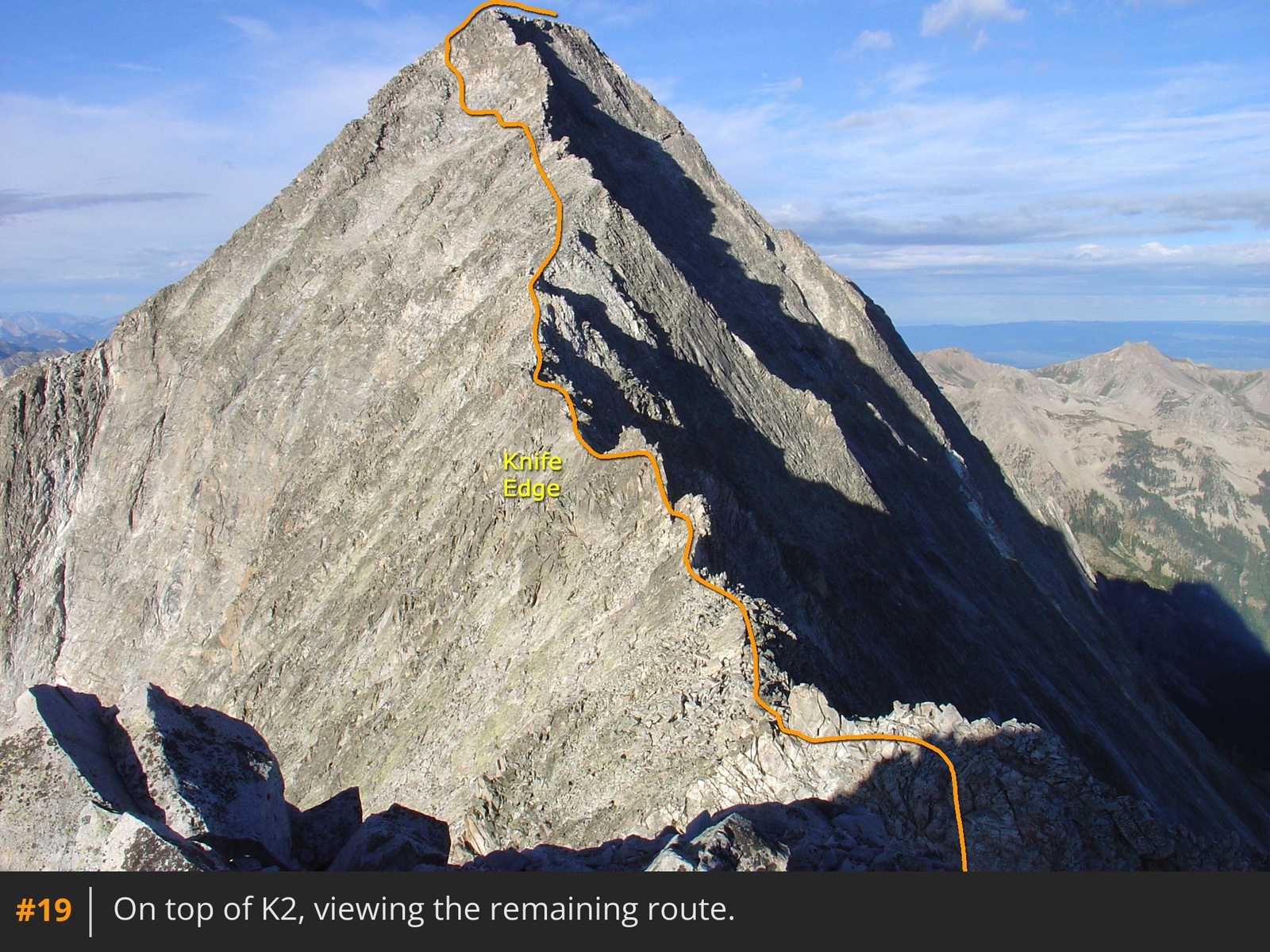
to continue along the ridge to Capitol. The best way is to climb to the top of K2 before descending its west side to regain the ridge. Climbing K2 is strongly recommended so you can see the stunning view of the remaining route
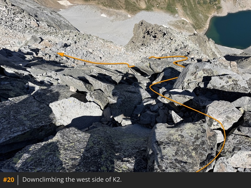
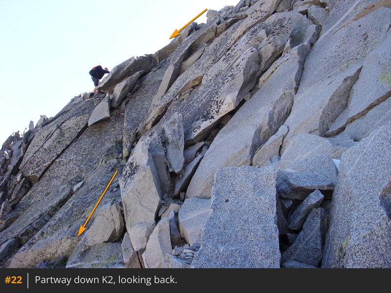
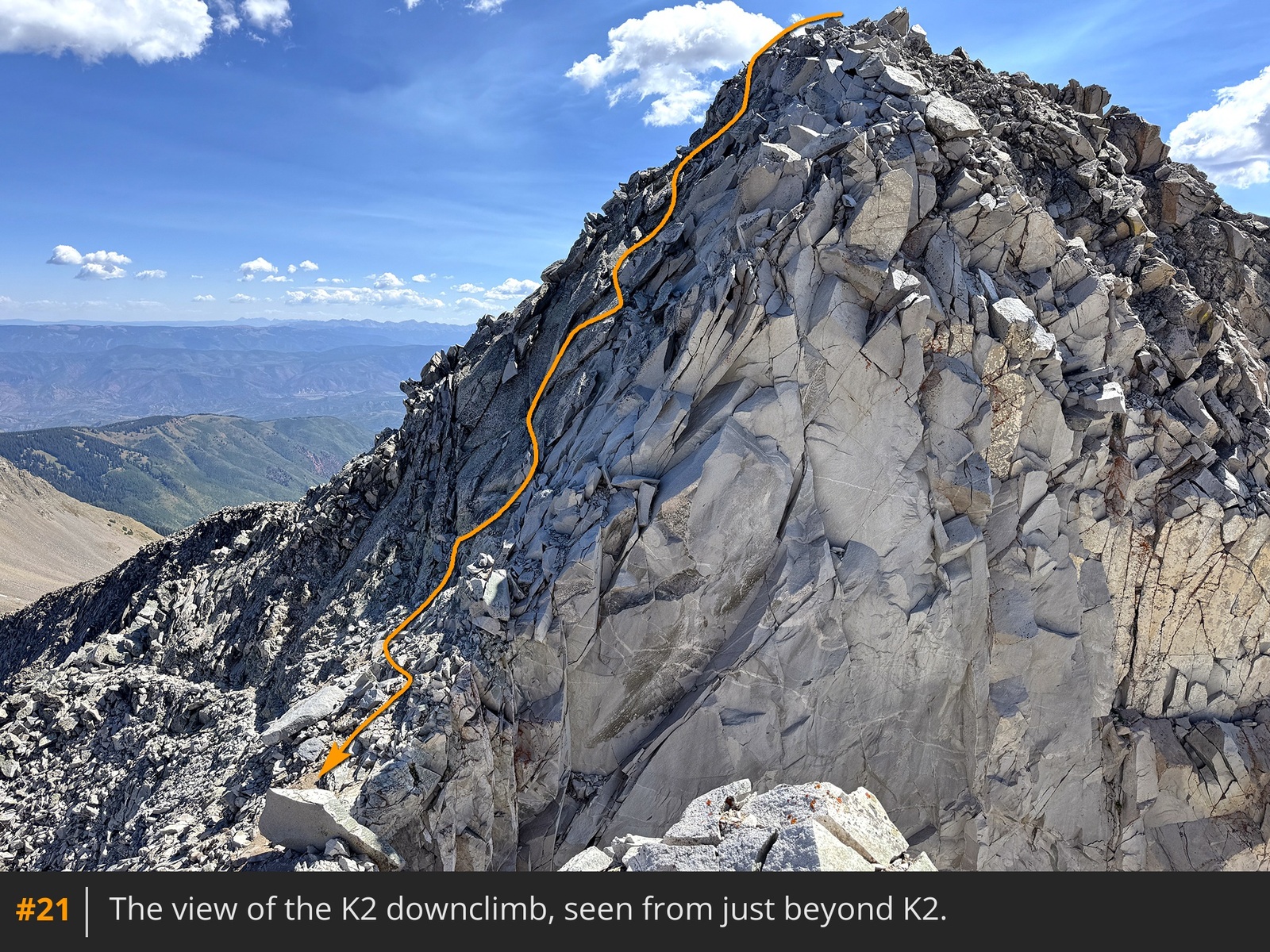
19. Backtrack a few feet from the top of K2 and step west to see the downclimb
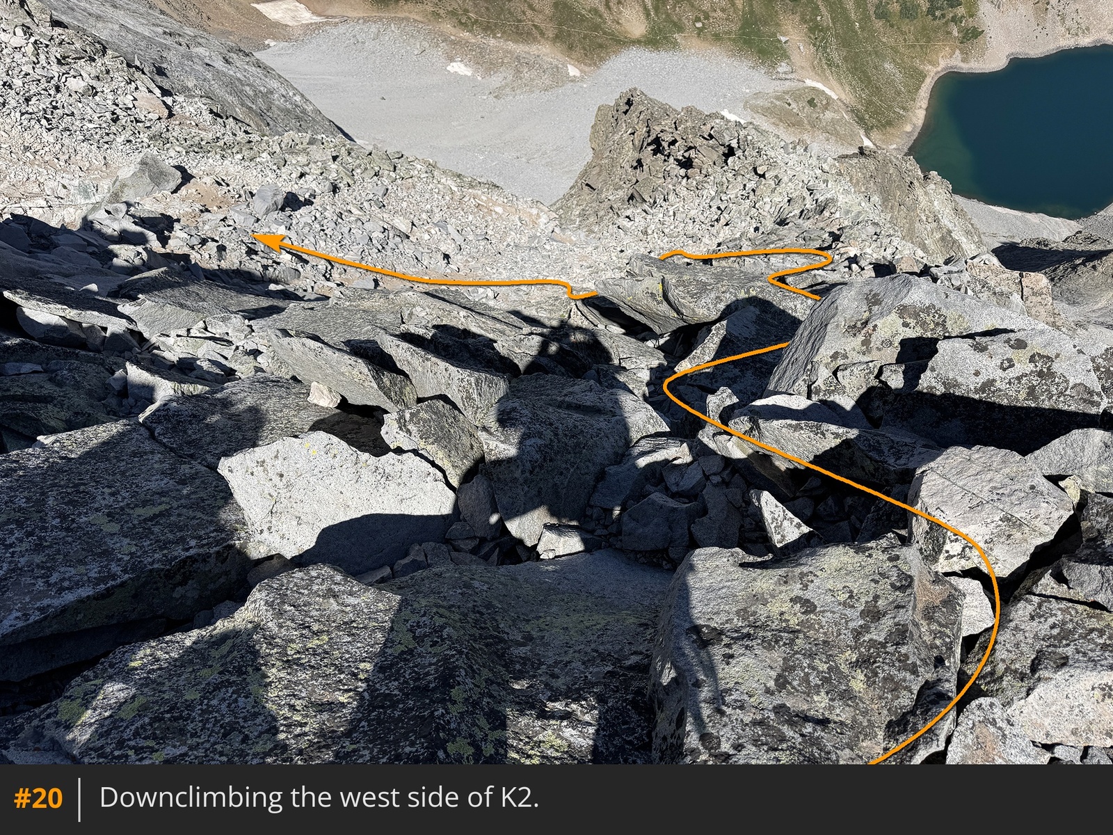
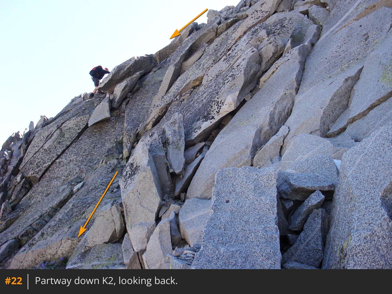
20 21 22. Choose your line and descend about 80 feet to reach a flat area and faint trail. Turn left and continue back to the ridge crest
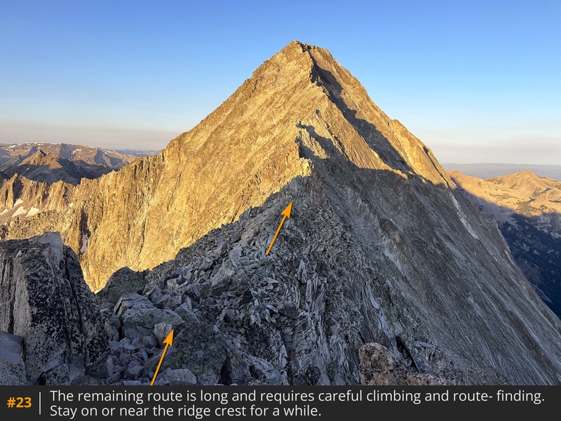
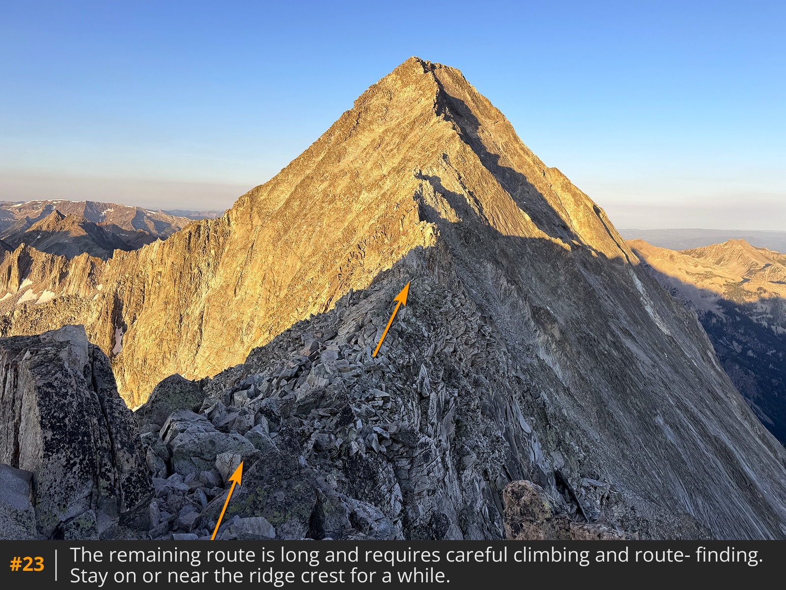
23.
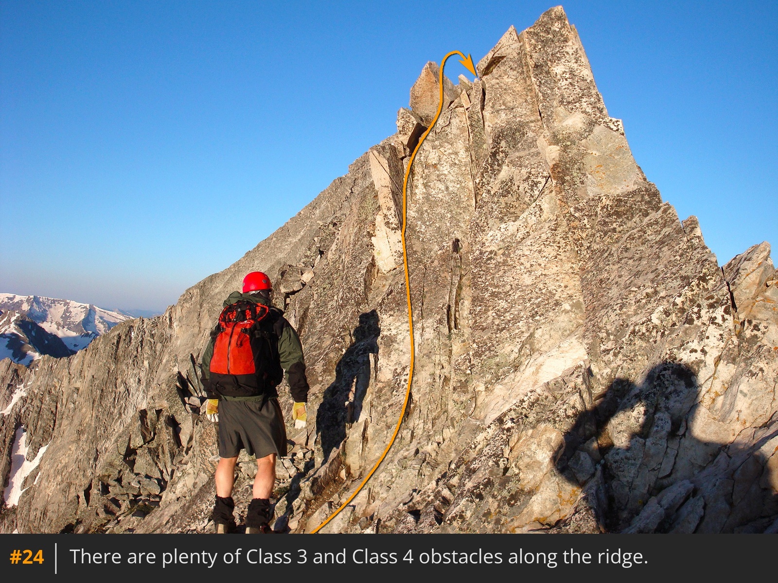
The remaining route involves a lot of exposed climbing and will test your route-finding skills. Pause here to assess conditions and make a decision to proceed based on weather. Although the summit isn't far off, the route is time-consuming and a dangerous place to be in bad weather. Descend slightly to reach the narrow ridge and continue to a rock tower
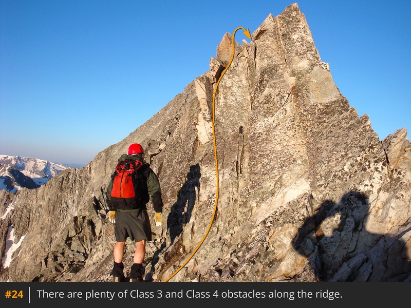
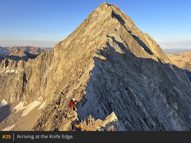
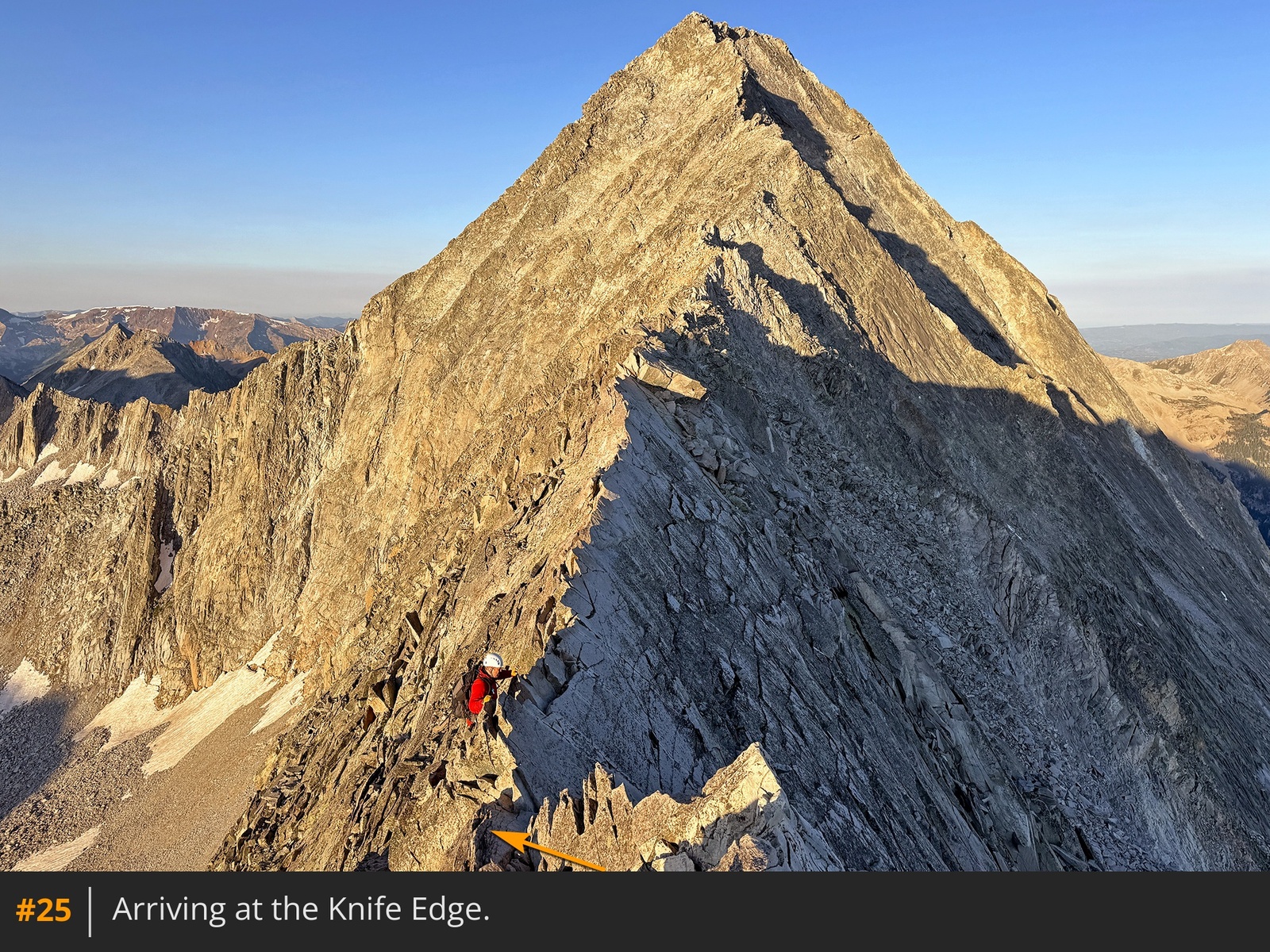
24. Climb over or around it and continue scrambling along the ridge to reach the Knife Edge, the crux of the route
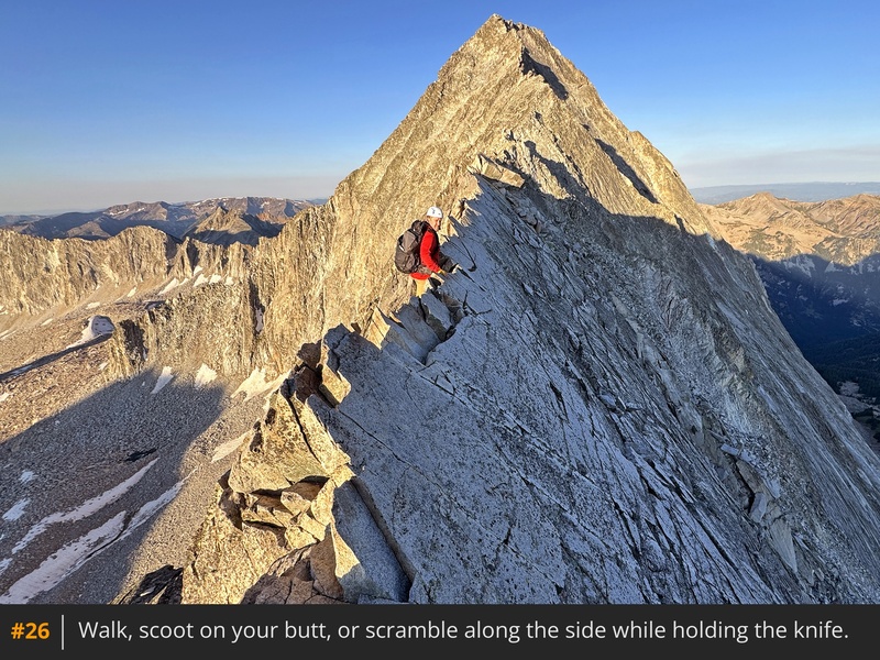
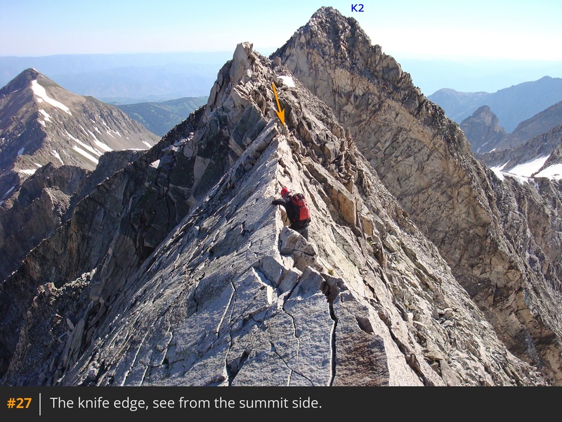
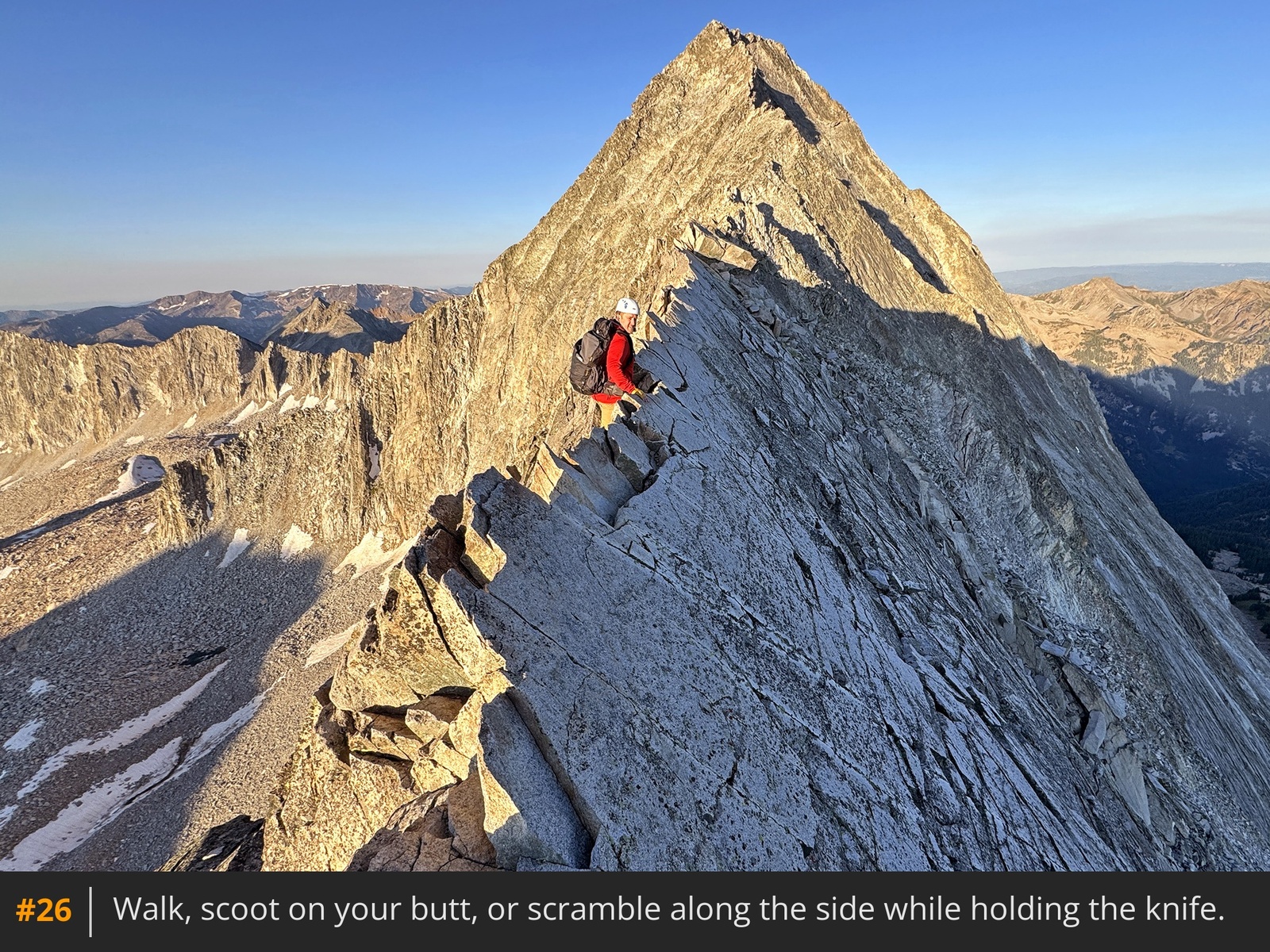
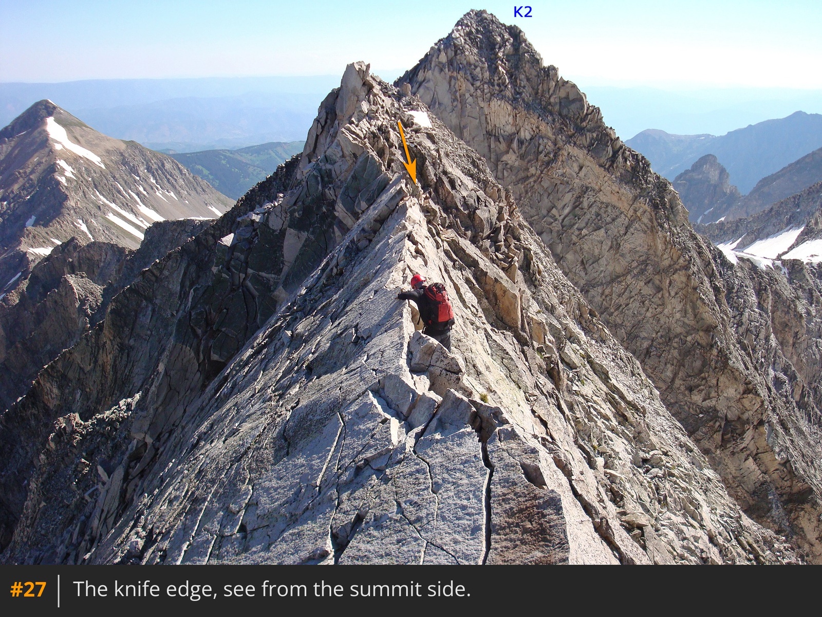
25. This short, exposed section demands concentration and a steady nerve. Scramble along the crest of the knife or carefully navigate the side, holding the ridge
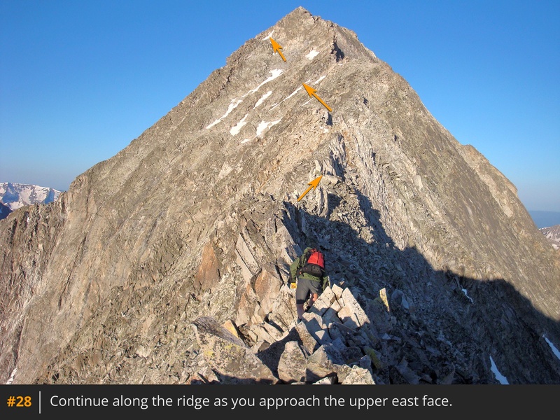
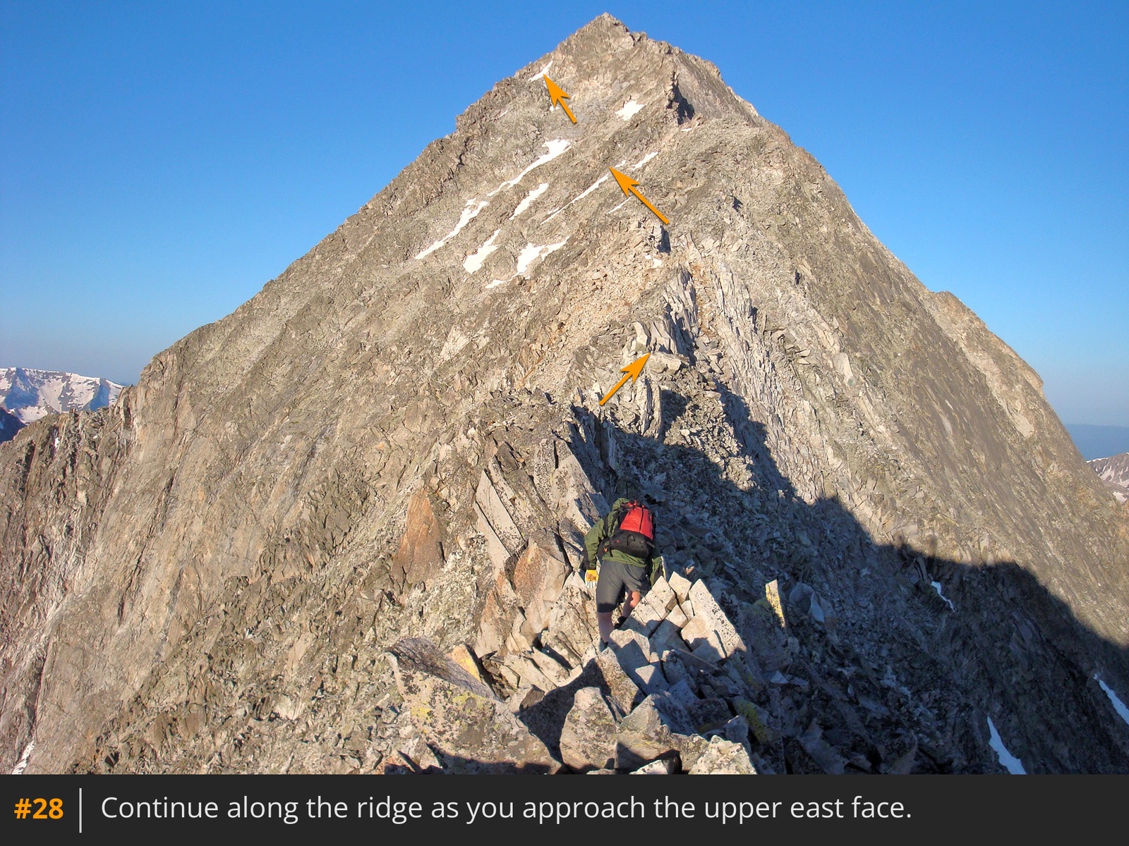
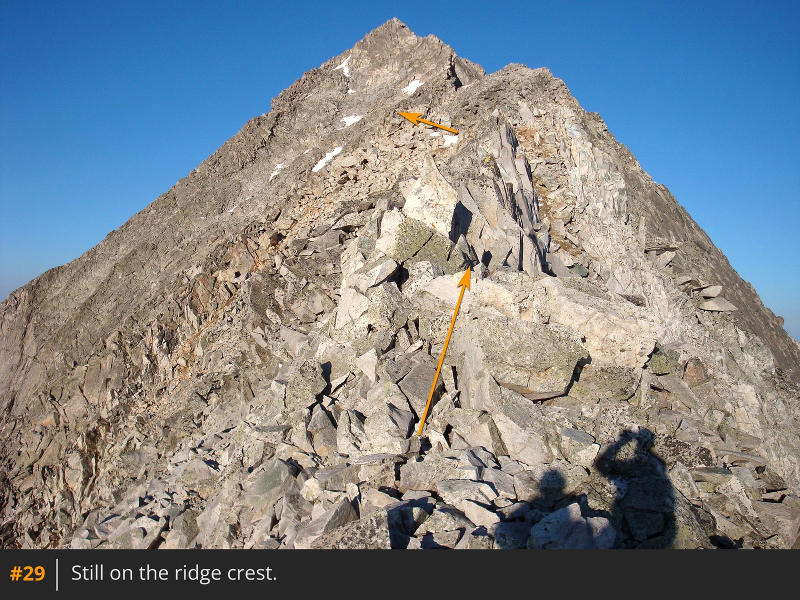
26 27. Beyond the Knife Edge, the climbing remains technically challenging. Traverse the ridge or its edges
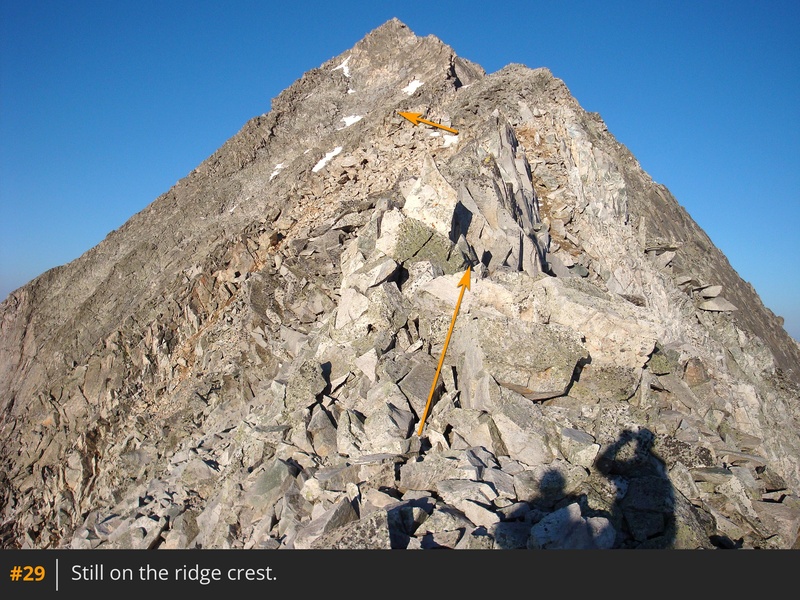
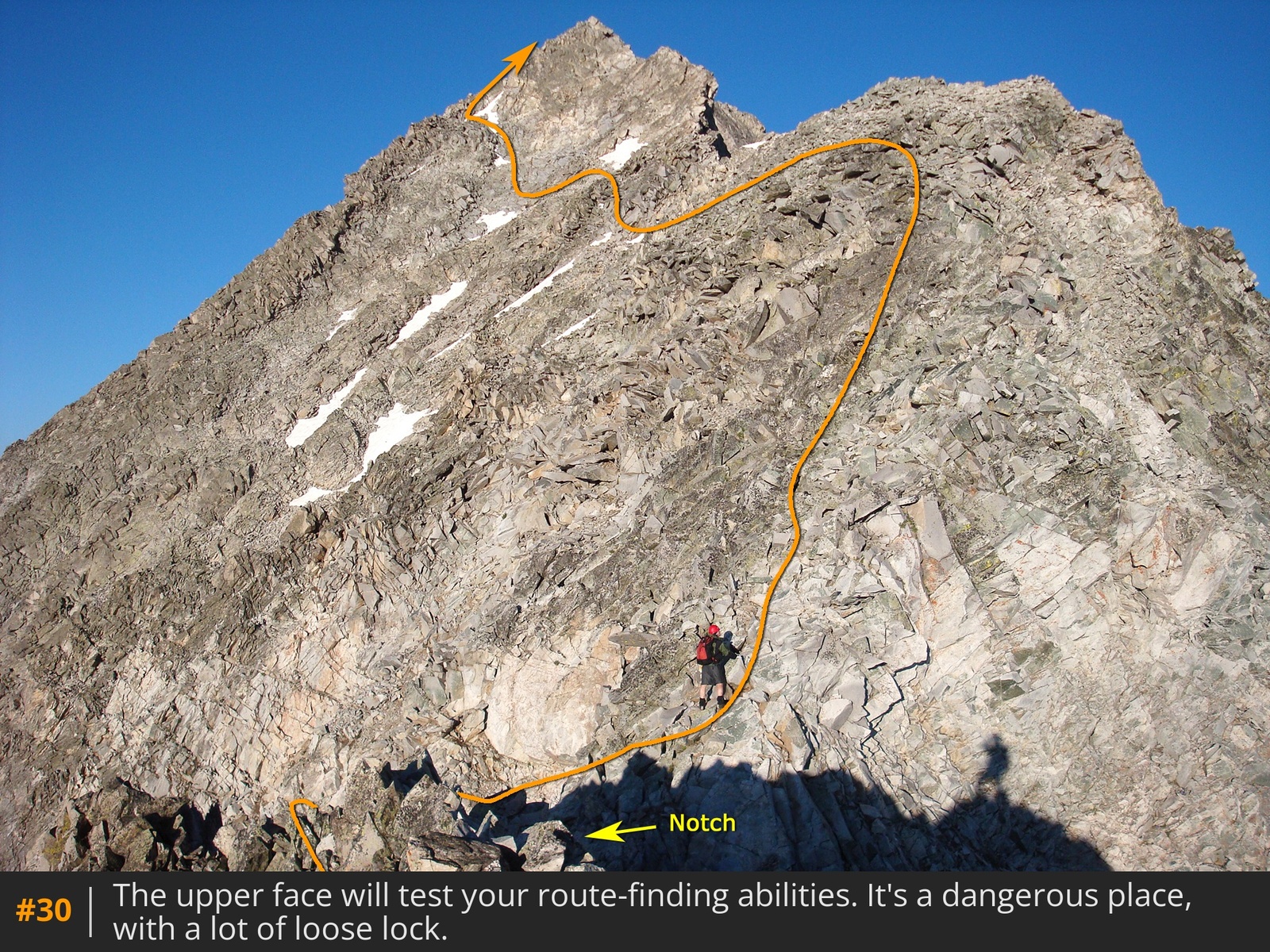
28 29 for about 0.1 mile, then descend to a notch with a steep gully to your left
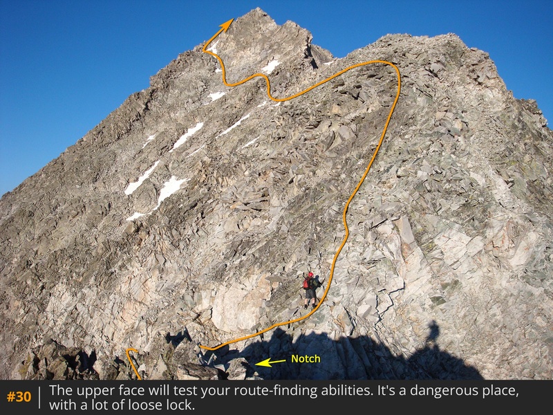
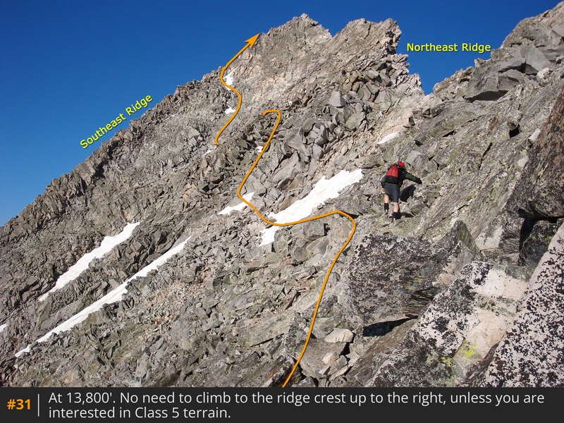
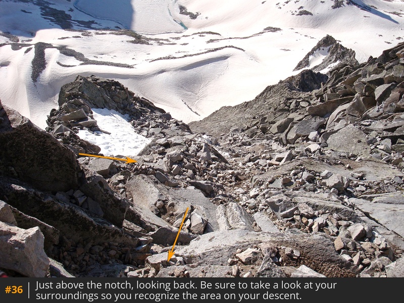
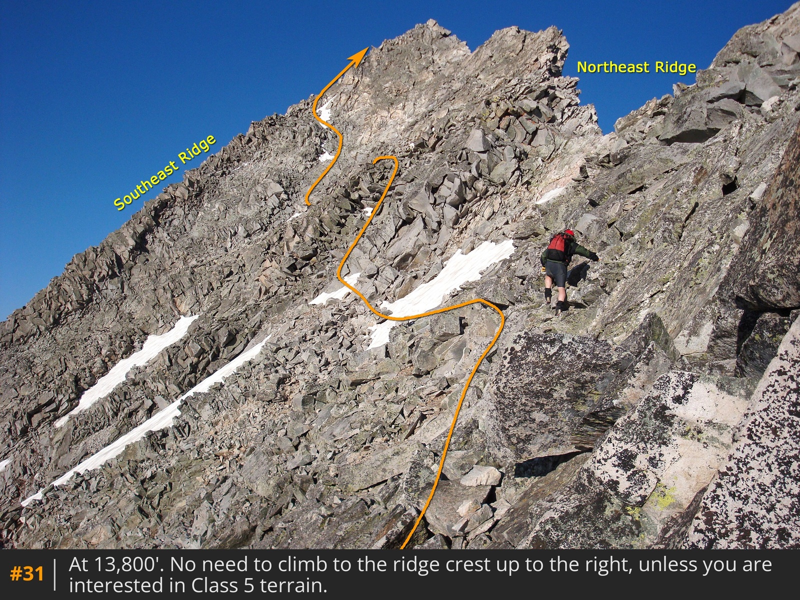
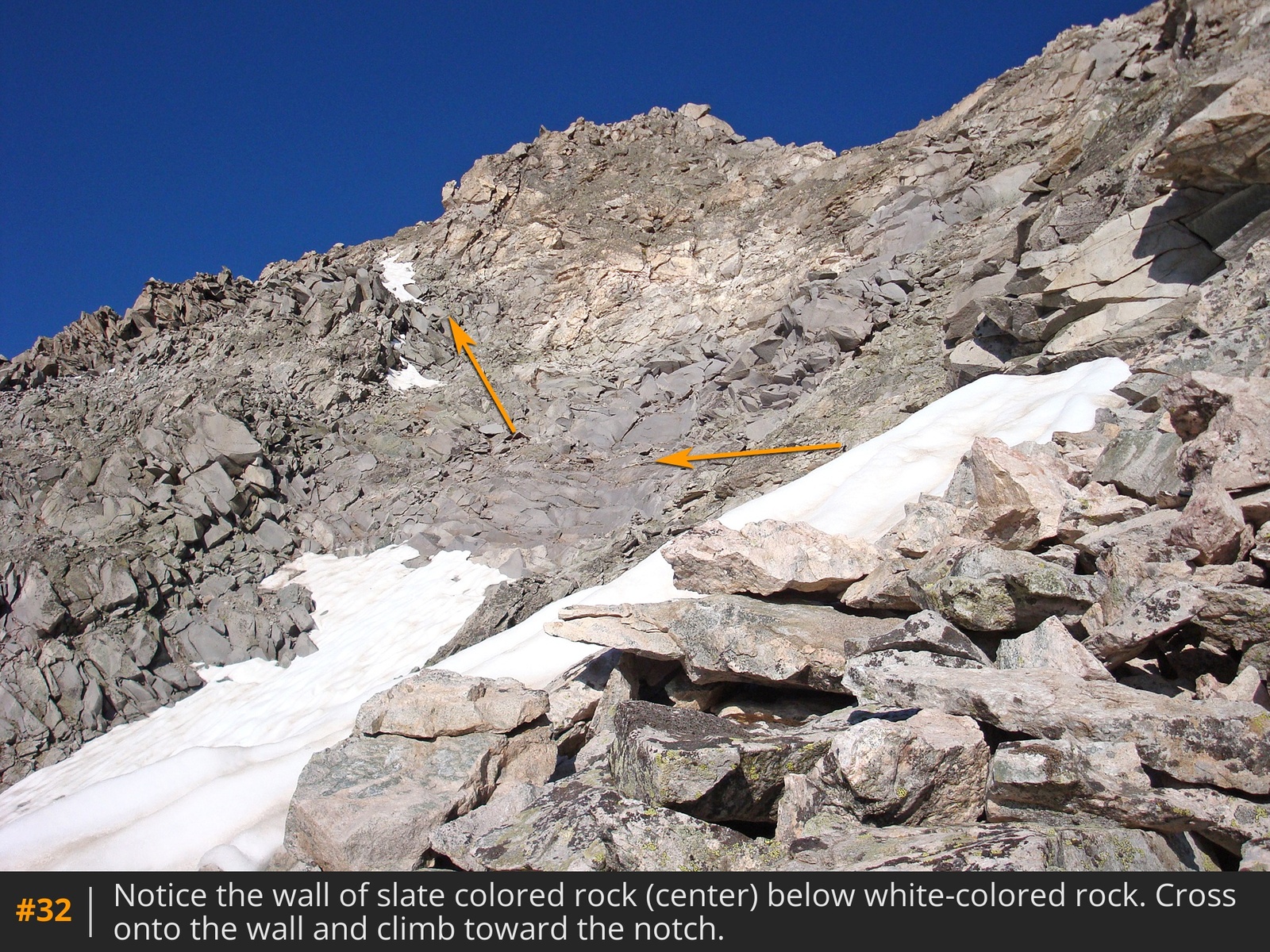
30. From here, be sure to study the upper east face, identifying landmarks. Drop into the notch then climb a steep pitch, following cairns where possible. Now above 13,800', avoid the remaining ridge crest and traverse the upper east face instead
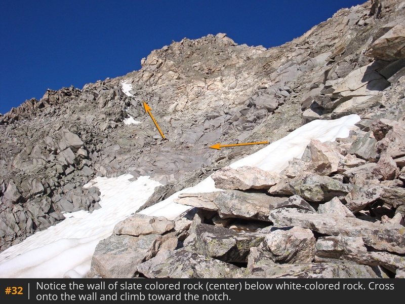
31. Angle left to a slate-colored rock wall
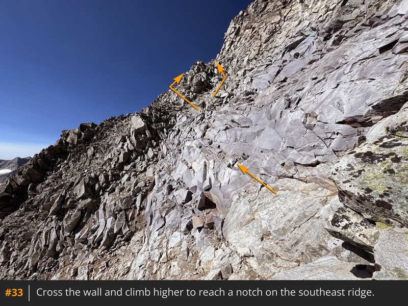
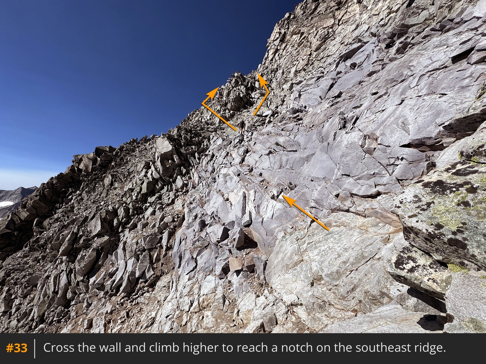
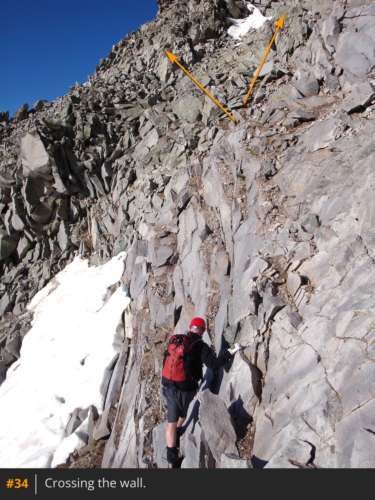
32, cross it
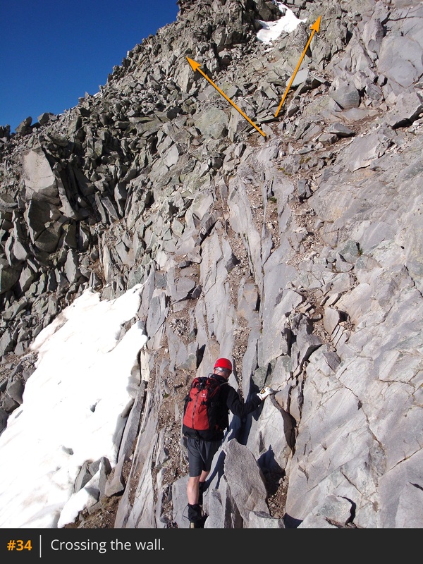
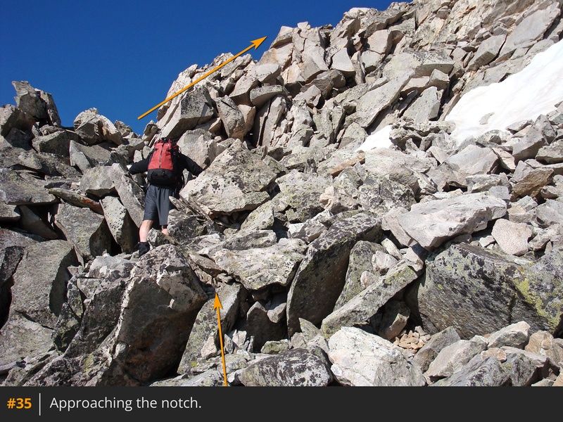
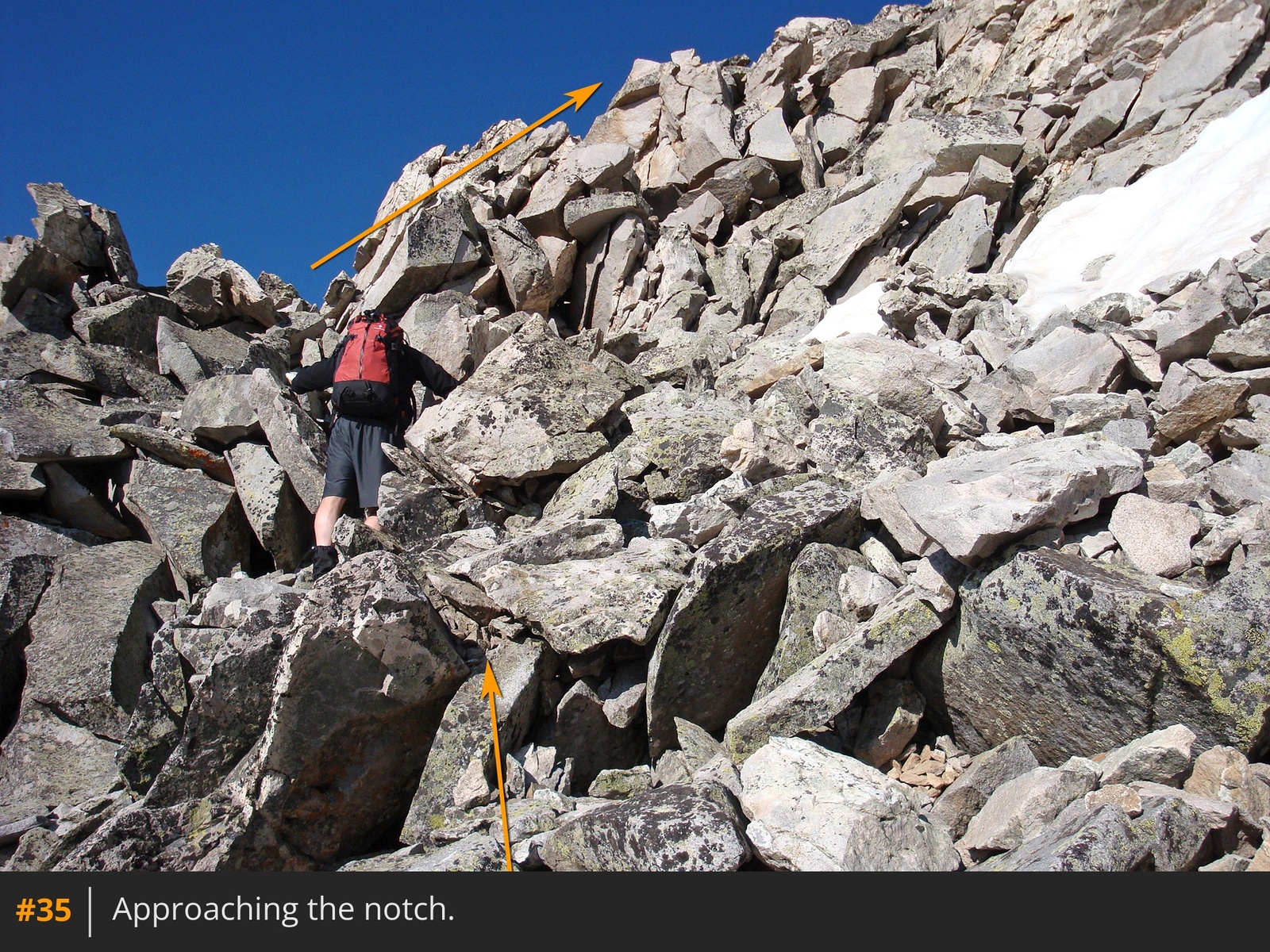
33 34, then climb steeply to a notch on the southeast ridge
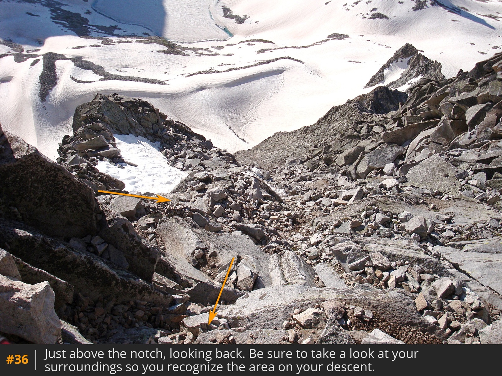
35. Turn right and climb the ridge
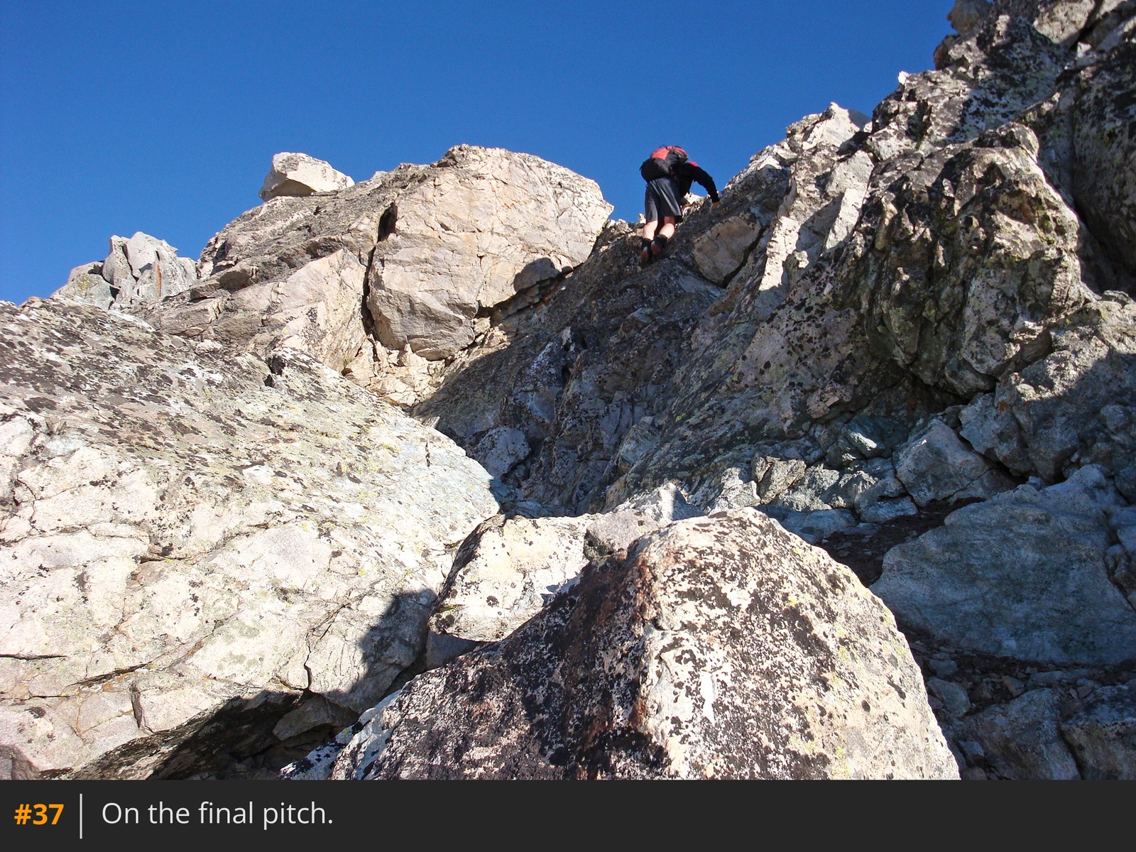
36,
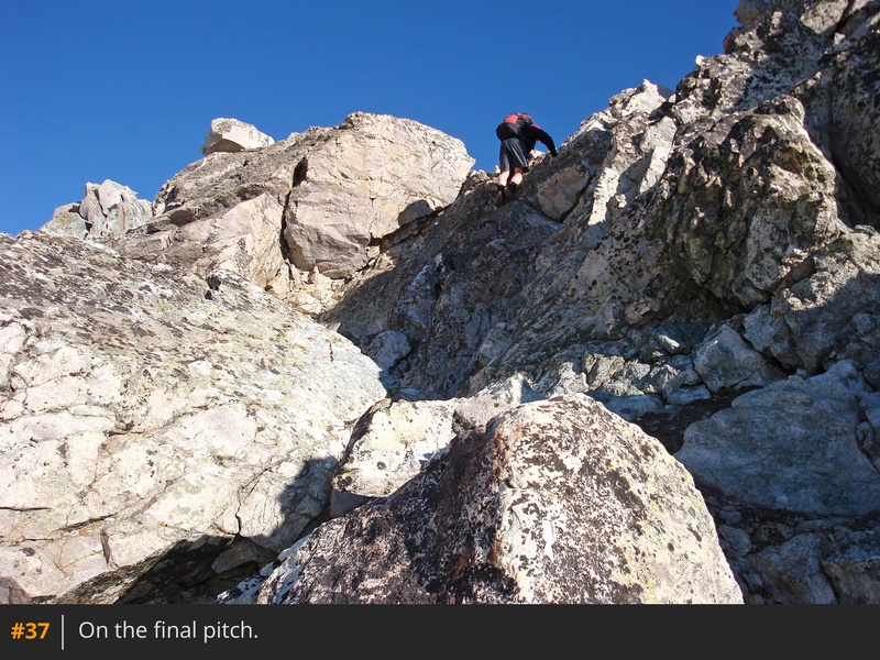
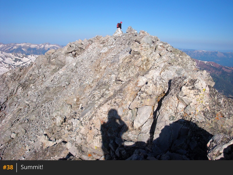
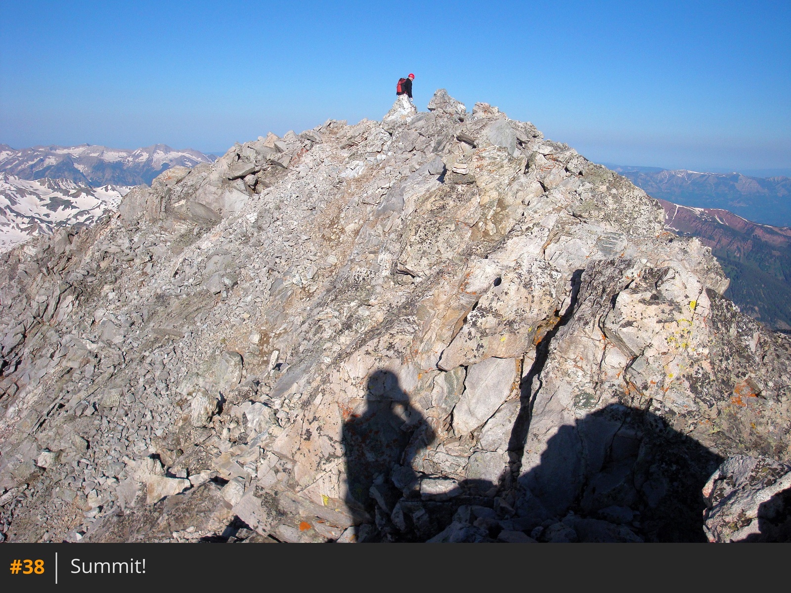
37. As you approach the top, stay on the ridge crest or traverse left before climbing to the summit
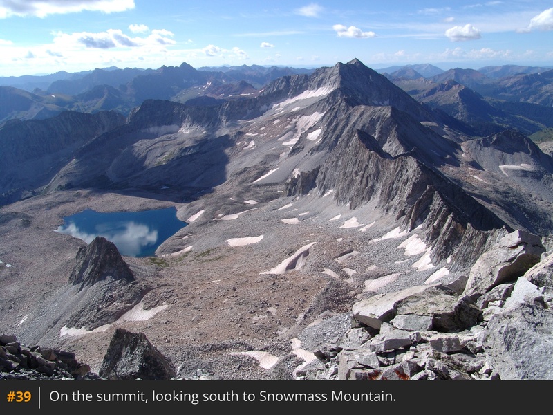
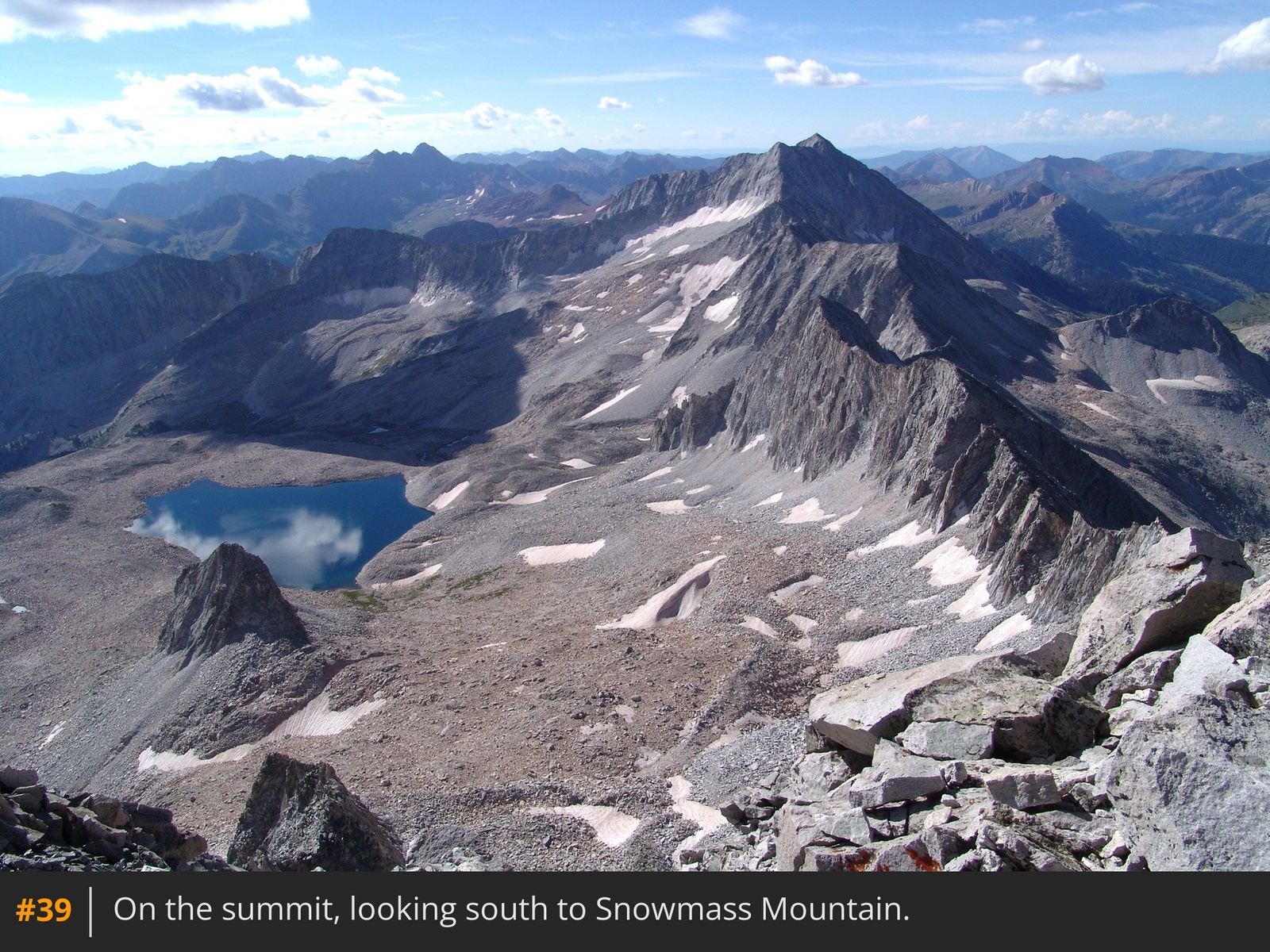
38. Staying on the ridge keeps you on the most stable terrain. Congratulations! Take in the incredible views
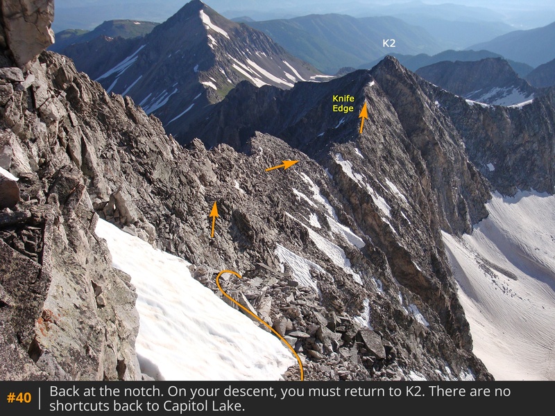
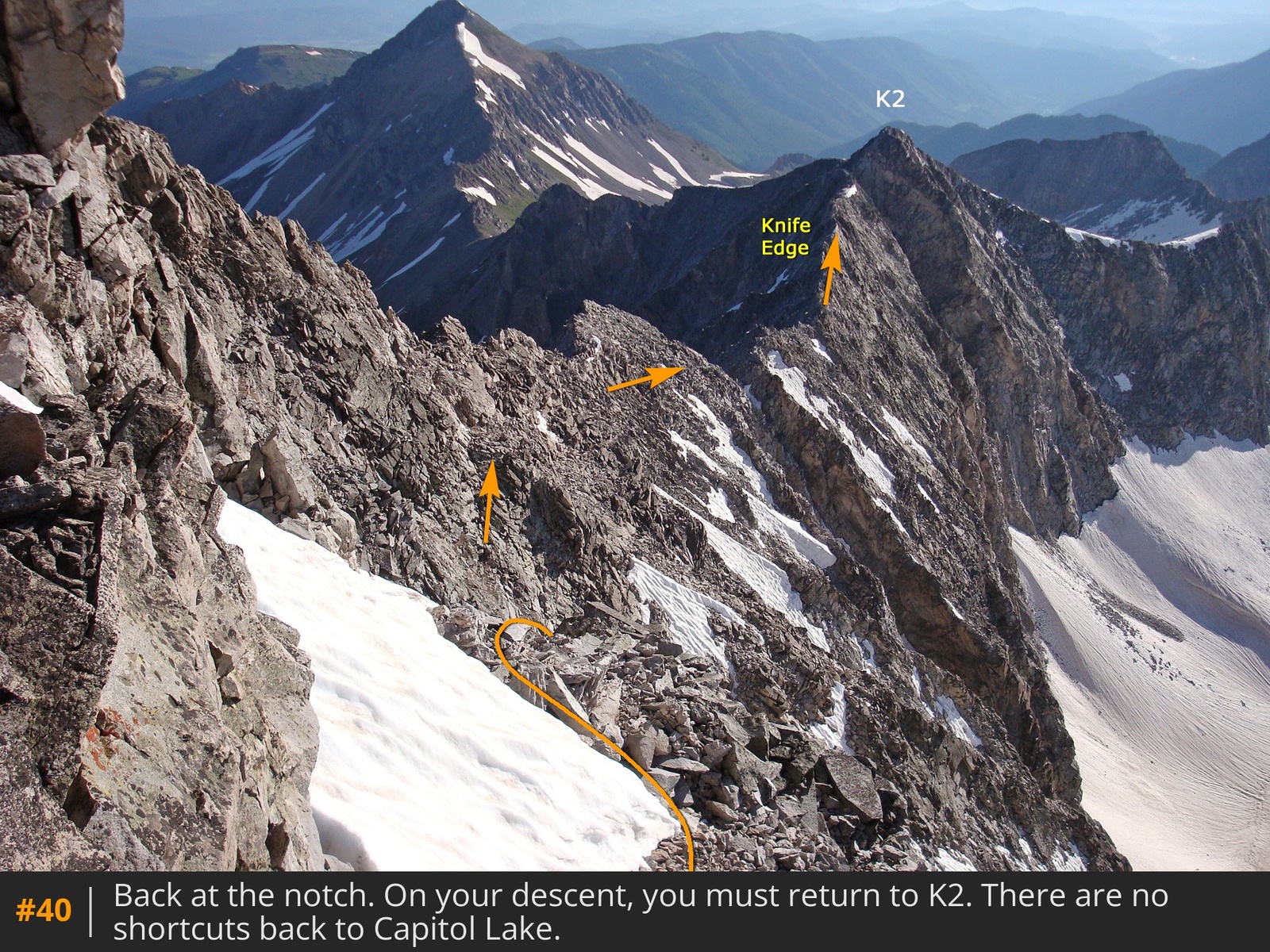
39 before the long descent back to K2
40. You must return to K2. Do not attempt shortcuts to Capitol Lake, as all terrain along the sides of the ridge leads to dangerous cliffs.





 GPX
GPX KML
KML