Log In 
Difficulty
 Class 1 
Summit
13,013 feet
Elevation Gain
1,500 ft
Length Round-TripRT
4.75 mi
Peak Conditions
Downloads
Photo
Show More
Route Last Updated: Sep 2021

Trailhead

Error

Route Description

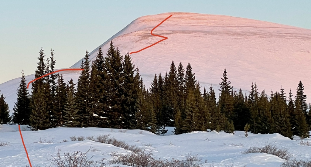
From the trailhead, hike northwest about 100 or so yards and keep left at a cairn marking a trail split. The righthand trail will take you down into the willows. Continue straight as you leave the already-sparse trees to gain your first tundra slope.

At about 11,900 feet, the trail ascends to another bench-like area along the SE ridge and begins to fade out. Continue in a NW direction towards the obvious slope, just following the ridge as it ascends more steeply, which starts at about 12,200 feet. This is also where snow typically holds, so you might pause here to put snowshoes on in the winter.

Sticking to the ridge, you will soon cross a 12,871 foot marker. This is also where you will typically get a clear view of the Sherman-Sheridan range. You have one more slope to gain after this dropping down about 200 feet and crossing a broad basin over to the final slope. During this final walk to the summit, you will cross by a number of mining ruins.

Skiing?

Ski-able, but grade doesn't exceed 25%

Notes

Parking lot is accessible season-round, which makes for an easy all-season low 13er. Described as a pleasant uphill stroll in most guidebooks.

Maps

JPG Image
Static Map JPG
Interactive Map & 3D Flythrough
Human Verification Required

Photos

#1

Weather

Caution: The information contained in this route may not be accurate and should not be the only resource used in preparation for your climb. Failure to have the necessary experience, physical conditioning, supplies or equipment can result in injury or death. 14ers.com and the author(s) of this route provide no warranties, either express or implied, that the information provided is accurate or reliable. By using the information provided, you agree to indemnify and hold harmless 14ers.com and the route author(s) with respect to any claims and demands against them, including any attorney fees and expenses. Please read the 14ers.com Safety and Disclaimer pages for more information.

Copyright: Route information, text, risk factors, maps, GPX files, charts, photos, 14ers.com-created map imagery, flythroughs, and other content provided in this route description are copyrighted by 14ers.com and may not be copied, reproduced, republished, distributed, modified, or used to create derivative works without prior written permission.

Please respect private property: 14ers.com supports the rights of private landowners to determine how and by whom their land will be used. In Colorado, it is your responsibility to determine if land is private and to obtain the appropriate permission before entering the property.

Heading to a 14er soon? Don't forget the 14ers.com mobile app.
Google Play     Apple App Store