Taken from 14er Mt. Antero,
1 shows much of the route. Start up the #277 Baldwin 4WD road. Snow usually covers portions of this road in early June but once it melts, you could take a 4WD vehicle up the first 3 miles. Hike/drive 3 miles to a road junction at 10,850' -
2. If you drove to here, there's parking just beyond the creek crossing. Turn left onto the #278 road, cross Baldwin Creek and continue to 11,600', just over a mile up from the stream crossing. You want to leave the road in this area but there's no exact point to exit and no trail from here. Exiting at the spot shown in
3 (Coordinates: 38.67074 N, 106.26547 W) works well. Leave the road and hike southwest into the forest (
4). Contour through the forest without losing or gaining too much elevation and after about 1/3 mile of zigzagging through fallen trees, reach the stream in Baldwin Gulch -
5. Drop to the stream and cross to the west side by bashing through the willows. Re-enter the forest and continue southwest -
6. Near 11,800' and before exiting the trees, turn right (west) and hike 200' up through the remaining trees to reach a clearing, at 12,000', where you can see Cronin's north ridge -
7. Continue west and exit the trees near 12,100'.
Now, with a clear view of the north ridge, you have a couple of options. Older route descriptions suggest continuing west and using a scree slope (
8 and
9) to directly gain the north ridge but that pitch is loose and unpleasant. Instead, hike left past a small talus field and continue southwest toward the north ridge, on more-stable terrain -
8. After passing the talus field, pick your line and ascend easy terrain (albeit rocky just before reaching the ridge) enroute to the ridge -
10,
11 and
12.
Finally, you're on the north ridge and less than 3/4 mile from the summit -
13. Stay on or near the ridge crest (Class 2, with a few sections of trail) and ascend toward a false summit -
14 and
15. From the top of the 13,550-foot false summit, the remaining route is clear -
16 and
17. Drop a few feet and start up the final pitch, which is also the crux of the route. Follow trail segments near the ridge crest (
18) and continue toward the top -
19.
20 looks back over the route and
21 shows Cronin's mellow summit.


 GPX Track File
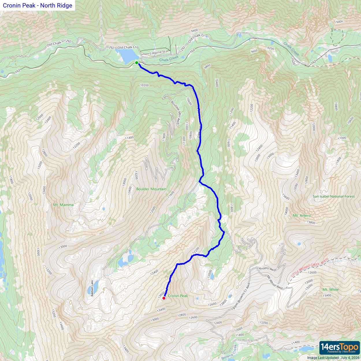


