Log In 
Photo

Mount Spalding

East Ridge
Difficulty Class 2 
Risk FactorsExposure: Moderate
Rockfall: Moderate  
Route-Finding: Moderate  
Commitment: Low  
 
Start12,850 feet
Summit13,863 feet
Total Gain1,025 feet
RT Length2.5 miles
Last UpdatedMay 2023
DownloadsgpxGPX File
Show More
Photo
Reservation Required
A reservation is required to park at Summit Lake and must be purchased through recreation.gov PRIOR to the day of your hike. It's $22. Tickets are based on a 2-Hour entry window that you select; however, the earliest entry window you can select is 7:00-9:00am. If you want to start a hike earlier, you still need to have a ticket, so reserve a 7:00-9:00am slot, print it out and display it on your dash when you drive in early. Prior to 7am you should find the gate open unless the weather is bad and they close the road.

More Information at the USFS

Trailhead

Take Exit 240 at Idaho Springs on Interstate 70. Drive south on Colorado 103 for 13.5 miles to Echo Lake. Show your reservation and drive 9 miles up the Mt. Blue Sky road (Colorado 5) to the signed Summit Lake parking area.

Route Description

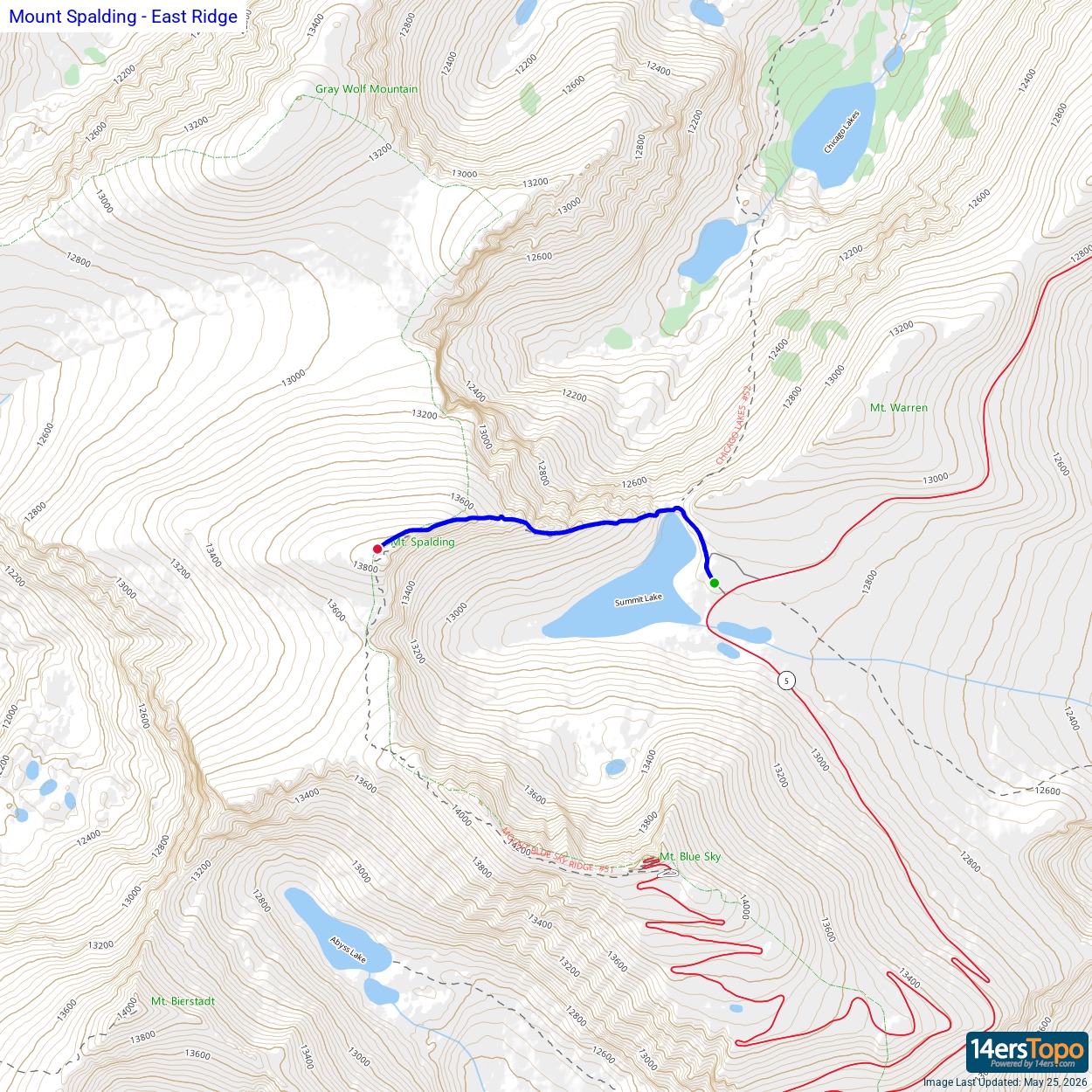
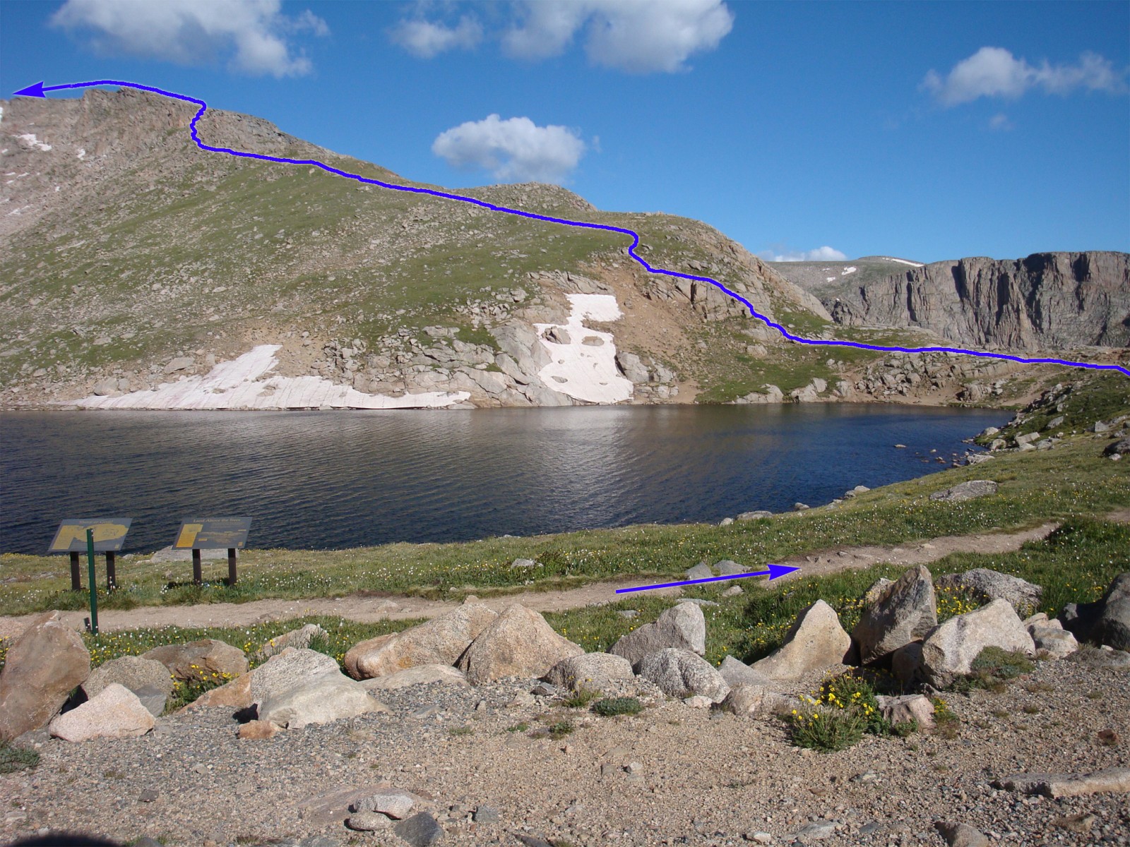
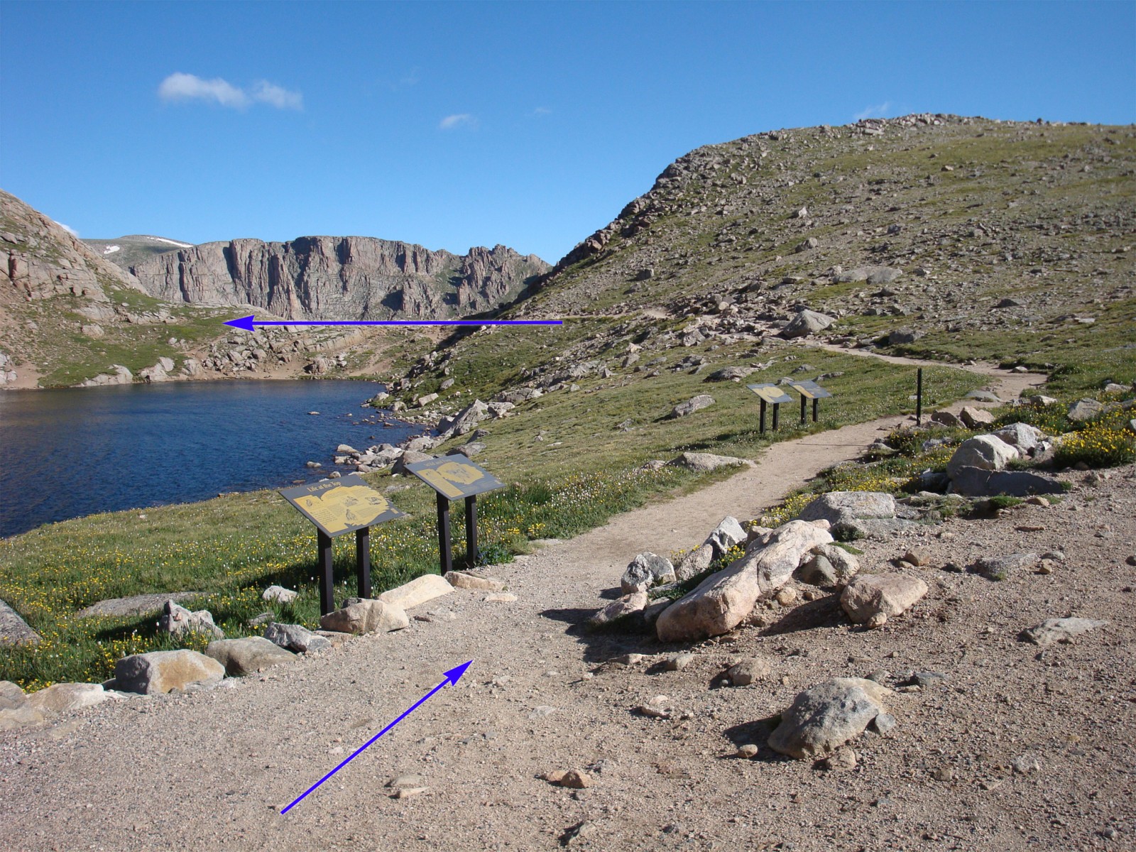
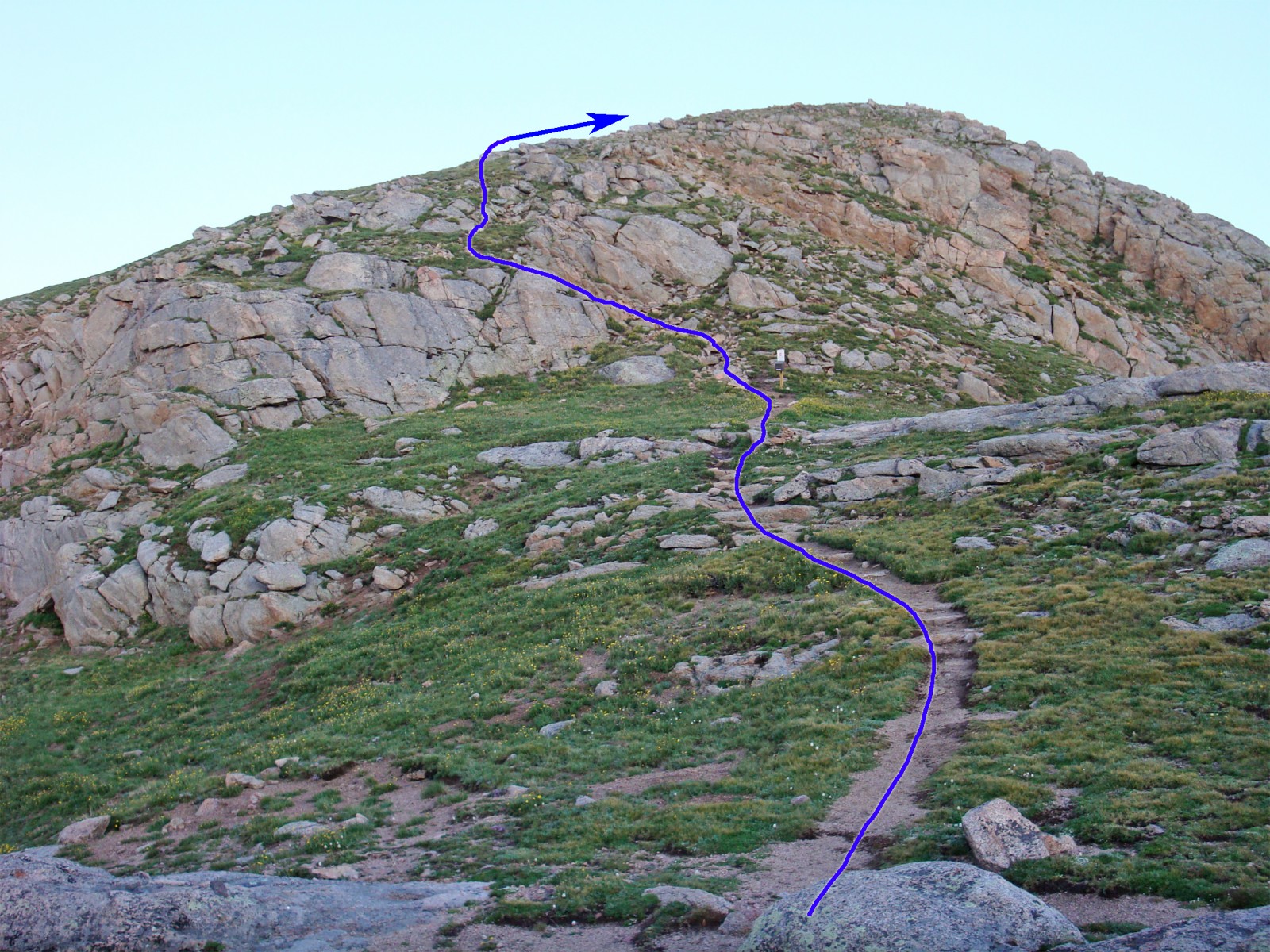
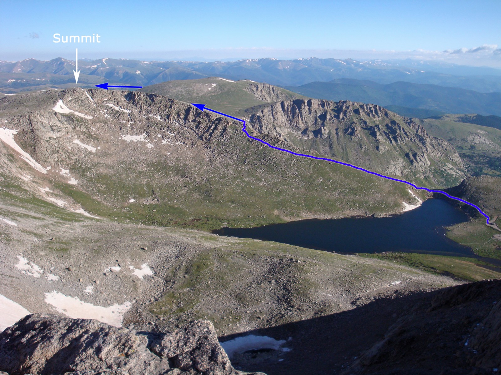
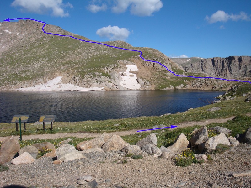
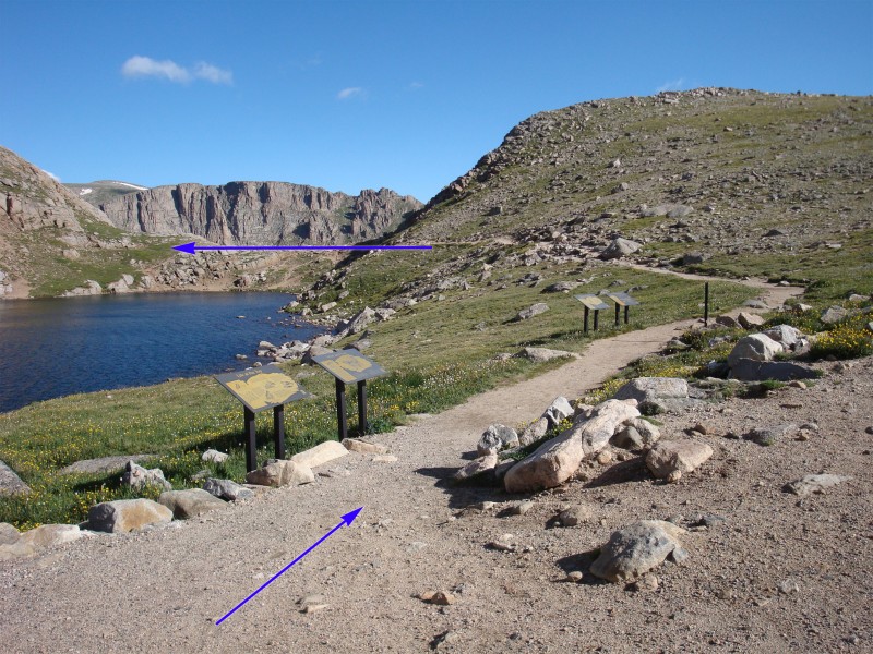
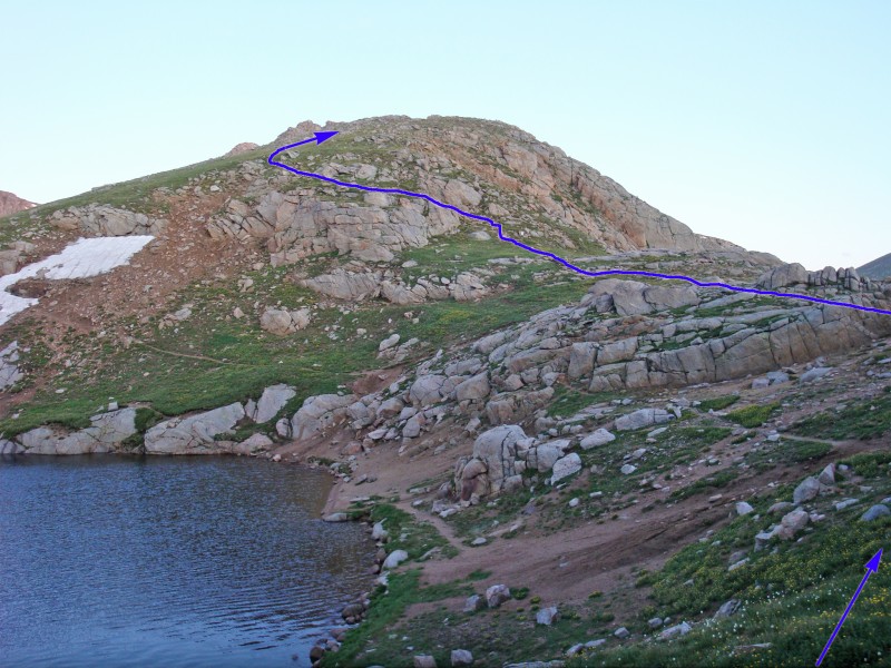
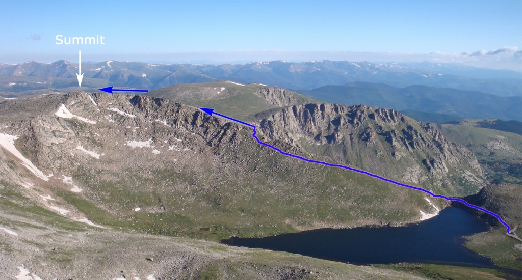
From the Summit Lake parking area, walk north past an old rock building to locate the trail which leads toward the north end of the lake -  1 and  2. Hike to the north end of the lake and locate a signed trail that climbs up Spalding's east ridge -  3.

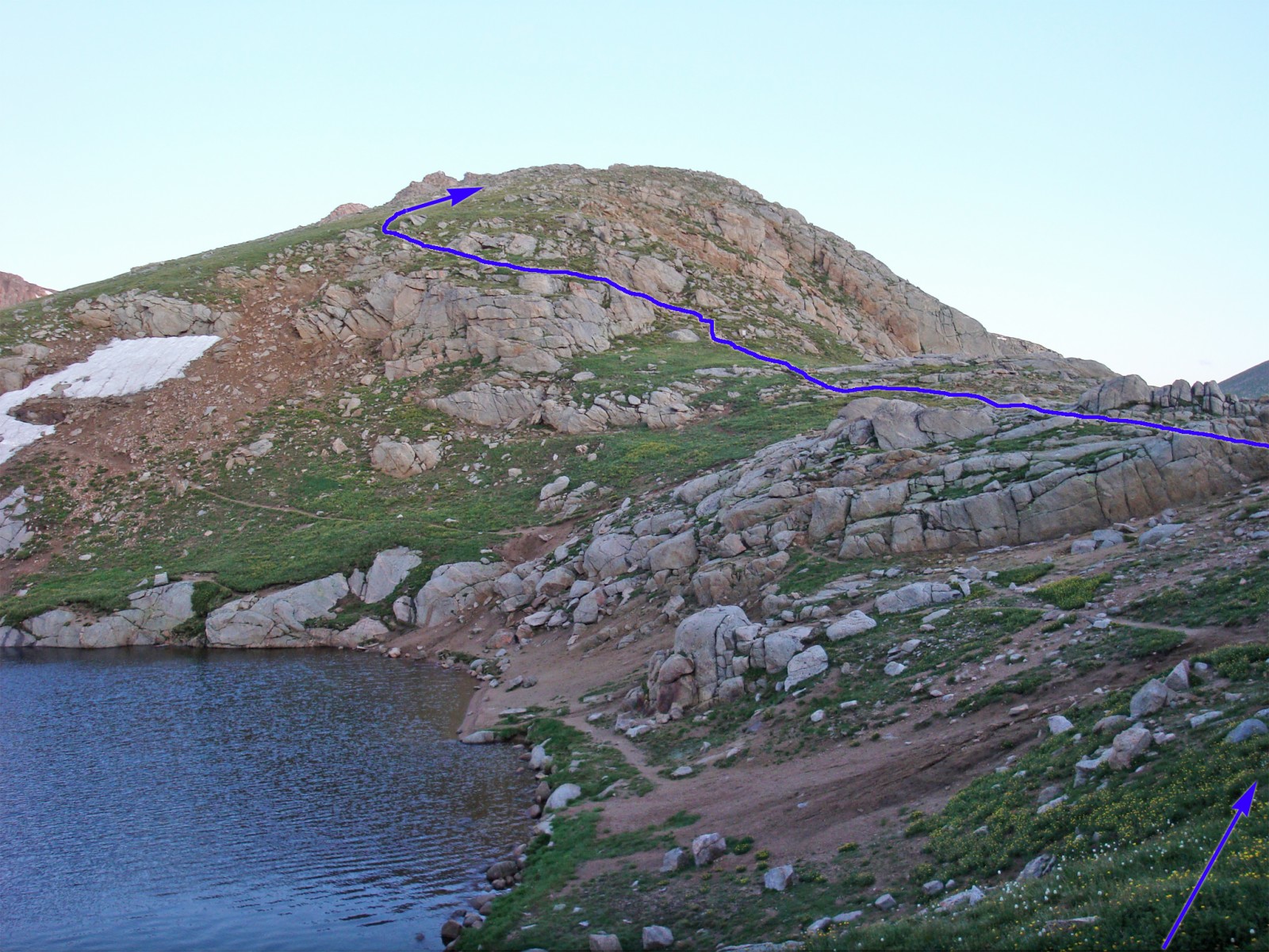
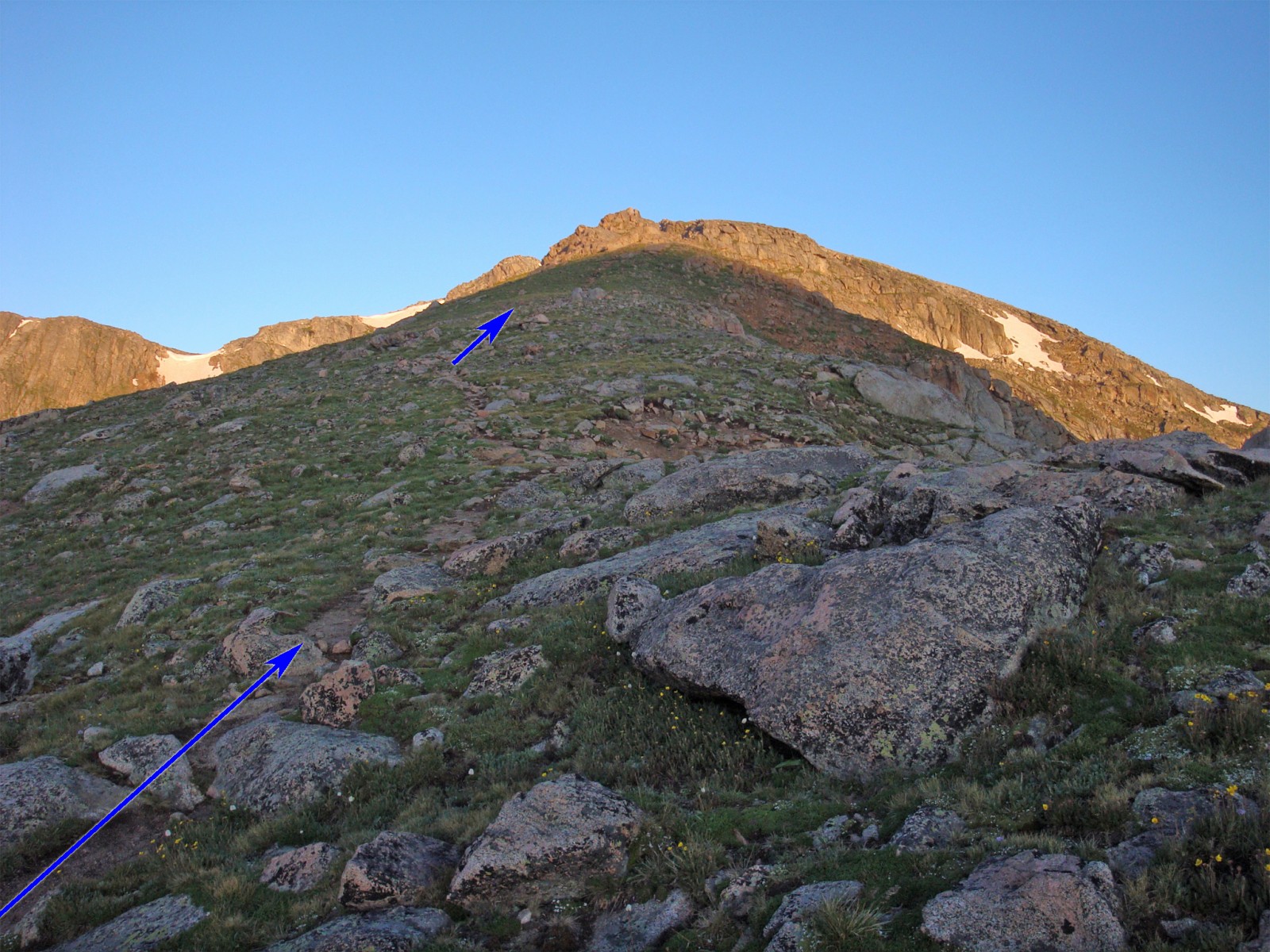
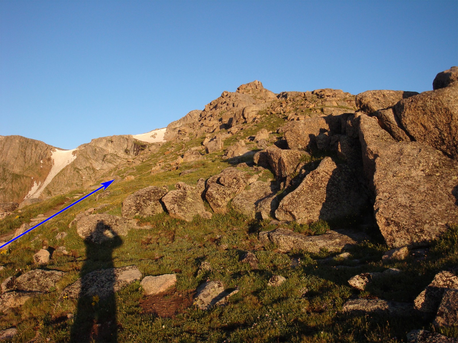
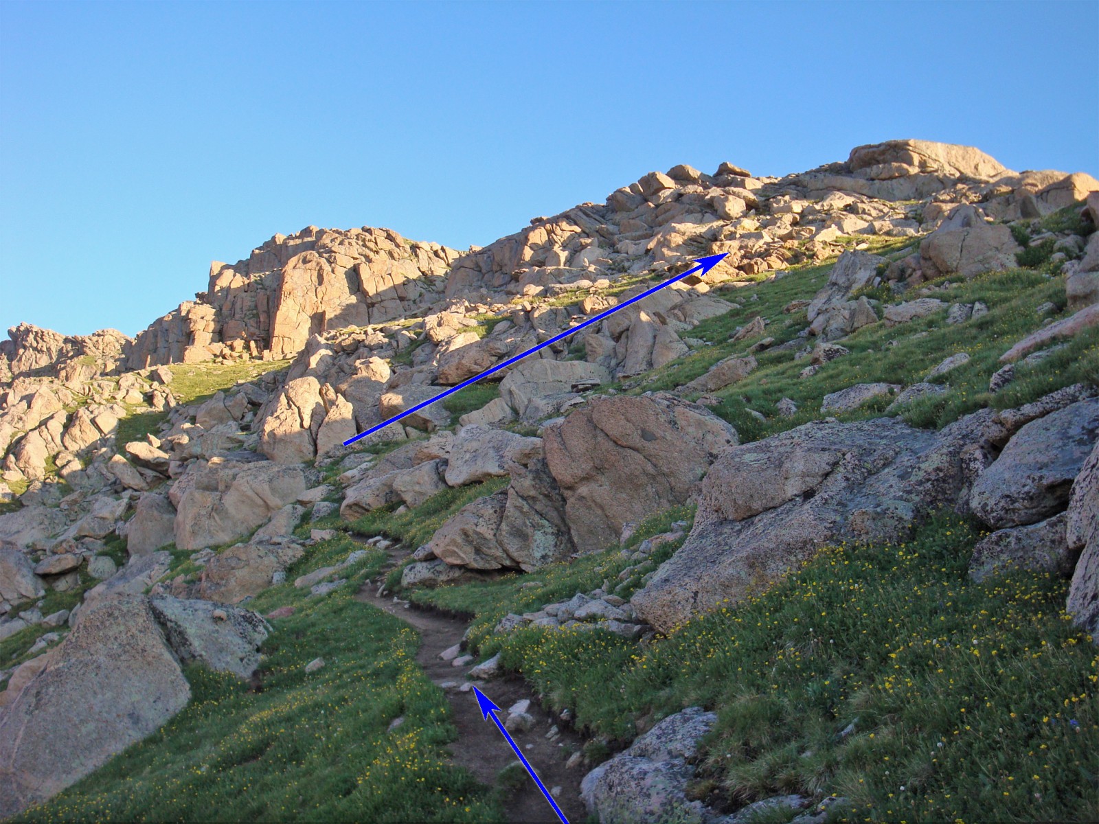
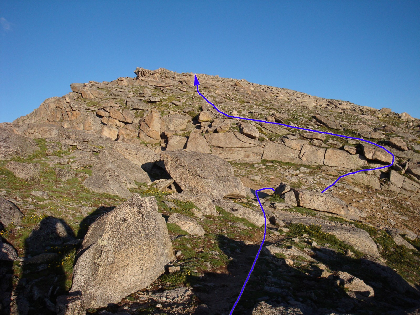
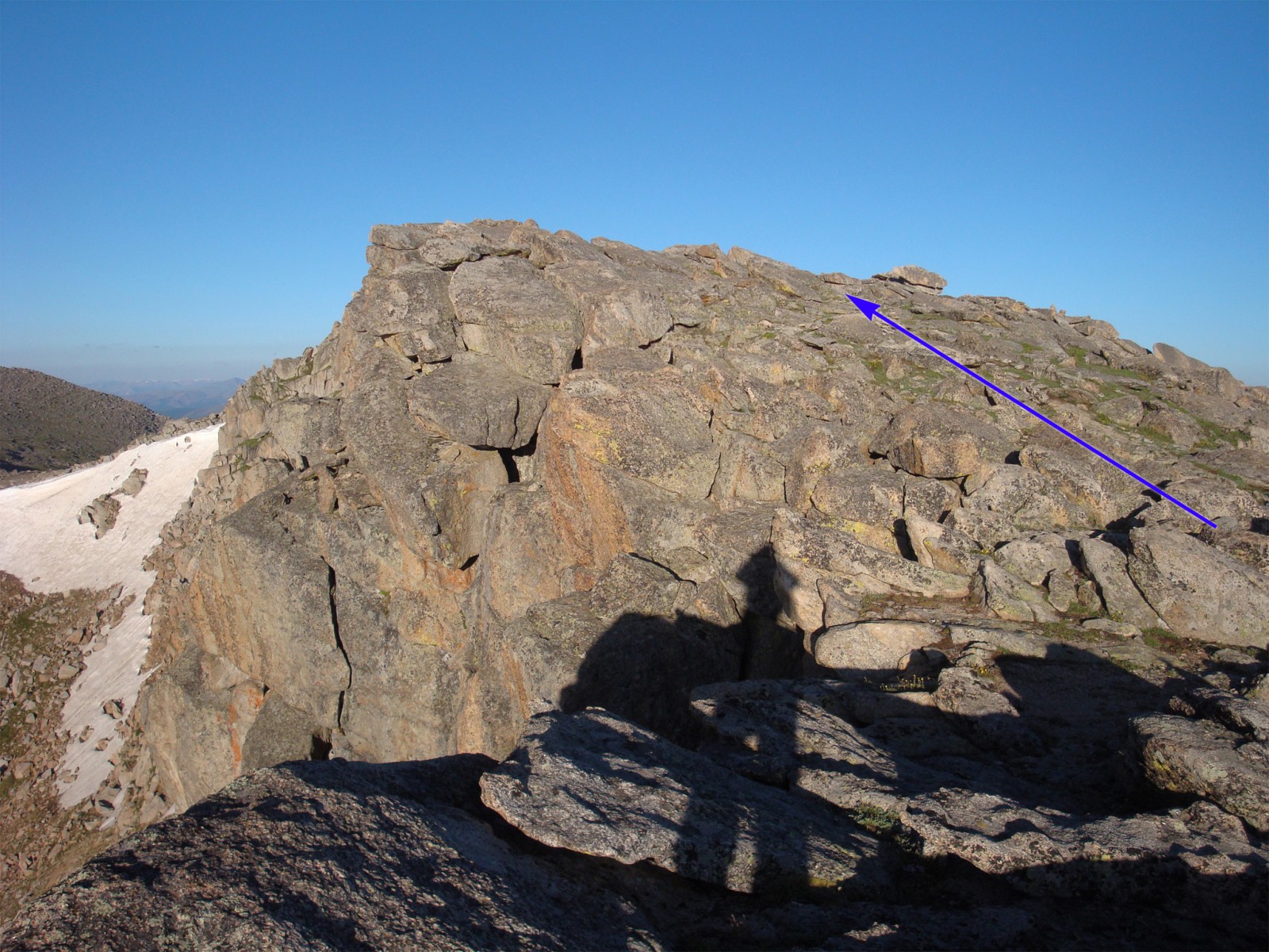
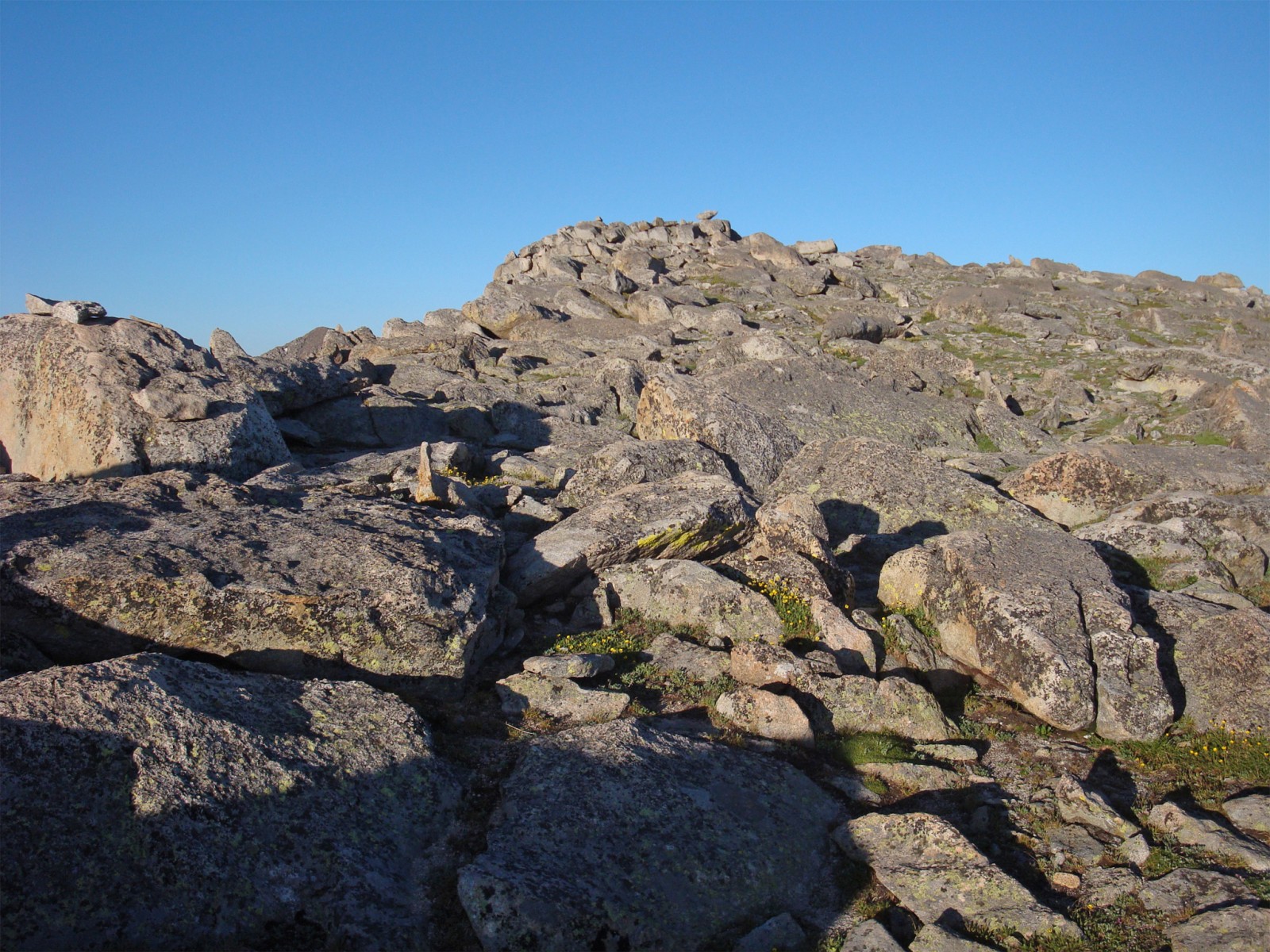
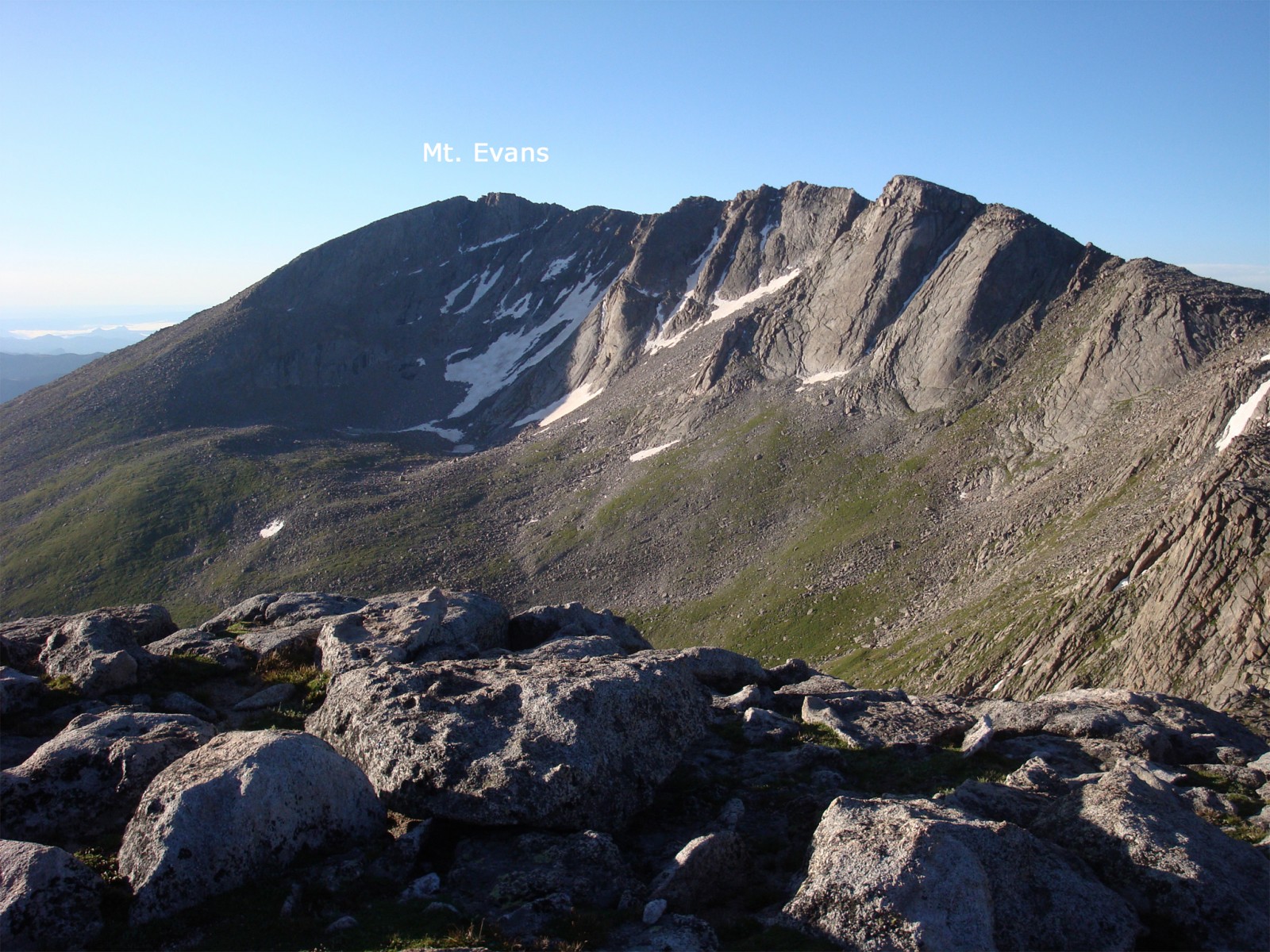
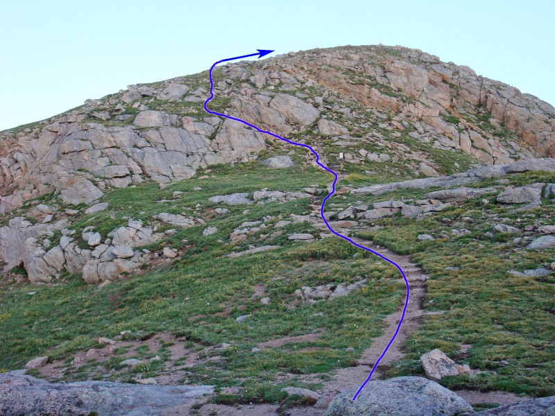
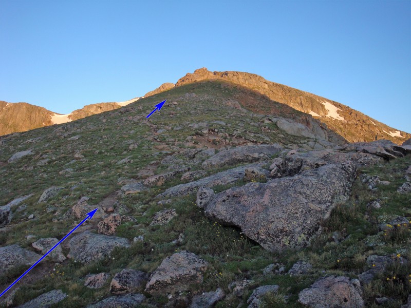
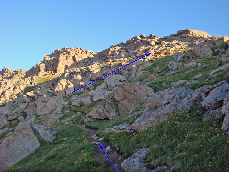
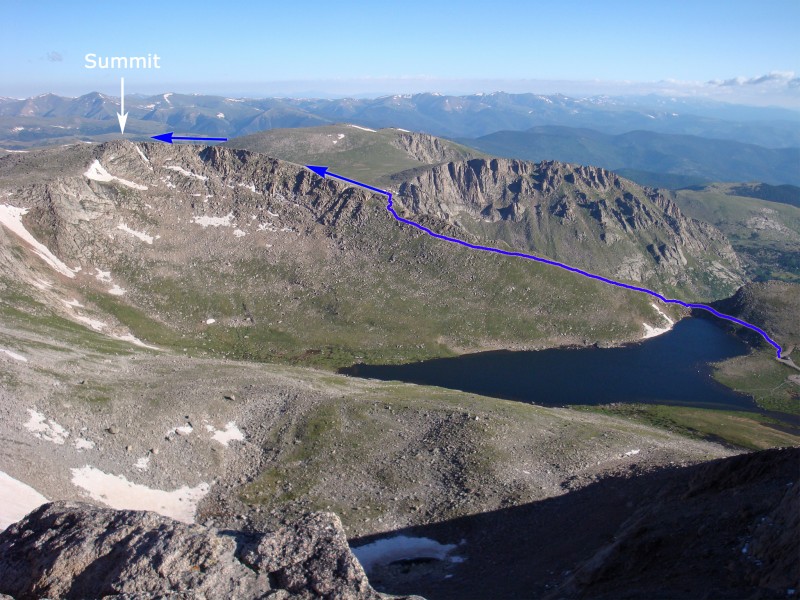
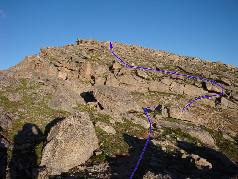
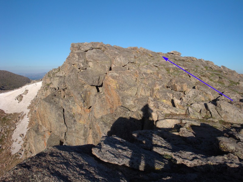
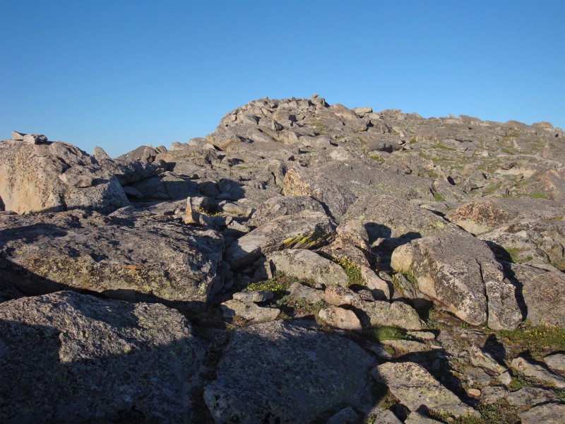
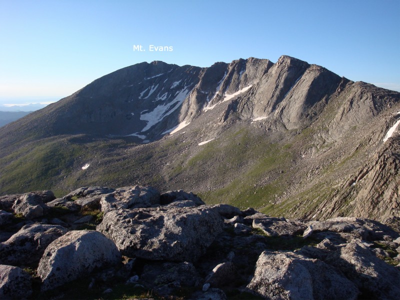
Follow the steep trail up through rocks ( 4) to reach easier terrain on the ridge -  5. Continue on the trail and, near 13,200', stay left of the ridge crest in order to bypass more difficult terrain up to the right. Near 13,300' ( 7), climb back toward the ridge crest. Taken from the summit of Blue Sky,  8 provides a broad view of the route. Pop out on the ridge crest near 13,400' to reach easier terrain -  9. Cross a small trough and continue along the rocky ridge ( 10) to reach the summit -  11 and  12.

Maps

JPG Image
Static Map JPG

Interactive Map & 3D Flythrough
Human Verification Required

Photos

#1#2#3#4#5#6#7#8#9#10#11#12

Weather

Caution: The information contained in this route may not be accurate and should not be the only resource used in preparation for your climb. Failure to have the necessary experience, physical conditioning, supplies or equipment can result in injury or death. 14ers.com and the author(s) of this route provide no warranties, either express or implied, that the information provided is accurate or reliable. By using the information provided, you agree to indemnify and hold harmless 14ers.com and the route author(s) with respect to any claims and demands against them, including any attorney fees and expenses. Please read the 14ers.com Safety and Disclaimer pages for more information.

Please respect private property: 14ers.com supports the rights of private landowners to determine how and by whom their land will be used. In Colorado, it is your responsibility to determine if land is private and to obtain the appropriate permission before entering the property.
Heading to a 14er soon? Don't forget the 14ers.com mobile app.
Google Play     Apple App Store