Log In 
Photo

South Arapaho Peak

Via Fourth of July trailhead
Difficulty Difficult Class 2 
Risk FactorsExposure:
Rockfall Potential: Moderate  
Route-Finding:   
Commitment:   
 
Start10,145 feet
Summit13,408 feet
Total Gain3,500 feet
RT Length8.6 miles
Authorkrishcane
Last UpdatedJun 2013
DownloadsgpxGPX File
Show More
Photo

Trailhead

If you live either north or south of Eldora, use the following directions:
Go north or south on Colorado 119 to the town of Nederland. Traveling north on 119, turn left at the Eldora turnoff. Coming from the north, turn right at the Eldora turn-off (County Road 130). Continue on that road past Nederland High School and past the turn for the Eldora "shelf road" that leads up to the resort. 1.8 miles after the Eldora shelf road, you'll read the town of Eldora.

Continue through town. The road is now called Eldorado Avenue. In less than a mile, you'll pass through the town and the road will turn to dirt (or you'll hit a closure if it's winter).

About 0.75 miles after the transition to dirt, the road splits. Keep to the right, following the sign to the 4th of July trailhead and Buckingham Campground.

You'll pass by a number of cabins along the way. About 4 miles past that road split and sign, you'll reach the trailhead.

This road is probably passable for most passenger cars but I wouldn't try it in a low clearance vehicle or with a new driver. The trail starts in the upper parking lot right after the Buckingham Campground. There is free parking if you get there early, but note that it can fill up on popular summer weekends, leaving people to park precariously on the narrow access road.

Route

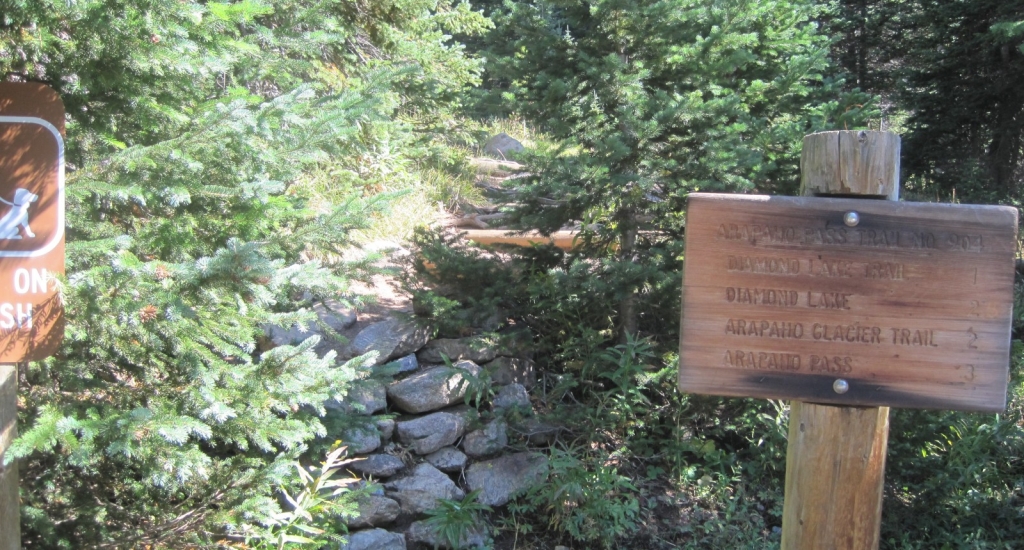
From the Fourth of July trailhead on the north side of the parking lot, follow the signs for the Arapaho Pass trail  1 to start. The trail starts out with a gentle climb  2. There are plenty of social trails, side trails, and closed-for-rehabilitation previous trails, so stick with the clear and heavily trodden trail when in doubt. The trail climbs about 500 vertical feet in easy class 2 terrain  3 in the first mile. Step carefully over various small streams.

Around 1.1 miles at 10,750 feet you reach the junction of the Diamond Lake trail. Stick with the Arapaho Pass trail  4.

At 1.5 miles, around 11,100 feet, the trail goes almost level for half a mile of beautiful scenery  5. At 2.0 miles and 11,200 feet, you'll reach the ruins of the old Fourth of July pit mine and the juncture of the Arapaho Glacier trail  6, a much smaller trail than the Arapaho Pass trail. Take care to make this right hand turn onto Arapaho Glacier trail.

Within a few feet cross a substantial stream or marshy area  7, pass a large boulder  8 and then continue your ascent  9  10 gradually gaining altitude. You'll pass through 12,000 feet about 3 miles from the trailhead  11. South Arapaho Peak's summit comes into view shortly thereafter  12.

Continue on the Arapahoe Glacier trail ( 13,  14) to the saddle at 12,700 feet  15 between South Arapaho Peak to the west and Old Baldy to the east. Enjoy the view from the saddle looking down on the Arapaho Glacier itself. You are about 3.8 miles from the trailhead.

Leave the Arapaho Glacier trail (which heads east across Old Baldy) and head west toward South Arapaho Peak's summit. From here, the dramatic point visible is a false summit. There is a visible trail if there is no snow. Pass the wind shelter on the west side of the saddle and ascend just to the left of the ridge line.

The terrain becomes more difficult here and to keep it as class 2, you'll have to pick your route carefully and look for the cairns ( 16). Comfort with a few class 3 moves gives you some more flexibility in route over the rocky scramble ( 17). Generally, stay just inside the ridge line and keep ascending.

Reach a rocky knob at 13,000 feet (4 miles from trailhead) and get a great view of the false summit ( 18). Continue to push up difficult class 2 terrain ( 19,  20). Reach the false summit and get a view of the true summit of South Arapaho Peak ( 21). Cross more Class 2 terrain ( 22).  23 looks back on the route from the false summit to the true summit of South Arapaho.

Reach the summit of South Arapaho Peak at 13,397 feet and 4.3 miles from the trailhead. There is a small wind shelter, and just east of that, an engraved metal disc with names of nearby peaks and distances to them. North Arapaho Peak's summit is beautifully visible from here ( 24) across the Class 4 traverse ( 25), and the Arapaho Glacier sprawls below, feeding Boulder's water supply.
Notes

None
#1 #2 #3 #4 #5 #6 #7 #8 #9 #10 #11 #12 #13 #14 #15 #16 #17 #18 #19 #20 #21 #22 #23 #24 #25

This page is only available to registered 14ers.com users. If you don't have an account, you can register in the forum.

Log In_

Caution: The information contained in this route may not be accurate and should not be the only resource used in preparation for your climb. Failure to have the necessary experience, physical conditioning, supplies or equipment can result in injury or death. 14ers.com and the author(s) of this route provide no warranties, either express or implied, that the information provided is accurate or reliable. By using the information provided, you agree to indemnify and hold harmless 14ers.com and the route author(s) with respect to any claims and demands against them, including any attorney fees and expenses. Please read the 14ers.com Safety and Disclaimer pages for more information.

Please respect private property: 14ers.com supports the rights of private landowners to determine how and by whom their land will be used. In Colorado, it is your responsibility to determine if land is private and to obtain the appropriate permission before entering the property.
Heading to a 14er soon? Don't forget the 14ers.com mobile app.
Google Play     Apple App Store