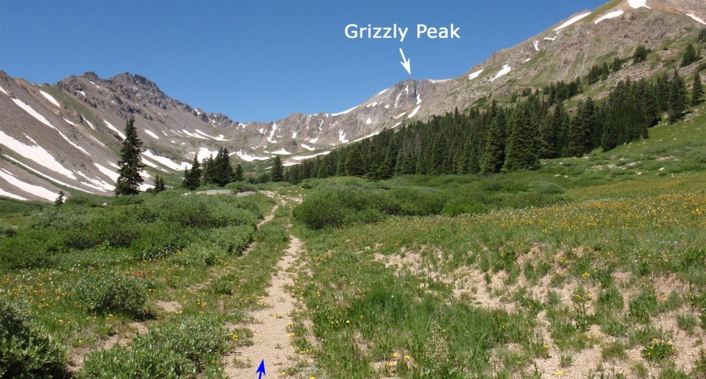
Pass the gate and follow the old road into McNasser Gulch. Soon the view opens up and you'll get your first look at Grizzly, off to the west -
1. Near 11,900' and after 1.2 miles on the road, zigzag up to a mining area (
2) where the road ends, near 12,100'. Hike west out of the mining area (
3) and continue west/northwest toward Grizzly as you gradually ascend the slope on the north side of McNasser Gulch. Near, 12,600', ascend northwest into rocky terrain (
4) and, near 12,800', turn north to climb through the rocks -
5. Above 13,100, the climbing becimes easier but the slope is scree-covered (
6) and rather unpleasant. Continue north to reach the saddle between Grizzly Peak (left) and unnamed point 13,441' -
7.
The summit is visible to the west but you must first overcome the difficulties just beyond the saddle - three gendarmes on the ridge. Hike a short distance along the east ridge to reach the first gendarme -
8. Stay on or left of the ridge crest (
9) and reach an easy section before the second gendarme -
10. Ascend nearly to the top of this one (
11) to regain the ridge crest beyond the gendarme. There's plenty of scree and loose rock but it's easy to keep the difficulty at Difficult Class 2. And now for the final gendarme -
12. To keep the difficulty below Class 3, bypass it by hiking around to the lower left. If snow prevents you from going around the gendarme, you'll have to climb onto it where the difficulty quickly becomes Class 3 -
13. Once beyond this section, ascend the remaining east ridge to reach the summit ridge -
14.
15 looks back along the ridge and gives you a good look at the gendarmes.
From the north end of the summit ridge, the summit is only 0.2 mile to the south -
16 and
17. Staying just below the ridge crest, hike toward the summit. If you find the terrain to be too difficult, descend slightly to the right (west). Bypass a notch before the summit and climb the final pitch (
18) to reach the top.
19 looks back along the summit ridge,
20 is another look at the east ridge and
21 looks south to Garfield Peak.
