Taken from Horseshoe Mountain,
1 shows the south side of White Ridge. The couloir used in this route description is just south of the summit and is the left of two couloirs that form a large "V." This route does not have a trail to the summit and there's no specific starting point on the Fourmile Creek road. Simply pull of the road near 11,700' once you identify the main couloir -
2 and
3. Leave the road and hike north through sparse trees and willows to reach tree line. Continue to the run-out below the two couloirs, near 12,000' -
4. This is a good spot to pick your route up the couloir. The remainder of this description will use the left (main) couloir -
5.
Walk up through the debris run-out and angle into the main couloir -
6 and
7. The couloir is often cross-loaded with snow from west winds, causing less stable snow to accumulate on the left side. If you are unsure of the snow stability, pick a line on the far right along the rocks or along the rocks on the far left side. Enter the couloir at 12,400' and start climbing -
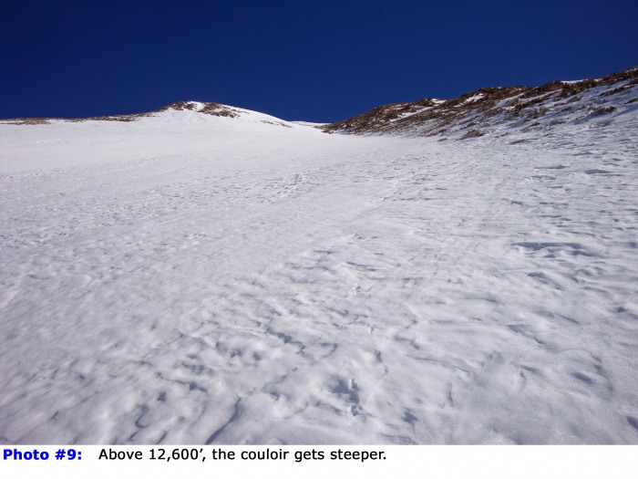
8.. The angle gradually increases but it doesn't take long before it exceeds 30 degrees -
9. Above 13,000', the couloir angles slightly left (
10) before reaching a line of rocks on the right side -
11. Between 12,700' and 13,200', the couloir reaches a maximum angle of approx. 39 degrees.
Swing around the line of rocks and continue climbing as the angle eases slightly above 13,200' -
12.
13 looks west across the couloir and provides a good look at the slope angle.
14 looks down the couloir. Depending on when you climb this route, the snow may not stretch to the ridge above -
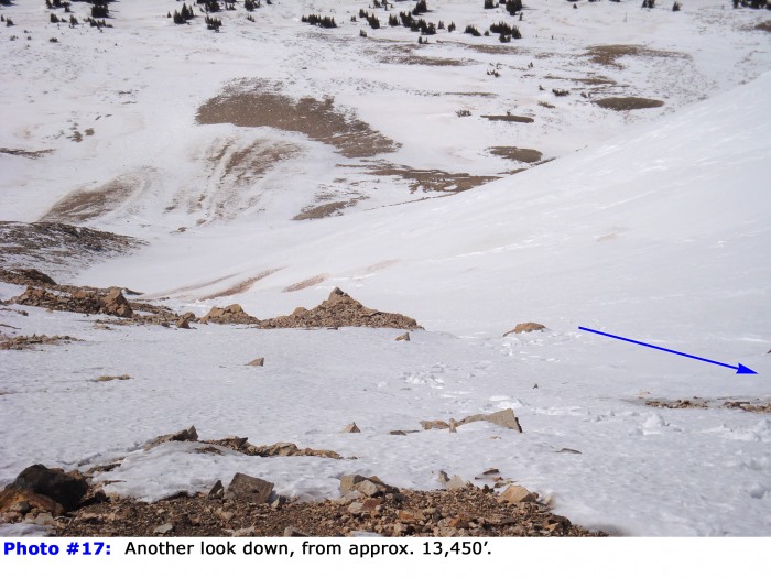
15. Taken near 13,400�,
16 is another look west across the couloir, and
17 is another look down. Continue on snow or scree to reach the summit ridge -
18.
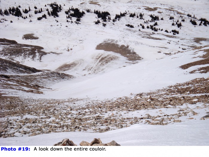
19 looks down the entire route. Turn left on the summit ridge and ascend the small point seen in
18 to see the summit -
20. Walk about 100 yards to reach the top -
21.
If you are not descending via the couloir, your best option is to hike northwest along White Ridge for exactly one mile to reach the west side of the saddle between
Mt. Sherman and White Ridge. Then, turn left (south) and descend the gully between the two peaks. This will take you into upper Fourmile Creek and back to the road. The topo map shows this descent. If there's snow in this area, you might be able to glissade portions of the upper basin. If you're skiing, it's a fairly easy ski from the top of the gully (approx. 13,500') back to the road. For more information (and photos) on this descent, please check out the Mt. Sherman - South Slope Route on 14ers.com.
22 provides another view of the route, including the easier descent from the Sherman-White saddle.


 GPX Track File


