From the upper end of the parking area
, start up the trail (
1) and hike nearly 1/2 mile to tree line where the trail approaches Nellie Creek. Near 11,800', pass some large boulders as you parallel the stream -
2. Ascend a hill
to reach a trail junction near 11,950' and continue west into the large basin, south of Uncompahgre -
3 and
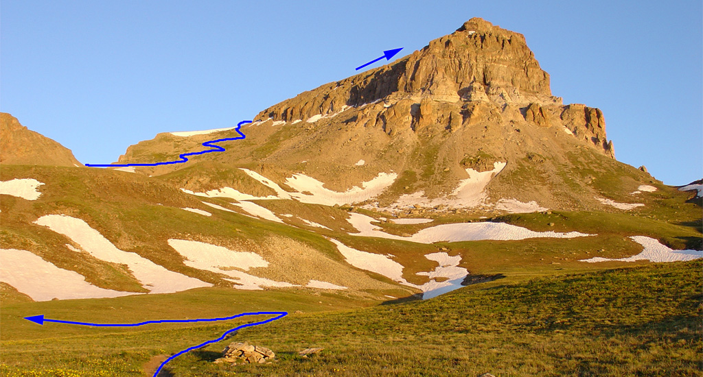
4. Turn left and follow the trail southwest across the basin and toward the south ridge -
6.
Reach the south ridge
near 12,900' and follow it west/northwest -
7. Continue to Uncompahgre's southeast face (
8 and
9) and ascend a few switchbacks to reach the crest
of the ridge, near 13,800' -
10. Follow the trail left to the west face, where you're faced with the crux of the route – 150 feet of steep, loose rock below the upper slopes -
11.
From here, your goal is to regain the ridge, but you must first ascend some loose, Class 2 terrain. Walk toward the tower seen in
11, where you'll have a couple of options: 1) Pass the tower (
12) before turning right to regain the ridge, or 2) Take a slightly steeper line just before the tower. Both options hold loose rock -
13. Once the terrain eases, you'll find a more-defined trail -
14 and
15.
16 looks down on much of the route. Walk up to the summit -
17,
18, and
19.
