Log In 
Photo

Wilson Peak

 Southwest Ridge
Difficulty Class 3 
Risk FactorsExposure: High
Rockfall Potential: Considerable  
Route-Finding: Considerable  
Commitment: Considerable  
 
TrailheadRock of Ages
Start10,350 feet
Summit14,021 feet
Total GainFrom Rock of Ages TH: 3,900 feet
From Navajo Basin TH: 5,000 feet
From Navajo Lake: 3,000 feet
RT LengthFrom Rock of Ages TH: 10 miles
From Navajo Basin TH: 16 miles
From Navajo Lake: 7 miles
Last UpdatedApr 2025
Show More
Photo

Trailhead

From Ridgway, leave U.S. 550 and take Colorado 62 toward Telluride. Drive over Dallas Divide, down to Placerville and turn left onto Colorado 145. Drive 6.7 miles and turn right onto the Silver Pick road (dirt). From here, it's 8.5 miles to the trailhead. Drive 4 miles to an intersection and turn right onto "59 H" which is also Forest Road 622. Continue 2.3 miles, turn right onto FR 645 and continue 2.2 miles to the Rock of Ages trailhead, near 10,350'. Notes: After 1 mile on the FR 645 road, you must cross the stream in Big Bear Creek which usually isn't too bad by mid-July. Also, there are some designated camp sites along this road.

Route Description

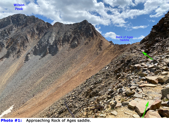
The easiest and most straightforward way to hike Wilson Peak on its own is by starting at the Rock of Ages trailhead. If this is your chosen starting point, follow the Rock of Ages Approach for 4 miles to reach the Rock of Ages saddle at 13,000' -  1. Alternatively, if you're using the Navajo Basin Approach, hike to 12,300' in the upper east end of Navajo Basin and follow the trail north to reach the Rock of Ages saddle -  2.

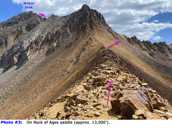
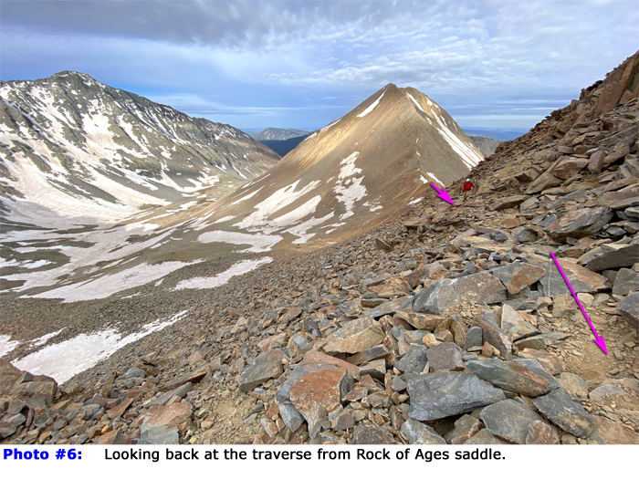
Once at the Rock of Ages saddle , the route continues east -  
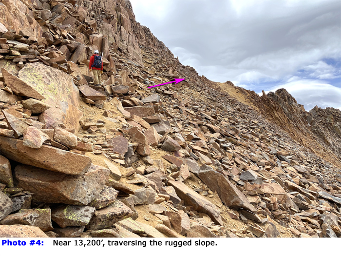
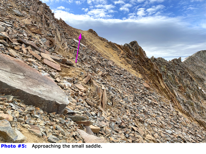
3. Follow the trail as it traverses the saddle and crosses a loose, rugged slope ( 4,  5, and  
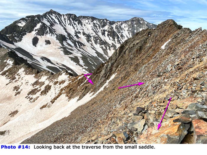
6) leading to a saddle located between Wilson Peak and 13er Gladstone Peak -  
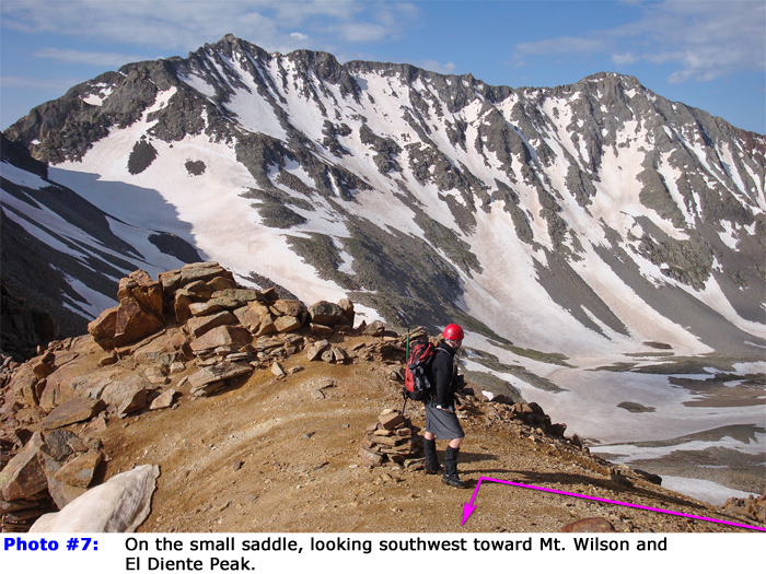
7. From this small saddle 
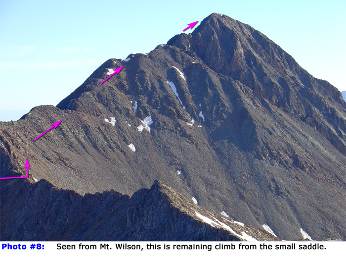
, the route navigates around the south side before climbing up to the southwest ridge -  8 and  
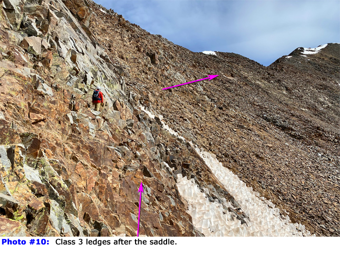
9. Next, scramble through slabs and ledges heading north -  10 and  11. This segment is a bit exposed and serves as an introduction to the challenge of the final summit pitch.

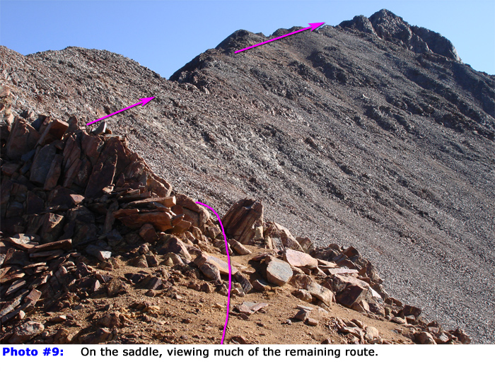
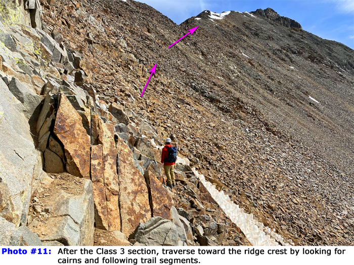
After passing through the scrambling section, traverse toward the ridge by following cairns and trail sections -  12 and  
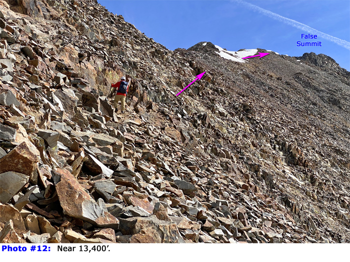
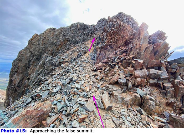
13. The slope is relatively steep and loose in places, but you should be able to follow a visible trail for most of the way. Ascend to the southwest ridge, reaching it near 13,550' -  
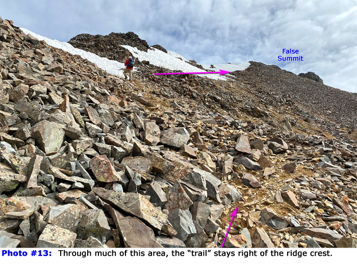
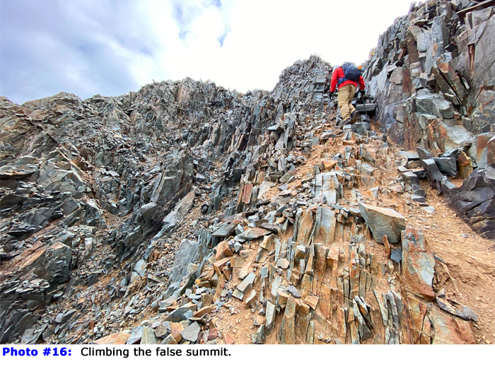
14. Progressing along the ridge crest, primarily on its right side, you'll climb to approximately 13,800' where the trail transitions to the left (north) side of the ridge. Follow an obvious line for 100 feet to reach a 13,900-foot false summit -  15 and  16.

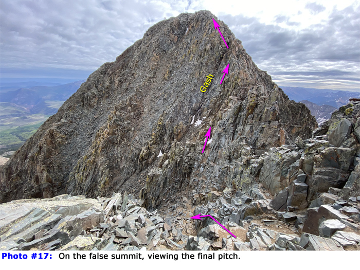
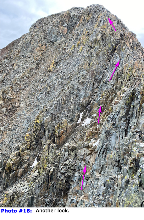
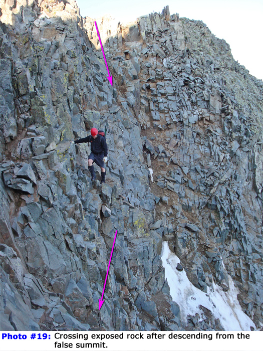
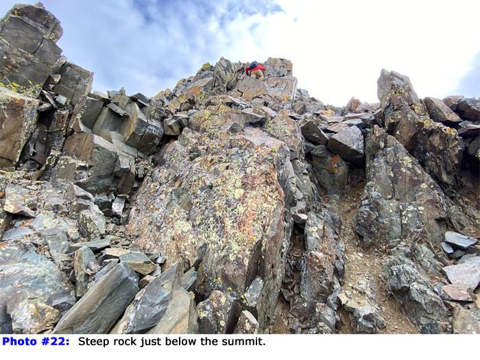
From the false summit, the final stretch may appear intimidating if it's your first time on the peak. However, by carefully choosing the correct path, you can avoid unstable, loose terrain and keep the difficulty within Class 3. Look carefully at photos  17 and  
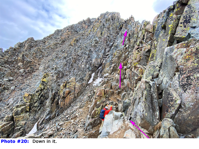
18 to locate a prominent dark gash in the face. You want to traverse toward the gash without descending excessively. Downclimb approximately 50 feet and begin scrambling across stacked rocks and ledges -  19 and  
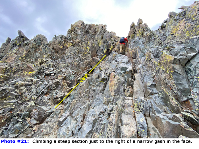
20. Just before reaching the gash, climb to your right to access the ridge crest -  21. From there, turn left and ascend the final Class 3 section to reach the summit
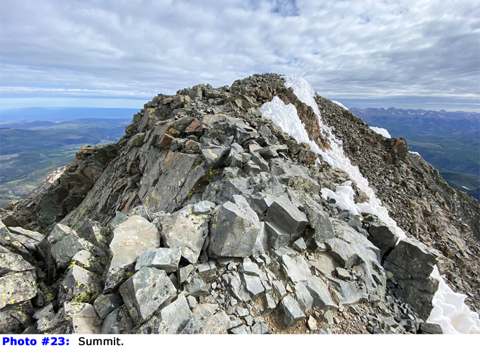
 -  22,  23, and  24.

Notes

IMPORTANT: This route enters the Lizard Head Wilderness area. Designated wilderness areas have special regulations and restrictions for party size, dispersed camping, campfires, etc. Also, dog owners should read the wilderness information carefully because some wilderness areas prohibit dogs to be off-leash and/or limit how close dogs can be to lakes and streams. If you have questions about the wilderness area, please contact a U.S. Forest Service office for the National Forest(s) listed above.
#1 #2 #3 #4 #5 #6 #7 #8 #9 #10 #11 #12 #13 #14 #15 #16 #17 #18 #19 #20 #21 #22 #23 #24

This page is only available to registered 14ers.com users. If you don't have an account, you can register in the forum.

Log In_

This page is only available to registered 14ers.com users. If you don't have an account, you can register in the forum.

Log In_

This page is only available to registered 14ers.com users. If you don't have an account, you can register in the forum.

Log In_

Caution: The information contained in this route may not be accurate and should not be the only resource used in preparation for your climb. Failure to have the necessary experience, physical conditioning, supplies or equipment can result in injury or death. 14ers.com and the author(s) of this route provide no warranties, either express or implied, that the information provided is accurate or reliable. By using the information provided, you agree to indemnify and hold harmless 14ers.com and the route author(s) with respect to any claims and demands against them, including any attorney fees and expenses. Please read the 14ers.com Safety and Disclaimer pages for more information.

Please respect private property: 14ers.com supports the rights of private landowners to determine how and by whom their land will be used. In Colorado, it is your responsibility to determine if land is private and to obtain the appropriate permission before entering the property.
Heading to a 14er soon? Don't forget the 14ers.com mobile app.
Google Play     Apple App Store