Starting at the Fish Hatchery trailhead (
1), follow a road southeast for just over 0.1 mile to reach the first of the Evergreen Lakes (
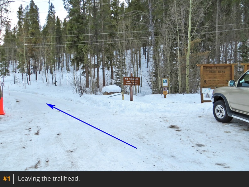
2). Since much of this route follows the Highline Trail, keep an eye on the signs to ensure you're headed in the right direction. Turn right and continue 0.25 mile past the second lake, staying on the trail as it heads northwest (
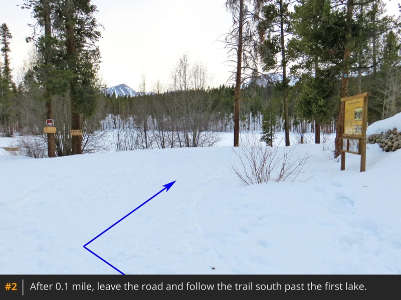
3). If you're hiking in winter and breaking trail, use the blue markers on the trees to guide your way for the first couple of miles. Less than a mile into your hike, continue straight through a junction (
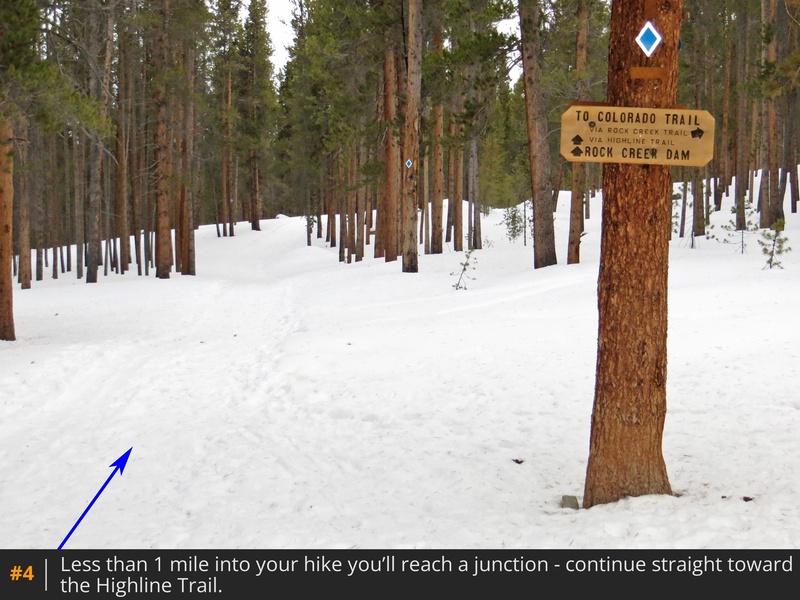
4), and further along, keep right at another (
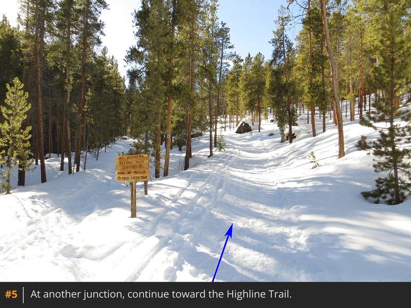
5). Reaching Rock Creek at yet another trail junction, turn left to cross the creek via a small bridge, keeping on the Highline Trail (
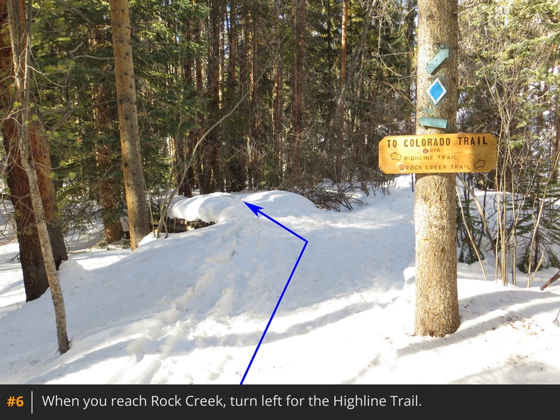
6). Hike another 0.4 mile to enter the Mount Massive Wilderness (
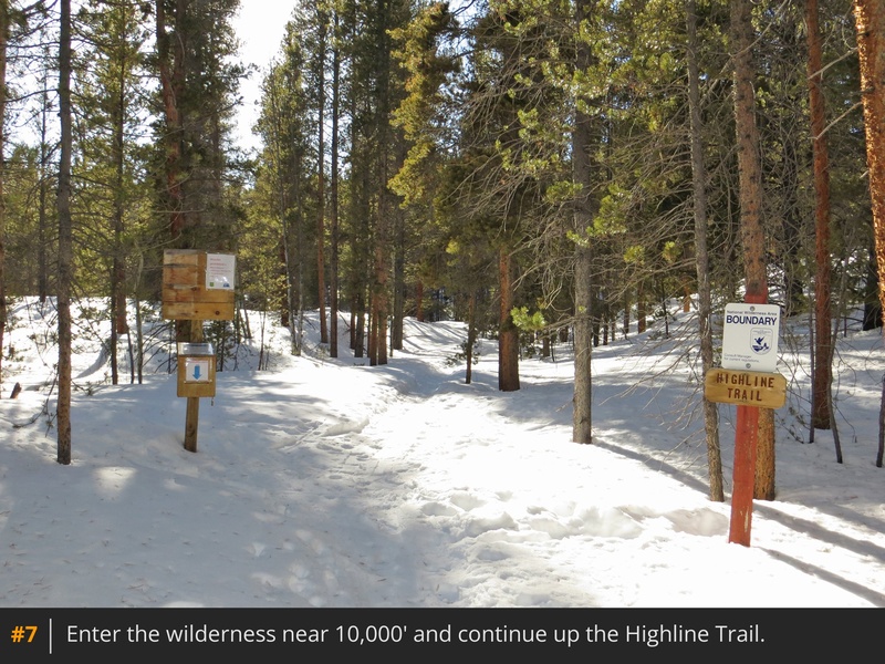
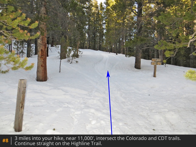
7), then continue for 1.6 more miles to meet the junction with the Colorado/Continental Divide trails, over 3 miles from the trailhead (
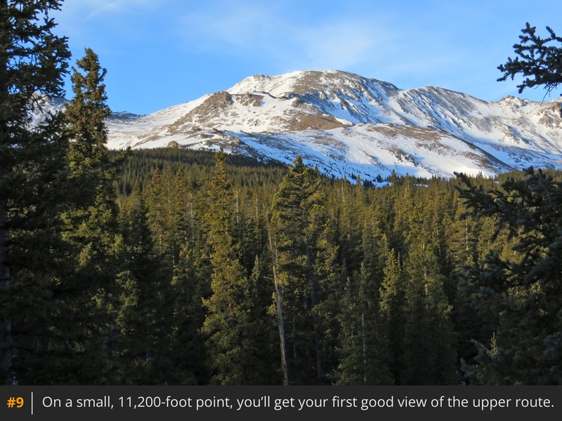
8). Stay straight on Highline for an additional 0.5 mile to reach a spot where you'll get a preview of the upper route (
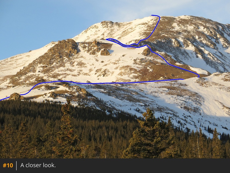
9,
10). After another 0.25 mile, you'll reach 11,300', where the trail turns northwest and descends into a marshy, willow-filled area (
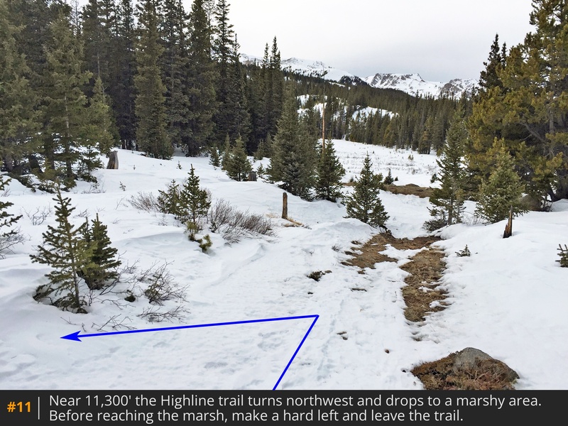
11). This is where you'll leave the Highline Trail.
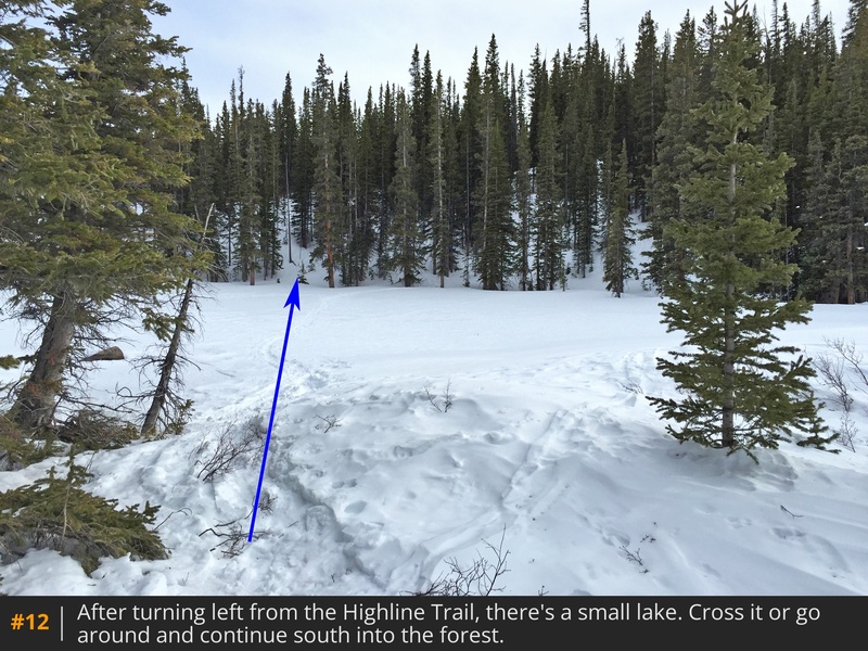
Before the trail drops into the marshy area, turn left and locate a small lake/pond. Leave the trail and either walk across the pond (in winter) or go around it (
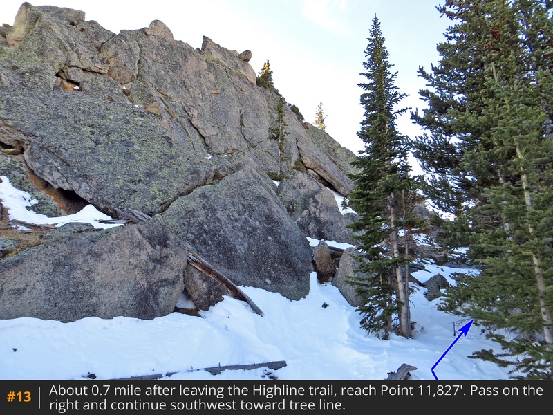
12). Navigate south and southwest through the forest to reach the rocky Point 11,827' (
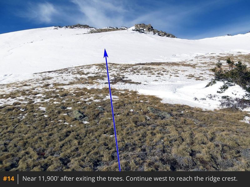
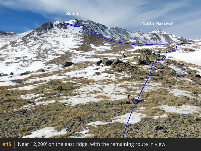
13). If you're using a GPS, it's a good idea to mark this point before starting your climb. From Point 11,827', hike less than 0.25 mile southwest to exit the forest near 11,900' (
14), then continue west to gain the east ridge at 12,200', where the remaining 2 miles of your ascent will come into view (
15).
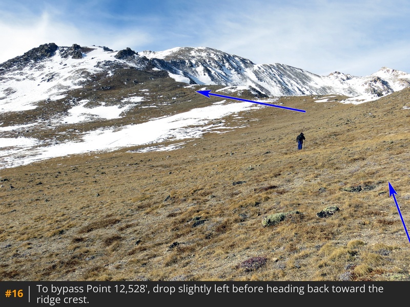
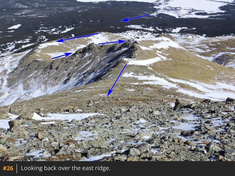
Follow the ridge west, passing a couple of small humps along the way. You'll reach Point 12,528' before the ridge curves to the south. Either hike over this point or bypass it by dropping to the left and then regaining the ridge further west (
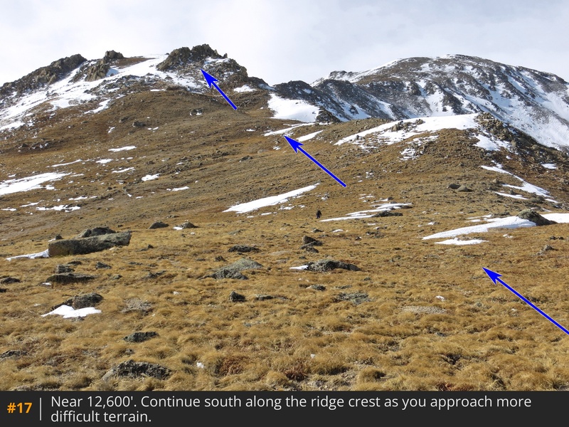
16). As you approach more difficult terrain at 12,600', continue south (
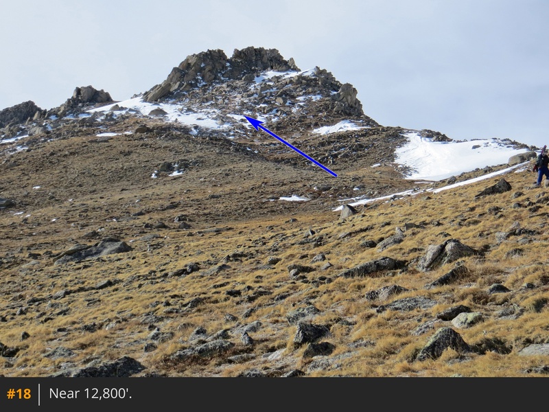
17). To the left of the ridge crest, ascend steeper terrain (
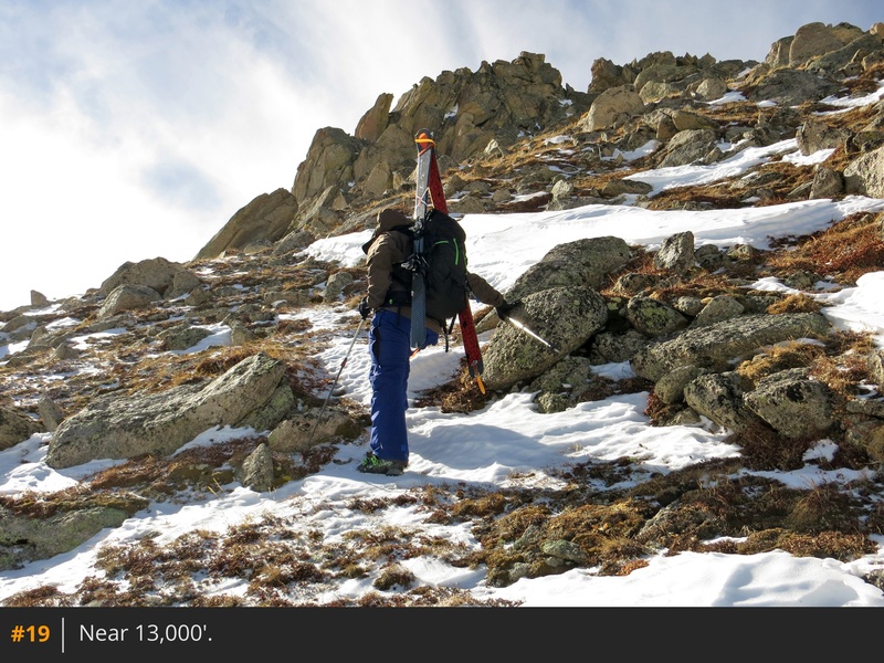
18) to reach a rocky point near 13,000' (
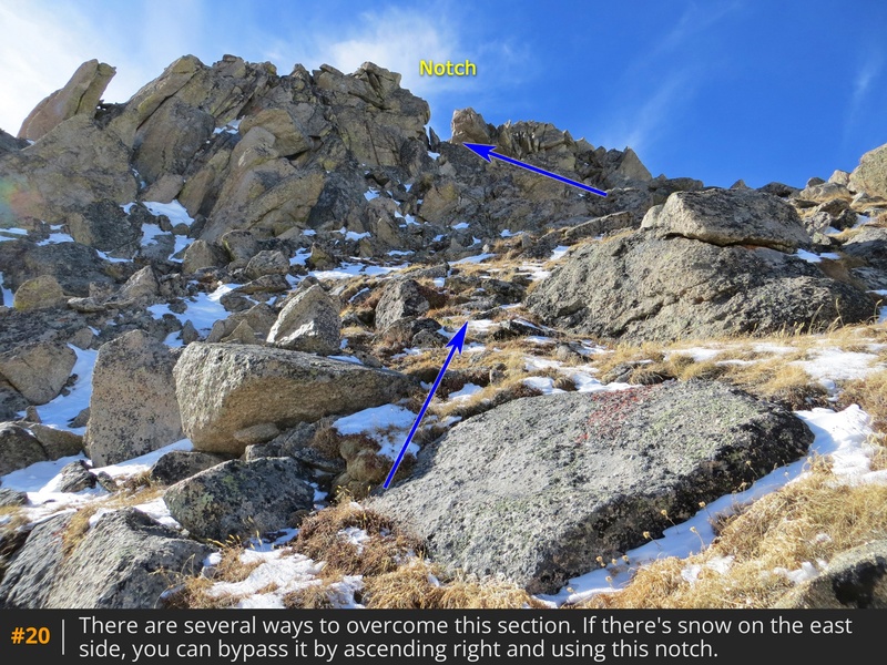
19). You have several options here, but if snow is present on the east side, the easiest route is to climb to the right before turning left to pass through a notch (
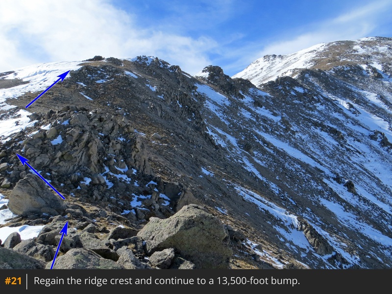
20). On the other side of the rocks, continue to a large bump near 13,500' (
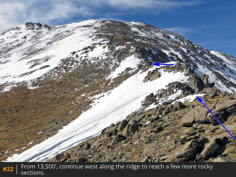
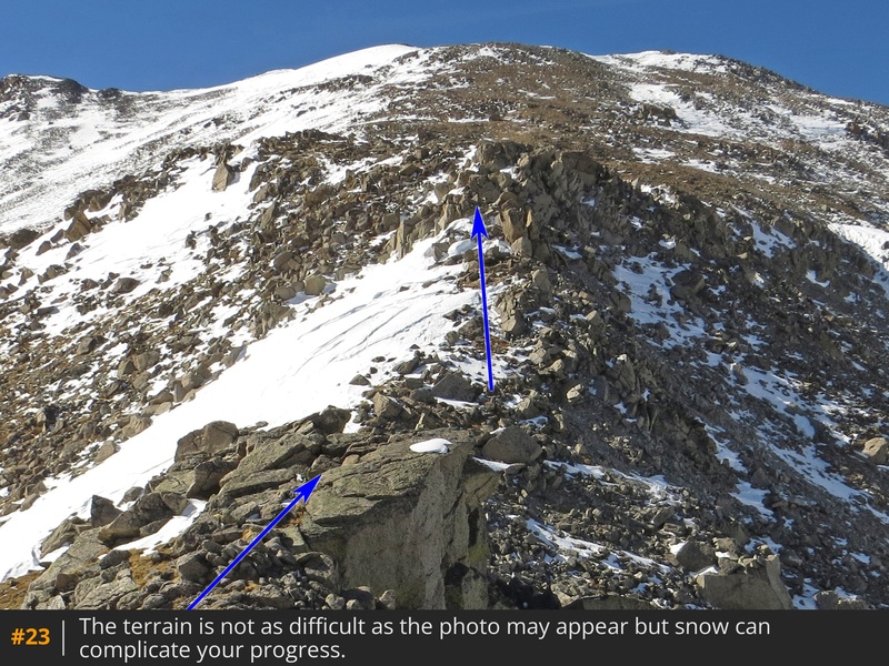
21). Ascend the bump and continue through a couple of rocky sections (
22,
23) to arrive at a flat spot—just before the final pitch (
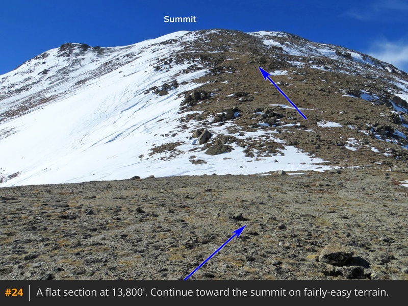
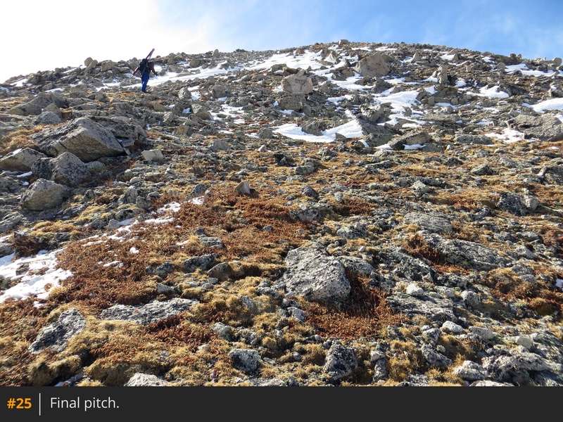
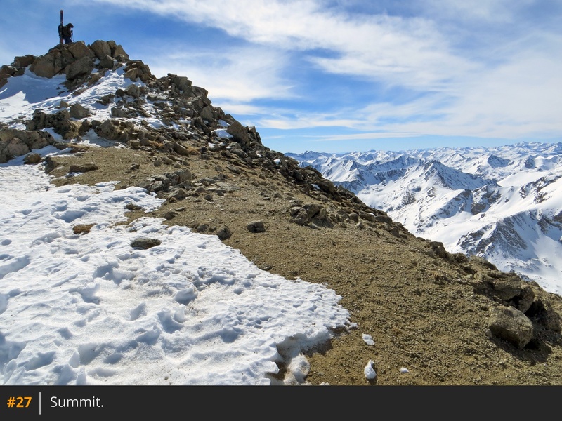
24). From here, ascend 600 feet of straightforward terrain (
25,
26), and finally, turn left to reach the summit (
27).


 GPX Track File
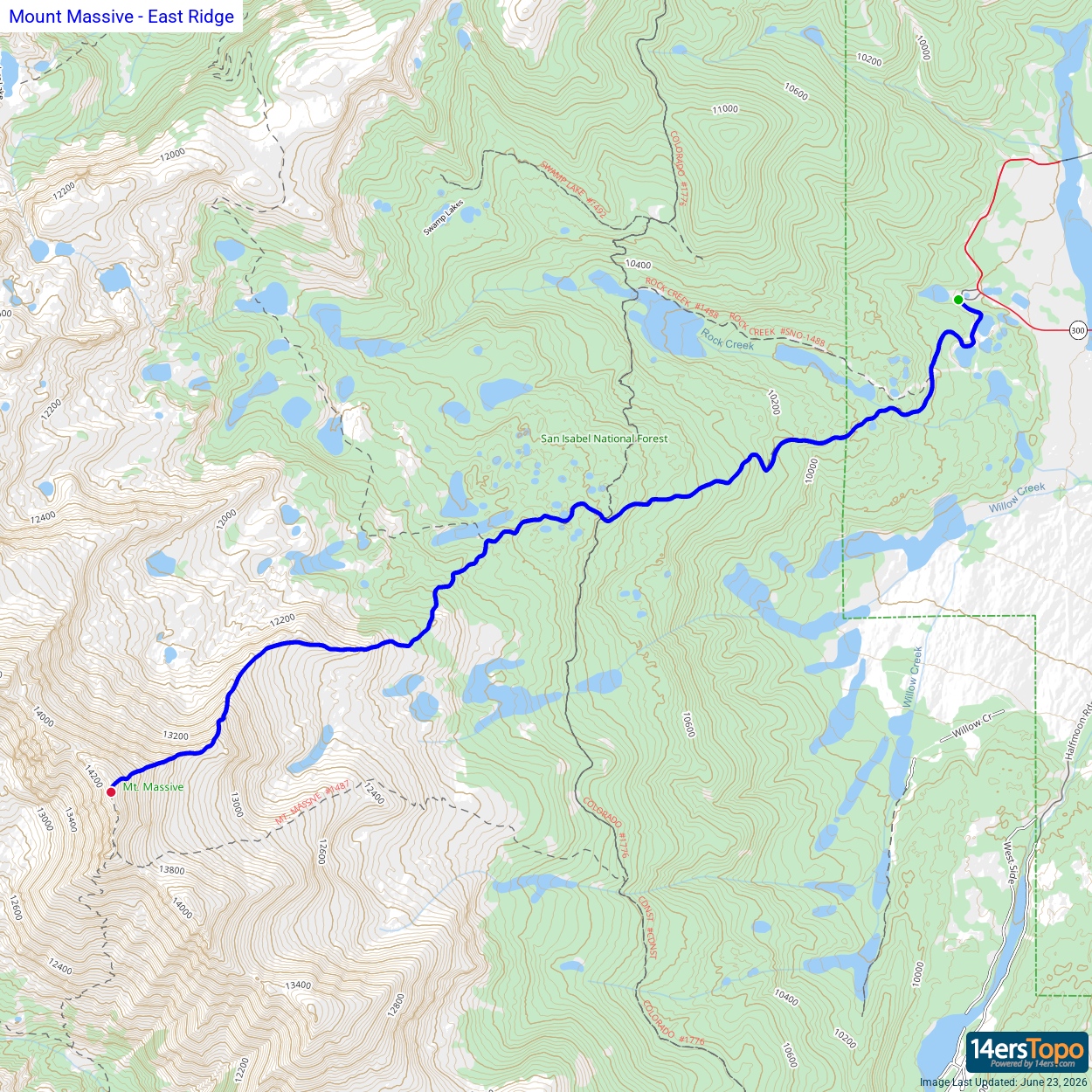


