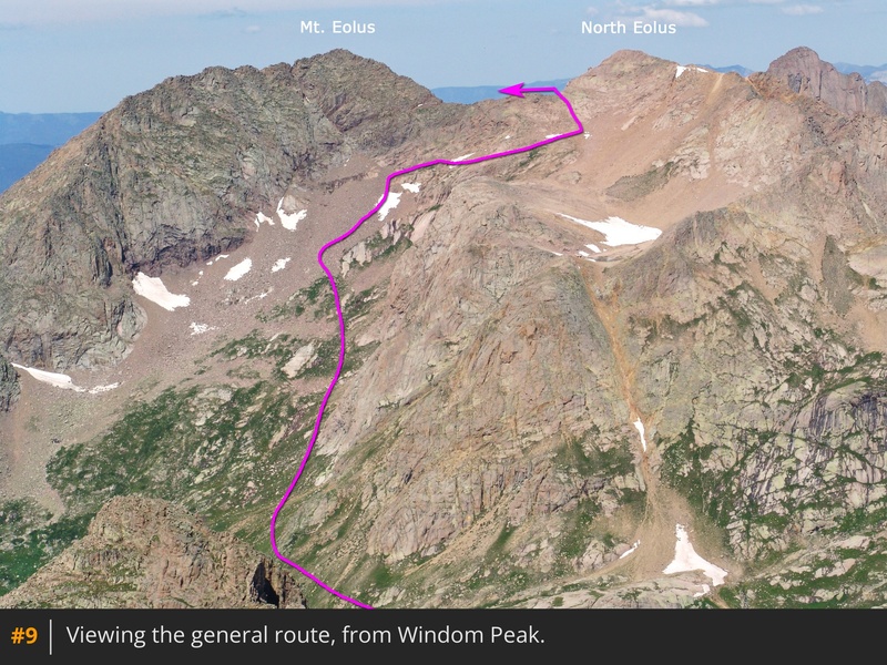
First, use the
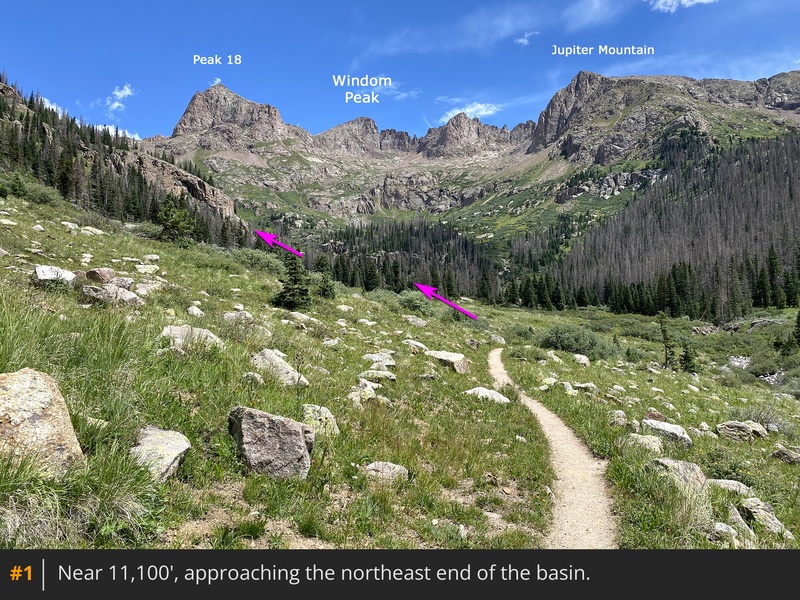
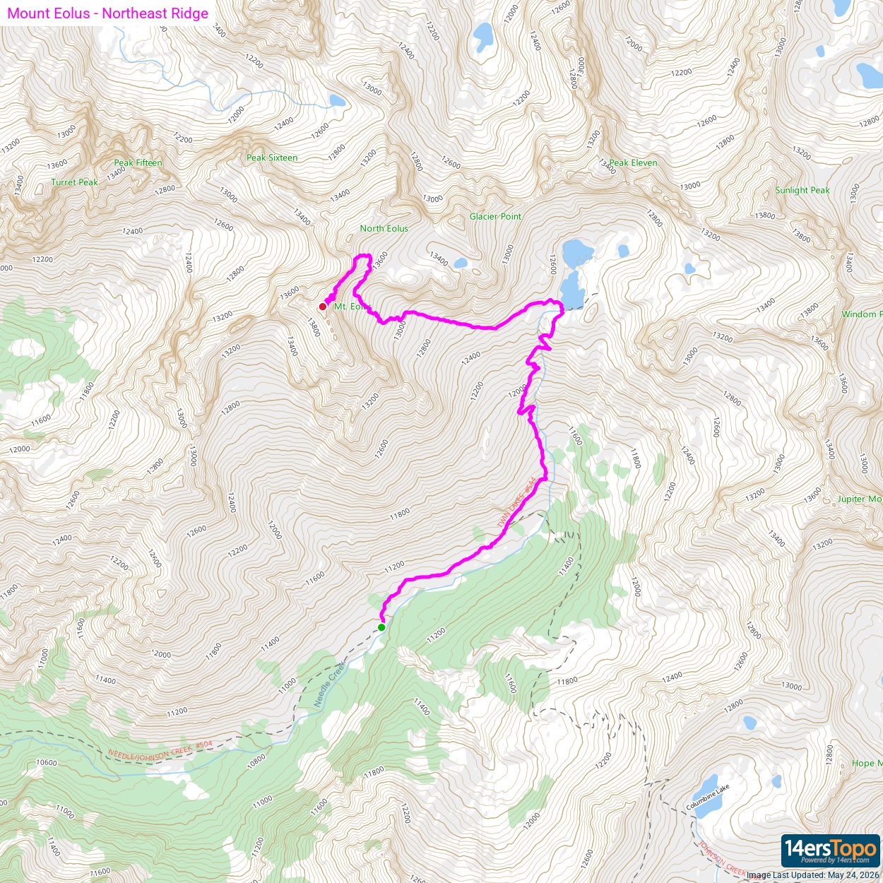
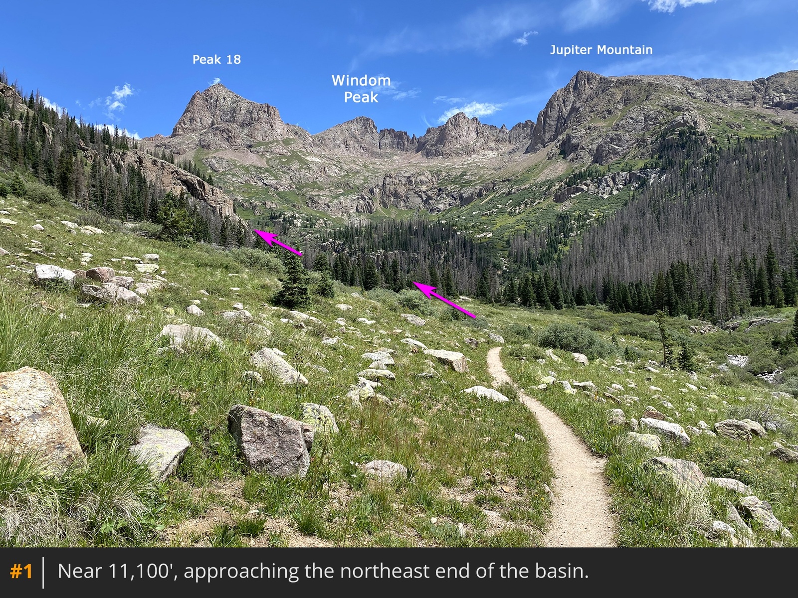
Chicago Basin Approach to reach Chicago Basin where dispersed camp sites can be found between 10,800' and 11,100'. From your high camp, follow the well-established trail northeast toward the end of the basin
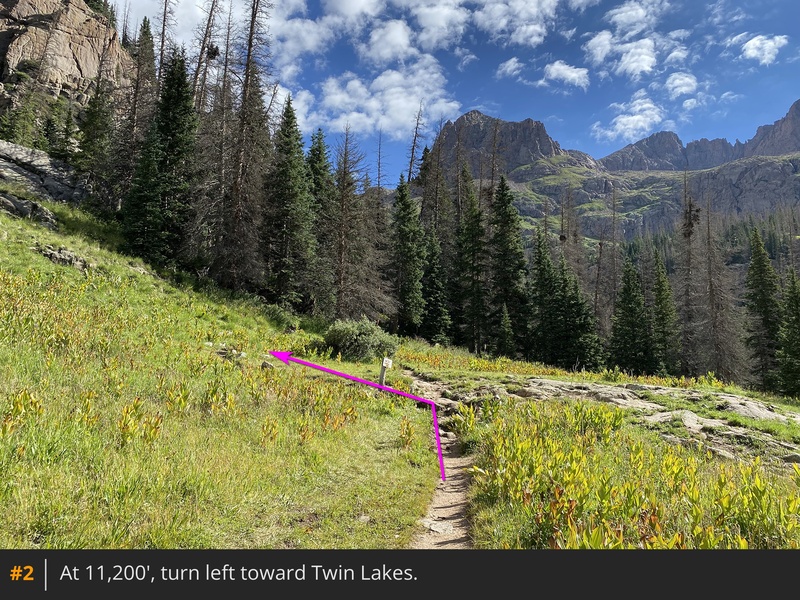
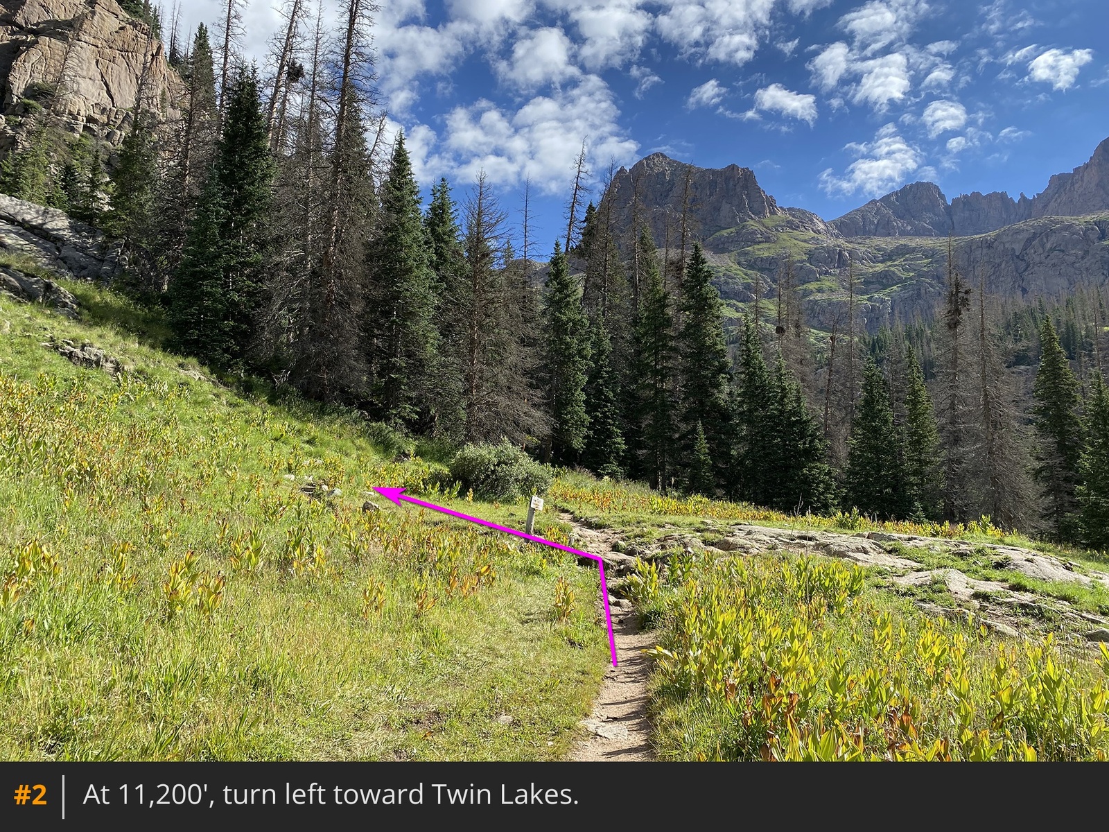
1. Near 11,200', turn left toward Twin Lakes at a signed junction
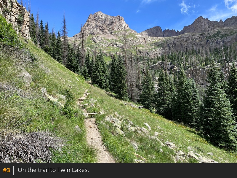
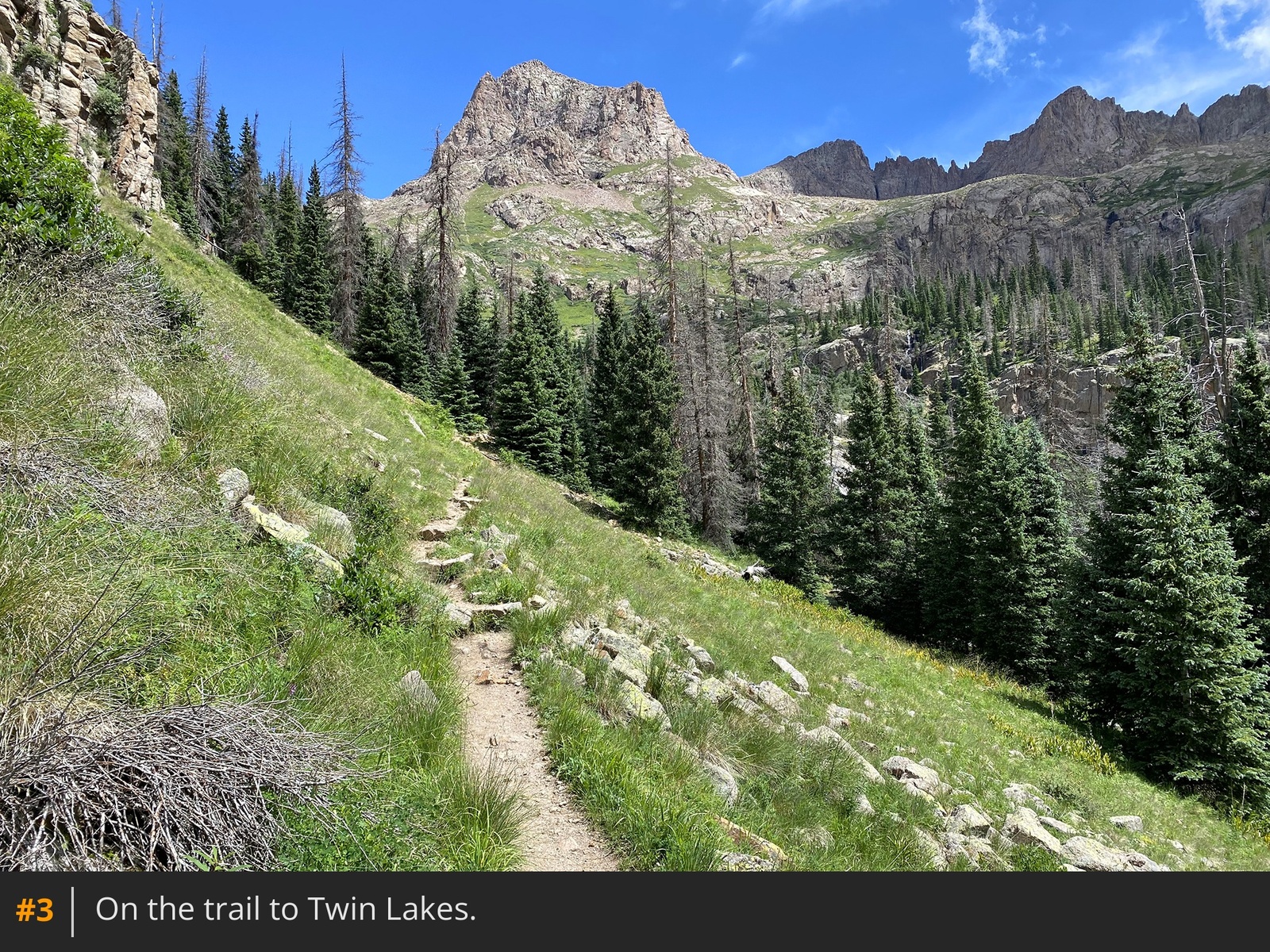
2. This trail provides access to Windom, Sunlight, and Eolus. Ascend through remaining forest
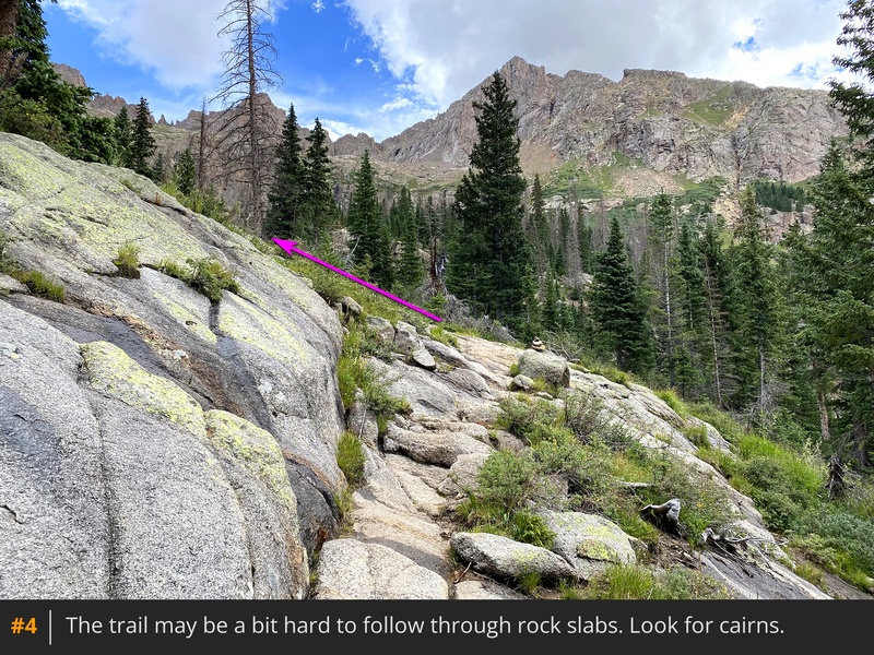
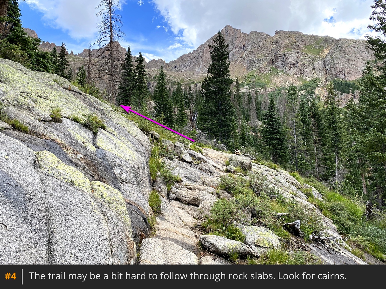
3 until the trail becomes less defined as you navigate over and around some rocky slabs
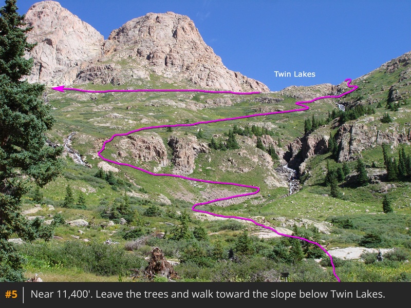
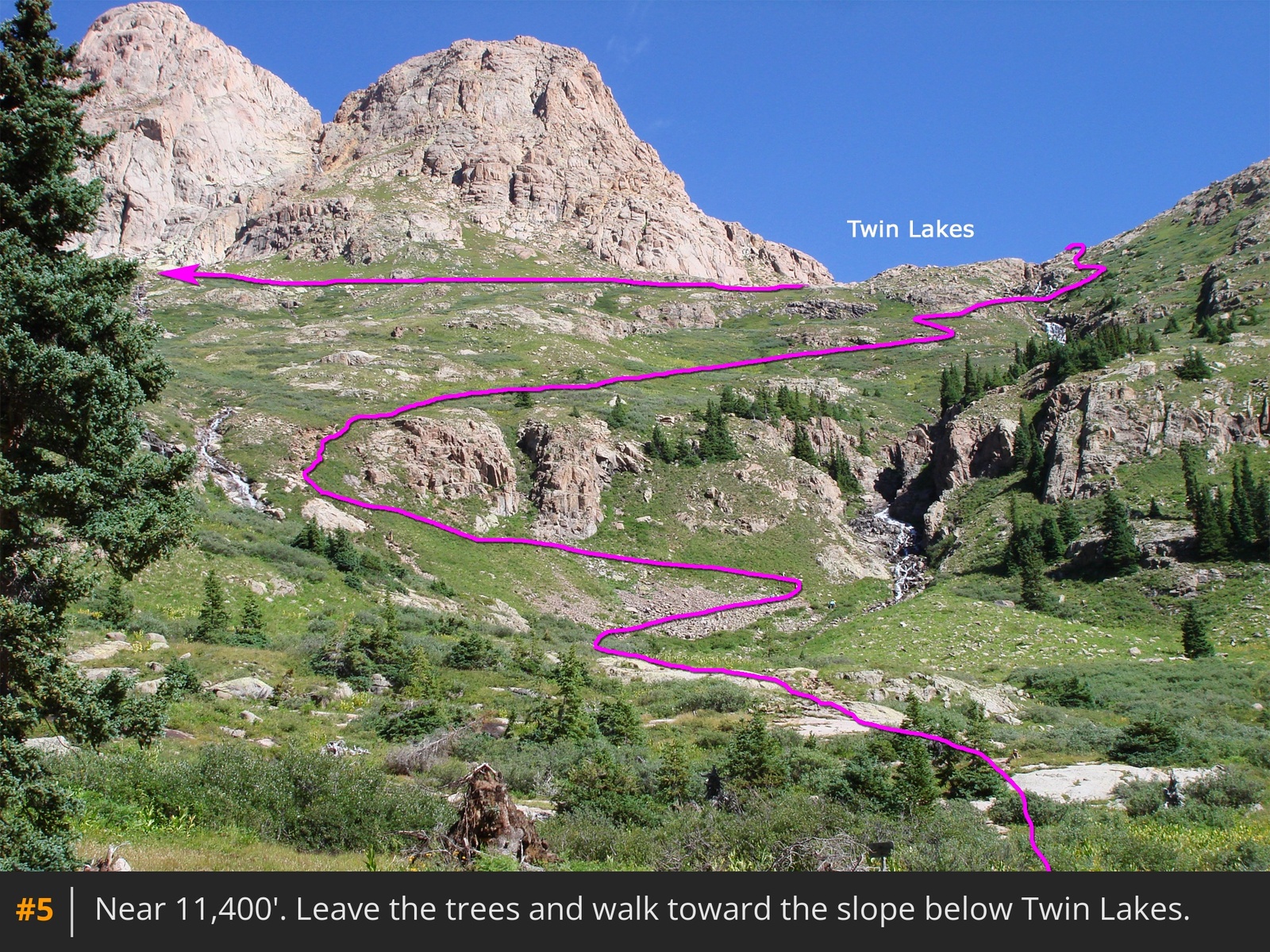
4. Near 11,400', exit the trees to see two streams on the slope beneath Twin Lakes
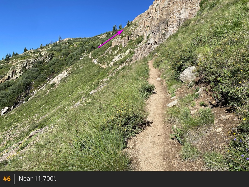
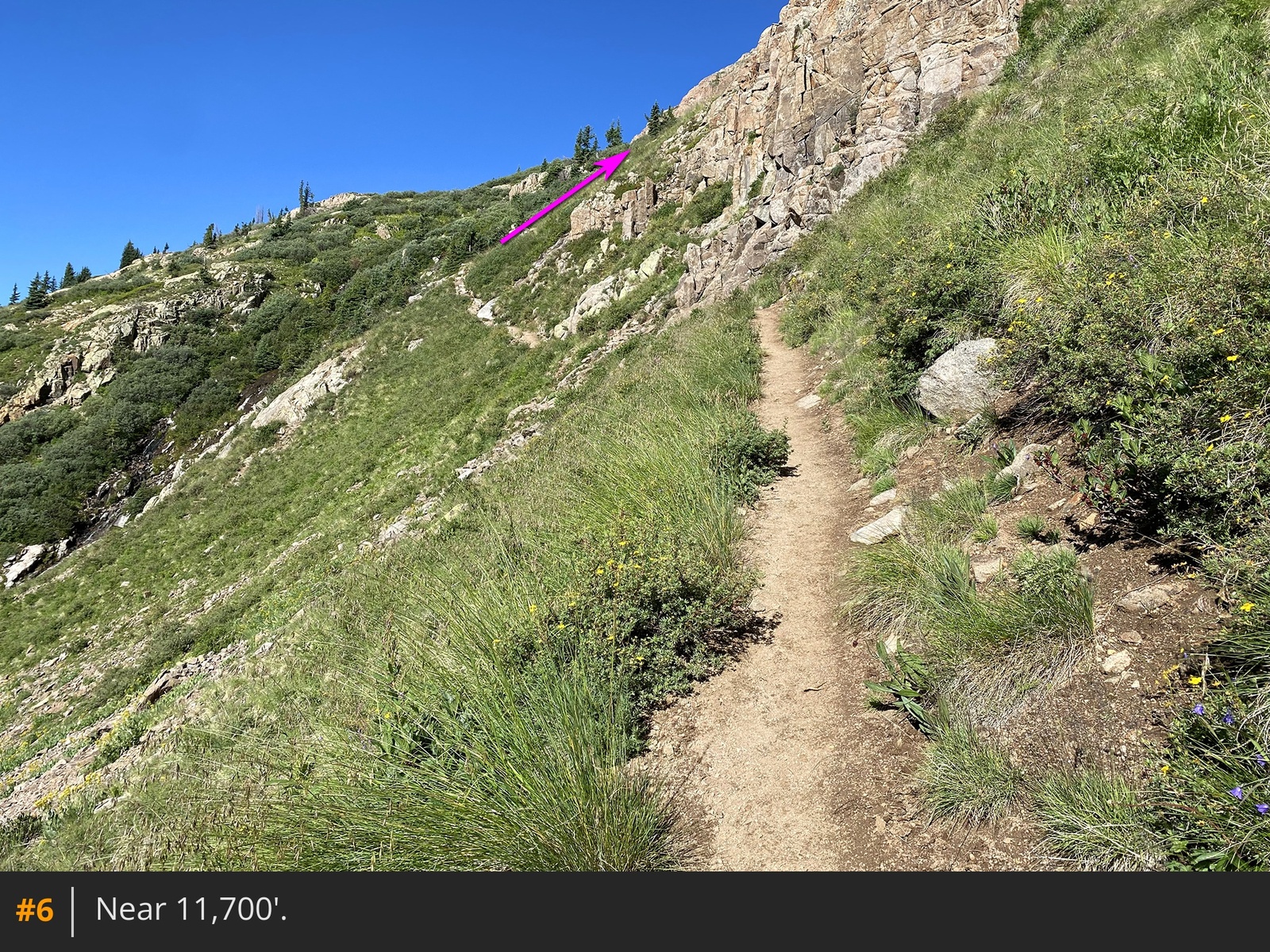
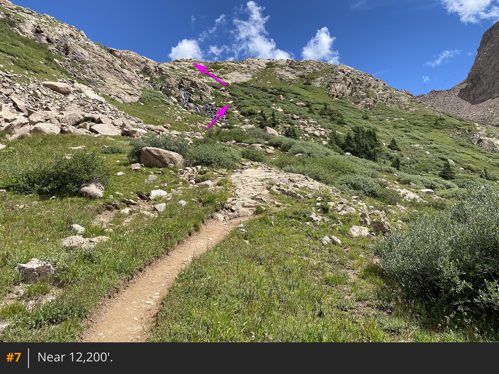
5. At 11,700', cross the first stream, veer right, and follow switchbacks up steeper terrain
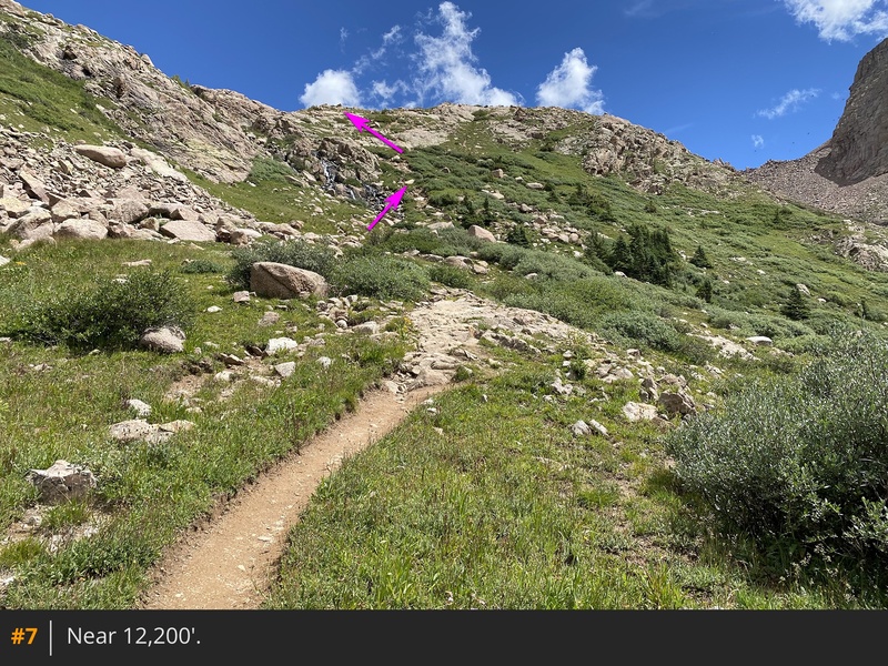
6. Continue to the second stream crossing, near 12,300' (
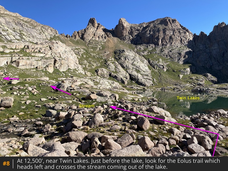
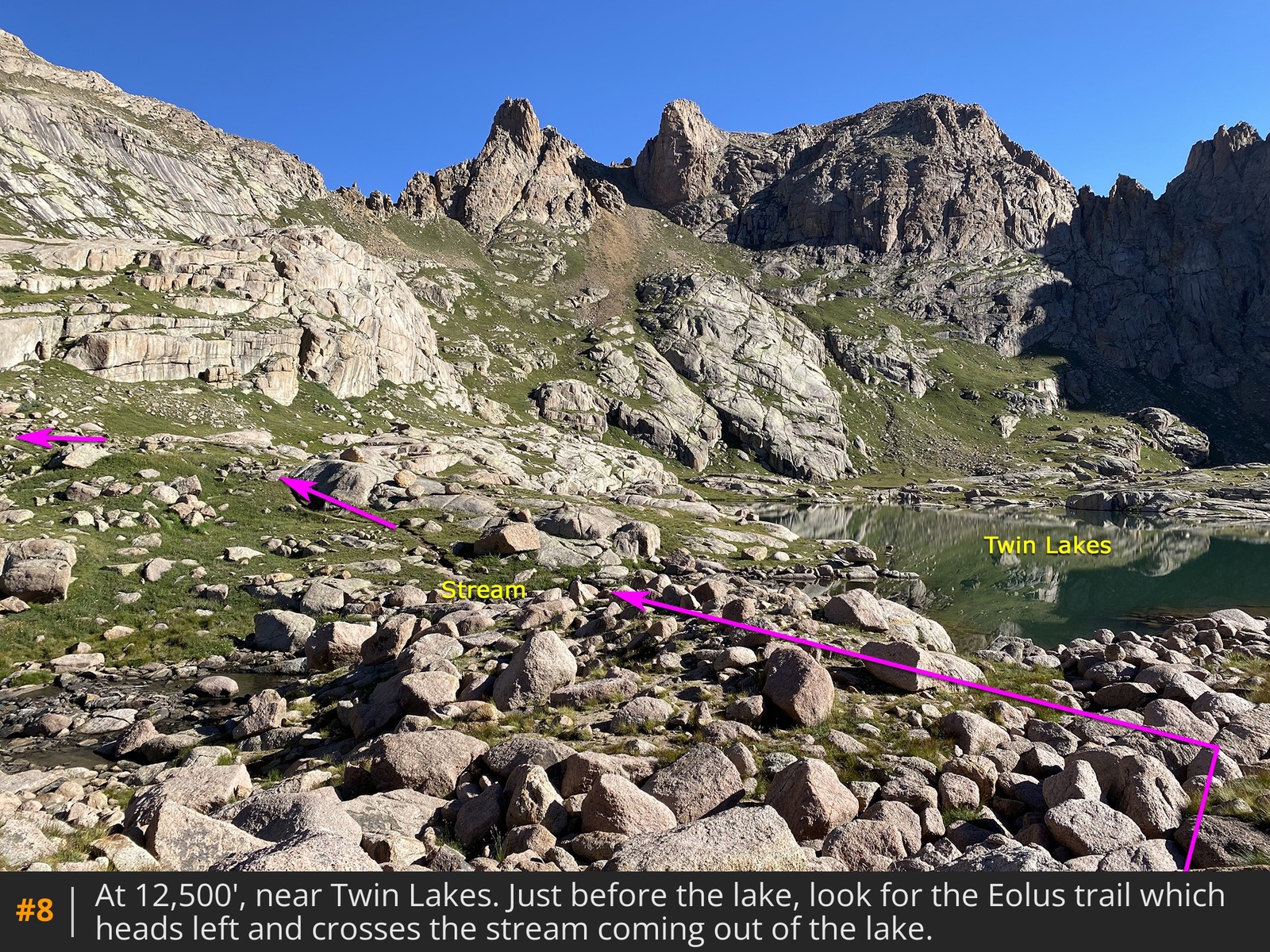
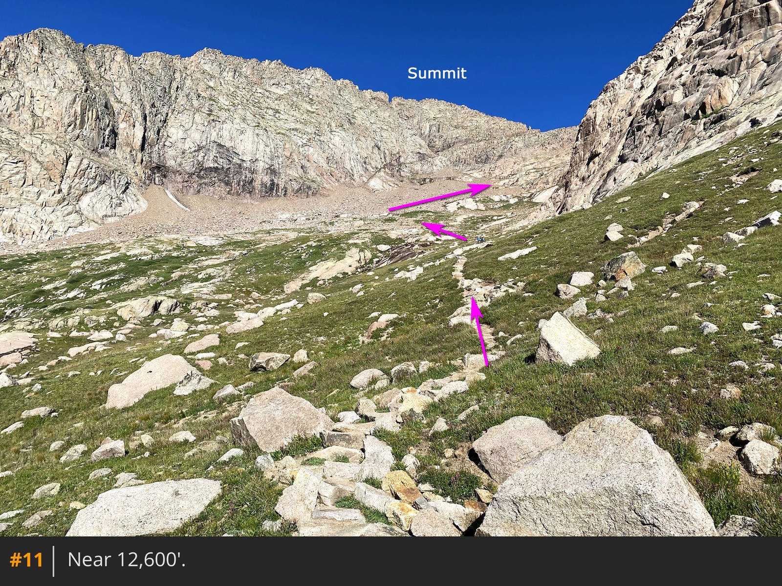
7). Haul a bit higher to reach Twin Lakes at 12,500'
8 9.
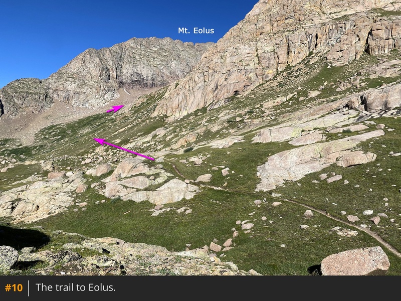
Near the first lake, find the Eolus trail, which branches off to the left, and follow it down to the stream
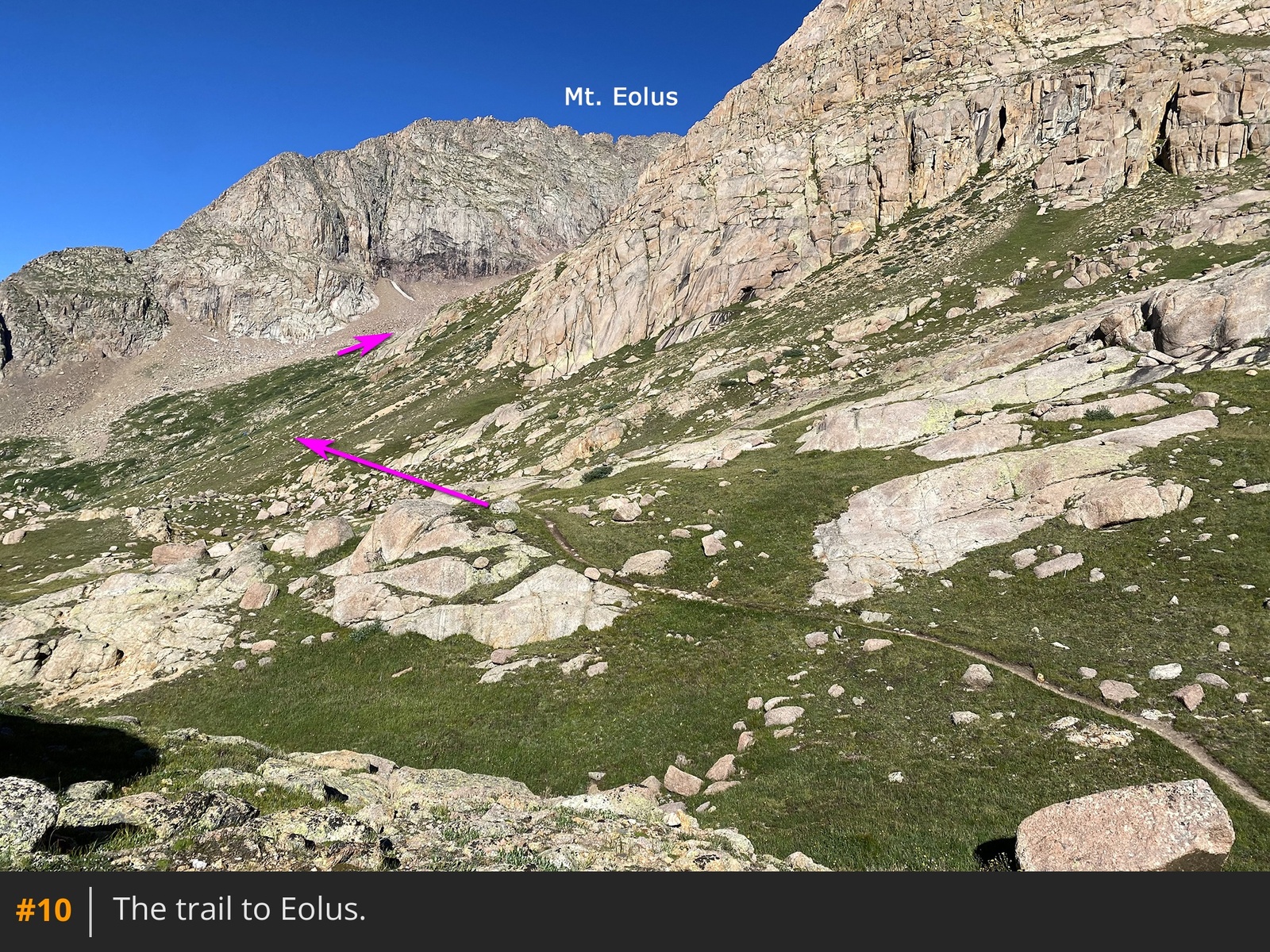
at the lake's end. Cross the stream, walk past some rock slabs, and continue west
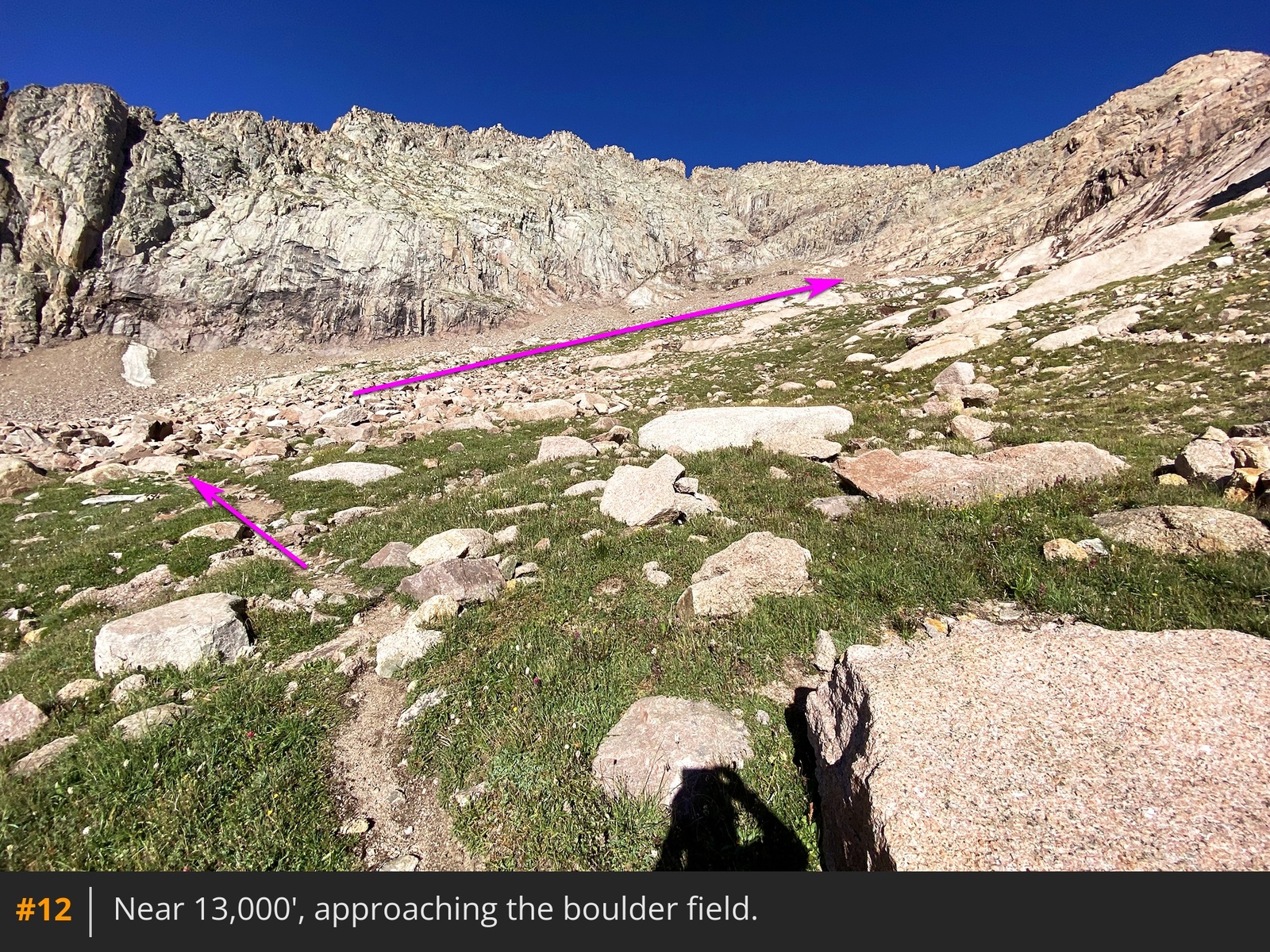
10. Traverse around cliffs to your right until Eolus' east face comes into view
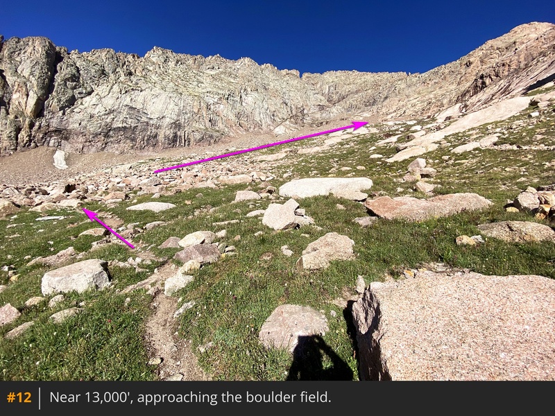
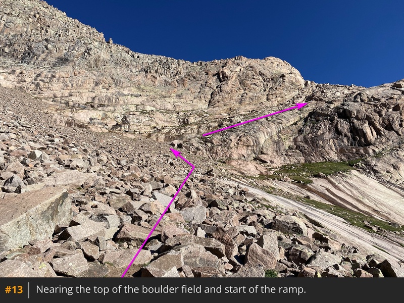
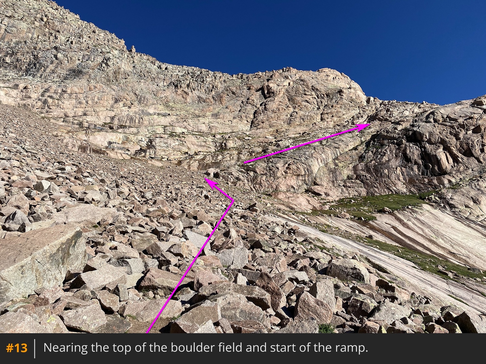
12. Around 13,300', the trail curves left and enters a boulder field. Follow the rocky, step-filled path through the boulder field
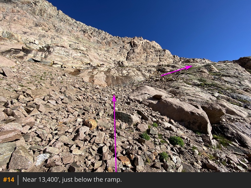
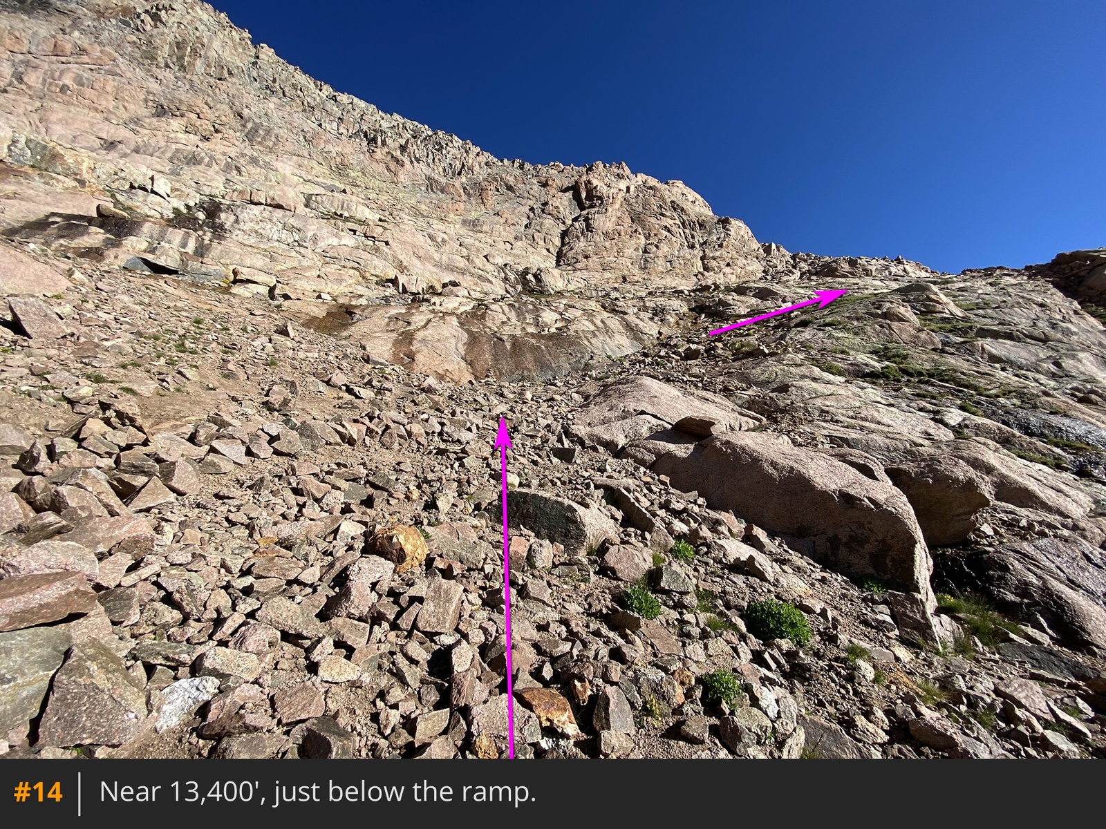
13 until it exits near 13,400'. Continue a bit higher to reach the base of a ledge/ramp
that leads up and out of the basin
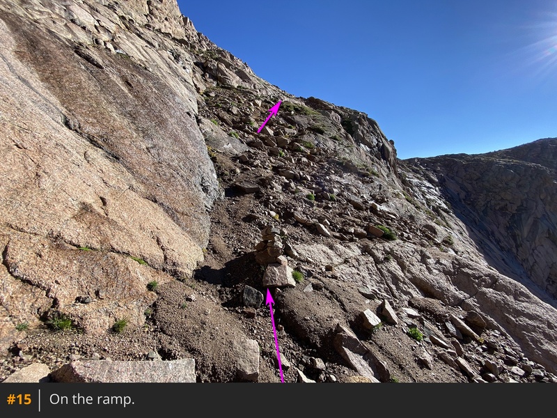
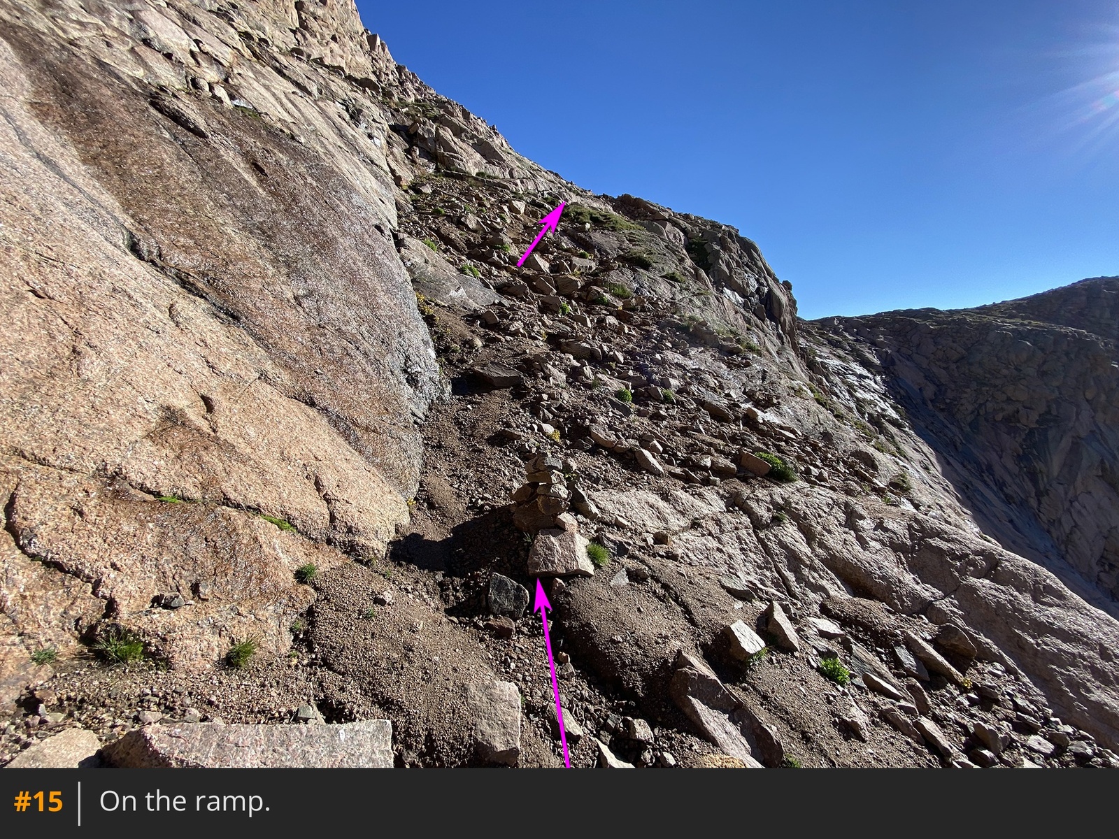
14. Look for a cairn marking the entrance. Turn right and ascend northeast on the Class 2 ramp
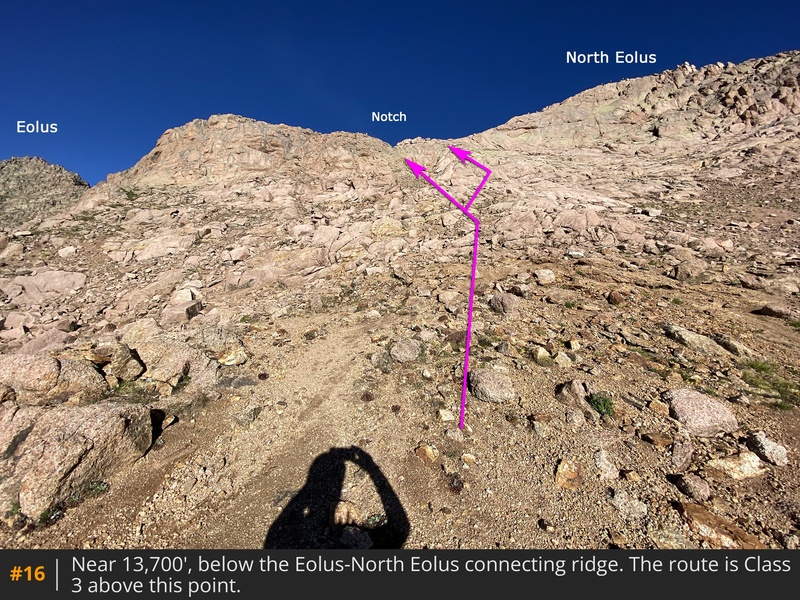
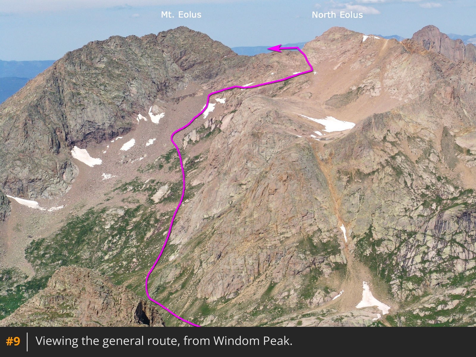
15. There are a couple of spots requiring careful movement across angled slabs, but the difficulty remains within Class 2. At the top of the ramp, continue north over easier terrain, reaching a flat area east of the ridge connecting Eolus and North Eolus.
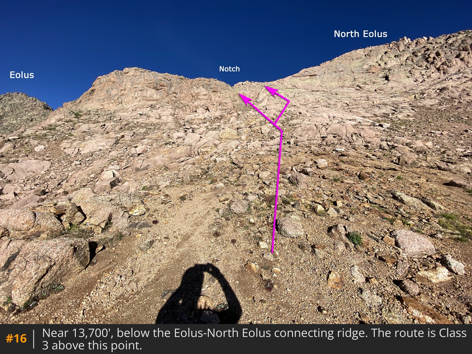
Next, you need to gain the Eolus-North Eolus ridge to the west
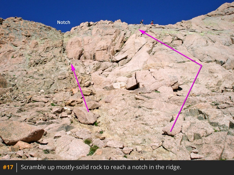
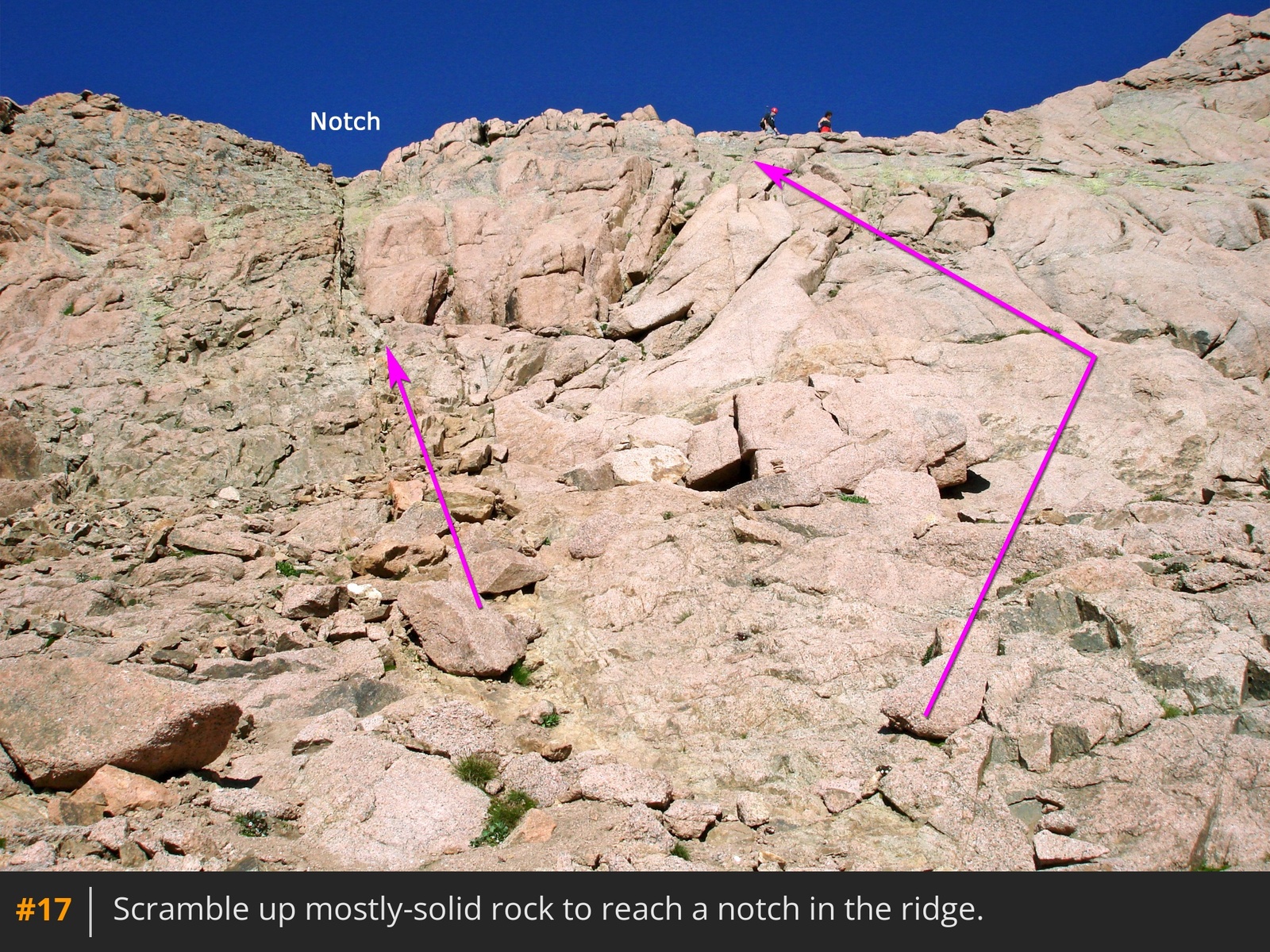
16. Look for a notch in the ridge located just above a short, steep green chute. It's best to ascend to the ridge at or near this notch. While there are multiple ways to gain the ridge, the most direct route is to climb the green chute
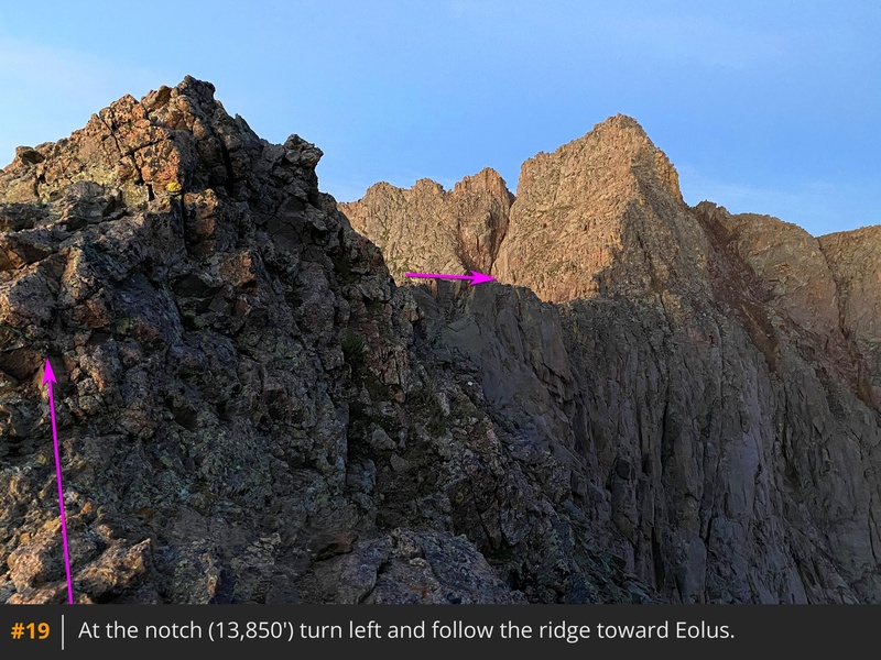
17. Alternatively, you can head slightly to the right and zigzag up angled slabs for an easier approach. After a brief section of Class 3 climbing, reach the notch
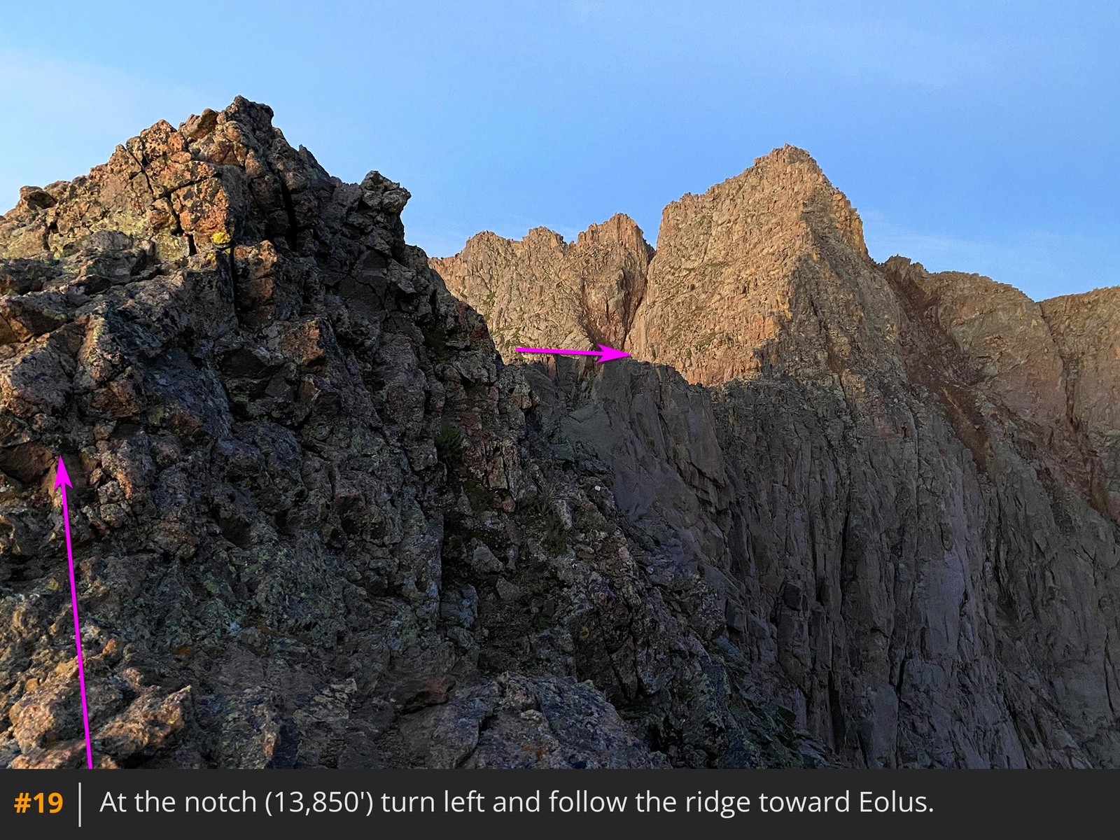
, near 13,850'
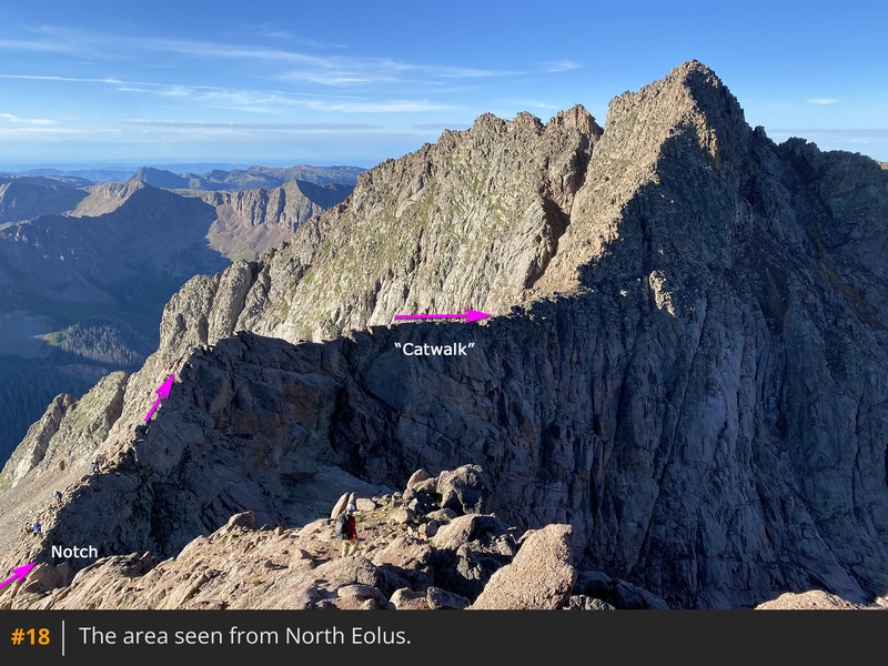
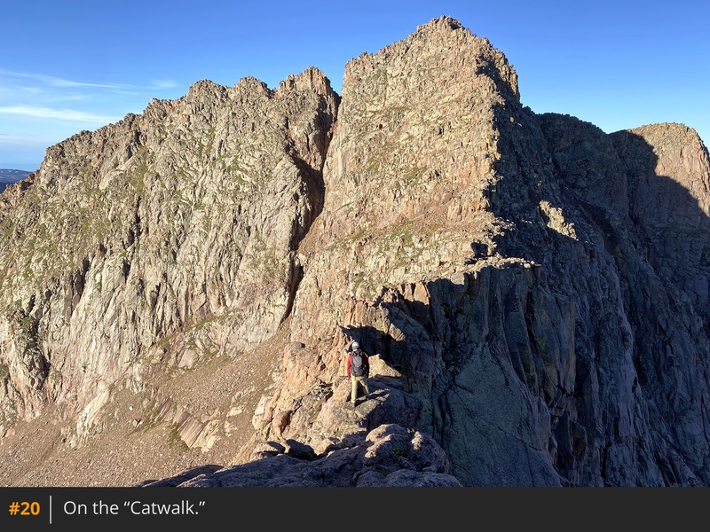
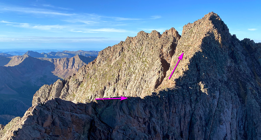
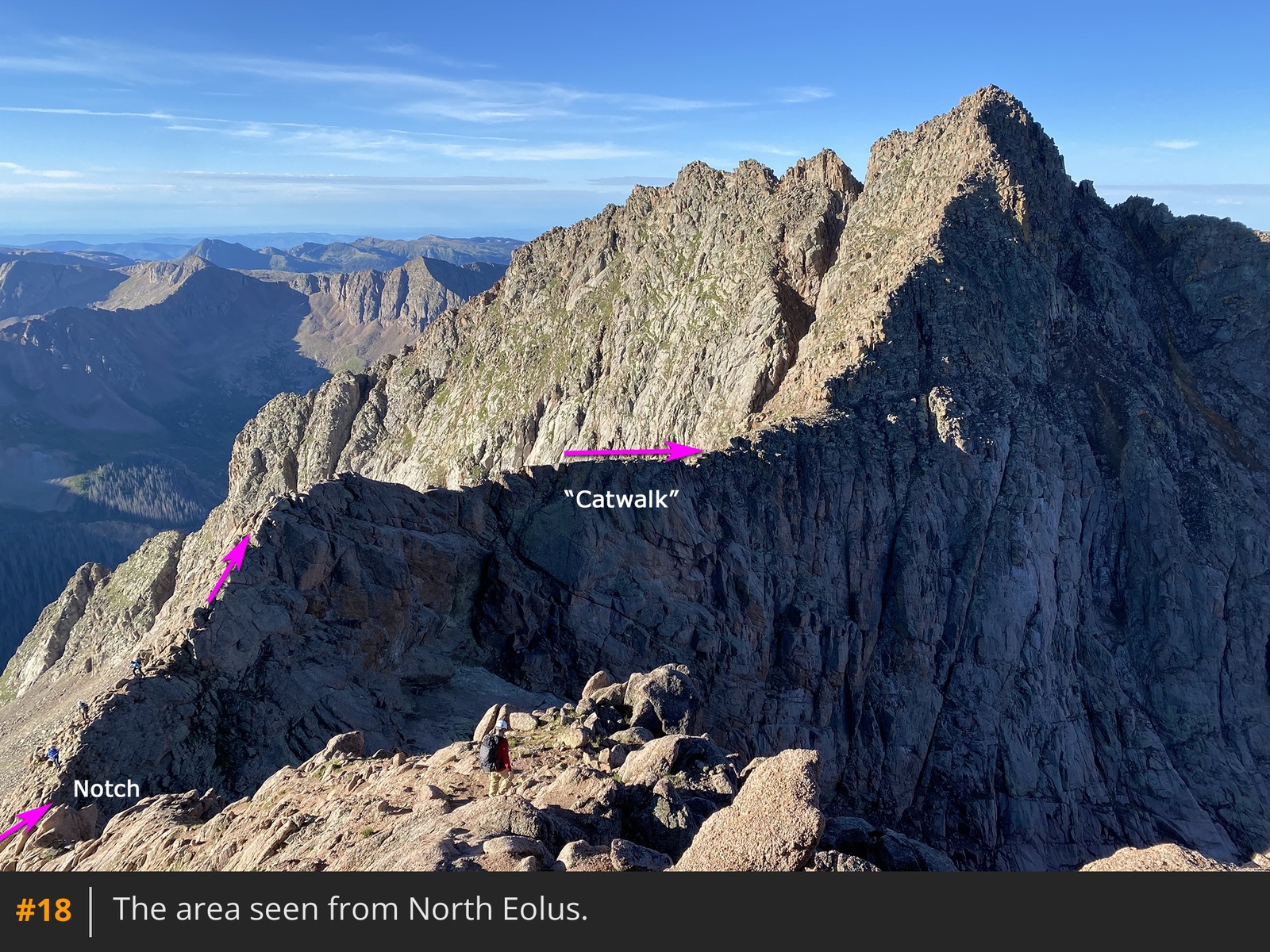
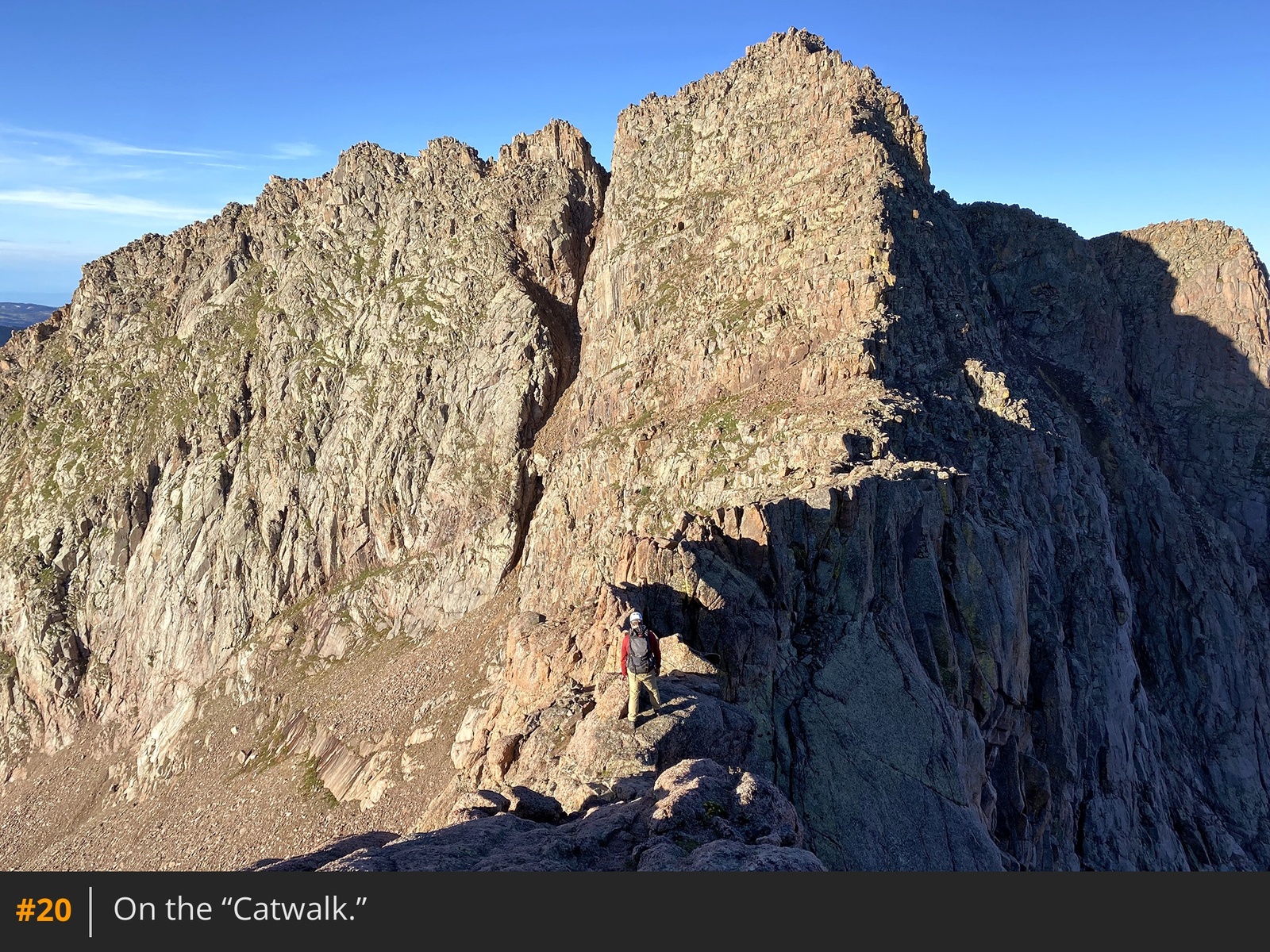
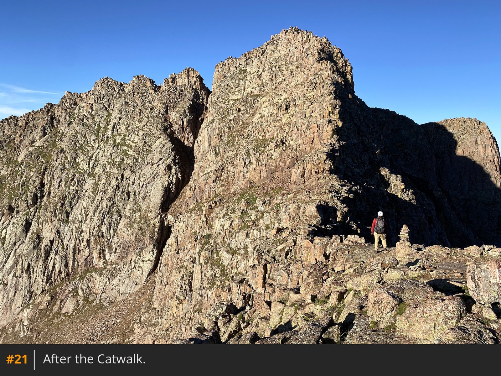
18 19. Turn left, climb over a ridge bump, and descend slightly to arrive at the "Catwalk," a narrow section along the ridge. While most of the Catwalk involves Class 2 climbing, a few sections require easy Class 3 moves. Scramble carefully across the Catwalk and continue toward Eolus
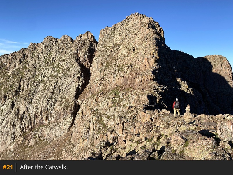
20 21. At the end of the Catwalk, reach easier terrain leading to the final summit pitch
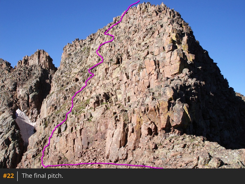
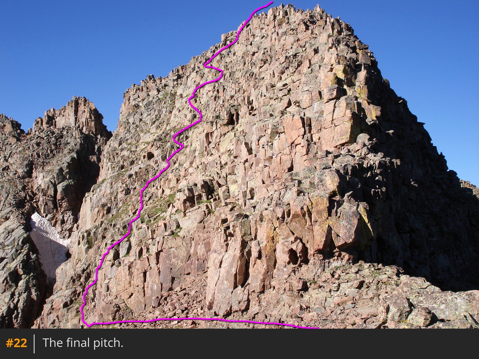
22.
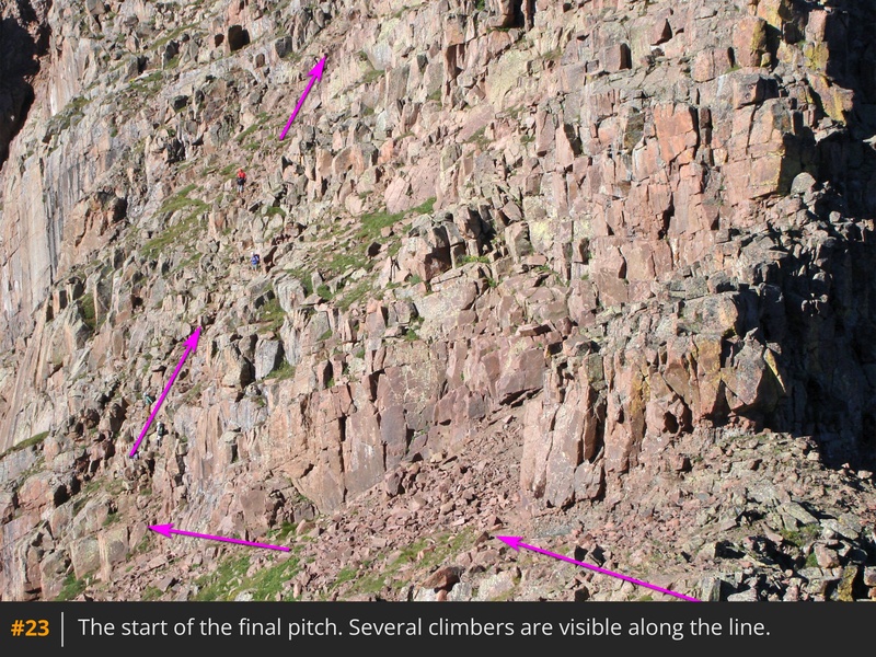
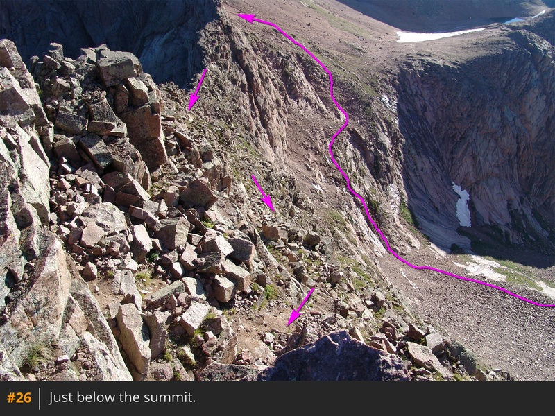
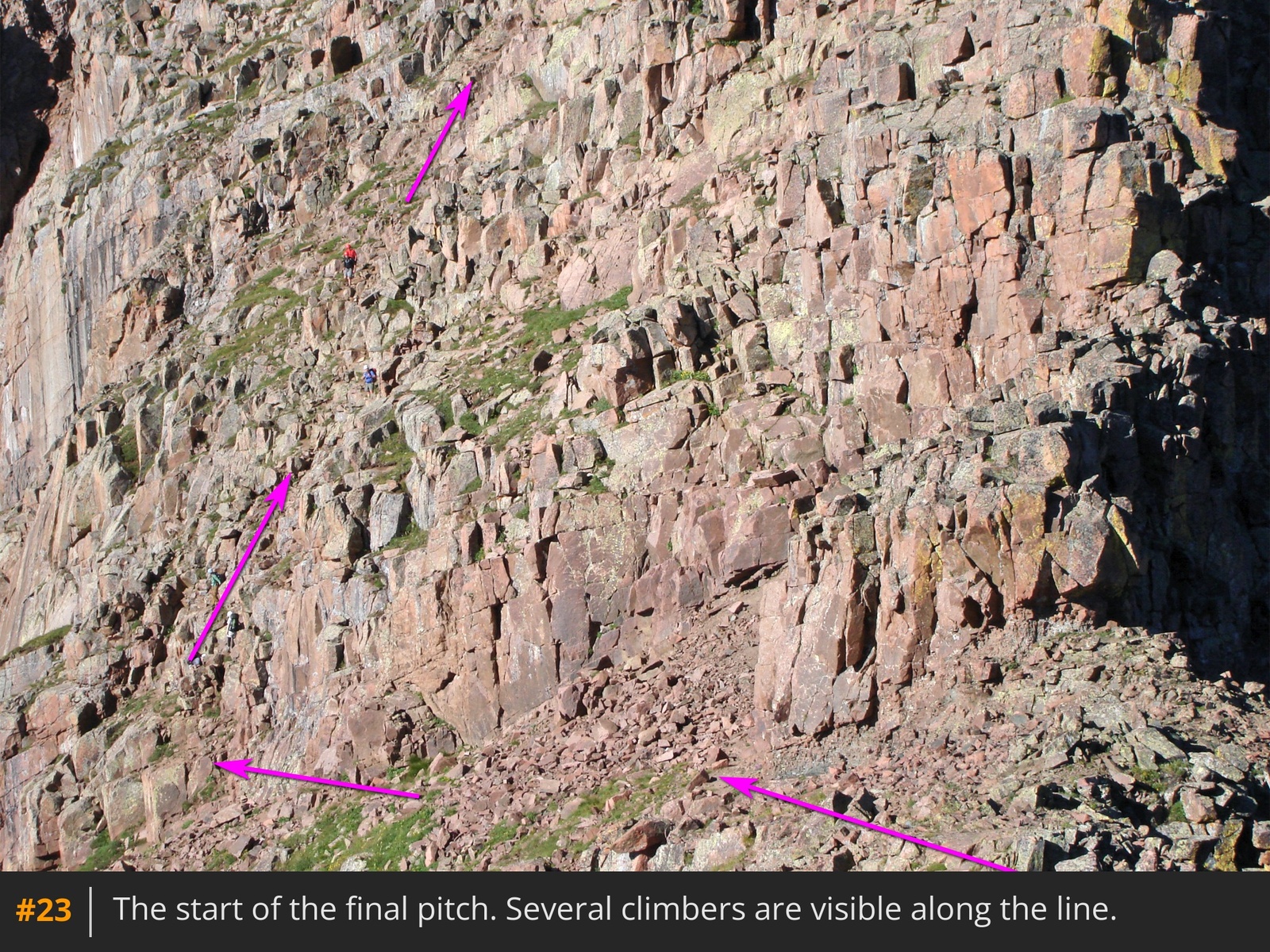
The last 250+ feet to the summit requires route-finding and Class 3 scrambling. While the northeast ridge rises directly above, the easiest route ascends the east face, left of the ridge. Start by turning left to traverse beneath rock walls
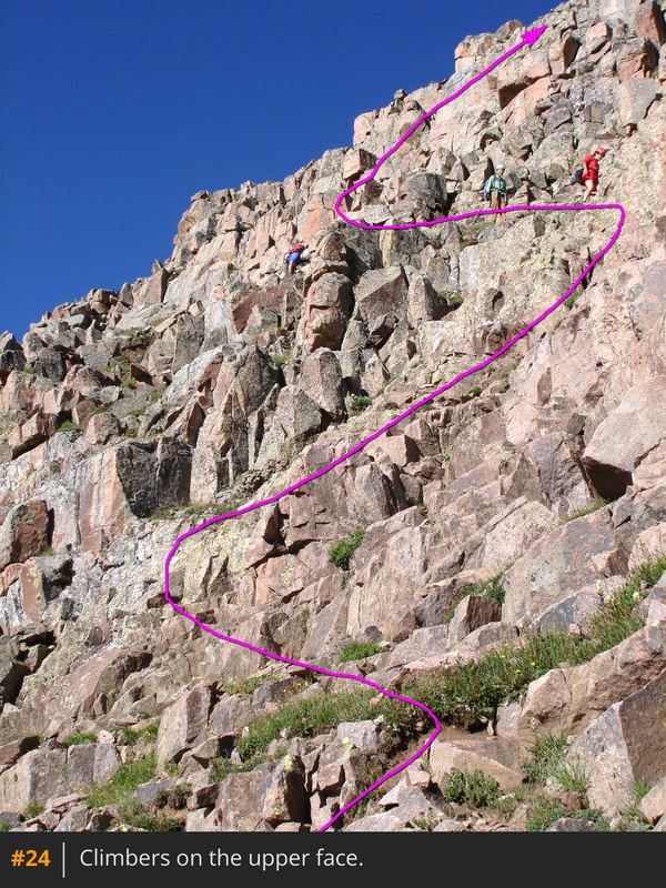
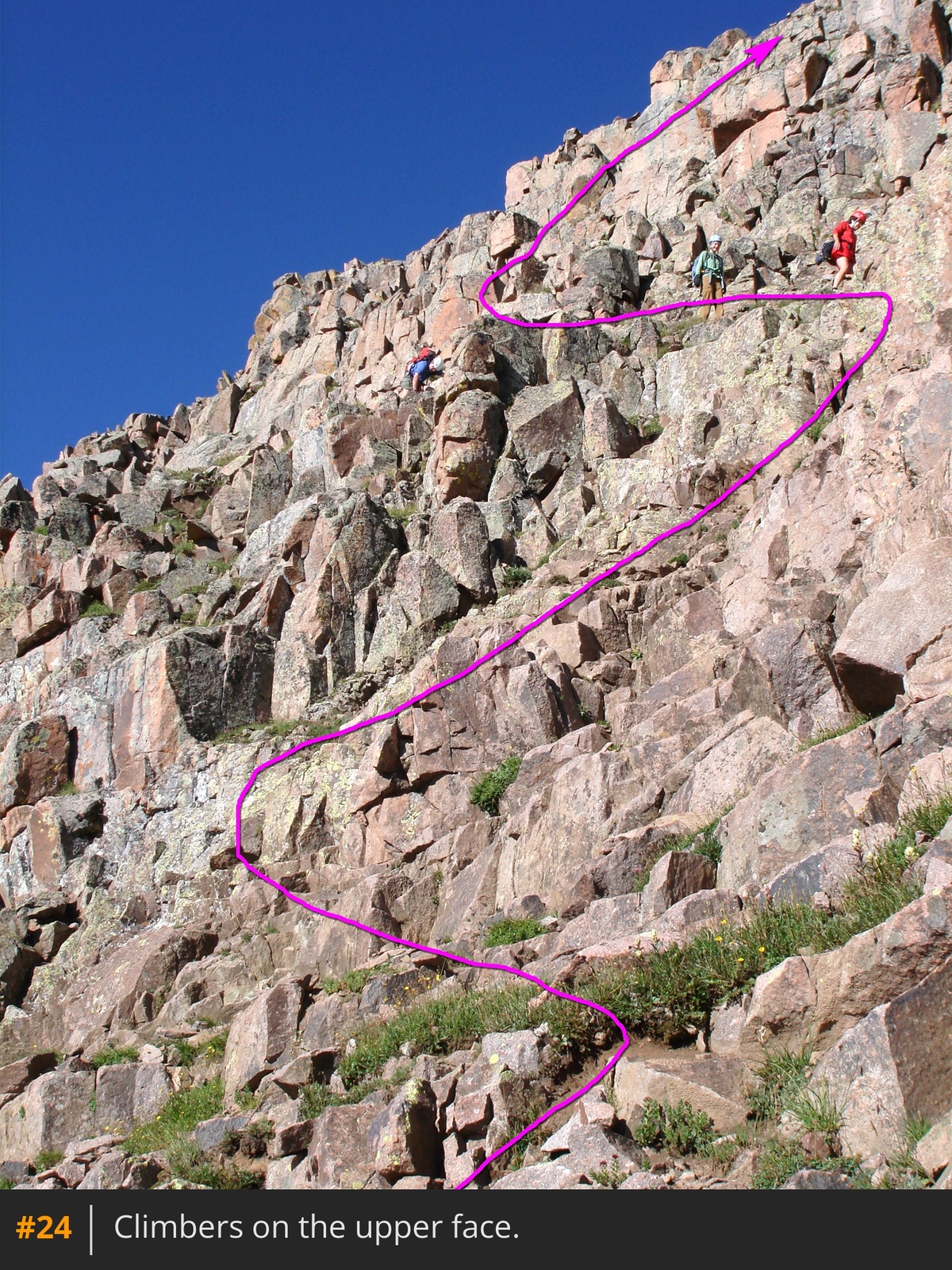
23. After traversing roughly halfway across the face, begin zigzagging upward along ledges
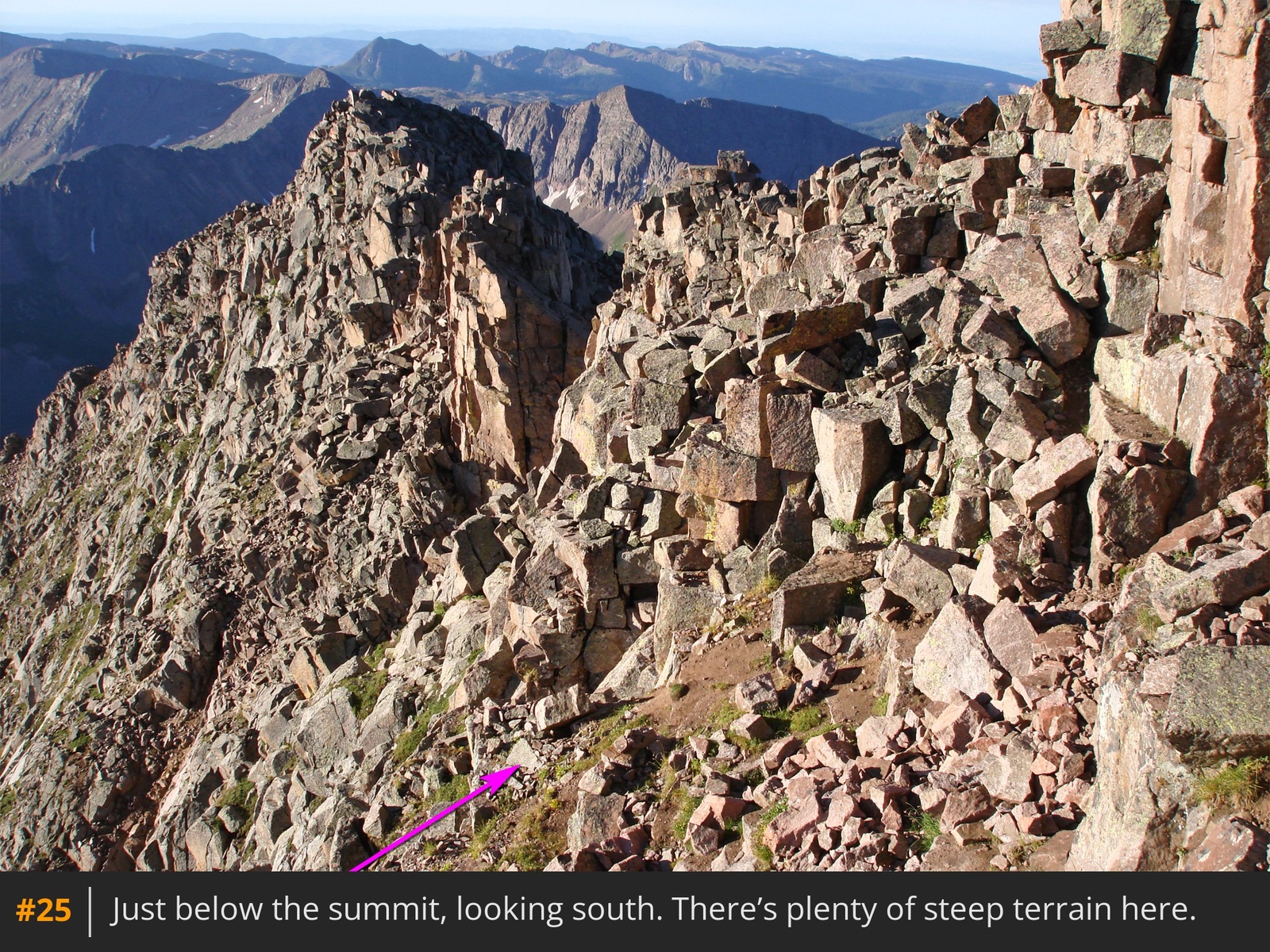
24. As you climb, the terrain becomes steeper. Even under dry conditions, take care navigating the narrow ledges
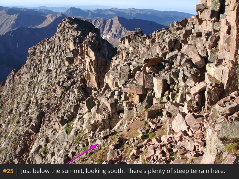
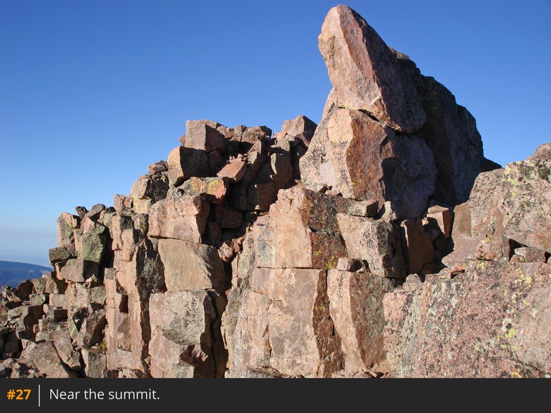
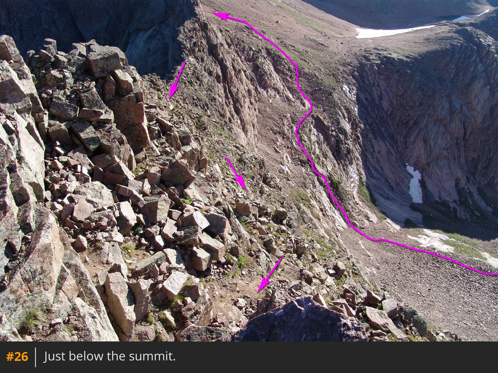
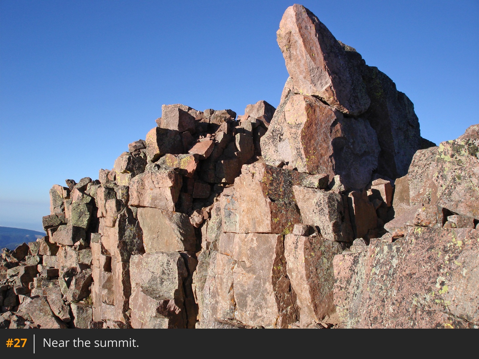
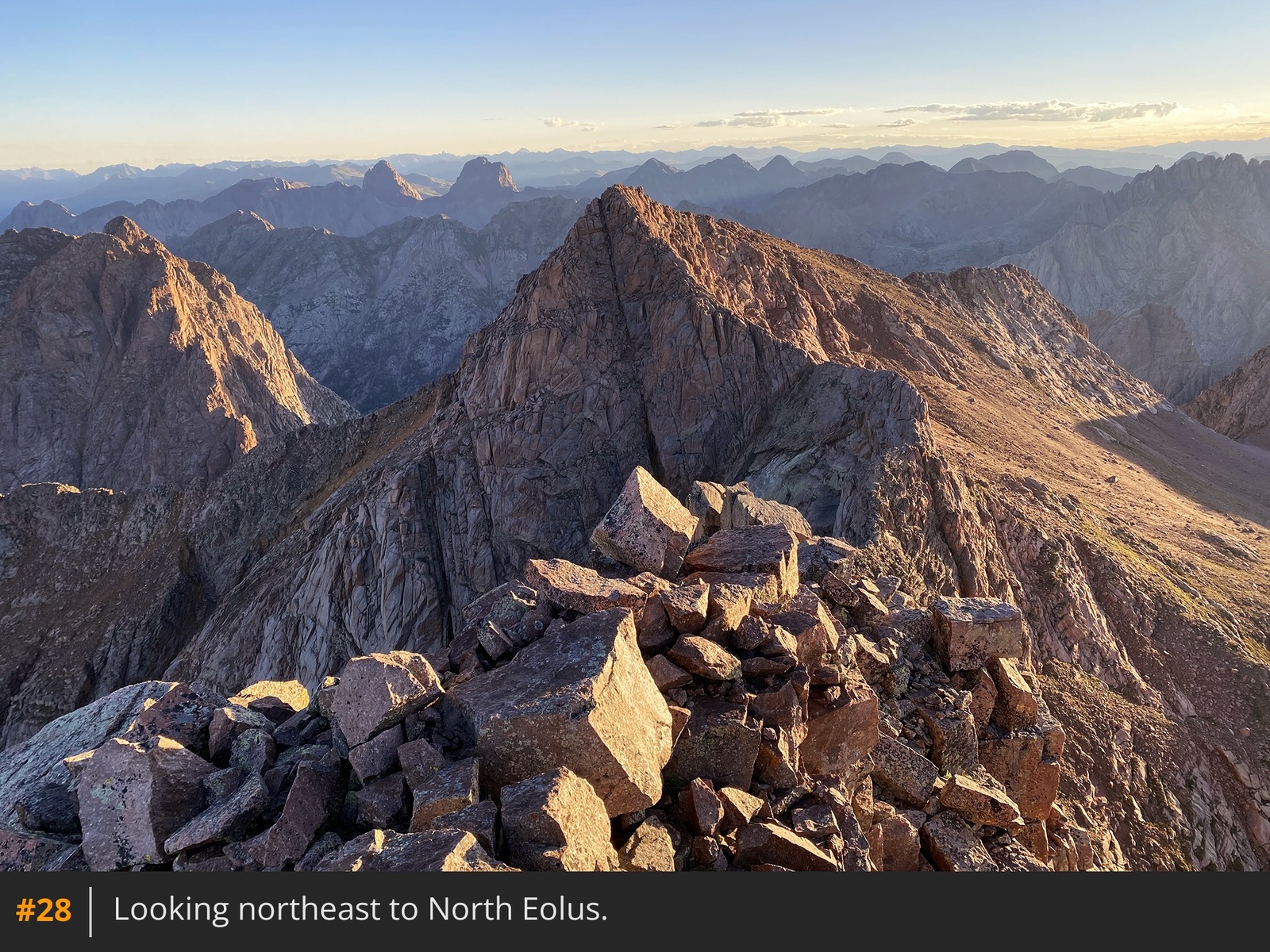
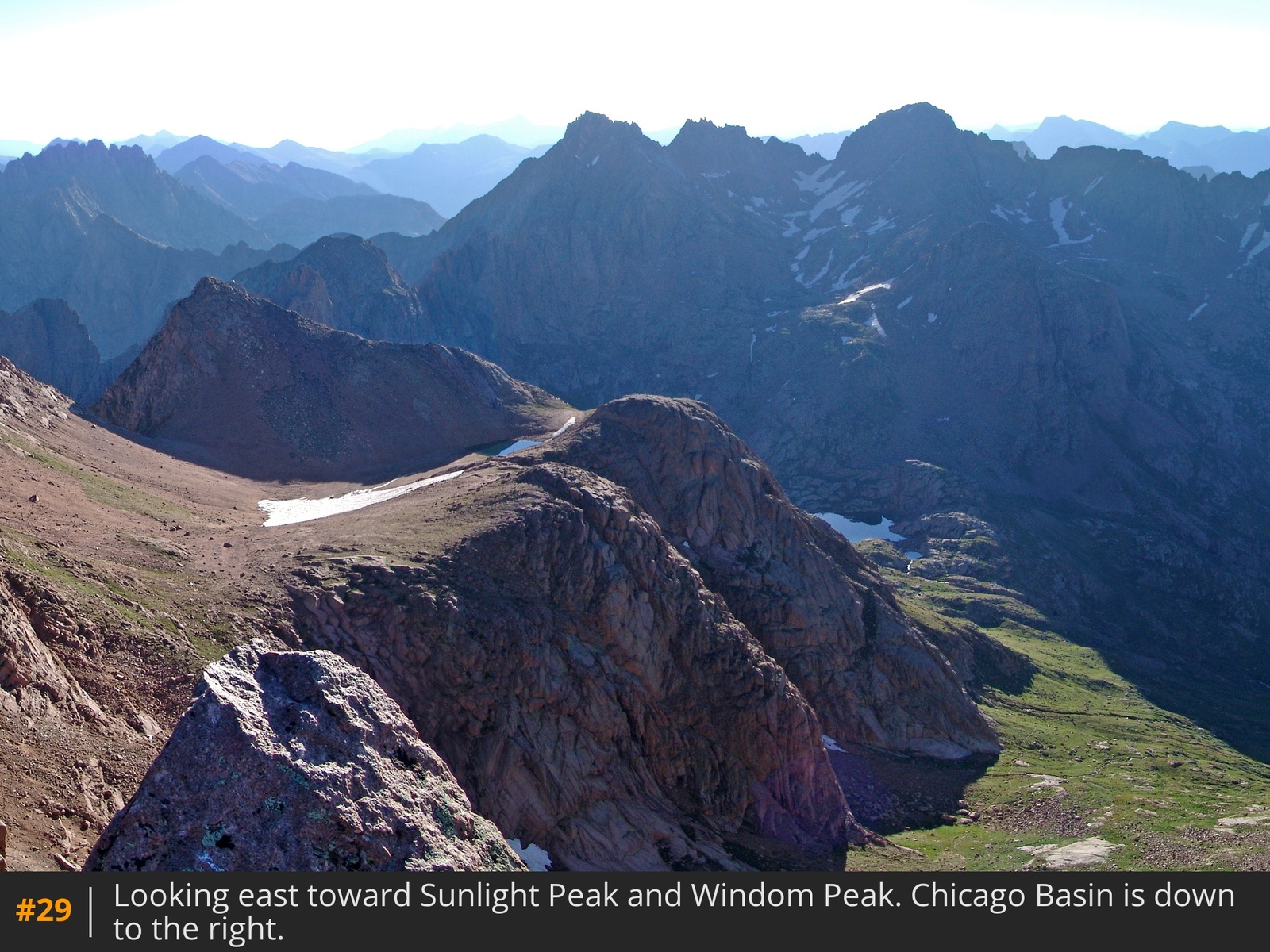
25 26. Gain the summit ridge
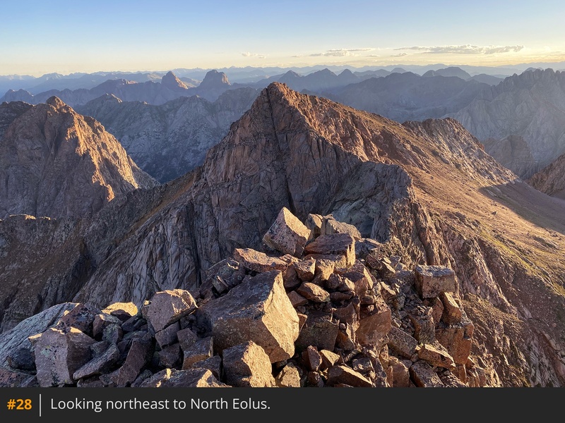
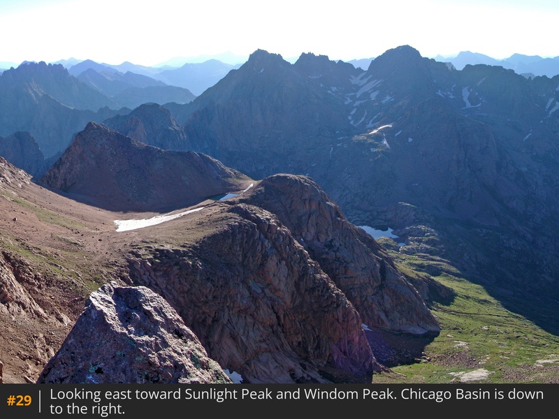
27 and scramble to the top
28 29.





 GPX
GPX KML
KML