Download Agreement, Release, and Acknowledgement of Risk:
You (the person requesting this file download) fully understand mountain climbing ("Activity") involves risks and dangers of serious bodily injury, including permanent disability, paralysis, and death ("Risks") and you fully accept and assume all such risks and all responsibility for losses, costs, and damages you incur as a result of your participation in this Activity.
You acknowledge that information in the file you have chosen to download may not be accurate and may contain errors. You agree to assume all risks when using this information and agree to release and discharge 14ers.com, 14ers Inc. and the author(s) of such information (collectively, the "Released Parties").
You hereby discharge the Released Parties from all damages, actions, claims and liabilities of any nature, specifically including, but not limited to, damages, actions, claims and liabilities arising from or related to the negligence of the Released Parties. You further agree to indemnify, hold harmless and defend 14ers.com, 14ers Inc. and each of the other Released Parties from and against any loss, damage, liability and expense, including costs and attorney fees, incurred by 14ers.com, 14ers Inc. or any of the other Released Parties as a result of you using information provided on the 14ers.com or 14ers Inc. websites.
You have read this agreement, fully understand its terms and intend it to be a complete and unconditional release of all liability to the greatest extent allowed by law and agree that if any portion of this agreement is held to be invalid the balance, notwithstanding, shall continue in full force and effect.
By clicking "OK" you agree to these terms. If you DO NOT agree, click "Cancel"...
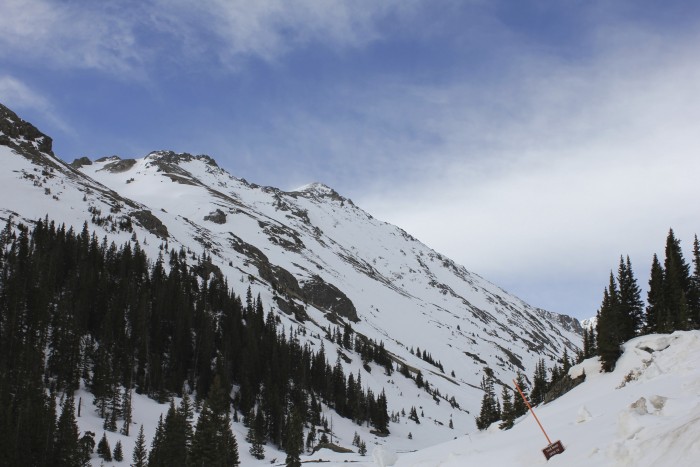
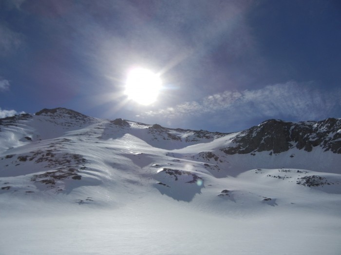
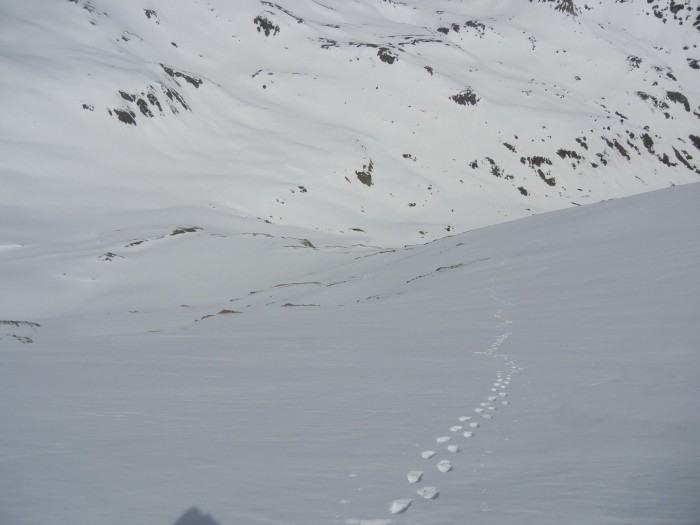
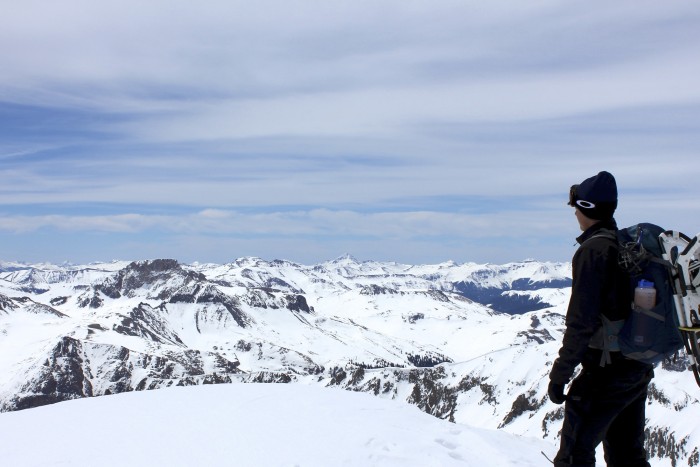
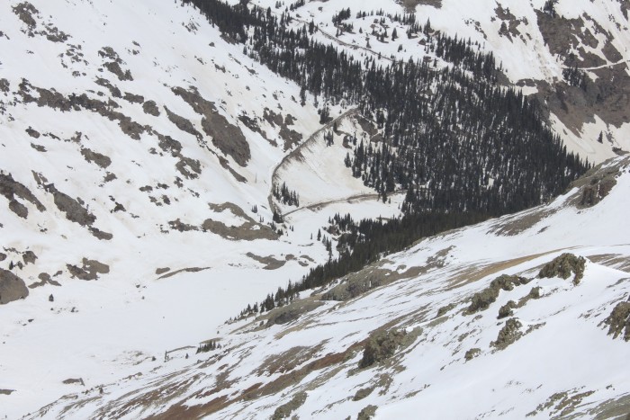
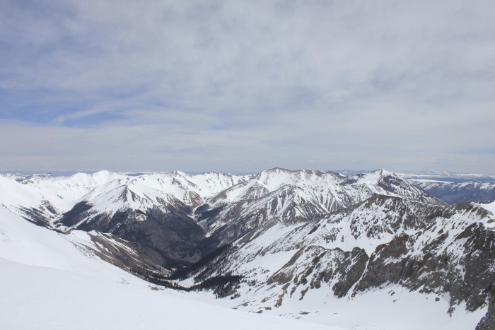
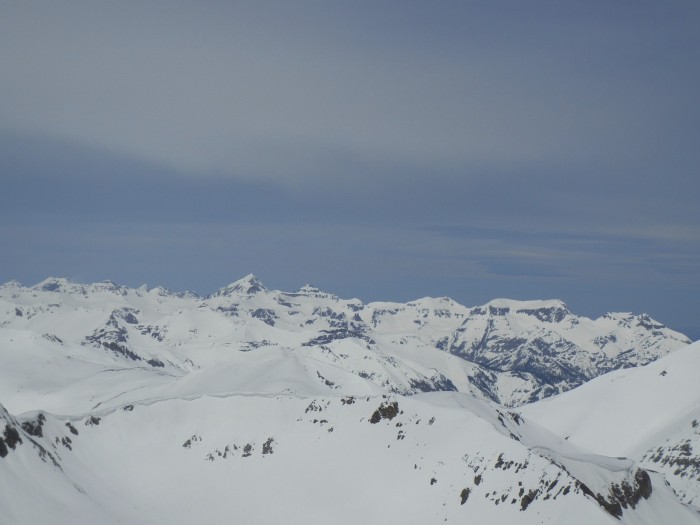
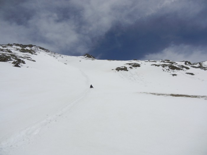
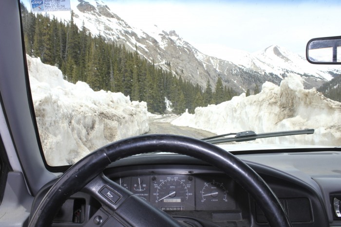
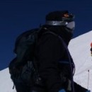
I prefer to read Trip reports with more information then stories, but the story fits in with the information. The story begins with my customary and traditional acclimation process. Waking up at 2 am in the morning and leaving Grand Junction en route to the trailhead this one being Handies. First pit stop was made at Los Jibertos (fast Mexican food, open 24/7) and then Montrose for a quick fill up to avoid "mountain town" gas prices. End of the story section, now on to story/information section. The trip to Lake City would have been more pleasure if I wasn't fearing for my life and potholed Blue Mesa cutoffs (max speed of 20 mph at night, it was sketch). Or the fact there were a gazillion elk and deer on the road between the cutoff and the town (be careful). The Alpine Scenic Byway from Lake City to Silver Creek was rather uneventful and relatively the similar to my October 3rd trip to Redcloud and Sunshine. Not a car parked at the parking lot. However, I was deeply troubled by the amount of snow on the east faces and hope for a more windblown accent. Past Silver Creek I took note of Redcloud west wind blown face and was greatly encouraged. I was more encouraged to see the bulldozer to the AB was gone! At the AB TH I noticed the wind was raging on Handies, but I was mostly calm in the valley. For those of you who will be attempting Handies this weekend: THERE IS NOT A LOT OF ROOM TO PARK AT THE TRAILHEAD AND NO WHERE TO PARK ALONG THE SIDE OF THE ROAD FOR A MILE (information section). Any way, my buddy and I endured PHing in the morning (at 8:15) to the bootpacked section .25 miles in. While he was worried about avalanches I was more worried about the LFGRiver crossing, it was covered in snow, but water may be running underneath. We followed the ski tracks of the guys who got "SPOT" to the west slopes and surveyed the terrain they ascended and descended. My buddy and I argued for a bit about which gulley was the gulley in the route description, but at the end of the day we took the route that "looked" the safest. We wore microspikes to what we thought was the summit ridge. It was the summit ridge except we ended up south of the true summit. I was baffled. I would advise taking the actual route described on the website the last section of our route was a little risky; the snow was more unstable and slippery without crampons. On the summit ridge we followed the barren San Juan talus to the summit, which is currently packing a nasty cornice. It was very windy on top as forecasted with sustain winds around 20-30 mph and an infrequent 50-60 gust. It was not miserable though because the temperature was quite warm (recorded 52 degrees at 11:45). We stayed at the summit for around 45 minutes. The glissade down was priceless and we managed to get to the base of the mountain in 20 minutes given the traditional "Igotacramp" break (which is some far east slang word spoken in other countries). The return overall took an hour and including breaks and the switch to snow shoes. As we approached the we were postholing with snowshoes in wet glop, though it was that deep. Most noticeable avalanches in and around treeline, but I did not notice much up high. The cornices near American peak are HUGE, but avalanche danger in the area is mostly avoidable. The return to Grand Junction featured less wildlife, but more road construction between Arrowhead and Montrose on highway 50, shame. If you have any questions feel free to ask, though I am not an expert. Please forgive my grammar.
Humor: the forecast given by NOAA for the day in the Silverton areas goes as follows: Snow showers 40% High, 35 (missed it by 15) Wind 30 mph (correct) Mostly sunny (lol) Snowshowers are usually forecasted with mostly cloudy days (which it was), but this time it was going to be different. From the TH Westslopes tracks me on summit plowed road Redcloud Sunshine useful picture? glissade Parking Walls of snow
Thumbnails for uploaded photos (click to open slideshow):
You say huge cornices? Could you tell if any of the north-facing couloirs on American were not topped by a cornice? Do you have any pictures in that direction?
Looks like a great day! Sketchy snow though, scary temps...
I have information on everything you are asking about. There are cornice on the North facing couloirs given the consistent wind direction. The appear if they are slightly avoidable, but too risky in my opinion. West of AP, there is a monster cornice and there are some sizeable ones in the AP couloirs. Not a good time of the year for AP yet.
For the info. We decided to hit Uncompahgre instead.
Caution: The information contained in this report may not be accurate and should not be the only resource used in preparation for your climb. Failure to have the necessary experience, physical conditioning, supplies or equipment can result in injury or death. 14ers.com and the author(s) of this report provide no warranties, either express or implied, that the information provided is accurate or reliable. By using the information provided, you agree to indemnify and hold harmless 14ers.com and the report author(s) with respect to any claims and demands against them, including any attorney fees and expenses. Please read the 14ers.com Safety and Disclaimer pages for more information.
Please respect private property: 14ers.com supports the rights of private landowners to determine how and by whom their land will be used. In Colorado, it is your responsibility to determine if land is private and to obtain the appropriate permission before entering the property.