Download Agreement, Release, and Acknowledgement of Risk:
You (the person requesting this file download) fully understand mountain climbing ("Activity") involves risks and dangers of serious bodily injury, including permanent disability, paralysis, and death ("Risks") and you fully accept and assume all such risks and all responsibility for losses, costs, and damages you incur as a result of your participation in this Activity.
You acknowledge that information in the file you have chosen to download may not be accurate and may contain errors. You agree to assume all risks when using this information and agree to release and discharge 14ers.com, 14ers Inc. and the author(s) of such information (collectively, the "Released Parties").
You hereby discharge the Released Parties from all damages, actions, claims and liabilities of any nature, specifically including, but not limited to, damages, actions, claims and liabilities arising from or related to the negligence of the Released Parties. You further agree to indemnify, hold harmless and defend 14ers.com, 14ers Inc. and each of the other Released Parties from and against any loss, damage, liability and expense, including costs and attorney fees, incurred by 14ers.com, 14ers Inc. or any of the other Released Parties as a result of you using information provided on the 14ers.com or 14ers Inc. websites.
You have read this agreement, fully understand its terms and intend it to be a complete and unconditional release of all liability to the greatest extent allowed by law and agree that if any portion of this agreement is held to be invalid the balance, notwithstanding, shall continue in full force and effect.
By clicking "OK" you agree to these terms. If you DO NOT agree, click "Cancel"...
May 20, 2011
~13,4 Miles, ~5,500 Gain
Trailhead: Horn Peak Trailhead
The weather all week wasn't good and the weather for Friday looked marginal. I was hoping to get some other climbing in but was only able to get a few days of rock climbing both of which I eventually had to cut short due to rain. Nevertheless, I was hoping on doing some additional climbing in the area, so Al and I drove separately. I drove down Thursday evening arriving at the trailhead around 9:30 to find Al already sleeping in his car.
We woke up around 5:30 AM and were hiking up the Horn Peak trail by 6:00 AM. There was a fresh inch of snow at the trailhead but the trail was dry. Continuing north at the Rainbow Creek Trail junction, it was nice to have a snow free trail. Previously this year, Al and I had been breaking trail with snowshoes by this point. Before reaching the Macy Creek trail junction, we started to head west up the east ridge of Little Baldy and around ~10,300, we had to strap on the snowshoes. Unlike earlier this year, the snow was consolidated and we were not wallowing around in waste deep powder with snowshoes.
That wind doesn't look good. (Photo by Al)
Colony Baldy getting battered by wind. (Photo by Al)
Leaving the Rainbow Trail. (Photo by Al)
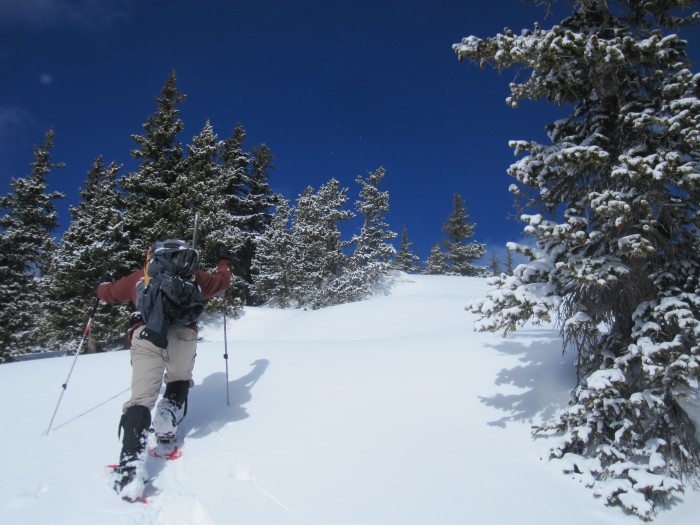
A touch of winter.
Travel slowed down with the snowshoes but we still made decent progress heading upwards. We broke out of treeline and stashed our snowshoes in some rocks. Near treeline, there was 2-4 inches of fresh snow. The ridge up Little Baldy is long. Really long. Painfully long. We reached our previous high point in much better time than previously but still had a long ways to go and the weather wasn't great. Cold icy wind with the high peaks going in and out of clouds.
Climbing out of treeline.
The valley below.
Climbing out of treeline. (Photo by Al)
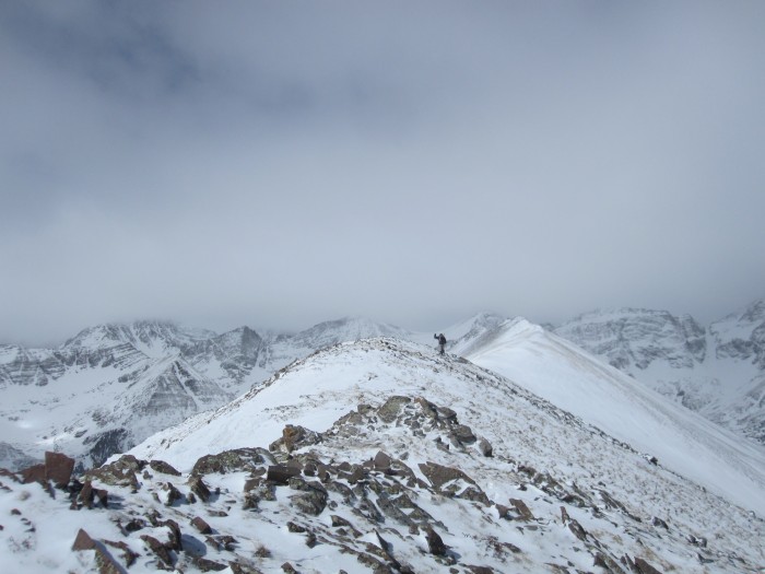
The long ridge towards 13,541 via Little Baldy.
Somewhere on the ridge. (Photo by Al)
Near Little Baldy. (Photo by Al)
13,541 from Little Baldy.
One of the many bumps in Little Baldy. (Photo by Al)
One of the many bumps in Little Baldy. 13,541 in the background. (Photo by Al)
Up and down Little Baldy we eventually reached the point to where we could traverse a snow slope to the 13,541-13,517 saddle. Little Baldy was slow going on the snow covered talus; we we not looking forward to climbing back down.
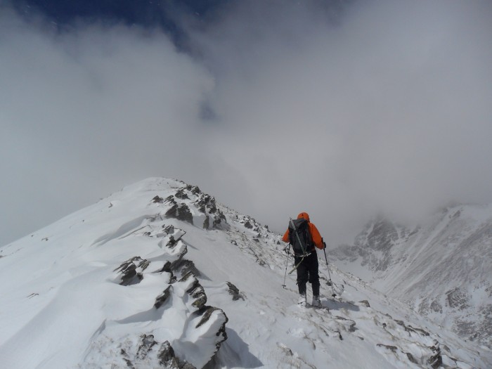
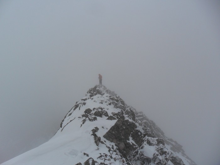
The snow traverse to the saddle was also slow going as it was knee deep powder. Once at the saddle, we ditched our packs and made the quick climb to the summit where we arrived at 12:15 PM. The last 100-150 feet to the summit was exciting as the ridge narrowed. Nothing exceeded class 2. Fortunately, the wind had died down but unfortunately, we were climbing in the clouds and our views were nonexistent. 13,541 is supposed to have some of the best views of Kit Carson but I guess we will never know until we return.
Al working his way up 13,517 before the snow traverse.
Snow traverse to the 13,517-13,541 saddle.
Ridge up 13,517. (Photo by Al)
Al working his way to the summit of 13,541.
Summit Ridge of 13,541. (Photo by Al)
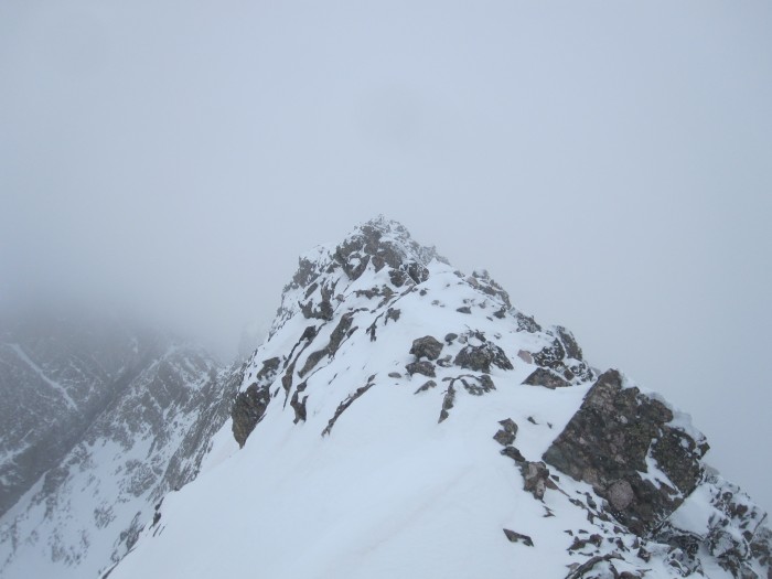
Narrow summit of 13,541.
East face exposure from the summit of 13,541.
Neat exposed south ridge of 13,541.
Al on the summit of 13,541.
Me on the summit of 13,541 (Photo by Al)
Working my way back from the summit of 13,541. (Photo by Al)
Willow lake during a clearing on the south ridge of 13,541.
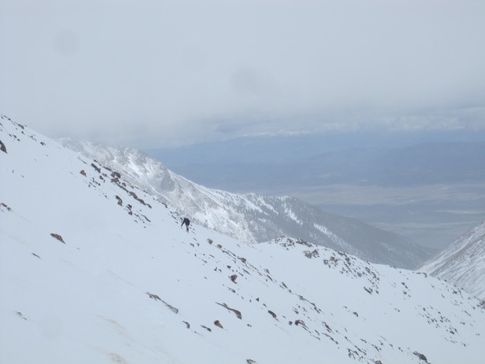
Our descent was faster than our ascent and we took a short cut back down towards the Rainbow Trail and we returned to our cars around 4:30 PM. When we returned to the car, the peaks were completely socked in and most of the fresh snow had melted. It took me 3 attempts to get this one climbed.
Colony Baldy near the 13,517-13,541 saddle.
The really long ridge of Little Baldy back to the car.
13,580.
Humboldt.
Route Map.
Thumbnails for uploaded photos (click to open slideshow):
Seems like everyone was in the Sangres this weekend. Thanks for another TR on a lesser known 13er. I've seen photos that show ”Probably Not” and maybe you didn't have the vest view of it, but does that ridge go all the way from Adams in summer conditions?
The first time attempted this peak was from Adams via 13,580 with the idea of adding this peak. It was summer and the ridge proper didn't go easy. When I attempted it, the weather wasn't ideal and the ridge was extremely wet so I retreated. The retreat back to Willow Lake was class 3.
If I had to guess, I think the ridge proper would go at 5.0 or harder. Perhaps Kevin Baker might chime in?? Most people I know that have combined this peak with Adams have had to descend 300 feet off of the ridge proper with class 3/4. It might be really fun to try the ridge proper.
Here is a photo of the ridge and the class 3 descent.
Kiefer and I also attempted this traverse. I'd agree with Derek that to stay on the ridge proper would be at least 5.0. Not wanting to lose much elevation, we tried to stay high, but it was pretty tough without a rope. There were a lot of cliff bands to get around, and most times we'd find steep, loose gulleys to downclimb. It was actually pretty fun despite losing so much elevation. I have pictures if you want, but I can't get them to upload here for some reason. Let me know if you want them.
I recall the NOAA forecast was 10% chance of rain/snow, mostly sunny. The 10% was right.
I enjoyed the report, looks like a fun and beautiful route.
Caution: The information contained in this report may not be accurate and should not be the only resource used in preparation for your climb. Failure to have the necessary experience, physical conditioning, supplies or equipment can result in injury or death. 14ers.com and the author(s) of this report provide no warranties, either express or implied, that the information provided is accurate or reliable. By using the information provided, you agree to indemnify and hold harmless 14ers.com and the report author(s) with respect to any claims and demands against them, including any attorney fees and expenses. Please read the 14ers.com Safety and Disclaimer pages for more information.
Please respect private property: 14ers.com supports the rights of private landowners to determine how and by whom their land will be used. In Colorado, it is your responsibility to determine if land is private and to obtain the appropriate permission before entering the property.


")
")
")
")
")
")
")
")
")
")
")
")
")
")
")
")
")
")
")
")
")
")
")
")
")
")
")
")
")
")


