Download Agreement, Release, and Acknowledgement of Risk:
You (the person requesting this file download) fully understand mountain climbing ("Activity") involves risks and dangers of serious bodily injury, including permanent disability, paralysis, and death ("Risks") and you fully accept and assume all such risks and all responsibility for losses, costs, and damages you incur as a result of your participation in this Activity.
You acknowledge that information in the file you have chosen to download may not be accurate and may contain errors. You agree to assume all risks when using this information and agree to release and discharge 14ers.com, 14ers Inc. and the author(s) of such information (collectively, the "Released Parties").
You hereby discharge the Released Parties from all damages, actions, claims and liabilities of any nature, specifically including, but not limited to, damages, actions, claims and liabilities arising from or related to the negligence of the Released Parties. You further agree to indemnify, hold harmless and defend 14ers.com, 14ers Inc. and each of the other Released Parties from and against any loss, damage, liability and expense, including costs and attorney fees, incurred by 14ers.com, 14ers Inc. or any of the other Released Parties as a result of you using information provided on the 14ers.com or 14ers Inc. websites.
You have read this agreement, fully understand its terms and intend it to be a complete and unconditional release of all liability to the greatest extent allowed by law and agree that if any portion of this agreement is held to be invalid the balance, notwithstanding, shall continue in full force and effect.
By clicking "OK" you agree to these terms. If you DO NOT agree, click "Cancel"...
8.2 miles
~5420'
About 10.5 hours, including stops for food, pictures, etc
Quick "Trail" Conditions:
Took the route to Spread Eagle Bill put together. As of May 15th don't be fooled by the lack of snow at the trailhead! There was quite a bit from around 10,000 feet up to tree line. About 3 feet deep on average, with deeper drifts and snow free patches to keep it interesting. Snowshoes were definitely required.
The traverse to 13,524 wasn't too bad, not much snow. There is a short, rocky class 2+ - 3 section which was snow free. If there had been ice on it would have been sketchy!
The Full Report
Been itching to hit the Sangre's again, and Spread Eagle looked like a good one. Weather reports were decent so I headed down Saturday afternoon. Had a considerable amount of rain through the Wet Mountains (good name for them!) and it rained snowed most of the night at my camp site near the trail head.
To my joy I did.'t wake up to a blizzard, and at the trailhead most of the snow had already melted. Started at 6:30am. Despite the lack of snow at the start I brought my snowshoes along just in case. I'm glad I did! At around 10,000 feet the snow started getting deep (3 feet on average), and it was constant all the way up to tree line. I left the trail at around 10,100 and headed up through the trees to the ridge. It really is a good route to take, the trees aren't too dense and bushwacking is minimal. Its steep enough that in the snow its a good workout.
Sufficient to say the night's snow had made the trip up ridiculously pretty. morning in the tress
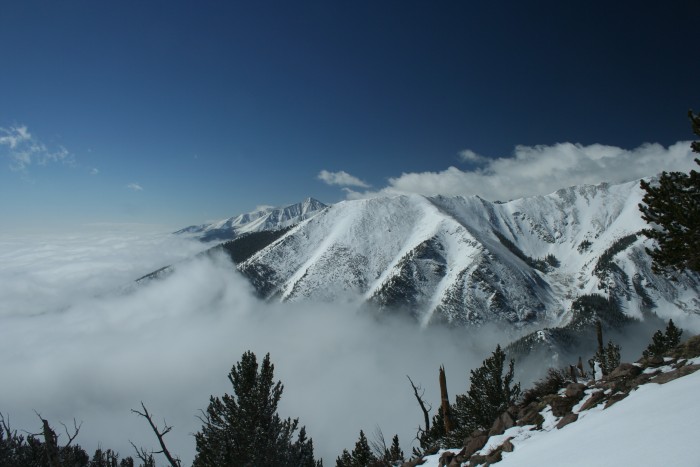
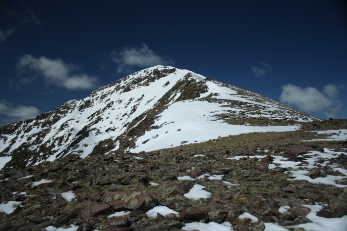
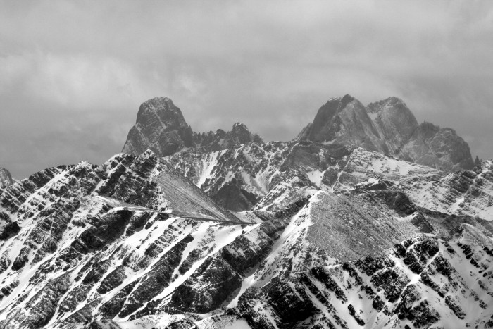
From the ridge I just followed it all the way to Spread Eagle. There was still a bit of snow on the forested portion of the ridge, much less above tree line. The views were amazing. The entire Wet Valley was completely filled with clouds and it felt like I was out on an island. The snow on the Sangre's made them look extra epic. Reached the summit at 11:30. false summit of Spread Eagle looking east into the sea Spread Eagle from east south from Spread Eagle Crestone and Crestone Needle Humboldt, Challenger and Kit Carson
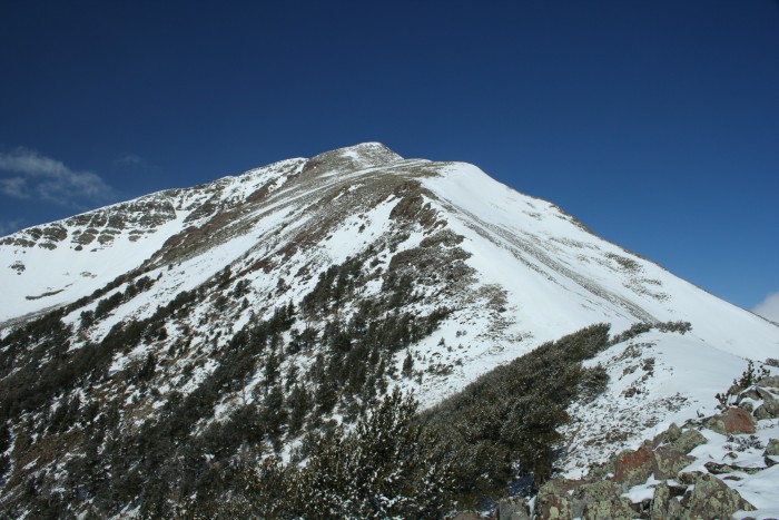
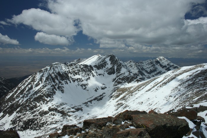
Took a bit of time looking around and decided to go for one more and decided to traverse to 13524. The most technical part of the traverse is coming off Spread Eagle (SE) to the saddle. Its a narrow ridge with steep rocky slopes on either side. I'd call it class 2+, with a very short section which might be called 3 (or 2++). Was free of snow, but it would have been sketchy if there was snow. From there its a gentle saddle follwed by a ~600 climb. Rio Alto and 13524 from Spread Eagle west ridge of Spread Eagle 13524 from saddle
The trip across was well worth it, got views to the west which you couldn't get from SE. Reached 13524 around 1pm. The San Luis Valley in contrast was free of clouds. The Sangre's are such a neat range, so high yet so narrow. A 13er was both S and N of me, I didn't climb them, but I could see Summit Fever being pretty bad in this area, always another 13er less than a mile away.
Pt 13490 from Pt 13524 Spread Eagle and Wet Valley from 13524
Made the return over SE (wasn't really another option) reaching the top around 2:30. Spread Eagle on Return
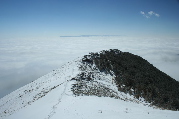
Back down the ridge than followed my tracks back the way I came. Final Cloud shot
The snow was softer and every step was followed by a slide in the deeper parts, not that I'm complaining. As i descended the sea of clouds were rising out of the valley. By the time I got back to the car the peaks were obscured but the valley was clear. Back to the car around 5. I can't say it was my all time favorite hike (I've done a lot), but its up there!
My GPS Tracks on Google Maps (made from a .GPX file upload):
Caution: The information contained in this report may not be accurate and should not be the only resource used in preparation for your climb. Failure to have the necessary experience, physical conditioning, supplies or equipment can result in injury or death. 14ers.com and the author(s) of this report provide no warranties, either express or implied, that the information provided is accurate or reliable. By using the information provided, you agree to indemnify and hold harmless 14ers.com and the report author(s) with respect to any claims and demands against them, including any attorney fees and expenses. Please read the 14ers.com Safety and Disclaimer pages for more information.
Please respect private property: 14ers.com supports the rights of private landowners to determine how and by whom their land will be used. In Colorado, it is your responsibility to determine if land is private and to obtain the appropriate permission before entering the property.
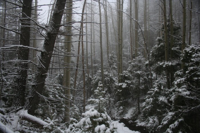


 morning in the tress")
")
")
 false summit of Spread Eagle")
 looking east into the sea")
 Spread Eagle from east")
 Rio Alto and 13524 from Spread Eagle")
 south from Spread Eagle")
")
 Crestone and Crestone Needle")
 Humboldt, Challenger and Kit Carson")
 west ridge of Spread Eagle")
 13524 from saddle")
 Pt 13490 from Pt 13524")
")
 Spread Eagle and Wet Valley from 13524")
")
 Spread Eagle on Return")
 Final Cloud shot")
")


