Download Agreement, Release, and Acknowledgement of Risk:
You (the person requesting this file download) fully understand mountain climbing ("Activity") involves risks and dangers of serious bodily injury, including permanent disability, paralysis, and death ("Risks") and you fully accept and assume all such risks and all responsibility for losses, costs, and damages you incur as a result of your participation in this Activity.
You acknowledge that information in the file you have chosen to download may not be accurate and may contain errors. You agree to assume all risks when using this information and agree to release and discharge 14ers.com, 14ers Inc. and the author(s) of such information (collectively, the "Released Parties").
You hereby discharge the Released Parties from all damages, actions, claims and liabilities of any nature, specifically including, but not limited to, damages, actions, claims and liabilities arising from or related to the negligence of the Released Parties. You further agree to indemnify, hold harmless and defend 14ers.com, 14ers Inc. and each of the other Released Parties from and against any loss, damage, liability and expense, including costs and attorney fees, incurred by 14ers.com, 14ers Inc. or any of the other Released Parties as a result of you using information provided on the 14ers.com or 14ers Inc. websites.
You have read this agreement, fully understand its terms and intend it to be a complete and unconditional release of all liability to the greatest extent allowed by law and agree that if any portion of this agreement is held to be invalid the balance, notwithstanding, shall continue in full force and effect.
By clicking "OK" you agree to these terms. If you DO NOT agree, click "Cancel"...
Trailhead: The standard, public access trailhead, which you can get to from County 1 just north (about 3.2 miles) of Fairplay on highway 9. We used Summitpost's directions, but we must have made a wrong turn because we ended up on the road to Mosquito Gulch. So we tried again from the start of County 1 at 9. (We think the Summitpost directions were a bit confusing and implied that you should make a right turn at .6 miles from 9.)
From County 1 and 9: Drive .8 miles and bear left to stay on County 1, though there was a sign for County 1 pointing in both directions here with "Loop" on it, so maybe you could go either way, but we went left
2.3 miles - Bear right
2.4 miles - Bear left onto "Valley of the Sun" road (though the sign was laying on the ground, it was still visible).
Stay on the road for 2.6 miles as it meanders around.
At 5.0 we got to a "T" intersection (Mountain View is the road) and turned right. Remember the location of this turn for the drive out.
We followed this road to its end, which is the TH. There is supposed to be a sign, but it was probably buried in snow. Here are internet directions to get to the TH (they don't follow the above, I'm not sure why).
The roads were all maintained and plowed. Some parts were muddy, but it was no problem for our Explorer and I can't imagine that any cars would have problems.
Route: We used Summitpost's "Southeast Ridge" to learn more about this mountain and to figure out the TH and the best route. We tried to hike it last summer, but we didn't know the correct route or TH so we were thwarted by big "No Trespassing" and "Private Property" signs.
The route itself is very simple: From the trailhead, head northwest (continuing as an extension of the road you parked on), then turn left where it looks appropriate to head up the ridge. Then, go up and over a false summit (I call it a fake summit, since it had a cairn and everything...), continue along the ridge in an arc to the real summit or head directly over to the real northernmost summit.
Group: Bob "BobbyFinn" and Kate "KatieFinn" Time to the summit: ~2.5 hrs Time back to the car: ~1.5 hrs Total distance: ~5.0 miles Trailhead elevation: ~11,700 Summit elevation: 13,006 feet Special gear: We brought crampons, ice axe, microspikes, but we never even got close to using them. We were on snowshoes most of the hike and we were glad we did, but they could have been ditched once we got out of the trees/willows.
Kate and I didn't get a chance to hike last weekend due to long work weeks, sleeping in on Saturday, and poor planning (my fault, not Kate's) and all week I was in a funk. So we had to get out. I've been working on the Mosquito Range 13ers and this one has been on my "to do soon" list. It's low avy risk, short, and there isn't much elevation gain. With the avy risk at "considerable" for this area, we thought this hike would be perfect for this weekend.
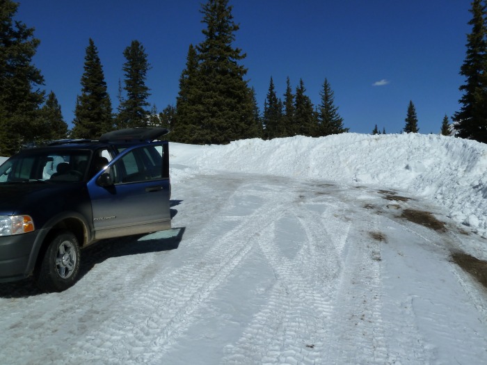
We arrived at the TH and started getting ready. The route starts in front of the tall tree in the middle. Trailhead
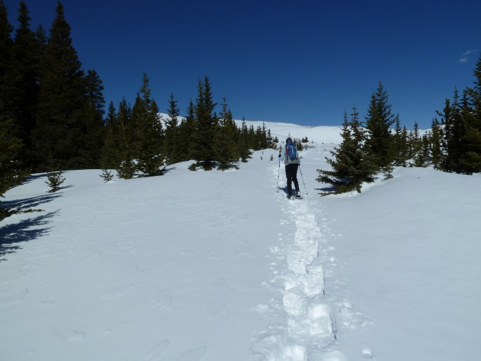
The route description says to follow an old road, but the road was under snow, so we walked from the TH following other snowshoe tracks until they disappeared. You can see the top of the ridge (not the summit) through the trees, left of center. Starting out
Then we headed to the left to try to stay close to the ridge. The snow in this area was pretty good for snowshoeing, but some postholes inevitably found us...
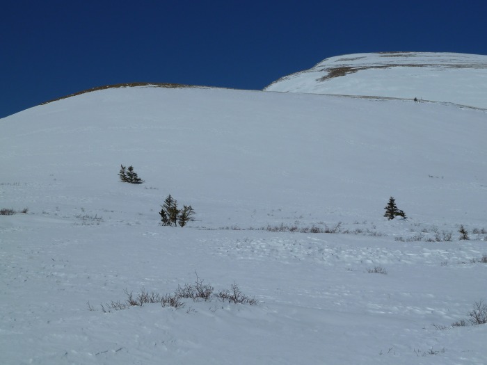
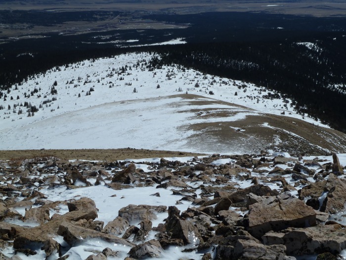
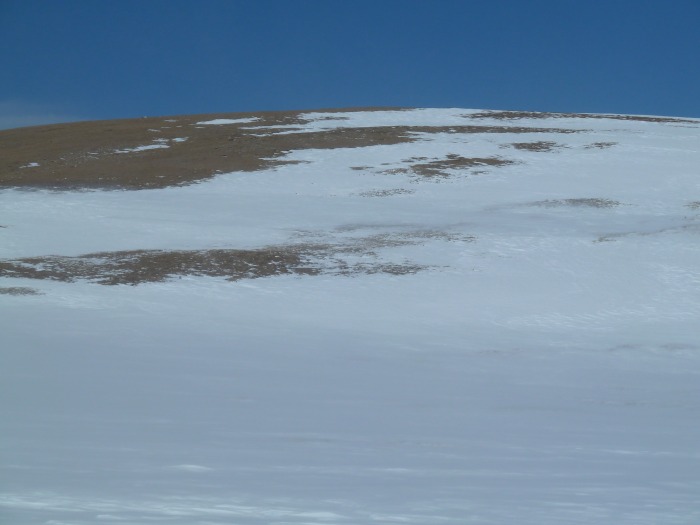
The view at the end of the trees/willows. The slope is mellow and snowshoes were fine (and probably a good idea) up to the top of this first rise. The ridge ahead
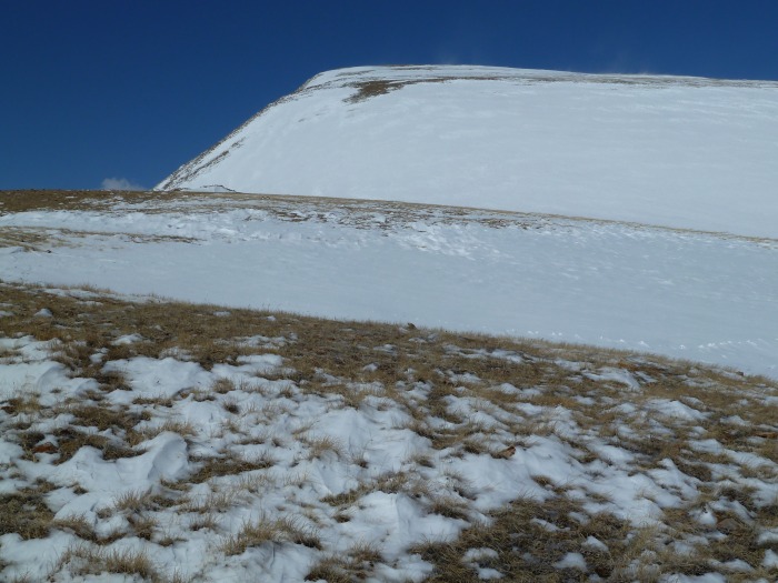
At the top of the first rise, the terrain is almost flat for a while. The route up is clear. The top of the first rise. Near 12,100.
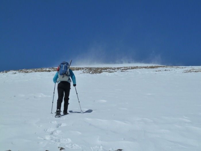
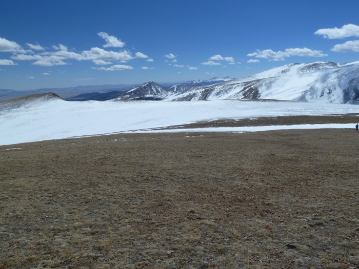
Looking back at the route from about 12,500. We kept our snowshoes on through here. We didn't feel like taking them off, just to put them on again to cross the next snowfield. Looking back.
Still heading up, near the edge of the ridge (but not right on the edge), the wind got a bit stronger. The wind wasn't too bad, but there were some gusts that stopped us in our tracks. We usually just turned out backs into the wind and waited it out, but sometimes we had to just endure. Gettin' a little windy.
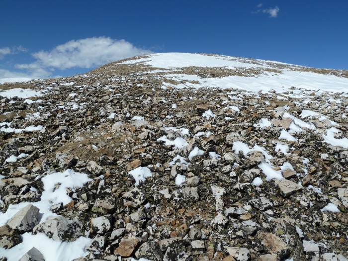
Hey - we're almost there! Let's drop out packs and take off our snowshoes! These white rocks were at about 12,850. We figured we were almost there, so why not drop our stuff. With the wind blowing so hard, we weren't going to spend a lot of time on the summit. The white rocks and our pack-stash point.
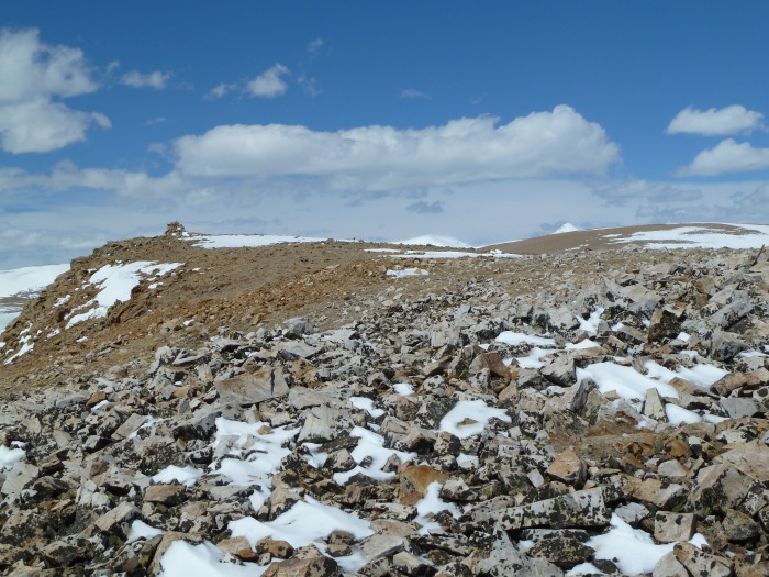
Look! It's the summit! There's a big cairn off to the left there and... and... what's that over there to the right? is that spot higher than this spot? Wait a minute... Where's the map? The fake summit is the pile of rocks on the left.
Yep. We were on a false summit. The real summit is the northern-most one. I knew this going into it, but somehow I forgot... Looking at the true summit from just below the fake summit.
Heading over to the real summit. We didn't have our snowshoes, but we took a curved line to the summit, trying not to lose too much elevation. We didn't really need snowshoes here. I sunk in to my ankles on most steps with a couple mid-shin postholes. Not too bad. Getting closer to the real summit.
At last we were on the real summit. The real summit!
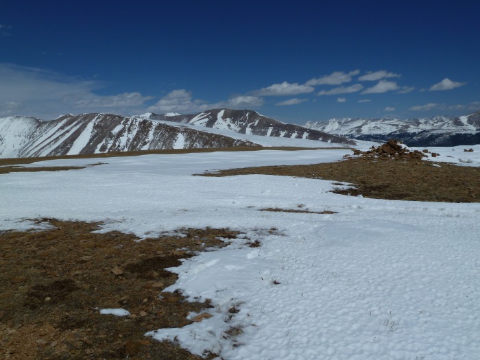
The next ridge over has Mt. Buckskin (far left edge of the pic) and Loveland Mountain (to the right of Mt. Buckskin) and Mt. Bross is in the center of the pic behind them.
On the way back down, we tried to lose as little elevation as we could. This had the added benefit of keeping us on the least-snowy route between the two summits. We ended up making quite an arc, but it was easier that walking in the snow. We headed way to the right and then stuck pretty close to the edge of the ridge. Kate is on the far right and the false summit is on the left. The way back to the fake summit.
Back down in the trees and near the trailhead, we were amazed at the amount of melting that had happened in the short time we had been away. We didn't start the hike until about 10:40 am or so and it was so warm at the trailhead that I considered hiking in just a t-shirt - until I heard the wind. When we got back down some of our footsteps and the surrounding snow had melted completely away. In fact, we could see part of the road we were supposed to follow - in the morning we had no indication at all that the road was there.
The views on the route and on top were really nice. This may be a short hike on a short mountain, but it's a good time.
We hope you liked this report.
Thumbnails for uploaded photos (click to open slideshow):
Jon - Thanks for your comment. I appreciate it. I try to do my TRs like trail descriptions so other people can use them for planning. I'm glad you liked the hike.
We're originally from Pennsylvania and this is on our list of climbs for this year. Thanks for the trailhead directions, I had been looking for them for a while and this helps.
Bob, this TR came in very useful for a solo climb of Penn today! Especially the TH directions. Much appreciated!
Caution: The information contained in this report may not be accurate and should not be the only resource used in preparation for your climb. Failure to have the necessary experience, physical conditioning, supplies or equipment can result in injury or death. 14ers.com and the author(s) of this report provide no warranties, either express or implied, that the information provided is accurate or reliable. By using the information provided, you agree to indemnify and hold harmless 14ers.com and the report author(s) with respect to any claims and demands against them, including any attorney fees and expenses. Please read the 14ers.com Safety and Disclaimer pages for more information.
Please respect private property: 14ers.com supports the rights of private landowners to determine how and by whom their land will be used. In Colorado, it is your responsibility to determine if land is private and to obtain the appropriate permission before entering the property.