Download Agreement, Release, and Acknowledgement of Risk:
You (the person requesting this file download) fully understand mountain climbing ("Activity") involves risks and dangers of serious bodily injury, including permanent disability, paralysis, and death ("Risks") and you fully accept and assume all such risks and all responsibility for losses, costs, and damages you incur as a result of your participation in this Activity.
You acknowledge that information in the file you have chosen to download may not be accurate and may contain errors. You agree to assume all risks when using this information and agree to release and discharge 14ers.com, 14ers Inc. and the author(s) of such information (collectively, the "Released Parties").
You hereby discharge the Released Parties from all damages, actions, claims and liabilities of any nature, specifically including, but not limited to, damages, actions, claims and liabilities arising from or related to the negligence of the Released Parties. You further agree to indemnify, hold harmless and defend 14ers.com, 14ers Inc. and each of the other Released Parties from and against any loss, damage, liability and expense, including costs and attorney fees, incurred by 14ers.com, 14ers Inc. or any of the other Released Parties as a result of you using information provided on the 14ers.com or 14ers Inc. websites.
You have read this agreement, fully understand its terms and intend it to be a complete and unconditional release of all liability to the greatest extent allowed by law and agree that if any portion of this agreement is held to be invalid the balance, notwithstanding, shall continue in full force and effect.
By clicking "OK" you agree to these terms. If you DO NOT agree, click "Cancel"...
The time had come; I was in need of some altitude. I hadn't stood above 14,000 feet since November and I was starting to get anxious. I'm sure all my talk of hiking was starting to drive my wife nuts too. It was time to get myself out there and up a mountain.
As often seems to be the case this time of year, the best weather forecast for the past weekend looked to be in the Sangres. I figured my best chances were either Humboldt, Blanca or Ellingwood. Thoughts of the Lake Como approach made Humboldt a pretty easy decision. Plus I had already hiked Humboldt's East Ridge last spring so familiarity with the route didn't hurt either since I would be hiking solo (and I really wanted that view of the Crestones again). So Humboldt it was, my first 14er of 2011.
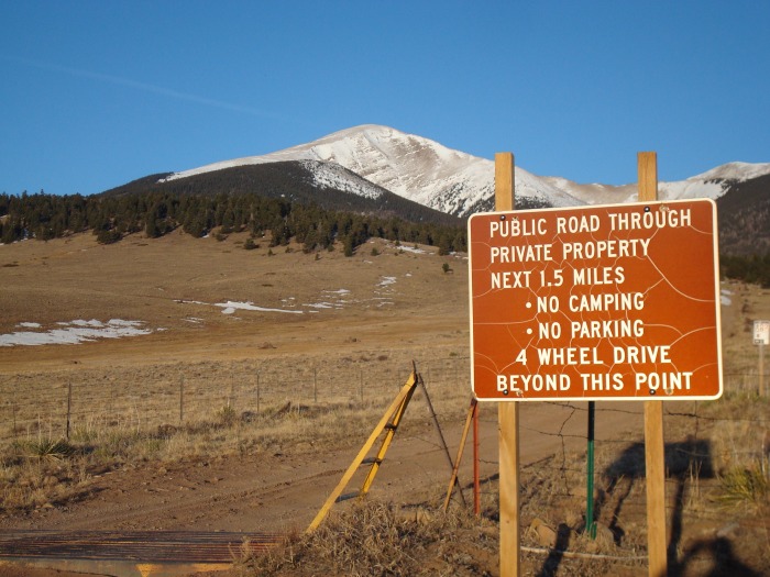
Not wanting to wake up at 3am and make the drive to Westcliffe in the morning I decided to make the drive Friday night and sleep in the back of my truck. Since getting my truck last year I much prefer this routine of driving to the TH the night before. When I arrived at the lower 2WD TH around 10:15pm it was dry, really dry. No snow in sight. So with very wishful thinking I drove up the road hoping that I could somehow make it 1.5 miles and past the private property so that I could get a nice head start. Not surprising it didn't happen and I made it .7 miles from the 2WD TH before being turned back by snow. It will be a while before enough melts off to make it past the private property but considering it's March, it's very dry right now.
Back at the 2WD parking area I was the only vehicle. It was a really windy night. The wind gusts would shake my truck and wake me up frequently. I kept thinking that it wasn't a good sign for the morning if it was this windy at this elevation. I had my alarm set for 5am wanting to be on the road hiking before 6. When the alarm went off at 5 the wind gusts were still shaking the truck and I considered for a minute to just call it a day before it even started. The thought of getting blasted by strong winds above treeline all afternoon was not appealing. I took a moment to think about how else I could spend my day. Maybe I could stop and see Bishop's Castle on the way home or maybe I could hike something shorter and closer to home. I knew though that I would regret that decision and I decided to go back to sleep and see how things were in another hour. I didn't reset my alarm and the second time I woke up it was now 6:30. It was a little later than I would have hoped to wake up but the winds had died down. I had to give it a shot.
I started getting my gear together when another vehicle pulled in the lot. It was a guy named Mike who also came from the Denver area for and attempt on Humboldt. We briefly discussed what each of us had intended on for a route and since we didn't know each others pace there was an unspoken understanding that we wouldn't hike together. Mike got his gear together quickly and started up the road about 15 minutes ahead of me.
The start of my day. 7:15am and clear blue skies!
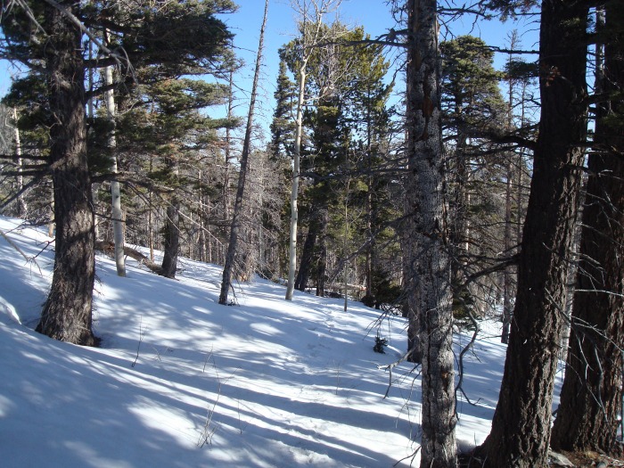
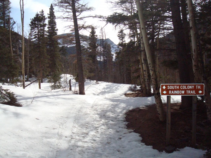
It took me the first 10 minutes up the road to get into a rhythm but after that the hike to the Rainbow Trail junction was quick and painless. No snowshoes or traction needed. It probably took about 45 minutes to reach the junction and after turning on the Rainbow Trail I still didn't need snowshoes. Now I still don't know exactly at which point you are supposed to turn left off the trail to find the ridge but I just made my best guess. Somewhere around .2 miles from the bridge I took a left and bushwacked my way on up. I really don't think it matters exactly where you turn, just take a left and go up and you'll find the ridge. When I got up there I was happy to see other footprints, some of which were fresh so I knew Mike was ahead of me. It turned out the tracks went all the way to treeline which I was very grateful for. That meant no routefinding issues in the trees, yay! (I did by the way put on my snowshoes once in the trees). Here's a picture just after gaining the ridge above the Rainbow Trail.
Parts of the trees are pretty steep but I was so happy to have a trail to follow I didn't even care. There was no wind and it was warm. It was really peaceful just to be by myself snowshoeing through the trees.
It was about 10:15 when I arrived at treeline. The wind instantly picked up. I usually don't leave any gear behind but I saw a large tree where Mike had stashed his snowshoes so I decided to do the same. I stopped for a snack and realized I had cell service so I gave my wife a quick call to let her know I was safe and having a great morning. Here's the view at treeline. You can see Mike probably about 15 minutes ahead of me.
Looking back at the trees.
Spanish Peaks to the south.
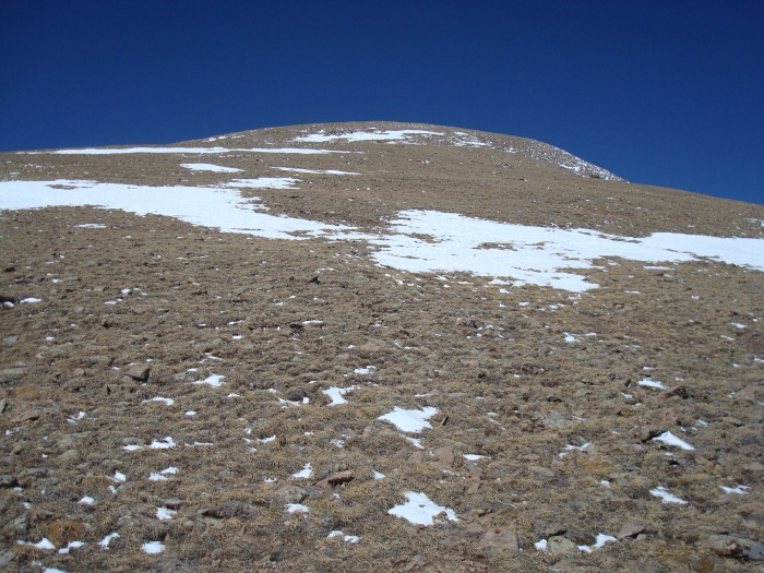
After my break at treeline I set out for the 13,200ft false summit. I started with microspikes on but took them shortly after I started. The slope was mostly just bare rock and grass. Compared to when I did this route last May I couldn't believe the lack on snow. This picture is almost hard to believe it's March.
Nice views along the way.
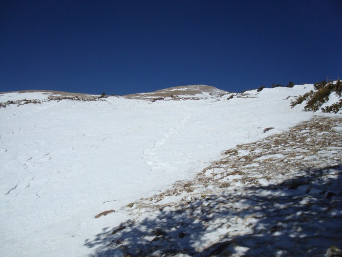
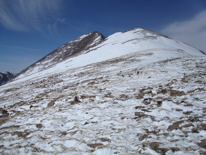
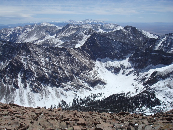
Making it to the top of the false summit was the hardest part of the day for me. I think it was knowing that even when I got to the top of what looked like the summit I still had another mile to go. Here the summit finally comes into view. This was a welcome sight. My energy and pace certainly went up after I reached 13,200ft.
Here is the final summit ridge. It's difficult to see but Mike is about a third of the way up the ridge.
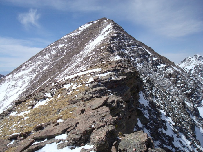
A majority of the snow can be avoided on the final ridge and it actually went quite fast. I made it to the summit around 1:00. Mike had arrived about 15 minutes ahead of me. It turned out we actually hiked at the same pace all day.
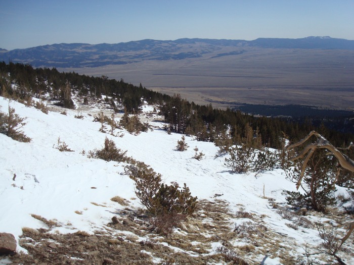
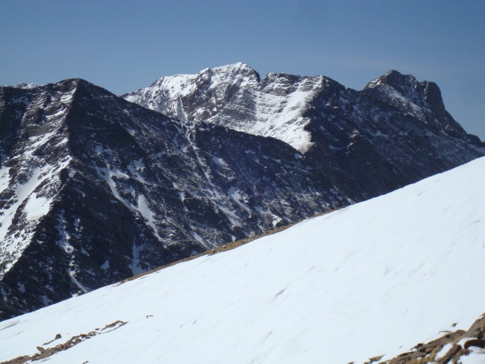
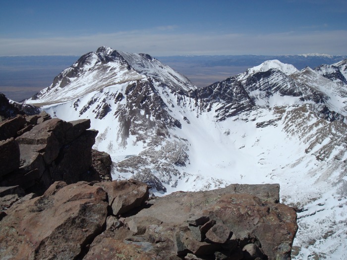
The summit views were spectacular! On last year's trip we encountered lots of clouds and never got a full view of the Crestones. Not this time - awesome views in all directions. Below is the view looking south.
This is one of my favorites, love it!
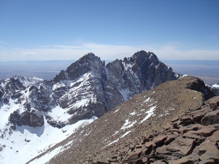
Kit Carson Peak.
Mike and I chatted on the summit for about 15 minutes. Nice guy. Unfortunately though he had lost his camera on the way up. He thought he knew exactly where it fell out of his pocket so he was hopeful to find it on the way down. After he left I stayed on the summit for another 10 minutes before making my own way down.
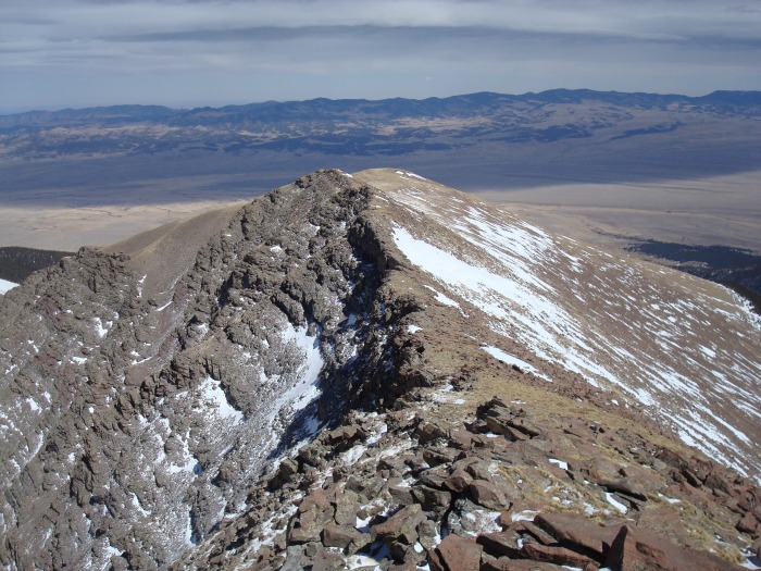
The hike down to treeline was uneventful. Here's a picture coming down the summit ridge.
At treeline we met up again and searched for Mike's camera but didn't have any luck. After searching for a while I strapped on my snowshoes and headed for the trees. Again it was really nice to have a trail to follow back down to the Rainbow Trail. Here's a look at the trail junction in the afternoon. It was nice to be back on the road knowing I was just a short hike back to the truck.
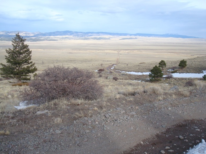
This picture is just to show how little snow there is on the lower section of the road. It's difficult to see but the two black specs in the middle of the photo are our vehicles in the parking area.
I arrived back at the truck around 5pm, just about a 10 hour day. Not necessarily a fast day but I was really pleased with the way everything went. I spent a few minutes changing into clean clothes and was off to Denver.
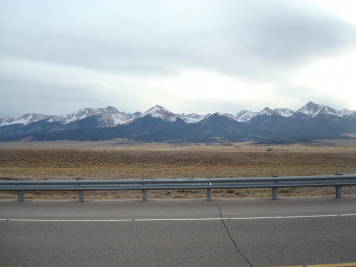
Below is a parting shot of the Sangres taken from the drive back to Westcliffe. I love how this mountain range just shoots up so dramatically.
I'm so glad I didn't make a hasty decision in the morning to drive back to Denver. It really turned out to be a superb day. On the summit Mike and I were discussing the current conditions. With the nice trail through the trees right now and how little snow there is above treeline Humboldt is going to be as easy as it gets for an early spring ascent. It wouldn't however be in any condition to ski (anywhere near the east ridge anyway). Mike, it was nice meeting you and chatting with you. I really hope you found your camera on the way down. I kept my eyes open for it but I didn't see anything.
I had anticipated (and I'm sure my wife had hoped) this trip would satisfy my 14er craving for a while. It seems to have had the opposite effect though, now I'm ready to get out there and do it again! Thanks for reading this long report.
Thumbnails for uploaded photos (click to open slideshow):
Humboldt is a great hike, the view of the Crestones is amazing. Glad you got a clear view of them this time. I agree also, the Sangres prominence over the valleys make them look awesome. One of my favorite drives is the stretch of highway 69 from Walsenburg to highway 50 at Cotopaxi. I love the way the Sangres are just looming over that entire stretch.
Thanks for sharing the report. I can relate to the ”urge” building. I went out last Friday and climbed Mt. Rosa here in the Springs just to squelch the feeling till I have more time. Rosa is 11,499 but it is a 14 mile round trip so it was able to give me that ”good” worn out feeling.
I just did this route yesterday. Pretty much duplicated your experience, except I drove up that morning. Was a nice route, albeit pretty long and quite a bit of elevation gain.
Caution: The information contained in this report may not be accurate and should not be the only resource used in preparation for your climb. Failure to have the necessary experience, physical conditioning, supplies or equipment can result in injury or death. 14ers.com and the author(s) of this report provide no warranties, either express or implied, that the information provided is accurate or reliable. By using the information provided, you agree to indemnify and hold harmless 14ers.com and the report author(s) with respect to any claims and demands against them, including any attorney fees and expenses. Please read the 14ers.com Safety and Disclaimer pages for more information.
Please respect private property: 14ers.com supports the rights of private landowners to determine how and by whom their land will be used. In Colorado, it is your responsibility to determine if land is private and to obtain the appropriate permission before entering the property.