Download Agreement, Release, and Acknowledgement of Risk:
You (the person requesting this file download) fully understand mountain climbing ("Activity") involves risks and dangers of serious bodily injury, including permanent disability, paralysis, and death ("Risks") and you fully accept and assume all such risks and all responsibility for losses, costs, and damages you incur as a result of your participation in this Activity.
You acknowledge that information in the file you have chosen to download may not be accurate and may contain errors. You agree to assume all risks when using this information and agree to release and discharge 14ers.com, 14ers Inc. and the author(s) of such information (collectively, the "Released Parties").
You hereby discharge the Released Parties from all damages, actions, claims and liabilities of any nature, specifically including, but not limited to, damages, actions, claims and liabilities arising from or related to the negligence of the Released Parties. You further agree to indemnify, hold harmless and defend 14ers.com, 14ers Inc. and each of the other Released Parties from and against any loss, damage, liability and expense, including costs and attorney fees, incurred by 14ers.com, 14ers Inc. or any of the other Released Parties as a result of you using information provided on the 14ers.com or 14ers Inc. websites.
You have read this agreement, fully understand its terms and intend it to be a complete and unconditional release of all liability to the greatest extent allowed by law and agree that if any portion of this agreement is held to be invalid the balance, notwithstanding, shall continue in full force and effect.
By clicking "OK" you agree to these terms. If you DO NOT agree, click "Cancel"...
This is my first report on 14ers.com so i hope it posts ok...
Mt Kilimanjaro - 19,340ft
Myself and Nic Devalera
Rongai Route
7 Days
13,900ft of Gain / 48.5 Miles
How it all began...
2/14/2009
I think it is maybe 8AM. I'm really not sure. Mt Kilimanjaro. 18,000 something. The sun has been up for a bit. I want to vomit again. I want to pass out. This fatigue is unbearable. This reminds me of maybe the worst hangover I've ever had - only much worse. AMS. Acute Mountain Sickness. This sucks. I hear my guide Geofrey encouraging me onward. My hikining partner is also with me but the rest of my team is nowhere to be found or seen. It's now been at least 2 to 3 hours of struggling 50 yards at a time. I can't endure anymore. I'm feeling grumpy, sick, confused and pissed off.
"No you can't carry my pack for me. Yes Yes, I see Stella Point. Shut up already. Yes Yes I know it's "right there". I don't care. I want to go down. Now. No, really, I'm going down now for sure..."
I had failed on my Kilimanjaro attempt...
Fast forward 8 months...
I reflected in detail on what had happened to me on Kili on my first attempt. A check of the GPS tells me I had made it to 18,458 ft. A mere 882 ft from Uhuru Peak. I came to a few important conclusions:
1. Physical conditioning was not to blame - I was in excellent shape physically
2. I was very dehydrated - I had 2 water sources with me on summit night. One was my camelback - which froze within 30 min of leaving the tent. Two was 2 Nalgene's inside my pack. Group dynamics dictated that we make almost no stops en route to the summit - not allowing me to stop and access my water. By the time I fell behind and started making stops on my own it was too late.
3. I was not properly acclimatized to the altitude - Our group was attempting to go from ~13,000 to 19,340 in just under 24 hours. That was way too fast for me. And I didn't take any Diamox to compensate.
4. I didn't have enough food energy - I'm a picky eater. I admit it. Not bringing along my own food to supplement what the porters provided was a huge mistake for me. I left for Kili 178 lbs and came home 2 weeks later 162 lbs.
My best friend Nic Devalera and I were sitting at a bar one night. I mentioned to him that I was going back to Kilimanjaro. He asked me about it and I told him that I thought I could make a more educated, informed attempt. I really wanted to go back on my own, on my terms, without distractions. I asked him if he would be interested in going - expected he would probably say no but to my surprise he was all for it. I didn't mind going alone but having him along would be cool - we have had a lot of adventures together over the years. I told him I wanted to go in August 2010 - 9 months out. This would allow me to save money, workout, get visas, arrange hotel and guide services etc.
I contacted the hotel and guide service we had used on the previous trip and began making plans. I wanted to do this trip what is known by them as the "hardway". The biggest difference between this way and the fully equipped way is that we bring and cook all our own food. We also bring all of our own gear.
The food we brought fit into a single duffel that weighed about 30 lbs. We brought such things as: crackers, candy, bagels, oatmeal, pre-cooked chicken and salmon, beef jerky, pasta, coffee, etc.
Over that 9 month time period we prepped and worked out at the gym. Preparations included gear evaluations, budgeting, route creation, trips to the Dr and travel nurse etc.
In evaluating Kili routes I decided that I needed time to acclimatize between 14K and about 17K to hopefully avoid the AMS issues I had previously. I decided on the Rongai route over 7 days. I did this for a few different reasons:
1. My last trip was up the Whiskey Route (Machame Route) on the south side of the mountain. Rongai is on the north side - so I would get to see the north side of the mountain.
2. Mawenzi Tarn would be a great way to acclimatize
3. The route starts about 1000 ft higher
4. Rongai should be a far less crowded route
5. After my failed attempt I spoke with my guide Geofrey and he recommended it
Nic and I had been hitting up some 14ers before the trip so I knew we had no real need to acclimatize lower on the Rongai Route. My goal was to get to Mawenzi Camp on day 3 - bypassing the "Second Cave" camp along the way.
This was the itinerary:
Day 1 - Trailhead to Simba Camp (8,680ft) - 3 hours/4.2 miles
Day 2 - Simba Camp - Kikilelewa Camp (12,060ft) - 6.5 hours/7.5 miles
Day 3 - Kikilelewa Camp - Mawenzi Tarn Camp (14,144ft) - 3 hours/2.4 miles
Day 4 - Mawenzi Tarn Camp - acclimatization hike up Mawenzi's North Corrie to 15,400ft
Day 5 - Mawenzi Tarn Camp - Kibo Hut (15,511ft)
Day 6 - Kibo Hut - Gilman's Point - Stella Point - Uhuru Peak Summit (19,340ft) - Horombo Hut (12,140ft)
6 hours UP/20 minutes on the summit/3 hours DOWN - 6.5 miles round trip from Kibo to summit and back - 8.50 miles from Kibo to Horombo
Day 7 - Hike out to the Marangu gate - 12.5 Miles
8/14/2010
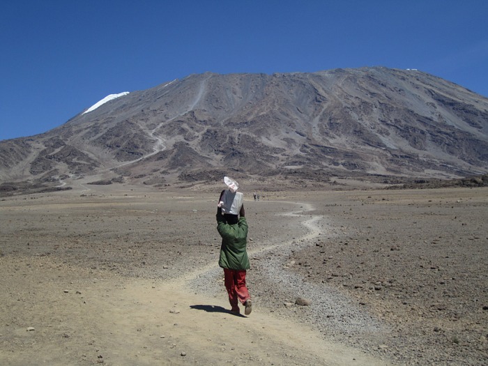
We left Denver, flying through Minneapolis and then through Amsterdam. I was mentally prepared for the 33 hours of travel as I had just done it the year prior. Although I hate to fly, my main focus as I left Denver was already on the mountain. 18,458ft. Would I have AMS again? Had I prepared enough? Was I physiologically destined to fail? I didn't know. And I wouldn't know. Until I got there again...
It was an expensive flight but I felt it was worth it to avoid having to make more stops or fly through places like Nairobi. We had a lot of gear with us. Losing luggage was not an option. We packed in such a way that everything that was super critical went in our carry on. Our carry-ons were basically our backpacks. Other important carry-on items included things like various food items, our boots, medicines, and cameras etc. One nice thing about flying this international flight with Delta was that we were allowed 2 checked bags each. And we took advantage. We had 4 duffels, each weighing around 40 lbs. We had split up the gear and food amongst the duffels in such a way that if a bag was lost - we wouldn't lose BOTH tents or ALL food etc. Something to realize about East Africa is that if you forget or lose something you can't exactly go down to the local Walgreen's and pick it up. If it is lost or forgotten you do without...
We arrived on the daily flight at around 8PM and had no issues with immigration or with our transport to the hotel. We had given ourselves 3 days at the hotel to get over jetlag and tour the local Chagga village etc. We also thought if any bags were delayed this would give us time to recover them. I also wanted to finalize plans with the hotel.
8/16/2010
I had a certain guide that I wanted to use and wanted to make sure the hotel had arranged for him to go with us. His name is Geofrey Moshi and he was the guide who was with me the year before when I turned around. Nic and I were sitting in the hotel bar after dinner when Geofrey came to see me. I had sent for him and when he came into the bar I welcomed him and asked him if he remembered me. He did remember me from the year before, mostly because I gave him quite a bit of gear. We sat and had beers and I told him I wanted him to take us up the mountain again. He was very thankful I had called after him - he was desperate for the work. We agreed that he would come by the next day and go over gear with us and then take us for a walk through the local village - his home.
8/17/2010
Nic and I were sitting in the bar hanging out when a large burly African man entered and came over to us. This man had the biggest smile on his face. He came by and sat down with us, shaking hands and asking us how we were. He asked us if we were all prepared for the mountain. Nic and I looked at each other quizzically and offered him a beer. He said his name was Char-Less which we realized was Charles. After a few minutes we finally asked him who the hell he was. Turns out he was Geofrey's cousin and our second guide for the trip. Geofrey soon showed up and we discussed gear and porters. It was decided we would use 5 porters. We would be a party of 9.
Marangu Hotel (bar and courtyard):
The climbers briefing room:
8/19/2010
Mountain Day 1 - Trailhead to Simba Camp (8,680ft) - 3 hours/4.2 miles
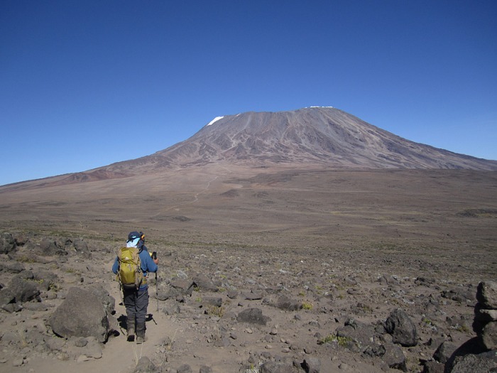
After breakfast at the hotel we forked over $1,500 in crisp new US $100 bills to acquire our 7 day park permit. We then packed up and made a long drive to near the Kenya border where we stopped at a roadside town for some chicken and rice. We then arrived at the Rongai TH where there appeared to be a large number of porters hanging out either waiting for their parties to arrive or for a chance at picking up some work. We signed in and headed down the trail. The hike to Simba camp was pretty uneventful. I tried hard not to let my anticipation about the hike get to me. We ate well for dinner and got to bed early.
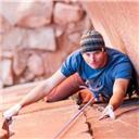
Geofrey and I resting along the Rongai Route
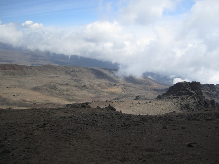
Mawenzi (in the distance) from Simba Camp
8/20/2010
Day 2 - Simba Camp - Kikilelewa Camp (12,060ft) - 6.5 hours/7.5 miles
After breakfast and a quick packing of camp we had a discussion about the days destination. Geofrey was concerned about our acclimatization. The porters, who would be ahead of us, needed to know if we were stopping at the Second Cave camp or continuing on to Kikilelewa Camp. Nic and I discussed it and we were clear that we had no need to acclimatize so low on the mountain. Getting to Kikilelewa Camp would then allow us to get to Mawenzi on day 3.
8/21/2010
Day 3 - Kikilelewa Camp - Mawenzi Tarn (14,144ft) - 3 hours/2.4 miles
This was a short day after our longer day previously. It felt good to get to Mawenzi Tarn camp early. I felt that being at this camp would kick start our acclimatization routine. We didn't go any higher than 14,144ft - choosing to hydrate and rest at the camp.
Kikilelewa Camp
Heading to Mawenzi Camp
8/22/2010
Day 4 - Mawenzi Tarn Camp - acclimatization hike up Mawenzi's North Corrie to 15,400ft
Day 4 was strictly an acclimatization day. Nic and I decided we would head up into Mawenzi's north corrie as far as we could - as long as we were feeling ok. We took it slow because we had no reason to hurry. We slowly made our way up the sometimes trail/sometimes scree slopes to the top of the corrie at 15,400ft. At this point I had a pretty good headache building and decided this was about as high as I needed to go. There was a "notch" just a bit higher up that would allow for views off to the south so Nic and Charles headed off for it while Geofrey and I sat comfortably at 15,400 and chatted about climbing, Africa, poverty and many other important things.
Nic enjoying a salmon bagel:
Mawenzi Camp
View from high up the North Corrie
8/23/2010
Day 5 - Mawenzi Tarn Camp - Kibo Hut (15,511ft)
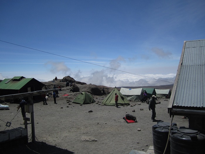
We packed up camp having had a great nights sleep. Kibo hut would turn out to be the longest slow uphill I've ever experienced - which was great for acclimatizing. The weather was warm and the winds cooperated as we slowly made our way across the expansive saddle between Mawenzi and Kibo. We passed the plane wreckage and took some photos and then headed on to Kibo Hut. When we arrived at Kibo Hut it was quite busy with lots of teams arriving from the Marangu route. The previous day 3 of our porters had ferried water to the hut for us so we were thankful to be able to hydrate well, cook dinner and prepare for our summit bid. My anticipation was building at this point as I could easily view the route up to Gilmans Point from my tent. I went to sleep early with the knowledge that I had done all I could to properly prepare myself for the summit bid.
Airplane Wreckage en route to Kibo
Porter carrying water
8/24/2010
Day 6 - Kibo Hut - Gilmans Point - Stella Point - Uhuru Peak Summit (19,340ft) - Horombo Hut (12,140ft)
6 hours UP/20 minutes on the summit/3 hours DOWN - 6.5 miles RT from Kibo to summit and back - 8.50 miles from Kibo to Horombo
We were up at 11PM. It was dark and breezy but surprisingly not too cold. I took time to eat a whole bowl of oatmeal and drink quite a bit of water. I brought no bladder this time. Instead I had an insulated bottle on my hip for easy access. Since I had hydrated well at camp, I decided to start with it full of Gatorade rather than water. I had another liter of water in my pack. I also had granola bars and other snacks at the ready so I wouldn't have to take my pack off to eat along the way. We were off by midnight with many teams already ahead of us. We agreed that Geofrey would set a pace but we would ultimately dictate pace and breaks etc. I felt like we were making a very slow pace, which I was ok with. I knew the risk of going too fast. I made no apologies when I put my iPod on and started into the trance of "pole pole" - 1 step slowly in front of the other - by the light of the full moon - no headlamp. I kept telling myself to stay "hyper-focused" and drink and eat often. The pace felt slow but we quickly started passing groups of people. Some of them were really struggling. I wanted to say "hey I know how you feel - been there" but of course I didn't. I'm usually a pretty social person and enjoy talking to people but not this night. iPod on - I wasn't there to make friends.
I knew that the first major landmark I was looking for was the Hans Meyer Cave which is over 1/3 of the way to Gilman's Point. It is also at the base of the notorious scree slope. A few hours in and I realized the route seemed quite steep. During one of our few breaks I asked Charles where he thought we were and ask about the cave. He indicated we had long since passed it. I was feeling great that we were quite a ways up the scree slope already. I began checking my GPS at some point, wondering how close I was getting to the previous turn around altitude of 18,458ft. Would I suddenly get sick again? I didn't know but knew I was feeling pretty good. And then there I was - at 18,459ft - still moving along quietly behind Nic. I didn't say a word as I set a new altitude personal best for myself. I was pretty excited.
The last bit of hiking up to Gilman's was class 2 with a few tricky moves. I was really excited to get to Gilman's - even though it was dark and cold. The guys wanted to quickly move along but I forced them to stop as I changed from Gatorade to water. The Gatorade was simply tasting way too sweet and causing me some nausea. There were some really sick people at Gilman's. On the way up I think we passed approximately 75-100 people - many of whom were seriously feeling the altitude.
We made quick time over to Stella Point and then slowly made our way toward Uhuru Peak. Nic and Geofrey were a bit ahead of Charles and I but it wasn't long before I could see the summit sign. The sun was beginning to rise and I'm sure I had a huge smile plastered across my face as I made it to the top of Africa at around 6:15AM. We took lots of photos. I checked the thermometer on my pack and it read +14F. Not too shabby. We didn't stay long on the summit and made really quick time back down to Gilman's - taking pictures along the way. The glaciers up there are stunning and I'm thankful I got to see them before they are gone. Then it was on to the scree slope - wow was that a crazy ride. We surfed scree for what seemed like 1,500ft. It was awesome and we were back at Kibo Hut in no time. We took a long rest at camp before packing up and then slowly made our way toward our final camp.
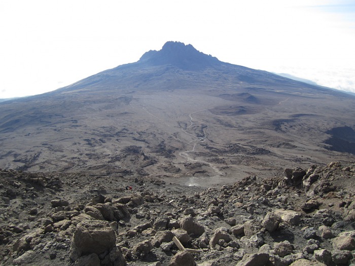
Route from Kibo
Kibo Hut Photos
Summit
What's left of the Furtwangler Glacier
Near Summit
Rebmann Glacier
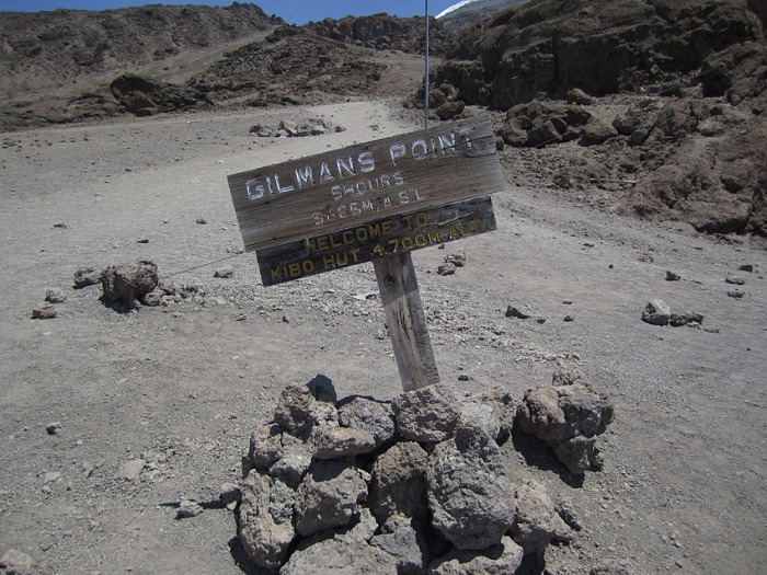
Gilman's Point
Looking down toward Kibo from near Gilman's Point
Coca-Cola Route
8/25/2010
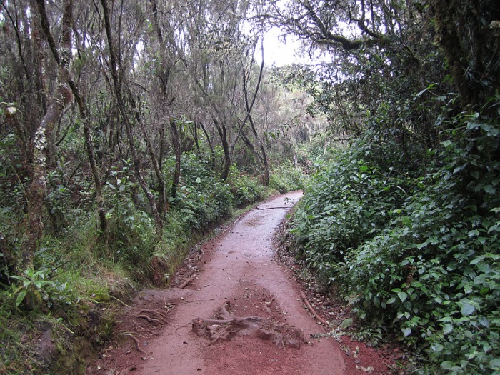
Day 7 - Hike out to the Marangu gate
We awoke to a light rain. I was tired and dirty but feeling awesome after having made the summit of Kili. The rain subsided just in time for some breakfast of coffee and oatmeal. As we packed up our wet camp I could see Mawenzi socked in with clouds. I think Geofrey saw my contemplation and came over to me to say something along the lines of 'those who summit tonight - not so lucky'. The hike out to The Marangu gate was cool - it was a long 12.5 mile hike but I got to see what the Coca-Cola route looked like. The rainforest is cool. Back at the gate we got our certificates and made the short ride back to the hotel. It is customary to buy the guides and porters beers and have a quick after hike party. We all proceeded to get stupid drunk and sing African songs for quite a few hours! We got our certificates from Geofrey and Charles and then handed out tips. It was recommended we tip in the range of $25 per porter and maybe $40 for each guide. We tipped each porter $60 and Geofrey and Charles each got $140. They all work their butts off and treated us well - they deserved every penny!
Huts
Rainforest
Our Team
8/26/2010
I awoke at the hotel the next morning in a fog - gear and clothes everywhere. I stumbled out onto the patio of our room to see our wet tents and other various gear such as our stove sprawled out all over the grass and patio. It wasn't long before Geofrey and gang showed up. We had told them we would give them what gear we could. In the end I gave away a Mountain Hardware tent, another nice Thermarest, socks, Nalgenes and various other stuff. We packed, ate breakfast and headed to Zanzibar for a few days of sun and partying before making the long trip home.
In the end I felt thankful for the very successful trip. Nic was a great friend and adventurer - again. There were no real issues at any point along the trip. No lost luggage, no injuries and a great visit to Zanzibar for snorkeling in the Indian Ocean.
Most importantly I was thankful that Kili allowed me to grace her slopes and her summit
In the end our trip was:
15 days
Hiking - 13,900 ft of gain and 48.5 miles over 7 days on the mountain
We took 10 flights in total, visiting 6 different airports (some twice in the same day) on 3 different continents - a staggering 77 hours "In Transit"
Other Random Photos
Rongai Route
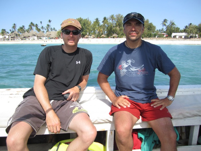
Riding a Dhow to go snorkeling at Mnemba Atoll - Indian Ocean
Thumbnails for uploaded photos (click to open slideshow):
Interesting report on a climb I most likely will never be able to attempt. So I really appreciate ”tagging along” with you on this trip. Must have been quite an experience! Thanks for posting it! :D
Just finished reading your report and wanted to know if you will share the company you went with? In addition, what was the $1,500 you handed over for park fees? I have looked at numerous reports as well as guide sites and I see nothing about park fees?
Thanks.
-Hankey
Maybe more accurately - we paid like $750 each for me and my buddy (total $1500) - for example - if a guide service tells you you can climb Kili for $1800 for a 7 day trip - there is just a $750 permit fee included in that price (that goes straight to the park service)...
HikerHankey
Sure I used the Marangu Hotel
These are the same folks the CMC has used for like 50 years.
You must have a "camping permit" to be in Kili National Park. This is essentially your climbing permit. You pay based on the number of days you are in the park. If you go with large guide groups (like Alpine Ascents) your "permit" fees are included in your climbing package. If you contact the Marangu they will break it all down for you - cost of the permit, guide cost per day, porter cost per day etc...if you need more help let me know...
Excellent, thanks for the information and link. I have been looking at a lot of the information from Zara as well, but want to check your link as well. We are thinking either the Marangu or Rongai routes in early January. We fly free on Delta, so airfare is good to go, but choosing a guide is proving to be the difficult part.
I may take you up on additional help.
Thanks.
-Hankey
My son and i just got back from Kili and we also used the Marangu. Thoroughly recommend them, they did a great job Somehow we ended up with a crew of 12 for the two of us. Almost embarrassing but Seamus the trip director said that they would be more than happy if we need 20 crew! We tipprd a total of $500 between the two of us and we were told that was on the ”generous side but the guys were more than worth that. With groups of of one or two they have lower tip expectations so it is nice to boost it a bit. I would recommend a small group. We passed a slew of groups on the way up to Stella and it became very apparent that the pace was laways dictated bu the weakest memebr of the group.. And believe me i am not that quick!!
Caution: The information contained in this report may not be accurate and should not be the only resource used in preparation for your climb. Failure to have the necessary experience, physical conditioning, supplies or equipment can result in injury or death. 14ers.com and the author(s) of this report provide no warranties, either express or implied, that the information provided is accurate or reliable. By using the information provided, you agree to indemnify and hold harmless 14ers.com and the report author(s) with respect to any claims and demands against them, including any attorney fees and expenses. Please read the 14ers.com Safety and Disclaimer pages for more information.
Please respect private property: 14ers.com supports the rights of private landowners to determine how and by whom their land will be used. In Colorado, it is your responsibility to determine if land is private and to obtain the appropriate permission before entering the property.


")
")
")
")
")
")
")
")
")
")
")
")
")
")
")
")
")
")
")
")
")
")
")
")
")
")
")
")
")
")