Download Agreement, Release, and Acknowledgement of Risk:
You (the person requesting this file download) fully understand mountain climbing ("Activity") involves risks and dangers of serious bodily injury, including permanent disability, paralysis, and death ("Risks") and you fully accept and assume all such risks and all responsibility for losses, costs, and damages you incur as a result of your participation in this Activity.
You acknowledge that information in the file you have chosen to download may not be accurate and may contain errors. You agree to assume all risks when using this information and agree to release and discharge 14ers.com, 14ers Inc. and the author(s) of such information (collectively, the "Released Parties").
You hereby discharge the Released Parties from all damages, actions, claims and liabilities of any nature, specifically including, but not limited to, damages, actions, claims and liabilities arising from or related to the negligence of the Released Parties. You further agree to indemnify, hold harmless and defend 14ers.com, 14ers Inc. and each of the other Released Parties from and against any loss, damage, liability and expense, including costs and attorney fees, incurred by 14ers.com, 14ers Inc. or any of the other Released Parties as a result of you using information provided on the 14ers.com or 14ers Inc. websites.
You have read this agreement, fully understand its terms and intend it to be a complete and unconditional release of all liability to the greatest extent allowed by law and agree that if any portion of this agreement is held to be invalid the balance, notwithstanding, shall continue in full force and effect.
By clicking "OK" you agree to these terms. If you DO NOT agree, click "Cancel"...
Yes, this is a pretty random trip report. These are two mountains on opposite sides of the state that I hiked a month apart. They are not tall mountains (their combined elevation barely exceeds Mt Elbert) and they certainly aren't remote or difficult. That said, I found them to be very enjoyable little hikes with nice scenery and a great way to spend a half a day if you ever have some time to kill in the Grand Junction or Denver areas.
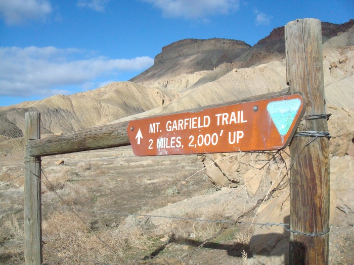
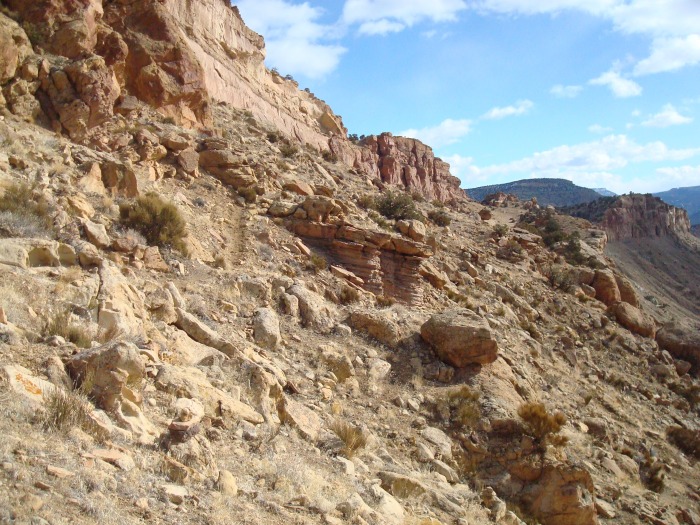
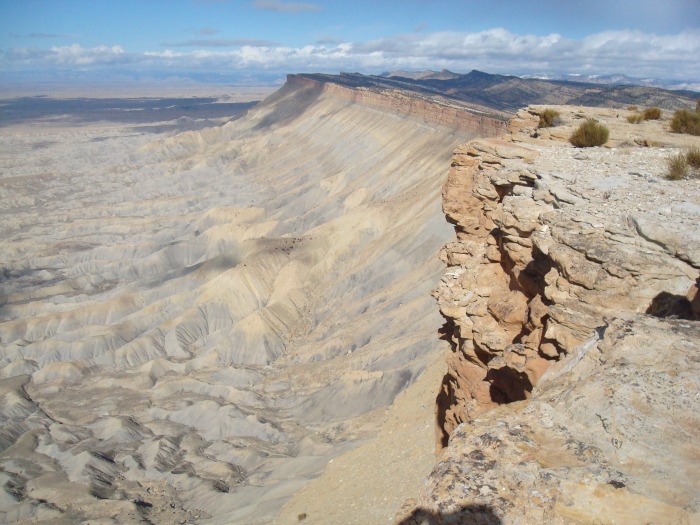
I hiked Mt Garfield while my wife and I were visiting my dad in Grand Junction over President's Day weekend. I had driven by the mountain dozens of times while visting my dad and always thought it looked interesting. On Sunday morning we didn't have any plans so I decided to give it a shot. I was able to get directions to the TH and a general idea of what to expect on Summitpost. Round trip the hike is 4 miles and 2,000 ft elevation gain. The beginning is fairly steep but it mellows out after that. The pictures mostly tell the story...
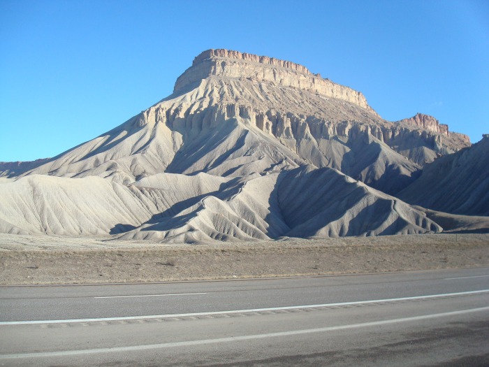
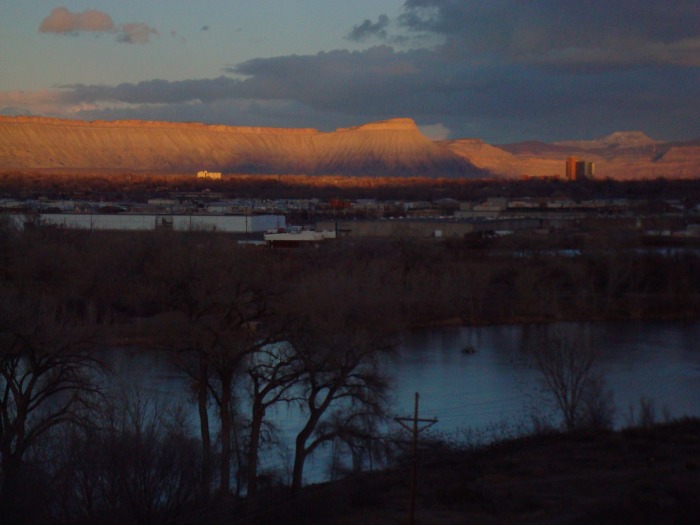
Mt Garfield viewed from I70
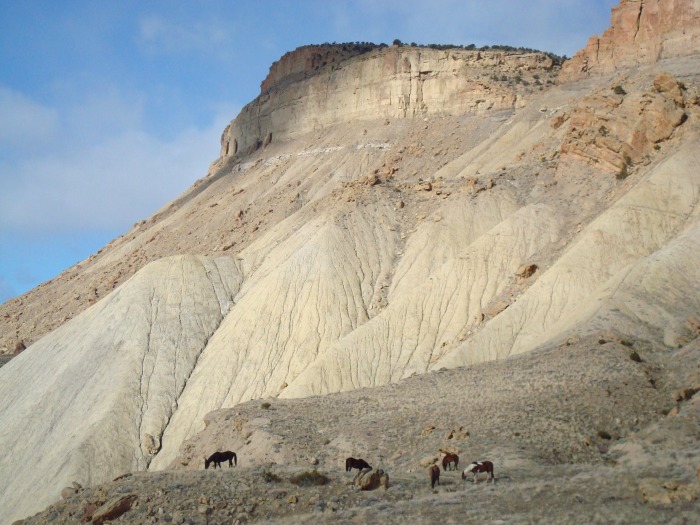
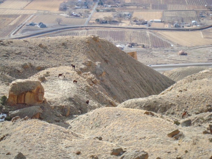
Before I left my dad's house in the morning he said that people often see wild horses in the area. He nailed that one on the head - I was lucky enough to come across 5 wild horses that were grazing just off the trail. I stopped to watch them for about 10 minutes, pretty cool.
Looking back down on the horses.
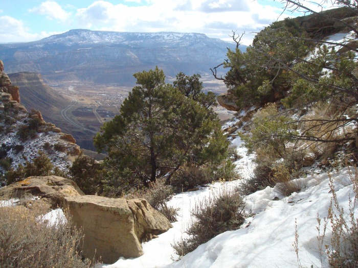
There were just a few patches of snow near to top.
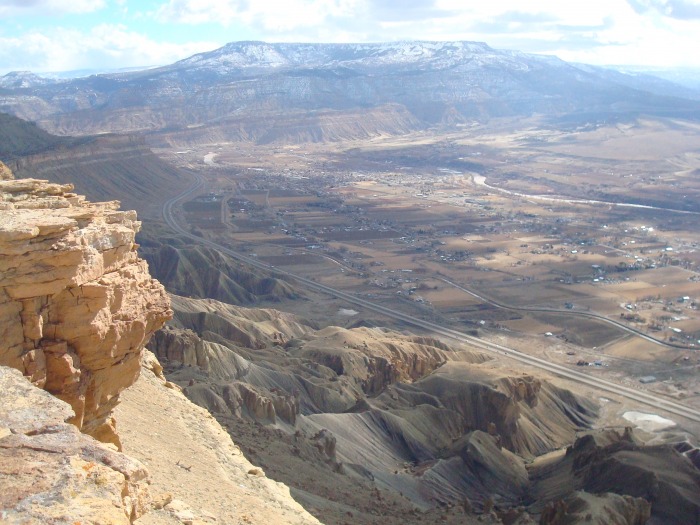
On the summit looking toward Palisade and the Grand Mesa.
Nice summit view looking the other direction.
Mt Garfield at sunset from my dad's house.
I found Mt Garfield to be a very enjoyable hike with interesting scenery. I enjoyed the desert landscape as a change of pace from the Front Range. It's a hike I'm sure I'll repeat on future trips visiting my dad on the Western Slope.
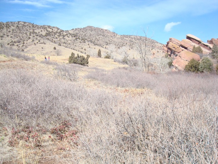
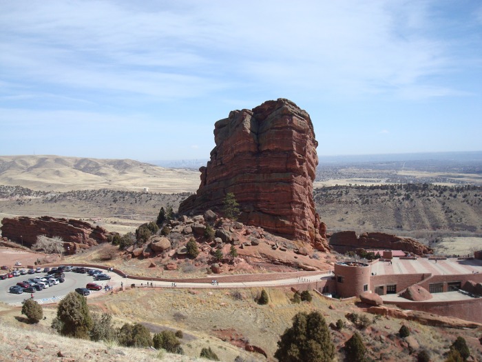
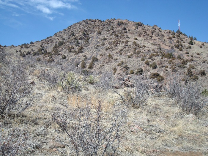
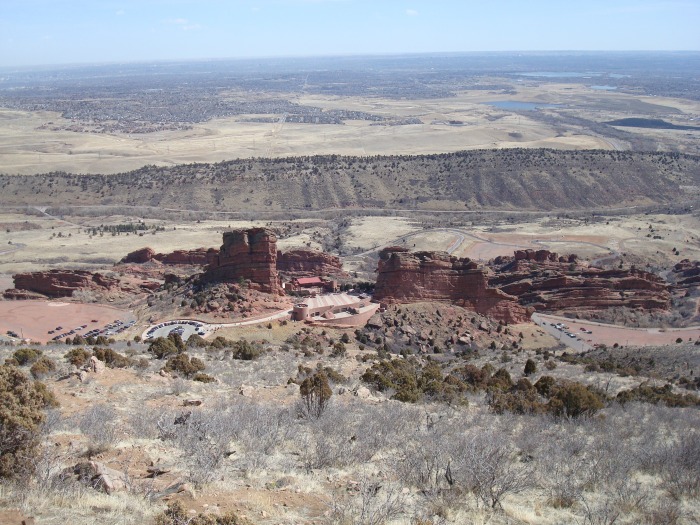
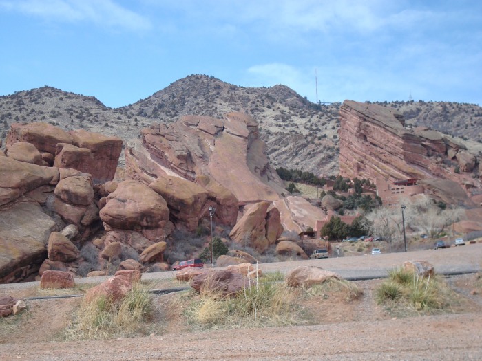
So this past weekend I was really hoping to get into the high country for a chance at a 14er or 13er before winter officially came to an end. Unfortunately other plans came up that kept me in Denver on Saturday morning but with the afternoon free I decided that it was time to hike Mt Morrison. I've been to Red Rocks many times for concerts or to run the steps or just to show off Red Rock's amazingness to visting family members but I had never done any hiking in the area. Once again I went to Summitpost for a route description and I decided on the Amphitheater Loop route which is also about 4 miles round trip and 2,000 ft elevation gain.
From the start of the trail, which is just inside Red Rock's South entrance.
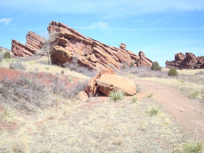
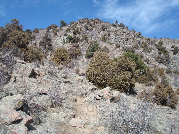
There is a fairly steep trail that goes right up the mountain behind the amphitheater. Some of the trails in this area were closed for restoration but if you get creative you can find a way up without hiking on any closed trails.
Remaining hike. There was a trail the entire way up, sometimes you just had to be on the lookout because there were trails heading in different directions, but they all will get you to the same place.
A nice place to catch a free concert?
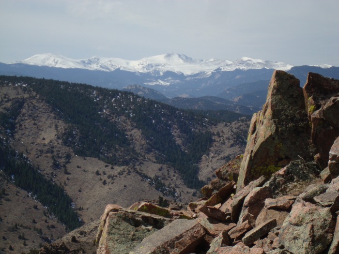
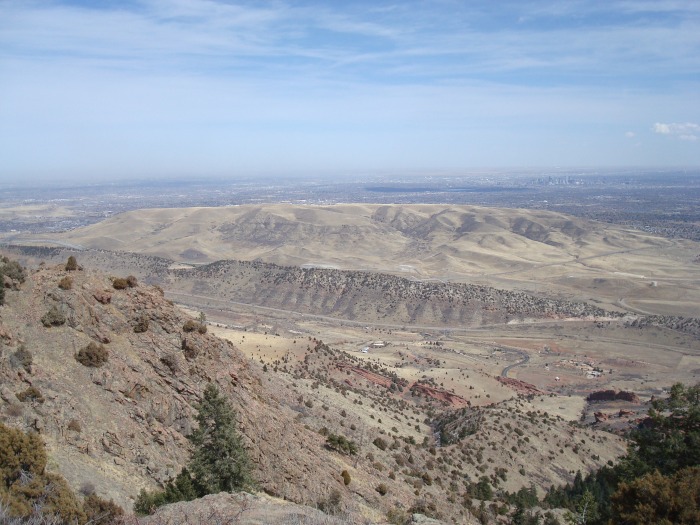
Before getting to the final little scramble to the summit you top out on a flat area and are treated with great views of Mt Evans.
Final scramble to the summit. Nothing really exceeding class 2 but still kind of fun.
On the summit looking at Green Mountain and Denver.
Another view from the top. You can also see Pikes Peak and Longs Peak from the summit but it was too hazy to get good pics of them.
On the way down I took a more direct route straight to the back of Red Rocks. Even with a stop inside the amphitheater the entire hike took just over 2 hours. It turned out to be a very enjoyable hike and great way to get in some conditioning for bigger hikes ahead. Here is a final shot of Mt Morrison (the summit is just left of the antenna) and Red Rocks. What a great place to have in your own backyard!
Thumbnails for uploaded photos (click to open slideshow):
How odd, I also climbed these two peaks in the past two months.
Caution: The information contained in this report may not be accurate and should not be the only resource used in preparation for your climb. Failure to have the necessary experience, physical conditioning, supplies or equipment can result in injury or death. 14ers.com and the author(s) of this report provide no warranties, either express or implied, that the information provided is accurate or reliable. By using the information provided, you agree to indemnify and hold harmless 14ers.com and the report author(s) with respect to any claims and demands against them, including any attorney fees and expenses. Please read the 14ers.com Safety and Disclaimer pages for more information.
Please respect private property: 14ers.com supports the rights of private landowners to determine how and by whom their land will be used. In Colorado, it is your responsibility to determine if land is private and to obtain the appropriate permission before entering the property.