| Report Type | Full |
| Peak(s) |
Gibbs Peak - 13,577 feet |
| Date Posted | 03/20/2011 |
| Modified | 03/21/2011 |
| Date Climbed | 03/18/2011 |
| Author | piper14er |
| Final Winter Summit 2011 East Ridge - via Rainbow Trail |
|---|
|
Gibbs Peak A - ranked number 218 at 13,553 feet Tri-Centennial 12 hours+ 13.3 miles 4550 feet plus 600-700 more feet on the rolling Rainbow Trail if I am not mistaken Okay actually the last winter summit of 2010-2011 winter season. There were some great winter climbs by people this past winter, Wilson Peak, Teakettle, Little Bear to name a few. This was not ones of those. There was some historic finishes like Steve's final winter 14er. This was not one of those. There were some dramatic rescue stories about some tough people like Alyson on Rosalie. I was in contact with her this last week (read that report again), Alyson is recovering and really has a positive attitude on things. This report is not a great winter story or dramatic, but here it is. I had attempted Gibbs about a month ago and had decided to wait until spring and a lot of melting before I would try again. Well it was kind of a spring day for the end of winter and yes some snow had melted but not nearly enough to make it easy. I just could not wait. The snow in the Sangre's this year seemed to be more than a challenge despite the fact that there was not copious amounts. The snow never seemed to set up of consolidate. This day was hardly an exception. Topping it off was the fact that both of my snowshoes broke and I had to spend a lot of time trying to jury rig the shoes with straps. Fortunately they made it back, although at one point I had thought of turning around. I was attempting to boot it up the mountain before spending the time to rig them through knee deep snow and was losing drive. This was the end of a week of that had not gone so well. I had my four wheel drive in for repair. It was supposed to be fixed Tuesday or Wednesday but was not. That would cost me as I attempted to park on the beginning of the Forest Service road to the trailhead when the car slipped into a rut left by some 4wd trying to get up the road. That would cost me an hour of digging the car out and trying to get back to the dirt part of the road. The end of the road has no parking signs from the local home owner even though it is a county road. I parked another few tenths of a mile down the road at the first intersection. There is plenty of parking at the end of the road that would not block the local's driveway but people have to have their little bit of power. I was a bit miffed about that but mostly because I could have parked down there to begin with and walked the extra couple of minutes without the trouble. The car has oh, about 4 inches of clearance and the front tires were not gripping on the ice. The car could not pull itself out. After a while I came up with the bright idea that I could push it out. It took two tries and surprisingly it worked. It would have been a funny picture to see me chasing the car down the road after the second push. I was saying to myself "don't fall". It only took about 25-30 feet to jump in and stop it. There were other frustrations during the week eye doctors, VA, etc. besides, but I won't bore anyone with the details. I thought what the heck I would give Gibbs another try. The winds over the last month had been rough and so the last few weeks had been hiking and climbing 8000 and 9000 foot peaks. I had not done 8ers and 9ers that much previously but had my first climb on the incline and several interesting peaks like Sheeps Nose and Turkey Rock. A great way to grab 9 peaks in two days but I was needing my 13er fix. My original plan was to try for DeAnza also but that was not meant to be. My 7:00 am start turned out to be 9:00 instead. The snow shoe repairs ate up another hour or so and would slow me down some otherwise as the hike slowly progressed up and down the peak. Anyway on to the report (which will probably not be of as much use in a week or two considering how quickly the snow is melting). The route may be of some interest if you want to approach this peak from the east. I will be trying for DeAnza from the west now. I believe I have seen this trailhead enough times for a while. Crossing the field and heading up towards the Rainbow Trail  The start of the Rainbow Trail, looked promising  I was thinking by now that someone would have packed the trail, but it looked almost as if the old snowshoe tracks were mine from weeks ago. Further up there were ski tracks and they looked the same. Looking back at two bridges  The trail  The trail at the Lake of the Clouds trailhead, heading for Texas Creek 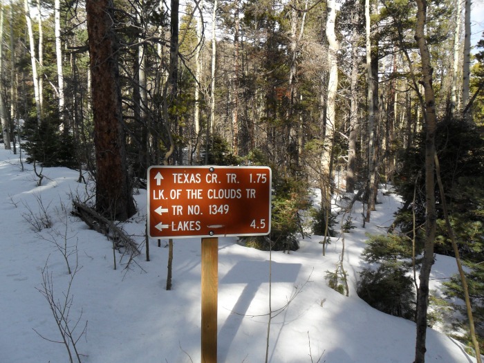 The old ski tracks which I wished had been wider for walking along in snowshoes  The trail crosses Short Creek  Merlin (splayed feet)  Follow arrow to the left and stay on trail 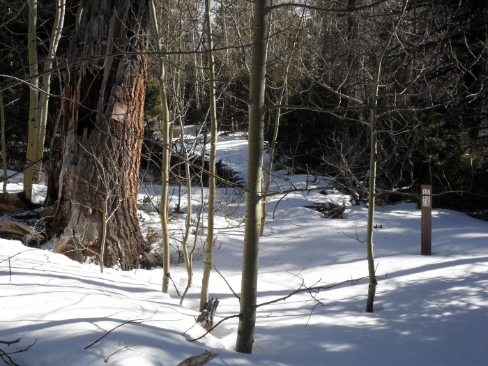 Alright the Texas Creek trailhead, take a left and now for the climbing. You see after 3 1/2 miles you haven't really gained any elevation. You go up and down some 9000 up to over 9500 feet and back down to about 9100 feet at this point. Really not much until you slog your way back out 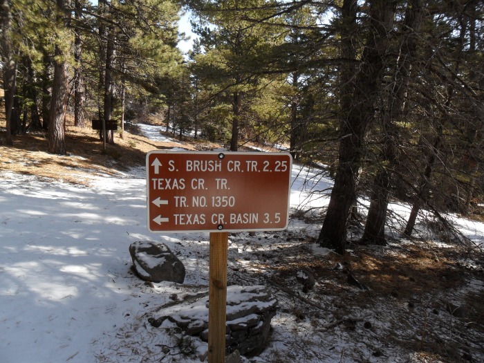 Texas Creek trail, not much snow for a while now  Starting up the ridge the trees are fairly thick, back on with the snowshoes 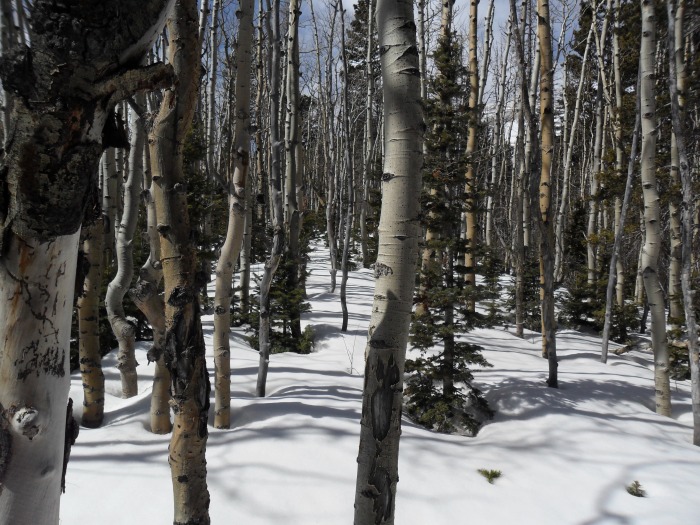 I slogged along through the snow for a while and after the first shoe broke I made my way over to the south facing slope along the ridge. I was able to work my way up and then later back down for a stretch where I did not need the shoes. I worked my way up to the point where I tried the booting through the knee deep snow and then decided if I was going to make it I needed to do some temporary repair. The repairs held up to treeline and back down about a third of the way back down to the Raibow Trail. The second shoe broke on the Rainbow Trail several miles from the finish The 1:00 o'clock summit was now beyond reach. I had phone service so I called and left my wife a message that the 1:00 pm Spot was going to be more like 3:00. This was at about 11,000 feet. I usually get nervous about late summits but I decided that the weather was going to hold and pushed on. As it worked out it was closer to 4:00 pm before I made it to the top Closer now to tree line a rock grotto  I have taken to getting pictures of what I see as the old men of the mountains. Trees that grew to maturity and lost the struggle, something stark and dramatic about them   Finally at tree line I stashed the snowshoes, unloaded a few items to reduce the weight of my pack. The weather was good, the wind only a breeze at the moment 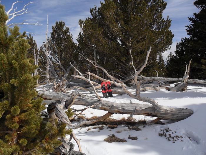 More trees  The ridge to Mount Marcy and Spread Eagle beyond I believe 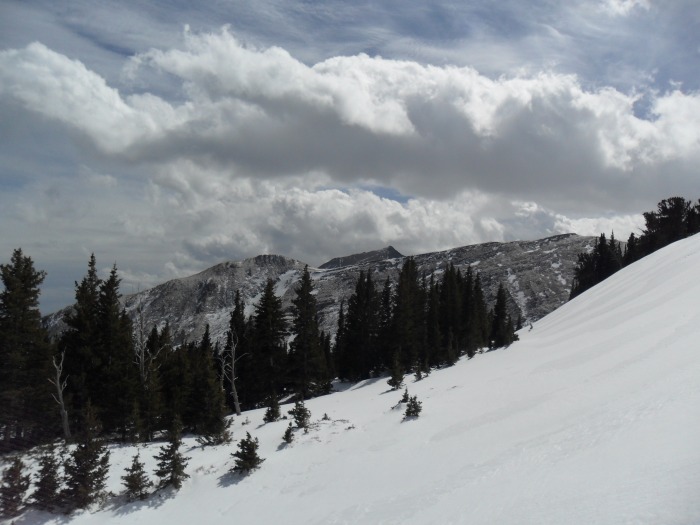 The first part of the ridge above tree line  Looking back at the stash  What you see is what you get. This is not quite the top but it is pretty much it. A steady 1400 or so feet, no breaks. 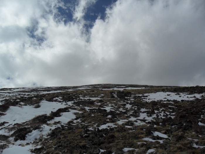 Closer  The day gets later and some grey clouds move in 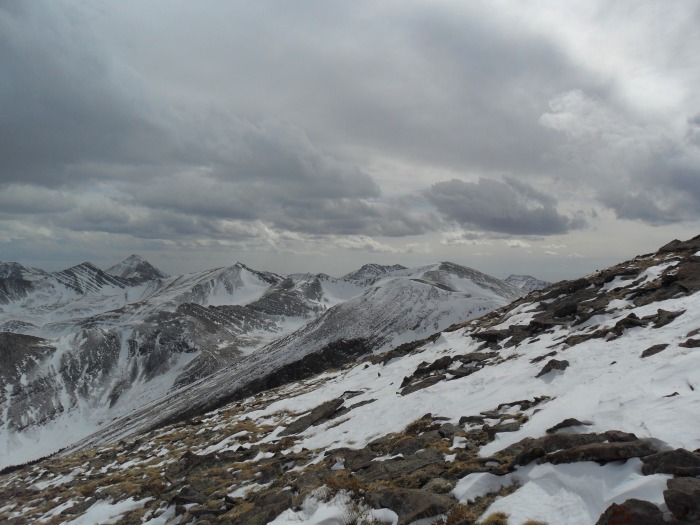 ta-da  Summit  DeAnza  South  Back to the snowshoes and it is all good here  Taking in the sky view before the slog back down through the trees  A final "old man" on the way down.  Snowshoes on, snowshoes off, etc., straps break, second shoe goes. Uphill again along the Rainbow Trail and the final descent to the car. Winter is over for me and happy springtime. Thumbnails for uploaded photos (click to open slideshow): ")
")
")
")
")
")
")
")
")
")
")
")
")
")
")
")
")
")
")
")
")
")
")
")
")
")
")
")
")
")
|
| Comments or Questions | ||||||
|---|---|---|---|---|---|---|
|
Caution: The information contained in this report may not be accurate and should not be the only resource used in preparation for your climb. Failure to have the necessary experience, physical conditioning, supplies or equipment can result in injury or death. 14ers.com and the author(s) of this report provide no warranties, either express or implied, that the information provided is accurate or reliable. By using the information provided, you agree to indemnify and hold harmless 14ers.com and the report author(s) with respect to any claims and demands against them, including any attorney fees and expenses. Please read the 14ers.com Safety and Disclaimer pages for more information.
Please respect private property: 14ers.com supports the rights of private landowners to determine how and by whom their land will be used. In Colorado, it is your responsibility to determine if land is private and to obtain the appropriate permission before entering the property.


