Download Agreement, Release, and Acknowledgement of Risk:
You (the person requesting this file download) fully understand mountain climbing ("Activity") involves risks and dangers of serious bodily injury, including permanent disability, paralysis, and death ("Risks") and you fully accept and assume all such risks and all responsibility for losses, costs, and damages you incur as a result of your participation in this Activity.
You acknowledge that information in the file you have chosen to download may not be accurate and may contain errors. You agree to assume all risks when using this information and agree to release and discharge 14ers.com, 14ers Inc. and the author(s) of such information (collectively, the "Released Parties").
You hereby discharge the Released Parties from all damages, actions, claims and liabilities of any nature, specifically including, but not limited to, damages, actions, claims and liabilities arising from or related to the negligence of the Released Parties. You further agree to indemnify, hold harmless and defend 14ers.com, 14ers Inc. and each of the other Released Parties from and against any loss, damage, liability and expense, including costs and attorney fees, incurred by 14ers.com, 14ers Inc. or any of the other Released Parties as a result of you using information provided on the 14ers.com or 14ers Inc. websites.
You have read this agreement, fully understand its terms and intend it to be a complete and unconditional release of all liability to the greatest extent allowed by law and agree that if any portion of this agreement is held to be invalid the balance, notwithstanding, shall continue in full force and effect.
By clicking "OK" you agree to these terms. If you DO NOT agree, click "Cancel"...
I realize that this mountain is around 6000 feet shorter than a 14er but I had so much fun out here I wanted to post about it. I suggest viewing this report with large files so you can see the details better.
Back in January during the freezy freeze weeks, I went out looking for good spring hikes and upon ,Derek, Monster5 and SuperPolok's advice I took my brother up to Crescent Peak to check it out.
My secondary goal was to see how realistic it is for me to carry my HD camera in my pack for 14ers. I used a 40 liter REI pack with 3 liters in the bladder, and all my gear to simulate a 14er hike. After loading it up it topped out at 24lbs. Not horrible but heavier than normal for me.
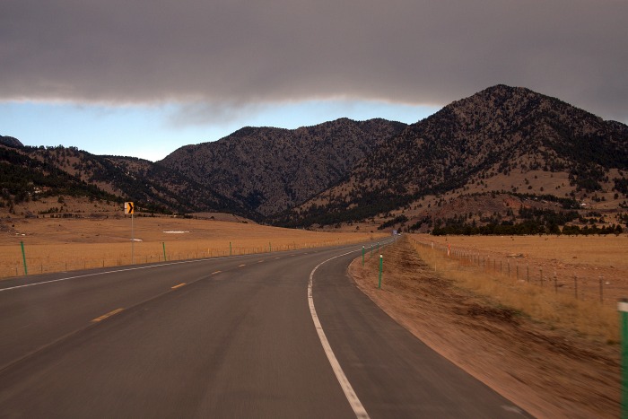
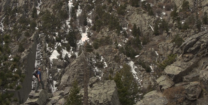
Coal Creek Peak on right, Crescent Peak is the twin bumps - Target right bump
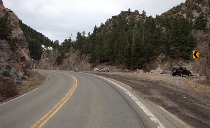
We parked at the turn off just past the strange gilded marble entryway to a mansion on a hill (currently un-built and most likely in foreclosure). The creek is low right now and there are plenty of rocks to hop across.
The turn off.
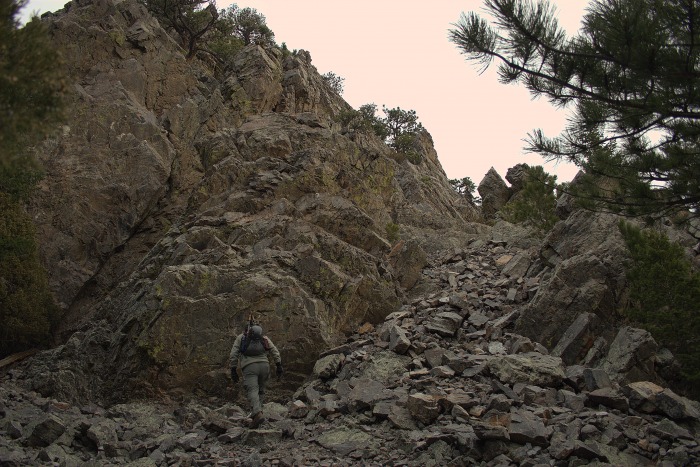
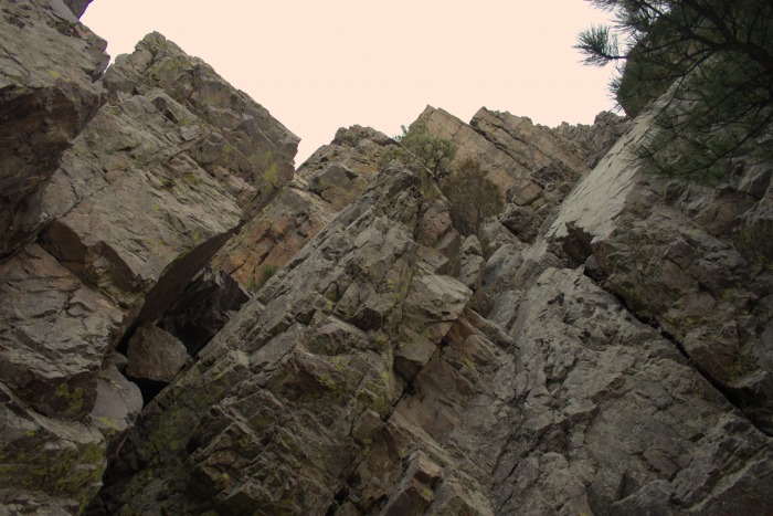
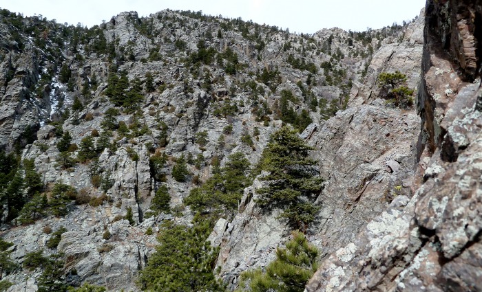
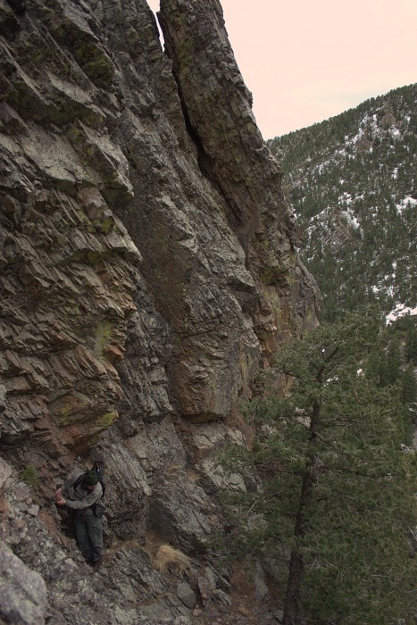
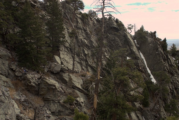
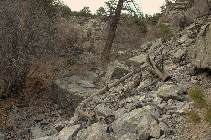
From this point forward, it's up to you. This place is a veritable playground of hiking and climbing. The following pictures are in no particular order, just some examples of our day. I was hoping to capture scale, rock style and condition, and potential for other climbers. One word of caution about the rock, it is marble and there are holds everywhere but we did notice places where it was loose and deceiving.
Also, I realize that these pics don't show us wearing helmets... in a few places we were irresponsible but for the majority of the day, we were never in any significant need of them.
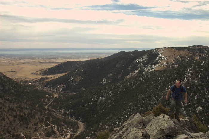
Right off the bat you are greeted with lots of up and lots of fun
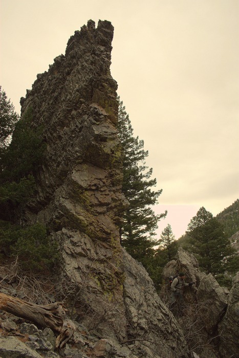
The rock - slabby glorious quartz filled marble...
My brother bottom right to give scale to a typical rib
Let's go... this way.
Come on up, the rock is fine!
Choose your own adventure climbing!
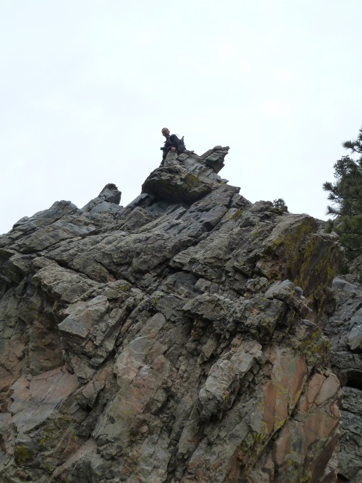
Eric standing on a mini ledge. Everything else is over two hundred yards across the valley. Need a better tele lens for dep
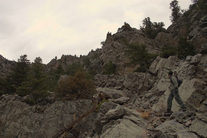
This place is a playground... stick to the gully or hug the rocks and you can stay class 2 or 2+, we wanted a full body workout so we stayed relatively low but in the class 3 rocks practicing traverses, up climbs, down climbs, etc... we kept the exposure to less than 40 or so feet at all times. Being still new enough to mountaineering, climbing, etc... I wasn't sure how to tell if we were doing class 4 or low 5 stuff but we always kept three points of contact and really just had a blast. It looks like there could be some short class 5 areas but I am no expert and wouldn't be able to tell it was protect-able or what.
Practice makes perfect. Not as much exposure as it seems.
We did NOT take this face... up and over the ledge and then to the left, much easier.
Eric (left side middle) negotiating a down climb.
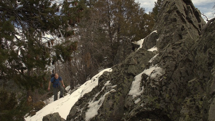
Little bit of snow but not bad.
Almost there.
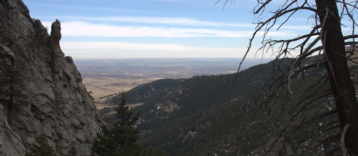
A reminder that we're not so far from home.
All said and done, we did 2200 feet of elevation gain in .9 miles (steeeeeeep) but since we were taking the scenic route and practicing it took about four hours. At the top we were treated with some really great views.
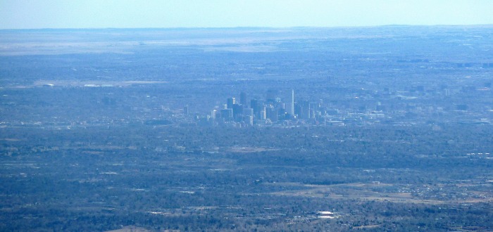
I grabbed a quick time lapse of Denver too since I brought up the camera but wasn't too impressed with the hazy smog. The clouds and time of day wasn't ideal either so from that distance nothing in motion turned out so I scrapped it.
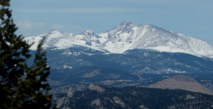
Longs... someday...
Green Mountain, Table Mountain, Ralston Buttes back side and Denver being hugged by the pines.
Denver...
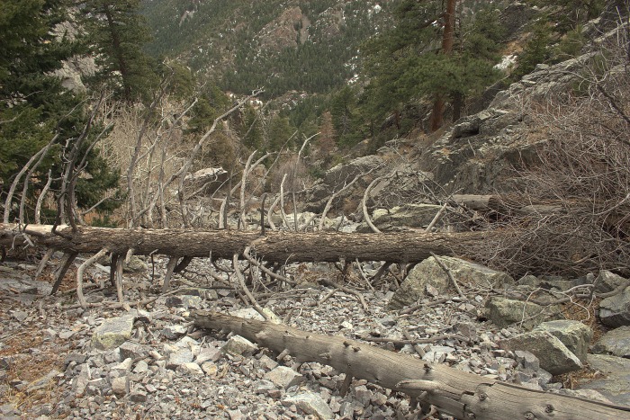
By 1:30, after a glorious turkey and provolone sammy, I realized I had to be at work at 5 to wait tables so we headed back down. Not wanting to be late we headed straight for the nearest gully and trucked it. If it is at all avoidable, avoid it. Take the time to down climb what you did because the particular gully we were in was nothing but loose scree and slick grass. Every step was either like surfing on rock (huge potential for a slide) or like trying to walk across a million playground teeter totters. EVERY step was a total guess. After a while the rock relented to deadfall and bushwhack, prickly plants everywhere, and just plain crap.
Typical scenery in the gully of death on the way down...
Not fun...nope.
Two hours later, we were back at the jeep in time for me to run home, through the shower, into the ol' Rib City uniform and off to work. I'm actually kinda glad I wait tables because I average a few miles of walking a night so my legs don't get super sore after a hike like this. Thanks for reading!
Thumbnails for uploaded photos (click to open slideshow):
Looks just like so many of my excursions up there! The up is great, the down is loose and rough. That quartzite rock is slicker than snot when wet but man is it great scrambling rock. I'm glad you got out and experienced this huge scramblers paradise close to Denver.
Thanks for posting. I've had 4 opportunities to explore this area, but not once have I made the summit. There are just too many pinnacles to check out. If you stick to the ridgeline, you are required to breach class 3. There are many crags that offer class 5 (I know, I've gotten myself stuck on them), but I'm not sure if they are protectable. I wonder, did you stick to the gully and explore the climbing possibilities, or did you stay closer to the ridgeline? There's some crazy class 3+ exposer in places on the ridge, however there are usually 5 other routes to be found if it gets to you. Also, did you notice that it looks like they are about to develop the acre or so just the other side of the creek crossing? I noticed some chainsaw work and a lot of tagged trees. OH, and there was a squatter there last time. I came a little too close to his/her tent, washpan, and clothesline for comfort.
We went up the left side of the ridge that starts at the parking area and just stayed mostly on the left side of the gully the entire climb up. We were all over that left side exploring though. There are routes everywhere too! We did almost 'cliff out' in one area (just our comfort level really) and had to loose 60 or so feet just to keep going up.
We did notice near the bottom that someone had used rocks to build in a little shelter but stayed away from it. Didn't notice the chainsaw work probably because if the decaying dead deer right before the stream crossing. :lol:
I did this one in May of 2009, going up the standard route (which just gets steeper and steeper as you go). My friend was sufficiently freaked out, so we descended into the crescent and ended up behind some private property. I'll always remember it, though!
Caution: The information contained in this report may not be accurate and should not be the only resource used in preparation for your climb. Failure to have the necessary experience, physical conditioning, supplies or equipment can result in injury or death. 14ers.com and the author(s) of this report provide no warranties, either express or implied, that the information provided is accurate or reliable. By using the information provided, you agree to indemnify and hold harmless 14ers.com and the report author(s) with respect to any claims and demands against them, including any attorney fees and expenses. Please read the 14ers.com Safety and Disclaimer pages for more information.
Please respect private property: 14ers.com supports the rights of private landowners to determine how and by whom their land will be used. In Colorado, it is your responsibility to determine if land is private and to obtain the appropriate permission before entering the property.