Download Agreement, Release, and Acknowledgement of Risk:
You (the person requesting this file download) fully understand mountain climbing ("Activity") involves risks and dangers of serious bodily injury, including permanent disability, paralysis, and death ("Risks") and you fully accept and assume all such risks and all responsibility for losses, costs, and damages you incur as a result of your participation in this Activity.
You acknowledge that information in the file you have chosen to download may not be accurate and may contain errors. You agree to assume all risks when using this information and agree to release and discharge 14ers.com, 14ers Inc. and the author(s) of such information (collectively, the "Released Parties").
You hereby discharge the Released Parties from all damages, actions, claims and liabilities of any nature, specifically including, but not limited to, damages, actions, claims and liabilities arising from or related to the negligence of the Released Parties. You further agree to indemnify, hold harmless and defend 14ers.com, 14ers Inc. and each of the other Released Parties from and against any loss, damage, liability and expense, including costs and attorney fees, incurred by 14ers.com, 14ers Inc. or any of the other Released Parties as a result of you using information provided on the 14ers.com or 14ers Inc. websites.
You have read this agreement, fully understand its terms and intend it to be a complete and unconditional release of all liability to the greatest extent allowed by law and agree that if any portion of this agreement is held to be invalid the balance, notwithstanding, shall continue in full force and effect.
By clicking "OK" you agree to these terms. If you DO NOT agree, click "Cancel"...
Date of Climb : 2/12/11
Peaks Climbed :
1) Mt Columbia - 14073'
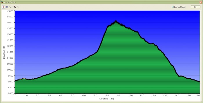
Distance : 15.5 miles
Elev Gain : 5074'
Time : ~14 hrs, 4:30am - 6:15pm, Ascent 9hrs, Descent 5 hrs
Ascent Party : John B. solo
I was planning to make this a 2-day trip, but had the opportunity to turn this into a day trip because I was spending the weekend at the Mt Princeton Hot Springs Resort (terrific place). Weather conditions were fantastic. I also had some good luck to be behind a duo camping and heading up to ski Mt Harvard. I met up with Craig & Zach after sunrise and helped break trail up to my Columbia turn-off. Ascending the std W Slopes route and descending the SE Ridge was a great combo loop, and worked best given the deep snow conditions on the ridge below tree line.
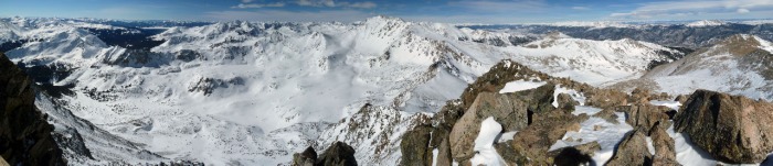
Columbia's SE & E Ridges
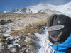
6:12a - Parked alongside the road near the N Cottonwood Winter TH ~8960' at 4:30a and walked via headlamp 3.3 mi. to the Summer TH 9860'. Crossed the 1st bridge 9900'.
7:10a - Crossed the 2nd N Cottonwood Creek bridge, 10340'
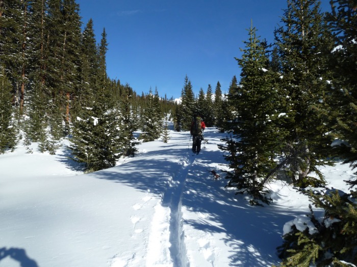
8:51a - Craig & Zach breaking trail. We are at 11000' and 0.1 mi. E of the std trail in a more open meadow area. Beautiful snowshoe, but slow going. The std trail was not much help anyways since no fresh tracks.
9:58a - We parted ways at my Columbia W Slopes turn-off at 11540'. The slopes were what I expected - wind blown SAFE.
10:12a - I kept my snowshoes on for as much snow travel as possible. The steep scree slope was loose and much harder to move on than I imagined.
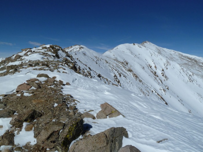
12:35p - Reached the W Slopes - SE Ridge junction point at 13660'. What a beautiful sight with the summit only 0.7 mi. away. I wasn't feeling too well at this point having little to eat and only drinking 1 Qt. I decided to sit, rest, and eat my lunch. Then I decided I could leave my snowshoes and pack here, taking only 1 Qt and my SPOT device. The ridge to the summit was either barren or hard-packed.
12:50p - View of Columbia & Harvard at 13740'.
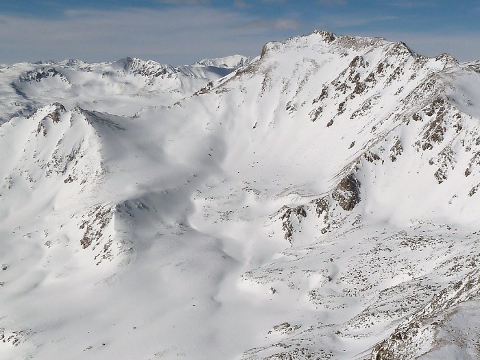
1:15p - finally a view of the true summit passing by two false summits. The wind gusted once in awhile along the summit ridge, blowing my hood off my head even though my goggles were wrapped around it.
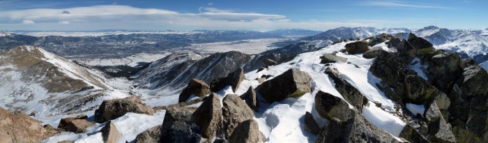
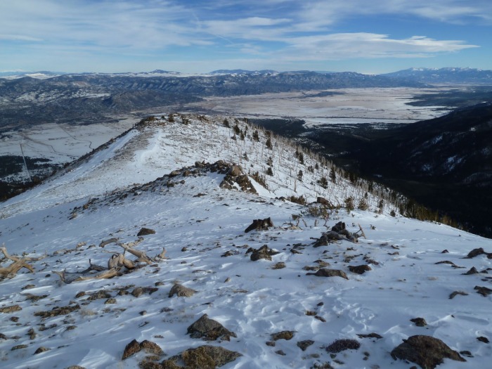
1:20p - View from Columbia's summit: E & SE Ridges, Buena Vista, Mt Princeton, and Mt Yale.
1:24p - ready to descend the SE Ridge - reached my pack at 13660' by 1:47p.
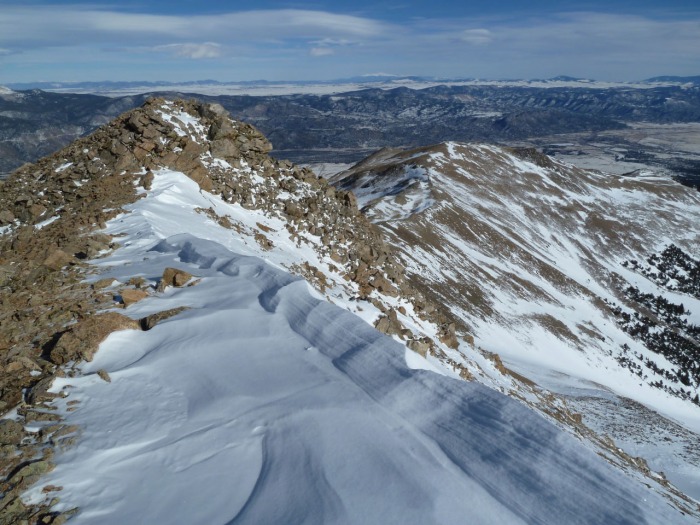
2:28p - view descending SE Ridge at 13400'
2:49p - at 13200' headed left around this bump
3:26p - view from 12340', a nice treat to see an Elk herd (they heard/saw me coming)
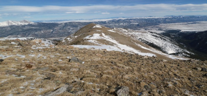
3:44p - looking back at complicated view of SE Ridge from 12160'
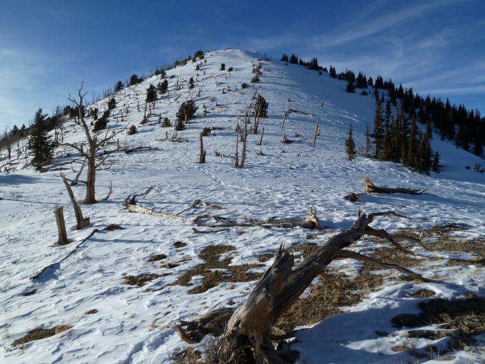
3:45p - approaching tree line, view from 12120'
3:52p - looking back from 12020'
4:03p - heading down with snowshoes on now, view from 11940'
4:11p - view back from 11660'
4:16p - at 11620'
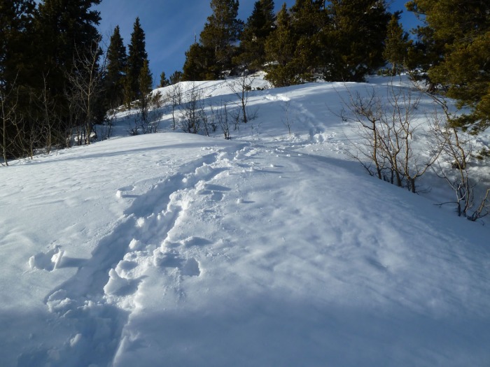
4:28p - looking up from 11320'. The snow began to get deeper at this pt. My snowshoe came off once due to the depth and weight of snow holding it back.
4:58p - every once in awhile you see one of these, at 10320'. Dropped 1K in 30 min (glad I was not ascending this stuff).
5:31p - back on the road by sunset at 9440' near the CO Trail TH. Back to the car before needing headlamp! Exhausted, but what a great climb for February! Craig & Zach's Subaru was still here.
Topo Track
Elevation Profile
GE view: pink - GPS route, red - GPS track
Thumbnails for uploaded photos (click to open slideshow):
Nice work knocking that out... long but rewarding day! Thanks for the great read.
Caution: The information contained in this report may not be accurate and should not be the only resource used in preparation for your climb. Failure to have the necessary experience, physical conditioning, supplies or equipment can result in injury or death. 14ers.com and the author(s) of this report provide no warranties, either express or implied, that the information provided is accurate or reliable. By using the information provided, you agree to indemnify and hold harmless 14ers.com and the report author(s) with respect to any claims and demands against them, including any attorney fees and expenses. Please read the 14ers.com Safety and Disclaimer pages for more information.
Please respect private property: 14ers.com supports the rights of private landowners to determine how and by whom their land will be used. In Colorado, it is your responsibility to determine if land is private and to obtain the appropriate permission before entering the property.


")
")
")
")
")
")
")
")
")
")
")
")
")
")
")
")
")
")
")
")
")
")
")
")
")
")
")
")