Download Agreement, Release, and Acknowledgement of Risk:
You (the person requesting this file download) fully understand mountain climbing ("Activity") involves risks and dangers of serious bodily injury, including permanent disability, paralysis, and death ("Risks") and you fully accept and assume all such risks and all responsibility for losses, costs, and damages you incur as a result of your participation in this Activity.
You acknowledge that information in the file you have chosen to download may not be accurate and may contain errors. You agree to assume all risks when using this information and agree to release and discharge 14ers.com, 14ers Inc. and the author(s) of such information (collectively, the "Released Parties").
You hereby discharge the Released Parties from all damages, actions, claims and liabilities of any nature, specifically including, but not limited to, damages, actions, claims and liabilities arising from or related to the negligence of the Released Parties. You further agree to indemnify, hold harmless and defend 14ers.com, 14ers Inc. and each of the other Released Parties from and against any loss, damage, liability and expense, including costs and attorney fees, incurred by 14ers.com, 14ers Inc. or any of the other Released Parties as a result of you using information provided on the 14ers.com or 14ers Inc. websites.
You have read this agreement, fully understand its terms and intend it to be a complete and unconditional release of all liability to the greatest extent allowed by law and agree that if any portion of this agreement is held to be invalid the balance, notwithstanding, shall continue in full force and effect.
By clicking "OK" you agree to these terms. If you DO NOT agree, click "Cancel"...
I created this trip report to help to assist people who are seeking information on current or at least fairly recent trail conditions. I will (hopefully) be hiking this route at least once a week this winter. I will update the date and pictures after each hike.
On this trip, I wore gore-tex lined trail runner shoes without spikes underfoot. Lots of slush and wet snow on the trail due to the warmer temperatures. Packed ice and hard snow about 1 inch thick on the section above the false summit. You can avoid slips with careful foot placement. Most snow covered steps are "domed", meaning you can avoid slipping back down hill if you place your foot close to the next step where the snow, if sloped, is usually sloped up hill. Not sure if my explanation makes sense, but you'll understand when you get there.
I didn't wear shoe spikes at all this trip and only experienced minor slipping on the Barr trail on a single random, steep, curved shady spot. I went during the warmest part of the day, (+50° F.), when most of the snow was soft, or slushy and a firm foot plant put the traction of my two-week new trail runners to good use. I like to think that I have great balance as well which may also explain why I haven't landed on my ass yet. Some parts of the trail are water covered, (puddles or trickling), with some mud. You can usually jump over or skirt this on the up-hill edge of the trail.
If you go earlier in the morning, or after the sun has gone behind the mountain, you will surely find different snow/slush conditions.
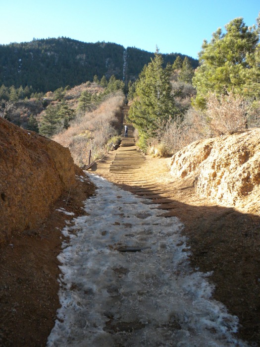
I forgot to snap a picture of the bottom. This pic is from just below the Barr Trailhead cut-in.
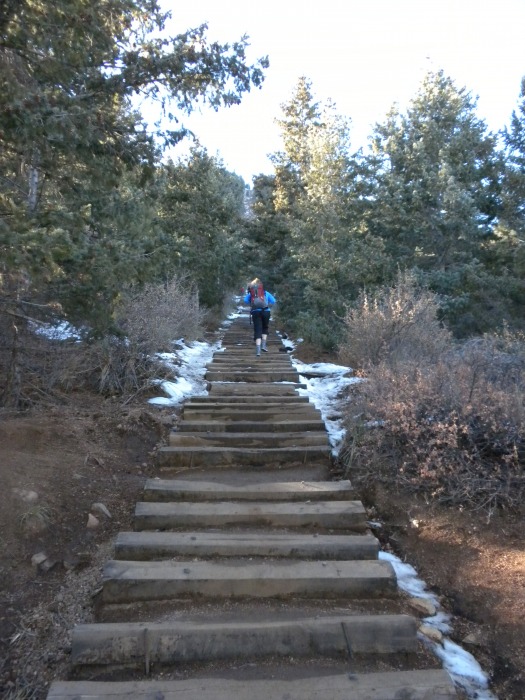
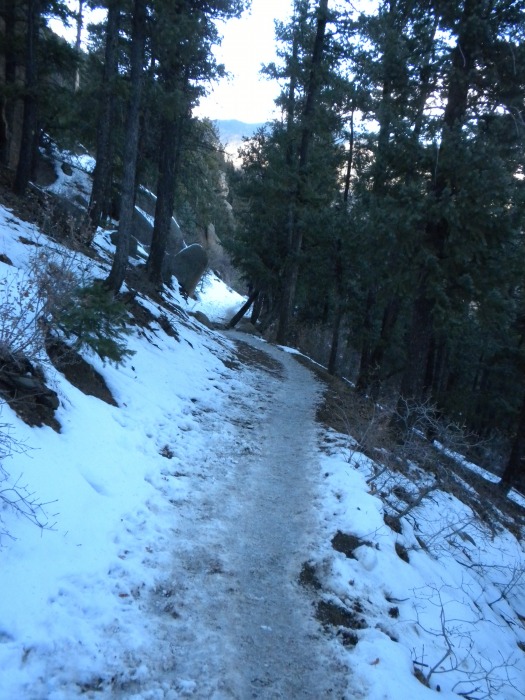
Headed into the trees.
Nearing the bottom of the wall, looking back.
Headed up the wall.
Over the false summit, looking up the final stretch.
At the top, looking back down.
Dry-ish Barr trail initially.
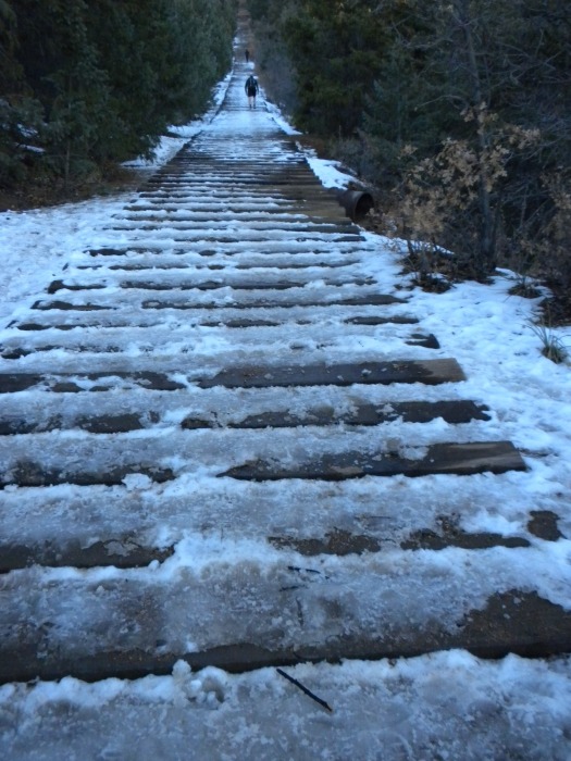
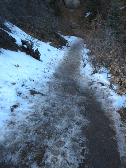
Slushy trail.
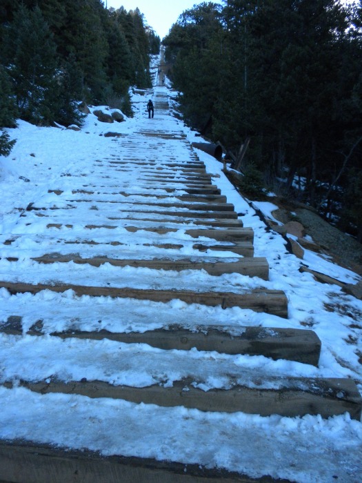
Lots of slush and soft snow.
I didn't take any more pics. I was kinda in a hurry this time around, so fewer pics all together. The trail was mostly just more of the same as seen in the last 3 pics. I will leave my previous trip report up, since it has far more pictures for reference. Just know that about 1/2 the snow covered trail sections were slushy.
Thumbnails for uploaded photos (click to open slideshow):
the warm nights have really trashed the snow up on gold camp and the usual riding places. Today was actually getting pretty rideable. Thanks for the post.
Took my Texas native friend on the incline on the 8th of January... he did surprisingly well for a flatlander (got up there just a bit over 1 hr)... anyway, that was a cold cold cold day, but I still got soaked a drowned in my own sweat... and we had at least a dozen other crazies also hiking in the whiteout... my friend then tried impress the waitress at The Keg in Manitou Springs, which BTW looked like a ghost town (who has been hiking the incline since a school girl) about how we just did the incline... good burger and Philisteak there, but no FRIES! and good beer.
Caution: The information contained in this report may not be accurate and should not be the only resource used in preparation for your climb. Failure to have the necessary experience, physical conditioning, supplies or equipment can result in injury or death. 14ers.com and the author(s) of this report provide no warranties, either express or implied, that the information provided is accurate or reliable. By using the information provided, you agree to indemnify and hold harmless 14ers.com and the report author(s) with respect to any claims and demands against them, including any attorney fees and expenses. Please read the 14ers.com Safety and Disclaimer pages for more information.
Please respect private property: 14ers.com supports the rights of private landowners to determine how and by whom their land will be used. In Colorado, it is your responsibility to determine if land is private and to obtain the appropriate permission before entering the property.