Download Agreement, Release, and Acknowledgement of Risk:
You (the person requesting this file download) fully understand mountain climbing ("Activity") involves risks and dangers of serious bodily injury, including permanent disability, paralysis, and death ("Risks") and you fully accept and assume all such risks and all responsibility for losses, costs, and damages you incur as a result of your participation in this Activity.
You acknowledge that information in the file you have chosen to download may not be accurate and may contain errors. You agree to assume all risks when using this information and agree to release and discharge 14ers.com, 14ers Inc. and the author(s) of such information (collectively, the "Released Parties").
You hereby discharge the Released Parties from all damages, actions, claims and liabilities of any nature, specifically including, but not limited to, damages, actions, claims and liabilities arising from or related to the negligence of the Released Parties. You further agree to indemnify, hold harmless and defend 14ers.com, 14ers Inc. and each of the other Released Parties from and against any loss, damage, liability and expense, including costs and attorney fees, incurred by 14ers.com, 14ers Inc. or any of the other Released Parties as a result of you using information provided on the 14ers.com or 14ers Inc. websites.
You have read this agreement, fully understand its terms and intend it to be a complete and unconditional release of all liability to the greatest extent allowed by law and agree that if any portion of this agreement is held to be invalid the balance, notwithstanding, shall continue in full force and effect.
By clicking "OK" you agree to these terms. If you DO NOT agree, click "Cancel"...
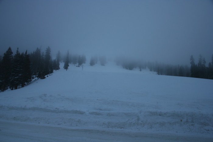
Was originally planning on hiking Flora from Berthoud Pass, but when I arrived the pass and ridge were inside a cloud. Waited for a little bit to see if it would burn off, but as it wasn't getting any better figured I better find somewhere else to go. view from Berthoud pass
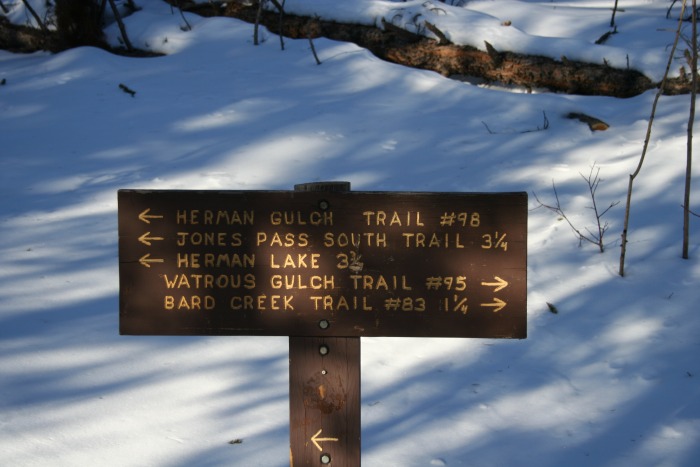
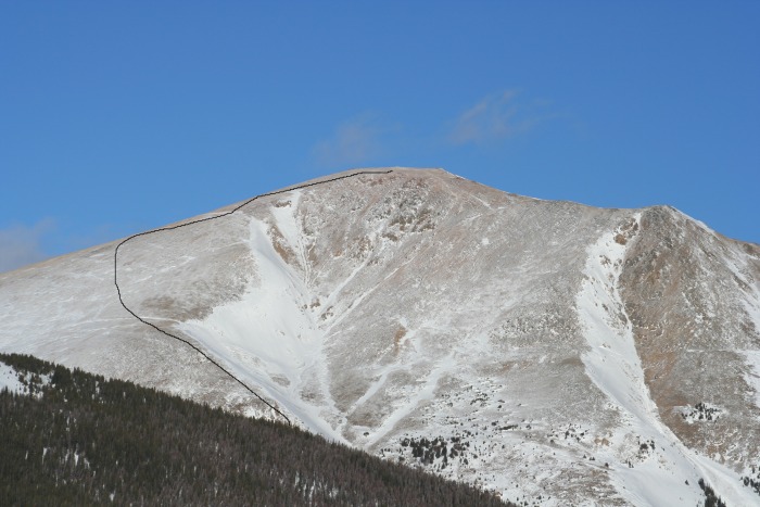
Drove back down to 70 then up to the Herman Gulch Trail head (Exit 218 ). Decided I'd hit Bard peak via Parnassus.
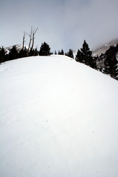
Basically hike up a little ways, make a right at the junction and follow it up into Watrous Gulch. turn right here
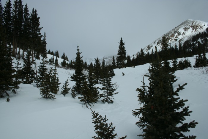
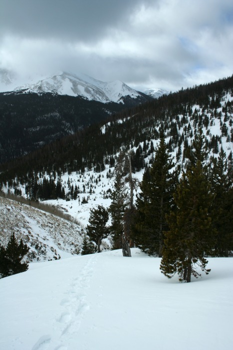
The trail was well packed into the gulch. After that
it got real as the tracks ended and there was a lot of gain. I headed up the ridge to the left of a gully. There wasn't a ton of snow but I figured the gulley was not the place to be none the less. I got to test out my MSR Lightning's and they did very well, even on the very steep parts. Snow was maybe knee deep to only a couple inches up the ridge.
up tthe gulch pretty up the ridge (sorry, no picture of gully) looking down the ridge
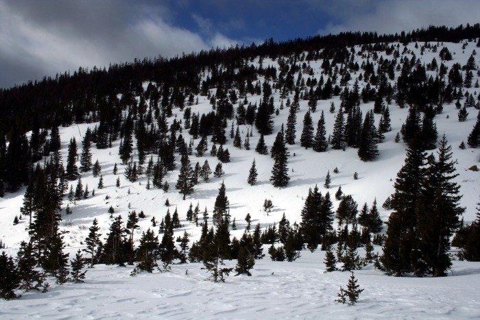
It was a beautiful day out, and up through the snow I was comfortable in only a long sleeve shirt (well had pants on too ). Got to a point where there was some wind and no snow so put on a wind shell, packed the shoes and climbed the renaming 1000 or so feet.
woods mtn? Parnassus near the top
Hiking up I intermittently heard loud booms echoing through the valley, probably explosions setting off prrscribed avalanches to clear dangerous areas, kinda creepy though. Little later saw two flight for life helicopters cruising the area.
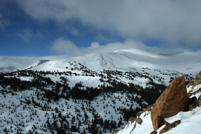
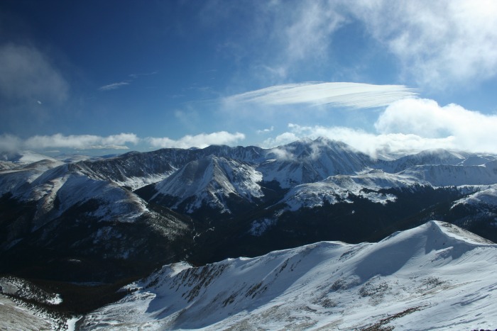
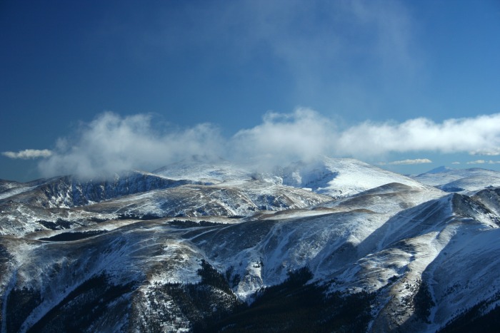
Views up top were incredible, pictures do better justice then words could.
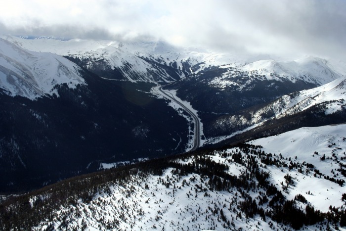
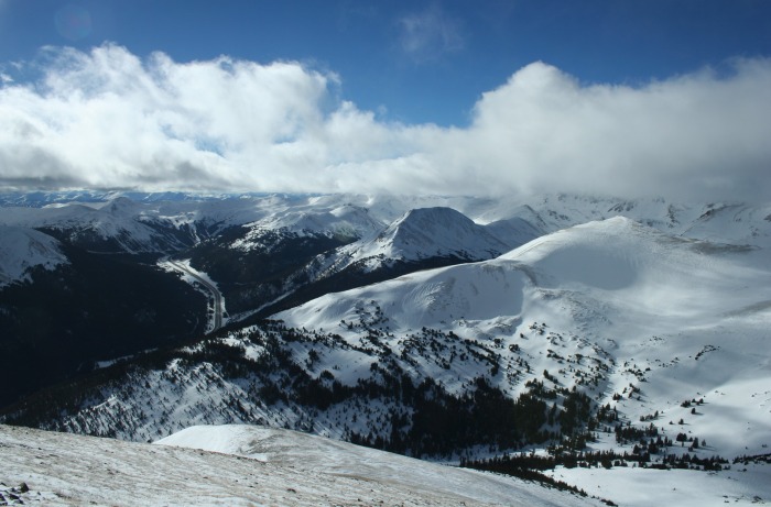
I70 Bard Peak a mile a way Grays and Torreys (double point on right) Evans, Sawtooth and Beirstadt so beautiful
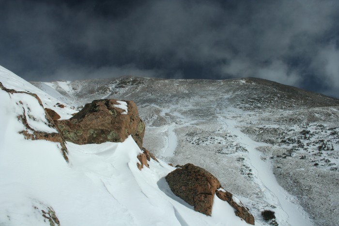
Bard peak was on the other side of a saddle a mile away, and I very seriously thought about heading over. But i fought the summit fever because A: it was already 2 thanks to a late start, and B: Bard would be adding at least 2 miles round trip with return over Parnassus or down toward 70 through uncertain terrain.
Got back to the car about 3:40, think I made the right call on Bard (probably wouldn't have made it back till 6), will just need to go back for it!
Since the Loveland Pass exit was quite visible from the top decided to drive up there to see my climb. Not too shabby. Parnassus from Loveland Pass Exit upper part of route roughly
My GPS Tracks on Google Maps (made from a .GPX file upload):
Thanks for sharing this. We did Flora today and on the way back were thinking of other peaks to do in the area. Looks like a great option.
Caution: The information contained in this report may not be accurate and should not be the only resource used in preparation for your climb. Failure to have the necessary experience, physical conditioning, supplies or equipment can result in injury or death. 14ers.com and the author(s) of this report provide no warranties, either express or implied, that the information provided is accurate or reliable. By using the information provided, you agree to indemnify and hold harmless 14ers.com and the report author(s) with respect to any claims and demands against them, including any attorney fees and expenses. Please read the 14ers.com Safety and Disclaimer pages for more information.
Please respect private property: 14ers.com supports the rights of private landowners to determine how and by whom their land will be used. In Colorado, it is your responsibility to determine if land is private and to obtain the appropriate permission before entering the property.