Download Agreement, Release, and Acknowledgement of Risk:
You (the person requesting this file download) fully understand mountain climbing ("Activity") involves risks and dangers of serious bodily injury, including permanent disability, paralysis, and death ("Risks") and you fully accept and assume all such risks and all responsibility for losses, costs, and damages you incur as a result of your participation in this Activity.
You acknowledge that information in the file you have chosen to download may not be accurate and may contain errors. You agree to assume all risks when using this information and agree to release and discharge 14ers.com, 14ers Inc. and the author(s) of such information (collectively, the "Released Parties").
You hereby discharge the Released Parties from all damages, actions, claims and liabilities of any nature, specifically including, but not limited to, damages, actions, claims and liabilities arising from or related to the negligence of the Released Parties. You further agree to indemnify, hold harmless and defend 14ers.com, 14ers Inc. and each of the other Released Parties from and against any loss, damage, liability and expense, including costs and attorney fees, incurred by 14ers.com, 14ers Inc. or any of the other Released Parties as a result of you using information provided on the 14ers.com or 14ers Inc. websites.
You have read this agreement, fully understand its terms and intend it to be a complete and unconditional release of all liability to the greatest extent allowed by law and agree that if any portion of this agreement is held to be invalid the balance, notwithstanding, shall continue in full force and effect.
By clicking "OK" you agree to these terms. If you DO NOT agree, click "Cancel"...
Been meaning to put this up for a while now, a really neat hike in a beautiful area.
True its not a Centennial, but it is the most prominent peak near the Great Sand Dunes.
Makes a good long day hike for the times of year when Medano Pass is open (given you have a good offroad vehicle (I would never take a Subaru/ CRV etc type vehicle up this road, but it probably could be done). Its about 4600' of gain if you climb both Herard and Medano, subtract 600 feet for Herard only.
Drove to the wet mountains from Denver I-25 to St Hwy 115 to St Hwy Co 67 to St Hwy 96 and camped for the night.
Got up very early and headed down to Medano pass
Was a little after sunrise as I started up. There were a few other vehicles at the lot, mostly hunters.
After walking a bit through the Aspens on a great trail (was too late for the leaves but this trail would be amazing late September/Early October).
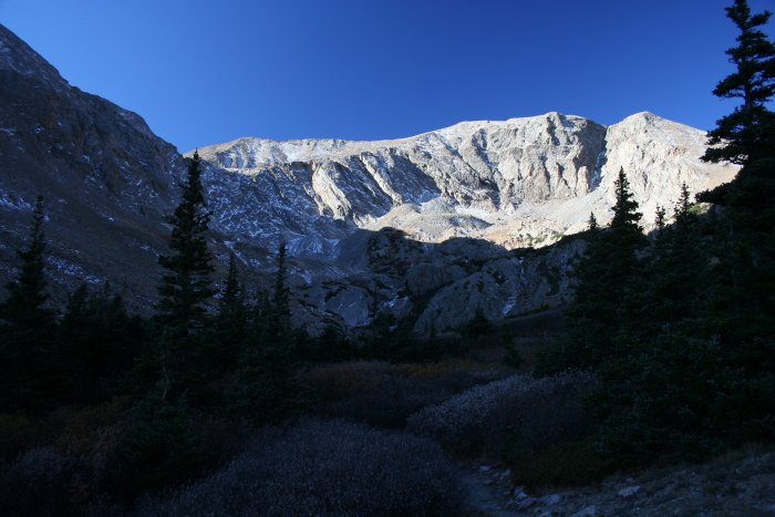
The first view of the Peak was no disappointment.
After passing a small lake you head up to the right toward the Herard/Medano saddle.
A few on the way up.
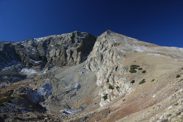
Very straight forward from the saddle.
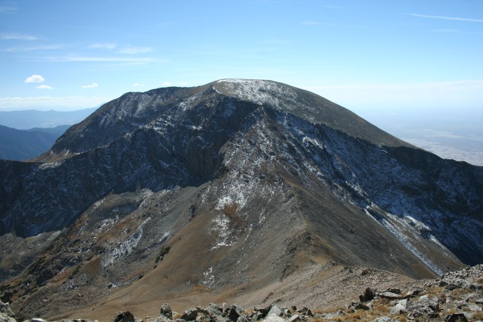
Here's looking back at Medano.
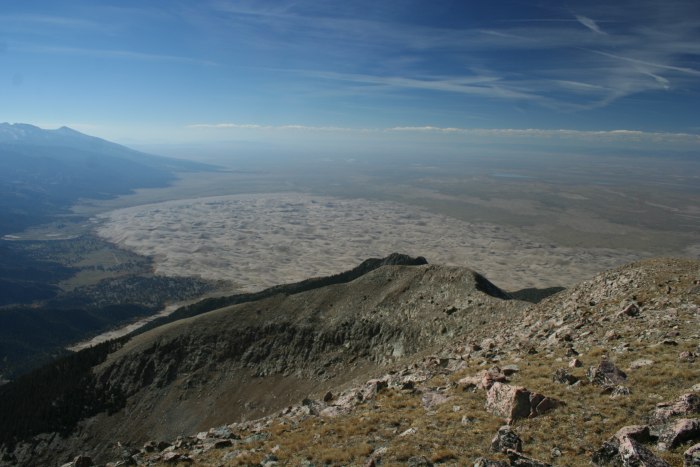
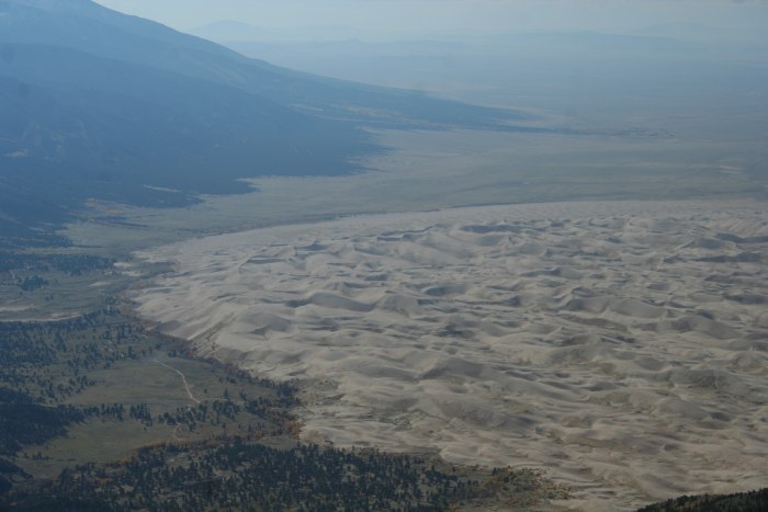
First view of the Dunes
As an FYI, you can't see the Dunes from the actual top. I met a hunter on the top who did not know that we were even so close to the dunes. Walk a few hundred feet west from the summit though and the view really opens up.
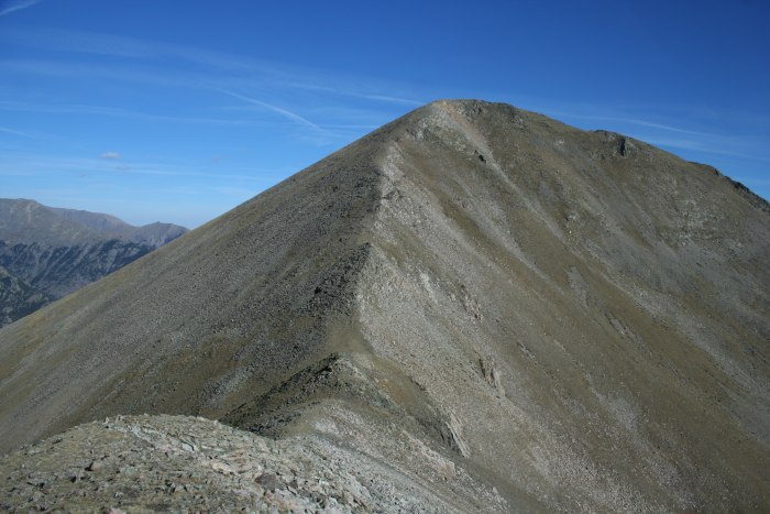
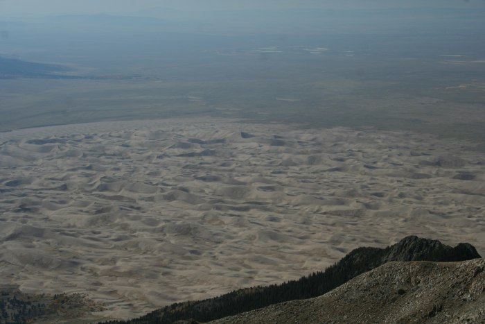
I had plenty of time so decided to get "Medano" as well. You loose the view of the Dunes, and the only really new view you get is more of the Wet Valley. Not terrible but I wouldn't climb this one again.
Herard from Medano
You get a decent view from the Crestones as well, the following are with a 300mm zoom
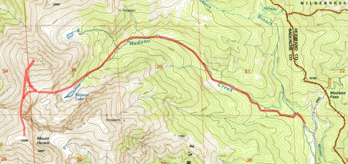
Here's a rough sketch of my route.
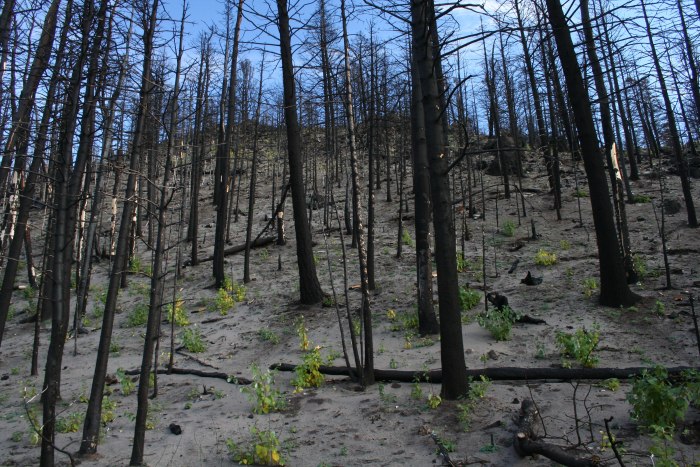
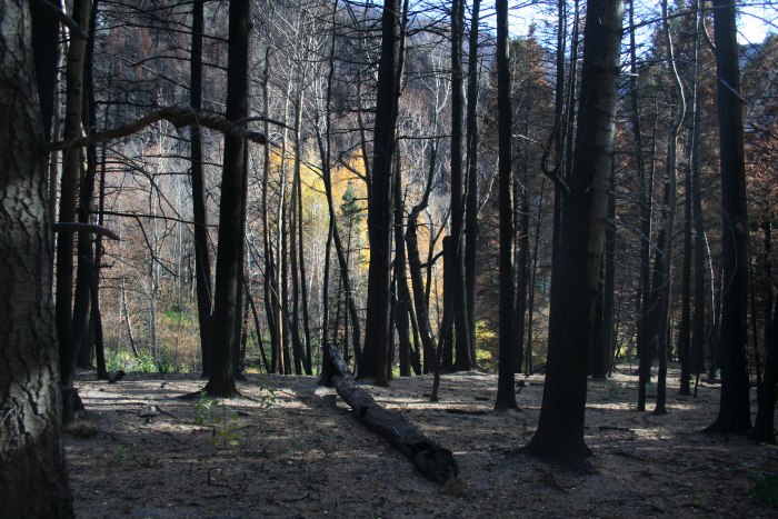
And finally some parting shots from the West side of the pass where there was a wildfire earlier this year.
Thumbnails for uploaded photos (click to open slideshow):
That's a beautiful area, the Great Sand Dunes... and somewhere along that ridge is the highpoint of the National Park, ”Herard Ridge.” I accidently ended up there a few weeks ago, and it was really a spectacular surprise! Still have to go back, for the highpoint and a ”ranked” dune, but will save that for a bad winter weather day, most likely. May actually do the peak, too, after reading your report :-) Thanks for posting!
I love the area around the sand dunes. I've been meaning to get back there to see what the area looks like around the Medano Pass Rd, given the extent of the fire that burned there this summer.
I actually camped off of the road on the last night before it burned, and the fire cut my trip a bit short. When we drove in we could see the fire burning one drainage away from the road. A wildland fire crew was driving in at the same time, and assured us that it was safe to camp up there, and that the fire was only a small fire (I seem to recall 3 or 13 acres at that time).
The next morning the smoke was blowing into our campsite. We packed up and were leaving when the fire crews closed the road. I heard that the area where we camped (at one of the NPS campsites) later burned, but I haven't been back to see the results of the fire as of yet.
Anyway, I really like your pictures of the dunes from above!
Caution: The information contained in this report may not be accurate and should not be the only resource used in preparation for your climb. Failure to have the necessary experience, physical conditioning, supplies or equipment can result in injury or death. 14ers.com and the author(s) of this report provide no warranties, either express or implied, that the information provided is accurate or reliable. By using the information provided, you agree to indemnify and hold harmless 14ers.com and the report author(s) with respect to any claims and demands against them, including any attorney fees and expenses. Please read the 14ers.com Safety and Disclaimer pages for more information.
Please respect private property: 14ers.com supports the rights of private landowners to determine how and by whom their land will be used. In Colorado, it is your responsibility to determine if land is private and to obtain the appropriate permission before entering the property.


")


