Download Agreement, Release, and Acknowledgement of Risk:
You (the person requesting this file download) fully understand mountain climbing ("Activity") involves risks and dangers of serious bodily injury, including permanent disability, paralysis, and death ("Risks") and you fully accept and assume all such risks and all responsibility for losses, costs, and damages you incur as a result of your participation in this Activity.
You acknowledge that information in the file you have chosen to download may not be accurate and may contain errors. You agree to assume all risks when using this information and agree to release and discharge 14ers.com, 14ers Inc. and the author(s) of such information (collectively, the "Released Parties").
You hereby discharge the Released Parties from all damages, actions, claims and liabilities of any nature, specifically including, but not limited to, damages, actions, claims and liabilities arising from or related to the negligence of the Released Parties. You further agree to indemnify, hold harmless and defend 14ers.com, 14ers Inc. and each of the other Released Parties from and against any loss, damage, liability and expense, including costs and attorney fees, incurred by 14ers.com, 14ers Inc. or any of the other Released Parties as a result of you using information provided on the 14ers.com or 14ers Inc. websites.
You have read this agreement, fully understand its terms and intend it to be a complete and unconditional release of all liability to the greatest extent allowed by law and agree that if any portion of this agreement is held to be invalid the balance, notwithstanding, shall continue in full force and effect.
By clicking "OK" you agree to these terms. If you DO NOT agree, click "Cancel"...
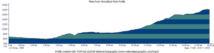
I've always wanted to leave my house under human power and climb Pikes. It only took 6 years but I managed to squeeze it in on the 17th of Oct. The weather was looking great so at 5:00am I hopped on my bike and rode downhill to the Golden Staircase trailhead south of the Chrystola Bar and Grill.
Locking my bike I headed up the trail by headlamp. A little bushwacking...
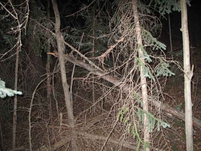
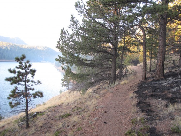
The route follows portions or all of 5 different trails starting with the Golden Staircase. From there you have to orienteer down a valley and back up to the Mt Dewey Trail. The undergrowth is a bit thick on the north facing hillsides. You get nice views of Colorado Springs and this vacation cottage nestled above Woodland Park. Yeesh!
Some cheap housing
Kinnkinnict Trail Catamount Reservoir
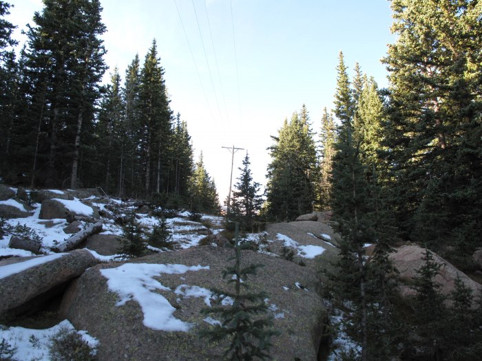
Powerline to Ski Hill
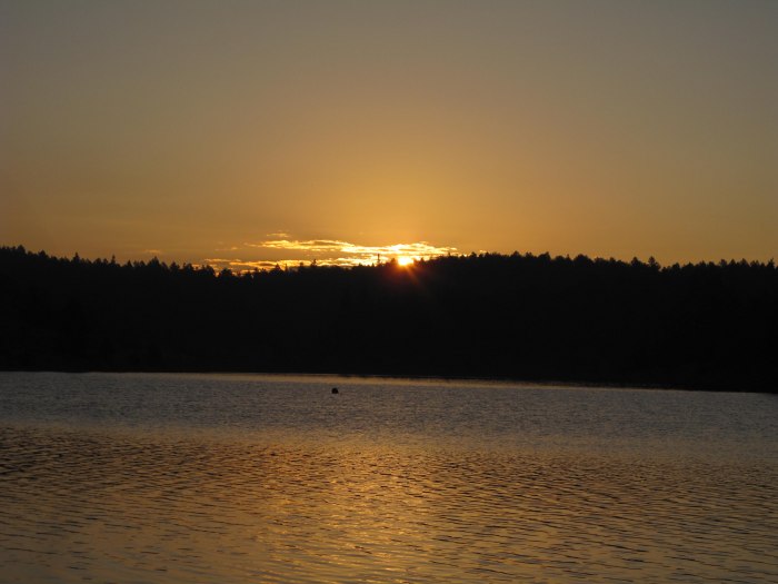
The Mt. Dewey trail gets you to North and South Catamount reservoirs. They recently did a controlled burn here and stumps and snags were still smoldering in the cold moring air. I was lucky to get sunrise here. Beautiful. The Kinnkinnict trail follows the shore of South Catamount Res. From the creek that feeds it there are about 4 trails that head some variation of south and my Pikes Peak atlas and GPS were handy references here.
The right trail isn't much of a trail but it was pretty easy walking compared to accessing the Mt. Dewey trail. Feeling good I made the Halfway Picnic area on the Pikes Peak Hwy in about 3 hours.
Sunrise over S. Catamount Reservoir
(icmg)8>
Continueing South I crossed the road and followed the powerlines to the Old Pikes Peak ski area. There was not much of a trail here but it and the ski runs are pretty open and made for good hiking. At the ski runs I couldn't believe how tall the trees were. It seems that they are just sapplings when we ski here. At the top I had a PB+J and looked North and West, beautiful.
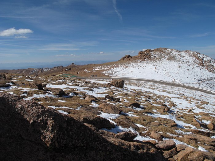
Looking Down on Devils Playground
From here I skirted the road and did some not so fun sidehilling on the skiers rt of the Blue run above Glen Cove. I crossed the road and had to do a 5.4 move to scale the rockcut to get above Devils Playground. I didn't want to be on the road for fear of a ticket. It was fun watching cars go by with passengers and drivers just a few feet away and they had no idea I was there. No guardrails will do that to people I guess. "Must Focus On Driving..."
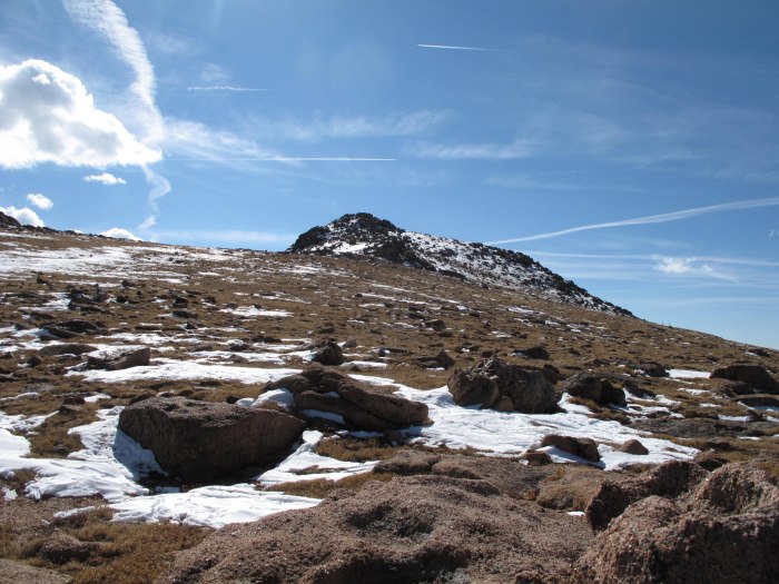
Little Pikes Peak
From Devils Playground it was an easy but tromp along the familiar Northwest slopes route from the Crags.
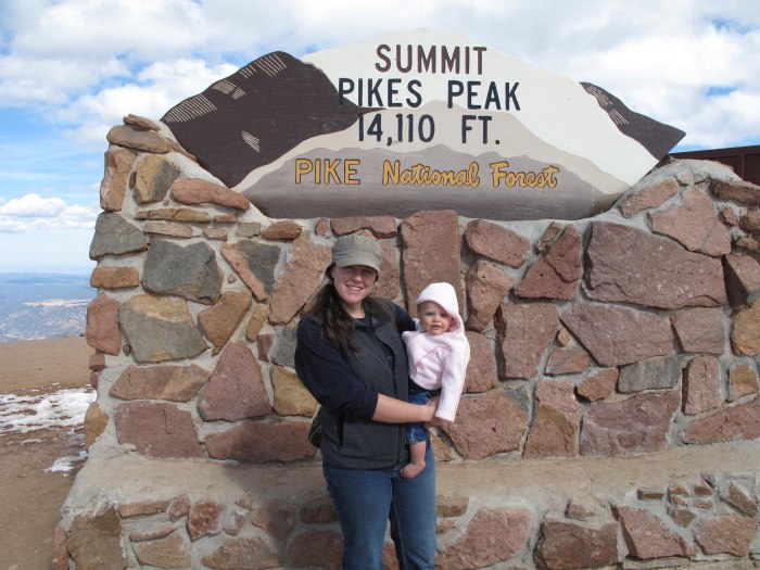
The ride down! Heather and Sarah
I summited around noon with 7335ft and 15.85 miles behind me. Due to Chiropractors orders and a bit of wimpyness I had called for a ride and Heather and Sarah met me at the top. This was my 8th summit Pikes. I also ran into some friends from work who had climbed from Manitou and they too had a ride down. Funny how that works.
(imcg)12>
Thumbnails for uploaded photos (click to open slideshow):
I have done the peak five times from Manitou Springs and twice from the Craigs. Interesting to see it from this different perspective. Looks like a good change from the ordinary.
Very creative route! Glad you were able to pull this off before the snow piles up.
Caution: The information contained in this report may not be accurate and should not be the only resource used in preparation for your climb. Failure to have the necessary experience, physical conditioning, supplies or equipment can result in injury or death. 14ers.com and the author(s) of this report provide no warranties, either express or implied, that the information provided is accurate or reliable. By using the information provided, you agree to indemnify and hold harmless 14ers.com and the report author(s) with respect to any claims and demands against them, including any attorney fees and expenses. Please read the 14ers.com Safety and Disclaimer pages for more information.
Please respect private property: 14ers.com supports the rights of private landowners to determine how and by whom their land will be used. In Colorado, it is your responsibility to determine if land is private and to obtain the appropriate permission before entering the property.
 Skiers Right- Blue Run")