Download Agreement, Release, and Acknowledgement of Risk:
You (the person requesting this file download) fully understand mountain climbing ("Activity") involves risks and dangers of serious bodily injury, including permanent disability, paralysis, and death ("Risks") and you fully accept and assume all such risks and all responsibility for losses, costs, and damages you incur as a result of your participation in this Activity.
You acknowledge that information in the file you have chosen to download may not be accurate and may contain errors. You agree to assume all risks when using this information and agree to release and discharge 14ers.com, 14ers Inc. and the author(s) of such information (collectively, the "Released Parties").
You hereby discharge the Released Parties from all damages, actions, claims and liabilities of any nature, specifically including, but not limited to, damages, actions, claims and liabilities arising from or related to the negligence of the Released Parties. You further agree to indemnify, hold harmless and defend 14ers.com, 14ers Inc. and each of the other Released Parties from and against any loss, damage, liability and expense, including costs and attorney fees, incurred by 14ers.com, 14ers Inc. or any of the other Released Parties as a result of you using information provided on the 14ers.com or 14ers Inc. websites.
You have read this agreement, fully understand its terms and intend it to be a complete and unconditional release of all liability to the greatest extent allowed by law and agree that if any portion of this agreement is held to be invalid the balance, notwithstanding, shall continue in full force and effect.
By clicking "OK" you agree to these terms. If you DO NOT agree, click "Cancel"...
The hike took me 3.5 hours up, 0.5 on top, and 2.5hrs down. Although this report comes off as if the hike was not fun, it was. It was very enjoyable to turn off the foot minding and just walk, think, and enjoy the morning. I would go back again.
For all those who have dared dream of the NM state highpoint, but were unsure of your route finding or mountaineering skills, please read on. If you have no inclination to venture south of the border or below 14k, please disregard.
With a weekend in Santa Fe with nothing to do on Sunday, I may as well attempt my second state highpoint. It was almost 2 hrs on the dot from the plaza area of Santa Fe to the parking lot at Taos.
Looking across at the ridge up to Wheeler. I can't tell if the humps in the center are Wheeler or Walter, but that is where I was headed.
Note here, the summitpost directions to the parking are pretty good, but the immediate left after the sign looks much like turning into a parking lot, not a road. Up the parking lot a ways is Twining road and about 40 yards up that road is the trail. I parked right at the entrance to Twining Road.
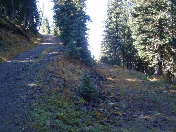
The first mile or so of trail is actually a bit rough and moderately steep. There are several horse trails that branch off, but they appeared to switchback and re-cross the main trail. I stuck to the main trail. It is about 1 mile from the parking lot up to the saddle-ish area where you take rights at the intersection.
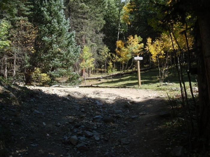
In some places, it looked like you could continue straight, but there were helpful signs telling which way to go
The creek crossing; these logs are tied together, so it is very stable
Another helpful sign; in this case not much of a trail going straight
At this point, you may be about ¾ mile up the road. I went right but the trail rejoined the road after about 100 feet, so take your pick. By here, the trail becomes very smooth and easy (class 0.5)
Almost at the top of the saddle, the signs tell me to go right. If I were to go straight, there is a white yurt about a hundred yards further.
Within just a few hundred feet, another intersection, and again, stay right
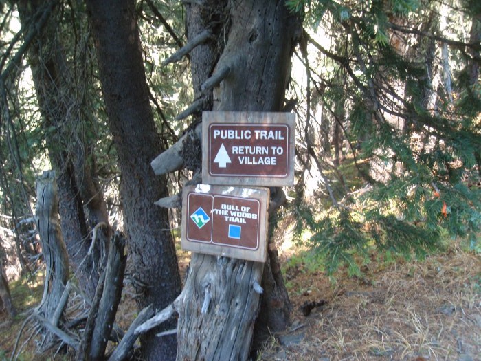
Many helpful signs; there were a lot of these, and at times the only one not marked was the Wheeler or often Bull of the Woods trail.
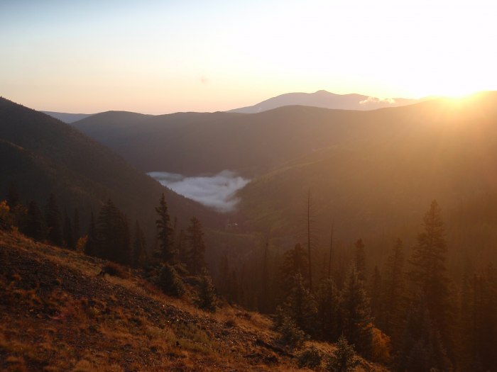
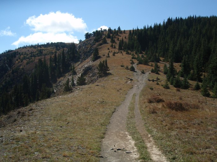
I reached the true ridge right at sunrise; nice view
Still on the road; one of the places where the path on the right is marked with some other name, so stick to the road on the left, which is unmarked.
Aside from the map, the fact that I am on the ridge and heading south, here is nice confirmation that I am still on the right path, but less than halfway there. The road is about to end.
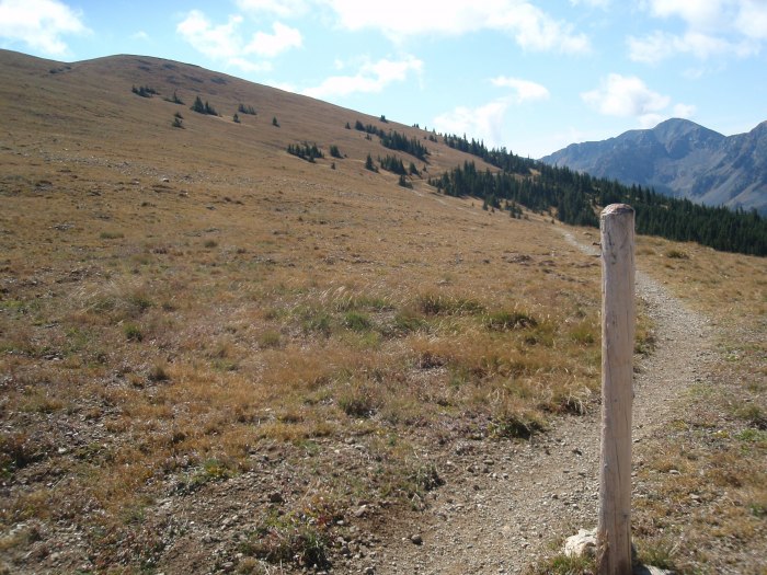
A few feet further at the gate area, the road ends and the trail begins. If you take the trail on the left, you may be in for a nice surprise. If you can't stand the suspense, look a bit up the trail to the right to see the surprise.
Around to the west side of the ridge. The trail snakes back and forth across the ridge and actually rarely stays on the ridge proper.
Looking back down the ridge. At the low point, the road goes west and drops down into the trees. The gate and transition from road to trail is right at the low point on the ridge.
Good thing the trail is well defined. Perhaps obviously taken in the morning whereas the clear shots are on the way down.
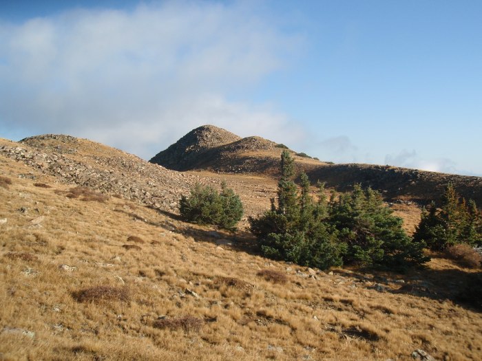
Right about here, you can see that we are not much closer to the Peak than we were 4 miles back at the car. I am at a higher elevation, so I'll take it.
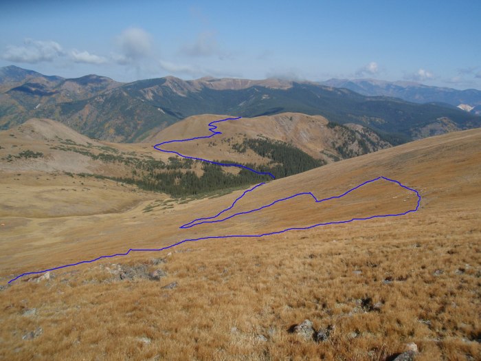
OK, here is where the fun begins or ends, this being La Cal Basin. The trail is approximately in blue; you can note that it gives up a bit of elevation. I went up on the green path (no trail), as it looks fun and more challenging. From here it looks like there could be some 2+ fun (another surprise coming ). In orange would be the path I would take if I were tired either up or down. It looks like you could easily traverse and avoid the re-gain in elevation. Note the red X for later photos.
A bit closer, you can see the trail route and the traverse route. A hiker is circled.
Here is taken from the red X, looking up the ridge. From a distance, it seemed like fun. From close, it is just a short rock hop. I guess that you could traverse around to the right, as it was steeper.
And from the red X, looking back at the first little hump, plenty of grass walking on this off trail ridge.
Taken on the way down, from near the ridge looking down and across La Cal Basin.
And looking up to gain the ridge. I think that this is Walter that you can see poking up.
From near the right hump in the previous photo, looking back along the ridge and basin. You can see plenty of grass on the ridge line, that made that option mildly interesting, but only mildly.
On the other side of the hump, I can finally see Wheeler, but Walter is standing in the way. I guess that is just life, having to climb over #2 if you want to get to #1.
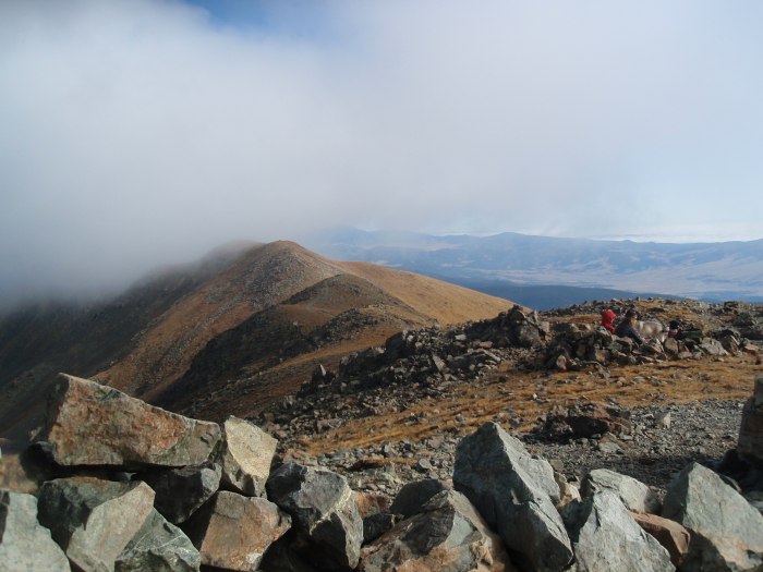
A bit foggy in the morning to find my way up. The fog actually held out hope that the trail might get worse (and fun), but it never did.
Here is the last bit up to Wheeler, from Walter. You can see the trail heading down and to the right; I presume this is the shortcut via Williams Lake
No indication, but this is the 2nd highest peak in NM. Nothing against those NM guys or H.D., but there is no way this is "official".
Finally on top, looking back on the trail toward Mt. Walter. You can see from the photo, I don't think Walter qualifies with either distance or saddle drop, but I'll take it.
Given the fog, the easy nature of the trail, and the relatively quick pace, I opted to return the same way. My regret is that I didn't continue around the ridge to nab #3, which is aptly named Old Mike Peak.
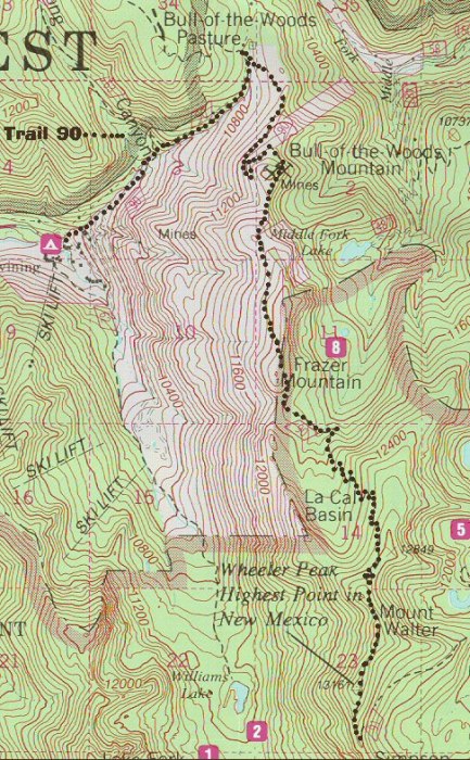
Here is the map from summitpost.
It actually was a bit helpful to determine that you keep going up away from the peak almost to a saddle, and that there really was an elevation drop across La Cal Basin.
Thumbnails for uploaded photos (click to open slideshow):
The photo of La Salle basin showing the green, orange and blue paths? I took the blue path on the way up and the orange path on the way down. Definitely the way to go for my tired, old (55 yr) knees!
If I could give two thumbs up I would. 10/9/2010 3:43am
This is a well documented report - thanks for the nice and timely beta. I'm heading to Taos and Cimarron at month end - Wheeler Peak is on the agenda.
There are a lot of aspens in that basin and they don't look fully turned yet. Not much may be left in three weeks but I hope to catch the last of it. Currently, how is the autumn color down lower, in and around Taos?
good to see my home state's gettin some love up on this website. New Mexico's gotta bit of everything including the Rockies.. Backpacked this trip over the summer and forgot my camera hahahah
Thanks Mike for the write up I to will be there within the next 3 weeks to tag the state highpoint.
Caution: The information contained in this report may not be accurate and should not be the only resource used in preparation for your climb. Failure to have the necessary experience, physical conditioning, supplies or equipment can result in injury or death. 14ers.com and the author(s) of this report provide no warranties, either express or implied, that the information provided is accurate or reliable. By using the information provided, you agree to indemnify and hold harmless 14ers.com and the report author(s) with respect to any claims and demands against them, including any attorney fees and expenses. Please read the 14ers.com Safety and Disclaimer pages for more information.
Please respect private property: 14ers.com supports the rights of private landowners to determine how and by whom their land will be used. In Colorado, it is your responsibility to determine if land is private and to obtain the appropriate permission before entering the property.


")
")
")
")
")
")
")
")
")
")
")
")
")
")
")
")
")
")
")
")
")
")
")
")
")
")
")
")
")