| Report Type | Full |
| Peak(s) |
Mt. Elbert - 14,438 feet "South Elbert" - 14,129 feet |
| Date Posted | 09/22/2010 |
| Date Climbed | 09/20/2010 |
| Author | mikemalick |
| Mt Elbert from Black Cloud TH |
|---|
|
Summary =============== Black Cloud TH Start: 6:24 AM Saddle: 8:44 AM South Elbert 9:15 AM Mount Elbert Summit: 10:05 AM Depart Summit: 10:53 AM Return South Elbert 11:36 AM Return Trailhead: 1:48 PM Total Time: 7 hours, 24 minutes Total Elevation: 5,109' ================ My original intention was to summit via the Southeast Ridge route and then on the descent hit Bull Hill and take that ridge back to main trail junction. However, based on weather forecast I read the night before coupled with how fast clouds would build in the Elks area and move in, I decided against the Bull Hill detour. Didn't want to be on that long ridge in bad weather. However, turns out I would have been perfectly fine. I did get a couple drops of rain, but not until I was heading out of the TH in my car. Oh well...better safe than sorry. Route overview and profile: 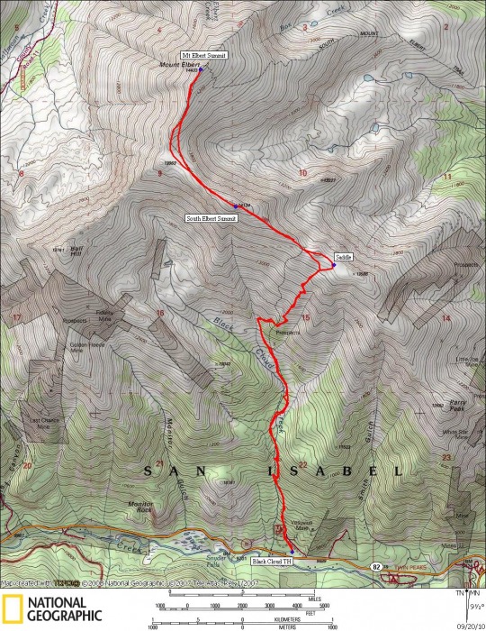 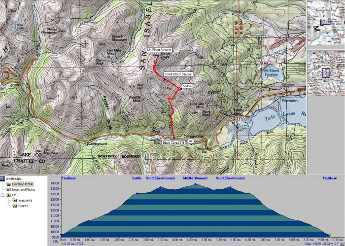 I apparently hit the area on the perfect day...peak Fall Folliage time. Didn't have it planned that way, but that sure is the way it ended up. Met someone at the summit that lives in Leadville who stated it was definitely the peak and even about 5 days earlier than last year which seemed to surprise him. I was on CO-82 early in the morning in the dark and went right past the turnoff to the TH. After going about 1/2 mile further up 82, I turned around and headed back only to miss the turnoff yet again. I read it was an easy turnoff to miss and I can certainly agree. It is on the right not too far past MM75. If you hit the Mt Elbert Lodge, you've gone too far. Here is a turnoff shot I took later in the day after I was back at the TH. 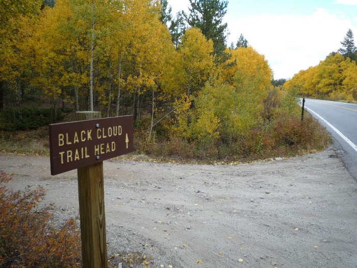 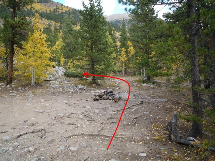 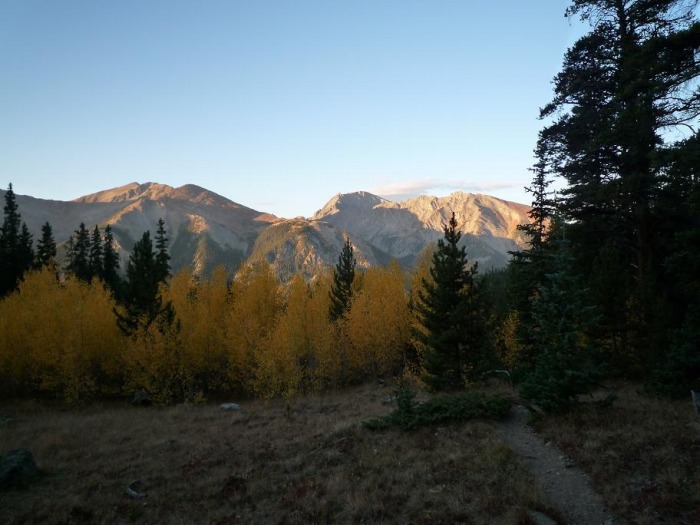 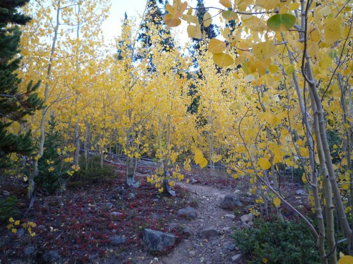 Around 11,600' in the Black Cloud Creek "basin" area looking westward at what was to be my descent route with Bull Hill (13,761') to right and ridgeline down extending southeast that connects with standard southeast ridge route in forest. 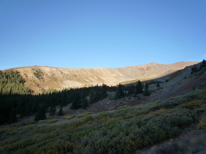  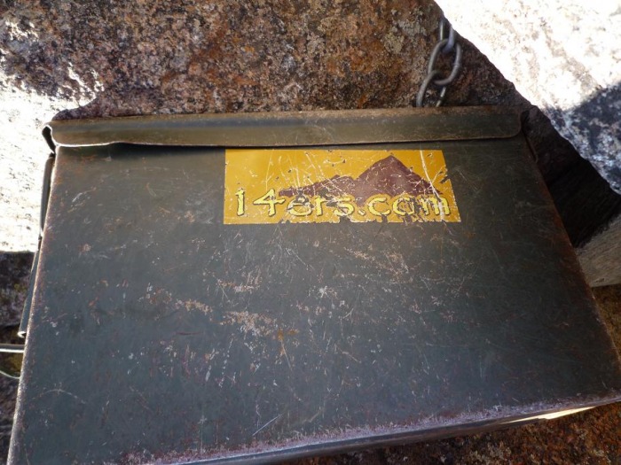 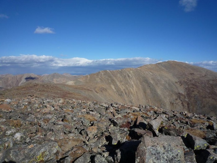  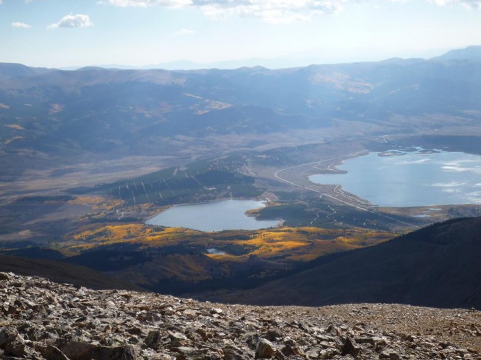 The clouds were amazing with such heavy winds. Not 10 minutes earlier I was wondering if I'd be able to summit because the clouds looked really bad whereas now they look ok. 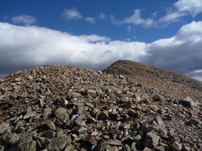 Just before the summit, this shot looks to the northwest in the North Halfmoon Creek valley below Mount Massive. Look at that rainbow!  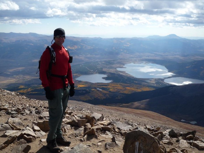 This flag had been up a couple days at least. The guy in the shot just came down from Calgary, Canada. Actually originally from Lithuania. He was enjoying his time in Colorado.  A happy dog at the summit. The two guys seated (did not summit together) were both ultramarathon runners ala Western States Endurance Run (100 miles) and Leadville Trail 100. Fellow on the left is actually from Westminster just like me. He was up hiking with his brother from Asheville, NC.  Another shot of the North Halfmoon Creek valley with Mount Massive above. 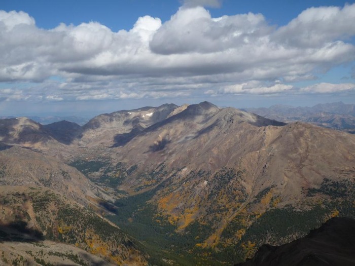  Not route-finding rocket science. Return trip down Elbert's southern ridge to the "Y". Heading right goes down into a saddle and up to Bull Hill whereas the left fork is back to South Elbert and the Southeast Ridge route.  And the "South Elbert" side of the "Y" with the ridgeline up to Elbert's summit to the right and the drop down to the Bull Hill saddle to the left. 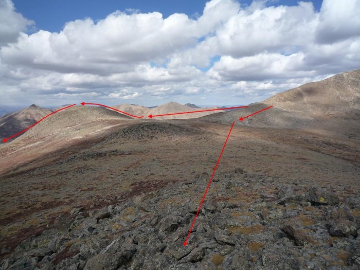 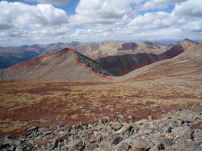 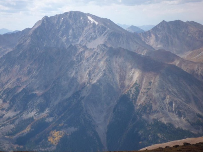 View from atop "South Elbert" down to the trailhead area. The area in the center/center-left portion of the pic is actually fairly steep and with no steps cut into the trail, it can be quite slippery of a descent. I almost had my feet go out from under me several times in that area. 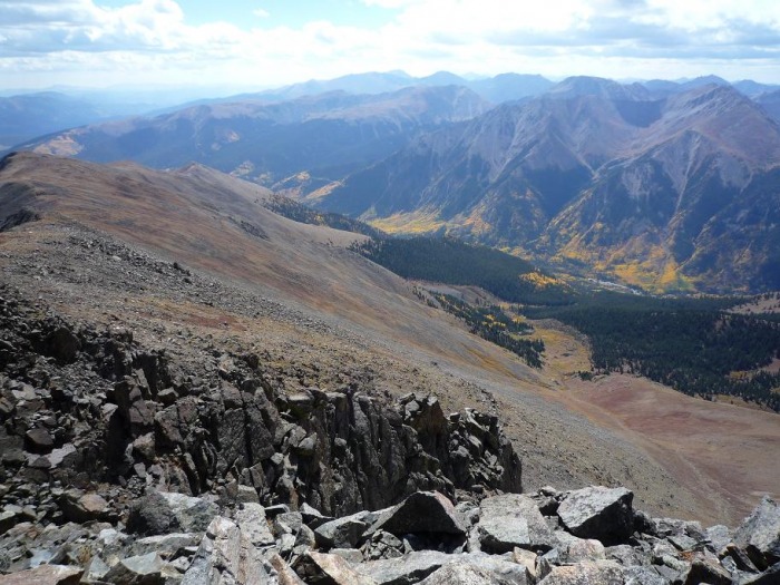 Much lower down in the valley now looking back to the Bull Hill ridge route I intended to descend. The clouds were building at this point, but in end the weather never would have been an issue. I should have done it! 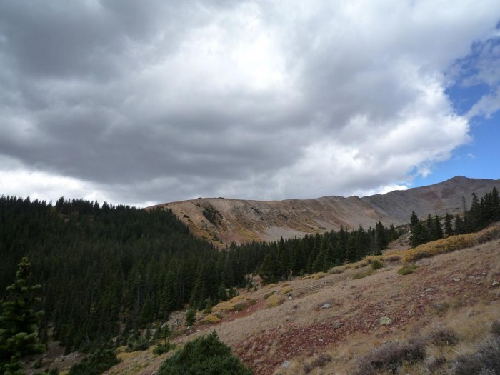  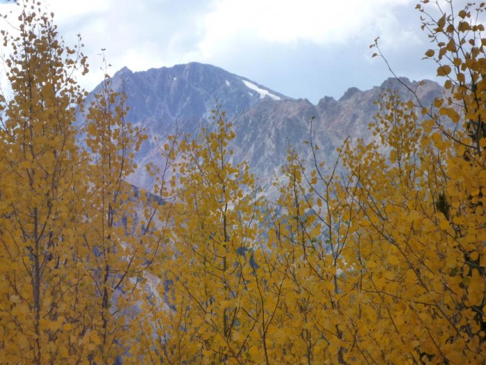 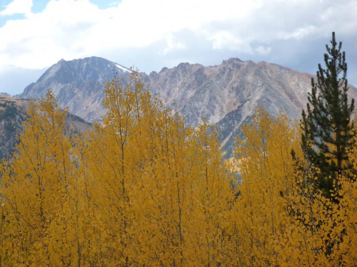 A little less than 1/2 mile away from the Black Cloud Trailhead. This is by far my favorite shot of the day! 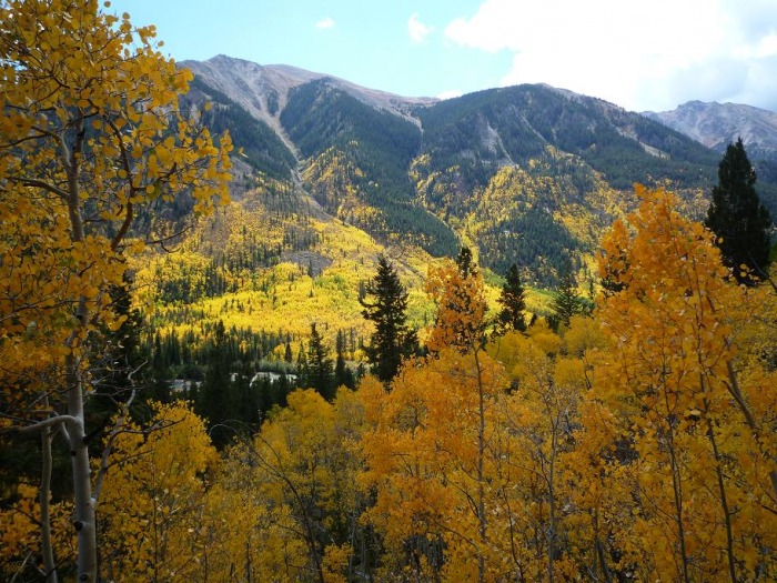 Thumbnails for uploaded photos (click to open slideshow):  Route Overview")
 Route Profile")
 Turnoff to Blackcloud TH")
 Very short distance in from turnoff. I parked at first spot on right and just to left of that was this entrance to trail")
 Looking back with Rinker Peak to the left and Ellingwood Ridge connecting to 14er La Plata Peak center right.")
 Pretty little stand of aspen around 11,100' I was")
")
 On ridge with view towards next tasks of")
 Register box on the summit of")
 On")
 On ridge up to summit with views of Mount Massive (last week's hike) off to left. Here winds were sustained at 30 mph wit")
 View from ascending ridge looking east, southeast with falls colors surrounding Mount Elbert Forebay center and Twin Lakes Re")
 Almost there!")
")
 Me at summit with Mount Elbert Forebay center and Twin Lakes Reservoir in background.")
")
")
")
 The patriotic summit dog.")
")
")
 The several hundred foot drop into the saddle and then climb back up to Bull Hill can be seen on the left.")
 Zoomed in on Ellingwood Ridge and La Plata Peak.")
")
 Bull Hill route")
 Another lovely stroll through a stand of aspen.")
 Aspen with Rinker Peak in background")
 Aspen with La Plata in background")
")
|
| Comments or Questions |
|---|
|
|
Caution: The information contained in this report may not be accurate and should not be the only resource used in preparation for your climb. Failure to have the necessary experience, physical conditioning, supplies or equipment can result in injury or death. 14ers.com and the author(s) of this report provide no warranties, either express or implied, that the information provided is accurate or reliable. By using the information provided, you agree to indemnify and hold harmless 14ers.com and the report author(s) with respect to any claims and demands against them, including any attorney fees and expenses. Please read the 14ers.com Safety and Disclaimer pages for more information.
Please respect private property: 14ers.com supports the rights of private landowners to determine how and by whom their land will be used. In Colorado, it is your responsibility to determine if land is private and to obtain the appropriate permission before entering the property.

