| Report Type | Full |
| Peak(s) |
West Buffalo Peak - 13,330 feet East Buffalo Peak - 13,303 feet |
| Date Posted | 09/13/2010 |
| Modified | 02/20/2018 |
| Date Climbed | 09/11/2010 |
| Author | JQDivide |
| Additional Members | FoodieHiker |
| Buffalo Peaks- East to West |
|---|
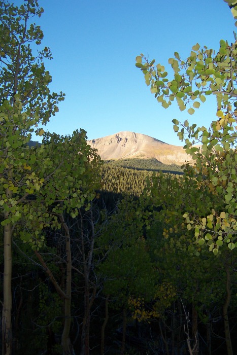 Date: Saturday, Sept. 11, 2010 Weather: Beautiful. Sunny. Not a cloud could be seen. Only had bad wind for 30 minutes. Temp at the TH: 25 at 6 a.m., 66 at 4 p.m. Time: Total 9 hours. Hiking, 7:30 hours, Rest/eat 1:45 Time break down. 1:30 - Trailhead to the end of the logging road to the willows. 1:00 - Willows, east ridge, to the knob 10 minute rest, there's a rock that looks just like a bench and we used it. 1:00 - the knob to the top of East Buffalo Peak 30 minute rest/snack 1:40 East Peak, the saddle, to West Peak 1:00 rest and lunch 2:40 West Peak, down the west side to the north side to the car Overall Thoughts: Great hike. Would do it again. Great views of the Arkansas River Valley and the 14ers along it and to the north. We saw NO ONE the entire time on the trail. But you can tell people are hiking these peaks. Will be totally beautiful when the aspens are at full color, but you'll have to watch out for the hunters. Seemed to be a lot of them scouting for elk this weekend. We really took our time and probably wasted a bit with a couple of poor choices because of a lack of a trail. If you don't like hiking boulder/rock fields, you will hate this hike. We did the loop east ridge to East Peak, the saddle, West Peak, west ridge and down and most of the hiking above 12,000 feet was all rocks. We followed lukyzsquirrel's trail report for the most part, which was pretty good. I suggest getting the Nation Geographic map #110 Fairplay/Leadville. What's a little frustrating, to get the entire area you'll also need the NG map #129 Buena Vista. The area is divided between the two maps, but the area on the BV map is mostly the southern part, the mountains, which is above tree line and pretty easy to see. Trailhead. FR 431/Buffalo Peaks Road does exist, even if you can't find it on some maps. It is 8 miles north of the Hwy 24/285 junction at Antero Junction. The turn off is located just north of the 170 mile maker on 285. We parked about � mile from the end of the road, about 8 miles in. The end of the road is the Lynch Creek Trailhead. Before that, the road curves south than back north and comes out of the trees. There are two trailheads for the peak hike about 50 yards apart, on each end of the curve. The NG map shows this well. The map shows two trails going south toward the peaks. The West Trail one is shorter and "ends" lower on the map. The East Trail one goes higher and longer up the ridge, this is the first trailhead on the curve. (At least I believe. I didn't check it out.) We parked at the second area, the west one. There is a trailmarker on the left side and an old logging road on the left side, with a marker "431-something." I didn't go down this road because someone was camping 30 yards in. Were we parked. You can see a camp in the clearing behind us and the 11,000 hill. Both of those can be seen from the peaks and in another photo later which helped us make our decent choice. 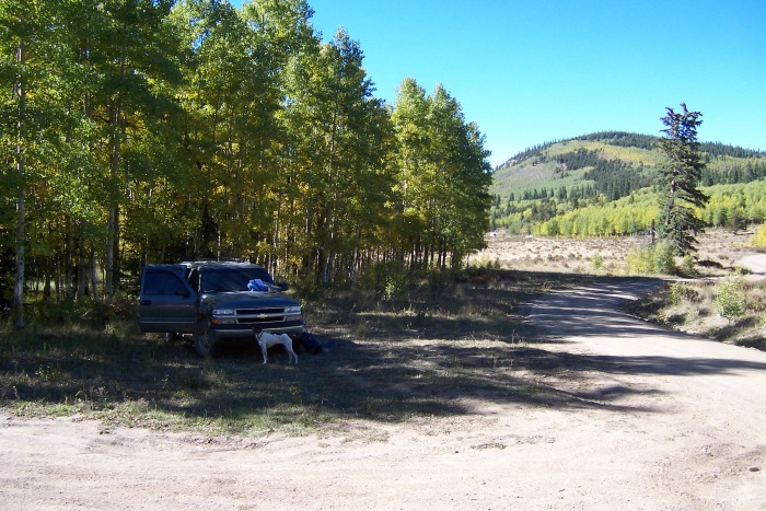 Luckzysquirrels Photo of the first/East TH. 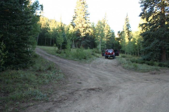 From the West Parking area, we followed the trailmarker on the left and came to another logging road and a well defined trail. You can take either because they meet up again. This is the East Trail I mentioned. The logging road "431-something" I believe is the West Trail shown on the map. The two trails will meet later. Logging Road Section: 1 hr 30 min The east trail on the map is an old logging road. The map does a really good job of showing the trails curves, etc. It's easy to follow, just keep on the main road. You'll know you're on the correct road as shortly up the trail it opens up a bit next to a raven. 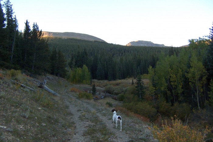 A tree trunk bridge crosses it. (DON'T GO THIS WAY, stay on the main East Trail.) This is just to show were the two trails meet, the way we came back on the West Trail to complete the loop. 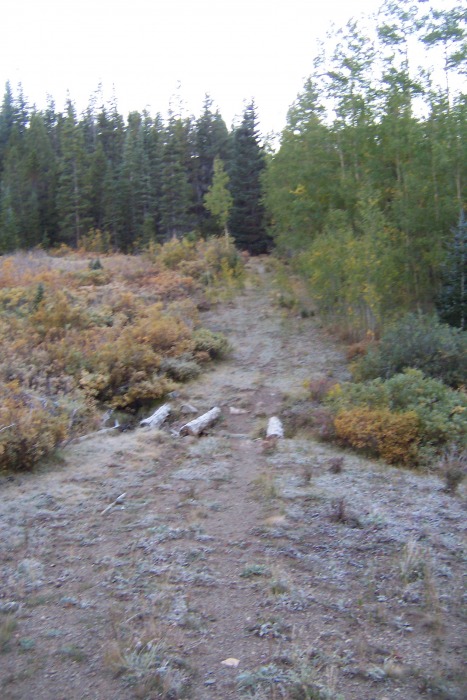 I didn't take many photos of the road/trail because it seemed pretty obvious. There was one or two spots we questioned, but in the light it was easy to tell which way to go. I think one spot was a shortcut. There are lots of fallen trees across the road/tail. As you get higher, especially towards the end, there are lots of small trees growing in the middle of the road. At the end of the road, there was an arrow made out of sticks pointing back the way you came, as in luckyzsquirrel's photo. Keep going past that. You'll see a long narrow treeless area, the trail goes through there up to the willows, tree line. Luckyzsquirrels photo of the end of the road. 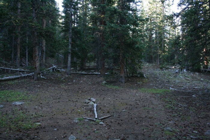 Above Tree Line/East Ridge Section: 1 hour From the willows, we went up. There's a trail to the left when you come out of the trees. There are also a couple of game trails trough the willows, which are head/chest high. We took the left trail which took us up to a rock field, the first of many. We worked our way up and west. There were a few cairns along the way and the willows got shorter. We finally went through the willows into the grassy areas then up to the saddle between the East Ridge and the East Peak.  Red is our route. The circle is about were the trail comes out of the trees. 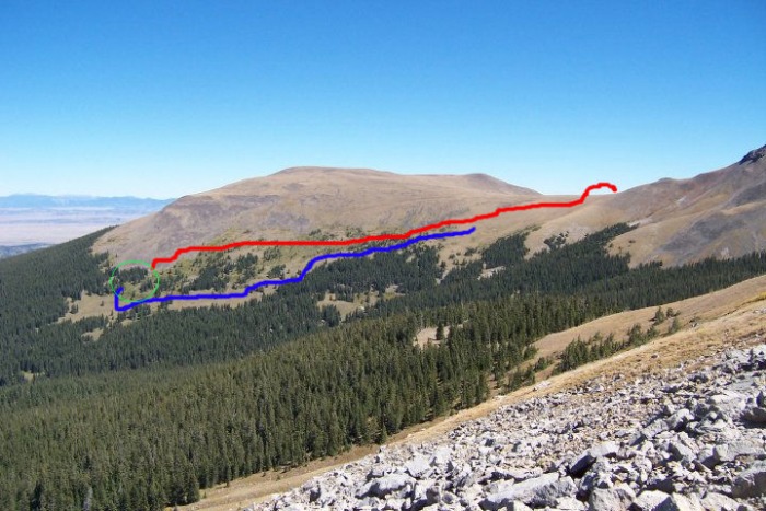 NOTE: If we do this again, we'll go down the BLUE Line, below the willows because it looks easier than going through or above them. The grassy areas seem to be easier to hike up and there is a lot of grass below in the photo. A closer look at the willow area. 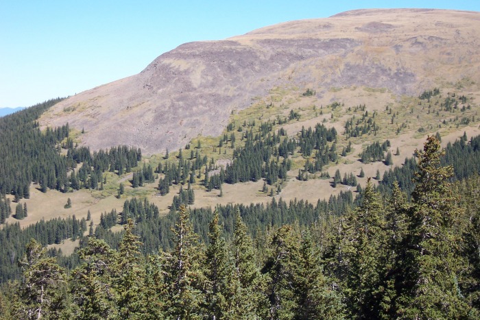 The grassy slope to the knob. There were a couple dark rocks near the top of the ridge, close to the knob, we thought were animals, but we realized they never moved.  Knob to East Peak Section: 1 hour We rested for a few minutes at the knob, before hiking up the back side/south side of the East Peak, which is basically a boulder field.  East Peak looking at West Peak  Looking south west to the Arkanas Valley, Buena Vista and Mt. Princeton. 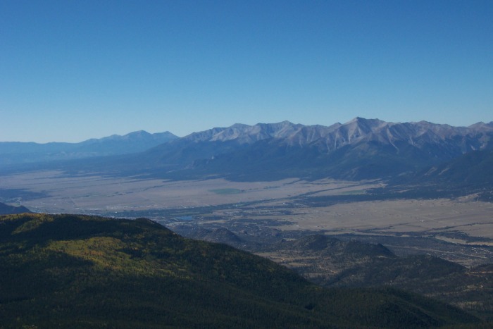 The Saddle to West Peak Section: 1 hr 40 min The saddle drops about 600 feet. The north side of the saddle is a drop off with lots of cool rock formations. I don't think you can follow the actual ridge. We took the south side. The way down, across and up was mostly rocks. I think we went down a little too far, but not sure. Just go down as far as you think you need to, to go across. As we went up the West Peak we looked for grassy areas between the rocks, which were much easier to hike up. One of the many cool rock formations on the saddle. 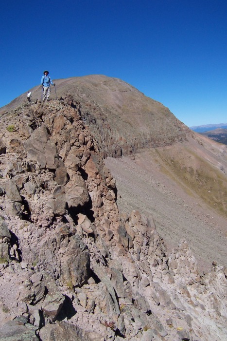 We ate lunch on top of West Peak, in a grassy area between two rock fields. 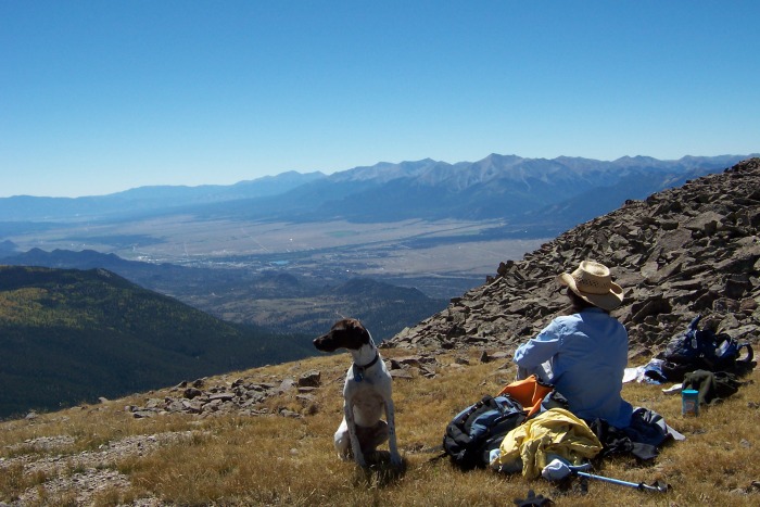 The view from the top.  Looking north at the 14ers. 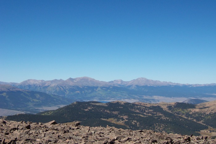 Looking NW at Elbert & Massive and a glimpse of the Twin Lakes. This is when we decided how to go back down. From here we could see a section of 431 and the cars/campers parked just a couple 100 yards from were we parked. We knew we didn't want to cross all those rocks again and chose to make a loop out of the hike. West Ridge and Down To Lynch Creek Section: We went down the west side of the West Peak. More rocks. But, we found more grassy areas to go down. We did not go all the way down to the west ridge. We started moving toward the north side of West Peak.  The Red was us. The blue is what I think lukyzsquirrel did. 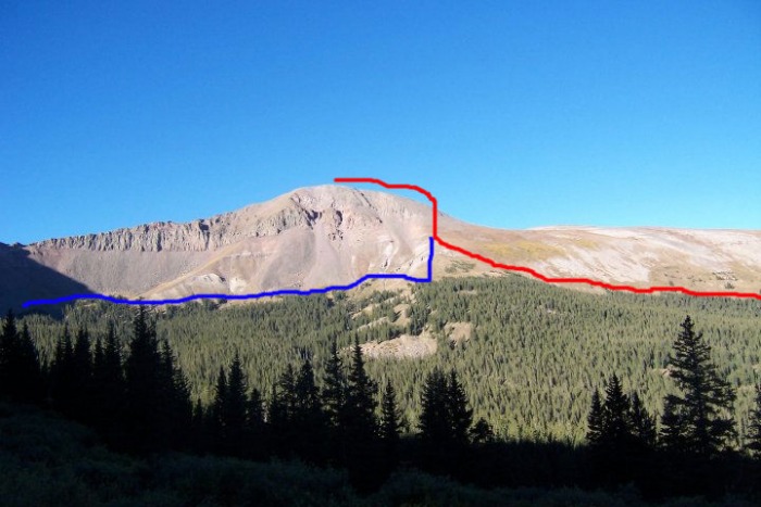 Looking north, down the slope.  Same photo. The Green Circle is the road 431. The camp you can see is just passed where we parked. The Red line is our route. The yellow line is the 431 road/trail and the Green line is the Lynch Creek Drainage. Not sure about the orange circle if that is the East Trail???? 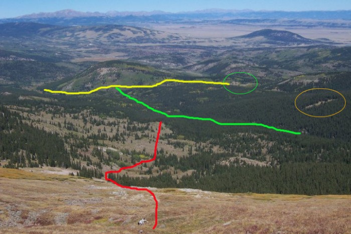 At this point we thought about going down and east around along the tree line and back toward the east trail that we came up. I think this is what lukyzsquirrel did. We decided to go north down toward the Lynch Creek drainage instead. We thought we'd follow Lynch Creek which looked like it hit 431 just below the 11,000 hill seen on the map and photo. Again, more rocks and grassy areas on the way down. We hit the first tree line and went west and down toward a small clump of gold aspens, then northeast toward a clearing and the creek. Lynch Creek to the trailhead Section: We dropped down into the west fork of the Lynch Creek drainage. We followed the dry creek bed for about 15 minutes, bushwacking our way, until we came to the junction of the west and east forks of the creeks. (I think this would be a bad route choice in the spring and maybe early summer because of the runoff. Then again, a cool dip in a creek on a hot day would be nice.) We took another look at the map and discovered the West Trail/log road was right above the fork junction. Yes, we had to climb up, but for just a few minutes and there was the road. We went left and followed the road, which I thought was exactly like the map showed. That was until we came to a second road, a T-junction. We turned left, down. This road was not the East Trail, but part of the West Trail. I think the section we were on was either another road or maybe a spur of the West Trail/road. A few hundred yards down the West Trail/road it kind of split. Left was narrow and right had wheel tracks. We went right and joined the East Trail at raven. On the map it shows the trails joining. Going up we noticed an old tree trunk bridge and I thought that might be the spot were they joined and it turned out to be. I think if we would have gone left, I believe we would have come out at the car on "431-something." A special thanks to luckyzsquirrel. I didn't ask permission to use his/her photos, hope that's OK. 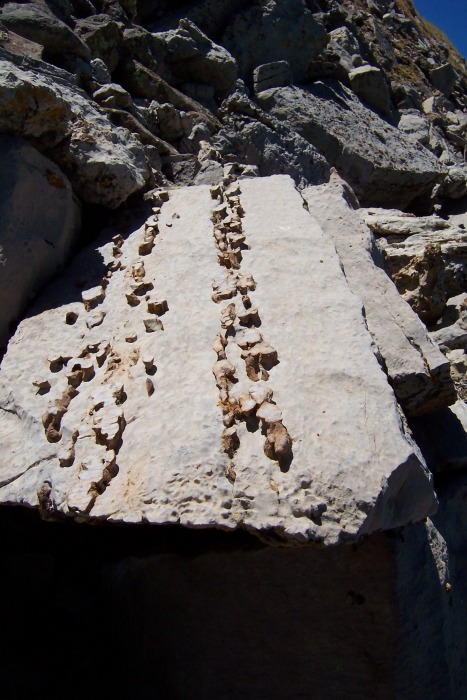 Odd rock formations we saw. Thumbnails for uploaded photos (click to open slideshow):  The main trail, follows a small raven, so you know you're going the right way.")
 Just past the raven, before a grove of aspens, there is a tree trunk bridge, this will take you to the West Trail, this is we")
 The West Peak from the trail.")
 Luckyzsquirrels photo of an arrow at the end of the logging road/East Trail.")
 The east ridge to East Peak.")
 The way up the east ridge to the knob.")
 A closer look at the")
 At the knob below East Peak")
 Arkansas River Valley and Buena Vista from East Peak")
 West Peak taken from East Peak")
 A cool rock formation on the lip of the saddle")
 Ark Valley & BV from a grassy spot on top West Peak")
 14ers to the north.")
 Elbert, Massive and glimpse of TwinLakes")
 Our way down to the Lynch Creek drainage on the north side.")
 Our trailhead. The West Trail head.")
 Luckyzsquirrels trail head / the East Trail")
 West Peak")
 West Peak")
 Interest rocks on the northside, Light gray with layers of other darker rocks.")
 Red Line is our trail, the blue is what we'd do next time.")
 Come down off West Peak")
 Coming down off WP in Red, Blue is what I think luckyzsquirrel did?")
 Looking north, come down West Peak.")
|
| Comments or Questions | |||
|---|---|---|---|
|
Caution: The information contained in this report may not be accurate and should not be the only resource used in preparation for your climb. Failure to have the necessary experience, physical conditioning, supplies or equipment can result in injury or death. 14ers.com and the author(s) of this report provide no warranties, either express or implied, that the information provided is accurate or reliable. By using the information provided, you agree to indemnify and hold harmless 14ers.com and the report author(s) with respect to any claims and demands against them, including any attorney fees and expenses. Please read the 14ers.com Safety and Disclaimer pages for more information.
Please respect private property: 14ers.com supports the rights of private landowners to determine how and by whom their land will be used. In Colorado, it is your responsibility to determine if land is private and to obtain the appropriate permission before entering the property.


