Download Agreement, Release, and Acknowledgement of Risk:
You (the person requesting this file download) fully understand mountain climbing ("Activity") involves risks and dangers of serious bodily injury, including permanent disability, paralysis, and death ("Risks") and you fully accept and assume all such risks and all responsibility for losses, costs, and damages you incur as a result of your participation in this Activity.
You acknowledge that information in the file you have chosen to download may not be accurate and may contain errors. You agree to assume all risks when using this information and agree to release and discharge 14ers.com, 14ers Inc. and the author(s) of such information (collectively, the "Released Parties").
You hereby discharge the Released Parties from all damages, actions, claims and liabilities of any nature, specifically including, but not limited to, damages, actions, claims and liabilities arising from or related to the negligence of the Released Parties. You further agree to indemnify, hold harmless and defend 14ers.com, 14ers Inc. and each of the other Released Parties from and against any loss, damage, liability and expense, including costs and attorney fees, incurred by 14ers.com, 14ers Inc. or any of the other Released Parties as a result of you using information provided on the 14ers.com or 14ers Inc. websites.
You have read this agreement, fully understand its terms and intend it to be a complete and unconditional release of all liability to the greatest extent allowed by law and agree that if any portion of this agreement is held to be invalid the balance, notwithstanding, shall continue in full force and effect.
By clicking "OK" you agree to these terms. If you DO NOT agree, click "Cancel"...
I've been considering a climb of the Maroon Bells since early summer when a friend mentioned a date sometime in July. My schedule never seemed to work out and it just kept getting postponed. Labor day weekend looked pretty good with weather conditions and there was a sense of urgency because snow had fallen a week ago. Any more snow that falls from here on out will probably stay and melt slowly if at all.
I had my doubts about a holiday weekend because of the crowds, but on the plus side I would surely be able to find someone to climb with or at least follow. I wanted to be especially careful of loose rock in light of the tragedy a couple of weeks ago. I studied route descriptions and recent trip reports on 14ers.com and chose to do North Maroon on Sunday morning.
I drove to the overnight parking lot by Maroon Lake and had a good conversation with the Host there. I showed him my setup for sleeping in the back of my pickup under the topper and he wished me well and told me to contact him if I had any problems. I was surprised to read on the website later that there is a fine for doing this. None of the forest service people said anything about it so I still don't know if car camping is allowed or not.
In any case, I went to sleep about 10:00 P.M. and arose at 2:30 A.M. for an early start. I had some breakfast and headed down the trail at 3:30. I met up with a guy named Steely(?) by the bus stop restrooms and he told me that he was attempting the traverse from Maroon to North Maroon. He left ahead of me so I was surprised when he came up behind me at the trail junction for the Maroon/Snowmass trail. He had gone back for more layers apparently. We talked for a minute and then headed our separate ways into the darkness.
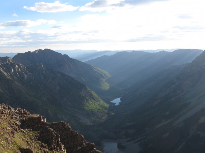
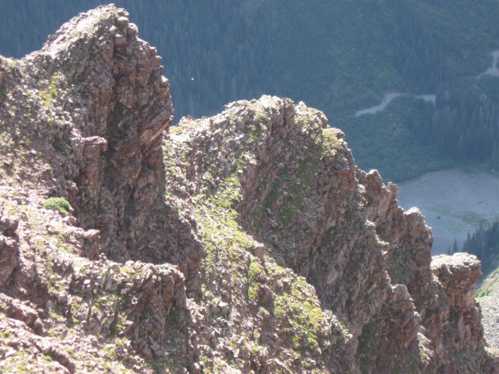
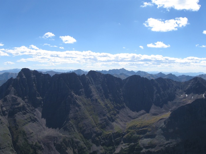
The hike up to the glacier and the traverse to the first gully was uneventful. The sun had finally come out and so did the camera.A look back down the first gullyCliffs above the traverse from the 1st gully to the 2ndSun streaks in the Maroon valley
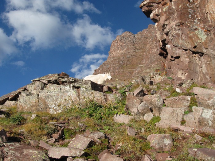
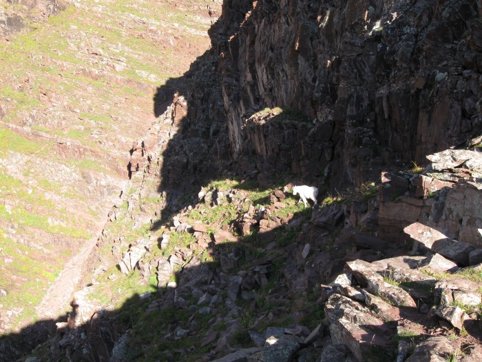
As I traversed from the top of the first gully to the bottom of the second I encountered one of the natives.One of the natives
He seemed to be encouraging me to follow him because he was walking right down the cairned trail.Leading me down the trail
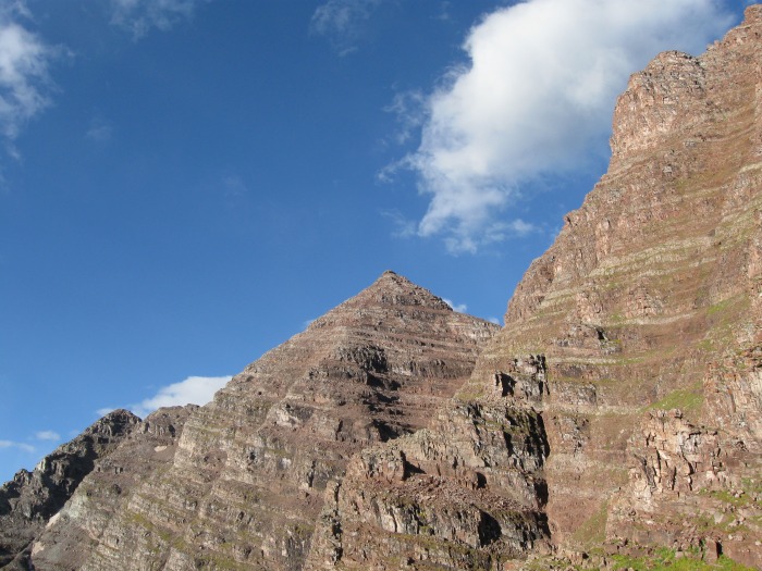
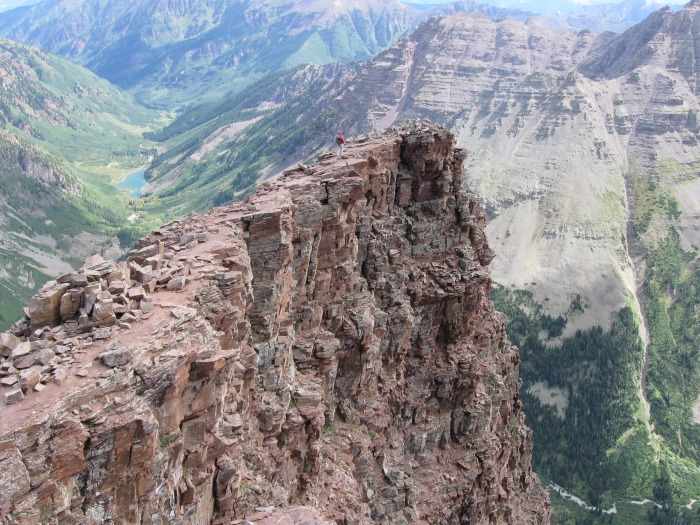
From that same location Maroon Peak comes into view for the first time.First view of Maroon Peak
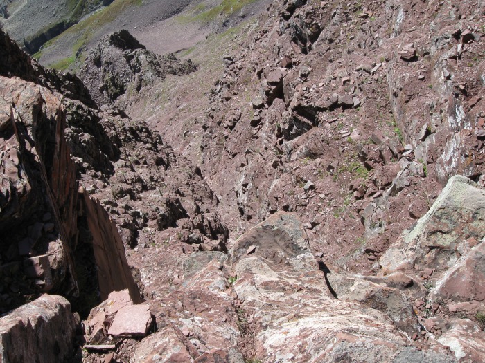
The second gully was much steeper but shorter and I arrived at the cliffs at the base of the ridge. Top of the second gully at the base of the ridge
I put away my trekking poles for the first time and moved along the foot of the cliff by the ridge before finally climbing up on top. A look back down the second gullyFrom the ridge looking down
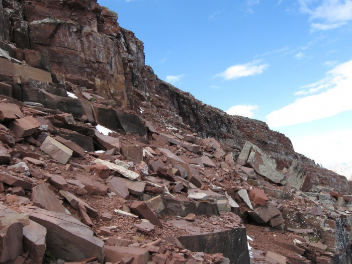
I always carry the route description from this website in my pocket and refer to it frequently. As I approached the "rock band" (as the description calls it) I read that you can go straight up a class 4 section or go to the right of it for a class 3 section. "Rock band" or black cliffs
I had to guess as to how far right to go and promptly got into a lot of trouble. Immediately to the right are some black cliffs that appeared to be about a hundred feet tall. Further to the right, the cliffs appeared to be about 30 feet tall so I elected to go up there. As I got up about 15 feet from the base I started slipping in mud and then snow. Grabbing for handholds I discovered ice, and finally rock that crumbles in your hands. On one occasion my feet started to slip so I grabbed for a rock that came down and then finally something solid. This is where I had to stop and think for a few minutes about options and plan every move carefully. A person who is holding onto a rope for dear life knows that he can't hold on forever and I was no different. The clock was ticking. I have a much easier time going up than down so my choice was obvious. After about an hour of carefully planning each move I was glad to peer over a rock and see the terrain ease up a bit. It was the slowest 30 feet that I've ever climbed.
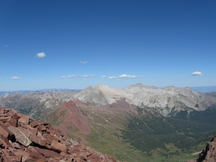
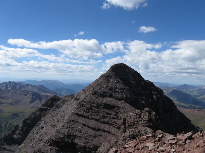
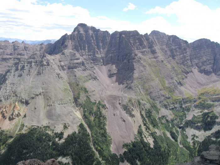
I saw a cairn up and to my left and headed straight for it. A few more feet of easy climbing and I was finally there! I summited at 10:35 and I was the only one there for about 20 minutes. My goal was to be there by 8:30 or 9:00 but my detour cost me a lot of time. I thanked God for preserving me through my mistakes. Snowmass and Capitol PeaksPyramid, Castle, and Conundrum PeaksMaroon peak (South Maroon)
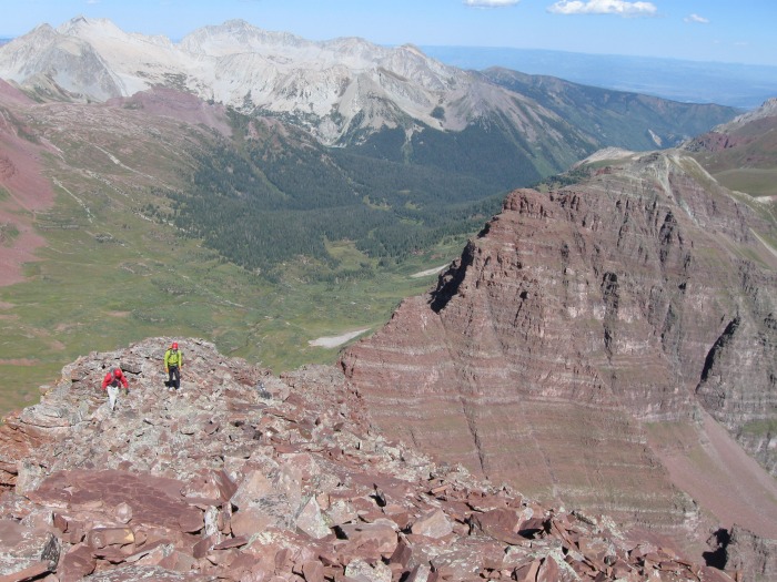
About 10:55, John and Kevin from Boulder and Ft. Collins arrived via the traverse from Maroon Peak. John and Kevin coming up from the traverse
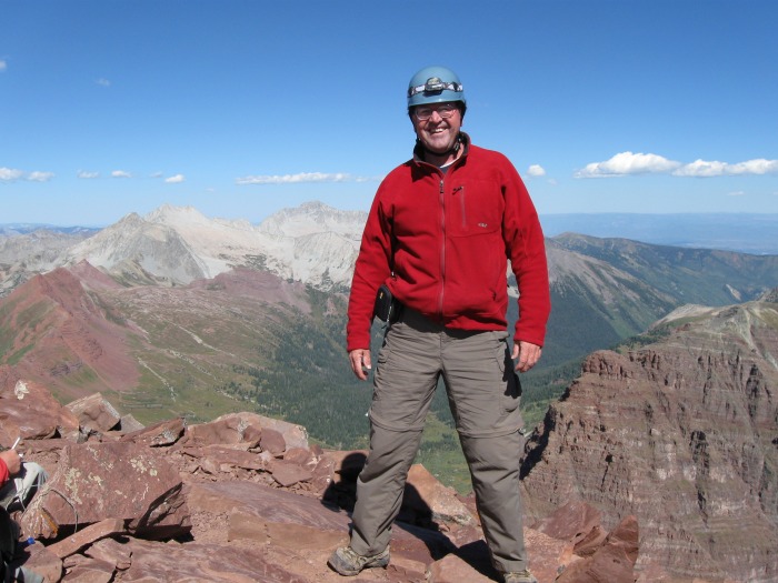
We traded taking pictures for each other and I asked them if I could follow them down. Me with Capitol and Snowmass in the background
They obliged and I was grateful to have the company for at least part of the way down. Kevin on the precipice on the way back down
They were much younger and faster and quickly put distance between us. John and Kevin headed down the 2nd chute
Besides the guy I met earlier they were the only climbers I saw all day. So much for Labor day traffic! Pyramid peak
Other than the tense situation on the cliffs, it was a great trip and I look forward to climbing the other Bell next summer.
Thumbnails for uploaded photos (click to open slideshow):
So you really have me wondering...what about the descent? Did you go back down that icy 30 foot loose section? Or the ”standard chimney”? And what about Kevin and John? Did they help you with the headwall area, or had they already taken off? (A really nice unfinished mystery...)
For the descent I went back down the standard chimney (the class 4 section) following Kevin and John. Turns out I didn't need any help and it was easy! I guess I was intimidated by a rating needlessly and I was worried about being alone tackling difficult terrain. I fully expected more people to be around on a holiday weekend. I kept up with them all the way down to the top of the 2nd gully and then took a break for pictures and a snack. I always take it slow on the way down at least until I get past the steep stuff.
Caution: The information contained in this report may not be accurate and should not be the only resource used in preparation for your climb. Failure to have the necessary experience, physical conditioning, supplies or equipment can result in injury or death. 14ers.com and the author(s) of this report provide no warranties, either express or implied, that the information provided is accurate or reliable. By using the information provided, you agree to indemnify and hold harmless 14ers.com and the report author(s) with respect to any claims and demands against them, including any attorney fees and expenses. Please read the 14ers.com Safety and Disclaimer pages for more information.
Please respect private property: 14ers.com supports the rights of private landowners to determine how and by whom their land will be used. In Colorado, it is your responsibility to determine if land is private and to obtain the appropriate permission before entering the property.