Download Agreement, Release, and Acknowledgement of Risk:
You (the person requesting this file download) fully understand mountain climbing ("Activity") involves risks and dangers of serious bodily injury, including permanent disability, paralysis, and death ("Risks") and you fully accept and assume all such risks and all responsibility for losses, costs, and damages you incur as a result of your participation in this Activity.
You acknowledge that information in the file you have chosen to download may not be accurate and may contain errors. You agree to assume all risks when using this information and agree to release and discharge 14ers.com, 14ers Inc. and the author(s) of such information (collectively, the "Released Parties").
You hereby discharge the Released Parties from all damages, actions, claims and liabilities of any nature, specifically including, but not limited to, damages, actions, claims and liabilities arising from or related to the negligence of the Released Parties. You further agree to indemnify, hold harmless and defend 14ers.com, 14ers Inc. and each of the other Released Parties from and against any loss, damage, liability and expense, including costs and attorney fees, incurred by 14ers.com, 14ers Inc. or any of the other Released Parties as a result of you using information provided on the 14ers.com or 14ers Inc. websites.
You have read this agreement, fully understand its terms and intend it to be a complete and unconditional release of all liability to the greatest extent allowed by law and agree that if any portion of this agreement is held to be invalid the balance, notwithstanding, shall continue in full force and effect.
By clicking "OK" you agree to these terms. If you DO NOT agree, click "Cancel"...
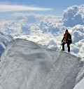
I'll start by saying I was a little reluctant to post this trip report. I've been hiking 14ers on-and-off (mostly off) since moving to Colorado two and a half years ago, primarily because the nature of my job makes it difficult for me to get out & hike as much as I'd like. Having a week of vacation, however, provided me with an opportunity to "catch up". I had initially planned on attempting eight 14ers in the Sawatch range over the course of three days. Day one would involve the hike up Browns Creek to summit Tab/Shav followed by Antero, day two would consist of Harvard with the traverse to Columbia, and day three would involve Belford/Oxford/Missouri. Pretty ambitious, and in retrospect I probably could've finished day two but completing the final tri-fecta certainly would've been a challenge. For reasons described below the outing was called off after the first day of hiking, so from my perspective I can't help but view this -- in some way -- as a defeat. That being said, my route of ascent of Tab/Shav from Browns Creek has not been extensively documented with supporting photos on this site (at least from my research), so hopefully this report may come in handy for future hikers who choose this route.
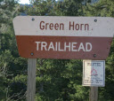
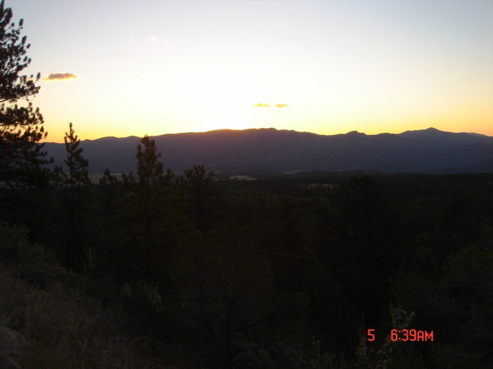
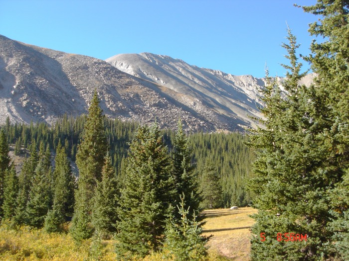
I knew an early start would be necessary to bag Shav/Tab/Antero all in one day. Unfortunately I opted to drive out EARLY that morning instead of coming out the day prior & setting up camp at Browns Lake. Boudreaux (dog) and I arrived at the Browns Creek TH around 6:15 a.m., later than I had hoped, and set out quickly. This would be Boudreaux's third & fourth 14er (Belford in snow & Quandary earlier), and I was a little anxious to see how he'd do. It was surprisingly warm -- 60 degrees -- at the TH with gusts of wind but otherwise there wasn't a cloud in the sky. Thankfully not a single cloud appeared the entire day, but it did turn out to be warm and VERY windy.
Sunrise at the TH
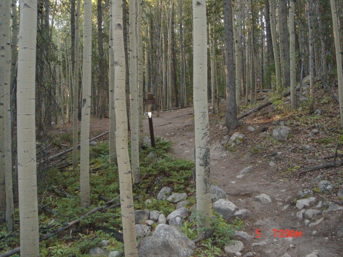
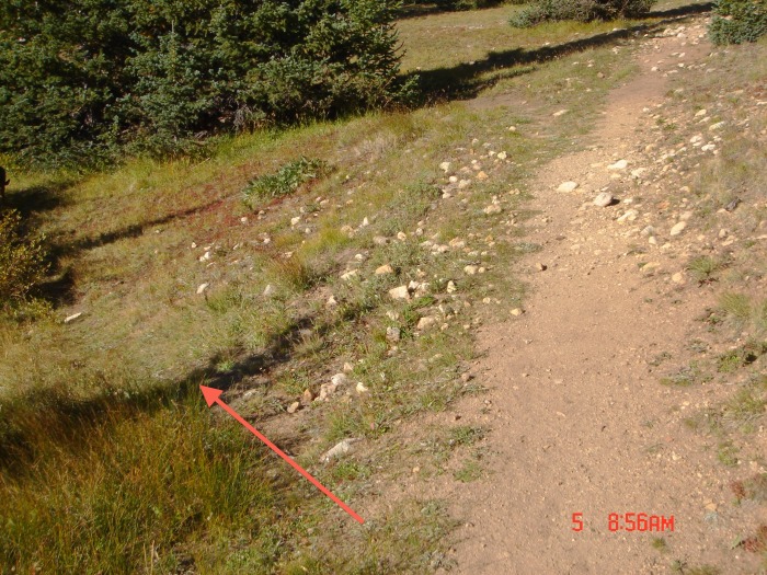
It's approximately six miles from the TH to Browns Lake and took me about 1:15-1:30 to complete. For those of you who are unfamiliar with the trail, yes, you do go through the barbed wire fence gate at the beginning of the trail. Otherwise the trail was very pleasant with casual climbs separated by nice, flat stretches and a few creek crossings. It's also pretty hard to lose track of but does diverge in a few of the camping areas -- if in doubt, as long as you continue to see/follow the horse droppings you're on the right path.
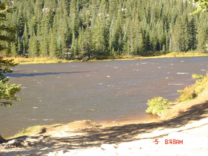
The wind had really picked up by the time I arrived at Browns Creek. I shot this photo of the lake to show the surface waves caused by the wind. From here you can also see a ridge, the backside of which contains the couloirs you'll be ascending.
As you continue on the trail for another quarter of a mile you'll come to a sign reading "Closed to Motor Vehicles". About 40 feet afterwards you'll notice a small trail veers off to the left through the campground -- follow it.
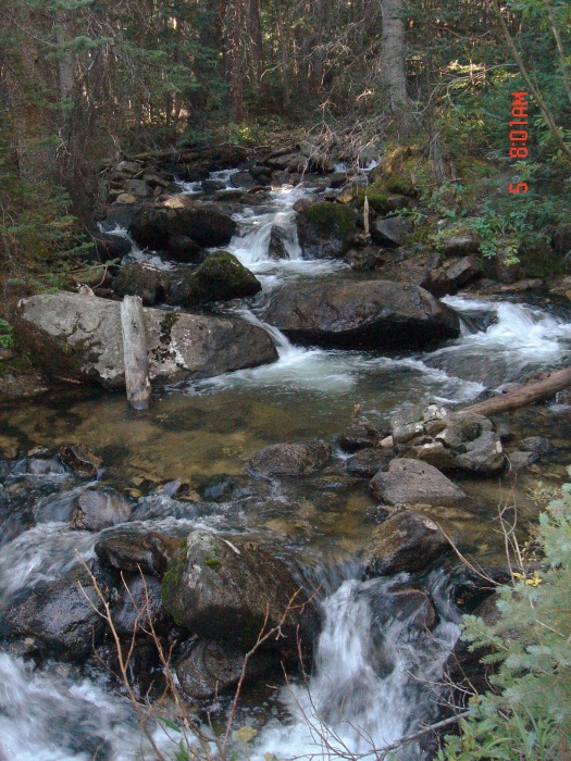
Stay to your left as you walk through the camping area and before long you'll come to a log bridge that crosses the creek (there's actually another one about 100 yards further upstream) -- it's pretty hard to miss.
Shortly after crossing the bridge you'll enter what's more-or-less a maze of talus ridges and troughs. If you keep your eyes peeled there are a few cairns marking the path, otherwise just head in the general direction of the couloir opening (at the bottom of the ridge photographed above). I may be wrong, but I think these troughs all begin at the bottom of the couloirs anyway.
Ideally I would've been starting my ascent up to the saddle just as the sun rose, but for a number of reasons I fell behind schedule and did not start my climb until 9:00 a.m. Here's a photo of the couloir with my route outlined.
In retrospect, correct path to the left.
I stayed to the right amongst the larger rocks/talus since it was easier to find footing. If you stay to the left you definitely start to have problems with slippage (as I learned on the descent). It's a pretty long climb, and as I drew nearer to the summit I began to feel that I was off-course (i.e., that I was not destined for the saddle). Near the top of this photo I changed course, gained the ridge on the left and surveyed what was, in fact, the true couloir to the saddle.
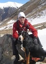
Unfortunately the descent into this couloir was covered in loose rock/scree but we eventually made it into the gully and completed the climb into the saddle around noon. Boudreaux was doing well at this point, but I noticed the shoes on his back paws hand turned up-side down and he had completely worn through the tops of his shoes:
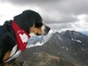
Mt. Antero from the saddle
That's what I get for not buying REI...I quickly removed his back shoes and replaced them with the intact front set, making sure I had them on tightly.
We ascended Tabaguache first. The initial trail is well-marked with a few cairns, but it was quickly lost in the talus. Ultimately we undertook a direct scramble to gain the summit. Signed the log -- first and maybe only climber of the day given my late start and didn't see anybody else while on Shavano.
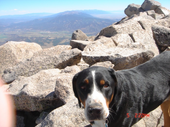
Mt. Shavano from Tabeguache summit.
Our descent back to the saddle was quick & uneventful. We then tackled Shavano, which also involved much scrambling over talus. Some sections bordered on too-technical for the dog & I had to coax him through some points. The wind from the west was also pretty horrible along the summit ridge, nearly blowing me off my feet (likely would have if didn't have poles) on a few occasions, and we were thankful for a reprieve when the trail kept to the eastern part of the ridge. The multiple false summits also became a little dis-heartening, but we finally reached the summit at 2:00 p.m. and took a breather. I would've been more concerned about our timing but the skies were still perfectly clear. Boudreaux was getting tired and kept putting down large amounts of water, but his spirits seemed pretty good:
The descent back to the saddle was uneventful. Here's a photo showing my general path down the couloir.
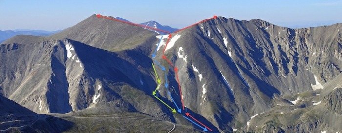
I stayed to the right, again amongst the larger rocks to keep better footing and hopped from one grassy/mossy patch of rocks to the next. I was unsure exactly how this couloir was going to end (I could not recollect seeing it's exit at the bottom on my initial ascent), so I crossed over the left and gained an easy, grassy ridge dividing the saddle couloir and the other couloir I had ascended to get a better view of the landscape. This is where I made a big mistake. Neither of the remaining couloir paths looked great, but I noticed a rough trail coming directly off the tip of the ridge I was on that descended directly to the end -- sorry, no photo! Unfortunately me & the dog took this path. I ended up sliding and crab-walking most of the way down, and Boudreaux was very reluctant/afraid to follow. I don't blame him -- it was my fault for taking him down a descent that was too technical, but with constant coaxing I eventually got him to the bottom. In retrospect, I should've stayed in the saddle couloir and followed it through to the end. What should've been a two hour (tops) descent turned into a 3.5-hour ordeal. We eventually made it to the bottom & the hike back to Browns Lake was pretty uneventful -- our arrival time there was approximately 6:00 p.m. Antero had been dismissed as an option hours earlier -- will have to come back another time. I could tell at this point Boudreaux was exhausted. He drank the rest of my water (last six miles to TH without -- ugh) and lapped up a good deal of Browns Creek. Hopefully he won't get Giardia...the sun set during our return trip and the last 1.5 miles was hiked in the pitch-black of the woods (with headlamp). So, things stood thus at the end of day one: unmet goals for day one, exhausted and banged-up dog that could not continue (I at least didn't want to test this), and exhausted owner after a 14-hour day. The rest of the peaks will have to wait for another time. Here's a photo showing my ascent (red), decent (blue), and the (IMO) correct descent route (in green).
Apologies for slacking off on the descent photos -- at that point my sole concern was getting to the bottom and finishing 2/3 of the peaks. Numerous apologies have also gone out to Boudreaux for what I put him through, and I suppose in a way writing this trip report has been somewhat cathartic. Only easy class 2s from now on, boy! If anybody has more experience with this route it'd be great to hear some feedback, although it's probably safe to say I won't be climbing this route again.
Thumbnails for uploaded photos (click to open slideshow):
Sounds like a fun, challenging day. We descended your ”green” route about a month ago after climbing Shav/Tab from Blank Cabin. If it's any consolation - that route wasn't all that pleasant either.
Rob -- the gusts I felt at the lake were almost as bad as those on the summit, so I wouldn't be surprised if the conditions were worse during your earlier ascent. I actually do remember seeing your tent & sorry I missed you. At least you were off the mountain at a decent time. :oops:
Green -- saw your TR, sounded like a fun challenge & too bad about the weather. The northern slopes are definitely the fastest way down, but if I had gone solo w/ the intent of bagging all 3 I considered setting out from Baldwin Gulch and taking the western ridge up to Tab (Tab-Carbonate traverse) before/after Antero. Less direct but seems more enjoyable...
I have a hard time planning more than two days- I think my ambitions just get in the way of my reality. Still, sounds like you had quite a day. Well done! Keep the perspective that what you experienced, most people would not be physically able to do it, and have never seen or lived it. Definitely NOT a defeat!
Good job! I am the guy you met around 8AM on your way up the trail. I spent the previous night on Tab so I know what you mean about the wind...WOW. I'll also post a report of the good time this approach offers these 3 peaks but I need to rest first. The easiest and safest route up is actually on the larger grassy slope to the east of your route. Glad you and Boudreaux made it safely.
Funny, we ascended your descent route, and vice-versa yesterday (9/6, labor day). You probably walked right through our camp just before the 3-log bridge, past Browns Lake (yellow-grey tent). We left camp at 7am, returned at 11:30 am.
You are tougher than us! After reaching the saddle, we tried Shavano first, kept getting blown off our feet, started crawling to the summit, finally gave up with literally 100' of vertical to go. We didn't even try Tab after returning to the saddle. I was with my son, and my fatherly protection kept us from being successful. We're talking about 9 am when at the saddle, maybe it got slightly less windy later.
Good job in really tough (wind) conditions!!!
Caution: The information contained in this report may not be accurate and should not be the only resource used in preparation for your climb. Failure to have the necessary experience, physical conditioning, supplies or equipment can result in injury or death. 14ers.com and the author(s) of this report provide no warranties, either express or implied, that the information provided is accurate or reliable. By using the information provided, you agree to indemnify and hold harmless 14ers.com and the report author(s) with respect to any claims and demands against them, including any attorney fees and expenses. Please read the 14ers.com Safety and Disclaimer pages for more information.
Please respect private property: 14ers.com supports the rights of private landowners to determine how and by whom their land will be used. In Colorado, it is your responsibility to determine if land is private and to obtain the appropriate permission before entering the property.


 Sunrise at the TH")
")
")
")
")
")
")
")
")
 In retrospect, correct path to the left.")
")
")
 Mt. Antero from the saddle")
 Mt. Shavano from Tabeguache summit.")
")
")
")