Download Agreement, Release, and Acknowledgement of Risk:
You (the person requesting this file download) fully understand mountain climbing ("Activity") involves risks and dangers of serious bodily injury, including permanent disability, paralysis, and death ("Risks") and you fully accept and assume all such risks and all responsibility for losses, costs, and damages you incur as a result of your participation in this Activity.
You acknowledge that information in the file you have chosen to download may not be accurate and may contain errors. You agree to assume all risks when using this information and agree to release and discharge 14ers.com, 14ers Inc. and the author(s) of such information (collectively, the "Released Parties").
You hereby discharge the Released Parties from all damages, actions, claims and liabilities of any nature, specifically including, but not limited to, damages, actions, claims and liabilities arising from or related to the negligence of the Released Parties. You further agree to indemnify, hold harmless and defend 14ers.com, 14ers Inc. and each of the other Released Parties from and against any loss, damage, liability and expense, including costs and attorney fees, incurred by 14ers.com, 14ers Inc. or any of the other Released Parties as a result of you using information provided on the 14ers.com or 14ers Inc. websites.
You have read this agreement, fully understand its terms and intend it to be a complete and unconditional release of all liability to the greatest extent allowed by law and agree that if any portion of this agreement is held to be invalid the balance, notwithstanding, shall continue in full force and effect.
By clicking "OK" you agree to these terms. If you DO NOT agree, click "Cancel"...
This is the standard route up Humboldt, and I'm putting up a trip report largely because we were very fortunate when it comes to photographic views. Anyhow, Colleen, Brad and I decided to knock off another mountain together - I managed to entice both by claiming that it wouldn't be that hard (for a fourteener) and that the views would be second to none. Luckily, I was right on both counts.
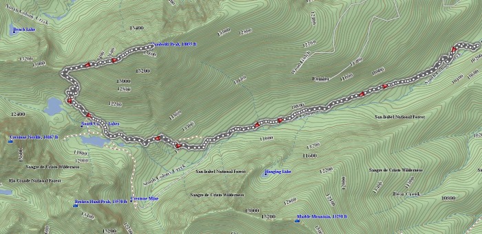
Our journey:
As you can see, we started at the recently-closed South Colony Lakes trailhead. The road to the trailhead wasn't as bad as I had feared (having said that, we weren't in my Ranger, and I wasn't driving, which always makes it less stressful). I'm not sure that I would attempt it in something lacking 4wd capability.
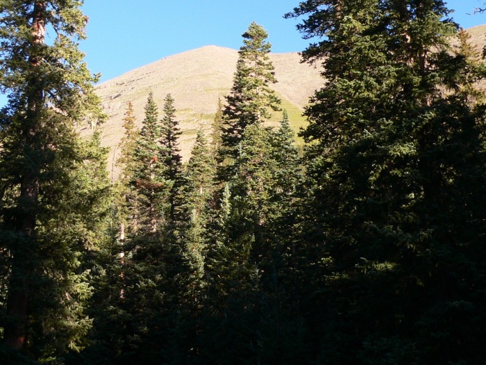
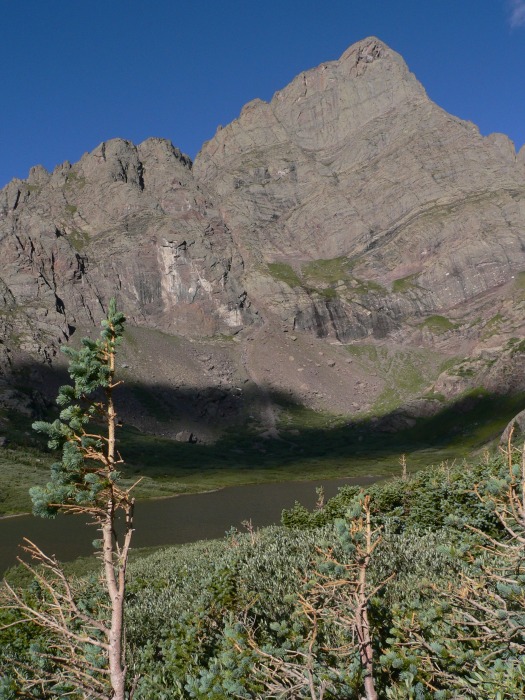
Starting up the now-closed road, we get our first few tantalizing views of Humboldt "peaking" through the forest:
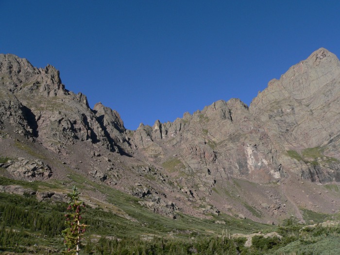
After a bit, the Crestones come into view, as well as Broken Hand Pass. For the entire hike, we kept looking over to see if we could see the trail over the Pass, and we would lose it near the top. Wherever it is, it's steep.
After taking one of the shortcut trails, we finally reach the end of the valley, and now have to climb the steep trail to the saddle. The trail is surprisingly good on the saddle climb:
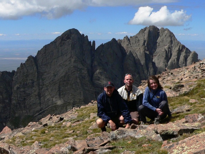
From the information I had been able to gather, I knew that the views of the Crestones were unparalleled on this hike. All of this information greatly undersold the actual views. Crestone Needle:
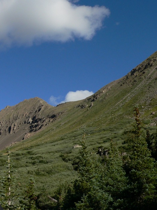
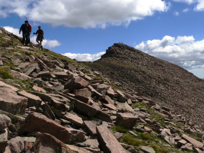
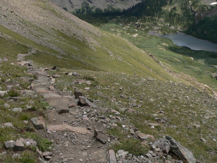
It's a steep climb to the saddle west of Humboldt, but someone (almost surely the CFI) put a heck of a lot of effort into the trail. These nice stone steps help to keep erosion away:
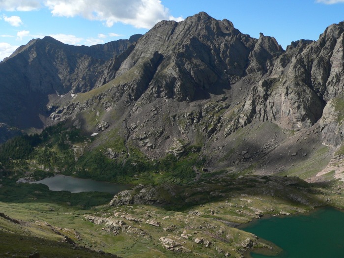
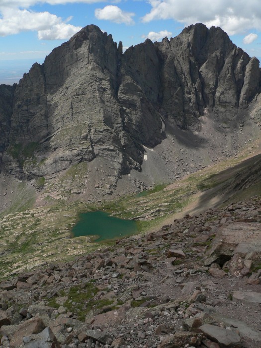
From higher up on the saddle - cameras are a great excuse to take breaks while ascending - here are the South Colony Lakes, with Marble Mountain, Broken Hand Peak, and a smidge of Crestone Needle:
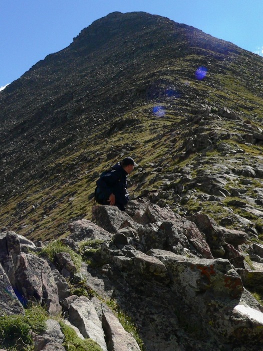
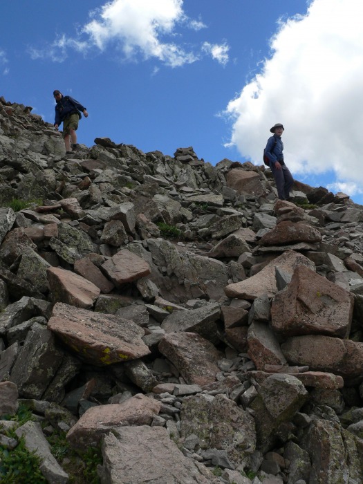
Finally, we make the saddle, and get a good look at Humboldt's west ridge. The trail starts to get harder to find here, and there is a lot of rock-hopping.
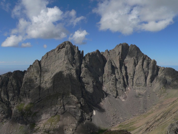
I could not believe that we were fortunate to view Crestone Needle and Crestone Peak for the vast majority of our hike. Keeps the blood pumping!
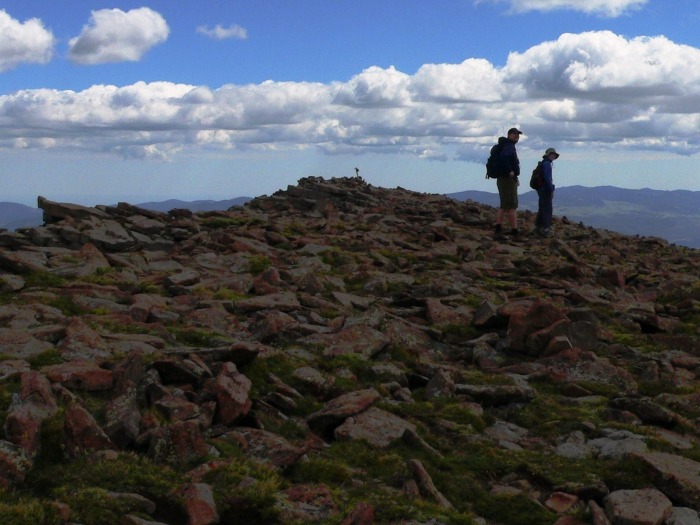
We reach the false summit, with still a little bit of work required to get to the true summit. Certainly not as bad as other false summits - maybe another 100 vertical feet to go?
Humboldt's north face - photo cropped to scare my mom:
And we reach the large, broad summit of Humboldt Peak. Only five others on the summit - an awfully low number for a beautiful storm-free Saturday in August.
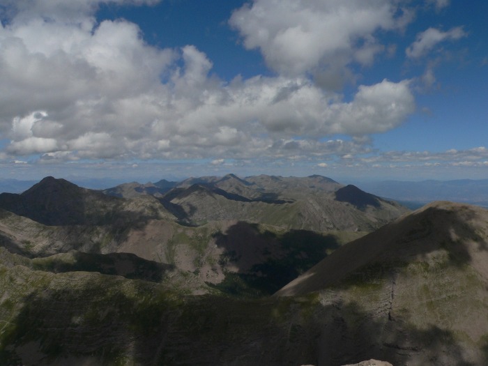
Foreground: Cleveland Peak and Milwaukee Peak. Midground: Tijeras Peak, Music Mountain, and Point 13,384'. Background: Mount Lindsey, Blanca Peak, Little Bear Peak, Twin Peaks.
So many beautiful mountains in the Sangre de Cristo range!
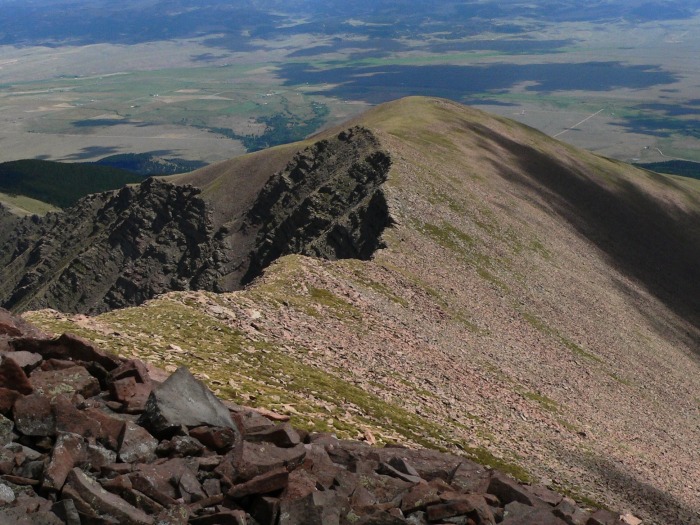
A look down Humboldt's east ridge (winter shortcut):
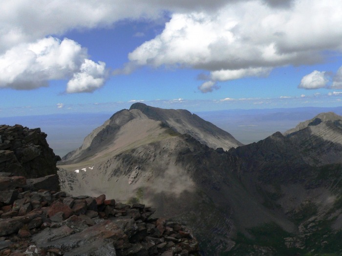
Columbia Point, Kit Carson Peak, and Challenger Point:
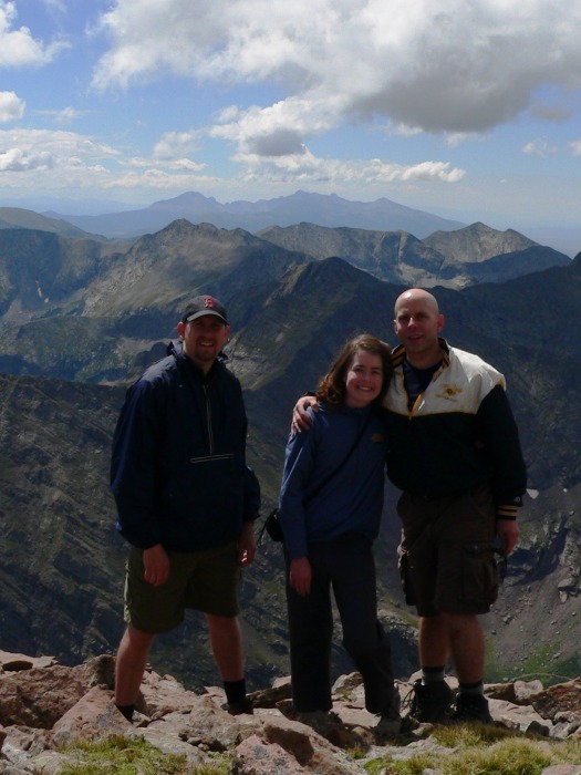
Official summit photo one of two, with the Crestones in the background. I lug a tripod around on these things, so I may as well use it:
Official summit photo two of two, with the Blanca massif in the background. This is Brad's third fourteener, Colleen's fourth, and my eighteenth.
Across to Marble Mountain and the Spanish Peaks. Colleen and I attempted West Spanish Peak a few months ago, but the weather was so nasty that we never even saw the peak (despite circumnavigating it).
To the north, a bevy of high peaks. Foreground: Colony Baldy. Midground: Mount Adams, Fluted Peak, Rio Alto Peak, Electric Peak, Little Horn Peak, Gibbs Peak, Spread Eagle Peak, and Horn Peak. Waaaaaay in the back, Mount Ouray and Mount Shavano. They're hard to see unless you already know where they are.
The hardest part of these hikes for me is the descent, but with views like this, it makes it easier:
The west ridge is steep, with handholds needed a lot of the time:
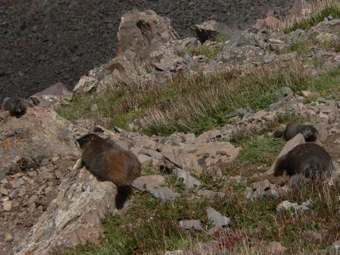
A marmot family! I've seen more adult marmots over the past few months than I care to count, but I can't recall seeing a baby (or two!) prior to this:
From the saddle back to the lakes? Steep, steep, and more steep.
Now at the top of the valley again, another shot of the Crestones. These peaks are hard to get tired of.
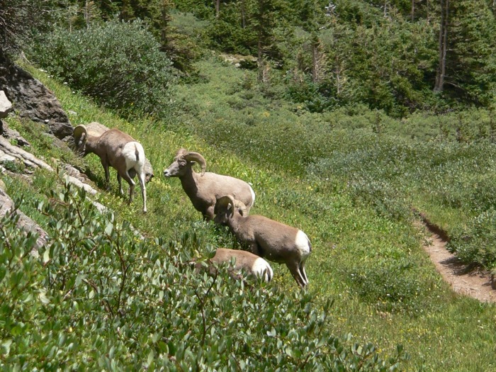
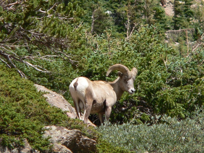
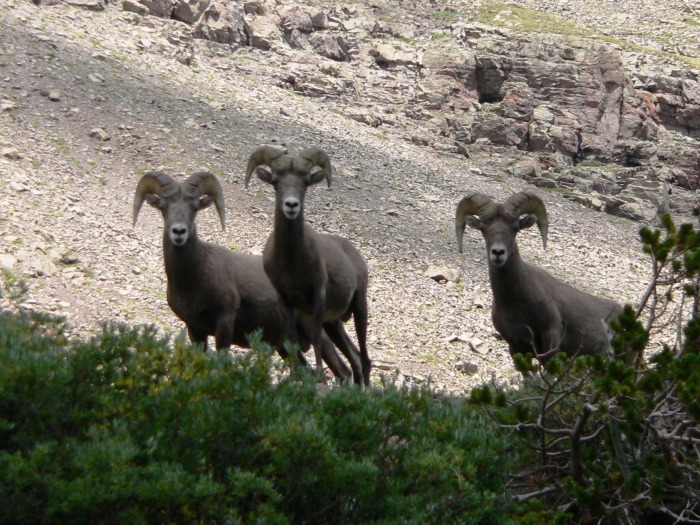
And...right place, right time! On the descent shortcut, we came within ten feet or so of a pack of bighorn sheep. They were very calm, climbing to a higher ridge to observe us.
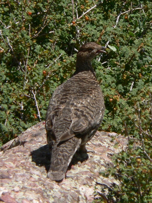
I think that this is a ptarmigan, but is it that, or a pheasant, or a grouse?
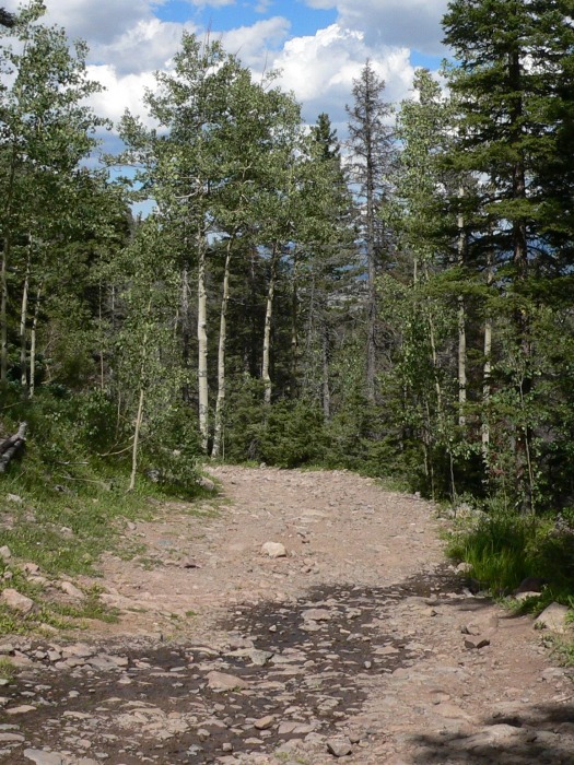
Back on the South Colony Lakes road, now rock-strewn and hot. Okay, always rock-strewn.
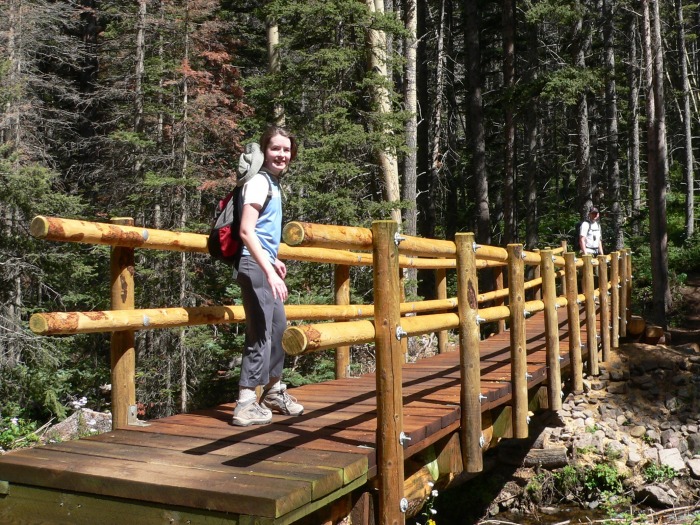
And back to the bridge which starts the hike (and ends the hike):
All in all, a great day of hiking with some eye-popping views, and great company. About 3.5 hours from downtown Denver to the trailhead each way, which makes for a long day (and we managed to hit Broncos traffic from Colorado Springs back to Denver), but I hope you've enjoyed the photos. I'm constrained to thirty, so I tried to pick the best of the best.
My GPS Tracks on Google Maps (made from a .GPX file upload):
The trail crews have been at work since I was up there last. Looks like you had pretty good weather and plenty of wildlife! I would guess that is a ptarmigan but I'm no expert and it looks pretty dark. Nice work.
Thanks for showing the conditions. It does look as thought CFI has done some work. Looked like a great day for you and your crew.
Caution: The information contained in this report may not be accurate and should not be the only resource used in preparation for your climb. Failure to have the necessary experience, physical conditioning, supplies or equipment can result in injury or death. 14ers.com and the author(s) of this report provide no warranties, either express or implied, that the information provided is accurate or reliable. By using the information provided, you agree to indemnify and hold harmless 14ers.com and the report author(s) with respect to any claims and demands against them, including any attorney fees and expenses. Please read the 14ers.com Safety and Disclaimer pages for more information.
Please respect private property: 14ers.com supports the rights of private landowners to determine how and by whom their land will be used. In Colorado, it is your responsibility to determine if land is private and to obtain the appropriate permission before entering the property.