Download Agreement, Release, and Acknowledgement of Risk:
You (the person requesting this file download) fully understand mountain climbing ("Activity") involves risks and dangers of serious bodily injury, including permanent disability, paralysis, and death ("Risks") and you fully accept and assume all such risks and all responsibility for losses, costs, and damages you incur as a result of your participation in this Activity.
You acknowledge that information in the file you have chosen to download may not be accurate and may contain errors. You agree to assume all risks when using this information and agree to release and discharge 14ers.com, 14ers Inc. and the author(s) of such information (collectively, the "Released Parties").
You hereby discharge the Released Parties from all damages, actions, claims and liabilities of any nature, specifically including, but not limited to, damages, actions, claims and liabilities arising from or related to the negligence of the Released Parties. You further agree to indemnify, hold harmless and defend 14ers.com, 14ers Inc. and each of the other Released Parties from and against any loss, damage, liability and expense, including costs and attorney fees, incurred by 14ers.com, 14ers Inc. or any of the other Released Parties as a result of you using information provided on the 14ers.com or 14ers Inc. websites.
You have read this agreement, fully understand its terms and intend it to be a complete and unconditional release of all liability to the greatest extent allowed by law and agree that if any portion of this agreement is held to be invalid the balance, notwithstanding, shall continue in full force and effect.
By clicking "OK" you agree to these terms. If you DO NOT agree, click "Cancel"...
Mount Oklahoma Elevation - 13,845 feet Route - Southwest Slopes Total Trip Time - 8 hours Round-Trip Distance - 8 miles Elevation Gain - 3,400 feet
Introduction
Looking at Mount Oklahoma's impressive southwestern ramparts while on a hike to the Fryingpan Lakes a few years ago I promised myself I would climb it someday. Then I found out that it was a "Centennial Thirteener" one of the highest 100 peaks in the state (#85 to be exact) and it quickly rose higher on my ever expanding list. Admittedly, it's taken me awhile to get to it, but I am glad that I finally did as it was a great day.
I drove to Leadville the night before and found a secluded camping spot just down the road from the North Halfmoon Trailhead. Upon my arrival around dark, I discovered that I had neglected to bring my toothbrush, cell phone (something I don't like climbing without), and also forgot to check the batteries on my altimeter, which was dead. I debated with myself whether to attempt the climb, but decided to give it a shot: "Well this is going to be an interesting day" I thought to myself as I settled in for the night, "I hope I don't get into trouble..."
Hiking The North Halfmoon Trail
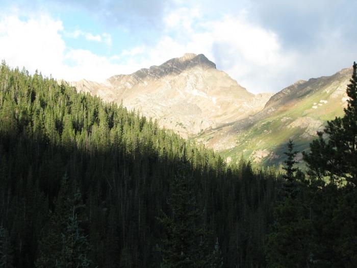
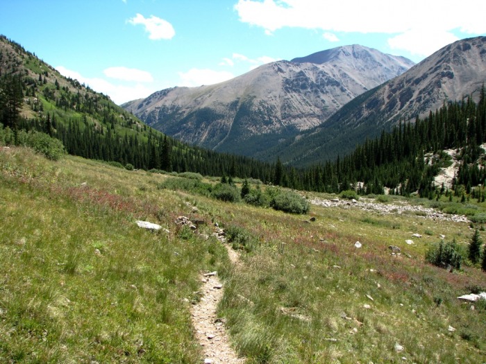
The alarm went off at 5 AM and I was on the trail by 5:45. As I began my hike I could feel a steady breeze and noticed the clouds moving quickly overhead. That's when I knew it was going to be a windy day. Nevertheless, guided by my headlight, I made good progress on the rocky trail through the evergreens and willows and soon reached a large open meadow below Mount Massive where Mount Oklahoma came into view:
Mount Oklahoma gets hit by early morning light
After crossing the meadow I came to the junction with the North Massive Trail. Here I continued straight (left) on the North Halfmoon Trail as it climbed steeply through the forest and over some large rocky areas towards the upper part of the valley.
North Massive/North Halfmoon Creek Trail Junction
Impressive looking Deer Mountain (13,761 feet) to the southeast
Climbing The Basin Below Mount Oklahoma
Not having my altimeter I was a bit concerned I would miss the turnoff into the basin for Mount Oklahoma which is supposedly at 11,600 feet but I couldn't tell for sure. Kane's excellent description on SummitPost to look for "a place where the stream cascades down, like a waterfall" was very helpful and I continued another .75 miles and soon reached a very evident stream crossing where a log straddled the creek:
The North Halfmoon Creek crossing at around 11,600 feet
Unfortunately it was too wet and slick to cross. Not wanting to take a early morning "swim", I looked for another spot and found a narrow section, behind a rock, just upstream.
A narrow spot where I crossed the creek just above the standard log crossing at 11,600
Once across, I climbed up a small slope and found a use trail that descended southwest through the trees.
A faint use trail winds its way through the woods towards Mount Oklahoma
I continued to follow this cairned trail for about .25 miles as it wound through the trees to the right around a marshy area and then popped out of the woods into the lower basin below Mount Oklahoma.
Emerging from the trees into the lower basin
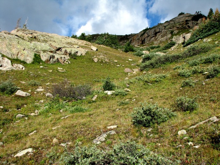
From here I crossed a small side stream, hiked through a couple of small meadows (avoiding the willows) and began to climb steeply up into the upper part of the basin, following more cairns.
Climbing steep grassy slopes to reach the upper basin
A look back down into the lower basin (my route followed the slope in the left side of this photo)
Reaching the upper basin below Mount Oklahoma's summit ridge
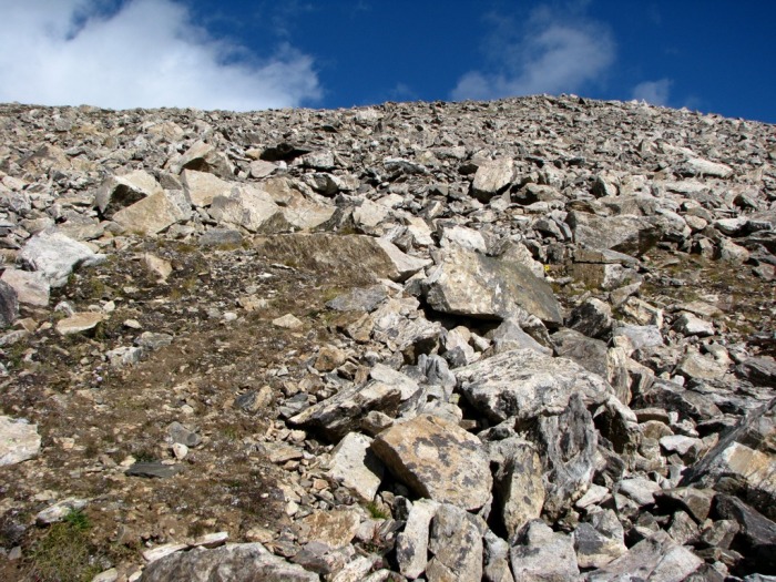
The Nasty Grass/Scree Slope
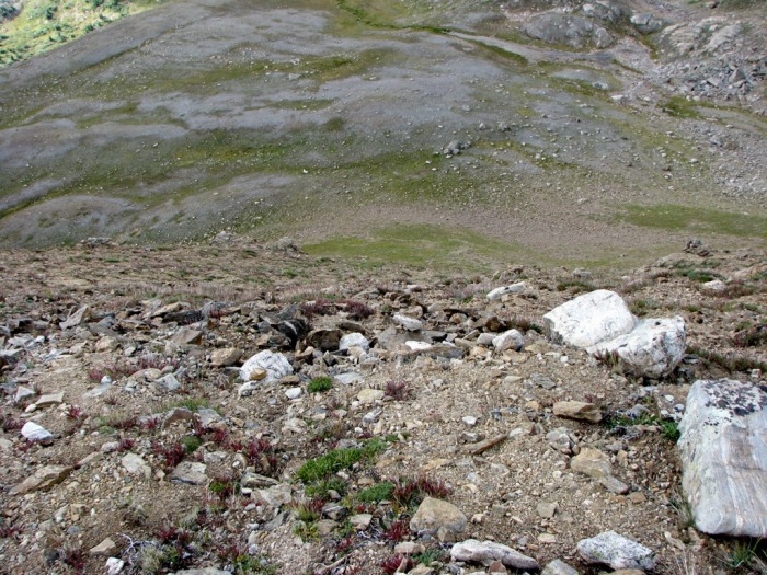
After hiking another .5 miles, I reached the upper basin below Mount Oklahoma's cliffs and saw grassy/scree ramp described in Gerry Roach's description (although he calls it a "talus slope") to my right. I began to climb this slope which was easy at first, but soon became steeper and looser as I reached the top. Also, random large gusts of wind that came blasting over the summit didn't help my ascent:
A look at the steep grass/scree slope (it doesn't look that steep but it is...)
Another view. Looking back down the grass/scree slope to the upper basin
The Summit
From the top of the ramp (grass/scree slope) the angle eased and I began climbing southeast across grass and talus on a faint trail towards the windy summit ridge. Soon I reached a flat area and saw the twin summit blocks the north. From here it was a short jaunt to reach the top around 10 AM.
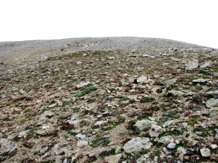
Climbing talus and grass to reach the summit ridge
More talus
A look back at the ridge just below the summit (my route ascended/descended around the corner to the left)
Mount Oklahoma's summit dome
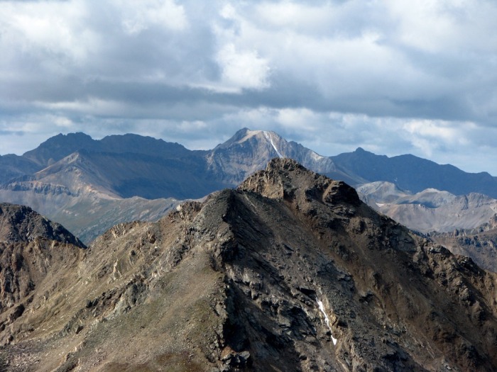
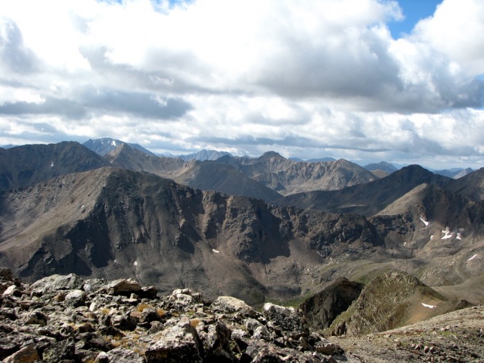
Some summit shots:
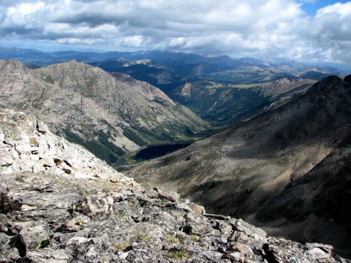
Looking down into the Fryingpan River Valley (Upper Fryingpan Lake can be seen in the lower left center)
North Massive above the North Halfmoon Lakes
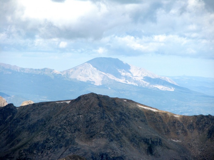
A personal favorite - Mount Sopris (12,953 feet) to the south
La Plata rises above Casco and Frasco Peaks
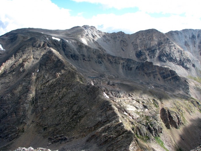
Who says the Sawatch doesn't have any rugged peaks? Grizzly Peak A (background) and Deer Mountain (foreground)
Basalt and Red Table Mountains (background)
A sea of Sawatch Range peaks
Oh, so that's why they call it Castle Peak!
My Descent
After spending a cold forty-five minutes on the summit in the rocks, reading the register and munching on food, and enjoying the views, I began my descent. Overall my downclimb was uneventful, until I reached the grass/scree slope.
The first part went okay, but after I got half way down, I got a bit cocky and attempted to scree ski a bit, only to find myself falling and sliding on my butt for a few feet. No harm done, except for a few minor scraps/bruises, but I did manage to tear a hole in my nice Go-Lite shell (bummer ) which I just sent in for repair.
A word to the wise: DON'T UNDERESTIMATE THIS SLOPE!
Looking down Mount Oklahoma's ridge from below the summit (the top of the slope begins below the small grassy area, cente
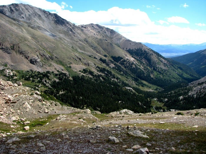
Once I made it to the flat area in the upper part of the basin, I stopped, ate a bit more, removed some clothes, and assessed the damages to my jacket before beginning my descent back towards the North Halfmoon Creek Trail.
Much of my route from the upper basin back down to the North Halfmoon Creek Trail
A look back up the lower part of the basin above North Halfmoon Creek
When I arrived at the trail the wind had died and the temperature was great, and I enjoyed the warmth and calm of the valley as I casually hiked the last couple of miles out, arriving back at the trailhead around 1:45 PM.
Descending the North Halfmoon Creek Trail (Mount Elbert is in the background)
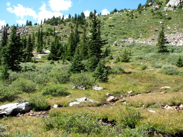
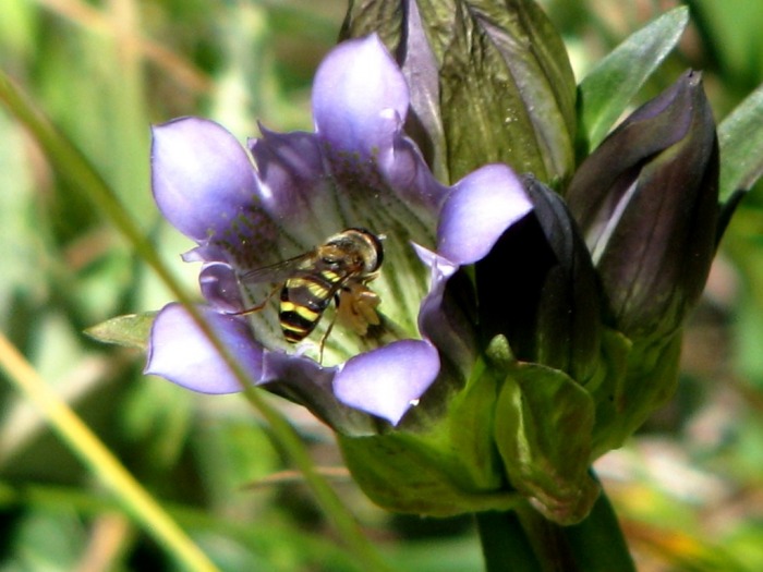
A bee collects the last pollen of the summer
Conclusion
Other then some "screeful adventures" (as KeithK would say) this was a great climb and the views of the Sawatch, Williams, and Elk Ranges from the summit were very enjoyable. Despite being somewhat ill-prepared, the climb was a success. I am really looking forward to going back to the area and completing the rest of the Sawatch Centennials with climbs of French, Casco, and Frasco in the near future.
Thumbnails for uploaded photos (click to open slideshow):
Oklahoma (and Deer) have been on my list for quite a while, this report is very helpful. Thanks! The loose slope that you ascended looks kind of similar to French Mt's slope. Just a warning... :) Really takes a lot of steam to get up that kind of stuff.
Great report as usual, have fun with the French group.
Yes I think Gerry Roach refers to the route to the saddle on the French Group as ”Fiascol” so I am prepared for anything...
Going up the slope wasn't too bad as I was able to sort of zigzag, but its the going down that will get you, so be careful! Of course non of it compares to the stuff in the San Juans :lol:
I was up on Champion and UN13,7xx on saturday and decided the wind was too much so I bailed out before getting deer. Now I am thinking it is a good one to get from the north along with k49.
I climbed Oklahoma the second week of July....I didnt sign the register, but I think we were the 9th or 10th of 2010. Extremely windy, but we didn't see a soul! We crossed the stream a little higher than you and found a nice ”bridge” next to a small waterfall. Great trip report...brought back memories of a great day!
Two of us climbed Oklahoma today. Your report is spot on! We enjoyed the screeful event as well. On our ascent, we followed the creek up further than the standard turnoff. There was a small talus field to cross but later found the footing was very solid on the steep stuff compared to the scree descent. We counted 54 climbers, including us, in the log for 2010. Thanks for posting.
Mt Oklahoma introduced me to the beauty of 13'ers. All the beauty and none of the crowds! What I loved most about this was a sense of adventure. Much more fun than following a well trod trail up to Mt Elbert the day before.
Your trip report was very helpful. The scree slope up high was more challenging than I expected. Trekking poles would have been helpful here. The view of the Mt Massive peaks and halfmoon creek basin were fantastic. The toughest part was wayfinding above 11,600 when we were crossing the creeks. My GPS paths were different on the up and down portions and I'm not sure either was quite as you described but close. Enjoy
Fantastic climbing beta and photos! Thanks for sharing. This will definitely help!
Caution: The information contained in this report may not be accurate and should not be the only resource used in preparation for your climb. Failure to have the necessary experience, physical conditioning, supplies or equipment can result in injury or death. 14ers.com and the author(s) of this report provide no warranties, either express or implied, that the information provided is accurate or reliable. By using the information provided, you agree to indemnify and hold harmless 14ers.com and the report author(s) with respect to any claims and demands against them, including any attorney fees and expenses. Please read the 14ers.com Safety and Disclaimer pages for more information.
Please respect private property: 14ers.com supports the rights of private landowners to determine how and by whom their land will be used. In Colorado, it is your responsibility to determine if land is private and to obtain the appropriate permission before entering the property.