Download Agreement, Release, and Acknowledgement of Risk:
You (the person requesting this file download) fully understand mountain climbing ("Activity") involves risks and dangers of serious bodily injury, including permanent disability, paralysis, and death ("Risks") and you fully accept and assume all such risks and all responsibility for losses, costs, and damages you incur as a result of your participation in this Activity.
You acknowledge that information in the file you have chosen to download may not be accurate and may contain errors. You agree to assume all risks when using this information and agree to release and discharge 14ers.com, 14ers Inc. and the author(s) of such information (collectively, the "Released Parties").
You hereby discharge the Released Parties from all damages, actions, claims and liabilities of any nature, specifically including, but not limited to, damages, actions, claims and liabilities arising from or related to the negligence of the Released Parties. You further agree to indemnify, hold harmless and defend 14ers.com, 14ers Inc. and each of the other Released Parties from and against any loss, damage, liability and expense, including costs and attorney fees, incurred by 14ers.com, 14ers Inc. or any of the other Released Parties as a result of you using information provided on the 14ers.com or 14ers Inc. websites.
You have read this agreement, fully understand its terms and intend it to be a complete and unconditional release of all liability to the greatest extent allowed by law and agree that if any portion of this agreement is held to be invalid the balance, notwithstanding, shall continue in full force and effect.
By clicking "OK" you agree to these terms. If you DO NOT agree, click "Cancel"...
This is the peak that we spent the most time researching and getting mentally prepared for. I may have to officially change my favorite 14er from Longs to Wetterhorn - it was an absolutely fantastic experience! We left the trailhead at 6:00 am due to concerns about weather later in the day. This was the first time during our trip the weather was predicted to have an influence on our ability to summit. I found the last 0.6 mile to the upper trailhead rougher than Nellie Creek road to Uncompahgre, but at least it was over quickly. I will let the pictures and captions tell the story. But basically everything that people say about this peak is correct:
1) It is easier than it appears
2) There are plenty of handholds and footholds on stable rock in the steep sections
3) Exhilarating, thrilling, exciting, scary and many other adjectives are applicable
4) Totally worth it - do not pass up an opportunity to climb Wetterhorn
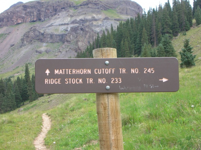
Don't miss this turn. Follow the ridge stock trail at this point.
Like everyone says, it is easier than it appears
Weather conditions weren't ideal - several sprinkles of rain, but nothing threatening
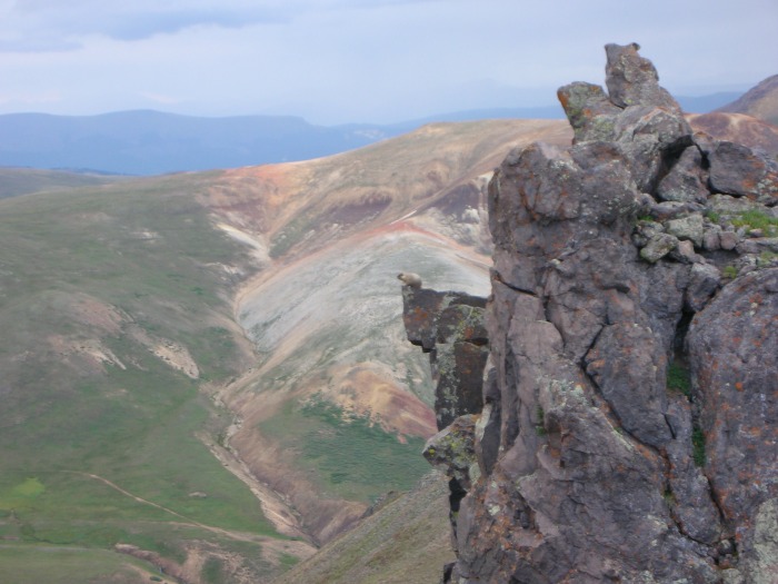
The marmot king surveying his minions below in marmot city
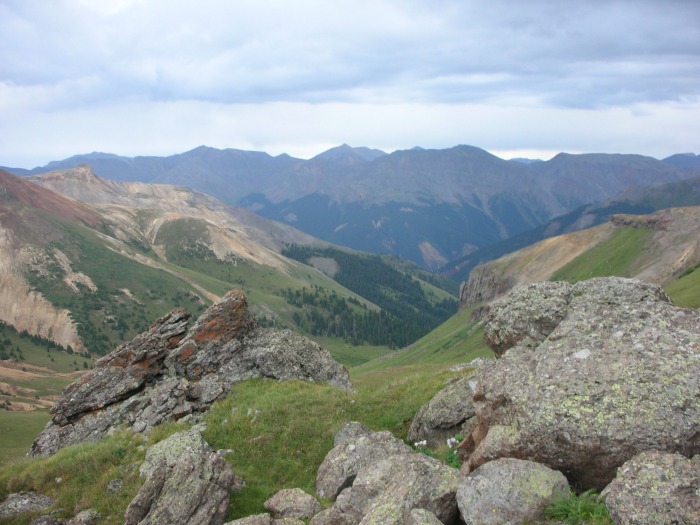
Closer look up by the yellow dirt
Up on the yellow dirt my head started spinning in a way I wasn't comfortable with - maybe due to sinus problems associated with a cold I was battling. The decision was made that Trent would continue on and catch up with 2 hikers that were a short ways ahead and join them for the summit. I would stay back and guard the packs from marauding marmots. After sitting for five minutes I felt much better and since Trent and the other hikers were well within range I decided to continue on. I had no further problems and I am so glad I got off my duff and made the summit. As an added bonus, the marmots respected our personal property and stayed clear!
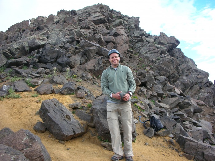
We ditched the packs here and put on helmets
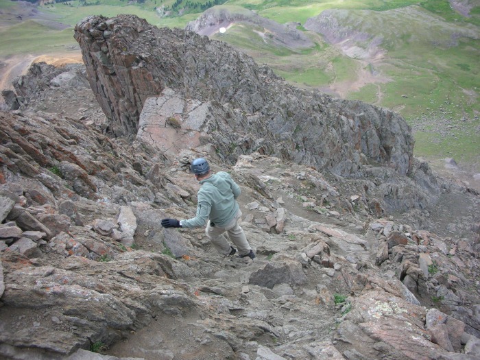
Trent on the ramp
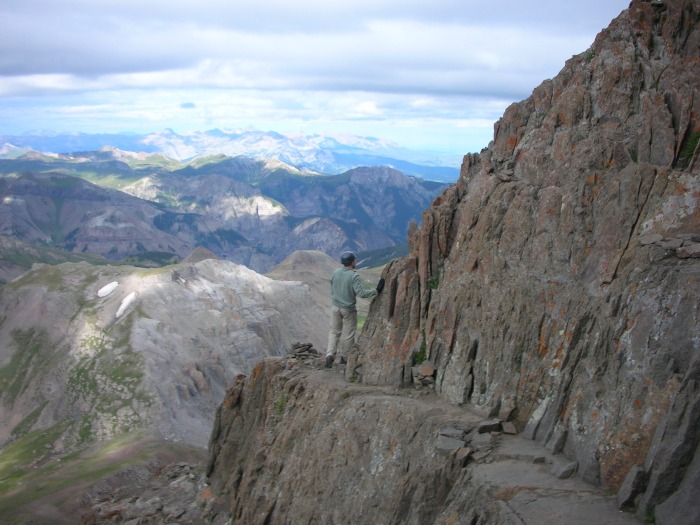
Some exposure, but the ledge is flat and easy to navigate
View from the summit - due to the cloud cover we didn't spend a lot of time on top
Starting the descent with Ship's Prow clearly visible
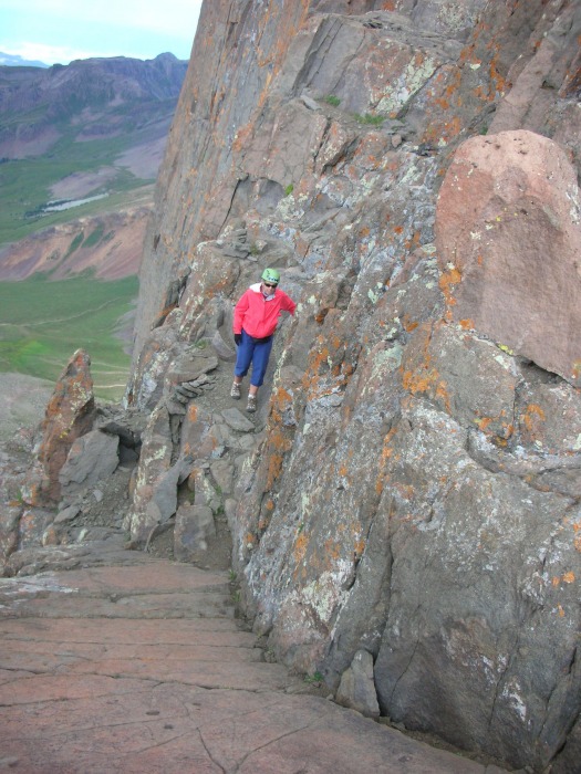
Nebraska hiker on the descent
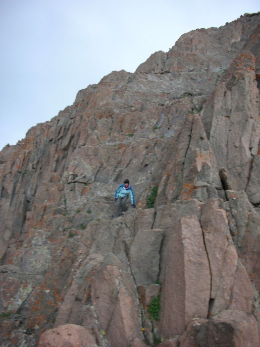
Another Nebraska hiker coming down the steep section - thanks for sharing the summit with us ladies!
One distant rumble of thunder was heard as we approached treeline. Many hikers were still on the way up - hopefully the bad
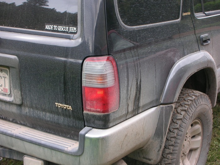
Sticker in window made me laugh - the last section of road to the trailhead is rough
Now back to Lake City for a lazy afternoon in the rain. Dinner that night at the Smoque Shack - fantastic BBQ. Next up - the grand finale, Redcloud/Sunshine combo.
Thumbnails for uploaded photos (click to open slideshow):
This looks like an amazing climb. The photos do a good job of confirming your text that the rock is stable--looks pretty doable. Best of luck with your grand finale on Redcloud and Sunshine. I'll keep my fingers crossed for good weather and that the Marmot King's minions don't roll rocks down upon you.
Caution: The information contained in this report may not be accurate and should not be the only resource used in preparation for your climb. Failure to have the necessary experience, physical conditioning, supplies or equipment can result in injury or death. 14ers.com and the author(s) of this report provide no warranties, either express or implied, that the information provided is accurate or reliable. By using the information provided, you agree to indemnify and hold harmless 14ers.com and the report author(s) with respect to any claims and demands against them, including any attorney fees and expenses. Please read the 14ers.com Safety and Disclaimer pages for more information.
Please respect private property: 14ers.com supports the rights of private landowners to determine how and by whom their land will be used. In Colorado, it is your responsibility to determine if land is private and to obtain the appropriate permission before entering the property.