Download Agreement, Release, and Acknowledgement of Risk:
You (the person requesting this file download) fully understand mountain climbing ("Activity") involves risks and dangers of serious bodily injury, including permanent disability, paralysis, and death ("Risks") and you fully accept and assume all such risks and all responsibility for losses, costs, and damages you incur as a result of your participation in this Activity.
You acknowledge that information in the file you have chosen to download may not be accurate and may contain errors. You agree to assume all risks when using this information and agree to release and discharge 14ers.com, 14ers Inc. and the author(s) of such information (collectively, the "Released Parties").
You hereby discharge the Released Parties from all damages, actions, claims and liabilities of any nature, specifically including, but not limited to, damages, actions, claims and liabilities arising from or related to the negligence of the Released Parties. You further agree to indemnify, hold harmless and defend 14ers.com, 14ers Inc. and each of the other Released Parties from and against any loss, damage, liability and expense, including costs and attorney fees, incurred by 14ers.com, 14ers Inc. or any of the other Released Parties as a result of you using information provided on the 14ers.com or 14ers Inc. websites.
You have read this agreement, fully understand its terms and intend it to be a complete and unconditional release of all liability to the greatest extent allowed by law and agree that if any portion of this agreement is held to be invalid the balance, notwithstanding, shall continue in full force and effect.
By clicking "OK" you agree to these terms. If you DO NOT agree, click "Cancel"...
I had wanted to wait to complete this peak as my finisher, but with my peak list dwindling and not much motivation for driving this weekend, I decided that I would get Pikes. I was a little disappointed as I had envisioned myself hiking up this mountain with my wife and with six more peaks under my belt. But with a lack of funds my plan of completing my goal this year won't happen. Whew! With that stress off of my back I can enjoy the rest of my summer hiking season!
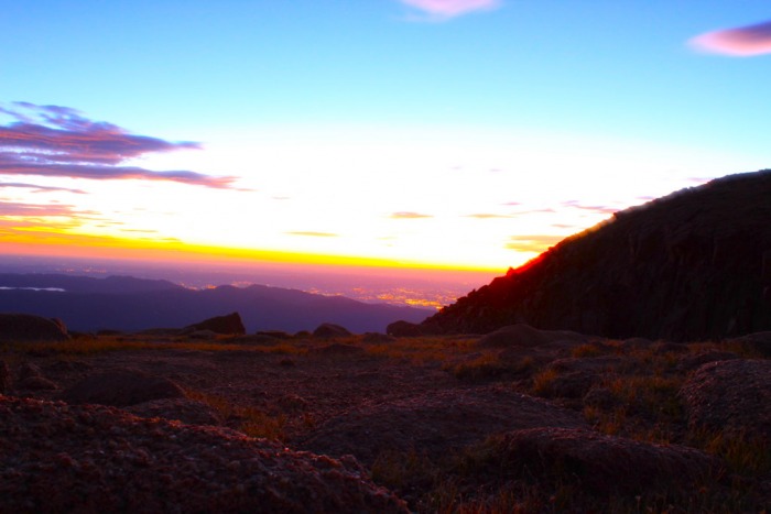
I had left my house in Broomfield at midnight with a planned early summit bid as to avoid the crowds on the summit. I hit the TH at 2am, and thought that the signage was a little lacking, but as Bill described on the route pages they are still building fences and putting up signs. There were some warning flags that were going off in my head, but I wanted to hurry, so I went. I did notice a sign on the trail which directed me to the Ring The Peak trail, which is what I would be doing right? It had been 45 minutes, and still no fork in the trail, and no ground pipes to be seen. I was on the wrong trail! So I went back, looked at the signs more closely and realized I was hiking up Raspberry hill (I guess that's what happens when you don't sleep). Oops, so I went back to the car and continued driving about another 1/4 of a mile up the road and saw the actual TH. It was so obvious I started laughing. So much for a quick start!
An hour and a half later I was standing on the saddle at 12,750 feet. I was surprised at how far away the summit was, but at least the trail moderates dramatically after gaining the saddle.
Little Pikes as viewed from near the saddle entrance
The three miles from the saddle were very pleasant, but my attempted speedy summit bid has taken quite a bit more energy than I had planned. So to help I thought I would slow down and attempt to mess around with my new camera.
I need a tripod!
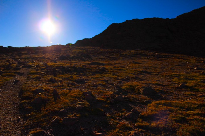
I welcomed the sun, it was warm and inviting. It also helped wake me up. It was a strange feeling to be so tired that I actually started to doze while hiking; good thing this is not a technical climb!
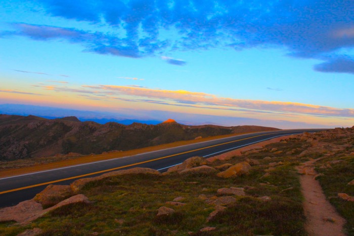
It felt quite peculiar hiking right next to a road, but at least there were no cars on it yet. This mountain is quite spectacular, and contradictory at the same time. With all it's beauty and unique rock formations, the reminder of our ever increasing encroachment on nature is constant.
Pikes Peak massif
Taken after crossing the road at Devils Playground
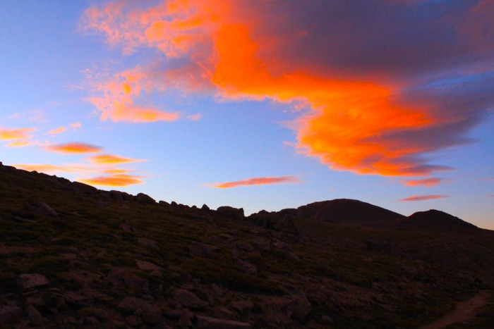
Looking back towards Devils Playground, Little Pikes in alpenglow
Shortly after the above picture was taken, I gradually descended to the road. I didn't see any other options to avoid the road, other than to hike on the shoulder, drop down below the road and climb back up. Nope, I took the lazy way and used the road to my advantage.
After using the shoulder to put you back on the obvious trail there is an easy little hill to ascend.
Pikes peaking above a small obstacle
Looking back down from the top of my short ascent
Once you surmount this little obstacle, Pikes Peak presents herself in all her glory. I also realized that the final summit push wouldn't be as difficult as once thought.
I'm so close!
I can't remember a peak where I was above tree line for such an extended period of time, I was having a blast!
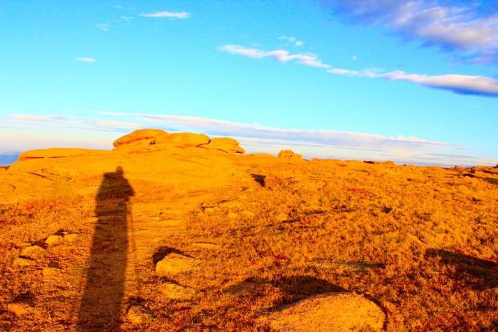
The wanderer
Looking back from before the final road crossing
I banked around a large hill and again dropped slightly toward the road. I didn't realize I would parallel the road for so long. I saw the cairns below the road, but the road proved to be the easiest way again. I stayed on the shoulder for about a hundred yards or so until it banked up to it's final summit run.
Taken before the final summit pitch
I had read in previous TR's that to finish this final push you pretty much just pick your own line, but I arrived at another option. There is a beautiful trail that switches back all the way up the massif. It is easy to follow with large cairns and well built steps, and it is extremely gradual. On the way down I ran into the "Friends of Pikes" who were in the final cleanup stage of the trail construction
On the final pitch, below a small ridge
The trail weaves it's way around the final stretch of the summit road, and eventually drops you off behind the large weather station or whatever it is. I saw the building was owned by the military.
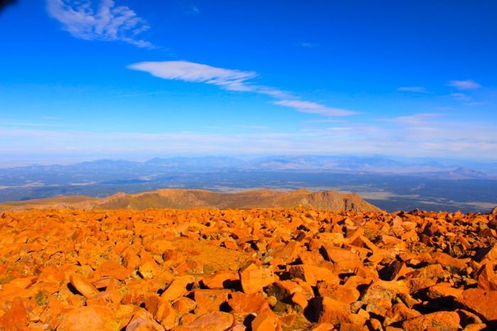
Summit rockpile
Summit success!
Although I had been up here many times by car, I was still struck by the size of this summit, it reminded me of Longs Peak. I sat down behind a rock and ate for the first time, and watched the droves of people start to arrive. There was a vanload of people, accompanied by an equal amount of bikes that arrived just before I did, I did something like that a few years back, it was a blast!
Looking back from the summit I knew I had a long way down, and the flow of people had just increased exponentially so I knew it was time to go.
Looking back towards the saddle entry three miles away (lower point on the saddle)
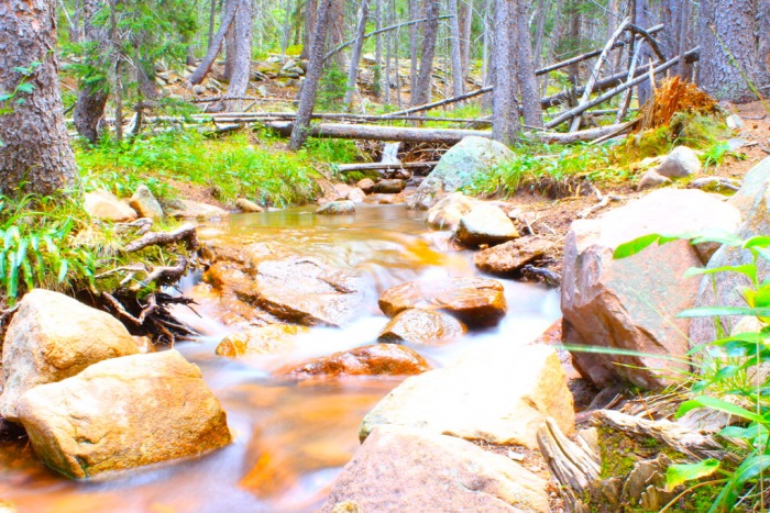
My 1st attempt at a flowing river shot
I was supposed to hike this mountain last, and to be honest I am glad I didn't. This mountain is full of contradictions, but they don't detract from its beauty to be sure. However, it was a little anti-climatic as I have been here many times before. This hike started out rough, and was definitely not a "gimmie" but ended quite nicely. I was a zombie on the drive home, made worse by the I-25 closure at Tomah Rd which added an hour to my short drive. I don't have much more time this summer to hike so I will definitely relish my last few 14ers of this summer, and Pikes was no exception.
Thank you for reading!
Thumbnails for uploaded photos (click to open slideshow):
I was on the Crags route yesterday as well. About an hour into the hike a few groups and I realized that we were hiking in the opposite direction of the summit :shock:
At the fork after the pipes we continued straight (the Crags sign seemed appropriate) onto another trail. Needless to say, we added an extra 3 miles RT to an already lengthy hike. It kicked my butt.
I like your pics; I bet the solitude of sunrise was exceptionally warming. If I were to do this route again (though unlikely), I would start early to catch the alpine glow.
Having this thing in your backyard makes it easy to get to, at least for me! Glad you enjoyed the route. I had a couple good friends that I work with hike that route yesterday also. Congrats on your summit Jason.
Thanks for pointing this out for me to look at on the forum.
Caution: The information contained in this report may not be accurate and should not be the only resource used in preparation for your climb. Failure to have the necessary experience, physical conditioning, supplies or equipment can result in injury or death. 14ers.com and the author(s) of this report provide no warranties, either express or implied, that the information provided is accurate or reliable. By using the information provided, you agree to indemnify and hold harmless 14ers.com and the report author(s) with respect to any claims and demands against them, including any attorney fees and expenses. Please read the 14ers.com Safety and Disclaimer pages for more information.
Please respect private property: 14ers.com supports the rights of private landowners to determine how and by whom their land will be used. In Colorado, it is your responsibility to determine if land is private and to obtain the appropriate permission before entering the property.