Log In 
Report Type 
Full
Peak(s)  Mount Russell - 14088
Horse Ranch Mountain - 8726
Hayford Peak - 9912
Rainbow Point - 9115
Date Posted  08/19/2010
Modified  10/26/2013
Date Climbed   08/10/2010
Author  susanjoypaul
 California 14er Mount Russell - East Arête   
Horse Ranch Mountain (8,726') - 8 miles RT, 3,650' elevation
Mount Russell (14,088') - 9 miles RT, 5,800' elevation
Hayford Peak (9,912') - 14 miles RT, 4,100' elevation
Rainbow Point (9,115') - Drive-up
Team: Doug Hatfield and Susan Paul


Sunday August 8 2010 - Horse Ranch Mountain


Distinction: Zion National Park Highpoint

Horse Ranch Mountain, south face. It sure looked pretty in the light of the morning sun!

100808-HorseMountainRanch.jpg

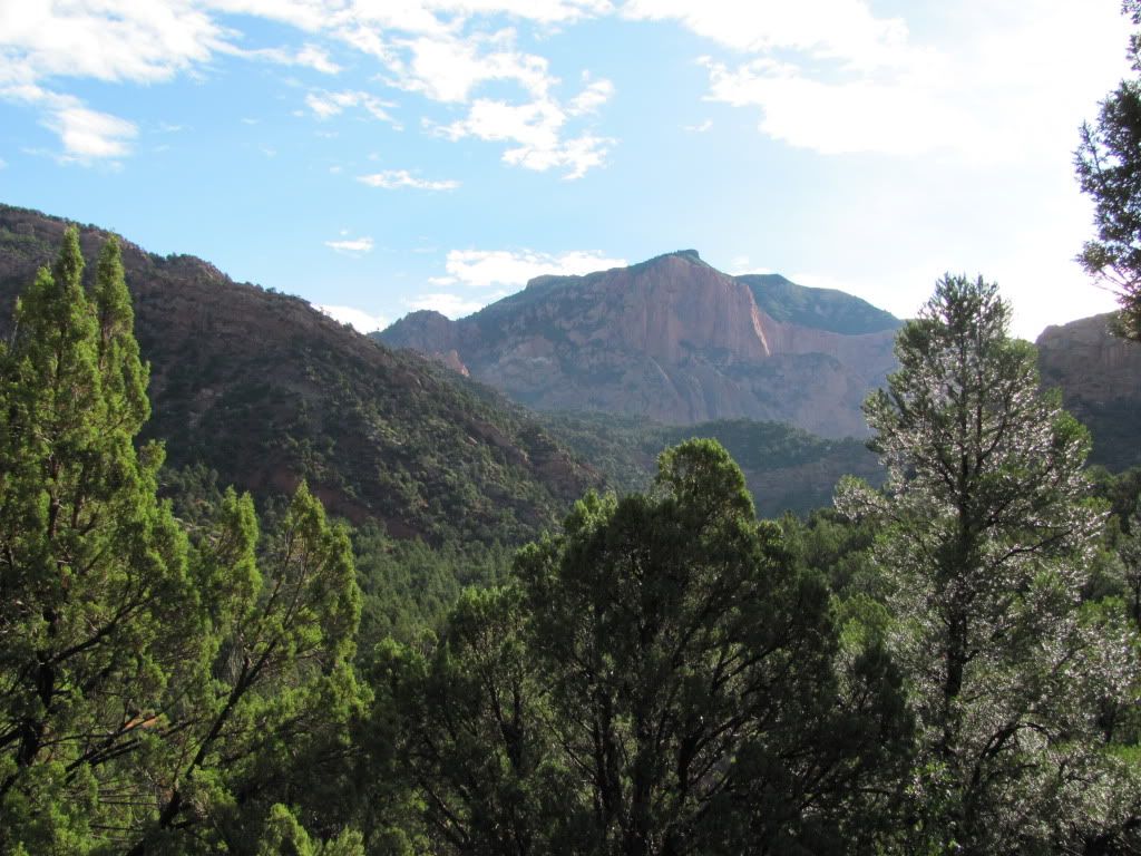
The prime objective of this trip was Mount Russell, but we figured Horse Ranch Mountain would make a good warm-up. Just eight miles, piece of cake! But then the weather report went from 20% to 50% precip. Three thunder and lightning storms, a couple miles of bushwhacking that rivaled even the nastiest Fremont county bash, one washed-out trail that meandered down a cliff face peppered with coffee-table-sized rocks that dislodged at the slightest touch, not to mention a boulder filled gully with occasional class 5 drop-offs later, we were down. Just in time for the deluge! We drove out in the dark, and did our best to follow the road that was now awash with mud and rocks. And we drove to Las Vegas for the night.


Tuesday August 10 2010 - Mount Russell


Distinction: California ranked 14er

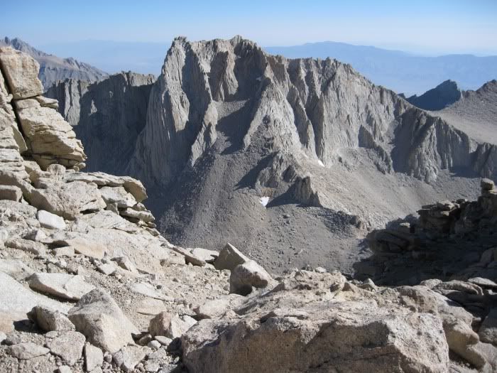
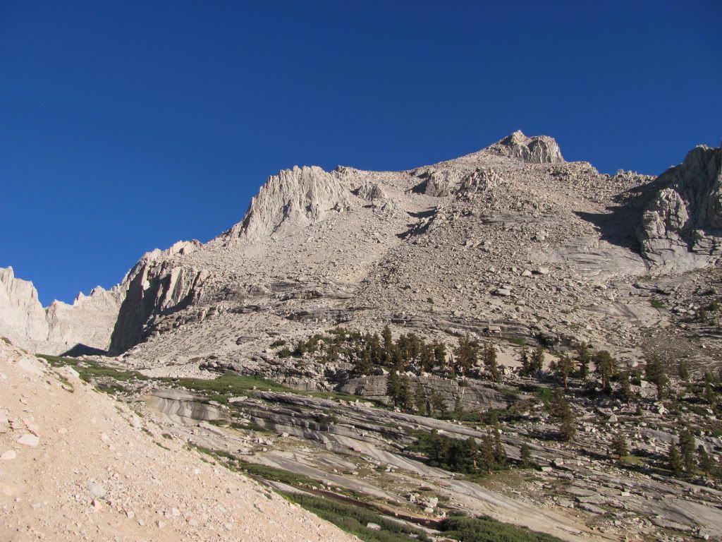
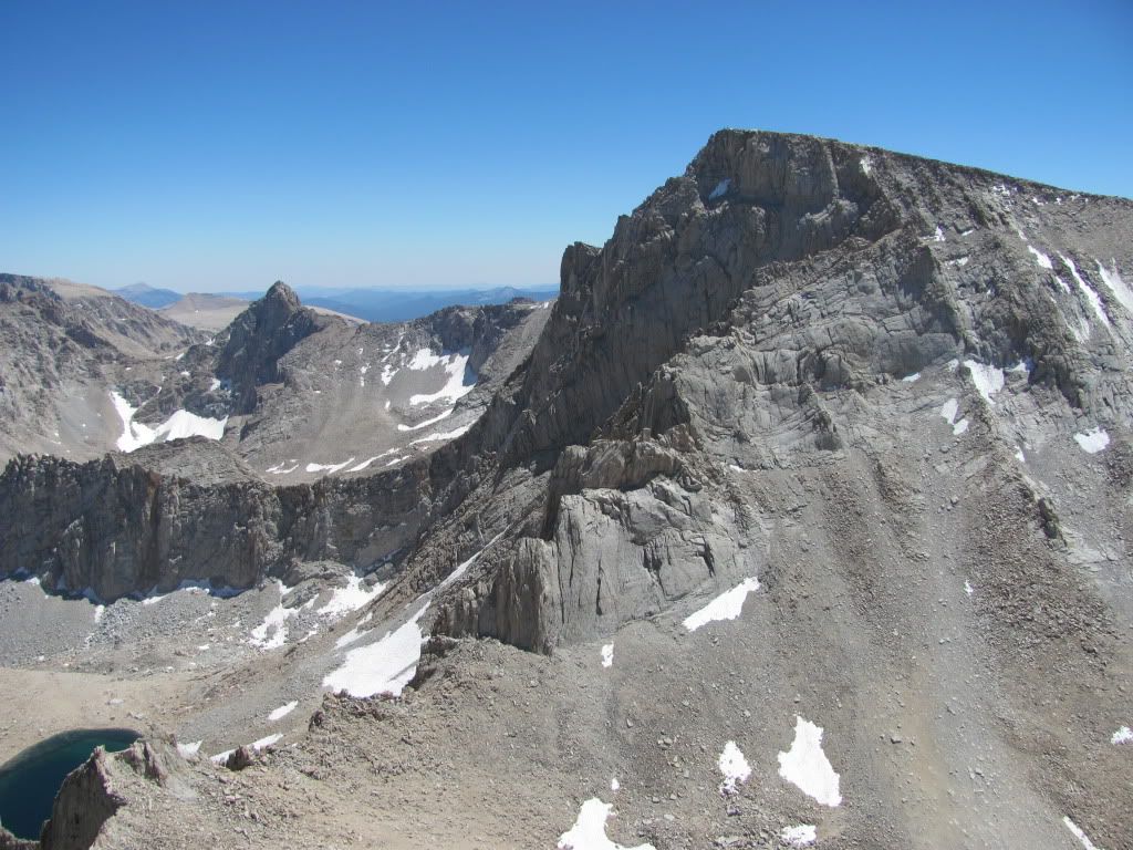
We had been looking forward to Mount Russell since last August, when we got this fantastic view of the south side of the peak from the Notch on the Mountaineer's route on Mount Whitney. The long, sweeping class 3 ridge starts at the saddle between Mount Russell and unranked 13er Mount Carillon (far right), and runs from east to west. The false east summit is obvious from this view, as is the narrow ridge connecting it to the slightly higher west summit. There are some great technical routes on the south side of the peak. We opted for the easier, class 3 east arête, or ridge route.

100810-MountRussell001.jpg

So here we were, back in Lone Pine. The route starts the same way as the Mountaineer's Route on Whitney. Rather than rehash that, you can check out DHatfield's and my trip report from last year: Mount Whitney via Mountaineers Route

It was much easier this year, due to the fact that we decided to day-hike it, and left our heavy packs behind.

Anyway, eventually we got to Upper Boy Scout Lake, and enjoyed the striking early morning views of the Whitney Zone.

100810-MountRussell002.jpg

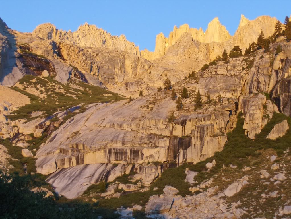
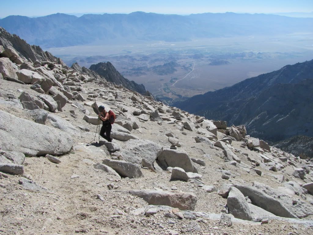
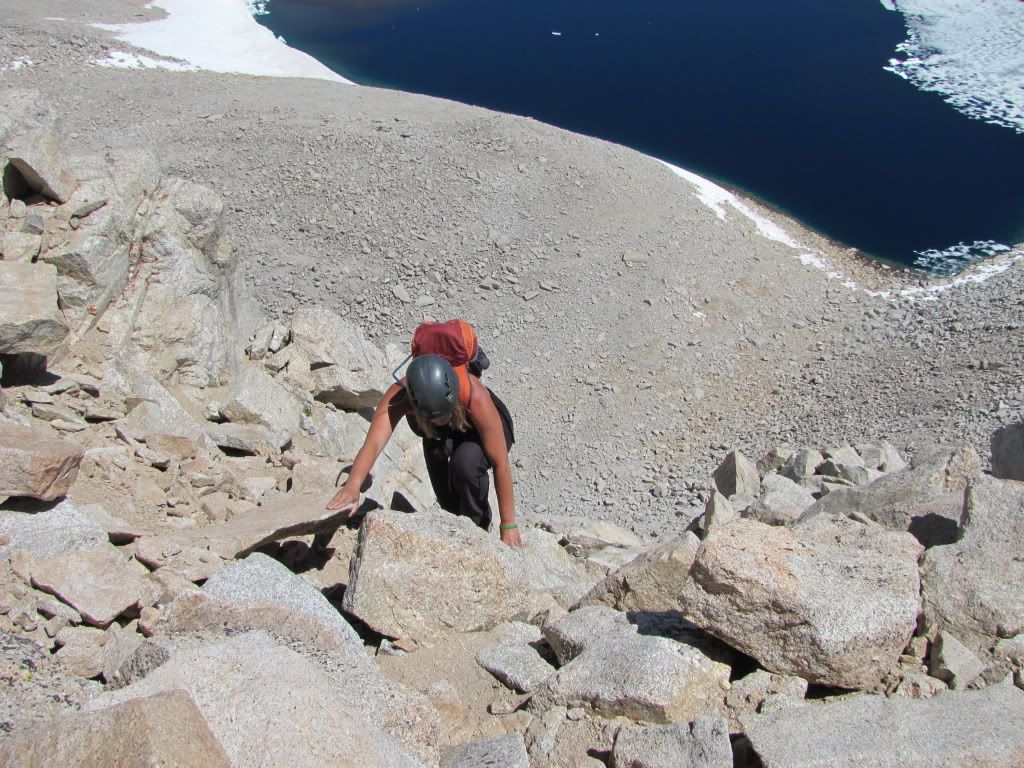
After this point, it's 2,000 feet of scree. We kept to the more solid stuff on the right, but would opt for the softer stuff on the left for the way down.

100810-MountRussell-Doug138.jpg

Lovin' the scree.

100810-MountRussell-Doug139.jpg

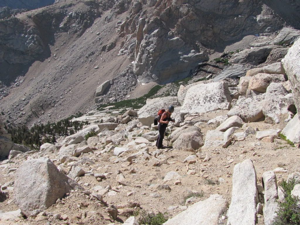
Aw, c'mon, it's not that bad.

100810-MountRussell-Doug140.jpg

Yes it is.

100810-MountRussell-Doug141.jpg

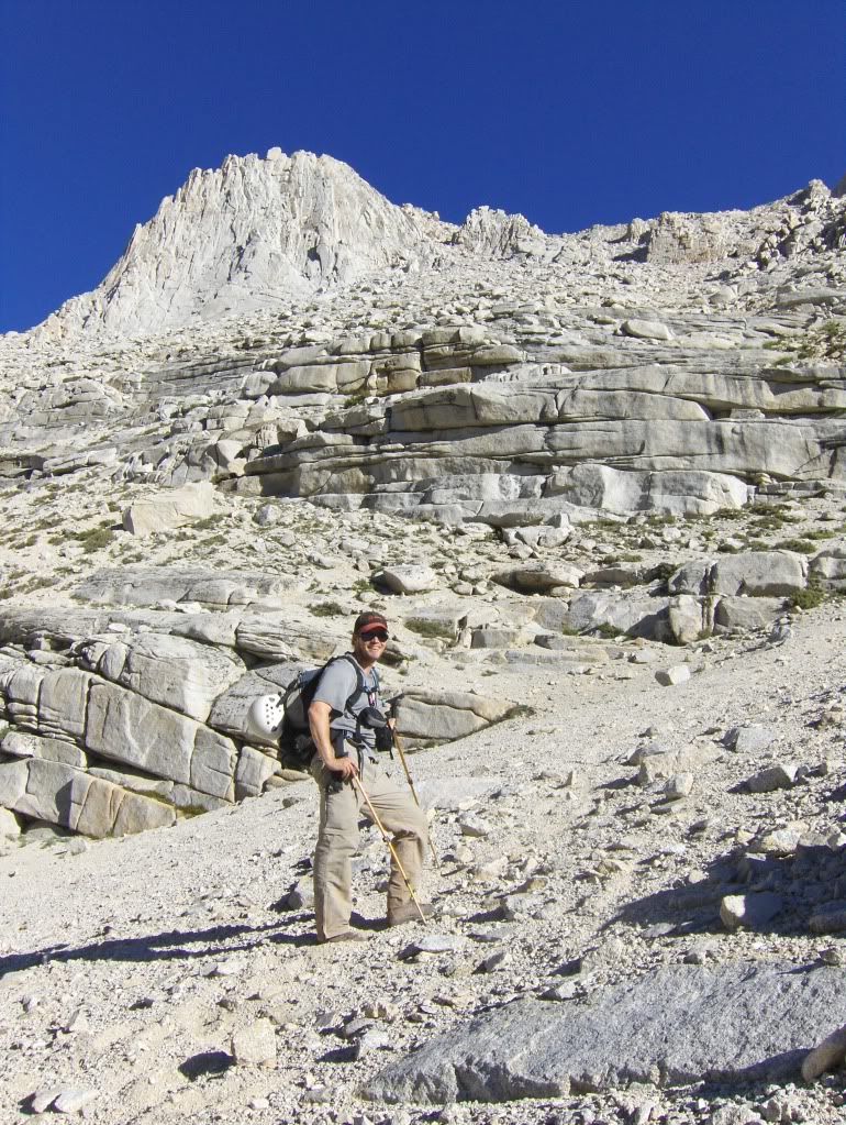
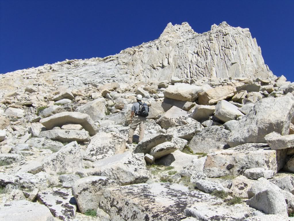
Near the top of the scree slope, you'll need to follow some ledges to gain the plateau.

100810-MountRussell-Doug179.jpg

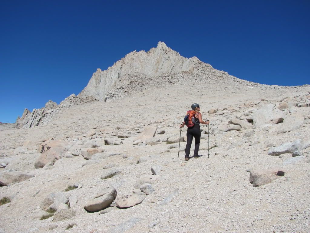
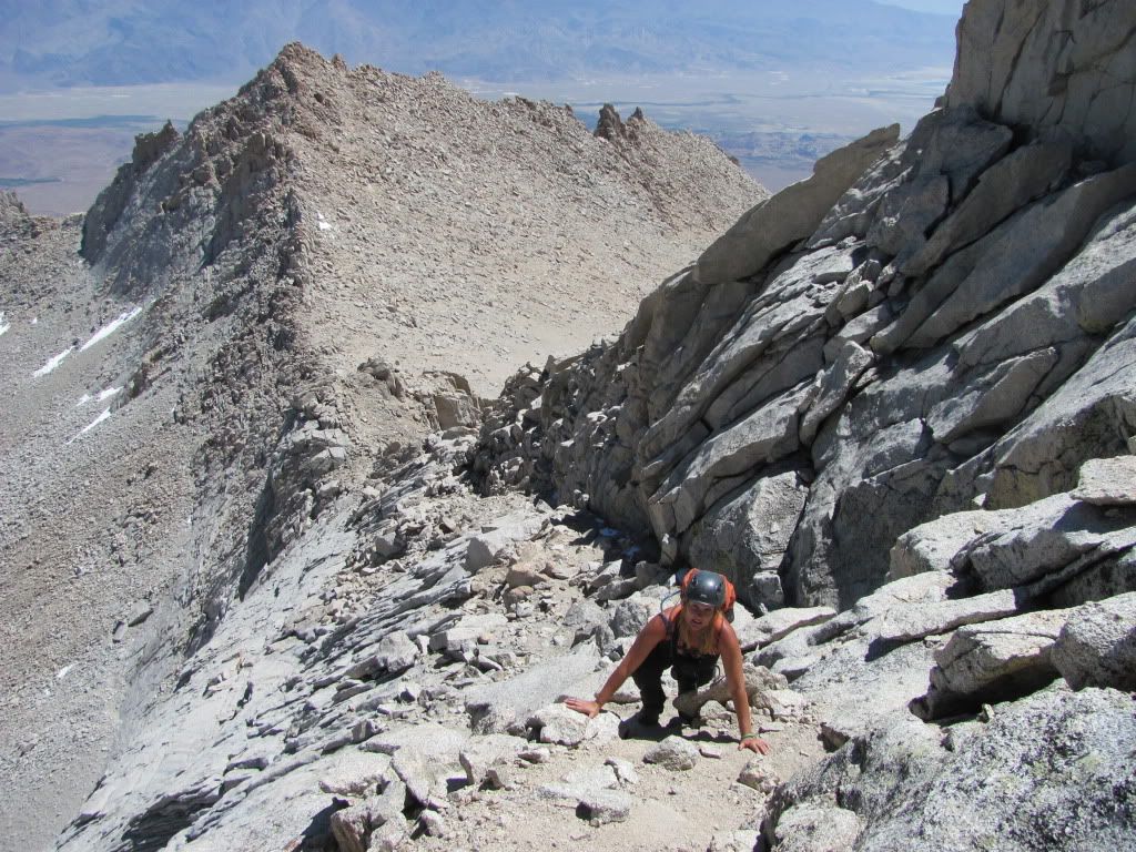
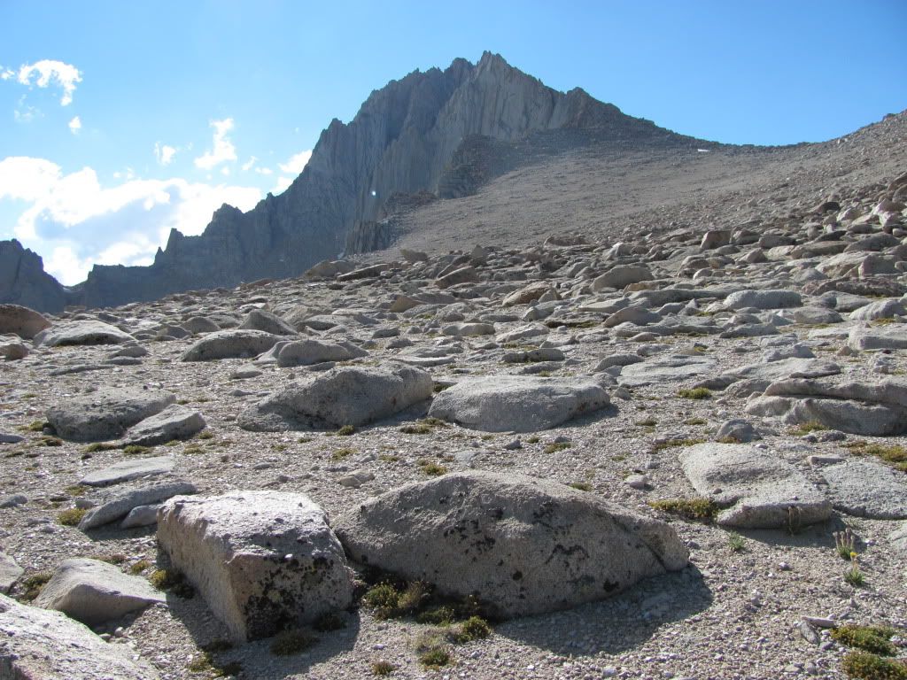
Almost to the Russell / Carillon saddle. What appears to be the higher point in this photo is actually the false summit; you need to continue west along the ridge to gain the true summit.

100810-MountRussell-Doug180.jpg

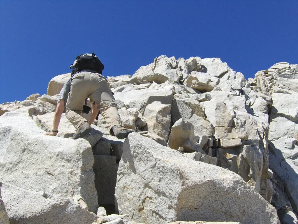
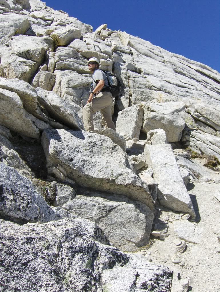
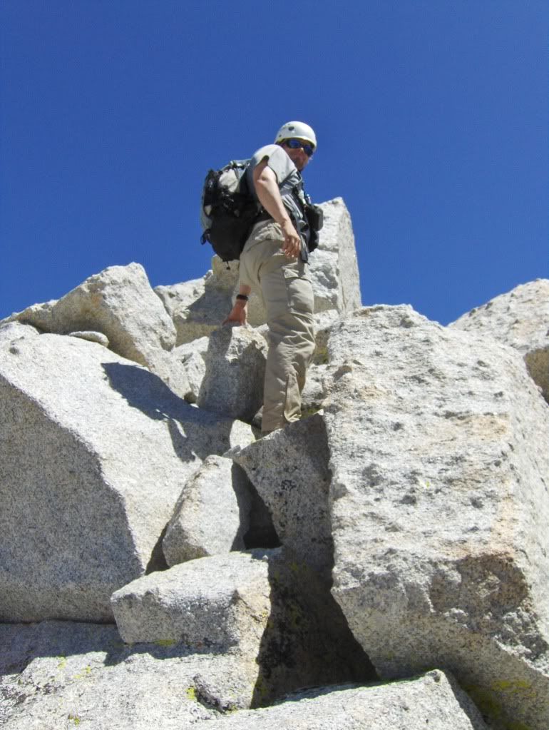
Doug works his way up to the ridge.

100810-MountRussell-Doug181.jpg

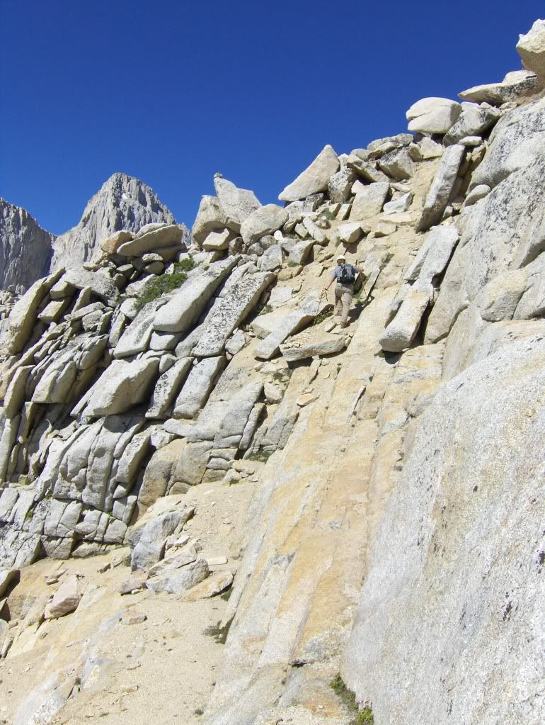
The scrambling starts immediately.

100810-MountRussell-Doug183.jpg

After a few stiff class 3 moves, the route relents quite a bit.

100810-MountRussell-Doug213.jpg

There's actually a section where a trail runs along the north side.

100810-MountRussell-Doug214.jpg

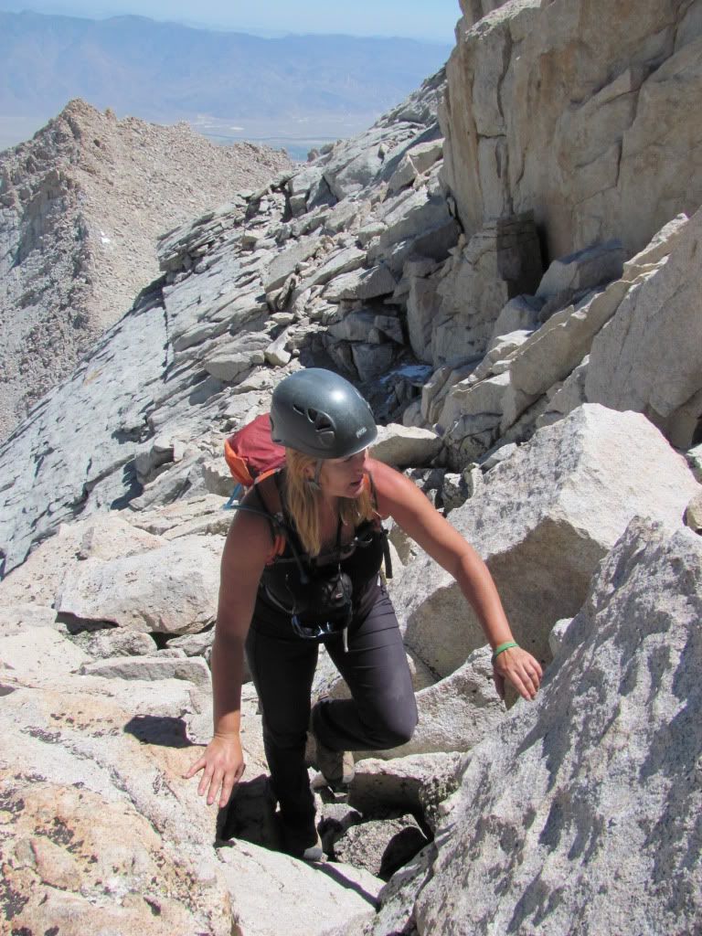
But soon enough you'll be back on rock, and working your way up to the ridge.

100810-MountRussell-Doug217.jpg

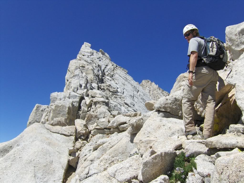
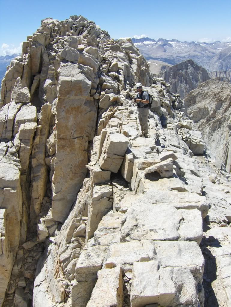
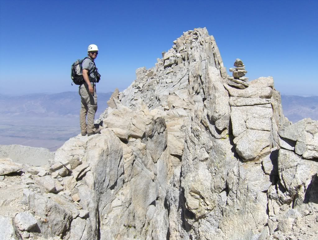
Gaining the ridge, with Mount Carillon behind me.

100810-MountRussell-Doug218.jpg

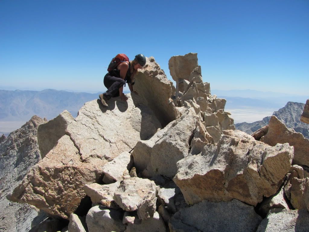
The rule here is: stay on the ridge till you can't any more, then find a route on the north side.

100810-MountRussell-Doug221.jpg

Rocky ridge road.

100810-MountRussell-Doug242.jpg

Straddling the rock. Doug did not enjoy this move - at all.

100810-MountRussell-Doug248.jpg

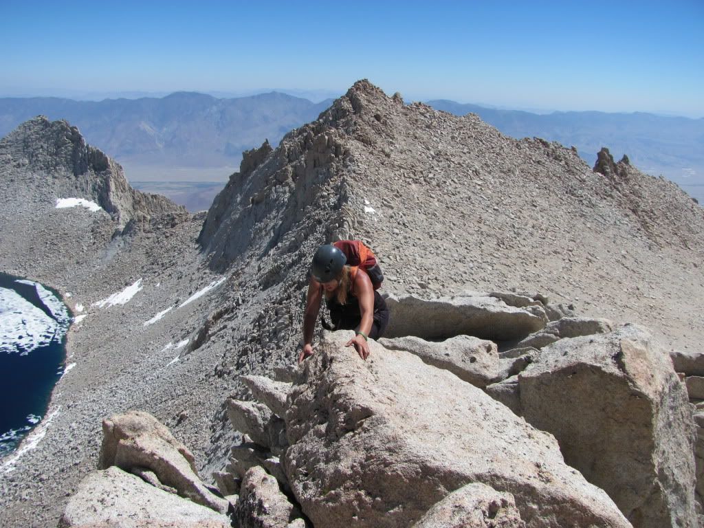
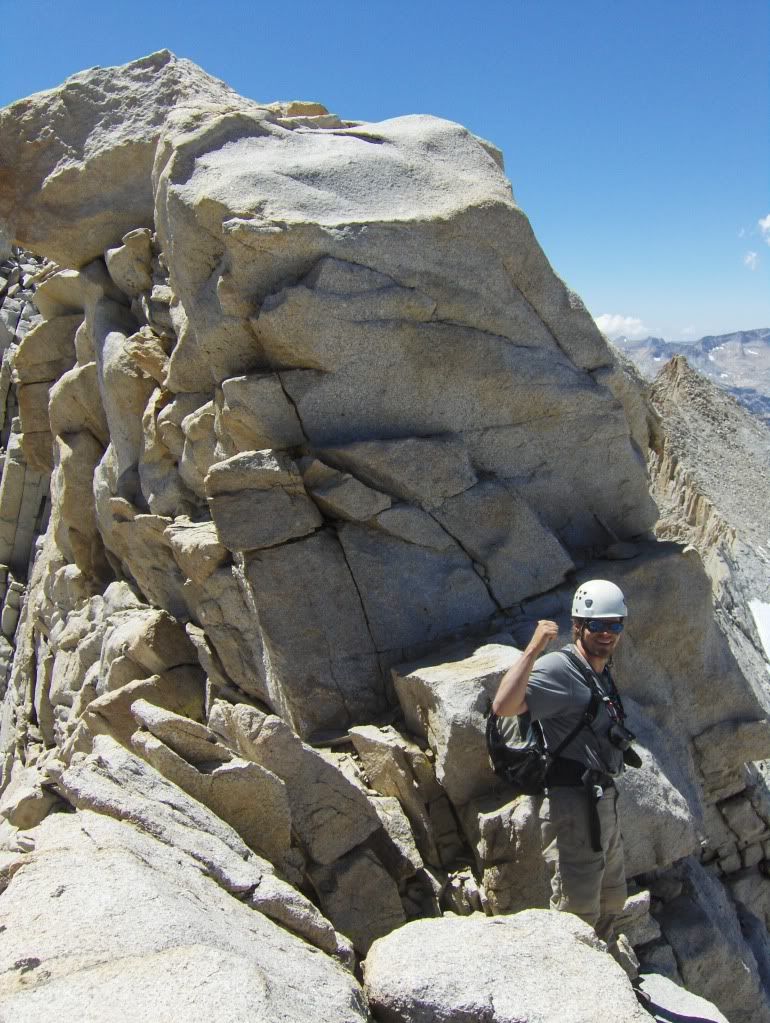
Looking toward the east summit.

100810-MountRussell-Doug252.jpg

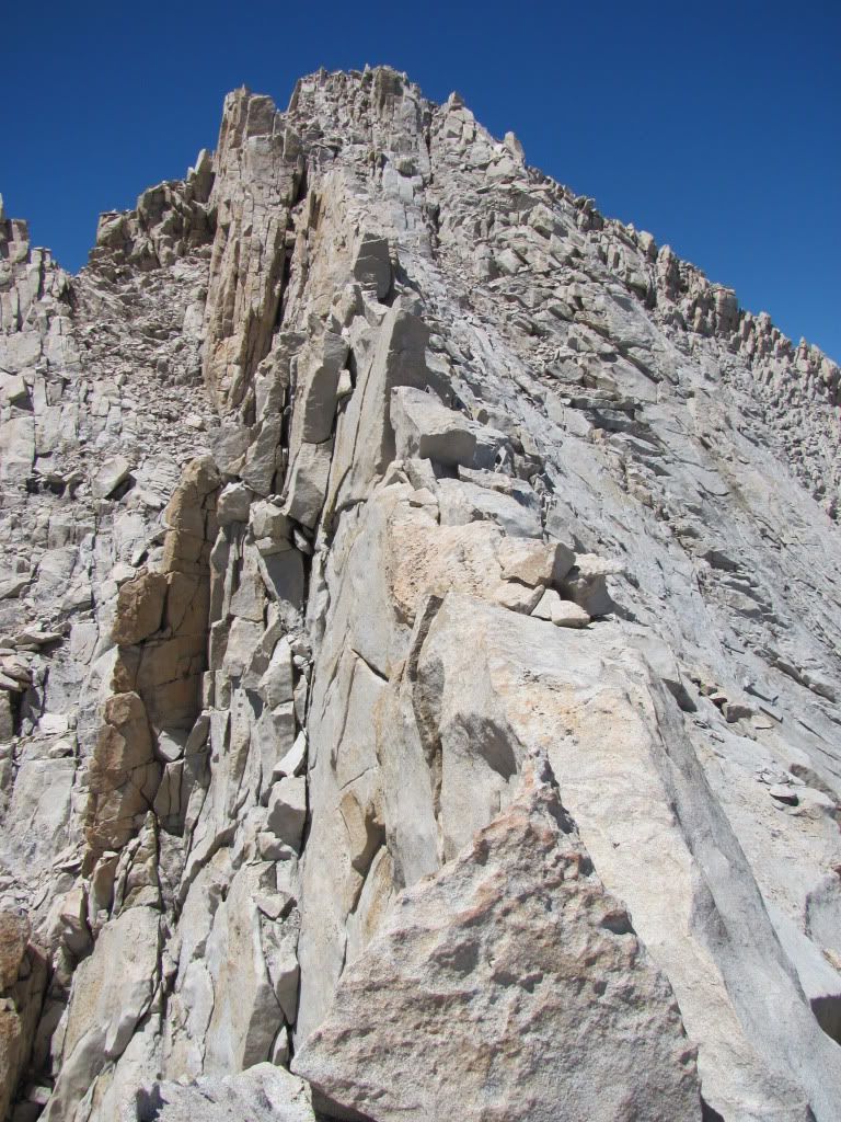
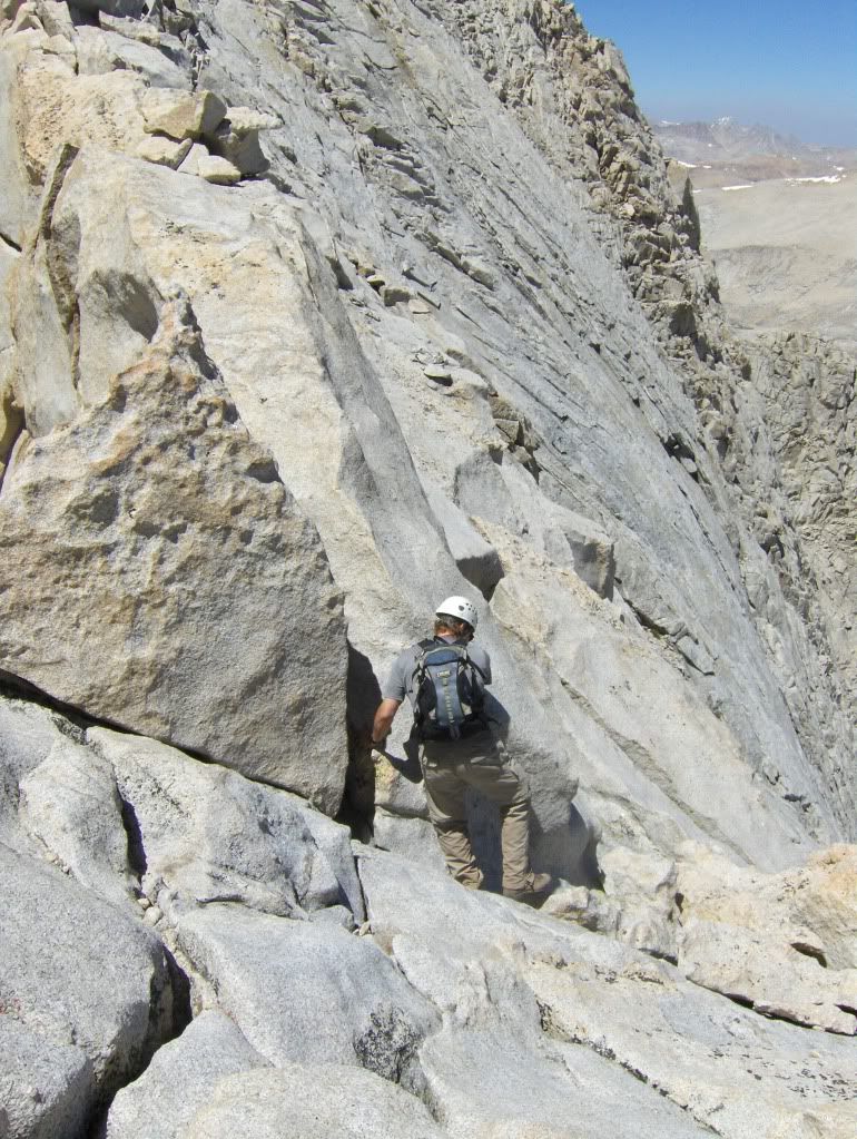
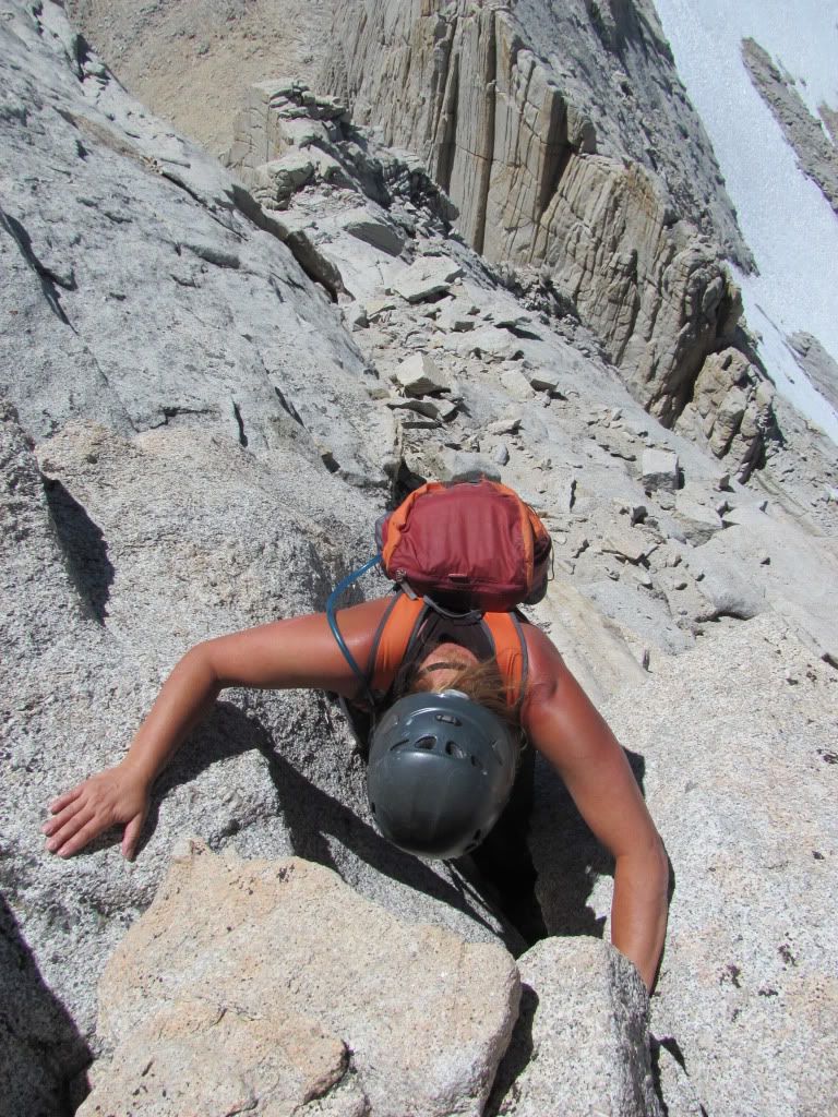
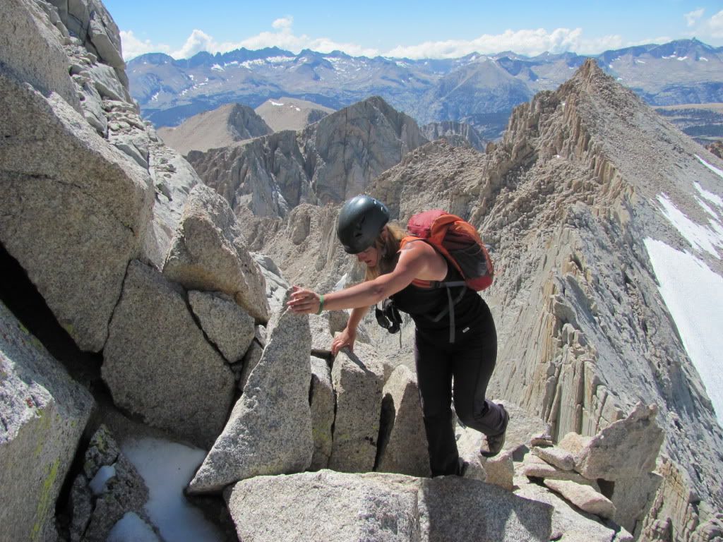
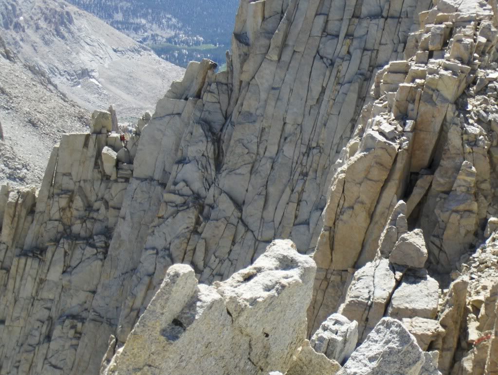
Doug working up the crack system on the north side, toward the east summit.

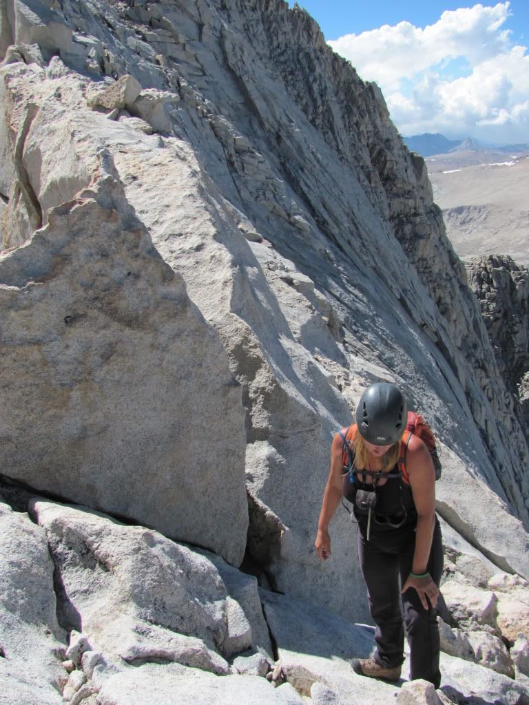
This route will get your attention. I've done my share of 14er ridges, and Mount Russell was by far the stiffest, most exposed class 3 route I have ever experienced. The good news is: it really is class 3, the rock is solid, and the holds are bomber. Once you wrap your mind around the fact that some of the moves are going to put you on some vertical rock with a lot of air under your feet - but with cracks big enough to stuff your entire hands and feet into - you'll be just fine!

100810-MountRussell-Doug254.jpg

The section between the east and west summits narrows quite a bit, and features a lovely catwalk.

100810-MountRussell-Doug256.jpg

Here's the crux: a block that demands a few easy moves, and a mantel up to the top. With this kind of exposure, we didn't want to rely on balance and smearing to make the moves.

100810-MountRussell-Doug257.jpg

Instead, we found an easier route to the north.
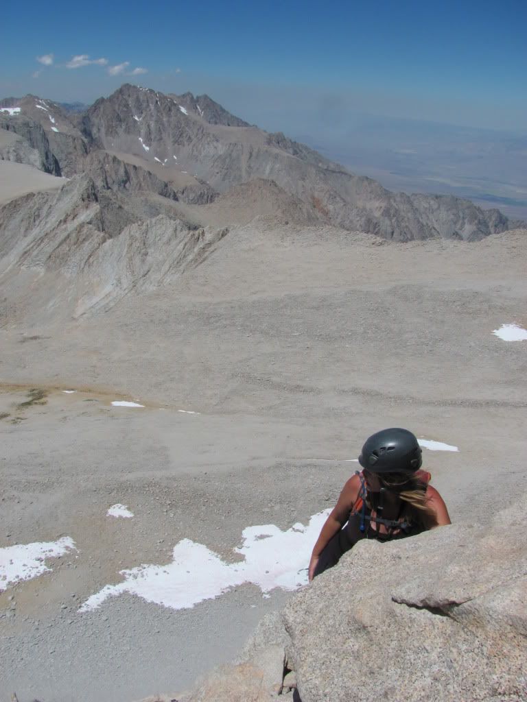
100810-MountRussell-Doug258.jpg

Straight up...

100810-MountRussell-Doug259.jpg

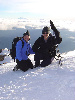
...and summit bound!

100810-MountRussell-Doug278.jpg

Hey, isn't that Mount Williamson, another California 14er?

100810-MountRussell-Doug279.jpg

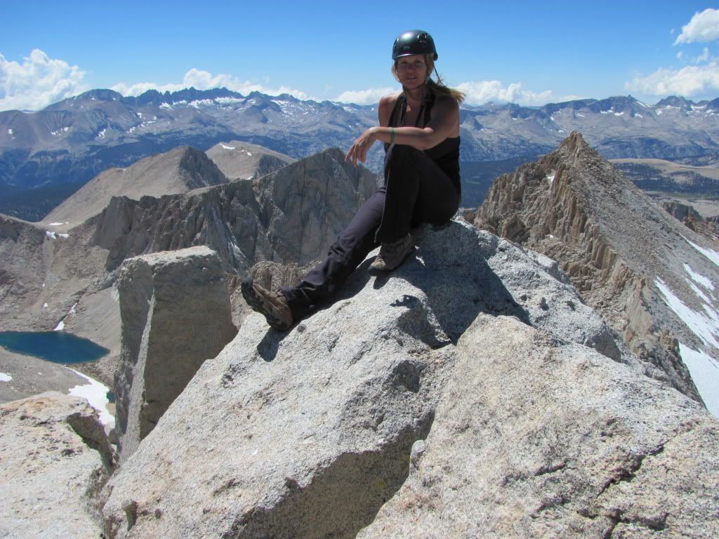
The teeny-tiny summit.

100810-MountRussell-Doug283.jpg

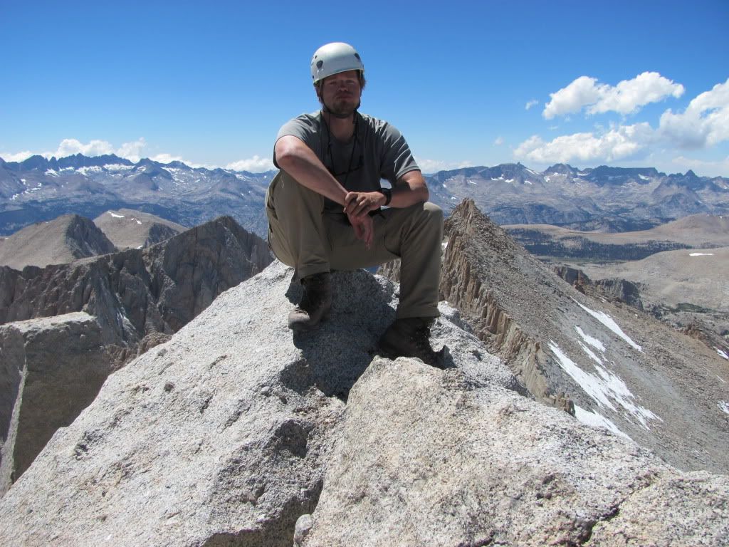
I sat up there for a while, feeling like the biggest badass in all the land, till I heard some guys coming up via the 5.9 Fishhook Arête!

100810-MountRussell-Doug284.jpg

Mount Whitney.

100810-MountRussell-Doug293.jpg

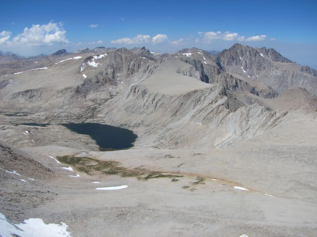
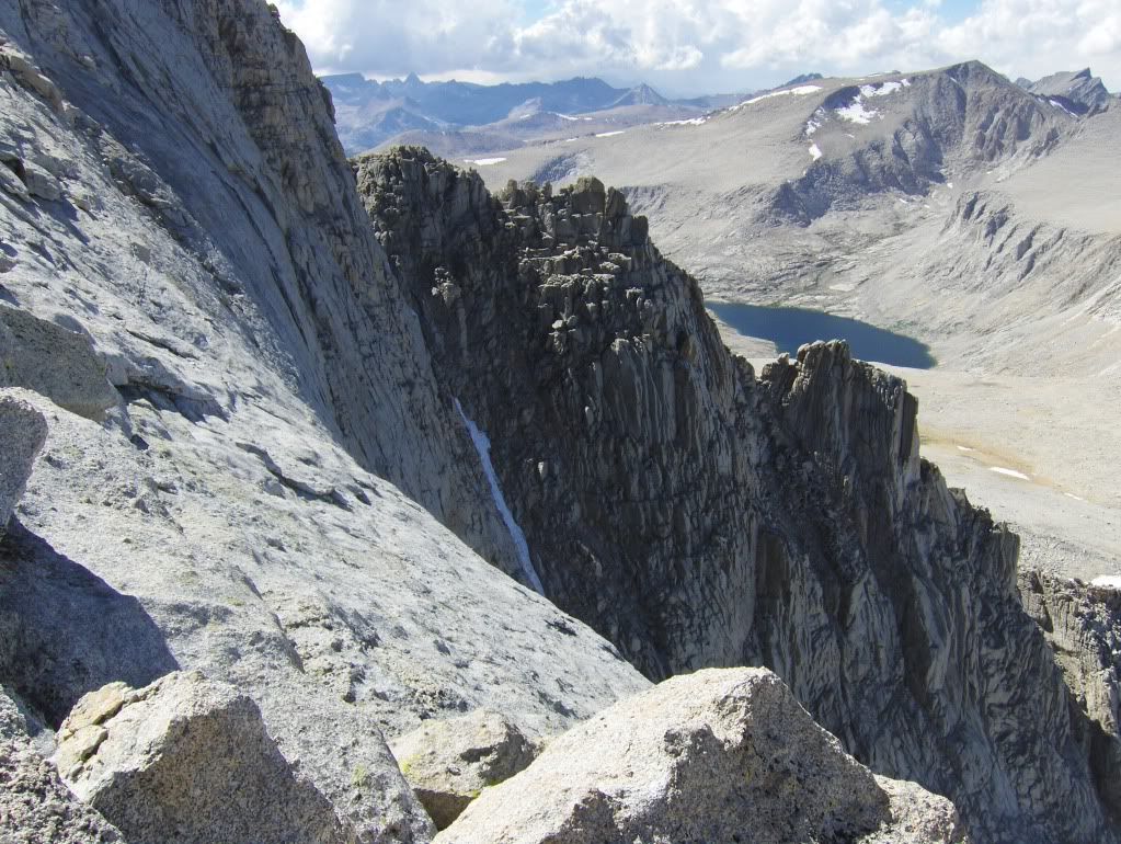
Looking north to the High Sierra.
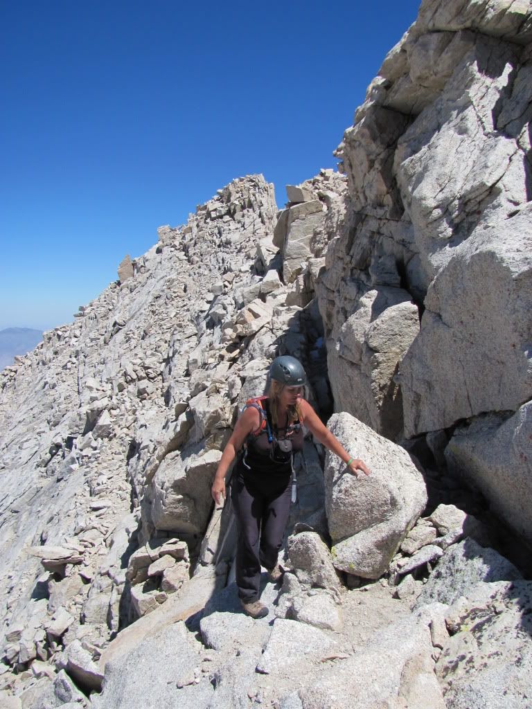
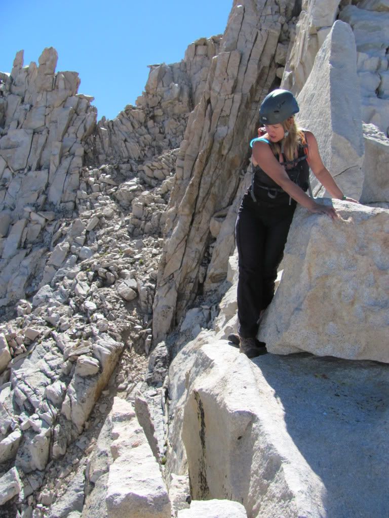
100810-MountRussell-Doug297.jpg

Scrambling down.

100810-MountRussell-Doug305.jpg

The catwalk leading back to the east summit. At this point, you've stopped noticing the exposure. You know the route, you know it goes, and it's rock solid, and you can do it. Going down was a whole lot easier than going up!

100810-MountRussell-Doug306.jpg

Looking back at the guys in the Fishhook. We met them later, on the hike out. They were the only guys on the trail the whole day, in and out.

100810-MountRussell-Doug308.jpg

The only point that I recall crossing the ridge on the south side.

100810-MountRussell-Doug331.jpg

The mellower north side.

100810-MountRussell-Doug370.jpg

A beautiful route, highly recommended.

100810-MountRussell-Doug371.jpg

We punted Carillon and left Mount Russell behind. This is the kind of peak you'll want to repeat.

100810-MountRussell-Doug381.jpg

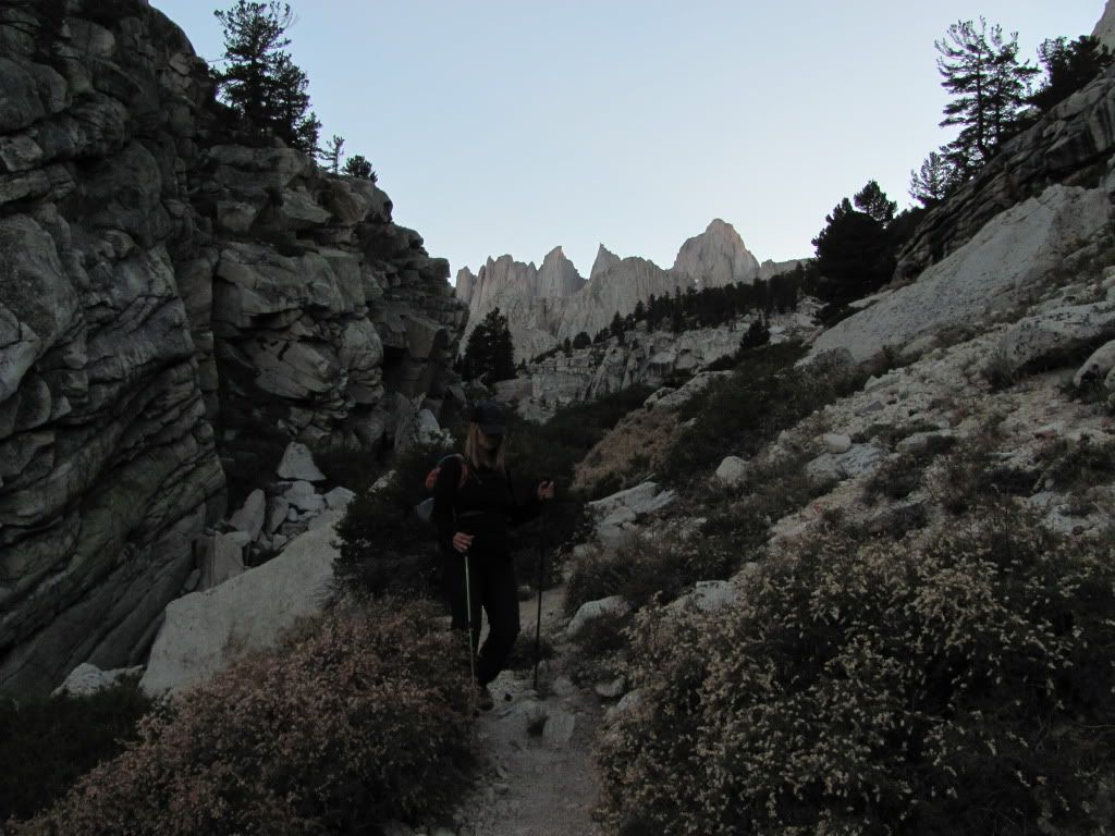
Hiking out in the dusk.

100810-MountRussell-Doug382.jpg


Friday August 13 2010 - Hayford Peak


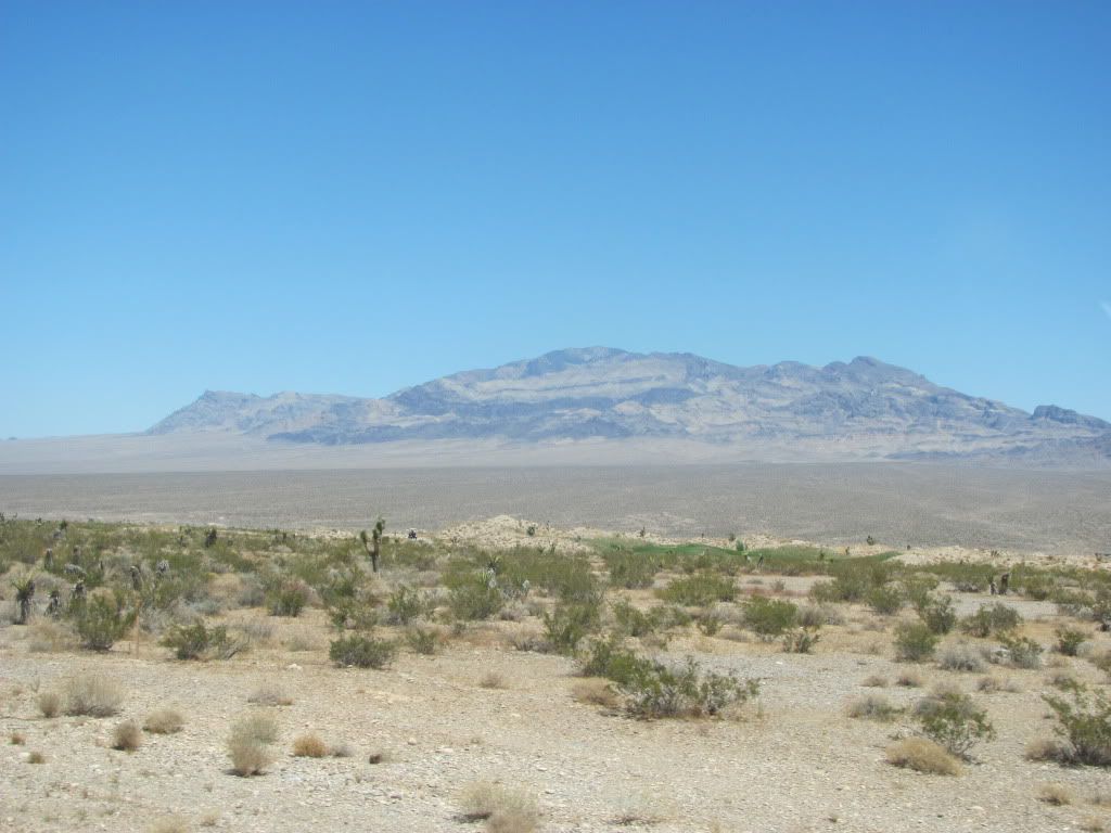
Distinction: Nevada Ultra-prominence Peak

There's a trail all the way to the top, but hiking fourteen miles in Las Vegas heat in the middle of August still made this a tough day. Five liters of water, and I drank it all.

100813-HayfordPeak.jpg


Sunday August 15 2010 - Rainbow Point


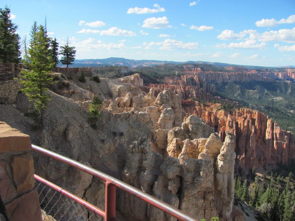
Distinction: Bryce Canyon National Park Highpoint

This was a drive-up. But after a week of hiking thirty-one miles and way too much elevation, in thunder and lightning, pouring rain and searing heat, across some of the toughest terrain I've ever encountered, I was happy to drive all the way up, and park in the spot closest to the summit!

100815-RainbowPoint.jpg

What a great trip.


Comments or Questions
Dancesatmoonrise
User
Beautiful!
8/20/2010 5:38am
Beautiful photos, gorgeous stone, and a fine write-up!


Presto
User
Fantastic!
8/20/2010 2:32pm
Makes me want to head to Cali to do some climbing. I've read that their class definitions are a bit more difficult than ours. Sure does look like a fun climb, though, and the views and weather looked great for that Russell climb. Sounds like you had a very successful vacation. Thanks so much for posting. Happy trails! :D


Chicago Transplant
User
Great trip!
8/20/2010 3:03pm
Thanks for sharing Susan! Looks like it was a great trip, Russell needs permits, right? One of these days I will get out for some Cali 14ers, I just recently bought the book. They look pretty impressive, and look like a lot of fun! I can't believe you did Hayford in August, too hot for me! I'll have to save that for like November :lol:


akmpolsen
User
How cool is that!
8/20/2010 3:04pm
I don't know what is more awesomer -- the great pics, the incredibly airy route, or your stunning tan.


susanjoypaul
User
Thanks
8/20/2010 3:27pm
Presto, the weather certainly did cooperate. We brought a rope, bods, and some pro, with the intent of bailing off a class 3 route on the south face in case the weather came in. But after talking to the guy at the InterAgency, we decided to leave the gear behind. First, there was no snow or ice at all on the route. Second, that south face route drops you off at the top of a talus field - which is apparently even looser than the 2,000 feet of scree we climbed on the ascent - at Iceberg Lake. From our Whitney hike last year, I remembered that - the section from Iceberg down to Upper Boy Scout - as the least enjoyable part of the climb. Finally, the weather was 100% Bluebird! So the decision to just reverse the route was easy. Plus, we got to redo that whole ridge! For the most up-to-date, accurate beta on those peaks, you can't beat the guys at the permit office. They know their stuff. Make a plan to get out there... with your climbing resume, you'd have no problem at all on these peaks!

Mike, you do need a permit, but it's a lot easier to get one for that area than it is for the standard Whitney route. Doug's managed to get one for us two years in a row, now. Aside from those two guys on the Fishhook, we were the *only* people on the peak all day. And yes, Hayford was nuts in August.

akmpolsen, awesomer indeed! It's funny you mention the tan. A couple of weeks ago my doctor told me that many women don't get enough Vitamin D these days, due to all the heavy-duty sunscreen in use, and so she usually tells them to take supplements. But then she said ”That doesn't seem to be a problem for you!” I slather the stuff on every morning, but I'm at 172 peaks this year and all that sunshine just seems to add up!


Yog
User
California Dreamin'
8/20/2010 3:48pm
Nice write up Susan. I have not read many reports on the peaks out there, but I have heard rumor that they rock. You've confirmed this rumor via your excellent photographs. Going to have to see these for myself one of these days. Thanks for sharing this great write-up!


JakeK
User
Range of Light
8/20/2010 3:55pm
Great report and photos... after hiking the JMT in July, I'm already itching to re-visit the Sierras and climb a bunch of peaks. That is such an amazing area. And your picture of Bryce has definitely inspired me to make a trip down that way within the next month or so.


benners
User
Nice Work!
8/20/2010 4:36pm
The Sierras sure do have a unique look to them and this TR makes them all the more enticing. Thanks for writing this up Susan! Congrads on a successful trip.


susanjoypaul
User
Thanks
8/20/2010 4:43pm
Thanks guys.

49ersRule, we are indeed planning on doing all the Cali-14ers. We did two of them last year - Whitney and White - and realized that we didn't want to just slam through them like we did the Colo-14ers (Doug did those in 15 months!). It made more sense to take our time, savor them. So we're shooting for just one a year. Hayford Peak is an ”ultra” - one of only 57 peaks in the contiguous U.S. with 5,000' or more of prominence. Autumn trip indeed... we baked up there :-)

Benners, it really was pretty productive. Since both Doug and I are working on the same ”lists,” he put together a map of all the California 14ers, state highpoints, Ultra-prominence peaks, and National Park highpoints. That way, it's easy to see at a glance what's possible en route to each Cali-14er, each year. We sure have a lot left!


lordhelmut
User
it ain't really class 3`
8/20/2010 5:02pm
till your talkin a Sierra class 3. Nice sunburn Susan. My friend hiked 60 miles of the JMT with no shirt and no longer looked caucasian by the end of the trip. Looks like you had incredibly nice weather. I'd go out on a limb and say the Sierras and the surrounding regions within striking distance (west Utah national parks, kings canyon, yosemite) blow the Rockies out of the water? Permit system aside, its a pretty unique feeling being out there in the middle of it all.

UT/CO gets better snow though, so I guess it evens out.


Chicago Transplant
User
2 Birds
8/20/2010 5:07pm
Susan, you will have to work Telescope in to your next CA trip, Death Valley NP high point AND an Ultra, 2 birds with one stone :D


uwe
User
Well, well, well
8/20/2010 9:10pm
CONGRATULATIONS Doug and Susan!!!
Another fine example of the dueling duo kicking a**. Looks like it was a great trip. Excellent story, beta and photos. I hope you don't mind Bill T. and I taking the TR's with us next week. Keep blazing those trails, I am right behind you, er way behind you.


susanjoypaul
User
Sunburn
8/20/2010 9:20pm
Dear Lord: I worked hard on this burn. It's a well-earned burn :-)

Mike: Ha! Telescope was on our original list for this trip, for the reasons you mentioned, along with the fact that you can see both the highest and lowest points in the lower 48 from its summit. We'll catch it the next time around...

Uwe, you and Bill are in for a treat. Just remember to put a leash on that man... he nearly killed me on South Little Bear, with those roaring flames shooting out of his feet! Have fun, be safe, and be very glad you have a small, solid group for this one :-)


Papillon
User
Cold hard reality...
8/20/2010 10:06pm
Susan, your california excursions hammer home the fact that I really really really need to climb something outside the state (and preferably in CA).
Like all of your previous reports with dhatfield, I truly enjoyed this one. You two make a great team. Thanks for posting.


susanjoypaul
User
Thanks!
8/22/2010 3:53am
Papillon, I just saw you on the trail. How cool is that? I hope you got your peaks (and didn't sleep through half of them like I did today!)

Brian, that would be my ”what the crap am I doing up here?” face :D

I really think we should all get a little more serious about doing those California 14ers, guys. The ”big one” is coming any day, California is going to fall into the ocean, and that old line ”the mountains will always be there” will be the favorite punchline of some Vegas standup comic who's now enjoying beachfront property off the deck of his crappy little condo. Get out there and do'em before they all go bobbing out to sea!


susanjoypaul
User
Thanks Steph
8/23/2010 2:28am
It sure was a lot of fun... I'm already looking at routes on the ones I have left! Just like the Colorado 14ers, once you do a few, you either give up - or want to do them all!


Brian C
User
Awesome as always
8/23/2010 2:48pm
Nice work Susan! I always love your reports. The more photos I see of these Cali trips the more it makes me want to get over there. Love the photo of you on the narrow ledge, the look on your face is how I've felt many a time! Keep on posting these!
-Brian


sgladbach
User
Looks like fun
8/23/2010 3:02pm
Thanks for the TR. I want to do the California 14ers someday!


susanjoypaul
User
You're the guy!
8/24/2010 2:54pm
You should, Steve... there are just 12 ranked ones, and you could probably finish them all well before that 12ers list!


susanjoypaul
User
Thanks
11/30/2010 5:28pm
Thanks guys. I kept the writing sparse - partly because I'm still tired!

Matt, this fits *my* definition of Class 3, in that it really is a scramble. There's no smearing or edging involved, and the holds are big and solid. However, I know that some people take "exposure" into account, in their definition of the different classes. I do not. But, if you did, the degree of difficulty would have to go up. Our photos just don't do justice to that aspect of the climb, unfortunately, as we were sticking close together and clinging to rock rather than taking photos on the more vertical sections. The mind-f*ck here is the dramatic drop-off on either side. It took some mental adjustment for us initially, but by the time we were halfway across, it was very easy. To give you some perspective: if you've done the southwest ridge on Ellingwood Point... it's about ten times worse than that :D

As for Hayford - yeah, we really should do a separate trip report for that one! It's an awesome peak, and we have plenty of pics, that's for sure. No one had been up there since June! And by the way, we were set to do Charleston (the other Vegas Ultra) the following day, but had concerns about doing a 16-mile, 4,300' elevation gain peak, in 105 degree heat. We opted instead for a visit to Red Rocks, a walking tour of the strip (by my son, who just moved there), ice cream for lunch, and dinner at Cabo Wabo Cantina. It was a perfect "down day" and a great way to stretch our legs, without collapsing from heatstroke. So we'll have to go back for that one!

California 14ers: 3/12 - Ultras: 12/57 - NP Highpoints: 9/58
Not that I'm counting :wink:


Matt
User
Road trip!!!!!
1/19/2011 3:38am
Russell looks like a blast; the photos and narrative are as aolid as the holds. How would you rate the ”California class 3” in relation to the standards here?
I'm ultra-disappointed to see only one photo and one sentence about Hayford, though.
Thanks for sharing.


Ridge runner
User
NIce!
2/1/2011 12:24am
Great work to both of you! Looks like a wonderful area to explore, guess I should get up there before CA breaks off into the ocean. A few weeks ago I did a route that SP said was really exposed class 3... I wondered, how can a route that's class 3 be very exposed?? I soon found out, and it was very tempting to say it was class 4, but none of the moves were really that hard. Exposure can sure mess with your mind though. Anyway, congrats on a great trip and thanks for the write-up!


Shasta Locales
User
Amazing Photos!
2/5/2011 12:22am
Great pictures of a truly great piece of the country. Well done!


12ersRule
User
Cali 14ers
7/29/2013 6:29pm
SJP, awesome report on Russell! The pics are fantastic. Are you looking at summitting all the Cali 14ers? I'm hoping for that as well. Had never heard of Hayford peak before. It does look like a good autumn trip.


   Not registered?


Caution: The information contained in this report may not be accurate and should not be the only resource used in preparation for your climb. Failure to have the necessary experience, physical conditioning, supplies or equipment can result in injury or death. 14ers.com and the author(s) of this report provide no warranties, either express or implied, that the information provided is accurate or reliable. By using the information provided, you agree to indemnify and hold harmless 14ers.com and the report author(s) with respect to any claims and demands against them, including any attorney fees and expenses. Please read the 14ers.com Safety and Disclaimer pages for more information.

Please respect private property: 14ers.com supports the rights of private landowners to determine how and by whom their land will be used. In Colorado, it is your responsibility to determine if land is private and to obtain the appropriate permission before entering the property.