| Report Type | Full |
| Peak(s) |
El Diente Peak - 14,175 feet Mt. Wilson - 14,256 feet Wilson Peak - 14,021 feet |
| Date Posted | 08/19/2010 |
| Date Climbed | 08/15/2010 |
| Author | PDavis |
| Snowmass and Wilson Group, Part 2 |
|---|
|
Aug. 13 Snowmass Mountian- West slope, class 4 gully Drive to Navajo Lake Trailhead and hike in 4 1/2 miles to lake Aug. 14 El Diente- North Buttress, ridge traverse to Mt. Wilson Aug. 15 Wilson Peak We climbed Snowmass in the morning and headed down to the Wilson group. By the time we reached the trailhead it was already a little after 9PM. It would have been nice just to set up camp there and go to bed, but we knew that we had to make it to the lake to have a good chance at getting all three mountains. We threw on our packs and started heading up the trail. Even though we were tired from the climb early in the day, I felt like we still made really good time to the lake. It took us about 2 hours and 20 mins to go the 4 1/2 miles to reach the lake, but once we got there I was shocked to see how many people were already camped out. It took us almost 30 minutes just to find a place to camp. Luckily it was right by the lake, but right in between a comfy rock and root, but it would have to do. We decided to sleep in some since there was no chance of rain for the whole day. We woke up at 6am and soon were on the trail. Morning view of the lake 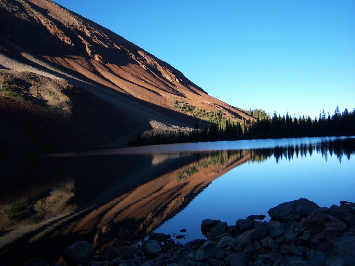 El Diente a little ways from camp 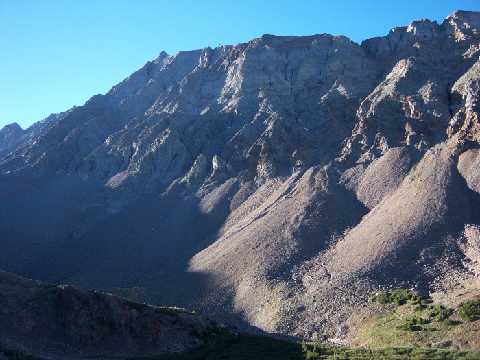 Approaching the N Buttress  The start looks like this and as you get higher up on the mountain the climbing gradually increases in difficulty 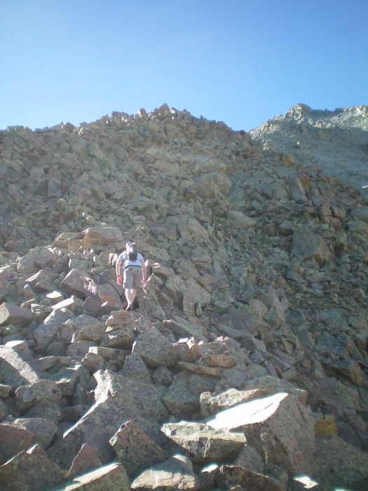 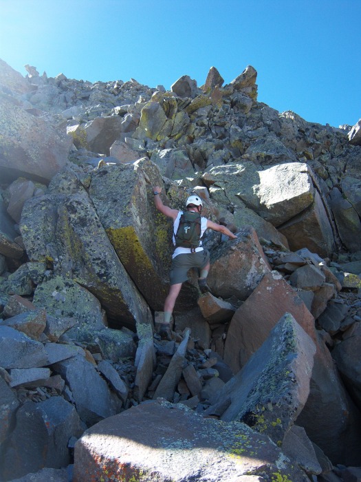 After a little bit you come to the first slabs. If you stay to the left you have solid holds 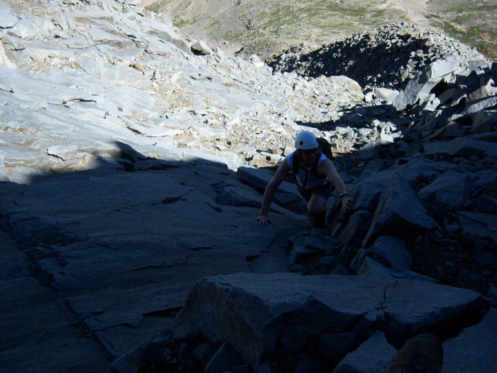  Soon after the first slabs you regain the ridge. The climbing here becomes a lot more exposed. You take this small catwalk to a tower  Right after the tower you drop down to a small saddle and then head directly up toward the next slabs. The holds are there if you just take your time to find them and commit to each move. Right before the slabs  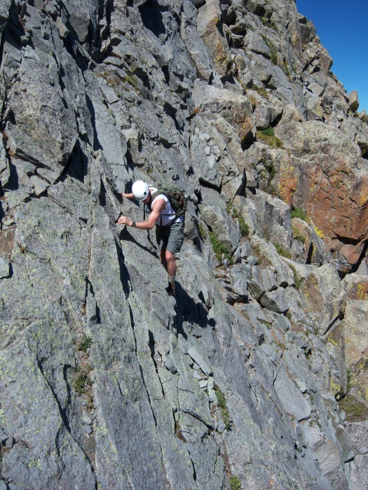 Above the slabs you have one chimney to climb up and then the summit is right ahead of you. Climbing the chimney 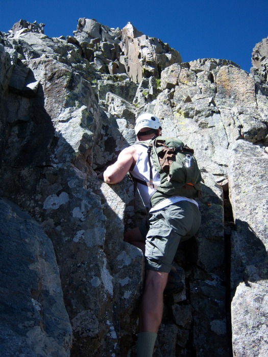 Summit 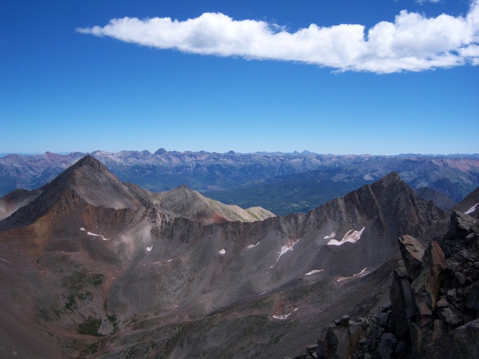 View of the ridge to Wilson from just below the summit 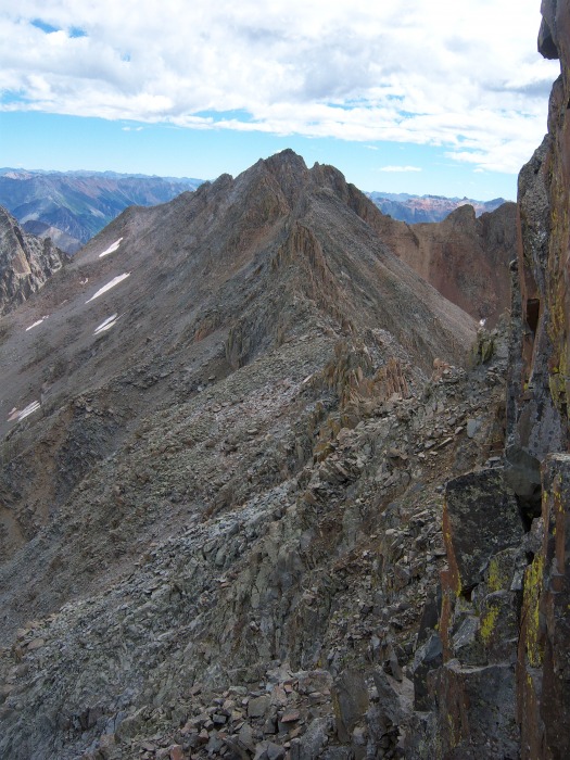 Stay on the right of the ridge for the first part traversing under the Organ Pipes.   After a good portion of the ridge you gain the top of the ridge and stay there almost the entire way till you reach the summit of MT. Wilson. Top of ridge with El Diente in the background   Here is the crux of the route. It's hard to make out exactly where it is, but it climbs the line of light gray rock in the left side of the photo 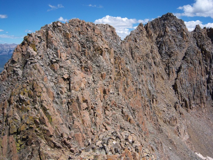 The crux 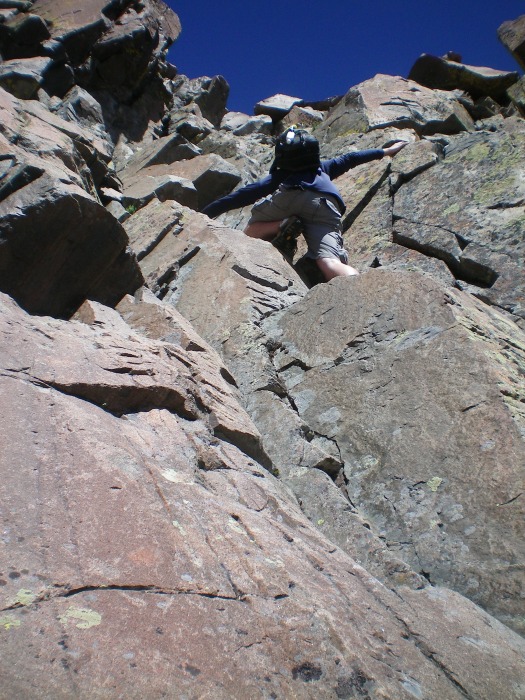 Back on the ridge  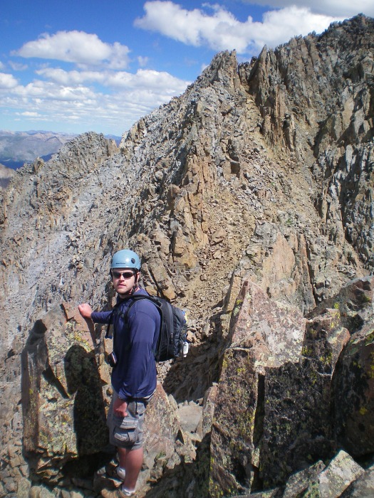 It took about three hours on the ridge to get to the summit of MT. Wilson. Summit of Mt. Wilson  Looking back at the ridge from Mt. Wilson to El Diente 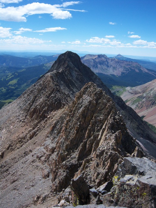 After a little bit on top we headed back down. Once we reached the notch just below the summit ridge it looked like a trail would take us down. Luckily it soon turned into a horrible scree field and we soon got back on track. We soon made it back to camp. Cooked some dinner and went to bed to get up for Wison Peak. We got up early and headed for Wilson Peak. Rock of Ages saddle 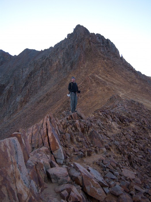 Once you get to the top of the saddle you head North up toward the false summit. Here is where you see the crux of the route. From the false summit it looks pretty intense, but once you get up under it you realize its not near as hard as it looks. Pic of the crux  Climbing the crux 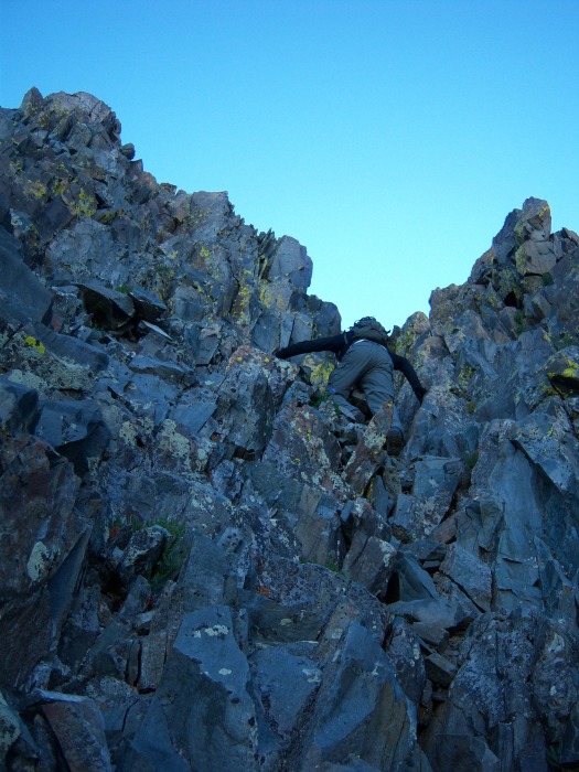 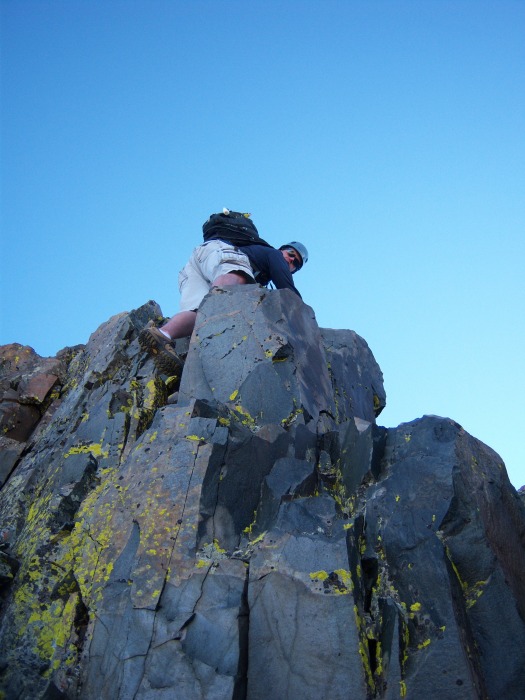 Right after the crux the summit is about 5 minutes off. Veiw of El Diente and the ridge traverse to Mt. Wilson from the summit of Wilson Peak  After summiting we headed back down to camp, packed things up and enjoyed the hike out, thinking about the awesome weekend we just had getting these 4 mountains. Wilson Peak from the highway 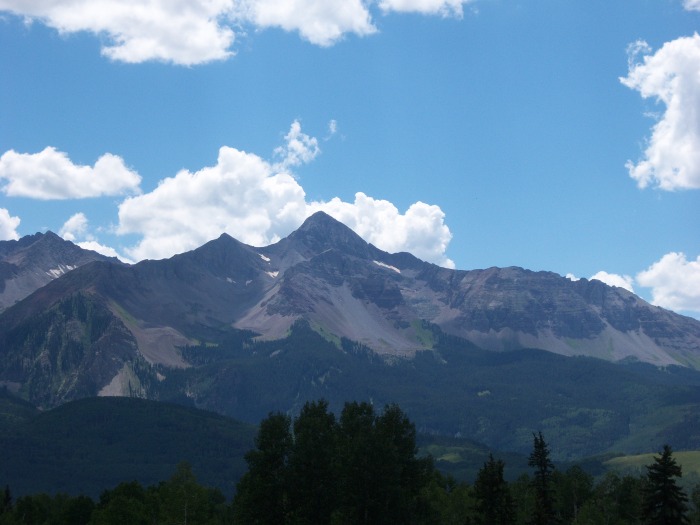 El Diente from the hike out 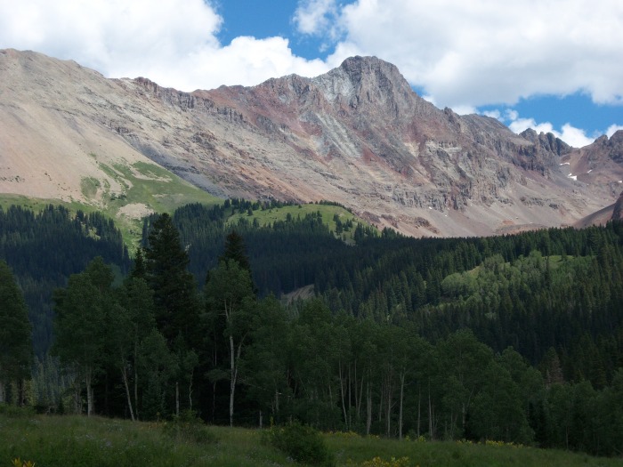 Thumbnails for uploaded photos (click to open slideshow): ")
")
")
")
")
")
")
")
")
")
")
")
")
")
")
")
")
")
")
")
")
")
")
")
")
")
")
")
")
")
|
| Comments or Questions |
|---|
|
|
Caution: The information contained in this report may not be accurate and should not be the only resource used in preparation for your climb. Failure to have the necessary experience, physical conditioning, supplies or equipment can result in injury or death. 14ers.com and the author(s) of this report provide no warranties, either express or implied, that the information provided is accurate or reliable. By using the information provided, you agree to indemnify and hold harmless 14ers.com and the report author(s) with respect to any claims and demands against them, including any attorney fees and expenses. Please read the 14ers.com Safety and Disclaimer pages for more information.
Please respect private property: 14ers.com supports the rights of private landowners to determine how and by whom their land will be used. In Colorado, it is your responsibility to determine if land is private and to obtain the appropriate permission before entering the property.

