Download Agreement, Release, and Acknowledgement of Risk:
You (the person requesting this file download) fully understand mountain climbing ("Activity") involves risks and dangers of serious bodily injury, including permanent disability, paralysis, and death ("Risks") and you fully accept and assume all such risks and all responsibility for losses, costs, and damages you incur as a result of your participation in this Activity.
You acknowledge that information in the file you have chosen to download may not be accurate and may contain errors. You agree to assume all risks when using this information and agree to release and discharge 14ers.com, 14ers Inc. and the author(s) of such information (collectively, the "Released Parties").
You hereby discharge the Released Parties from all damages, actions, claims and liabilities of any nature, specifically including, but not limited to, damages, actions, claims and liabilities arising from or related to the negligence of the Released Parties. You further agree to indemnify, hold harmless and defend 14ers.com, 14ers Inc. and each of the other Released Parties from and against any loss, damage, liability and expense, including costs and attorney fees, incurred by 14ers.com, 14ers Inc. or any of the other Released Parties as a result of you using information provided on the 14ers.com or 14ers Inc. websites.
You have read this agreement, fully understand its terms and intend it to be a complete and unconditional release of all liability to the greatest extent allowed by law and agree that if any portion of this agreement is held to be invalid the balance, notwithstanding, shall continue in full force and effect.
By clicking "OK" you agree to these terms. If you DO NOT agree, click "Cancel"...
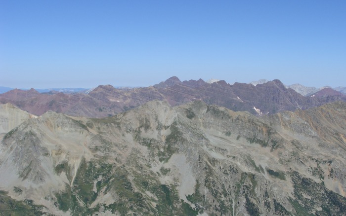
This summer I've been focusing heavily on the Elk Mountain range, and this weekend was no exception. My ever shortening list of 14ers has eliminated the option of quick and easy day trips, except for my planned finisher, Pikes Peak. I've never really wanted to do this combo for reasons unknown. Since I haven't really wanted to hike these peaks, I decided to make it a little more enjoyable and add a relaxing weekend of camping with my wife. This combo turned out to be a very nice day, and compared to last week's trip to Maroon Peak, these peaks were a breeze!
We woke up at 5 a.m. and immediately I knew something was wrong with Amanda. First off, she didn't get any sleep and furthermore she wasn't feeling well. I told her not to stress because we were going to drive substantialy high into Montezuma Basin, and the drive would give her some extra time to cure whatever was bothering her. We drove to within a half mile of the end of the road and I proclaimed "this is OUR trailhead for the day!" We made coffee, ate breakfast and hit the road. We made it to the end of the road and Amanda was finished. "Not this time babe." I kissed her goodbye, and she watched me climb the large headwall, and disappear behind Castle Peak's bulk.
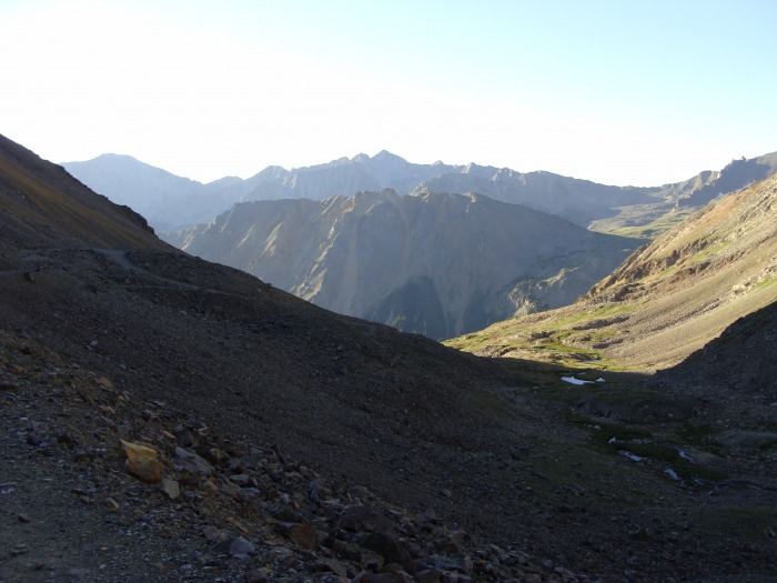
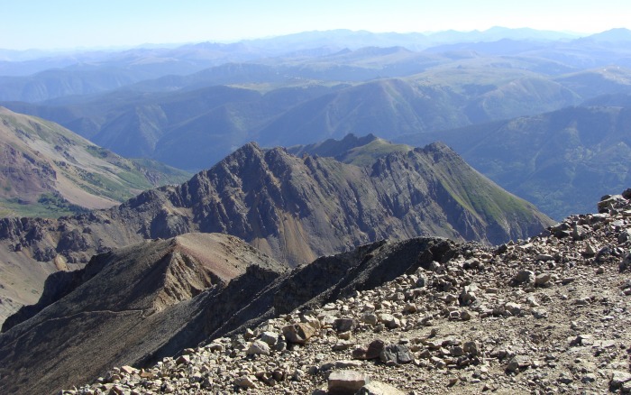
Looking back into Montezuma Basin
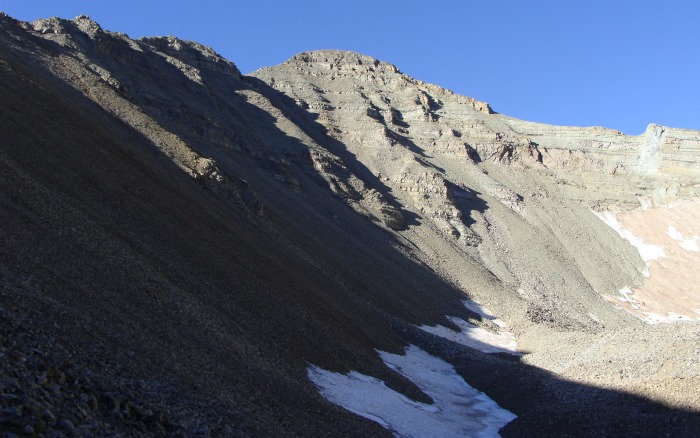
After hiking Maroon Peak last weekend this peak was rather mellow, and I took full advantage of its ease. Following Bill's route description, I contoured up the left side of the basin which was definitely advantageous, much elevation gained, with minimal effort. It was interesting how most of the hikers below me cut straight across the basin floor and then nearly straight up to where I was.
Taken from the left side of the basin, below the headwall
Looking back at my watchful spouse
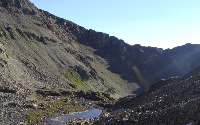
A few minutes later after crossing below a couple of small rock ribs I found my first cairn. This was surprising as I thought I would be blazing my own trail up to Castle's northeast ridge. Contouring up the left side of the basin dropped me off right at the beginning of the trail
The beginning of the well carined trail up to the Northeast ridge
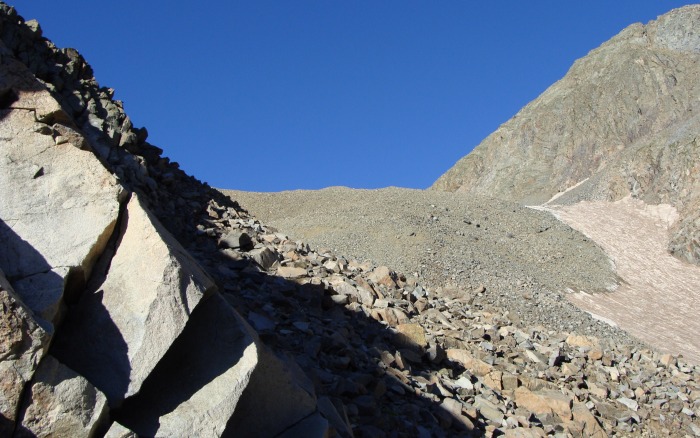
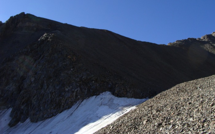
I followed this pleasant trail up above the snowfiled present in the above picture. Once above the headwall, the trail becomes much easier and obvious.
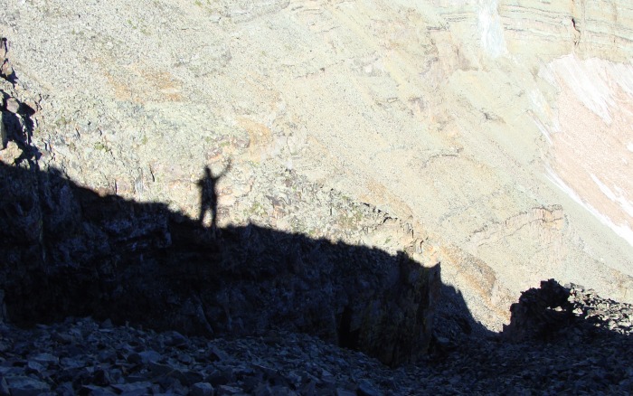
With a closer look through the shadow, you can see the trail leading up to the ridge
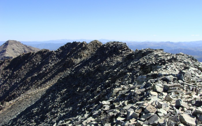
This portion of the trail reminded me of Grays. It was enjoyable, and the views looking down into the basin were extraordinary. The multiple, tight little switchbacks were nice!
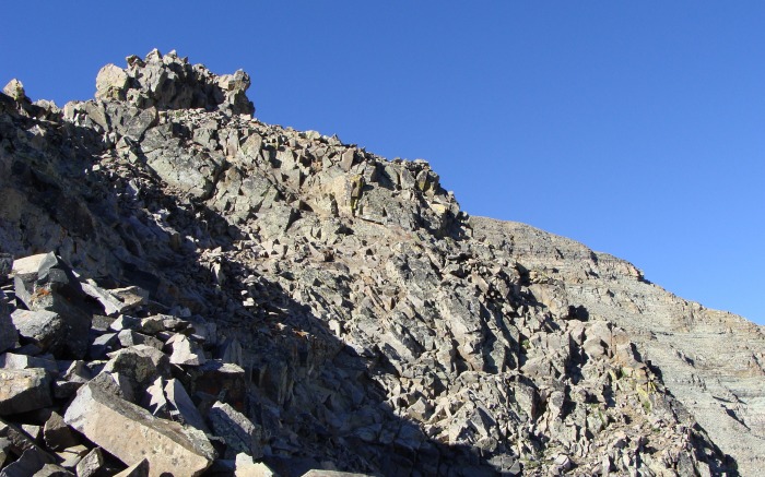
Looking up at Castle's bulk from the short switchbacks leading up to the ridge
Once I hit the ridgeline, the hiking began to differ from Grays, there were some short fun scrambling sections that kept me on the ridge proper. At this point the weather was looking absolutely stunning and I was seriously enjoying the day!
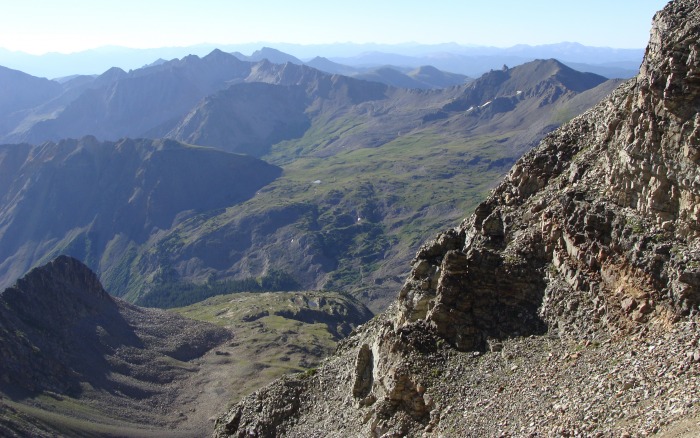
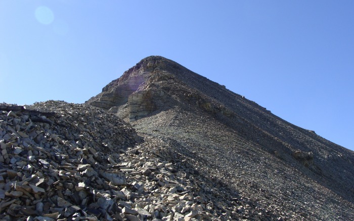
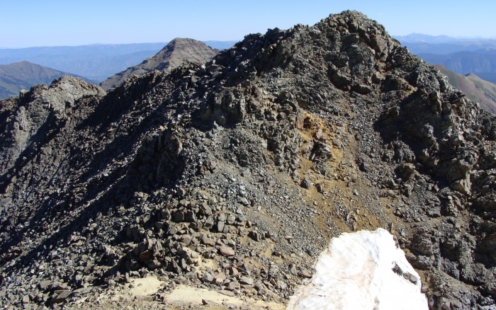
Looking down at Pearl Pass road from a small notch on the ridgeline
The remaining route up Castle from the small notch
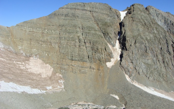
Conundrum couloir
I started hopping, jumping and just all around having a great time! The ridge contained some decent moves and before I knew it, I was looking at the summit cone!
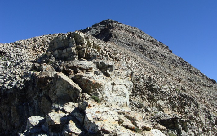
Typical schist on Castle
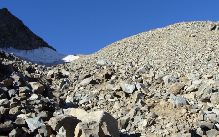
I would recomend staying on the ridge proper, as I was dscending Castle over to Conundrum I noticed quite a few hikers well below the ridge just before the last summit push. Maybe they weren't comfortable with any exposure (there is some, but it is nominal), or maybe they were off route I don't know, but it would be miserable climbing below the ridge in all that loose stuff.
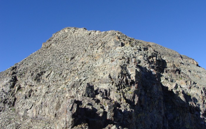
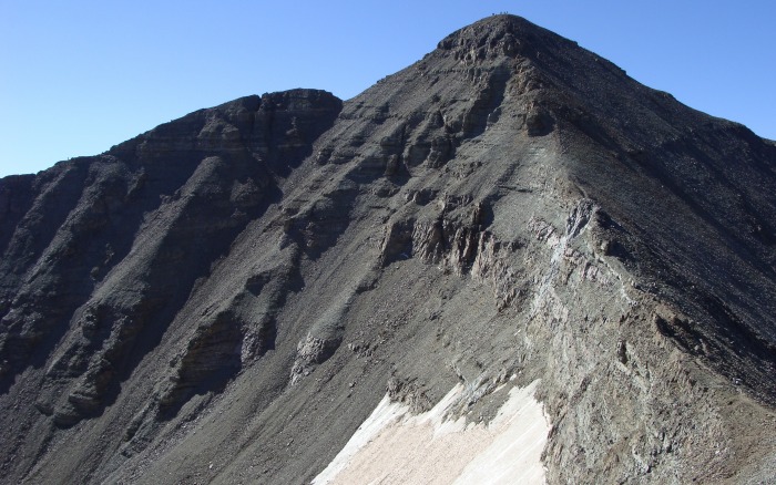
Last ridge push before the summit cone
Goofing around!
Final summit push
I must be jaded because all I could think of was that this led me up to a false summit. As I neared the top I remember thinking, "No way!" Before I knew it, I was on the summit of the tallest mountain in the Elk range.
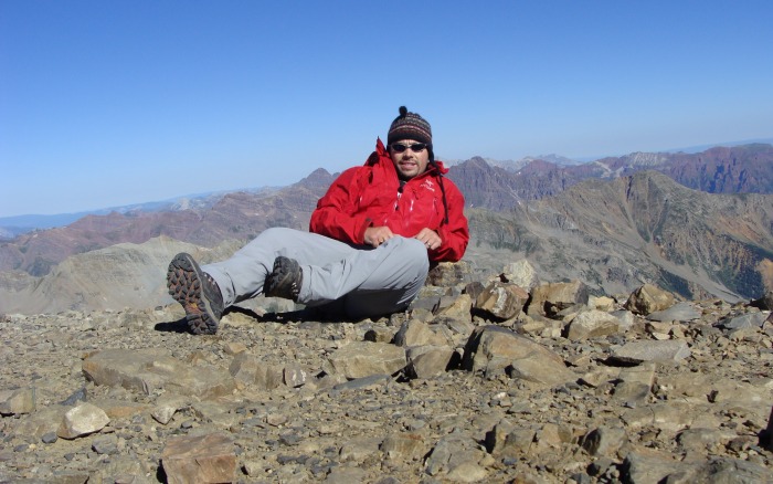
Trying to beat the timer on my camera!
Looking down most of the route on Castle
I quickly rehydrated, sucked down some muscle milk and relished the fact that I was the first summiter of the day! I wanted to continue that trend, so shortly after I left for Conundrum.
The trail leading off of the Northwest ridge was loose and not entirely pleasant. I strayed off route and ended up making a move that I thought wouldn't be present on this route. It turns out I was right and located the trail that went around where I downclimbed.
Looking back up Castle's Northwest Ridge
Once off of Castle's bulk, the saddle was a breeze. I made it to the final upclimb on Conundrum's main ridge in about 20 minutes. Of course my return route was in question........
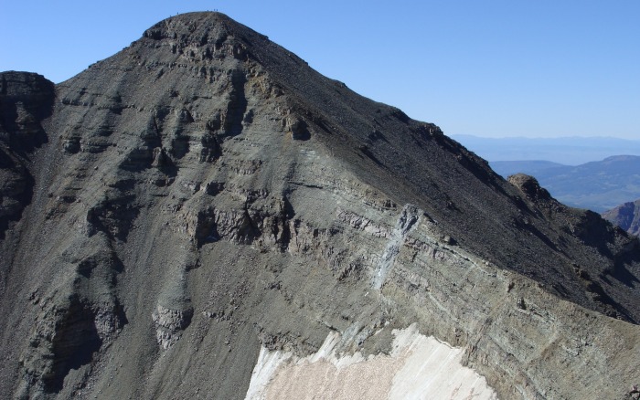
Look at the crowd on Castle!
Castle looks very cool from Conundrum and it does give you a sense of how tall the beast is. I made it up to Conundrum's South ridge and took in the amazing views of the Bells.
Notice the summiter on Maroon Peak, I was there last week!
Looking up Conundrum's South ridge
Once I summited the South Ridge, I strolled across to the top of the Conundrum couloir.
Conudrum's easy ridge
Conundrum's summit is straight across from where I'm standing on the other side of the couloir
I downclimbed to the top of the couloir, looked over the edge, but not too closely though and got the heck away! It is an uneasy feeling looking down that hole, you people that climb those couloirs are nuts!
I made it up Conundrum about 40 minutes from the summit of Castle.
Summit success!
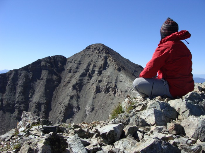
Castle from Conundrum
The Bells, Pyramid and some of Capital and Snowmass
On my way down I ran into some trouble trying to come down from the rusty colored rock on the saddle. I planned on glissading but I should have known that the snow would not be in prime condition to either glissade down from, or even just walk down at this time of the season. It was solid ice, I ended up slipping down it and self arresting with my ice axe. The snow was much softer a little lower and I finished with a glissade. It was a good lesson learned! To avoid the snow it wouldn't be a problem to climb above the snow and follow it down to the bottom near the lake.
I made it back to the car in about 3 hours and my wife and I were back at the camp site 40 minutes later. A few people that I ran into on the way down had finally wandered past our campsite 6-7 hours later and they all looked like the walking dead! The road would be a miserable hike. I am so glad we camped up there and I would recomend it to anyone wanting to climb these mountains.
I am now so close to my goal that I can almost taste it! I feel like I have learned so much on these last few peaks and I am so thrilled! I hope this trip report can help others out as I know it isn't that complicated of a peak, if not I hope you enjoyed the pictures!
Thank you for reading!
Thumbnails for uploaded photos (click to open slideshow):
Great trip report - thanks for all the info. I'm thinking about this combo over the next few weeks. On the descent you say it wouldn't be a problem to climb above the snow; would that mean heading down to your left coming off the saddle? Did you guys camp at the junction with the Pearl Pass road or lower? Thanks again!
I had that same feeling on Castle. I was thinking surely this can't be the summit but the crowd on top told me otherwise. It was a stellar day. We were on Pyramid the same day. Did you see us :wink:
Congrats on a couple of summits that weren't super appealing to you - understand the feeling. Love the TR, details and photos, especially the shadow one.
Thanks for the great reading!
You're getting close to the finish!
Corndiggs-Yes, if you are looking down from the saddle (rusty colored rocks) you can see the top of the snowfield, best to go left; going right would not put you in a good postition to get off of the snow. As for camping, we actually camped a little bit before the first bridge crossing, it was a nice spot with the fire pit quite close to the road, but our tent was in a heavily forested area.
Randalmartin-I think I may have seen you guys, along with hikers on Maroon Peak!
Sunny1-Thank you, I've been spoiled with the bright colors of the San Juans and the Bells!
Caution: The information contained in this report may not be accurate and should not be the only resource used in preparation for your climb. Failure to have the necessary experience, physical conditioning, supplies or equipment can result in injury or death. 14ers.com and the author(s) of this report provide no warranties, either express or implied, that the information provided is accurate or reliable. By using the information provided, you agree to indemnify and hold harmless 14ers.com and the report author(s) with respect to any claims and demands against them, including any attorney fees and expenses. Please read the 14ers.com Safety and Disclaimer pages for more information.
Please respect private property: 14ers.com supports the rights of private landowners to determine how and by whom their land will be used. In Colorado, it is your responsibility to determine if land is private and to obtain the appropriate permission before entering the property.