Download Agreement, Release, and Acknowledgement of Risk:
You (the person requesting this file download) fully understand mountain climbing ("Activity") involves risks and dangers of serious bodily injury, including permanent disability, paralysis, and death ("Risks") and you fully accept and assume all such risks and all responsibility for losses, costs, and damages you incur as a result of your participation in this Activity.
You acknowledge that information in the file you have chosen to download may not be accurate and may contain errors. You agree to assume all risks when using this information and agree to release and discharge 14ers.com, 14ers Inc. and the author(s) of such information (collectively, the "Released Parties").
You hereby discharge the Released Parties from all damages, actions, claims and liabilities of any nature, specifically including, but not limited to, damages, actions, claims and liabilities arising from or related to the negligence of the Released Parties. You further agree to indemnify, hold harmless and defend 14ers.com, 14ers Inc. and each of the other Released Parties from and against any loss, damage, liability and expense, including costs and attorney fees, incurred by 14ers.com, 14ers Inc. or any of the other Released Parties as a result of you using information provided on the 14ers.com or 14ers Inc. websites.
You have read this agreement, fully understand its terms and intend it to be a complete and unconditional release of all liability to the greatest extent allowed by law and agree that if any portion of this agreement is held to be invalid the balance, notwithstanding, shall continue in full force and effect.
By clicking "OK" you agree to these terms. If you DO NOT agree, click "Cancel"...
Tenmile/Mosquito Centennial Finisher - Clinton, McNamee, and Traver Peaks
Introduction
After checking off my last Sawatch Range Fourteeners last week with a successful climb of Mount Columbia, I decided to continue this trend by completing climbs of all the Tenmile/Mosquito Centennial Thirteeners. With only two left (Clinton and Traver), this certainly seemed possible this summer, so I freed up some time in my schedule, and off I went.
The Approach
With the weather forecast looking good for Wednesday August 11th, I arrived at the Alma State Wildlife Area on County Road 4 around 7:30 PM Tuesday evening. Being tired from work and driving, I decided not to pitch my tent, but instead quickly set up camp in the back of my truck.
After a cold and restless night, listening to the seemingly endless traffic on Highway 91, the alarm went off at 4:30 AM and I was soon up and rolling. Not wanting to even attempt driving up the Wheeler 4WD road, I parked above Montgomery Reservoir (near the Magnolia Mine) and was on the trail by 5:15.
Even though it had not rained in the area for several days, it was still plenty wet and muddy and I was glad to have my headlamp to help me navigate as I hiked the 3 miles up the rough road to reach Wheeler Lake.
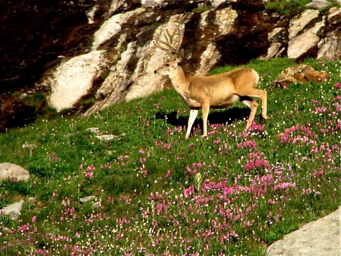
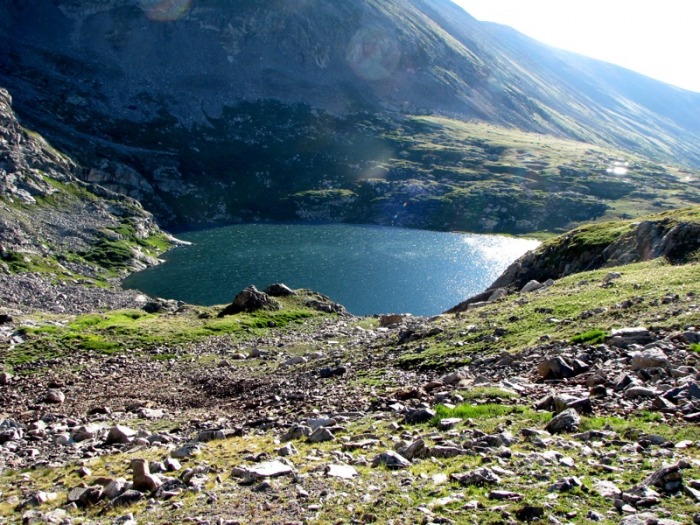
The worst part was the last quarter mile below Wheeler Lake, which was both rough and loose and had the entire outlet stream from the lake running down the center of it. Nevertheless, I arrived at the lake around 7:05 AM. Near the lake, I ran into a group of deer getting a drink from a side stream.
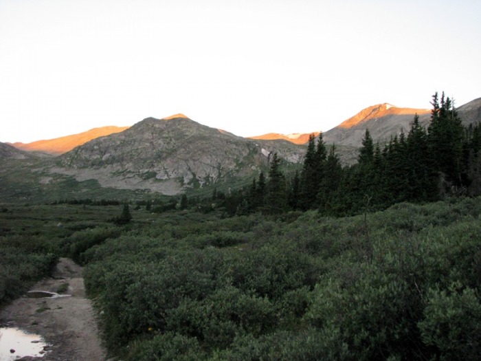
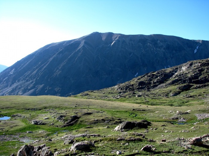
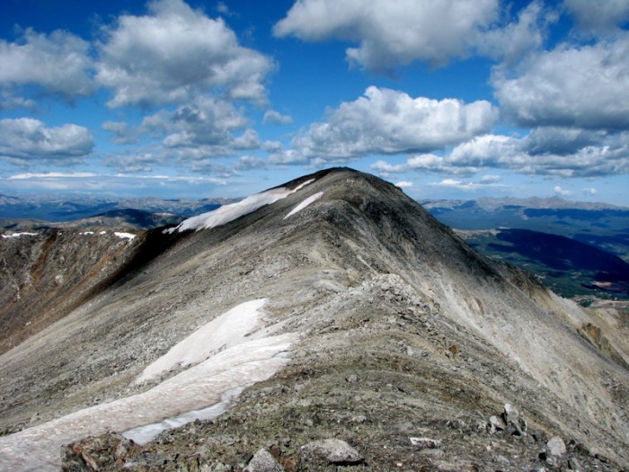
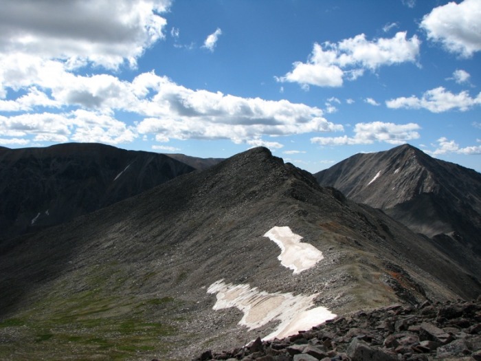
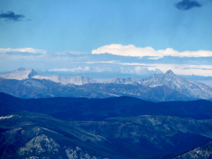
Alpenglow on Clinton, McNamee, and Traver Peaks
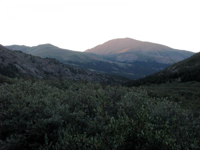
Mount Silverheels in the morning sun
A young buck near Wheeler Lake
The Climb
At the lake, I took a quick break, ate a snack and removed some clothes in preparation for the rest of my climb. I then followed a trail around the left side of Wheeler Lake and began climbing up the steep rocky gully into the basin above on a distinct trail.
Traversing around the south side of Wheeler Lake
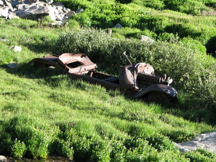
The infamous rusting car
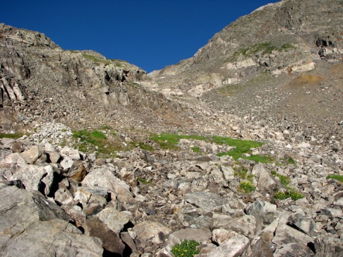
Beginning the ascent up the steep gully above Wheeler Lake
Looking back on the climb up into the lower basin above Wheeler Lake
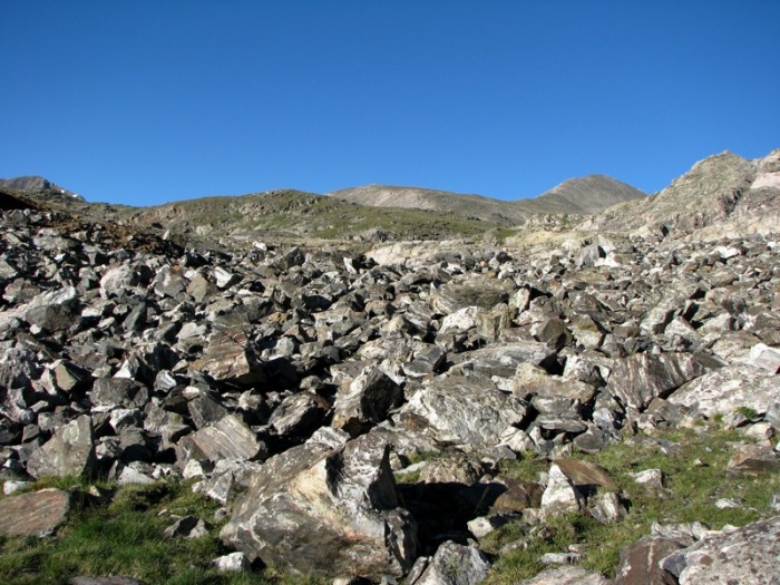
At the top of the gully, the trail became faint, but the route was obvious, and I traversed along the northwest edge of the basin passing tailing piles, shafts, and other remnants of mining activity in the area.
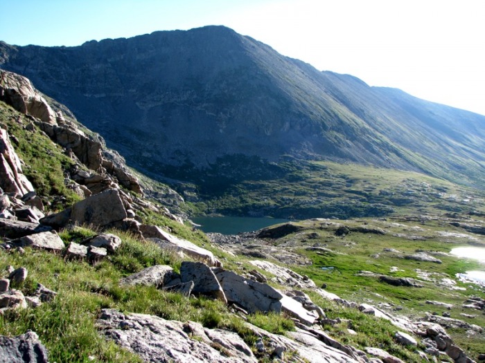
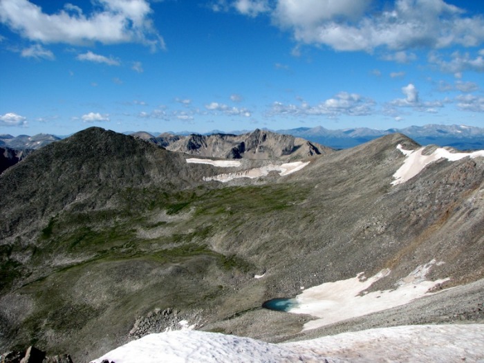
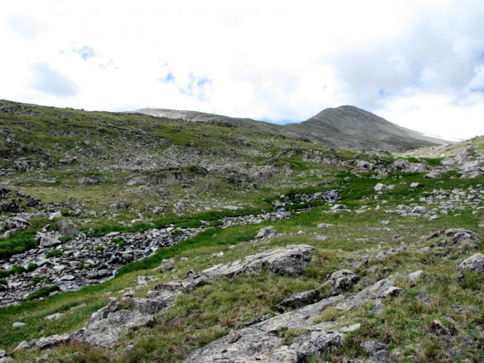
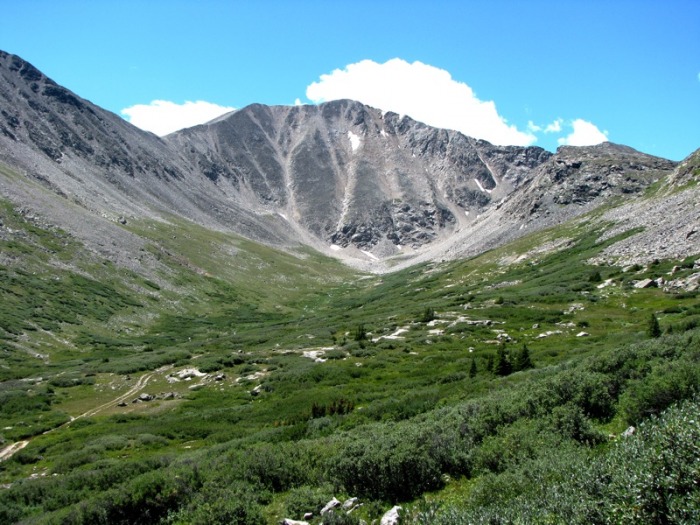
The basin below Clinton and Traver Peaks (Traver Peak can be seen in the distance on the right)
Mount Lincoln as seen across Platte Gulch
Staying away from the marshy meadows and creek to my left, I continued to climb up the basin and on to the shoulder of Clinton Peak. After about a half mile of hiking, I left the basin and began to climb steeply up the talus and dirt covered slope towards the ridge.
In retrospect, I could have probably continued up the basin for another half mile or so before beginning my ascent towards the summit, but I was a bit worried about having to cross the steep snowfields I had noticed on Clinton's northern face during my approach and decided to ascend to the ridge as soon as possible.
Wheeler Mountain and Wheeler Lake from the shoulder of Clinton Peak
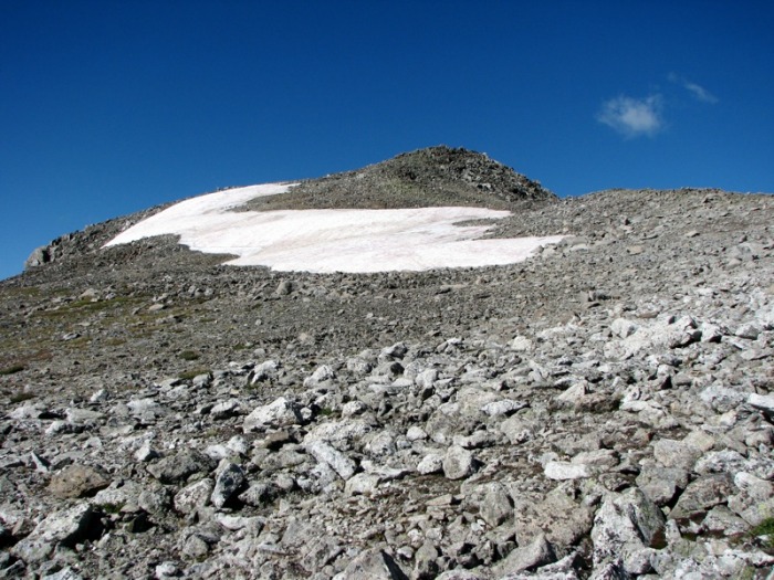
Reaching the ridge on Clinton Peak
After climbing for about 30 minutes, the angle of the slope moderated and I reached the ridge as views of surrounding peaks began to open up before me.
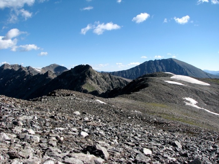
Drift, Fletcher, and Quandary Peaks from Clinton Peak's summit ridge
From here I followed the well-defined trail for about a quarter mile, over one false summit, before reaching the top of Clinton Peak around 9:20 AM.
The summit of Clinton Peak
Traver and McNamee Peaks seen from just below Clinton Peak's summit
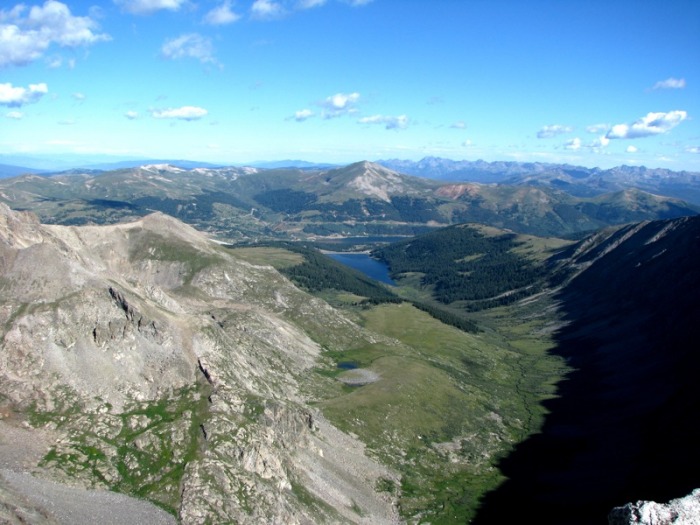
Looking south towards Fremont Pass (Clinton Reservior and Jacque Peak can be seen in the center)
On the summit, the wind picked up dramatically and I could see a line of rain clouds to the south headed my way. I decided if I was going to finish the traverse I should continue, so almost without pause, I was off towards McNamee Peak.
I descended for about 5 minutes along the somewhat rough ridge, before reaching the saddle between Clinton/McNamee and began to climb gently over a couple small humps towards McNamee's summit, where I topped out around 9:50.
The ridge between Clinton and McNamee Peaks
Here I could clearly see the rest of the route to Traver Peak, and after pausing momentarily to watch and ponder the activity at the Climax Mine below me, kept on truckin'.
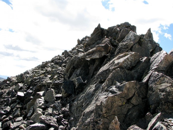
I was soon climbing Traver's southwest slopes. While a fairly well-defined trail winds along the north side of the ridge, for most of my ascent I chose to stay close to the ridge crest as possible encountering several fun sections of easy Class 2+/Class 3 scrambling along the way.
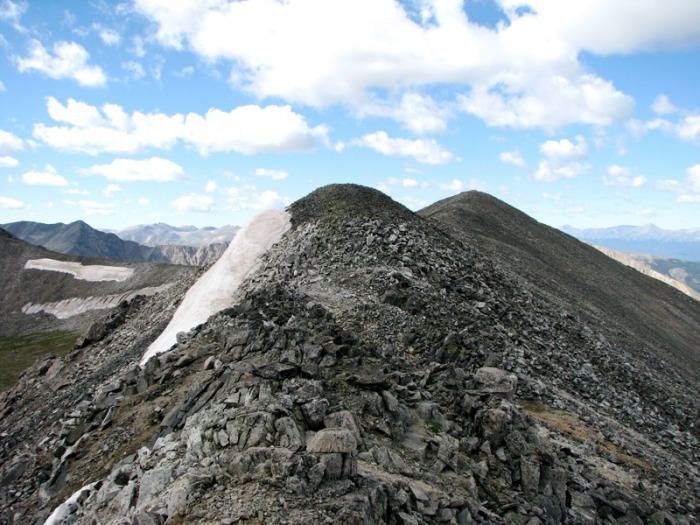
Traver Peak from the summit of McNamee
A rough section of the ridge on Traver Peak
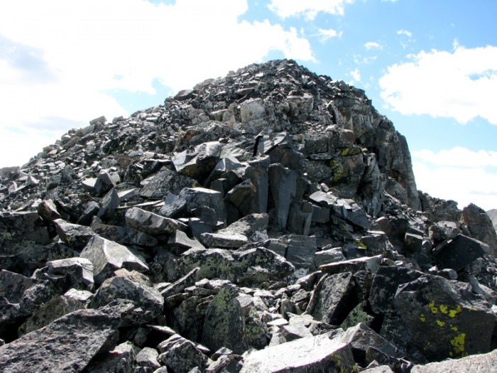
Approaching Traver Peak's summit
I arrived on Traver's summit around 10:15 AM and stopped to take in the views, snap some photos, and take a break for about a half hour before beginning my long descent back down into Platte Gulch.
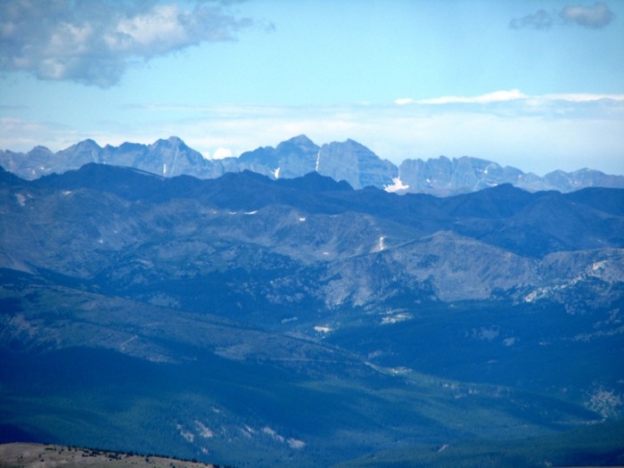
I was surprised how well I could see the Elk Range from Traver's summit:
Pyramid Peak and the Maroon Bells from the summit of Traver Peak
Snowmass Mountain and Capitol Peak as seen from the top of Traver
My descent back to Wheeler Lake was fairly uneventful and I arrived at the shoreline just a few minutes before 12 PM.
Descending off of Traver Peak back towards Wheeler Lake
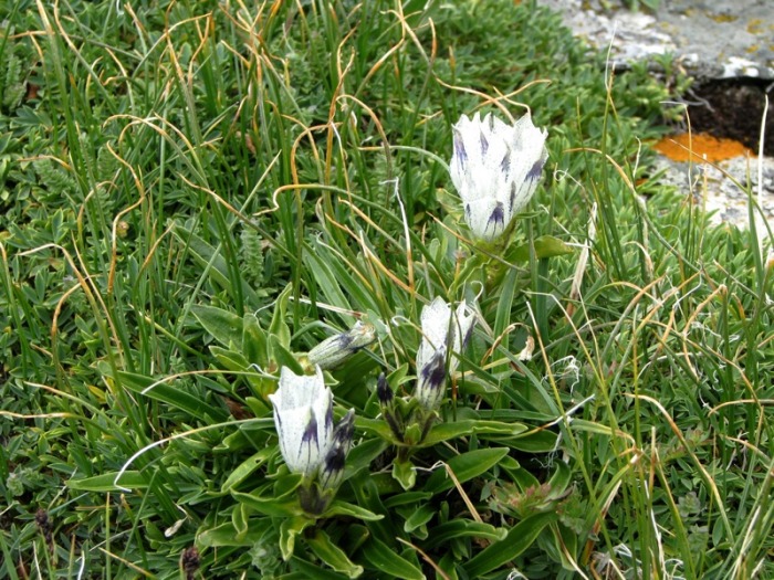
Arctic Gentian (Gentiana algida) in Platte Gulch
Looking back on my descent route from Traver Peak
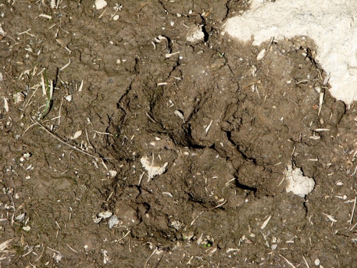
Bear paw print in the mud near Wheeler Lake
From here I took my time hiking out the 4WD road back to the trailhead arriving at my truck around 2:15 PM.
Conclusion
In conclusion it was another great day in the Tenmile/Mosquito Range with 3 successful summits, 10 miles round-trip, and 3,250 feet of elevation gain.
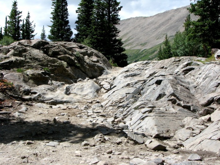
A rough section of the 4WD road below Wheeler Lake
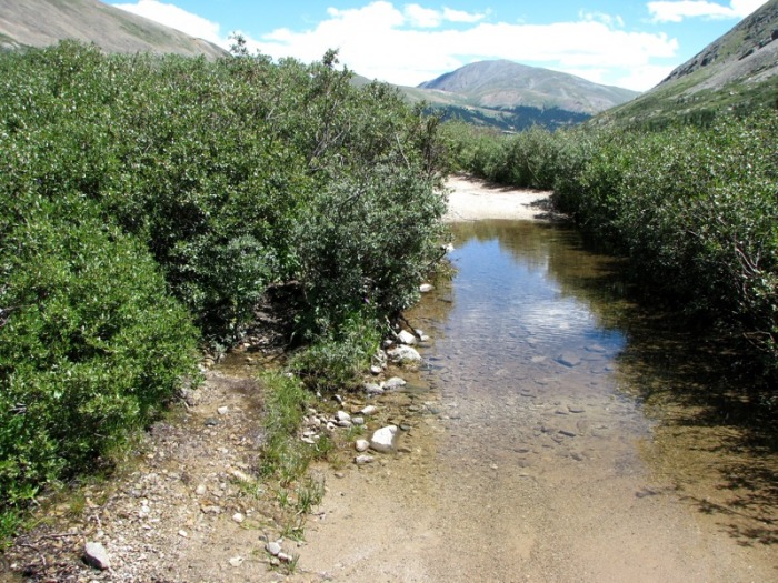
One of the many pond size puddles on the Wheeler Trail 4WD road (notice the small trail through the willows on the lefthand s
Mount Democrat looms over upper Platte Gulch
Definitely not a 4WD road for stock SUVs
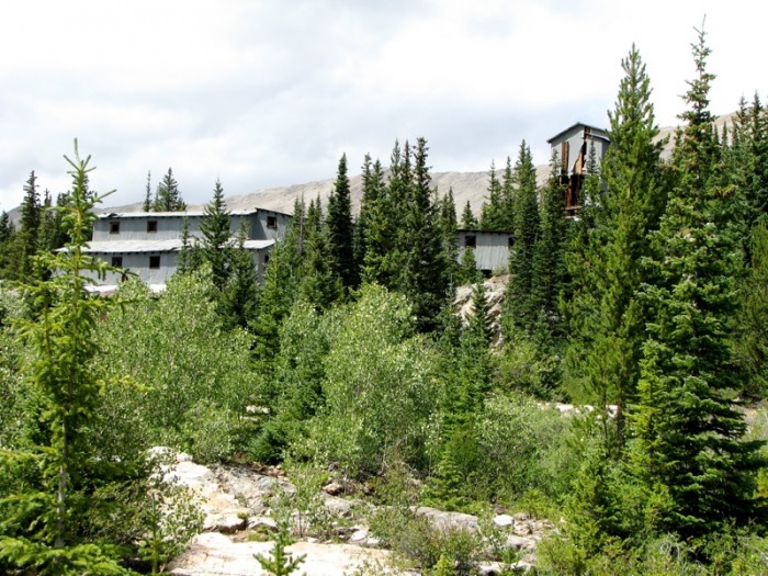
The remnants of the Magnolia Mine complex
Notes:
The Wheeler Lake road is on a par with the Lake Como and former South Colony Lake Roads and should not be attempted by stock 4WD vehicles. In addition to being really rough in spots, there are several sections that require specialized lifts, tires, and other equipment. So if you choose to drive this road, come prepared for some serious off-roading.
Also note that the Wheeler Lake road has about a dozen sections on it with 6-10 inches of standing water that is unavoidable to those traveling on foot. Luckily, the Forest Service (or some group of smart and courteous trail workers) has added small trails through the trees/willows on the north side of the road which will help hikers get around these spots. Finding them is key and will help you keep your feet dry and make your climb much more enjoyable.
Thumbnails for uploaded photos (click to open slideshow):
I enjoyed that trio last year, it was unexpectedly pleasant! It looks like you ascended a different slope than Greenhouseguy and I did up to Clinton. I think the slope we took ended right at the summit. I'd like to get back to that area again sometime to try Wheeler, but I sure won't be driving! :D
Congrats on the peaks, and a very nice write up.
Yep, I could have probably continued up the basin more before ascending to Clinton's summit ridge. From below it looked like there was a whole lot more snow along that ridge (which I was trying to avoid), but that wasn't the case. Anyway it worked.
Yes, Wheeler looks like an interesting climb with some serious gulleys and Class 3 scrambling...
Caution: The information contained in this report may not be accurate and should not be the only resource used in preparation for your climb. Failure to have the necessary experience, physical conditioning, supplies or equipment can result in injury or death. 14ers.com and the author(s) of this report provide no warranties, either express or implied, that the information provided is accurate or reliable. By using the information provided, you agree to indemnify and hold harmless 14ers.com and the report author(s) with respect to any claims and demands against them, including any attorney fees and expenses. Please read the 14ers.com Safety and Disclaimer pages for more information.
Please respect private property: 14ers.com supports the rights of private landowners to determine how and by whom their land will be used. In Colorado, it is your responsibility to determine if land is private and to obtain the appropriate permission before entering the property.